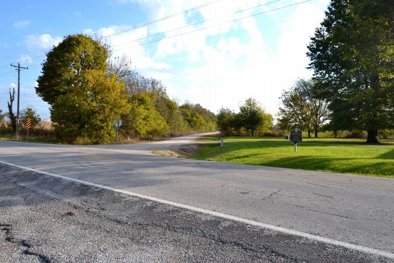
The John I. Smith Relay Station was 172 ½ miles from the Tipton Terminus and stood in northeast Barry County, about 7 miles west of Crane. — — Map (db m99688) HM
Cassville, the last town
on the route of
the Butterfield Mail in Missouri,
was not a relay station
but the coaches stopped
for mail and passengers — — Map (db m80212) HM
Between 1855 and 1884, there stood on this square, a two-story brick courthouse that was known as Missouri's "second Confederate capitol." It was here that members of the state legislature gathered between Oct. 29 and Nov. 7, 1861 to complete a . . . — — Map (db m44605) HM
Dedicated to men and women who serve in the Armed Forces of the United States, during war and peace. We sincerely appreciate your sacrifice and dedication to preserve the freedom of this great nation. God will one day judge our actions. Until then . . . — — Map (db m62885)
This valleys bountiful resources, particularly its abundant water, attracted settlers beginning in the 1820s. The constant rapid flowing of spring-fed Roaring River appealed to millwrights, who saw the opportunities such a reliable source of power . . . — — Map (db m68553) HM
Monett, as well as Neosho and Joplin, was an early aviation hotbed in
the United States. Monett had investors from the area named L.B.
Durnil and U.S. Barnsley who wanted to build an airplane. They had
two projects in Monett including the . . . — — Map (db m251422) HM
At this location, the Central School was
built around 1892 and serviced 1st through
12th grades. As Monett continued to grow
in size, Central School became the main
grade school.
Written by: Jasmine Rodriguez and Genesis
Guerra
. . . — — Map (db m251468) HM
Dedicated to a fallen hero and all Armed Forces Serving and Protecting the United States of America.
Greater love hath no man than this, that a man lay down his life for his friends. John 15:13.
Under a picture of Specialist . . . — — Map (db m62712) WM
Originally built in 1904, Eugene Field School
was a feeder school. It was located on
Benton Street at Sixth Street. It was built by
L.A. Mason, a major contractor in Monett at
the time. Other feeder schools during that
time were Plymouth and . . . — — Map (db m251471) HM
Monett High School was built in 1905.
Monett's student population later outgrew
the building and they had to build a bigger
building for grades 9-12. The second high
school building was built in 1922-23 by
M.E. Gillioz and a junior college was . . . — — Map (db m251473) HM
Logan David McKee, born on the 27th of February in 1877, is known
as a remarkable man in Monett Missouri. Logan grew up in
Hutchinson, Kansas. He came to Monett in 1891 to be a pharmacist
and worked for many drug stores in the area until he had . . . — — Map (db m251425) HM
Christopher Glenn Stark was a veteran of Monett. Christopher graduated
Monett High School in 2007, joined the Army in 2008, and was part of the
705th Explosive Ordnance Disposal company. Christopher was killed in
action on February 28, 2011 . . . — — Map (db m251412)
In the early 1900s, it was well known that there was a
cave underneath the current Monett City Park Casino. In
1918, it was reported in the Monett Weekly Times that
they were referring to the cave as a quarry. Logan McKee
was studying the cave . . . — — Map (db m251438) HM
Kelly Creek in downtown Monett has been flooding since about
1907 and there have been at least 40 floods that have been
documented. The 1927 flood arose so quickly that waitresses at
the Frisco Hotel stood on tables until firefighters came along . . . — — Map (db m251460) HM
In 1921, Monett was known for having a legendary football
team as well as having an undefeated season of eleven games.
Finis Engleman was the coach of this legendary team. Monett
had a great season that year going against Arkansas 57 to . . . — — Map (db m251475) HM
The founder of the Harvey Houses was Frederick Henry Harvey.
After he married, he and his wife opened up their first Harvey
House in 1878 in Florence, Kansas. In 1881 he replaced his male
waiters with the famous “Harvey Girls.” Harvey gained a . . . — — Map (db m251449) HM
Monett has always been known as a nice, peaceful railroad town. However, in 1894,
that was disrupted. There were five lynchings in twelve years near the turn of the
century in this area, however, only one of these was in Monett. On June 28, 1894 . . . — — Map (db m251447) HM
At Sixth and Front Streets in 1898 the Monett
Railroad YMCA was built. The YMCA was a very
active unit in Monett under the direction of Mr.
George J.C. Wilhelm. The YMCA housed railroad
workers with clean rooms, hot baths, and even gave
people . . . — — Map (db m251453) HM
Native Americans have a long history in the Monett area. Artifacts from the
bottomland of the Monett golf course and the Long farm east of town
reflect centuries of occupation dating back to the Archaic Period 2,800 to
9,000 years ago, which is . . . — — Map (db m251440) HM
Strawberries were a huge start to the Monett economy. Strawberries were
one of the first crops introduced to Southwest Missouri in the 1800s.
Southwest Missouri produced the finest strawberries in the United States
and Monett became one of the . . . — — Map (db m251444) HM
Downtown Monett Missouri is home to one of the
most famous landmarks in Monett Missouri, the
Freedom Silo located by the train tracks. The
Freedom Silo has stood for 130 years and is believed
to have been built around 1890. It is called . . . — — Map (db m251452) HM
In 1887, Plymouth Junction or Plymouth Crossing, now known
as Monett, served as a trading post and main shipping center
for the Frisco Railroad. The Frisco Railroad was originally
known as the Louis-San Francisco Railway. The railroad . . . — — Map (db m251455) HM
The Gardner home on 713 Central was built
shortly after the Sizer house by Solon Wright,
owner of Wright Dry Goods, in an attempt to
show up Callumura. Wright wanted the grandest
home in Monett. However, after the construction
of the home, . . . — — Map (db m251469) HM
The Gillioz Theater was built in 1931 and was operated by
Commonwealth Amusement by 1941. Johnson and Maack of St.
Louis were the architects of the Gillioz. This theater was very
popular amongst the local community. During the prom season
the . . . — — Map (db m251465) HM
Monett has been home to four hospitals since its founding. Dr. West's
hospital was first established in 1914 and was the first hospital in
Monett. It housed 18 beds by the time it closed around WWI. After
WWI, Dr. West later reopened his . . . — — Map (db m251396) HM
The Sizer home on 800 Central was built for the
family of Fielding Sizer, an attorney, in 1916. The
current occupants are only the second set of
people to live in the house. The house still
retains most of its original features including . . . — — Map (db m251470) HM
On the Trail of Tears there were 3 paths that
removed the Native Americans from their land to
Indian Territory due to the Indian Removal Act.
One of the paths from the Trail of Tears went just
southeast of Monett near Star City and Madry.
We . . . — — Map (db m251439) HM
Viga Burns Hall was born on 17th of June, 1892 in Hancock Missouri. Raised
by a prominent Monett businessman, Francis Marion Hall, V.B. Hall followed
in his father's footsteps founding V.B. Hall Company in 1919. A leader in the
transition from a . . . — — Map (db m251443) HM
Monett had four other names before it was called Monett. Monett was first
named Kings Prairie Depot. Monett began as a Frisco Railroad town because
of its location. By 1875, Plymouth had become a new name for Kings Prairie
Depot. The name . . . — — Map (db m251457) HM
Railroad was a prominent mode of transportation in the first half of
the 20th Century. Presidential nominees would come and stop in
towns to give speeches and try to convince people to vote for them.
These stops were known as “whistle stops.” . . . — — Map (db m251445) HM
The Waldensian church originated in Europe with the preaching of
the merchant Valdo in 1140-1217. The official symbol of the
Waldensian church is a candle positioned over an open Bible. The
original homeland of the Waldenses was in Northern . . . — — Map (db m251428) HM
This monument is dedicated to those who served our country by the people of Purdy, Missouri. We must always remember that by the sacrifices we enjoy our freedom today. Dedicated 2012. — — Map (db m62800) WM
This Douglas A-4 Skyhawk was generously donated to the City of Purdy by the Department of Navy, Naval Air Systems, in response to the joint acquisitions efforts of the late Norman “Gabby” Gibbons and U.S. Navy Commander Edward Estes. The City of . . . — — Map (db m229667) HM
Air Force ☆ Army ☆ Coast Guard Marines ☆ Navy In honored memory of those who served in defense of their country so that all may enjoy freedom. Let us show them that we do care, Let us gather with them and share, Their . . . — — Map (db m229649) WM
In the shade of one of Colonial Boston's largest trees, Patriots known as the "Sons of Liberty" assembled to protest Britain's Stamp Act of 1765. In the days leading to the Revolutionary War, large shade trees in villages and townships served as . . . — — Map (db m210380) HM
Marvel Cave
has been designated a
Registered
Natural Landmark
under the provisions of the Historic Sites Act of August 21, 1935. This site possesses exceptional value in illustrating the natural history of the United States
US. . . . — — Map (db m209709) HM
As we walk the streets of our city everyday, we remember those who have served and are today serving our nation in all branches of our nation's military. To each of these brave individuals and their families, we say from the bottom of our hearts: . . . — — Map (db m250648) WM
Lloyd Edward "Shad" Heller spent over 25 years at the City's forge & anvil.
Shad created memories for millions though his wit, humor & all-around character.
In addition to his roles as Silver Dollar City's resident blacksmith and the . . . — — Map (db m246365) HM
In the late 1800s, the beautiful Ozark Mountains were home to determined and hardworking hill folk
living off the land. Summers were filled with steady farming in preparation for long winters. While most
crops struggled to grow in the rocky . . . — — Map (db m250642) HM
Seat of justice for Stone County. Galena lies 1,016 feet above sea level on the James River in whose beautiful, crystal waters the explorer H.R. Schoolcraft reported seeing lumps of galena on his 1818-19 trip in the Ozarks. First known as . . . — — Map (db m265276) HM
You are standing on the northeast side of the famous Y bridge in Galena, Missouri. 764’ long by 23’ wide, she was built to replace an older steel bridge whose pilings are still visible to the south. The Y Bridge was built in just over a year and . . . — — Map (db m123484) HM
In honored memory of those from the Hurley community who lost their lives in World War One, World War Two, The Korean and Vietnam Conflicts. Those heroes live beyond the tomb.
WW I
Medlin, Elmer • Medlin, John W
WW II
Barnett, Robert • . . . — — Map (db m62891) WM
Manufactured by: North American Aviation
Introduced in 1942 over 15,000 were built. This aircraft
was considered to be the premier frontline fighter of World War II.
There are 50 soldiers portrayed here of actual WWII infantrymen. Each Man was sculpted from real life and represents his individual State in the United States
The lead man is Fred Hoppe Sr. the sculptor's father representing the State of . . . — — Map (db m209922) WM
All Gave Some ... Some gave all,
So That Old Glory Will Always Fly
Over the Land of the Free and
the Home of the Brave.
We, the People, Raise This Flag
to Salute You and to Say...
Thank You! — — Map (db m236121) WM
LVT 4 Water Buffalo
The LVT is an amphibious warfare vehicle and amphibious landing craft introduced by the United States Navy and United States Marine Corps. The LVT 4 was designed in 1943 and was based on the previous LVT 2. It was the . . . — — Map (db m210606) HM
M25 Tank Transporter "Dragon Wagon"
The M25 was a heavy tank transporter / tank recovery tractor that came in both armored and unarmored versions (what you see here is the unarmored configuration). M25 was the original designation for what . . . — — Map (db m210519) HM
The idea for the Weasel came from the work of British inventor Geoffrey Pyke. In November 1944, USMC distributed M29s to the 3rd, 4th, and 5th Marine Divisions. They proved invaluable with their first appearance in combat on Iwo Jima. It also saw . . . — — Map (db m210039) HM
M3 Half-Track
One of the world's first armored personnel carriers was the U.S. Army's half-track. Half-wheeled, half-tracked, the half-track saw service around the world. Its sides were lightly armored for protection against shell . . . — — Map (db m210607) HM
MS High Speed Tractor Artillery Transport
The M5 is a full-track vehicle designed to tow the 105 mm Howitzer M2 and the 155 mm Long Tom field artillery and carry the gun crew and ammunition. A winch and roller system allowed the M5 to pull . . . — — Map (db m210057) HM
The M561 was a diesel powered, six-wheel-drive (5x5), articulating chassis, commonly known as the "Gama Goat The "Goat was designed to negotiate the rough terrain found in Southeast Asia during the Vietnam War when the M37 four-wheel cargo truck . . . — — Map (db m210024) HM
Designed by the Pontiac Motor Division in the early 1950's as the T46, this vehicle began life intended replacement for the Studebaker M29 Weasel, This amphibious cargo carrier was designed to carry cargo or up to eight troops over shallow rivers . . . — — Map (db m209912) HM
Welcome all curiosity seekers, military aficionados, veterans and history buffs! This exhibits in a tribute to all who serve in the fight for freedom by presenting some of the unique mobile equipment that have helped these brave men and women in . . . — — Map (db m210623) WM
These are the flags and seals of the branches of the United States Armed Forces.
This garden is a tribute to all who serve and have served our Nation to defend and preserve our freedom.
Department of the Army
United States of . . . — — Map (db m210621) HM WM
The WCTC-6 amphibious trailer, affectionately known as the "duckling" was made for use with the Landing Vehicle Tracked (LVT) and the Amphibious truck. It has a 4.5 ton capacity with its 245 cu ft. cargo box.
Approximately 212 of these . . . — — Map (db m209917) HM
The Jeep legend began in November 1940, in the early days of World War II just a year before the United States entered the war. A small, four-wheel-drive prototype, the Willys "Quad," was delivered to the US Army. The Quad was the father of the . . . — — Map (db m210034) HM
Patriots Park built by staff and students 2015-2019
This park honors those who sacrificed for our country, while affirming the Patriotic goal of College of the Ozarks:
"To encourage an understanding of American heritage, . . . — — Map (db m246420) HM WM
The Global War on Terrorism Memorial honors those who have selflessly dedicated their lives in the fight against terrorism.
This memorial represents all modern warriors who have faithfully served and sacrificed in the name of freedom. The . . . — — Map (db m246654) WM
This Memorial pay tribute to all who served and sacrificed during the Korean War conflict. (June 25, 1950 to July 27, 1953)
The purpose is not only to honor the 944 Missourians who made the ultimate sacrifice but to honor all 36,574 . . . — — Map (db m246750) WM
This wall honors Gold Star Families of Missouri (those who have lost family members who died while in service to our country), preserves the memory of the fallen, and stands as a stark reminder that freedom is not free.
The scenes on each . . . — — Map (db m246414) WM
The Wall is divided as the country was divided, yet stood in the divide forged ahead, doing what their country asked of them.
The "V" symbolizes the valor stall who served whereas the red flowers symbolize the blood shed
by those whose . . . — — Map (db m246659) WM
The Patriotic Education Travel Program was founded to reinforce the Patriotic goal of the College. In June 2009, the inaugural trip provided the opportunity for 20 College of the Ozarks students and ten WWII Veterans to travel to the battlefields . . . — — Map (db m247156) HM WM
The ravine below is a natural glade and sink formation. Glade lands are found only in the White River Valley of the United States. At the base of the ravine, there is a natural spring-sink named Devil's Pool. The pool's name comes from the Indian . . . — — Map (db m48148) HM