By Michael Sean Nix, November 14, 2009
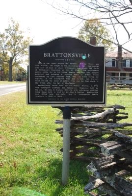
Brattonsville Marker
RANKED BY RELEVANCE
| On Brattonsville Road at Percival Road, on the right when traveling south on Brattonsville Road. |
| On Brattonsville Road 0.1 miles north of Percival Road, on the right when traveling south. Reported missing. |
| On York Street at Bell Avenue, on the left when traveling north on York Street. |
| Near Brattonsville Road 0.5 miles north of Percival Road. |
| On Brattonsville Road (State Highway 165) 0.1 miles north of Percival Road (State Highway S-46-38), on the right when traveling north. |
| On Saluda Street (South Carolina Route 72/901) south of Tigler Court, on the right when traveling south. |
| On York Street (State Highway 49) at Woodlawn Street, on the left when traveling north on York Street. |
| On Main Street 0.1 miles west of Nimitz Road, on the right when traveling east. |
| On Allison Creek Road (County Road 1081) 0.1 miles east of Hands Mill Highway (State Highway 274), on the left when traveling east. |
| On North White Street at Horse Road, on the right when traveling north on North White Street. Reported missing. |
| On Brattonsville Road 0.5 miles south of McConnells Highway ( Highway 322), on the left when traveling south. |
| On Brattonsville Road 0.3 miles north of Percival Road, on the left when traveling south. |
| On Lockhart Road (State Highway 49) 0.3 miles north of Bonner Horton Road, on the left when traveling south. |
| On South White Street at Main Street, on the right when traveling north on South White Street. |
| On Wylie Avenue at Wilkerson Street, on the left when traveling south on Wylie Avenue. |
| On Brattonsville Road 0.1 miles north of Percival Road, on the right when traveling south. |
| Near Brattonsville Road at Percival Road. |
| Near Brattonsville Road 0.1 miles north of Percival Road, on the right when traveling south. Reported permanently removed. |
| On Chester Highway (U.S. 321) at McConnells Highway (State Highway 332), on the left when traveling north on Chester Highway. |
| On East Main Street (State Highway 1) near North Oakland Avenue (U.S. 21), on the right when traveling east. |
| On East Black Street (State Highway 5) at Hampton Street on East Black Street. |
| On South Dave Lyle Boulevard south of West Moore Street, on the right when traveling south. |
| On Dave Lyle Boulevard (U.S. 122), on the right when traveling east. |
| On W. Liberty Street (State Highway 5) at S. Congress Street (U.S. 321), on the left when traveling west on W. Liberty Street. |
| On East Liberty Street (South Carolina Route 161) at Vector Street, on the right when traveling west on East Liberty Street. |
| On State Street near Benjamin Street, on the right when traveling north. |
| On Court Square (State Highway 28) south of Washington Street (State Highway 203), on the right when traveling north. |
| On Kings Mountain Park Road. |
| On Cherry Road (Route 21). Reported missing. |
| On East Liberty Street (South Carolina Route 161) at Garner Street, on the right when traveling west on East Liberty Street. |
| On East Liberty Street (South Carolina Route 161) east of College Street, on the left when traveling east. |
| On East Liberty Street (South Carolina Route 161) east of College Street, on the right when traveling east. |
| On East Liberty Street (South Carolina Route 161) east of College Street, on the left when traveling east. |
| On East Liberty Street (South Carolina Route 161) east of College Street, on the left when traveling east. |
| On East Liberty Street (South Carolina Route 161) west of Church Street, on the left when traveling west. |
| On South Congress Street (U.S. 321), on the right when traveling north. |
| On South Congress Street (Business U.S. 321) just south of West Liberty Street (State Highway 161/5), on the right when traveling south. |
| Near East Main Street west of Hampton Street, on the right when traveling west. |
| On West 5th Street just west of North Church Street, on the right when traveling west. |
| On North Main Street (State Highway 71) at Wardlaw Street, on the right when traveling west on North Main Street. |
| Near East Main Street west of Hampton Street, on the right when traveling west. |
| On Valley Pike (U.S. 11) south of Shady Lane, on the right. |
| Near Brattonsville Road (South Carolina Route 165) north of Percival Road ( Road 46-380), on the right when traveling north. |
| On Galilee Church Road, on the left when traveling east. |
| Near Hotwater Trail 1 mile west of Centerville Road (Virginia Route 614), on the left when traveling west. |
| On South Piedmont Avenue south of East Mountain Street, on the left when traveling south. |
| On North McDuffie Street at Whitner Street on North McDuffie Street. |
| On Main Street (State Highway 160) at Academy Street, on the left when traveling east on Main Street. |
| Near East Main Street west of Hampton Street, on the right when traveling west. |
| On George Washington Memorial Highway (U.S. 17) south of Chesapeake Road, on the right when traveling south. |
| On Rock Hill Pineville Road (Highway 51) 0.1 miles west of Miller Road. |
| On College Drive at South Johnson Street, on the left when traveling south on College Drive. |
| Near Blackstock Road (State Highway 40) 0.2 miles north of New Cut Road, on the right when traveling north. |
| On East Liberty Street at Garner Street, on the right when traveling west on East Liberty Street. |
| On Battleground Drive (State Highway 216) at Rock House Road, on the left when traveling south on Battleground Drive. |
| On Monument Road 1.4 miles north of Blackstock Road. |
| On Cross Keys Highway (State Highway 49) at Blackstock Road, on the left when traveling east on Cross Keys Highway. |
| On Columbia Avenue at West White Street, on the right when traveling north on Columbia Avenue. |
| Near East Main Street west of Hampton Street, on the right when traveling west. |
| On South Congress Street (State Highway 49) at West Liberty Street (State Highway 161), on the right when traveling south on South Congress Street. |
| Near Courtland Farm Road (Virginia Route 820) 0.2 miles east of Hanover Courthouse Road (U.S. 301), on the right when traveling east. |
| Near Streetman Road west of Ephesus Church Road, on the left when traveling west. |
| On Dave Lyle Boulevard (State Highway 122) at West Black Street, on the right when traveling south on Dave Lyle Boulevard. |
| Near Greenville Street (State Highway 20). |
| On Greenville Street (State Highway 20) near Beltline Road (County Road S-1-35). |
Thin black lines indicate changes in relevance. Between each pair of lines entries are ordered geographically but all have the same relevance.* Inflectional forms of words are their plurals, singulars, and possessives as well as gramatical tenses and similar variations.
Nov. 12, 2026
