By Mark Hilton, December 17, 2013
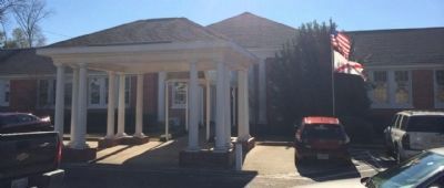
Plaque located at entrance to this rebuilt school.
GEOGRAPHIC SORT Title Sort Marker Number Sort Marker Number Sort N Marker Number Sort T Publication Order Sort Publication Order Sort A Erected Year Sort Most Viewed Sort Most Recent-Interest Sort Most Recently Changed Sort SEE FAQ #33 FOR DESCRIPTIONS
Near Wetumpka Street at South Washington Street, on the right when traveling east.
Near South Washington Street at East 4th Street, on the left when traveling south.
On Washington Avenue south of Old Blakeley Road, on the right when traveling south.
Near West Fort Morgan Road (Alabama Route 180) at Island Club Drive, on the right when traveling west.
On Eufaula Avenue at Court Square, in the median on Eufaula Avenue.
On Riverside Drive at Front Street, on the right when traveling north on Riverside Drive.
On East Broad Street, on the right when traveling west.
On U.S. 82 close to County Road 79, on the left when traveling west.
On Old Broadway Street (U.S. 82) at Main Street, on the right when traveling west on Old Broadway Street.
On East Commerce Street (Alabama Route 10) at South Park Street, on the left when traveling west on East Commerce Street.
On South Park Street south of Walnut Street, on the right when traveling north.
On Adams Street west of South Park Street, on the right when traveling west.
Near South Park Street north of Dunklin Street.
On Quintard Avenue at East 10th Street, in the median on Quintard Avenue.
On Choctaw Street north of Tomahawk Trail, on the right when traveling north.
Paid Advertisement
On Clinton Street Southeast, on the right when traveling west.
On Chinabee Avenue Southeast at Ladiga Street Southeast, on the right when traveling north on Chinabee Avenue Southeast.
On Church Ave SE at James St SE, on the right when traveling north on Church Ave SE.
Near Recreation Drive east of Mc Cullars Lane, on the right when traveling east.
On Southeast Avenue A (County Route 50) 0.1 miles east of Southeast 3rd Street, on the right when traveling east.
On State Highway 9, 0.1 miles west of Route 35, on the right when traveling west.
Near County Road 45 north of County Road 315.
On South Mulberry Street (Alabama Route 17) at West Pushmataha Street (Alabama Route 10), on the right when traveling south on South Mulberry Street.
On South Hamburg Avenue at West Pushmataha Street (Alabama Route 10), on the left when traveling south on South Hamburg Avenue.
On Vickery Street at Hunnicutt Street, on the right when traveling south on Vickery Street.
On North Main Street at West 4th Street, on the right when traveling south on North Main Street.
Near Sportsman Lake Road NW near Route 31.
On South Union Avenue (Alabama Route 123) at West Reynolds Street, on the right when traveling south on South Union Avenue.
On Arsenal Place at Church Street on Arsenal Place.
On Range Street at 4th Avenue, on the right when traveling north on Range Street.
Near Dallas Avenue (Alabama Route 22) at Kings Alley.
Paid Advertisement
On Water Avenue at Sylvan Street, on the right when traveling east on Water Avenue.
On West Tuskeena Street at North Bridge Street (Alabama Route 111), on the left when traveling west on West Tuskeena Street.
On Jasmine Hill Road at Old Montgomery Highway, on the right when traveling south on Jasmine Hill Road.
On Broad Street at South 1st Street, in the median on Broad Street.
Near Main Street, 0.1 miles south of Alabama Route 173, on the right when traveling north.
On Main Street, 0.1 miles south of Alabama Route 173, on the right when traveling north.
On Pond Street (Alabama Route 17) at 1st Avenue NE, on the right when traveling north on Pond Street.
On South Magnolia Street, on the right when traveling north.
On Geneva Street south of South 8th Street, on the left when traveling south.
Near South Marion Street north of West Washington Street, on the right when traveling south.
Near East Hobbs Street west of Thomas Street, on the left when traveling west.
On Market Street West at South Marion Street, on the right when traveling east on Market Street West.
Near North Broad Street, 1.5 miles north of U.S. 80, on the right when traveling north.
On Union Camp Road, 0.2 miles north of Cooper Lane, on the right when traveling north.
On Alabama Route 199 at Old Chehaw Road, on the right when traveling north on State Route 199.
On East Rosa Parks Avenue at North Main Street (Alabama Route 81), on the left when traveling west on East Rosa Parks Avenue.
Paid Advertisement
On John T Reid Parkway/Lee Highway (U.S. 72) 0.1 miles east of Walker Street, on the right when traveling west.
On Westside Square, on the right when traveling north.
On North Main Avenue at West Capitol Street, in the median on North Main Avenue.
On North Perry Street at Monroe Street, on the right when traveling south on North Perry Street. Reported permanently removed.
On Dexter Avenue at Decatur Street, on the right when traveling east on Dexter Avenue.
On North Court Street at Randolph Street, on the right when traveling north on North Court Street.
On North Bainbridge Street at Dexter Avenue, on the right when traveling north on North Bainbridge Street.
Near Church Street, 0.1 miles north of Catoma Street, on the right when traveling north.
On Bibb Street at Commerce Street, on the right when traveling west on Bibb Street.
On East Jefferson Street, 0.1 miles east of North Hull Street, on the left when traveling east.
Near Washington Street at Memorial Drive when traveling south.
On Ferry Street NE south of Cain Street NE, on the right when traveling south.
On Washington Street (Alabama Route 286) north of Jefferson Street, on the right when traveling north.
On Washington Street at Jackson Street, on the right when traveling north on Washington Street.
On South Three Notch Street (U.S. 29) south of Elm Street, on the left when traveling south.
Paid Advertisement
On 5th Street (U.S. 411) at 7th Avenue, on the right when traveling south on 5th Street.
On Hardwick Road at Mays Drive, on the left when traveling north on Hardwick Road.
Near Lafayette Street at Franklin Street, on the right when traveling south.
On Jenifer Road at Campbell Road, on the right when traveling north on Jenifer Road.
On Jenifer Road at Campbell Road, on the right when traveling north on Jenifer Road.
Near Confederate Parkway.
On 19th Street at 3rd Avenue, on the right when traveling west on 19th Street.
On Court Street at Central Avenue (Alabama Route 56), on the left when traveling north on Court Street.
Near Adams Street, 0.1 miles west of 15th Avenue and Adams. Reported permanently removed.
Near Interstate 10. Reported missing.
On West Central Avenue at North Main Street, on the left when traveling east on West Central Avenue. Reported permanently removed.
On West Rush Avenue east of North Willow Street, on the right.
On North Lakeshore Drive (State Highway 144) at Main Street, in the median on North Lakeshore Drive.
On Clay Street at Court Street, on the right when traveling east on Clay Street.
Paid Advertisement
On East Kings Highway (Arkansas Route 18/91) at Jacksonport Road (County Road 118), on the left when traveling east on East Kings Highway.
On Main Street east of South 3rd Street, on the right when traveling east.
On South 4th Street at Webster Street, on the left when traveling north on South 4th Street.
Near Fayetteville Road (State Highway 59) south of McKibben Street, on the right when traveling south.
On Old Highway 64 (Business Highway 64) 0.1 miles east of Main Street (State Route 50), on the right when traveling east.
Near Court Street north of East Military Road.
On South Main Street (State Highway 83) south of East Shelton Street, on the right when traveling south.
On Robinson Avenue west of Locust Avenue, on the right when traveling west.
Near State Highway 46, 1.9 miles south of State Highway 291, on the right when traveling south.
Near U.S. 278, 1 mile north of State Highway 195, on the right when traveling south.
On East Main Street at Broad Street, on the left when traveling west on East Main Street.
Near Oaklawn Cemetery at Montgomery Street.
Near East Main Street at North Poplar Street when traveling south.
On South Jefferson Street at West Bradley Street, on the left when traveling south on South Jefferson Street.
On North Center Street (State Highway 31) north of 2nd Street, on the right when traveling north.
Near McClure Road at Cobb Lane, on the left when traveling east.
Paid Advertisement
On North Walnut Street (U.S. 61) at West Hale Avenue, on the right when traveling north on North Walnut Street.
On Court Street (State Highway 7) at Stone Street (State Highway 7), on the right when traveling east on Court Street.
On Jefferson Street, SW near Scott Alley.
On Arkansas Route 76, 0.2 miles east of County Road 175, on the right when traveling east.
Near West Markham Street at Ashley Street, on the right when traveling west.
661 entries matched your criteria. The first 100 are listed above.
Next 100 ⊳