By Craig Swain, August 30, 2010
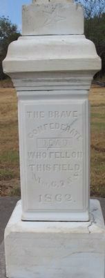
Front of Memorial
GEOGRAPHIC SORT Title Sort Marker Number Sort Marker Number Sort N Marker Number Sort T Publication Order Sort Publication Order Sort A Erected Year Sort Most Viewed Sort Most Recent-Interest Sort Most Recently Changed Sort SEE FAQ #33 FOR DESCRIPTIONS
On Military Park Road (County Road 65), on the right when traveling south.
On East Douglas Street (U.S. 62), on the right when traveling west on East Douglas Street.
On 13th Street Northwest at Quakenbos Street Northwest, on the right when traveling north on 13th Street Northwest.
On Ford Avenue (State Highway 144) at Coastal Highway (U.S. 17), on the right when traveling east on Ford Avenue.
On Nashville Street (U.S. 41) 0.3 miles south of Peters Lane, on the left when traveling north.
On Johnson Street at North McDonough Street, on the left when traveling east on Johnson Street.
On Burnt Hickory Road NW at Old Mountain Road NW, on the left when traveling east on Burnt Hickory Road NW.
On Palisades Road, 0 miles east of Peachtree Road NE (U.S. 19), in the median.
On Hall Memorial Road NW at Hall Road, on the left when traveling south on Hall Memorial Road NW.
Near Battlefield Memorial Highway (U.S. 421), on the right when traveling south.
Near Chapel Point Road, on the right when traveling east.
On Bethany Road (County Route 370) at Route 833, on the right when traveling west on Bethany Road.
Near Main Street, on the right when traveling north.
On East Fort Macon Road, in the median.
On Burnett Road (State Highway 82) at Ross West Road, on the right when traveling south on Burnett Road.
Paid Advertisement
On Bass Road (County Route 1008) at Bass Road (County Route 1194), on the left when traveling east on Bass Road.
On New Bern Road (U.S. 70) at Woodmen Way on New Bern Road.
On 1340 Old Waynesboro Road, on the right when traveling south.
On Broadway (Pennsylvania Route 194) at Carlisle Street (Pennsylvania Route 94), on the right on Broadway.
On Holtzclaw Avenue, on the right when traveling south.
Near Fort Dickerson Road west of Chapman Highway, on the left when traveling north.
On Jefferson Davis Highway (U.S. 51) at Graves Street (State Highway 87), on the right when traveling north on Jefferson Davis Highway.
On Fort Donelson Park Road, 0.1 miles north of Donelson Parkway (U.S. 79), on the right when traveling north. Reported missing.
On Appomattox Court House NHP entrance road, on the right when traveling north.
On Beverly Ford Road (County Route 676), on the right when traveling north.
On General Winder Road (County Route 657) at James Madison Highway (U.S. 15), on the right when traveling west on General Winder Road. Reported permanently removed.
On Dabney Mill Road (Virginia Route 613), on the right when traveling east.
On White Oak Road (Virginia Route 613) at Courthouse Road (Virginia Route 627), on the left when traveling west on White Oak Road.
On Boydon Plank Road (U.S. 1) at Duncan Road (Virginia Route 670), on the left on Boydon Plank Road.
Paid Advertisement
On Reams Drive (County Route 606) 0.1 miles west of Halifax Road (County Route 604), on the right when traveling west. Reported permanently removed.
Near White Oak Road at Clairborne Road, on the right when traveling west. Reported permanently removed.
Near West Ox Road (Virginia Route 608).
On Valley Pike (U.S. 11) at Belle Grove Road, on the right when traveling south on Valley Pike.
On Opequon Church Lane, on the right when traveling west.
On Redbud Road (Route 661), on the right when traveling east. Reported permanently removed.
On Washington Highway (U.S. 1), on the right when traveling south.
Near Cold Harbor Road (Virginia Route 156), on the right when traveling east. Reported missing.
On Anderson Wright Drive, on the right when traveling north. Reported permanently removed.
On Cold Harbor Road (Virginia Route 156), on the right when traveling east.
On Watt House Road (Virginia Route 718), on the right when traveling south. Reported permanently removed.
On Brook Road (U.S. 1) at Interstate 295, on the left when traveling south on Brook Road.
On New Market Road (Virginia Route 5) at Malvern Hill Lane, on the right when traveling west on New Market Road. Reported permanently removed.
On Charles City Road at Willis Church Road (Virginia Route 156), on the right when traveling west on Charles City Road.
On Darbytown Road at Fussells Ridge Drive, on the right when traveling east on Darbytown Road.
On East Williamsburg Road (U.S. 60), on the left when traveling west. Reported permanently removed.
Paid Advertisement
On Highland Turnpike (U.S. 250) at Bullpasture River Road (Virginia Route 678), on the left when traveling west on Highland Turnpike.
Near U.S. 250, on the right when traveling west.
Near Ball’s Bluff Road, on the left when traveling east.
On Louisa Road (U.S. 33) at Trevilians Square, on the right when traveling east on Louisa Road.
On Sandusky Drive, on the left when traveling west.
Near Battery Heights Boulevard at Quarry Road, on the left when traveling south. Reported permanently removed.
On Massey Hughes Drive, 0.4 miles Maryland Avenue, on the left when traveling east.
On Constitution Highway (State Highway 20), on the right when traveling west.
On Constitution Highway (State Highway 20) at Gold Dale Road (County Route 611), on the right when traveling east on Constitution Highway. Reported unreadable.
On Virginia Route 619, on the left when traveling south.
On Port Republic Road (County Route 659) south of Cross Keys Road (Virginia Route 276), on the right when traveling south.
On South East Side Highway (U.S. 340) at Ore Bank Road / Lynnwood Road (Virginia Route 708), on the right when traveling east on South East Side Highway.
On Old Valley Pike (U.S. 11), on the right when traveling south.
On George Collin Parkway aka Miller Lane (Virginia Route 305) near Interstate 81, exit 264 west (U.S. 211), in the median.
Near Old Salem Church Road near Plank Road (Virginia Route 3).
Near Plank Road / Germania Highway (State Highway 3), on the right when traveling west.
Paid Advertisement
On Grant Drive, 0.1 miles north of Brock Road (County Route 613), on the left when traveling south.
On East Main Street near Blue Ridge Avenue.
Near Laurel Mountain Road (County Route 15), on the right when traveling east.
On Mansfield Drive (U.S. 250) at North Main Street (U.S. 250), on the right when traveling east on Mansfield Drive.
On Fort Mill Ridge Park Road, on the right when traveling east.
On Seneca Trail (U.S. 219) 0.2 miles north of Delta Road 18, on the right when traveling north. Reported damaged.
On Rich Mountain Road / Files Creek Road (County Route 37/8), on the right when traveling east.
On Poplar Street, on the right when traveling south.