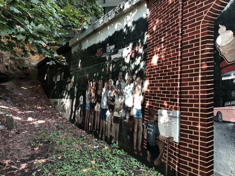
[Mural is on both sides of brick walls on the northern end of town that lie on both sides of the street:]
Wellsville Revitalization Committee Picnic
"Riverside"
Presbyterian Church, USA
525 Riverside Ave.
Founded April 5, 1831 . . . — — Map (db m156060) HM WM
On Sandusky Street at William Street (U.S. 36), on the right when traveling north on Sandusky Street.
The old city hall opened in 1882. Its clock tower rose to a height of 92ft. The first floor housed administrative offices, the police department, the jail, and the fire department. A 1,050 seat auditorium known as the Opera House graced the second . . . — — Map (db m12852) HM
University Hall was completed in 1893. It is constructed of Amherst Sandstone. The bell tower rises to a height of 148 feet. The structure houses administrative offices, classrooms, and the legendary Gray Chapel. Among the celebrities who have . . . — — Map (db m12845) HM
On East Court Street (U.S. 22) at North Main Street, on the left when traveling east on East Court Street.
Fayette County Court House Opened on May 1, 1885, this is the third Fayette County Court House building. Ohio artist Archibald Willard, who is best known for the patriotic painting, "The Spirit of '76," was commissioned by the firm Cooks . . . — — Map (db m106289) HM
On Broad Street (U.S. 40) at Drexel Avenue, on the right when traveling west on Broad Street.
To establish a camp of general rendezvous for the Ohio National Guard and other Ohio troops, the citizens of Columbus offered to the State of Ohio Bullitt Park, now a part of Bexley - President William McKinley, April 25 1898, through Governor Asa . . . — — Map (db m16931) HM
Near Broad Street (U.S. 40) at Starling Street, on the right when traveling east.
Toledo and Ohio Central Railroad Station
The only remaining Columbus railroad station, The Toledo & Ohio Central (T&OC) Railroad Station was constructed in 1895 and was the departure point for William McKinley when he left for Washington D.C to . . . — — Map (db m13067) HM
On West Broad Street (Old National Road) (U.S. 40) west of South Roys Avenue, on the left when traveling west.
Camp Chase was named in honor of Salmon P. Chase, former governor of Ohio and Secretary of the Treasury in President Abraham Lincoln’s Cabinet.
In July 1861, a small prison was erected at Camp Chase to handle the influx of political prisoners . . . — — Map (db m135244) HM
Panel 1
Camp Chase Prison
When President Abraham Lincoln called for volunteers to suppress the southern rebellion in April 1861, thousands of men rushed to Camp Jackson in Columbus, Ohio. Authorities established Camp Chase after . . . — — Map (db m94551) HM
On South High Street south of Broad Street (U.S. 40), on the left when traveling south.
“Let us ever remember that our interest is in concord, not conflict; and that our real eminence rests in the victories of peace, not those of war.”
“Our earnest prayer is that God will graciously vouchsafe prosperity, . . . — — Map (db m9887) HM
On Auburn Avenue, on the left when traveling south.
William Howard Taft. Born here on September 15, 1857, William Howard Taft is the only American to have served as President and Chief Justice of the United States. His unique career of public service began after he graduated from Yale . . . — — Map (db m168978) HM
On Columbia Street at South Street, on the left when traveling south on Columbia Street.
McKinley Park. William McKinley was the 25th President of the
United States. Following McKinley’s assassination
in 1901, the Village of Jackson dedicated this
triangle of land as a park in his honor. Earlier
in the nineteenth century, a . . . — — Map (db m123234) HM
On South Detroit Street at West Chillicothe Avenue, on the left when traveling south on South Detroit Street. Reported damaged.
Distinguished citizen, legislator, public servant, and historian born in Bellefontaine, January 23, 1840. A Civil War hero, he was promoted to brigadier general at only 25 years of age. Admitted to the bar in 1866, he practiced in Bellefontaine . . . — — Map (db m75545) HM
On Ohio Route 58 at Ohio Route 162, on the right when traveling north on State Route 58.
Side one:
Horr Cheese House, 1865
As late as the Civil War era, cheesemaking in Ohio remained largely a cottage industry. After investigating new processes and obtaining pledges for a reliable milk supply from area farmers, brothers . . . — — Map (db m38814) HM
On Adams Street east of North Michigan Street (State Route 25), on the left when traveling east.
(panel 1)
William McKinley
Born at Niles – Trumbull County, Ohio
January Twenty-Ninth – Eighteen Hundred and Forty-Three
Volunteer Soldier of the Rebellion
Representative in Congress
Twice Governor of Ohio
Twice . . . — — Map (db m121996) HM
On College Street near Lee Street, on the left when traveling west.
Poland Academy, an elite private school, was established on this site in 1830 and in 1859 graduated its most notable student William McKinley, who became the 25th president of the United States. In 1862, the school changed its name to Poland . . . — — Map (db m43799) HM
On South Main Street (Ohio Route 170) at College Street on South Main Street.
William McKinley’s boyhood home once stood here. The McKinley family moved to Poland in 1852 when William was nine to send the children to its superior schools. William was a diligent student at the Poland Academy, and passed his time playing . . . — — Map (db m77091) HM
On Main Street (Ohio Route 170) near College Street, on the left when traveling south.
Built in 1804 by Jonathan Fowler, one of the founders of Poland Village, this structure served as his family home, general store, tavern and a hotel all at the same time. It became an important stagecoach stop on the main highway between Pittsburgh . . . — — Map (db m43797) HM
On 2nd Street at Mulberry Avenue, on the left when traveling east on 2nd Street.
Side A: Morgan's Raid Route
Pursuers converge at Pomeroy
As Morgan's Raiders rode eastward across southern Ohio during the third week of July 1863, the scattered defensive forces pursuing him consolidated and drew closer. Four regiments . . . — — Map (db m28480) HM
On Burdette Road at Laurel Cliff Road, on the right when traveling north on Burdette Road.
Upon approaching the road to Pomeroy just before noon on July 18, 1863, Brigadier General John Hunt Morgan and his Confederate raiders faced a major challenge. Colonel Adam Johnson's detachment, which had been sent south to investigate a river . . . — — Map (db m108278) HM
Near Ohio River Scenic Byway (Ohio Route 124) south of New Portland Road, on the right when traveling south.
Union Troops Withdraw
In the early morning of July 19, Union Brigadier
General Henry Judah's forces, dispatched the day
before from Pomeroy, surprised both themselves
and the raiders by virtually running right into
Confederates hidden . . . — — Map (db m108361) HM
Piqua's public square, like in many mid-western communities, functions as the historical and cultural center of the city. Long after government buildings have moved to newer and larger sites, the public square maintains its status as the focal . . . — — Map (db m17367) HM
On N Patterson Blvd at 2nd Street, on the left when traveling north on N Patterson Blvd.
To The Memory of William McKinley
born Jan. 29th, 1843
died Sept. 14th, 1901
soldier in the Army of the Union
representative in Congress
Governor of Ohio
President of the United States
statesman, patriot, martyr
a Christian . . . — — Map (db m104552) HM WM
On Edison Street west of North Paul Laurence Dunbar Street, on the left when traveling west.
As a poet, novelist, and popular lecturer, Paul Laurence Dunbar used his extraordinary way with words to achieve international fame. In just ten years, Dunbar rose from a job running a downtown Dayton elevator to receiving an invitation to President . . . — — Map (db m67590) HM
On Main Street west of 2nd Street, on the right when traveling west.
Shawnee’s founder, T.J. Davis, purchased land from his fellow investors including this site, then occupied by the farm house of Israel Gordon. Within several months of the town’s platting in March, 1872, the farm house became the town’s first hotel, . . . — — Map (db m139214) HM
On Diamond Street at Park Street South, on the left when traveling south on Diamond Street.
Side A: John Sherman 1923-1900
Born in Lancaster, Fairfield County, John Sherman moved to Mansfield to practice law and was elected to Congress in 1854 as one of the first Republicans. In 1861, Sherman was elected to the U.S. Senate. . . . — — Map (db m20684) HM
On Cleveland Avenue at McKinley Parkway on Cleveland Avenue.
In honor of Grover Cleveland 22nd President of the United States and President-Elect for the Term 1893 - 1897 and William McKinley Governor of Ohio 1892 - 1896. Later 24th President of the United States 1897 - 1901. Mourners at the Funeral of their . . . — — Map (db m91955) HM
On South Washington Street (Ohio Route 100/231) at East Market Street (Ohio Route 18/101), on the right when traveling north on South Washington Street.
General Gibson believed the two most
important things in life were piety and
patriotism. In his creed they were linked
in indissoluble union. His piety was broad
enough to include every creed, his patriotism
wide enough to cover . . . — — Map (db m195296) HM WM
On West Main Street, 0.1 miles west of South Union Avenue (Ohio Route 183), on the right when traveling west.
In 1866, Alliance physician, amateur horticulturalist, and politician Dr. Levi Lamborn propagated the scarlet carnation from French seedlings in greenhouses at this site. Opposing William McKinley for the 18th Congressional District in 1876, . . . — — Map (db m78945) HM
On Harrison Avenue NW at 13th Street NW, on the right when traveling south on Harrison Avenue NW.
This large piece of steel was once a part of the proud USS Battleship Maine. The ship was commissioned in 1895 and was part of the “Great White Fleet.” The Maine sailed into Havana Harbor on January 25, 1898. The ship had been sent . . . — — Map (db m88563) HM
Built from 1905 to 1907, the McKinley National Memorial is the final resting place for President McKinley, his wife Ida, and their two young daughters. This magnificent tribute to our 25th President was built entirely from private donations, . . . — — Map (db m88512) HM
On McKinley Monument Drive NW, on the left when traveling north.
Final resting place of William McKinley Twenty-fifth President of the United States of America A government like ours rests upon the intelligence, morality and patriotism of the people. Speech delivered by President William McKinley . . . — — Map (db m88523) HM
Near The O'Jays Parkway NE south of 12th Street NE (Ohio Route 153), on the right when traveling south. Reported missing.
Nimisilla Park was established in 1894. Prior to its
founding, the site was the location of the county
fair from 1859 to 1893. Throughout its history,
Nimisilla Park hosted horse races, live music, soldier
reunions, and a zoo, among other . . . — — Map (db m231552) HM
Each detail incorporated into the Monument was designed to symbolically tell the visitor about William McKinley. According to the architect’s writings Harold Van Buren Magonigle’s design considered these factors: • The Memorial was to be . . . — — Map (db m88516) HM
On McKinley Monument Drive NW north of 7th Street NW.
William McKinley served the nation as president, the people of Ohio as governor, and the citizens of his congressional district as a representative. McKinley was shot by an assassin in Buffalo, New York, in September 1901 and died several days . . . — — Map (db m67439) HM
On Market Avenue S north of 4th Street, on the right when traveling south.
This house was built by George Dewalt ca 1840. A substantial section was then added CA 1870 by son-in-law James Saxton, father of Ida Saxton McKinley and son of John Saxton (founder of the Canton Repository). This was the home of Ida prior to her . . . — — Map (db m67414) HM
On McKinley Monument Drive NW north of 7th Street NW.
A statesman singularly gifted to unite the discordant forces of government and mould the diverse purposes of men toward progressive and salutary action. A magistrate whose poise of judgment was tested and vindicated in a succession of national . . . — — Map (db m67438) HM WM
On McKinley Monument Drive NW, on the left when traveling north.
25th President of the United States Born 1843 • Died 1901 — • — He was an obedient and affectionate son, patriotic and faithful as a soldier, honest and upright as a citizen, tender and devoted as a husband, and truthful, generous, . . . — — Map (db m86771) HM
William McKinley’s house, once located at this site, was the scene of his 1896 “front porch campaign” for President of the United States. During the campaign McKinley addressed about 750,000 people who came to his home in Canton. . . . — — Map (db m67418) HM
Near Front Street at Prospect Avenue, on the right when traveling north.
In 1879, local hardware store owners L.W. Loomis and H.E. Parks established a summer resort at Front Street and Prospect Avenue. The High Bridge Glens and Caves park spanned both sides of the Cuyahoga River and featured a dance and dining . . . — — Map (db m225405) HM
On Ohio Route 46, 0.1 miles south of West Park Avenue, on the right when traveling south.
Side A:
One of seven native Ohioans to serve as president of the United States, William McKinley (1843-1901) was born at this site. The original house was moved from this site and ultimately destroyed by fire. The McKinleys lived here until . . . — — Map (db m65454) HM
On Howland Springs Road SE, 0.2 miles east of Niles Corland Road SE (Ohio Route 46), on the right when traveling west.
On January 31, 1798, Joseph Howland bought Township 4-Range 3 (Howland Twp.) for $12, 903.23 and an equalizing portion of Township 1-Range 10 (Springfield Twp.) as part of a lottery held to distribute Connecticut's Western Reserve lands. On February . . . — — Map (db m121473) HM
On Mahoning Avenue, 0.3 miles north of West Market Street, on the right when traveling south.
This ornate Victorian/Italianate house was constructed in 1871 as the home of Henry Bishop Perkins, Sr., a civic, business, and political leader of the Western Reserve. During the 19th and early 20th century political figures such as U.S. Grant, . . . — — Map (db m65450) HM
On Pacific Highway West at Pacific Hwy W (U.S. 20) on Pacific Highway West.
The Opera House was built on this site in 1870. It was a wooden building with a porch and covered entrance which faced on Fourth Street. The residents of Corvallis raised the money by subscription and donated their labor to build it. Inside there . . . — — Map (db m112917) HM
On Perkiomen Avenue (Business U.S. 422), on the left when traveling east.
Born at Niles, Ohio, 1843
Enlisted in the Union Army as Private, 1861
Mustered out as Major, 1865
Elected President, 1896
Re-elected President, 1900
Died at Buffalo, N.Y. 1901
Last Public Utterances at the
Pan American Exposition, . . . — — Map (db m25289) HM
On Coal Hill Road (U.S. 219) 0.1 miles east of Bearfield Road, on the right when traveling east.
A famous portrait and scenic artist, Burfoot came to the US in the 1880's and Clearfield County in 1895. His home later in life was at this site with a studio in his yard. He also had studios in Pittsburgh, Washington and New York. His work is . . . — — Map (db m122450) HM
On North Union Street (Pennsylvania Route 441), on the left when traveling north.
Covering three square miles, the former Camp Meade was situated a half mile to the northwest. Named for famed Civil War General, it was opened during the Spanish-American War and visited by President William McKinley on August 27, 1898. — — Map (db m216484) HM
On Meredith Street east of Main Street (Business U.S. 6), on the right when traveling east.
Terence Powderly and National Labor Movements
Terence Powderly grew from child laborer in Carbondale to a leader in the national labor movement.
Terence Vincent Powderly
Terence Vincent Powderly was born in Carbondale on . . . — — Map (db m128155) HM
On Walnut Street (County Road 3006) near South Watts Street, on the right when traveling west.
Until 1903, "The Yellow Mansion," pictured here, stood at the northeast corner of Broad and Walnut streets (directly behind where you are standing). Build in 1839 for a wealthy banker, it was for a time the most valuable home in the city. . . . — — Map (db m191882) HM
On Walnut Street at South 16th Street, on the right when traveling west on Walnut Street. Reported damaged.
This stately Renaissance-style home at the Northwest corner of 16th & Walnut Streets was built in 1901 for a wealthy banker and designed by renowned Philadelphia architect Horace Trumbauer, who also designed the Philadelphia Museum of Art. This . . . — — Map (db m191880) HM
Near Limekiln Pike at Haines Street (69th Avenue).
The Confederate Section All of the Confederate prisoners of war buried here died in a Civil War military hospital in or near Philadelphia. All were originally interred near the hospital where they died. In the late 1880s, the dead were moved . . . — — Map (db m136479) HM
On S Penn Square, on the left when traveling east.
President William McKinley, who led the country during the Spanish-American War, had many fervent supporters in Philadelphia. Three days after his assassination in 1901, The Philadelphia Inquirer newspaper started a drive to fund a . . . — — Map (db m107329) HM
On Freedom Blvd. (US 21) at Freedom Rd. (US 21), on the right when traveling north on Freedom Blvd. (US 21).
The first settlement of the town of Branchville was 1735 about one mile southeast of the present town. Almost 100 years later, the present town grew from 170 acres of land purchased from the South Carolina Canal and Railroad Company. It was . . . — — Map (db m16536) HM
On North Phillips Avenue south of West 5th Street, on the right when traveling north.
Train loads of visitors swarmed to Sioux Falls on October 14, 1899, to see the first president ever to visit South Dakota. The city appeared to be “one blaze of national colors.” Hundreds of flags waved, and patriotic bunting stretched “from . . . — — Map (db m124182) HM
On North Phillips Avenue north of West 5th Street, on the right when traveling north.
(panel 1)
”If you didn't drink whiskey, play cards, use your fists or otherwise intimidate, you didn't belong in the arena with Frank Pettigrew… a man who came to the Dakotas with nothing but desire, talent and ambition. He pitched his . . . — — Map (db m124226) HM
Born: October 27, 1858, New York, New York
Married: Alice Hathaway Lee (1861-1884), October 27, 1880; Edith Kermit Carow (1861-1848), December 2, 1886
Children: Alice, Theodore, Jr., Kermit, Ethel, Archibald, Quentin
Died: January 6, . . . — — Map (db m89459) HM
On Walnut Street at West 3rd Street, on the right when traveling north on Walnut Street.
This corner of Walnut and 3rd Streets has been the focal point of many historical events in Yankton. Among the most significant were visits by William Jennings Bryan, President William McKinley, and President Theodore Roosevelt.
William . . . — — Map (db m211682) HM
On Church Street, 0.1 miles west of 4th Avenue North, on the left when traveling east.
On this site stood the Maxwell House Hotel built by John Overton in 1859. It was destroyed by fire on Christmas Day, 1961. After wartime use as a barracks, hospital and prison, it was formally opened as a hotel in 1869. Presidents Andrew Johnson, . . . — — Map (db m24145) HM
On Corpus Christi Street, on the right when traveling east.
Bee County was created in 1857 from parts of five neighboring counties. The first county seat was located seven miles east of this site, and the first commissioners court was held on the banks of Medio Creek in February 1858. The city's earliest . . . — — Map (db m32200) HM
On King Court, 0.1 miles west of East FM Road 1431, on the left when traveling west.
The McKinley Coach is the oldest rail car at The Antlers Hotel. Construction with square nails date it to the 1800’s. Coach/baggage combination cars were especially suited for shortline railroads such as the 7 mile long Rockdale, Sandow & . . . — — Map (db m110806) HM
On Congress Avenue south of West 11th Street, on the right when traveling south.
Built 1876 by Chas. Lundberg. Bread then was not sliced or wrapped; children and maids waited with baskets to take home loaves hot from the oven. House specialties were sponge cake ladyfingers, glazed kisses, almond-meal macaroons.
A front . . . — — Map (db m26046) HM
On West Shore Road, 1.2 miles south of New Road, on the right when traveling north.
On this site on September 6, 1901, Vice President Teddy Roosevelt was a guest at the home of Lieut. Gov. Nelson Fisk to be the main speaker at the annual meeting of the Vermont Fish and Game League. Here Roosevelt learned that President McKinley . . . — — Map (db m74729) HM
On South Washington Street (U.S. 29) at Hillwood Avenue (Virginia Route 338), on the right when traveling north on South Washington Street.
Rebuilding 1865 - 1890
Coming of the Railroad
Railroads began to spread across the eastern seaboard in the 1830s, providing fast and reliable transportation for goods and passengers. The local railroad received its charger in . . . — — Map (db m206634) HM
On Klines Mill Road (Virginia Route 633) 0.5 miles west of Valley Pike (U.S. 11), on the left when traveling west.
General Philip Sheridan arrived on the battlefield following his famous and dramatic "Ride" from his headquarters in Winchester. Along the way he ordered Captain (and future U.S. President) William McKinley to stop retreating units and direct . . . — — Map (db m235380) HM
Near Battle Park Drive, on the right when traveling west.
The First Battle of Kernstown, fought by 10,000 Americans on March 23, 1862, was the first battle waged in the Shenandoah Valley. Throughout the morning, sixteen Union cannon crowned the knolls of Pritchard’s Hill (the high ground immediately north . . . — — Map (db m2169) HM
On Redbud Road (County Route 661), on the right when traveling east. Reported permanently removed.
The Third Battle of Winchester, fought here on September 19, 1864, was a proving ground for several men on both sides who shaped post-war America. They included two future presidents, two senators, a state governor, and several military leaders. . . . — — Map (db m155042) HM
On Hanover Street just west of Charles Street, on the left when traveling west.
Historic Fredericksburg Foundation
1851
Built for Eustace Conway, Lawyer
Visited by President William McKinley in 1900
[Additional plaque below:]
Owners of
401 Hanover Street
Land
Original Land . . . — — Map (db m148568) HM
On Lafayette Boulevard at Sunken Road, on the right when traveling south on Lafayette Boulevard.
To commemorate the valor of the Fifth Corps, Army of the Potomac, and in loving memory of its heroic dead this monument has been erected by Major General Daniel Butterfield, U.S.V., its commander on this field December 13th 1862.
. . . — — Map (db m1677) HM
On Business US 17 at Calhoun Street, on the left when traveling south on Business US 17.
Here lived Thomas Calhoun Walker, the first black to practice law in Gloucester County and a civil rights spokesman who vigorously advocated education and land ownership for blacks. Mr. Walker was elected for two terms to Gloucester's Board of . . . — — Map (db m7582) HM
On Sandusky Drive, on the left when traveling west.
Union Gen. David Hunter’s army reached the outskirts of Lynchburg on June 17, 1864, despite being delayed by engagements with Gen. John McCausland’s Confederate cavalry. That evening, Hunter made his headquarters here at Sandusky, aware that . . . — — Map (db m3923) HM
On Fort Avenue (Business U.S. 460) at Coronado Lane, on the right when traveling east on Fort Avenue.
To the northwest is Sandusky, built by Charles Johnston about 1808. He named it after a place in Ohio where Indians had held him prisoner in 1790. The two-story structure was one of the Lynchburg area's first houses to display the details and . . . — — Map (db m54420) HM
Near Effingham Street at Crawford Parkway, on the right when traveling north.
On June 17, 1898, President William McKinley signed a bill establishing the Navy Hospital Corps. Navy Corpsmen are trained in the science of health and nursing skills necessary to provide proper patient care at hospitals, ships at sea and to the . . . — — Map (db m83932) HM
On Cleburne Boulevard (Virginia Route 100) at International Boulevard (County Route 790), on the right when traveling south on Cleburne Boulevard.
Here on May 9, 1864, was fought the Battle of Cloyd's Farm in which more than 800 gallant men were killed.
Rutherford B. Hayes & William McKinley later presidents of the United States engaged in this battle as officers of the Union . . . — — Map (db m162942) HM
Near Berkley Williams Drive, 0.7 miles Charlie Coles Drive.
On May 10, 1864, the day after defeating Confederate forces in the bloody battle of Cloyd's Mountain, Union Gen. George Crook's Army of the Kanawha attacked and burned this railroad bridge over the New River. During the Civil War, the railroad was . . . — — Map (db m9514) HM
Near Dock Street at Pear Street, on the right when traveling east.
The concrete walls in front of you are all that is left of the once-bustling Trigg Shipyard. The yard employed 2,000 men and was comprised of 16 large industrial buildings on a 25-acre site with 20 acres in water, dock, and boat basin. In . . . — — Map (db m92632) HM
Near Thompson Memorial Drive (Virginia Route 311) at Kessler Mill Drive.
On June 21, 1864, two future presidents marched with Major General David Hunter’s Army of Western Virginia on its retreat from Lynchburg to West Virginia by way of Hanging Rock and the old New Castle Turnpike.
Colonel Rutherford Birchard . . . — — Map (db m15101) HM
On Brownsburg Turnpike (Virginia Route 252) at Hays Creek Road (Virginia Route 724), on the left when traveling south on Brownsburg Turnpike.
On May 26, 1864, Union Gen. David Hunter marched south from Cedar Creek near Winchester to drive out Confederate forces, lay waste to the Shenandoah Valley, and destroy the railroads at Lynchburg. His raid was part of Gen. Ulysses S. . . . — — Map (db m182682) HM
On Battle Park Drive at Saratoga Drive, on the right when traveling west on Battle Park Drive.
The nearly three-hundred-year-old farm in front of you was the site of two major battlefields—First and Second Kernstown—as well as the opening scenes of the Second Battle of Winchester and several smaller engagements. The Hoge family . . . — — Map (db m159184) HM
Near Battle Park Drive, on the right when traveling west. Reported permanently removed.
Colonel James A. Mulligan’s Union command of 1,800 men encamped on these heights on the night of July 23-24, 1864. When Confederate cavalry drove Union cavalry back toward Kernstown on the morning of the 24th, Mulligan deployed two cannon on this . . . — — Map (db m154717) HM
On Battle Park Drive, 0.5 miles west of Saratoga Drive, on the right when traveling west.
Colonel James A. Mulligan's Union command of 1,800 men encamped on these heights on the night of July 23, 1864, when Confederate cavalry drove Union cavalry back toward Kernstown on the morning of the 24th, Mulligan deployed two cannons on the . . . — — Map (db m159178) HM
On National Avenue (State Highway 7), on the right when traveling east.
Near here Early, facing east, took his last position on September 19, 1864. About sundown he was attacked and driven from it, retreating south. Presidents Rutherford B. Hayes and William McKinley served in this engagement on the Union side. — — Map (db m2656) HM
Located across Kanawha River from this point was Civil War camp for Union Army, 1862-64. Site had 56 cabins and parade grounds for 23rd Ohio Vol. Inf. commanded by Col. Rutherford B. Hayes and Lt. William McKinley, future United States presidents. — — Map (db m50397) HM
On West Dupont Avenue (Local Route 60/12) north of West 15th Street, on the right when traveling north.
Site of the largest Civil War camp
in the Kanawha Valley, it was named
for Union Col. A. Sanders Piatt of
the 34th Ohio (Zouaves). Location
along present-day U.S. Route 60 and
the Kanawha River was of strategic
importance to troops of both . . . — — Map (db m137854) HM
On Mt. View Drive at Sheridan Circle, on the right when traveling east on Mt. View Drive.
At the top of the hill is the site of an earthwork fort built by Union soldiers in 1863. During the battle of Sept. 13, 1862, Confederate artillery fired on Charleston from this place. Hayes and McKinley, future presidents, served at the fort. — — Map (db m178789) HM
On Kanawha Boulevard at Court Street, on the right when traveling south on Kanawha Boulevard.
Camp White, the main Union camp at Charleston, was located directly across the Kanawha River from here. Col. Rutherford B. Hayes, 23rd Ohio Infantry, occupied the camp and Charleston in March 1863. He ordered his men to build a fort on top of the . . . — — Map (db m59521) HM
On U.S. 19 at Toad Level Road, on the right when traveling north on U.S. 19.
Here in 1862 was stationed the 23rd Ohio Regt., U.S.A. Encamped here were Gen. J.D. Cox, Maj. R.B. Hayes and Sergt. William McKinley. All became governors of Ohio; Hayes and McKinley became Presidents of the United States. — — Map (db m42175) HM
On North Walker Street at Honaker Street (U.S. 19), on the left when traveling north on North Walker Street.
This house, the home of physician Robert B. McNutt, is the only antebellum dwelling in Princeton. It survived the fire that Col. Walter H. Jenifer of the 8th Virginia Cavalry ignited on May 1, 1862, as he evacuated the town.
Jenifer was . . . — — Map (db m37744) HM
On Main Street (U.S. 219) at Nota Street, on the right when traveling north on Main Street.
In May 1864, as Union Gen. George Crook led his force through Union on a Sunday morning after his victory at Cloyd’s Mountain, VA., on May 9, “there was a Sabbath stillness, scarcely anyone to be seen.” Although some of the Federals . . . — — Map (db m59262) HM
On Veterans Memorial Highway (West Virginia Route 7) at Alpine Lake Road (County Route 46), on the right when traveling west on Veterans Memorial Highway.
Barbour County
Attractions
Alderson-Broaddus College. This private coeducational college is situated on a beautiful 170-acre campus overlooking Philippi, site of the first land battle of the Civil War. Its excellent performing arts . . . — — Map (db m239336) HM
This pavilion was built as a 450-seat lecture hall for the Monona Lake Assembly. Established to provide instruction for Sunday school teachers, it soon became a popular summer camp for tourists from throughout the Midwest. As many as 15,000 came . . . — — Map (db m35403) HM
Near West Greenfield Avenue (State Highway 59) north of South 81st Street, on the right when traveling west.
At the outbreak of the Spanish-American War in April of 1898, President William McKinley called on the states to gather their military forces. State officials ordered the Wisconsin National Guard to report for duty at Camp Harvey, named for . . . — — Map (db m36393) HM
193 entries matched your criteria. Entries 101 through 193 are listed above. ⊲ Previous 100