193 entries match your criteria. Entries 101 through 193 are listed.⊲ Previous 100
Former U.S. Presidents: #25 William McKinley Historical Markers
By Devry Becker Jones (CC0), September 10, 2020
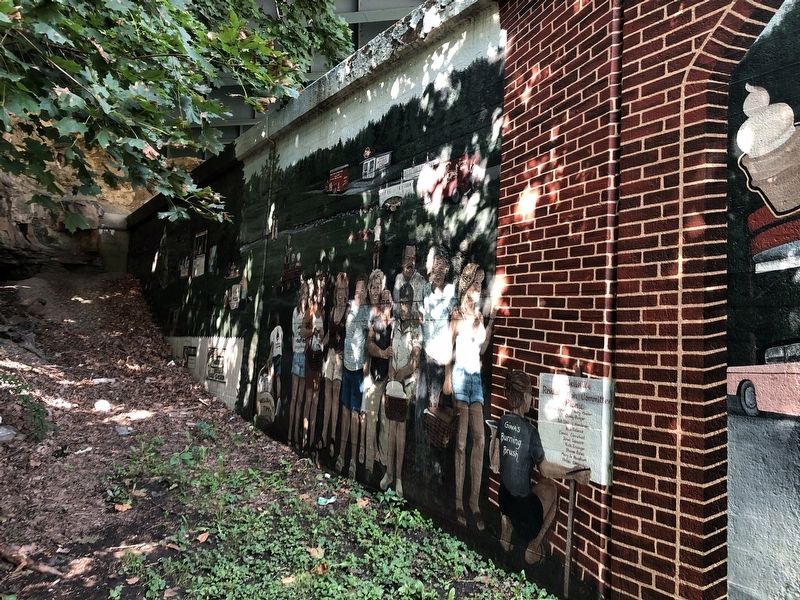
Wellsville Mural Marker
| 101 ► Ohio, Columbiana County, Wellsville — Wellsville Mural — |
| On Lisbon Street at 1st Street on Lisbon Street. | |||
| 102 ► Ohio, Delaware County, Delaware — Old City Hall and Opera House — |
| On Sandusky Street at William Street (U.S. 36), on the right when traveling north on Sandusky Street. | |||
| 103 ► Ohio, Delaware County, Delaware — University Hall and Gray Chapel — |
| 104 ► Ohio, Fayette County, Washington Court House — 1-24 — Fayette County Court House / Washington Court House Riot of 1894 — Archibald M. Willard Murals — |
| On East Court Street (U.S. 22) at North Main Street, on the left when traveling east on East Court Street. | |||
| 105 ► Ohio, Franklin County, Bexley, Bullitt Park — Camp Bushnell — Spanish American War — Here Ohio Loyalty Responded to the Summons"Remember the Maine" — |
| On Broad Street (U.S. 40) at Drexel Avenue, on the right when traveling west on Broad Street. | |||
| 106 ► Ohio, Franklin County, Columbus, Downtown — 106-25 — Toledo and Ohio Central Railroad Station / Macklin Hotel — |
| Near Broad Street (U.S. 40) at Starling Street, on the right when traveling east. | |||
| 107 ► Ohio, Franklin County, Columbus, Hilltop — Camp Chase — The Historic National Road in Ohio — |
| On West Broad Street (Old National Road) (U.S. 40) west of South Roys Avenue, on the left when traveling west. | |||
| 108 ► Ohio, Franklin County, Columbus, Hilltop — Camp Chase Confederate Cemetery — |
| 109 ► Ohio, Franklin County, Columbus, Uptown District — William McKinley — Twenty-Fifth President of the United States — |
| On South High Street south of Broad Street (U.S. 40), on the left when traveling south. | |||
| 110 ► Ohio, Hamilton County, Cincinnati, Mount Auburn — 43-31 — William Howard Taft / Robert Alphonso Taft — |
| On Auburn Avenue, on the left when traveling south. | |||
| 111 ► Ohio, Jackson County, Jackson — 8-40 — McKinley Park / William McKinley — |
| On Columbia Street at South Street, on the left when traveling south on Columbia Street. | |||
| 112 ► Ohio, Logan County, Bellefontaine — 13-46 — General Robert Patterson Kennedy |
| On South Detroit Street at West Chillicothe Avenue, on the left when traveling south on South Detroit Street. Reported damaged. | |||
| 113 ► Ohio, Lorain County, Wellington — 5-47 — Horr Cheese House, 1865 / Myron T. Herrick (1854-1929) — |
| On Ohio Route 58 at Ohio Route 162, on the right when traveling north on State Route 58. | |||
| 114 ► Ohio, Lucas County, Toledo, Center City — William McKinley Monument — |
| On Adams Street east of North Michigan Street (State Route 25), on the left when traveling east. | |||
| 115 ► Ohio, Mahoning County, Poland — 17-50 — Poland Academy and Poland Seminary — |
| On College Street near Lee Street, on the left when traveling west. | |||
| 116 ► Ohio, Mahoning County, Poland — 35-50 — President William McKinley's Boyhood Home — |
| On South Main Street (Ohio Route 170) at College Street on South Main Street. | |||
| 117 ► Ohio, Mahoning County, Poland — 27-50 — The Old Stone Tavern — |
| On Main Street (Ohio Route 170) near College Street, on the left when traveling south. | |||
| 118 ► Ohio, Meigs County, Pomeroy — 12-53 — Morgan's Raid Route / Meigs County Courthouse — Pursuers converge at Pomeroy — |
| On 2nd Street at Mulberry Avenue, on the left when traveling east on 2nd Street. | |||
| 119 ► Ohio, Meigs County, Pomeroy — 20 — Salisbury Township — The Gauntlet — John Hunt Morgan Heritage Trail — |
| On Burdette Road at Laurel Cliff Road, on the right when traveling north on Burdette Road. | |||
| 120 ► Ohio, Meigs County, Portland — Surprise Encounter — Battle of Buffington Island — |
| Near Ohio River Scenic Byway (Ohio Route 124) south of New Portland Road, on the right when traveling south. | |||
| 121 ► Ohio, Miami County, Piqua — Public Square — Sign of the Past — |
| Near Main Street. | |||
| 122 ► Ohio, Montgomery County, Dayton, Downtown — To the Memory of William McKinley — |
| On N Patterson Blvd at 2nd Street, on the left when traveling north on N Patterson Blvd. | |||
| 123 ► Ohio, Montgomery County, Dayton, Wolf Creek — Making His Way With Words — Paul Laurence Dunbar — Dayton Aviation Heritage National Historic Park — |
| On Edison Street west of North Paul Laurence Dunbar Street, on the left when traveling west. | |||
| 124 ► Ohio, Perry County, Shawnee — 4 — A Boom Town — |
| On Main Street west of 2nd Street, on the right when traveling west. | |||
| 125 ► Ohio, Richland County, Mansfield — 6-70 — John Sherman, 1823-1900 / The Sherman Anti-Trust Act — |
| On Diamond Street at Park Street South, on the left when traveling south on Diamond Street. | |||
| 126 ► Ohio, Sandusky County, Fremont — Cleveland Gateway — McKinley Memorial Parkway — |
| On Cleveland Avenue at McKinley Parkway on Cleveland Avenue. | |||
| 127 ► Ohio, Seneca County, Tiffin — William Harvey Gibson — |
| On South Washington Street (Ohio Route 100/231) at East Market Street (Ohio Route 18/101), on the right when traveling north on South Washington Street. | |||
| 128 ► Ohio, Stark County, Alliance — 20-76 — Alliance-Birthplace of Ohio's State Flower - The Scarlet Carnation — |
| On West Main Street, 0.1 miles west of South Union Avenue (Ohio Route 183), on the right when traveling west. | |||
| 129 ► Ohio, Stark County, Canton — Base of the Conning Tower of the US Battleship Maine — |
| On Harrison Avenue NW at 13th Street NW, on the right when traveling south on Harrison Avenue NW. | |||
| 130 ► Ohio, Stark County, Canton — Building the McKinley National Memorial — |
| Near Monument Drive NW north of 7th Street NW. | |||
| 131 ► Ohio, Stark County, Canton — McKinley National Memorial — |
| On McKinley Monument Drive NW, on the left when traveling north. | |||
| 132 ► Ohio, Stark County, Canton — 25-76 — Nimisilla Park |
| Near The O'Jays Parkway NE south of 12th Street NE (Ohio Route 153), on the right when traveling south. Reported missing. | |||
| 133 ► Ohio, Stark County, Canton — Symbolism of the McKinley National Memorial — |
| On Monument Drive NW north of 7th Street NW. | |||
| 134 ► Ohio, Stark County, Canton — 6-76 — The McKinley National Memorial — |
| On McKinley Monument Drive NW north of 7th Street NW. | |||
| 135 ► Ohio, Stark County, Canton — The Saxton House — Home of Ida Saxton McKinley — First Ladies National Historic Site — |
| On Market Avenue S north of 4th Street, on the right when traveling south. | |||
| 136 ► Ohio, Stark County, Canton — William McKinley — President of the United States — |
| On McKinley Monument Drive NW north of 7th Street NW. | |||
| 137 ► Ohio, Stark County, Canton — William McKinley — |
| On McKinley Monument Drive NW, on the left when traveling north. | |||
| 138 ► Ohio, Stark County, Canton — 18-76 — William McKinley — Former Site of the Home of President William McKinley — |
| On 8th Street NW west of Market Avenue N. | |||
| 139 ► Ohio, Summit County, Cuyahoga Falls — 42-77 — High Bridge Glens — |
| Near Front Street at Prospect Avenue, on the right when traveling north. | |||
| 140 ► Ohio, Trumbull County, Niles — William McKinley — Historical Museum and Memorial Library — |
| On South Main Street. | |||
| 141 ► Ohio, Trumbull County, Niles — 17-78 — William McKinley Birthplace — |
| On Ohio Route 46, 0.1 miles south of West Park Avenue, on the right when traveling south. | |||
| 142 ► Ohio, Trumbull County, Warren — 16-78 — Howland Springs — |
| On Howland Springs Road SE, 0.2 miles east of Niles Corland Road SE (Ohio Route 46), on the right when traveling west. | |||
| 143 ► Ohio, Trumbull County, Warren — 1-78 — Perkins House — |
| On Mahoning Avenue, 0.3 miles north of West Market Street, on the right when traveling south. | |||
| 144 ► Oregon, Benton County, Corvallis — The Opera House — |
| On Pacific Highway West at Pacific Hwy W (U.S. 20) on Pacific Highway West. | |||
| 145 ► Pennsylvania, Berks County, Reading — William McKinley — |
| On Perkiomen Avenue (Business U.S. 422), on the left when traveling east. | |||
| 146 ► Pennsylvania, Clearfield County, Luthersburg — Richard H. Burfoot — (1866-1939) — |
| On Coal Hill Road (U.S. 219) 0.1 miles east of Bearfield Road, on the right when traveling east. | |||
| 147 ► Pennsylvania, Dauphin County, Middletown, Lower Swatara Township — Camp George Gordon Meade — |
| On North Union Street (Pennsylvania Route 441), on the left when traveling north. | |||
| 148 ► Pennsylvania, Lackawanna County, Carbondale, Carbondale Township — Terence Powderly and National Labor Movements / A Valley of Firsts — Lackawanna River Heritage Trail — |
| On Meredith Street east of Main Street (Business U.S. 6), on the right when traveling east. | |||
| 149 ► Pennsylvania, Philadelphia County, Philadelphia, Gayborhood — On this block in 1902 — |
| On Walnut Street (County Road 3006) near South Watts Street, on the right when traveling west. | |||
| 150 ► Pennsylvania, Philadelphia County, Philadelphia, Rittenhouse Square — 16th & Walnut — On this block in 1901 |
| On Walnut Street at South 16th Street, on the right when traveling west on Walnut Street. Reported damaged. | |||
| 151 ► Pennsylvania, Philadelphia County, Philadelphia, West Oak Lane — Confederate Burials in the National Cemetery — |
| Near Limekiln Pike at Haines Street (69th Avenue). | |||
| 152 ► Pennsylvania, Philadelphia County, Philadelphia, William Penn Annex West — 111 — William McKinley — 1908 — Charles Albert Lopez (1869-1906); Isidore Konti (1862-1938) — |
| On S Penn Square, on the left when traveling east. | |||
| 153 ► South Carolina, Orangeburg County, Branchville — Branchville Depot — |
| On Freedom Blvd. (US 21) at Freedom Rd. (US 21), on the right when traveling north on Freedom Blvd. (US 21). | |||
| 154 ► South Dakota, Minnehaha County, Sioux Falls, Downtown — President William McKinley — |
| On North Phillips Avenue south of West 5th Street, on the right when traveling north. | |||
| 155 ► South Dakota, Minnehaha County, Sioux Falls, Downtown — Richard Franklin Pettigrew — (1848 - 1926) — |
| On North Phillips Avenue north of West 5th Street, on the right when traveling north. | |||
| 156 ► South Dakota, Pennington County, Keystone — Theodore Roosevelt — 26th President — 1901-1909 — |
| Near State Highway 244. | |||
| 157 ► South Dakota, Yankton County, Yankton — The Intersection of Third & Walnut — |
| On Walnut Street at West 3rd Street, on the right when traveling north on Walnut Street. | |||
| 158 ► Tennessee, Davidson County, Nashville, Downtown — 3A 77 — Maxwell House Hotel — |
| On Church Street, 0.1 miles west of 4th Avenue North, on the left when traveling east. | |||
| 159 ► Texas, Bee County, Beeville — 12317 — Bee County Courthouse — |
| On Corpus Christi Street, on the right when traveling east. | |||
| 160 ► Texas, Llano County, Kingsland — McKinley Coach — |
| On King Court, 0.1 miles west of East FM Road 1431, on the left when traveling west. | |||
| 161 ► Texas, Travis County, Austin, Downtown Austin — 14949 — Old Bakery — |
| On Congress Avenue south of West 11th Street, on the right when traveling south. | |||
| 162 ► Vermont, Grand Isle County, Isle La Motte — Theodore Roosevelt's Visit to Isle La Motte — |
| On West Shore Road, 1.2 miles south of New Road, on the right when traveling north. | |||
| 163 ► Virginia, Falls Church — Rebuilding 1865 - 1890 / Turn of the 20th Century 1890 - 1920 — |
| On South Washington Street (U.S. 29) at Hillwood Avenue (Virginia Route 338), on the right when traveling north on South Washington Street. | |||
| 164 ► Virginia, Frederick County, Middletown — Sheridan Arrives — 10:30 am — |
| On Klines Mill Road (Virginia Route 633) 0.5 miles west of Valley Pike (U.S. 11), on the left when traveling west. | |||
| 165 ► Virginia, Frederick County, Winchester — Ohio — To Her Noble Sons — |
| Near Redbud Road (Virginia Route 661) 0.9 miles south of Martinsburg Pike (U.S. 11), on the right when traveling south. | |||
| 166 ► Virginia, Frederick County, Winchester — The First Battle of Kernstown — The Beginning of “Stonewall” Jackson’s Valley Campaign — |
| Near Battle Park Drive, on the right when traveling west. | |||
| 167 ► Virginia, Frederick County, Winchester — Third Battle of Winchester — A Gathering of Future Leaders — 1864 Valley Campaign |
| On Redbud Road (County Route 661), on the right when traveling east. Reported permanently removed. | |||
| 168 ► Virginia, Fredericksburg — 401 Hanover Street — |
| On Hanover Street just west of Charles Street, on the left when traveling west. | |||
| 169 ► Virginia, Fredericksburg — The Fifth Corps, Army of the Potomac — |
| On Lafayette Boulevard at Sunken Road, on the right when traveling south on Lafayette Boulevard. | |||
| 170 ► Virginia, Gloucester County, Gloucester — NW-11 — Thomas Calhoun Walker — (1862 - 1953) — |
| On Business US 17 at Calhoun Street, on the left when traveling south on Business US 17. | |||
| 171 ► Virginia, Lynchburg, Sandusky — Sandusky — Hunter's Headquarters — Battle of Lynchburg — |
| On Sandusky Drive, on the left when traveling west. | |||
| 172 ► Virginia, Lynchburg, Sheffield — L-22 — Sandusky — |
| On Fort Avenue (Business U.S. 460) at Coronado Lane, on the right when traveling east on Fort Avenue. | |||
| 173 ► Virginia, Portsmouth, Swimming Point — Portsmouth Naval Hospital — “The Navy’s First Corps School 1902” — Fort Nelson Park — |
| Near Effingham Street at Crawford Parkway, on the right when traveling north. | |||
| 174 ► Virginia, Pulaski County, Dublin — Battle of Cloyd's Farm — |
| On Cleburne Boulevard (Virginia Route 100) at International Boulevard (County Route 790), on the right when traveling south on Cleburne Boulevard. | |||
| 175 ► Virginia, Radford — New River Bridge — Attack on the Virginia & Tennessee Railroad — |
| Near Berkley Williams Drive, 0.7 miles Charlie Coles Drive. | |||
| 176 ► Virginia, Richmond, Shockoe Bottom — Here Stood the Trigg Shipyard — |
| Near Dock Street at Pear Street, on the right when traveling east. | |||
| 177 ► Virginia, Roanoke County, Hanging Rock — Two Future Presidents In Wartime Retreat — Hanging Rock Battlefield Trail — |
| Near Thompson Memorial Drive (Virginia Route 311) at Kessler Mill Drive. | |||
| 178 ► Virginia, Rockbridge County, Brownsburg — Brownsburg — Target of Hunter's Raid — |
| On Brownsburg Turnpike (Virginia Route 252) at Hays Creek Road (Virginia Route 724), on the left when traveling south on Brownsburg Turnpike. | |||
| 179 ► Virginia, Winchester — Kernstown Battlefield — A Unique Civil War Site — |
| On Battle Park Drive at Saratoga Drive, on the right when traveling west on Battle Park Drive. | |||
| 180 ► Virginia, Winchester — President William McKinley — Mason — |
| Near Loudoun Street Pedestrian Mall. | |||
| 181 ► Virginia, Winchester — The Second Battle of Kernstown — Two Future U.S. Presidents Fought at Kernstown |
| Near Battle Park Drive, on the right when traveling west. Reported permanently removed. | |||
| 182 ► Virginia, Winchester — The Second Battle of Kernstown — Two U.S. Presidents Fought at Kernstown — |
| On Battle Park Drive, 0.5 miles west of Saratoga Drive, on the right when traveling west. | |||
| 183 ► Virginia, Winchester — J-4 — Third Battle of Winchester — |
| On National Avenue (State Highway 7), on the right when traveling east. | |||
| 184 ► West Virginia, Fayette County, Glen Ferris — Camp Reynolds — |
| On U.S. 60, on the right when traveling east. | |||
| 185 ► West Virginia, Kanawha County, Belle — Camp Piatt — |
| On West Dupont Avenue (Local Route 60/12) north of West 15th Street, on the right when traveling north. | |||
| 186 ► West Virginia, Kanawha County, Charleston — KA-1 — Fort Scammon — |
| On Mt. View Drive at Sheridan Circle, on the right when traveling east on Mt. View Drive. | |||
| 187 ► West Virginia, Kanawha County, Charleston — Presidential Presence — Tending to Family, Fort, and Ferry — |
| On Kanawha Boulevard at Court Street, on the right when traveling south on Kanawha Boulevard. | |||
| 188 ► West Virginia, Mercer County, Flat Top — Camp Jones — |
| On U.S. 19 at Toad Level Road, on the right when traveling north on U.S. 19. | |||
| 189 ► West Virginia, Mercer County, Princeton — McNutt House — Sole Survivor — |
| On North Walker Street at Honaker Street (U.S. 19), on the left when traveling north on North Walker Street. | |||
| 190 ► West Virginia, Monroe County, Union — Crook's Occupation of Union — Confederate Union under Federal Control — |
| On Main Street (U.S. 219) at Nota Street, on the right when traveling north on Main Street. | |||
| 191 ► West Virginia, Preston County, Terra Alta — Welcome to West Virginia's Mountaineer Country — |
| On Veterans Memorial Highway (West Virginia Route 7) at Alpine Lake Road (County Route 46), on the right when traveling west on Veterans Memorial Highway. | |||
| 192 ► Wisconsin, Dane County, Madison — 83 — Monona Lake Assembly Normal Hall — D. R. Jones, Architect — 1884 — |
| On Olin-Turville Court. | |||
| 193 ► Wisconsin, Milwaukee County, West Allis — 318 — Camp Harvey — |
| Near West Greenfield Avenue (State Highway 59) north of South 81st Street, on the right when traveling west. | |||
193 entries matched your criteria. Entries 101 through 193 are listed above. ⊲ Previous 100