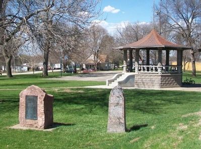
On Main Street west of Market Street, on the right when traveling west.
Determined and authenticated
by the Historical Department of Iowa, 1911.
This monument was erected in 1917 by the
Iowa Daughters of the American Revolution
in memory of the pioneers who followed
this trail and its tributaries.
We cross . . . — — Map (db m93819) HM
On Main Street west of Market Street, on the right when traveling west.
In honor of those who served
in World Wars One and Two
In Memory Of
Ray Enfield • Frank H. Enfield
Guy H. Peters • Harry Porter
Kenneth Lawton • Bernard Kaiser
Wayne Reynolds — — Map (db m93818) WM
On Poplar Street near Wetherell Street, on the right when traveling north.
The four houses on this Poplar Street block were here in the 1870s and 1880s when Herbert Hoover was a boy. Families built the houses on lots they bought from John Wetherell, a Quaker real-estate developer who had subdivided 5 acres. The Hoover's . . . — — Map (db m162572) HM
On Wetherell Street at South Downey Street, on the left when traveling west on Wetherell Street.
Born in a modest two-room cottage, Herbert Hoover spent most of his first 11 years in West branch. He went on to become the President of the United States-the first one born west of the Mississippi River. Here Hoover's parents and neighbors . . . — — Map (db m163143) HM
Near S Downey Street, on the right when traveling south.
“It was here that I was given that tender care of mind and body, those first steps in education, that knowledge of poverty and struggle for family betterment which contribute to understanding of American life.” President . . . — — Map (db m87749) HM
Near S Downey Street, on the left when traveling north.
“My country owes me nothing. It gave me, as it gives every boy and girl, a chance . . . In no other land could a boy from a country village, without inheritance or influential friends, look forward with unbounded hope.” . . . — — Map (db m87751) HM
On Wetherell Street at Downey Street, on the right when traveling east on Wetherell Street.
“My country owes me nothing. It gave me, as it gives every boy and girl, a chance...in no other land could a boy from a country village, without inheritance or influential friends, look forward with unbounded . . . — — Map (db m162568) HM
On South Downey Street at Penn Street, on the left when traveling north on South Downey Street.
This cottage where I was born is physical proof of the unbounded opportunity of American life. In no other land could a boy from a country village, without inheritance or influential friends, look forward with unbounded hope. . . . — — Map (db m162634) HM
On South Downey Street south of West Main Street, on the right when traveling south.
Charles E. Smith, a Civil War veteran and carpenter, moved in the 1880s to West Branch with his wife, Deborah. In 1903 he finished this dream house on top of Cook’s Hill, down the road to your left, where each spring he tapped his maple trees to . . . — — Map (db m162619) HM
On Penn Street at Downey Street, on the left when traveling west on Penn Street.
Visit the West Branch Commercial Historic District, just a block up the street. Buildings from the late 1800s and early 1900s, now listed in the National Register of Historic places, show how downtown West Branch changed from modest wood structures . . . — — Map (db m162607) HM
As a boy Herbert Hoover liked to watch his father, Jesse, shoe horses and repair plows, but he was not always careful. "Playing barefoot around the blacksmith shop," he recalled, "I stepped on a chip of hot iron and carry the brand of Iowa on my . . . — — Map (db m162555) HM
The Hoover family worshipped in this building along with neighbors and relatives who were members of the Religious Society of Friends, or Quakers as they are often called. West Branch was predominately a Quaker community in the 1850's when this . . . — — Map (db m48312) HM
On South Downey Street near Penn Street, on the left when traveling south.
Herbert Clark Hoover was born on August 10, 1874, in this two-room cottage. He spent his early boyhood years on the edge of the village Surrounded by farmland. His parents, relatives, and many neighbors were Quakers whose daily lives were centered . . . — — Map (db m163144) HM
On Downey Street, on the right when traveling south.
Amanda Garvin was single and 35 when she bought this lot for $90 in 1870 and had the cottage built. She was renting the house by 1878 but lost it to foreclosure in 1885. With its gingerbread trim and ornamental arches, the cottage is a wonderful . . . — — Map (db m162642) HM
The Statue of Isis, Egyptian goddess of life, symbolizes Herbert Hoover's humanitarian efforts. Belgians gave Hoover the bronze statue to thank him for his help and staving off famine in their country in World War I. Hoover, a wealthy mining . . . — — Map (db m162581) HM
This site commemorates the life and accomplishments of Herbert Hover, 31st President (1929-1932). The first president born west of the Mississippi River. Hoover grew up in a tradition that deeply influenced his ideals and long life of public . . . — — Map (db m48307) HM
On Wetherell Street at Poplar Street, on the left when traveling west on Wetherell Street.
Herbert Hoover, the first president born west of the Mississippi, spent his formative years in this neighborhood, which is preserved as Herbert Hoover National Historic Site. You may visit his birthplace and other buildings he remembered from his . . . — — Map (db m162574) HM
On North Downey Street. Reported permanently removed.
"This cottage where I was born is physical proof of the unbounded opportunity of American life."
In 1871, Jesse Hoover built this two-room cottage near his blacksmith shop and moved in with his wife, Hulda, and young son, Theodore. . . . — — Map (db m162633) HM
President Herbert Hoover died in New York City on October 20, 1964, at the age of 90. Five days later his body was interred on this hillside overlooking his birthplace and presidential library-a symbolic vista of his journey from birth to death. The . . . — — Map (db m162637) HM
The Hoovers bought a home on this site in 1879. During the winter Theodore, Herbert and Mary enjoyed sledding with the Peter Smith youngsters who lived in the green house just south of here. Jesse Hoover died in 1880. Hulda passed away three years . . . — — Map (db m48316) HM
You are viewing 76 acres of partially restored tall grass prairie, planted in 1971. Extending from the historic Miles Farm, at the hilltop on your left, it provides a south western boundary for the historic site. Prior to the . . . — — Map (db m163147) HM
On South Downey Street at Wetherell Street, on the left when traveling south on South Downey Street.
This was the home of Herbert Hoover's aunt and uncle, Agnes and Laban Miles, before they moved in 1878 to Oklahoma Territory. Laban served as agent on the Osage and Kaw Indian Reservation. Hoover, age eight, stayed with them for several months after . . . — — Map (db m162579) HM
On Penn Street at Poplar Street, on the right when traveling west on Penn Street.
Quakers, including the Hoovers, believe strongly in educating both boys and girls equally, and by 1853 West Branch's population was large enough to build this one-room schoolhouse. Because the Quakers had raised much of the funds, they also used it . . . — — Map (db m162554) HM
Near South Downey Street, on the left when traveling south.
Dr. Lewis J. Leech built and moved into this house in 1920. Before that he hosted ice cream socials and Fourth of July parties on the lot. When Dr. Leech died in 1937 at age 91, former President Hoover praised his “long life of usefulness...to . . . — — Map (db m162610) HM
On South Downey Street, on the left when traveling south.
In this meetinghouse, the Religious Society of Friends, or Quakers, practiced principles of simplicity, honesty, equality, peace, and service to others. These values shaped young Hoover's character and were evident in his humanitarian endeavors and . . . — — Map (db m162636) HM
The early settlers of West Branch had a strong regard for education, and in 1853 they built this school. It was used not only as a school but as a place of worship for the members of the Society of Friends. Originally the building housed all of the . . . — — Map (db m162553) HM
Near Parkside Drive, on the right when traveling south.
As a boy Herbert Hoover visited his relatives at their farm on the top of this hill. Issac and Esther Miles' 100-acre property was typical of the self-sufficient farms that surrounded West Branch. In 1880 they had 73 acres under cultivation with . . . — — Map (db m163148) HM
Near Parkside Drive, on the right when traveling south.
This landscape offers a glimpse of the tallgrass prairie that once covered 85 percent of Iowa. By the time of Herbert Hoover's birth in 1874, farmers were converting much of the state's prairie to cropland. When Hoover was a boy, Isaac Miles raise . . . — — Map (db m163149) HM
On Downey Street at Wetherell Street, on the left when traveling east on Downey Street. Reported permanently removed.
Miss Amanda Garvin purchased this lot in 1870 and by 1872 had this small frame cottage built. She resided here until 1878. Herbert Hoover was familiar with this house and would have passed it often to and from school. The Garvin Cottage is . . . — — Map (db m162640) HM
On Downey Street south of Wetherell Street, on the left when traveling north. Reported permanently removed.
Charles Smith moved to West Branch in the 1880’s and pursued his trade as a carpenter and contractor. In 1903 Smith built this retirement dream home for himself and his wife. They celebrated many special occasions here including their 50th wedding . . . — — Map (db m162618) HM
On Downey Street south of Wetherell Street, on the right when traveling north. Reported permanently removed.
Dr. L.J. Leech opened a medical practice in West Branch in 1882 and practiced here for the next 55 years. For many years he lived in the house one door to the north. In 1920 he moved to this home and lived here until his death in 1937. At his . . . — — Map (db m162609) HM
On Downey Street, on the right when traveling north. Reported permanently removed.
This house was built in 1899 for Hannah Varney. Mrs. Varney lived in the house only about one year, but her daughters Cora and Clara continued to live here until 1915. Although built some thirteen years after Herbert Hoover left West Branch, this . . . — — Map (db m162575) HM
Near East Main Street, 0.1 miles east of South Downey Street, on the right when traveling east.
This site is along the original route of the Herbert Hoover Highway, a 42-mile series of local, state and county roads that run between the foot of Old Capitol in Iowa City and the Cedar County community of Lowden. The Hoover Highway was designated . . . — — Map (db m76108) HM
On Downey Street at Wetherell Street, on the right when traveling north on Downey Street. Reported permanently removed.
Herbert Hoover’s distinguished uncle, Laban Miles, owned this house from 1875-1886, and Herbert would have visited the Miles family here on many occasions. In 1878 Laban Miles moved his family to the Oklahoma Territory where he had been appointed . . . — — Map (db m162578) HM
On Poplar Street, on the right when traveling north.
David Mackey, a local carpenter, built this house between 1868 and 1871. He lived in this home until 1876. Mackey also ran a butcher shop and served as mayor of West Branch in 1879 and postmaster in 1885. Built several years before his birth, this . . . — — Map (db m87736) HM
Hannah Varney built this house in 1899 after divorcing her husband. She lived here with her six children less than a year, moved to Iowa City, and left the house to her daughters Cora and Clara, who lived here until 1915.
Photo . . . — — Map (db m162577) HM
On Wetherell Street at Poplar Street, on the left when traveling west on Wetherell Street. Reported permanently removed.
Many of the commercial buildings in West Branch are included in a historic district on the National Register of Historic Places. It commemorates the “Golden Age of American Agriculture” (1895-1916). A variety of shops and services are . . . — — Map (db m162573) HM
Near Interstate 80 at milepost 270,, 1 miles west of Rose Avenue (County Highway X64), on the right when traveling west.
Marker Front: The land on which Iowa City is located was a wilderness when it was selected and surveyed for the capital of the Territory of Iowa in 1839. The cornerstone of the new capitol building was laid by Governor Lucas on July 4, 1840. . . . — — Map (db m224357) HM
Near Interstate 80 at milepost 270,, 1 miles west of Rose Avenue (County Highway X64), on the right when traveling west.
The Herbert Hoover National Historic Site, located in nearby West Branch, honors a distinguished son of Iowa, citizen of the world, and the 31st president of the United States. Established in 1965, the Site’s foundations were laid earlier when in . . . — — Map (db m224358) HM
On North Shore Drive west of Buddy Holly Place, on the right when traveling west.
The above legends played
their last concert at the
Surf Ballroom,
Clear Lake, Iowa,
on February 2, 1959.
Their earthly life
tragically ended in a
plane crash 5.2 miles
northwest of the
Mason City Airport.
February 3, . . . — — Map (db m89468) HM
On Lake View Drive north of Main Avenue, on the right when traveling north.
The 32nd Iowa Volunteer Infantry
Mustered in on October 6, 1862, the 32nd Iowa Volunteer Infantry would see service in the western theater of the Civil War. Organized in Dubuque, Iowa, the infantry unit originally consisted of 930 men who . . . — — Map (db m89526) HM
On Lake View Drive north of Main Avenue, on the right when traveling north.
G.A.R. Post No. 101 - Clear Lake, Iowa
The Tom Howard Post, No. 101, of the Grand Army of the Republic, was organized Oct. 15, 1872 with the name in honor of Lieut. Thomas Howard of the 32nd Iowa. He was a gallant soldier from Clear Lake, . . . — — Map (db m89528) HM
On Lake View Drive north of Main Avenue, on the right when traveling north.
The Battle of Pleasant Hill
The Battle of Pleasant Hill can be considered as day two of the Battle of Mansfield, or Sabine Cross Roads. Due to the single, narrow road available for advance the Union Army, consisting of infantry, cavalry and . . . — — Map (db m89504) HM
On North Shore Drive east of 7th Avenue North, on the left when traveling east.
Built in 1948
and placed on the
National Register
of Historic Places
by the United States
Department of the Interior
September 16, 2011 — — Map (db m89467) HM
This circular park plays off the musical significance of the neighboring Surf Ballroom and honors the legacies and final performance of Buddy Holly, Ritchie Valens and J.P. "The Big Bopper" Richardson on February 2, 1959. The monument was built and . . . — — Map (db m133139) HM
On Main Avenue at Lake View Drive, on the left when traveling west on Main Avenue.
In memory of
those who served and
gave their lives in
the Vietnam Conflict
————————
Died in Service
John H. Wrisberg, III
January 16, 1968 . . . — — Map (db m89483) WM
Near South Pennsylvania Avenue south of 2nd Street Southeast, on the right when traveling south.
The musical score resounds the spirit of “River City,” a tribute to the community of Mason City from the creator-composer. Meredith Willson May 18, 1902 – June 15, 1984 ”May the good Lord bless and keep you.” A . . . — — Map (db m162292) HM
On Federal Avenue south of 1st Street NW, on the right when traveling south.
Pleasant Hill, La.
O. A. Wilson, Co. B. 32d Iowa,
Died of wounds received at
Pleasant Hill, La. 1864.
Samuel Robins, Co. B. 32d Iowa,
Killed by a falling building
at Eastpoint, Miss. Jan. 22, 1865.
Lieut. W. C. . . . — — Map (db m89718) WM
On 1st Street NE north of State Street, on the right when traveling north.
Frank Lloyd Wright
1908
Prairie School Architecture
In Mason City
This Property is Listed in
The National Register of Historic Places
U.S. Department of [the] Interior — — Map (db m89571) HM
On Washington Avenue (U.S. 65) south of 1st Street NW, on the left when traveling south.
To all veterans that have served during peacetime and conflicts in the Armed Forces of the United States.
To the mothers, fathers, and families whose sons and daughters have made the supreme sacrifice.
To those veterans who still suffer the . . . — — Map (db m89704) WM
[Left Panel]
Steam railroad history began in 1869 for Mason City when the McGregor & Missouri River Rwy laid track from Nora Springs to Clear Lake and became part of the effort to link Chicago with South Dakota, and in 1870-71 when the Mason . . . — — Map (db m89655) HM
On Washington Avenue (U.S. 65) at 1st Street NW, on the left when traveling south on Washington Avenue.
With the faith and courage of
their forefathers who made
possible the freedom of these
United States
The Boy Scouts of America
dedicate this replica of the
Statue of Liberty as a pledge
of everlasting fidelity and
loyalty . . . — — Map (db m89676) HM
On 6th Street SW at South Jackson Avenue, on the right when traveling east on 6th Street SW.
Conceptualized in 1919, incorporated - September 21, 1920. This site for the church was purchased in 1926. The founding members and families of St. John Baptist Church worked diligently to erect a building to bring a small but growing . . . — — Map (db m172803) HM
On State Street at Federal Avenue, on the left when traveling west on State Street.
Frank Lloyd Wright
1910
This property has
benn placed on the
National Register
of Historic Places
by the
United States Department
of the Interior — — Map (db m89586) HM
Minneapolis & St. Louis #457 History
1912 American Locomotive Company of Schenectady, N.Y. built the 457 for the Minneapolis and St. Louis Railroad at a cost of $18,456.03. The Consolidation type locomotive served 38 years for the M&StL, . . . — — Map (db m89634) HM
On 2nd Street NE east of Connecticut Avenue, on the left when traveling east.
These doors turning with the wind, once flew in Vietnam. They now host the names & towns of those from Mason City and surrounding counties who died in in an ungrateful war. You've never really died if you are remembered. These names will be . . . — — Map (db m89533) WM
On Washington Avenue at 3rd Street NW, on the right when traveling south on Washington Avenue.
Dedicated to the memory of
the men who entered the
service of their country
from Cerro Gordo County
and who gave their lives
in the World War
[Dedicated] June 24, 1934 . . . — — Map (db m89729) WM
On County Route S25 at Larch Street, on the left when traveling north on County Route S25.
In honor and memory of all
men and women who served
in the Armed Forces of the
United States of America.
This memorial is not to honor war,
but to show the price of peace lest
future generations forget the
sacrifice made to maintain . . . — — Map (db m89465) WM
Francis L. Sampson
1912-1996
Francis L. Sampson's amazing record as a war hero put him in history books. As the "Paratrooper Padre" in World War II, he was one of the 20th century's best-known Army Chaplains. His real life story of . . . — — Map (db m126926) HM WM
If It were Not
For the Brave
There Would
Be No Land
Of the Free
This Memorial is
Dedicated with
Appreciation to the
Men and Women Whose
Loyalty and Service
During Times of War
And Peace Define the
Character of this . . . — — Map (db m119047) WM
On South Main Street (U.S. 69) south of West Washington Street, on the right when traveling south.
Dedicated to all Clarke County veterans who gave their last full measure of devotion
Civil War
Alloway, Nelson ·
Avery, Philo ·
Babington, George ·
Bare, Ira A. ·
Bare, Thompson ·
Barnes, George ·
Barrows, Thomas J. · . . . — — Map (db m235827) WM
Near Interstate 35 south of Iowa Highway 34, on the right when traveling south.
The Mormon Trail The Mormons of Nauvoo, Illinois, forced from their homes following the murder of their prophet, Joseph Smith, Jr., began their trek across Iowa in 1846 on the way to the Great Salt Lake Valley. From their first permanent . . . — — Map (db m237260) HM
Near Interstate 35 at milepost 32,, 2.9 miles north of Elk Street, on the right when traveling north.
From the late 1840s through the 1860s, an exodus of more than 70,000 Mormons passed by here on their way to their "New Zion" in Utah. Starting from Nauvoo, Illinois in February 1846, the first group of at least 13,000 Mormons crossed into Iowa to . . . — — Map (db m235830) HM
On Grand Avenue (U.S. 18/71) just south of East 8th Street, on the right when traveling north.
Who for thirty-five years played Santa Claus to the needy children of this community. May his untiring efforts, his sacrifices and generosity ever be an inspiration to all to share their blessings with those less fortunate. — — Map (db m238883) HM
On River Bluffs Scenic Highway/Hiawatha Pioneer Trail (U.S. 52) at Ivory Rd (County Highway B60), on the right when traveling north on River Bluffs Scenic Highway/Hiawatha Pioneer Trail.
Dedicated June 13, 1954
In memory of deceased members of Post 27
Memorials for
Cyrill Matt and Arthur Meyer
have made this park possible — — Map (db m202889) WM
On Great River Road Hiawatha Pioneer Trail (U.S. 52), on the right when traveling north.
The valley of the Mississippi River is one of the most distinctive landscape features of the central United States. Set in a geologic framework of ancient sea floors and glacial flood waters, this rock-lined corridor hosts interesting . . . — — Map (db m202873) HM
Near Great River Road (State Highway 76) 2 miles north of U.S. 18, on the right when traveling north.
This rock marks the beginning of the Old Military Trail first used in the summer of 1840 by troops from Fort Crawford in Wisconsin when building Fort Atkinson in Iowa. It served as a highway for the movement of troops and supplies from Fort Crawford . . . — — Map (db m44190) HM
Near River Street (Business U.S. 18) 0.4 miles north of Front Street, on the left when traveling north.
Cave History
Workers for the Hagensieck brewery created these cave openings around 1867 using picks, shovels and blasting powder. They used the caves to store ice and beer until the brewery closed in 1888. Hundreds of bats used the caves . . . — — Map (db m46742) HM
John Froelich invented the very first successful gasoline powered tractor able to proplel itself backward and forward, in 1892, right here in this village named after the Froelich family. The blacksmith, William Mann, assisted with the creation of . . . — — Map (db m203106) HM
On Froelich Road, on the left when traveling east.
In this village, John Froelich built the first gasoline tractor that propelled itself backward as well as forward. Far-reaching in its effect on modern agricultural history. It moved out of this village and into the world in 1892.
Later that . . . — — Map (db m202935) HM
On A Street / Dr. Clifford Smith Street west of Main Street (Iowa Highway 76), on the right when traveling west.
McGregor
"Royal is my race," was the motto of Clan MacGregor of which McGregor's founder, Alexander MacGregor, was a descendant. It was 1837 when Alexander began a ferry boat operation on "MacGregor's Landing" that became a thriving town of . . . — — Map (db m44758) HM
On Pikes Peak Road, 0.5 miles east of County Highway X56.
Across this impressive gorge of the Mississippi River is the mouth of the Wisconsin River. The steeply notched valleys of both rivers are carved into sedimentary bedrock which underlies the level, plateau-like uplands and forms the abrupt, . . . — — Map (db m46138) HM
Near Pikes Peak Road, 0.5 miles east of Highway X56.
Across the Mississippi is the mouth of the Wisconsin River. This is the point where on June 17, 1673 Pere Marquette and Louis Joliet, in two small canoes entered the mighty Mississippi. They were the first white men to discover the Upper Mississippi . . . — — Map (db m44797) HM
On Froelich Road, on the right when traveling south.
The original Froelich Train Depot had been a large building located just to the north of the present location of our current depot. It was located on the west side of the old highway 18 & 52. In 1872, the railroad came through what became known . . . — — Map (db m203108) HM
On Froelich Road, on the left when traveling east.
This store was built in 1891 by Edwin Froelich, after the previous general store burned down that had been located where the Frolelich Monument is currently located. It was called the Iron Clad Store for the exterior was covered with fire-proof . . . — — Map (db m203105) HM
On South Prince Street, 0.1 miles south of Charles Street, on the right when traveling south.
Registrar National Historical Places June 14, 1972 by National Park Service United States Dept. of Interior Sign: Compliments Dow City Churches — — Map (db m162183) HM
"The dead soldier's silence sings our National anthem."
- Rev. A. Kibourn
[Motorcycle parked by a couple of Veteran’s graves. Sgt. Casey Byers and his brother Justin Paul Byers and James Alan Justice. ]
_ _ _ _ _ _ _ _ _ _
[WWII . . . — — Map (db m135785) WM
Near 400th Street, 0.5 miles north of Lincoln Highway (U.S. 30), on the left when traveling north.
To the men and women of this community who helped preserve the freedoms of humanity for all ages to come US Army ☆ US Navy ☆ US Marine Corps ☆ US Air Force Lester L Peters • Donald H Bornhoft • Floyd E Koenck • David J Mason • . . . — — Map (db m239794) WM
On Lincoln Highway (U.S. 30) east of Main Street, on the right when traveling east.
History of Westside Iowa became part of the United States in 1805 as part of the Louisiana Purchase, and was admitted to the Union as the 29th state on December 28, 1846. The Railroad Telegraph road was built from Boone to Council . . . — — Map (db m186199) HM
Near 400th Street, 0.5 miles north of Lincoln Highway (U.S. 30), on the left when traveling north.
It is an investment, not a loss, when a man gives his life for his country. John Boock • Howard Eiffert • Emil Ewoldt • Jude Gary • Herman Goettsch • John Henrichsen • Herman Joens • Joseph Kolln • Henry Mess • Fred Passick • Louis Rowedder • Julius . . . — — Map (db m239795) WM
On J Avenue (County Route P58) at 240th Street (Iowa Highway 44), on the right when traveling south on J Avenue.
The community of Panther was located where you are currently standing. In the late 1800s, three buildings stood on this site: a blacksmith shop, a tin shop, and a general store. As Panther continued to grow, a creamery and post office also served . . . — — Map (db m30809) HM
1164 entries matched your criteria. Entries 101 through 200 are listed above. ⊲ Previous 100 — Next 100 ⊳