1190 entries match your criteria. The first 100 are listed. ⊳
Historical Markers and War Memorials in Oregon
By Barry Swackhamer, June 28, 2017
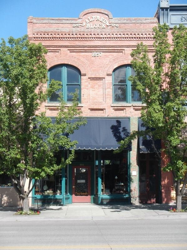
Alfred Block and Marker
| 1 ► Oregon, Baker County, Baker City — Alfred Block — Baker City Historic District — Established 1874 — |
| On Main Street (Oregon Route 7) near Valley Avenuee, on the right when traveling north. | |||
| 2 ► Oregon, Baker County, Baker City — Antlers Hotel — Baker City Historic District — Established 1874 — |
| On Washington Street at 1st Street, on the left when traveling west on Washington Street. | |||
| 3 ► Oregon, Baker County, Baker City — Baker — Historic Oregon Trail — |
| Near Campbell Street near Sunridge Lane, on the right when traveling west. | |||
| 4 ► Oregon, Baker County, Baker City — Baker City Chinese History — |
| On Windmill Road near Campbell Street, on the left when traveling south. | |||
| 5 ► Oregon, Baker County, Baker City — Baker City Hall — Baker City Historic District — Established 1874 — |
| On 1st Street near Auburn Avenue when traveling north. | |||
| 6 ► Oregon, Baker County, Baker City — Baker Loan and Trust Building — Baker City Historic District — Established 1874 — |
| On Main Street (Oregon Route 7) at Broadway Street (U.S. 30), on the left when traveling north on Main Street. | |||
| 7 ► Oregon, Baker County, Baker City — Basche-Sage Hardware Co. Building — |
| On Main Street (Oregon Route 7) at Broadway Street, on the left when traveling north on Main Street. | |||
| 8 ► Oregon, Baker County, Baker City — Bishop Building — |
| On Main Street (Oregon Route 7) at Broadway Street, on the right when traveling north on Main Street. | |||
| 9 ► Oregon, Baker County, Baker City — Chinese Shrine — 1890 — |
| On Windmill Road near Campbell Street, on the left when traveling south. | |||
| 10 ► Oregon, Baker County, Baker City — First National Bank Building — Baker City Historic District — Established 1874 — |
| On Main Street near Court Avenue when traveling north. | |||
| 11 ► Oregon, Baker County, Baker City — Flynn Building — Baker City Historic District — Established 1874 — |
| On Valley Avenue near !st Street, on the left when traveling west. | |||
| 12 ► Oregon, Baker County, Baker City — Geiser Grand Hotel — Baker City Historic District — Established 1874 — |
| On Main Street (Oregon Route 7) near Washington Avenue, on the right when traveling north. | |||
| 13 ► Oregon, Baker County, Baker City — Gerstle-Solomon Building — Baker City Historic District — Established 1874 |
| Near Main Street near Court Avenue, on the left when traveling north. Reported missing. | |||
| 14 ► Oregon, Baker County, Baker City — Gwilliam Brothers Bakery — Baker City Historic District — Established 1874 — |
| On Main Street (Oregon Route 7) at Church Street, on the right when traveling north on Main Street. | |||
| 15 ► Oregon, Baker County, Baker City — Haskell Building — Baker City Historic District — Established 1874 — |
| On Main Street (Oregon Route 7) near Court Avenueu, on the right when traveling north. | |||
| 16 ► Oregon, Baker County, Baker City — J.C. Penney Building — Historic Oregon Trail — Established 1874 — |
| On Main Street near Valley Avenue, on the left when traveling north. | |||
| 17 ► Oregon, Baker County, Baker City — Jett Building — Baker City Historic District — Established 1874 — |
| On Valley Avenue at 1st Street, on the right when traveling west on Valley Avenue. | |||
| 18 ► Oregon, Baker County, Baker City — Kennedy Building — Baker City Historic District — Established 1874 — |
| On Main Street (Oregon Route 7) at Court Avenueu, on the right when traveling north on Main Street. | |||
| 19 ► Oregon, Baker County, Baker City — Log Cabin Saloon — Baker City Historic District — Established 1874 — |
| On Main Street (Oregon Route 7) near Valley Avenuee, on the right when traveling north. | |||
| 20 ► Oregon, Baker County, Baker City — Lynndale Building — Baker City Historic District — Established 1874 — |
| On Main Street (Oregon Route 7) near Broadway Street, on the right when traveling north. | |||
| 21 ► Oregon, Baker County, Baker City — Mann Block — |
| On Main Street at Valley Avenuee, on the right when traveling north on Main Street. | |||
| 22 ► Oregon, Baker County, Baker City — McCord House and Shop — Baker City Historic District — Established 1874 — |
| On Resort Street at Broadway Street, on the right when traveling north on Resort Street. | |||
| 23 ► Oregon, Baker County, Baker City — Miller Apartment Building — Baker City Historic District — Established 1874 — |
| On Washington Street near 1st Street, on the right when traveling west. | |||
| 24 ► Oregon, Baker County, Baker City — Miller's Lunch Building — Baker City Historic District — Established 1874 — |
| Near Main Street (Oregon Route 7) at Washington Avenue, on the left when traveling north. | |||
| 25 ► Oregon, Baker County, Baker City — Mint-Fox Building — Baker City Historic District — Established 1874 — |
| On Main Street (Oregon Route 7) near Court Avenueu, on the right when traveling north. | |||
| 26 ► Oregon, Baker County, Baker City — Old Oregon Trail — 1843 — |
| On Auburn Avenue at Bridge Street, on the right when traveling east on Auburn Avenue. | |||
| 27 ► Oregon, Baker County, Baker City — Old Post Office — Historic Oregon Trail — Established 1874 — |
| On Dewey Avenue (Oregon Route 7) near Auburn Avenue, on the right when traveling north. | |||
| 28 ► Oregon, Baker County, Baker City — Oregon Trail Memorial — 1843 - 1943 — |
| On Oregon Route 86 near Ruckles Creek Road, on the left when traveling west. | |||
| 29 ► Oregon, Baker County, Baker City — Rogers Hotel — Baker City Historic District — Established 1874 — |
| On 1st Street near Washington Avenue, on the right when traveling north. | |||
| 30 ► Oregon, Baker County, Baker City — Ruts of the Oregon Trail — |
| Near Oregon Route 86 near Oregon Trail, on the right when traveling west. | |||
| 31 ► Oregon, Baker County, Baker City — Shoemaker Building — Baker City Historic District — Established 1874 — |
| On 1st Street at Court Avenueu, on the left when traveling north on 1st Street. | |||
| 32 ► Oregon, Baker County, Baker City — The Lone Tree of the Oregon Trail — |
| 33 ► Oregon, Baker County, Baker City — The Lure of Gold — Oregon Trail — Oregon History — |
| On Oregon Route 86 near Oregon Trail, on the right when traveling west. | |||
| 34 ► Oregon, Baker County, Baker City — The Masonic Temple — Baker City Historic District — Established 1874 — |
| On Main Street (Oregon Route 7) at Church Street, on the left when traveling north on Main Street. | |||
| 35 ► Oregon, Baker County, Baker City — The Oregon Trail — Route of Wagon Trains — from 1843 to the 1860's — |
| Near Campbell Street near Sunridge Lane, on the right when traveling west. | |||
| 36 ► Oregon, Baker County, Baker City — The Smoke Shop — Baker City Historic District — Established 1874 — |
| On Main Street near Washington Street. | |||
| 37 ► Oregon, Baker County, Baker City — The Telephone Exchange — Baker City Historic District — Established 1874 — |
| On 1st Street near Washington Avenue, on the right when traveling north. | |||
| 38 ► Oregon, Baker County, Baker City — The Wagon Encampment — |
| 39 ► Oregon, Baker County, Baker City — Walker Block — Baker City Historic District — Established 1874 — |
| On Main Street near Court Avenue, on the left when traveling north. | |||
| 40 ► Oregon, Baker County, Baker City — Weller-Henry Building — |
| On Main Street (Oregon Route 7) near Valley Avenuee, on the left when traveling north. | |||
| 41 ► Oregon, Baker County, Baker City — YMCA Building — Baker City Historic District — Established 1874 — |
| On Valley Avenue at !st Street, on the left when traveling west on Valley Avenue. | |||
| 42 ► Oregon, Baker County, Durkee — Durkee — Historic Oregon Trail — |
| On Old U.S. 30 at Oxman Ranch Road, on the left when traveling west on Old U.S. 30. | |||
| 43 ► Oregon, Baker County, Granite — Ah Hee Diggings — A Job of Mythical Proportions — |
| On Forest Road 73, 2.2 miles north of County Road 24, on the right when traveling north. | |||
| 44 ► Oregon, Baker County, Granite — Red Boy Mine — |
| On Forest Service Road 10 (County Road 24) 0.3 miles south of Federal Road 13, on the right when traveling west. | |||
| 45 ► Oregon, Baker County, Granite — The Fremont Powerhouse Historic District — History written by nature and people — |
| Near Forest Service Road 10 (County Road 24). | |||
| 46 ► Oregon, Baker County, Haines — "The 1880's Park" in Haines — |
| On Front Street (La Grande-Baker Highway) near 4th Street, on the left when traveling north. | |||
| 47 ► Oregon, Baker County, Haines — Baker Valley Rest Area Oregon Trail Kiosk — |
| On Interstate 84 at milepost 293 near Medical Springs Highway (Chandler Lane) (Oregon Route 203), on the right when traveling west. | |||
| 48 ► Oregon, Baker County, Haines — Cattle Drives — |
| On Front Street (La Grande-Baker Highway) near 4, on the left when traveling south. | |||
| 49 ► Oregon, Baker County, Haines — Chandler Cabin — |
| Near Front Street (La Grande-Baker Highway) near 4th Street, on the left when traveling north. | |||
| 50 ► Oregon, Baker County, Huntington — Farewell Bend — Historic Oregon Trail — |
| Near Oregon Trail Boulevard (Business U.S. 30) near Frontage Road, on the right when traveling north. | |||
| 51 ► Oregon, Baker County, Huntington — Farewell Bend Oregon Trail Kiosk — |
| Near Huntington Highway (Business U.S. 30) near Interstate 84, on the right when traveling north. | |||
| 52 ► Oregon, Baker County, Huntington — Remnants of the Oregon Trail — |
| On Lockett Road near Vietnam Veterans Memorial Highway (Interstate 84), on the right when traveling south. | |||
| 53 ► Oregon, Baker County, Huntington — The Last Spike — |
| On Washinton Street East (Business U.S. 30) near 1st Street East, on the right when traveling west. | |||
| 54 ► Oregon, Baker County, Huntington — Van Ornum Massacre — |
| On Oregon Trail Boulevard (Business U.S. 30) near Frontage Road, on the left when traveling north. | |||
| 55 ► Oregon, Baker County, Huntington — Van Ornum Wagon Train Massacre — |
| On Oregon Trail Boulevard (Business U.S. 30) when traveling north. | |||
| 56 ► Oregon, Baker County, Huntington — Van Ornum Wagon Train Massacre — |
| On Washinton Street East (Business U.S. 30) near 1st Street East. | |||
| 57 ► Oregon, Baker County, Sumpter — A Golden History — Sumpter Valley Dredge — |
| On Austin Street, 0.1 miles west of Mill Street, on the right when traveling west. | |||
| 58 ► Oregon, Baker County, Sumpter — A Tale of the Tailings — Natural Recovery — |
| Near Austin Street near Mill Street, on the right when traveling south. | |||
| 59 ► Oregon, Baker County, Sumpter — A Working Dredge — The Ultimate Gold Mining Machine — |
| Near Austin Street. | |||
| 60 ► Oregon, Baker County, Sumpter — Anchoring the Dredge — The Biggest Spud You Ever Saw — |
| Near Austin Street near Mill Street (County Route 410), on the right when traveling south. | |||
| 61 ► Oregon, Baker County, Sumpter — Floating in its own pond — Moving the dredge — |
| Near Austin Street. | |||
| 62 ► Oregon, Baker County, Sumpter — Site of Bank of Sumpter — Sumpter, Oregon — |
| On Mill Street (County Route 410) near Sumpter Street, on the right when traveling north. | |||
| 63 ► Oregon, Baker County, Sumpter — Sumpter, Oregon — |
| On Mill Street at Sumpter Highway (Oregon Route 410), on the right when traveling north on Mill Street. | |||
| 64 ► Oregon, Baker County, Weatherby — Weatherby Oregon Trail Kiosk — |
| Near Interstate 84 near Gate Road/Sisley Creek Road, on the right when traveling north. | |||
| 65 ► Oregon, Benton County, Corvallis — 96th Infantry Division — "Deadeyes" — |
| Near Camp Adair Road near Pacific Highway West (Oregon Route 99W), on the left when traveling east. | |||
| 66 ► Oregon, Benton County, Corvallis — Alice E. Biddle — First Woman Graduate of Oregon State University — |
| 67 ► Oregon, Benton County, Corvallis — Avery Park Applegate Trail Kiosk — Southern Route to Oregon — |
| On SW Avery Park Drive, on the left when traveling east. | |||
| 68 ► Oregon, Benton County, Corvallis — Benton County Courthouse — |
| On 4th Street, on the right when traveling south. | |||
| 69 ► Oregon, Benton County, Corvallis — Benton County State Bank — |
| On SW Madison Avenue, on the right when traveling west. | |||
| 70 ► Oregon, Benton County, Corvallis — Camp Adair — |
| Near Camp Adair Road near Pacific Highway West (Oregon Route 99W), on the left when traveling east. | |||
| 71 ► Oregon, Benton County, Corvallis — Capitol of Territorial Oregon — 1855 — |
| On SW 2nd Street at SW Adams Avenue on SW 2nd Street. | |||
| 72 ► Oregon, Benton County, Corvallis — City Hall — |
| On Southwest Madison Avenue at Pacific Hwy W (U.S. 20), on the right when traveling east on Southwest Madison Avenue. | |||
| 73 ► Oregon, Benton County, Corvallis — Early Town Development — The Corvallis Riverfront — |
| On SW 1st Street north of SW Jefferson Avenue, on the right when traveling north. | |||
| 74 ► Oregon, Benton County, Corvallis — Ecology of the Agricultural Reach — |
| On SW Campus Way, 0.5 miles west of SW 35th Street, on the left when traveling west. | |||
| 75 ► Oregon, Benton County, Corvallis — Elementary Schools — Central Park — |
| 76 ► Oregon, Benton County, Corvallis — First Congregational Church — 1918-1932 — |
| On SW 8th St at SW Madison Ave, on the right when traveling north on SW 8th St. | |||
| 77 ► Oregon, Benton County, Corvallis — Home of Fred J. Porter — Corvallis City Engineer From 1909 to 1949 — |
| On SW Madison Ave at SW 8th St, on the right when traveling west on SW Madison Ave. | |||
| 78 ► Oregon, Benton County, Corvallis — Kearney Hall — |
| On Southwest Monroe Avenue, on the left when traveling west. | |||
| 79 ► Oregon, Benton County, Corvallis — Kings Valley Millstone — |
| 80 ► Oregon, Benton County, Corvallis — L.G. Kline Building — |
| On Southwest Madison Avenue at SW 2nd St, on the left when traveling east on Southwest Madison Avenue. | |||
| 81 ► Oregon, Benton County, Corvallis — Madison Avenue — A Place For People — |
| On SW Madison Ave, on the left when traveling north. | |||
| 82 ► Oregon, Benton County, Corvallis — Oak Creek’s Watershed — |
| On SW Campus Way, 0.5 miles west of SW 35th Street, on the left when traveling west. | |||
| 83 ► Oregon, Benton County, Corvallis — Oregon State University — National Historic District — |
| On SW Jefferson Way at SW 15th Street, on the right when traveling west on SW Jefferson Way. | |||
| 84 ► Oregon, Benton County, Corvallis — Peavy Hall War Memorial — |
| Near SW Jefferson Way at SW 30th St. | |||
| 85 ► Oregon, Benton County, Corvallis — River Transport — |
| On SW 1st Street north of SW Jefferson Avenue, on the right when traveling north. | |||
| 86 ► Oregon, Benton County, Corvallis — Site of Corvallis Public Schools — 1889-1946 — |
| 87 ► Oregon, Benton County, Corvallis — Site of the Earliest Boat Landing — Lower Town, Marysville, 1851 — |
| On Northwest Van Buren Avenue. | |||
| 88 ► Oregon, Benton County, Corvallis — Sustainable Farm Management — |
| On SW Campus Way, 0.5 miles west of SW 35th Street, on the left when traveling west. | |||
| 89 ► Oregon, Benton County, Corvallis — The Corvallis Arts Center — |
| On SW Madison Ave, on the left when traveling north. | |||
| 90 ► Oregon, Benton County, Corvallis — The Corvallis Ferry — |
| 91 ► Oregon, Benton County, Corvallis — The Incubator House & Poultry Building — |
| On SW Washington Avenue at SW 8th Street, on the right when traveling east on SW Washington Avenue. | |||
| 92 ► Oregon, Benton County, Corvallis — The Opera House — |
| On Pacific Highway West at Pacific Hwy W (U.S. 20) on Pacific Highway West. | |||
| 93 ► Oregon, Benton County, Corvallis — The Timberwolves — |
| On Camp Adair Road near Pacific Highway West (Oregon Route 99W). | |||
| 94 ► Oregon, Benton County, Corvallis — The Trailblazers — |
| Near Camp Adair Road near Pacific Highway West (Oregon Route 99W), on the left when traveling east. | |||
| 95 ► Oregon, Benton County, Corvallis — The Van Buren Street Bridge — |
| Near NE 1st Street south of NW Harrison Boulevard. | |||
| 96 ► Oregon, Benton County, Corvallis — The Whiteside Theatre — |
| On Pacific Hwy W (U.S. 99) at SW Madison Ave, on the right when traveling north on Pacific Hwy W. | |||
| 97 ► Oregon, Benton County, Corvallis — The Wild West Division — Powder River! Let'er Buck! — |
| Near Camp Adair Road near Pacific Highway West (Oregon Route 99W), on the left when traveling east. | |||
| 98 ► Oregon, Benton County, Monroe — Applegate Trail — |
| On Dawson Rd, on the right when traveling east. | |||
| 99 ► Oregon, Benton County, Monroe — Ebenezer Schoolhouse — United Methodist Historic Site — |
| On Bellfountain Rd, on the left when traveling south. | |||
| 100 ► Oregon, Benton County, Monroe — The Applegate Trail — Southern Route to Oregon — |
| On Pacific Hwy (U.S. 99) at Main Street, on the right when traveling south on Pacific Hwy. | |||
1190 entries matched your criteria. The first 100 are listed above. Next 100 ⊳