4585 entries match your criteria. The first 100 are listed. ⊳
Historical Markers and War Memorials in South Carolina
By Brian Scott, September 27, 2008
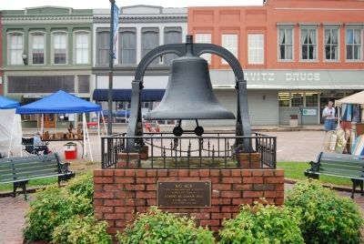
"Big Bob" and Marker
| 1 ► South Carolina, Abbeville County, Abbeville — "Big Bob" — |
| On Court Square (State Highway 28) south of Washington Street (State Highway 203), in the median. | |||
| 2 ► South Carolina, Abbeville County, Abbeville — Abbeville County Confederate Monument — |
| On Court Square (State Highway 20), in the median. | |||
| 3 ► South Carolina, Abbeville County, Abbeville — Abbeville County Courthouse (1908) — |
| On Court Square (State Highway 28) south of Washington Street (State Highway 203), on the right when traveling north. | |||
| 4 ► South Carolina, Abbeville County, Abbeville — Abbeville County Veterans Memorial — |
| On Court Square (State Highway 20), on the right when traveling north. | |||
| 5 ► South Carolina, Abbeville County, Abbeville — Abbeville Opera House (1908) — |
| On Court Square (State Highway 20) at East Pickens Street, on the right when traveling north on Court Square. | |||
| 6 ► South Carolina, Abbeville County, Abbeville — Abbeville Square — A Stately County Square — |
| On Court Square (State Highway 20), on the right when traveling south. | |||
| 7 ► South Carolina, Abbeville County, Abbeville — 1-4 — Abbeville's Confederate Colonels — |
| On North Main Street (State Highway 71) at Wardlaw Street, on the right when traveling west on North Main Street. | |||
| 8 ► South Carolina, Abbeville County, Abbeville — Belmont Inn (1903) — |
| On East Pickens Street, on the right when traveling west. | |||
| 9 ► South Carolina, Abbeville County, Abbeville — 1-5 — Birthplace of Calhoun — |
| On Mt. Carmel Road (State Highway 823). | |||
| 10 ► South Carolina, Abbeville County, Abbeville — Bowie — Christian Pioneers — |
| Near Gilgal Church Road (County Road 1-74). | |||
| 11 ► South Carolina, Abbeville County, Abbeville — 1-3 — Bowie Family Memorial — |
| On Greenville Street (State Highway 20) at Central Shiloh / Milford Dairy Road (State Highway S-1-100), on the left when traveling south on Greenville Street. | |||
| 12 ► South Carolina, Abbeville County, Abbeville — 1-7 — Burt-Stark House / Jefferson Davis’s Flight — |
| On North Main Street (State Highway 71) at Greenville Street (State Highway 20) on North Main Street. | |||
| 13 ► South Carolina, Abbeville County, Abbeville — Clarence E. Pressley — |
| On Washington Street (State Highway 203) at Clarence E. Pressley Place on Washington Street. | |||
| 14 ► South Carolina, Abbeville County, Abbeville — 1-18 — Colonial Block House/Fort Pickens — |
| On Washington Street (State Highway 203) at Cambridge Street on Washington Street. | |||
| 15 ► South Carolina, Abbeville County, Abbeville — Conservation Cabin — |
| On Henry M Turner Street. | |||
| 16 ► South Carolina, Abbeville County, Abbeville — Constitution Tree — |
| Near Campground Road. | |||
| 17 ► South Carolina, Abbeville County, Abbeville — First Burial in Long Cane Cemetery — |
| Near Greenville Street (State Highway 20). | |||
| 18 ► South Carolina, Abbeville County, Abbeville — First Secession Meeting Boulder — |
| Near Secession Avenue (County Road 01-120) east of Branch Street, on the right when traveling north. | |||
| 19 ► South Carolina, Abbeville County, Abbeville — First Secession Meeting Columns — |
| On Magazine Street at Secession Avenue (County Road 120) on Magazine Street. | |||
| 20 ► South Carolina, Abbeville County, Abbeville — Forest Lawn Memory Gardens Veterans Monument — |
| Near State Highway 72 at Olive Rose Drive, on the left when traveling south. | |||
| 21 ► South Carolina, Abbeville County, Abbeville — Fort Pickens — |
| On Cambridge Street at Washington Street (South Carolina Highway 203) on Cambridge Street. | |||
| 22 ► South Carolina, Abbeville County, Abbeville — Harbison College President's Home — |
| Near Greenville Street (State Highway 20) north of College Street, on the right when traveling north. | |||
| 23 ► South Carolina, Abbeville County, Abbeville — Henry McNeal Turner — |
| On Henry M. Turner Street at Secession Avenue, on the left when traveling south on Henry M. Turner Street. | |||
| 24 ► South Carolina, Abbeville County, Abbeville — Humane Society Alliance Fountain (1912) — |
| On County Square (State Highway 20), on the left when traveling south. | |||
| 25 ► South Carolina, Abbeville County, Abbeville — Lebanon Presbyterian Church — 1821-1963 — |
| On Mount Carmel Road (State Highway 823) north of Dogwood Lane, on the right when traveling south. | |||
| 26 ► South Carolina, Abbeville County, Abbeville — 1-16 — Long Cane Cemetery — |
| On Greenville Street (State Highway 20) near Beltline Road (County Road S-1-35). | |||
| 27 ► South Carolina, Abbeville County, Abbeville — 1-8 — Maj. Thomas D. Howie — The Major of St. Lô — |
| On West Pinckney Street at Church Street, on the right when traveling south on West Pinckney Street. | |||
| 28 ► South Carolina, Abbeville County, Abbeville — Major Thomas Dry Howie — Commander, 2nd Battalion, 116th Infantry, 29th Division U.S. Army — 1908–1944 — |
| On Court Square (Main Street) (Business Route 28), on the right when traveling north. | |||
| 29 ► South Carolina, Abbeville County, Abbeville — Marie Cromer Seigler — |
| On Henry M. Turner Street at Cedar Lane, on the right when traveling east on Henry M. Turner Street. | |||
| 30 ► South Carolina, Abbeville County, Abbeville — Marilyn Anne McKinney — |
| Near Gilgal Church Road. | |||
| 31 ► South Carolina, Abbeville County, Abbeville — 1-11 — McGowan-Barksdale-Bundy House — |
| On North Main Street at Lane Street, on the left when traveling north on North Main Street. | |||
| 32 ► South Carolina, Abbeville County, Abbeville — 1 21 — Mulberry A.M.E. Church — |
| On Mount Carmel Road (South Carolina Route 823) at Mulberry Road, on the right when traveling south on Mount Carmel Road. | |||
| 33 ► South Carolina, Abbeville County, Abbeville — Old Bank Building (ca. 1865) — |
| On Court Square (State Highway 20) north of West Pickens Street, on the right when traveling south. | |||
| 34 ► South Carolina, Abbeville County, Abbeville — Operation Desert Shield / Storm Monument — Lest We Forget — |
| On Court Square (State Highway 28), on the right when traveling north. | |||
| 35 ► South Carolina, Abbeville County, Abbeville — Parsons Mountain — Land Renewed — |
| On Campground Road. | |||
| 36 ► South Carolina, Abbeville County, Abbeville — Parsons Mountain World War II Memorial — In Memoriam — |
| Near Campground Road. | |||
| 37 ► South Carolina, Abbeville County, Abbeville — 1-1 — Patrick Calhoun Burial Grounds — |
| On State Highway 72 at Mt. Carmel Road (State Highway 823), on the left when traveling south on State Highway 72. | |||
| 38 ► South Carolina, Abbeville County, Abbeville — 01-17 — Quay-Wardlaw House — |
| On Church Street at West Pickens Street, on the right when traveling south on Church Street. | |||
| 39 ► South Carolina, Abbeville County, Abbeville — Secession Hill — |
| On Secession Avenue, on the left when traveling south. | |||
| 40 ► South Carolina, Abbeville County, Abbeville — 1-14 — Secession Hill — |
| On Secession Road (State Highway 120). | |||
| 41 ► South Carolina, Abbeville County, Abbeville — The Bundy-Barksdale-McGowan House |
| On North Main Street, on the right when traveling south. Reported missing. | |||
| 42 ► South Carolina, Abbeville County, Abbeville — The Last Meeting of the Confederate States Cabinet — |
| On Main Street at Greenville Street, in the median on Main Street. | |||
| 43 ► South Carolina, Abbeville County, Abbeville — The Law Offices of John C. Calhoun — |
| On County Square. | |||
| 44 ► South Carolina, Abbeville County, Abbeville — The Lynching of Anthony Crawford / Racial Violence in South Carolina — Community Remembrance Project — |
| On Court Square (State Highway 202), on the right when traveling north. | |||
| 45 ► South Carolina, Abbeville County, Abbeville — The Old Livery Stable — |
| On Trinity Street. | |||
| 46 ► South Carolina, Abbeville County, Abbeville — This Water Fountain — |
| On Henry M Turner Street north of Cedar Lane. | |||
| 47 ► South Carolina, Abbeville County, Abbeville — 1-10 — Thomas Chiles Perrin House — |
| On North Main Street (State Highway 28) at Wardlaw Street, on the left when traveling north on North Main Street. | |||
| 48 ► South Carolina, Abbeville County, Abbeville — Trinity Episcopal Church — Abbeville's Gothic Revival Church — |
| On North Church Street at Trinity Street, on the left when traveling north on North Church Street. | |||
| 49 ► South Carolina, Abbeville County, Abbeville — William Bartram Trail — Traced 1773-1777 — South Atlantic Region — |
| On State Highway 71, 0.5 miles east of County Road 1-63. | |||
| 50 ► South Carolina, Abbeville County, Calhoun Falls — Calhoun Falls World War I and II Veterans Monument — |
| On South Calhoun Street (State Highway 81) near East Savannah Street (State Highway 72). | |||
| 51 ► South Carolina, Abbeville County, Calhoun Falls — 1-2 — Millwood — Home of James Edward Calhoun — |
| On Calhoun Falls Highway (State Highway 72), on the right when traveling west. | |||
| 52 ► South Carolina, Abbeville County, Calhoun Falls — Olin D. Johnston Memorial Boulevard — |
| On Calhoun Falls Highway (State Highway 72). | |||
| 53 ► South Carolina, Abbeville County, Calhoun Falls — Richard B. Russell Dam — Flood Control, Electric Power, and Recreation — |
| On Russell Dam Overlook Road (State Highway 1-269), on the right when traveling south. | |||
| 54 ► South Carolina, Abbeville County, Calhoun Falls — Welcome to Calhoun Falls State Recreation Area — |
| On Camp Shop Road, on the right when traveling south. | |||
| 55 ► South Carolina, Abbeville County, Donalds — 1-9 — Boonesborough Township (1763) — |
| On West Main Street (State Highway 184) north of Brooks Lane, on the left when traveling south. | |||
| 56 ► South Carolina, Abbeville County, Donalds — Templeton-Drake Cabin ca. 1764 — |
| On West Main Street (State Highway 184) south of Austin Road, on the right when traveling south. | |||
| 57 ► South Carolina, Abbeville County, Donalds — The Donalds Grange No. 497 — Patrons of Husbandry and Literacy — |
| On SC Highway 184, on the right when traveling north. | |||
| 58 ► South Carolina, Abbeville County, Due West — Abbeville County — Rich in History and Natural Resources — |
| On Depot Street, on the left when traveling north. | |||
| 59 ► South Carolina, Abbeville County, Due West — 1-13 — Action at Pratt's Mill — |
| On State Highway 184, on the right when traveling north. | |||
| 60 ► South Carolina, Abbeville County, Due West — Angela Marlow Newton — Class of 1995 — |
| On College Street (State Highway 186) at Alexander Street, on the right when traveling north on College Street. | |||
| 61 ► South Carolina, Abbeville County, Due West — Bryson College Memorial — Living Water — |
| On South Main Street, on the right when traveling south. | |||
| 62 ► South Carolina, Abbeville County, Due West — Camp-Walker Plaza — |
| On Dode Phillips Road. | |||
| 63 ► South Carolina, Abbeville County, Due West — 1-6 — Due West — |
| On North Main Street (State Highway 184) at College Street (State Highway 20), on the left when traveling south on North Main Street. | |||
| 64 ► South Carolina, Abbeville County, Due West — Erskine College — South Carolina's First Four-Year Church-Related College — |
| On Depot Street. | |||
| 65 ► South Carolina, Abbeville County, Due West — Rev. J.I. Bonner Monument — |
| On North Main Street (State Highway 184). | |||
| 66 ► South Carolina, Abbeville County, Due West — William Moffatt Grier — |
| On South Main Street. | |||
| 67 ► South Carolina, Abbeville County, Honea Path — 1-15 — Broadmouth Baptist Church — |
| On Broadmouth Church Road, on the right when traveling north. | |||
| 68 ► South Carolina, Abbeville County, Honea Path — John Callaham - Zachariah Carwile Memorial — |
| Near Keowee Road near Murdock Road. | |||
| 69 ► South Carolina, Abbeville County, Honea Path — Southside Baptist Church — Formerly Goose Creek — |
| On U.S. 178 at Malone Road, on the left when traveling south on U.S. 178. | |||
| 70 ► South Carolina, Abbeville County, Honea Path — 01-20 — Treaty of DeWitt's Corner — |
| On Due West Road (State Highway 20) north of Brock Road. | |||
| 71 ► South Carolina, Abbeville County, Lowndesville — Bartlett Tucker Family Cemetery — |
| Near Ridge Road (County Road S-1-232). | |||
| 72 ► South Carolina, Abbeville County, Lowndesville — Harpers Ferry Drowning — |
| On Marshall Avenue, on the right when traveling west. | |||
| 73 ► South Carolina, Abbeville County, Lowndesville — 1-12 — Lowndesville — |
| On Main Street. | |||
| 74 ► South Carolina, Abbeville County, Lowndesville — Lowndesville Veterans Monument — |
| On Main Street (State Highway 81) at Louise Street, on the right when traveling north on Main Street. | |||
| 75 ► South Carolina, Abbeville County, Lowndesville — W.D. Nixon Bridge — |
| On SC Highway 81 (State Highway 81). | |||
| 76 ► South Carolina, Aiken County, Aiken — "Banksia" — Aiken County Historical Museum — |
| Near Newberry Street Southwest north of First Avenue Southwest, on the right when traveling south. | |||
| 77 ► South Carolina, Aiken County, Aiken — 1953 Gas Explosion — |
| On Laurens Street SW south of Richland Avenue W, on the right when traveling south. | |||
| 78 ► South Carolina, Aiken County, Aiken — 2 55 — Adath Yeshurun Synagogue — |
| On Greenville Street Northwest at Barnwell Avenue Northwest, on the right when traveling north on Greenville Street Northwest. | |||
| 79 ► South Carolina, Aiken County, Aiken — 2-23 — Aiken — |
| On Laurens Street SW near The Alley, on the right when traveling north. | |||
| 80 ► South Carolina, Aiken County, Aiken — 2-53 — Aiken Colored Cemetery / Pine Lawn Memorial Gardens — |
| On Hampton Avenue Northwest at Florence Street Northwest, on the right when traveling east on Hampton Avenue Northwest. | |||
| 81 ► South Carolina, Aiken County, Aiken — 2–8 — Aiken County — |
| On Park Avenue near York St. SE (U.S. 1), on the right when traveling east. | |||
| 82 ► South Carolina, Aiken County, Aiken — Aiken County 125th Anniversary — |
| On York Street SE at Richland Avenue (U.S. 78), on the right when traveling north on York Street SE. | |||
| 83 ► South Carolina, Aiken County, Aiken — Aiken County Confederate Monument — |
| On York Street (State Highway 19) near Richland Avenue SE (U.S. 78). | |||
| 84 ► South Carolina, Aiken County, Aiken — Aiken County Courthouse Bell — |
| Near Newberry Street Southwest north of AFirst Avenue Southwest, on the right when traveling south. | |||
| 85 ► South Carolina, Aiken County, Aiken — Aiken County Courthouse Bell |
| Near Newberry Street SW at New Lane SW, on the right when traveling south. Reported missing. | |||
| 86 ► South Carolina, Aiken County, Aiken — 2-32 — Aiken County Farmers' Market — |
| On Williamsburg Street near Richland Street SE (U.S. 78), in the median. | |||
| 87 ► South Carolina, Aiken County, Aiken — Aiken County Museum — |
| Near Newberry Street SW near 1st Avenue, on the right when traveling west. | |||
| 88 ► South Carolina, Aiken County, Aiken — 2-29 — Aiken First Baptist Church — |
| On York Street Northeast (U.S. 1) near Richland Avenue (U.S. 78), on the right when traveling south. | |||
| 89 ► South Carolina, Aiken County, Aiken — 2-50 — Aiken Graded School — |
| On Hampton Avenue Northeast at Kershaw Street Northeast, on the right when traveling east on Hampton Avenue Northeast. | |||
| 90 ► South Carolina, Aiken County, Aiken — 2-47 — Aiken Hospital / Aiken County Hospital — |
| On Richland Avenue W (U.S. 1) near Morgan Street, on the right when traveling west. | |||
| 91 ► South Carolina, Aiken County, Aiken — 2–16 — Aiken Institute — |
| On Whiskey Road (State Highway 19) near Colleton Ave Southeast, on the right when traveling north. | |||
| 92 ► South Carolina, Aiken County, Aiken — 2 51 — Aiken Preparatory School — |
| On Barnwell Avenue NW east of Lancaster Street, on the right when traveling east. | |||
| 93 ► South Carolina, Aiken County, Aiken — 2 60 — Aiken Railroad Depot — |
| On Park Avenue SE at Union Street SE, on the right when traveling west on Park Avenue SE. | |||
| 94 ► South Carolina, Aiken County, Aiken — 2 61 — Aiken Training Track — |
| On Two Notch Road Southeast at Mead Avenue, on the left when traveling south on Two Notch Road Southeast. | |||
| 95 ► South Carolina, Aiken County, Aiken — Aiken Vietnam War Monument — |
| On Laurens Street NW (State Highway 19) at Edgefield Avenue NW, on the left when traveling south on Laurens Street NW. | |||
| 96 ► South Carolina, Aiken County, Aiken — Author Jeff Scott — |
| On Laurens Street NW, on the right when traveling south. | |||
| 97 ► South Carolina, Aiken County, Aiken — 2 57 — Banksia — |
| On Newberry Street Southwest north of First Avenue Southwest, on the right when traveling south. | |||
| 98 ► South Carolina, Aiken County, Aiken — Battle of Aiken — |
| On Chesterfield Street NE near Richland Avenue (U.S. 78), in the median. | |||
| 99 ► South Carolina, Aiken County, Aiken — Bells and Whistles: Signaling — |
| Near Union Street SE north of Sea Lane SE, on the left when traveling south. | |||
| 100 ► South Carolina, Aiken County, Aiken — City of Aiken: A Glimpse Into Our Past — |
| Near Union Street SE north of Sea Lane SE, on the left when traveling south. | |||
4585 entries matched your criteria. The first 100 are listed above. Next 100 ⊳