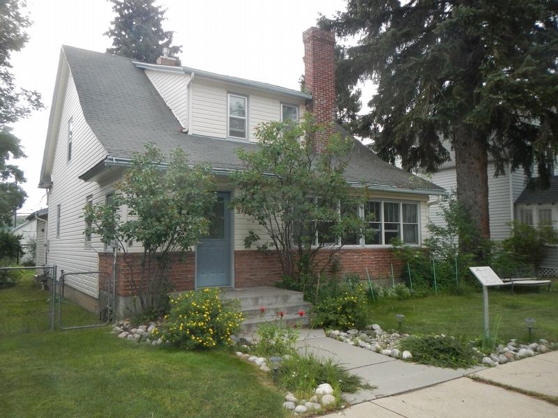
The sloping roof of this one-and-one-half-story house once shaded an open porch. The curved roofline and shed dormer add Craftsman style elegance to the home, constructed on a double lot after 1907. The interior also reflected Craftsman ideals with . . . — — Map (db m190276) HM
These two turn-of-the-twentieth-century wood-frame commercial buildings with a tiny shop sandwiched in between today share one façade. In 1900, Biagio Sconfienza opened a bakery in the one-story building. In 1903, as the business prospered, Biagio . . . — — Map (db m190225) HM
German-born Victor and Otto Neithammer first established their meat market on North Broadway in 1912, raising their own livestock to supply this and other local family-run stores. Because the Neithammers' employees represented many ethnic groups, . . . — — Map (db m45415) HM
One of nine remaining homes on Nutting Row, this foursquare cottage features a hip-roofed main block with ornate dormers with shingles in an imbricate pattern. The design and plan of this 1907 home reflects William B. Nutting’s role in the . . . — — Map (db m190448) HM
Irish immigrant Daniel G. O’Shea arrived in Carbon in 1887. The eager eighteen year old took a position with the Rocky Fork Coal Company, serving as paymaster and bookkeeper until 1899 when he was appointed manager. He resigned from RFCC in 1903 to . . . — — Map (db m190438) HM
“Coziness” was the watchword of progressive builders in the early twentieth century. Small, well-designed houses proliferated after 1900 in part to compensate for the expense of such modern conveniences as indoor plumbing. Plans for . . . — — Map (db m190227) HM
Designed by Red Lodge carpenter and amateur architect Frank A. Sell and built by W. T. Pernham in 1902, this impressive brick commercial building was home to the Red Lodge Picket and, after 1918, the Picket-Journal, the primary news . . . — — Map (db m45416) HM
Michigan-born attorney George Pierson and his wife Loretta moved to Red Lodge in 1894. Soon thereafter they purchased this lot, where they lived in a one-story cottage. After the Piersons decided to build this “Free Classic” Queen Anne style . . . — — Map (db m190248) HM
During the summer of 1887, Ben F. Pippinger became Red Lodge’s first teacher, hired to teach the children of the Rocky Fork Coal Company miners opening the area’s first coal mines. Pippinger later ran the Cloverdale Dairy on a ranch north of town. . . . — — Map (db m190453) HM
"The buffalo gone and freedom denied him, the Indian was visited by two equally hideous strangers, famine and tuberculosis. The could cope with neither. His pride broken he felt himself and outcast, a beggar in his own country. It was now that . . . — — Map (db m190094) HM WM
High transom windows that provide interior light for a mezzanine commercial display area are an interesting design feature of this well-constructed commercial building. The simple chain-patterned ornamentation of buff brick across the tall parapet . . . — — Map (db m45419) HM
The Rocky Fork Coal Company constructed this hotel, originally the Spofford, which welcomed its first guests on July 4, 1893. This architectural landmark, built before the commercial district was platted, originally had its main entrance on 11th . . . — — Map (db m45390) HM
Coal was discovered in the Rock Creek Valley nearly two decades before Red Lodge was established as a mail stop on the Meeteese Trail in 1884. In 1887, the Rocky Fork Coal Company opened the first large-scale mine at Red Lodge sparking the . . . — — Map (db m45250) HM
Pure Rock Creek water and a ready market of thirsty coal miners struck Bozeman beer baron Julius Lehrkind as a recipe for success. With nephews Fred and Paul, Julius incorporated the Red Lodge Brewing Company in 1910, hiring the prominent . . . — — Map (db m190564) HM
Rapid growth of the young town of Red Lodge coincided with the arrival of the Northern Pacific Railroad’s branch line in 1889. The area became Montana’s leading coal mining region. Town lots were platted by the secretary of the Rocky Fork Town and . . . — — Map (db m45386) HM
The Consolidated Mausoleum Company made the case for constructing a communal mausoleum in a full-page newspaper advertisement in 1921. “The present high state of civilization demands for the masses a more humane and sanitary method of taking care of . . . — — Map (db m190570) HM
Prominent Red Lodge businessman William B. Nutting subdivided this northwestern neighborhood as the Nutting Addition circa 1899. Beginning in 1900 with this home, he built five cottages north of his own residence that became known as Nutting Row. J. . . . — — Map (db m190443) HM
A steep-roofed gable-front cottage with a wraparound porch stood on this lot by 1901. Sometime before 1907 Rose Robbins—who owned the one-and-one-half-story home along with many other lots in the neighborhood—expanded the residence, adding a rear . . . — — Map (db m190275) HM
Original rusticated and ashlar concrete blocks and the 1935 ROMAN marquee distinguish the façade of this early movie theater. Austrian immigrant Steve Roman built the theater in 1917. One of fourteen sons, nineteen-year-old Roman came to Red Lodge . . . — — Map (db m190222) HM
Real estate speculation abounded after the Northern Pacific Railroad constructed a branch line to Red Lodge to take advantage of the area's rich coal deposits. In 1891 Nathan Smethurst purchased this lot for $36, selling it for a profit the same . . . — — Map (db m190249) HM
A prestigious corner site contributes much to the elegance of this Queen Anne style cottage, built by rancher and businessman Louis Sichler in 1902. The steep and asymmetrical roofline, projecting gables, and two-storied bay epitomize the Queen Anne . . . — — Map (db m190245) HM
W. A. Talmage arrived in Red Lodge in 1888 to manage a branch of a Billings mercantile. By 1894, the ambitious businessman owned his own large hardware and farm implements store on Billings Avenue. Undoubtedly, his business connections helped . . . — — Map (db m190436) HM
According to an oral tradition handed down in the Crockett family, this gable-front cottage was moved here from “Old Town.” It was remodeled circa 1901 when it is first recorded on this lot. At that time, prominent merchant W. A. Talmage owned the . . . — — Map (db m190246) HM
The Beartooth Plateau contains some of the oldest exposed rocks on Earth and provides a unique window into the history of our planet. About 55 million years ago, this massive block of metamorphic basement rock pushed its way upward nearly two . . . — — Map (db m45251) HM
Originally intended as a meeting hall with storefront space, tenants Byton Down and Robert Pryde redesigned the building’s ground floor before its completion for use as a theater. When the Iris opened in 1925, residents viewed it as welcome . . . — — Map (db m45410) HM
According to tradition, a band of Crow Indians left the main tribe and moved west into the foothills of the Beartooth Range many years ago. They painted their council tepee with red-clay and this old-time artistry resulted in the name Red Lodge. . . . — — Map (db m45247) HM
A keen sense of the town’s future prompted businessman William Talmage to move his hardware business away from the busy commercial center a few blocks south to this building in 1894. When other businesses began to move to the newly platted main . . . — — Map (db m45420) HM
This fine example of masonry architecture, with its unusually preserved storefront and recessed entry, appears almost as it did in 1900 when Walter Hall opened his first-floor grocery. Sandstone banding, corbelled arches, and original stained glass . . . — — Map (db m190221) HM
Medicine Rocks State Park was once a sea of sand dunes. About 61 million years ago during the Tertiary Era, a large freshwater river deposited fine-grained sands along its shores. From there, coastal winds blew the sand into dunes that eventually . . . — — Map (db m164323) HM
If you had visited Medicine Rocks 61.5 million years ago, you would have needed gills to breathe!
A vast river once flowed through the regions, depositing layers of underwater sandbars along its deep channel. Over tine, other rivers buried the . . . — — Map (db m164615) HM
Some people claim an old buffalo hunter figured that starting a thirst emporium for parched cowpunchers on this end of the range would furnish him a more lucrative and interesting vocation than downing buffalo. He picks a location and was hauling a . . . — — Map (db m164322) HM
In 1934, at the height of the Great Depression, fire destroyed four Main Street buildings, including the First National Bank. When the economy recovered, local contractor V. E. Figg designed and constructed this 1940 commercial structure. With . . . — — Map (db m164217) HM
If you had been a Texas cattle baron in the 1880s, the endless miles of lush grasslands and open range surrounding Medicine Rocks would have seemed like heaven on earth.
Enormous cattle ranches - running thousands of head each - once dominated . . . — — Map (db m164616) HM
Traveling through southeastern Montana in 1883, naturalist, writer, and future United States President Theodore Roosevelt was struck by what he called the Medicine Buttes. He wrote, "Altogether it was as fantastically beautiful a place as I have . . . — — Map (db m216004) HM
The Sioux aptly named Medicine Rocks Inyan-oka-la-ka, or "Rock with a Hole in It."
Evidence suggests the ancestors of modern-day American Indians lived and hunted in southeastern Montana beginning at the end of the last ice age, or about . . . — — Map (db m164326) HM
With prairie stretching toward the horizon in nearly every direction, Medicine Rocks seem like a tiny "island" in a vast, grassy sea.
Indeed, the rocky buttes, spires and columns stand tall above the prairie junegrass, little bluestem and . . . — — Map (db m164544) HM
The town of Belt owes its existence to the coal mines located here in the 1890's. In those days the pop. was 4,000. The Anaconda mine, seen here, employed 1,000 men and produced 2,500 tons of coal daily.
The bituminous coal went to the Anaconda . . . — — Map (db m143651) HM
Pennsylvania native John Castner discovered rich coal deposits along Belt Creek in 1870. Within just a few years, he and Fort Benton trader T.C. Power opened a commercial coal mine near here. The partners sold coal for use by the Great Northern . . . — — Map (db m143650) HM
Lewis and Clark named nearby Belt Butte for its girdle of rocks and, in 1877, John Castner named his town Belt. Coal brought Castner here, and Fort Benton was the first market for his Castner Coal Company. Then, in 1889, the Boston and Montana . . . — — Map (db m143649) HM
The scenic Highwood Mountains, visible on the skyline to the northeast, are composed of resistant volcanic rocks which tower above the relatively soft surrounding sedimentary rocks. The mountains contain an unusual abundance of a dark igneous rock . . . — — Map (db m143648) HM
A one-story wood-frame building stood here between 1897 and 1907. Reflecting the mining town's early hard-drinking culture, it first originally housed two saloons. When Swedish immigrants Charles Carlson and George Edman purchased the lot in 1907, . . . — — Map (db m246264) HM
During a geologically brief interval of only 3 million years, between 76 and 73 millions years ago. volcanoes erupted blocks of congealed lava and volcanic ash interspersed with lava flows. The volcanoes that erupted this material have since been . . . — — Map (db m245763) HM
The son of a wealthy St. Louis family, Charles M. “Charlie” Russell longed for western adventure. In 1880, at fifteen, he convinced his parents to let him visit Montana. He never looked back. For over ten years, he worked as a night herder during . . . — — Map (db m245460) HM
Lewis noted "an Indian road enters the mountain at the same place with the river... and continues along it's border under the steep cliff."
The Indian road Lewis mentioned follows the Hardy Creek drainage to the north. It was an . . . — — Map (db m245895) HM
"The Indians have informed us that we should shorty leave the buffaloe (sic) country after passing the falls" wrote Lewis. "this I much regret for I know when we leave the buffaloe that we shal (sic) sometimes be under the necessity of fasting . . . — — Map (db m245893) HM
The entire expedition first camped in this area on their journey westward in July of 1805. Exactly a year later, Sergeant Ordway and a party of nine men retuned to this site.
Where were Captain Lewis and Captain Clark? Meriwether Lewis was . . . — — Map (db m245462) HM
On July 16, 1805 as the Expedition was about to enter the Rocky Mountains, Lewis describes some rapids "immediately at the foot of the mountain were the Missouri first enters." He also wrote about a "large pine tree situated on a small island at . . . — — Map (db m245808) HM
Tower Rock marks he (sic) point where the Corps of Discovery left the plains and entered the Rocky Mountains The point where they left the familiar prairies and entered an new terrain.
Only July 16, 1805 Lewis recorded that "at this place . . . — — Map (db m245811) HM
The Lewis and Clark Expedition passed through this canyon of "nearly perpendicular rocks" during its journey up the Missouri River in July 1805. Although the men grumbled about mosquitos and prickly pear cactus, the Corps of Discovery was clearly . . . — — Map (db m245761) HM
While walking the trail, look for the angular red, purple, gray, and green colored rocks. You are looking at geologic signs of transition between soft rock of the prairie and erosion-resistant igneous rock that make up the Adel Mountains. Volcanics. . . . — — Map (db m245815) HM
In the area of present day Cascade, Montana Lewis and Clark had not seen any American Indians. In fact, they had not seen any Indians since entering Montana. However, there were signs of their presence in the form of "boothes" or leather . . . — — Map (db m245461) HM
This building was constructed in 1867 and served as the private quarters for the commanding officer's and their families while stationed here.
13th U.S. Infantry 1867-1871
Maj. William Clinton
Lt. Col. G.L. Andrews
Col. I.V.D. Reeves . . . — — Map (db m144026) HM
Barring fur trading posts, the first important white settlements in Montana were the mining camps in the western mountains.
Everything to the east belonged to the plains Indians and was buffalo range.
To protect the miners and settlers from . . . — — Map (db m101871) HM
Camp Reynolds was established on this site June 30 - 1867 to protect route from Helena to Fort Benton.
Name changed to Fort Shaw July 4 - 1867 in remembrance of Colonel Robert G. Shaw.
Declared a military reservation January 11 - 1870 . . . — — Map (db m144022) HM
"Come bring your lunch basket and you friends and have a good time," urged Montana newspapers in June 1897. The Fort Shaw Indian School's year-end exercises would begin at 1:00 p.m. with a band concert, followed by field games, recitations, and . . . — — Map (db m144021) HM
Fred C. Campbell became superintendent of the Fort Shaw Indian School in 1898. He was a progressive teacher and administrator skilled in public relations; and he quickly recognized the ability of the young women's basketball team. By 1902 he was . . . — — Map (db m143987) HM
"Nibbles," a Montanoceratops cerorynchus (sic, cerorhynchos?), was a small plant eating dinosaur from the late cretaceous period. The species is about 68 million years old and was discovered in 1942 in the St. Mary River Formation in North Central . . . — — Map (db m143859) HM
A graceful wraparound porch with square posts, a central entry beneath a projecting gable, and transomed windows distinguish this charming vernacular example of the Greek Revival style. Inside, a rounded hall ceiling adds lovely period elegance. The . . . — — Map (db m143826) HM
Great Falls’ premier residential street, Fourth Avenue North, gained 24 new homes between 1900 and 1910. Among them was this substantial residence, constructed in 1904 for bookkeeper Edgar Newlon and his wife Anna. The home is a classic American . . . — — Map (db m143823) HM
Hidasta informants described a fall of water on the Missouri River near the mountains, so the Captains expected a short portage. Instead of one waterfall, Lewis happened upon a succession of five, and their hope for a short portage faded. Look . . . — — Map (db m80319) HM
Pictured in 1909 in the Great Falls Tribune under the headline “A Great Falls Residence,” this Queen Anne style house was hardly typical of its day. An imposing two-and-one-half-story structure, the elegant home was built in 1901 for . . . — — Map (db m143815) HM
A dramatic living room fireplace, crystal chandelier, and boxed-beam dining room ceiling are among the original fixtures continuing to decorate the interior of the Abe and Carrie Kaufman residence. Neoclassical, Craftsman, and Victorian detailing . . . — — Map (db m143816) HM
The Boston and Montana Consolidated Copper and Silver Mining Company, later acquired by the Anaconda Company, chose a treeless bluff overlooking the river to locate its smelter and refinery in 1892. Among the seventeen managers’ houses built at . . . — — Map (db m143828) HM
During the busy 1890s, Great Falls’ business district swarmed with activity. City boosters such as pioneer rancher Robert Vaughn expressed confidence in the town’s future by investing in commercial real estate. Vaughn commissioned an unknown . . . — — Map (db m143679) HM
The uppermost of the Great Falls of the Missouri bears west of this point. The name is a modern one derived from an entry for June 14th, 1805 in the journal of Capt. Meriwether Lewis of the Lewis and Clark Expedition. He discovered the falls on that . . . — — Map (db m80427) HM
By 1910, the Queen Anne style had lost much of its allure. Once admired, its artistic jumble of angles, textures, and colors had become reviled as cluttered and artificial. This rejection of complexity was gradual, and many houses—like this . . . — — Map (db m143856) HM
Streamline Moderne architecture celebrated America’s engineering prowess. The style—which offered an optimistic response to the woes of the Great Depression—promised a better future through technology. Its celebration of speed and . . . — — Map (db m143678) HM
Charles E. Davis, “expert watchmaker and jeweler,” arrived in Great Falls with his wife, Grace, in 1900. With Charles’ two brothers, the couple opened a store on bustling Central Avenue, selling jewelry, watches, cut glass, gifts, and . . . — — Map (db m143805) HM
"... my ears were saluated (sic) with the agreeable sound of a fall of water...I saw the spray arrise (sic) above the plain like a collunm (sic) of smoke....soon began to make a roaring too tremendious (sic) to be mistaken for any cause short of . . . — — Map (db m246038) HM
Spirited revelry in the streets of Great Falls greeted news of the creation of Cascade County in 1887.
Named county seat, Great Falls grew quickly, with county offices located in various downtown buildings.
In 1891 voters approved the . . . — — Map (db m101873) HM
The Chicago, Milwaukee and St. Paul Railway was constructed between 1907 and 1909, the last transcontinental railroad to cross Montana. Its service to Great Falls during the homestead boom supported the city’s establishment as a major urban center . . . — — Map (db m141948) HM
The plains surrounding Great Falls were crowded with immense herds of deer, elk, antelope and buffalo. Buffalo was a staple diet item for plains Indians and became a favorite meal for the members of the Lewis and Clark Expedition.
Lewis and Clark . . . — — Map (db m126498) HM
Former Great Falls “cowhands” held a reunion in 1938. Now grown men, as boys they had earned money herding local milk cows in and out of town each day or driving range cattle through the city streets. Membership soon expanded beyond . . . — — Map (db m143671) HM
A shortage of steel and limited purchases of nonessential goods during World War II caused the automobile industry to skyrocket after the war ended. As the troops came home and the economy recovered, Montana experienced this boom as well. By the . . . — — Map (db m143772) HM
excerpt from the journals of Captain Meriwether Lewis
I scelected a fat buffaloe and shot him very well
Robert M. Scriver, Sculptor
, through the lungs ... expecting him to fall ...
...a large white, or reather brown bear ... crept on me . . . — — Map (db m141981) HM
A close look at the Woolworth Building’s upper floors makes evident that it was originally two separate, but closely related edifices. Connecting arches over second-story windows, a decorative metal cornice, and a crowning brick parapet distinguish . . . — — Map (db m143769) HM
First Sermon by
Reverend Jacob Mills
401 Central Avenue
1884
Reverend Francis Asbury Riggin and Reverend William Wesley Van Orsdel secured present Church site
1886
First Sanctuary 1888
Second Sanctuary 1902
Educational . . . — — Map (db m143773) HM
The pioneer Methodist circuit rider William Wesley Van Orsdel—better known as “Brother Van”—arrived in Fort Benton, Montana, on the steamboat, Far West, in 1872. For forty-five years, he traveled on horseback, by wagon, by rail, and, finally, as a . . . — — Map (db m143788) HM
... the rocks seems to be most happily fixed to present a sheet of the whitest beaten froath for 200 yards in length and about 80 feet perpendicular. — Meriwether Lewis, June 13, 1805
The Great Falls of the Missouri . . . — — Map (db m82766) HM
Inside the Ryan Powerhouse, electricity is generated from Missouri River water as it drops 150 feet from the reservoir behind the dam. The water you see flowing from the bottom of the powerhouse has passed through the turbines and is returning to . . . — — Map (db m245998) HM
Lewis and Clark
On their historic Expedition to the Pacific Coast
discovered this
Giant Fountain
June 18 - 1805
In honor of the courage, fidelity and
patriotism of the explorers
this tablet is here
placed and . . . — — Map (db m148969) HM
An eclectic cultural landscape has long characterized the West Bank. Separated from downtown Great Falls by the broad Missouri River, the larger neighborhood has hosted a varied mix of industrial, residential, and commercial development since the . . . — — Map (db m143758) HM
Clean lines, formal monumental openings, and restrained revival details mark the 1939 Great Falls Civic Center as a municipal Art Deco style building. The Works Projects Administration provided most of the funding for the building. The . . . — — Map (db m143680) HM
Discovered by
Capt. Meriwether Lewis
June 13 1805
Power development
The Montana Power Co.
--- 1915 ---
Height of Falls 77.8 Ft.
Height of Dam 65 Ft.
Length of Spillway 1000 Ft.
Maximum Head 155 Ft.
Maximum Capacity . . . — — Map (db m246040) HM
An eclectic cultural landscape has long characterized the West Bank. Separated from downtown Great Falls by the broad Missouri River, the larger neighborhood has hosted a varied mix of industrial, residential, and commercial development since the . . . — — Map (db m143676) HM
"...and took the hight with as much accuricy as possible with a Spirit Leavels &c. dined at a fine Spring 200 yards below the pitch near which place ₄ Cotton willow trees grew. on one of them I marked my name the date and the hight of the . . . — — Map (db m246000) HM
Beneath the façade of this solid-looking building stands a much older wooden boarding house. In 1891, only seven years after the founding of Great Falls, a two-story dwelling stood on this lot. Mrs. S. H. Lemon ran the boarding house in 1896 and . . . — — Map (db m143770) HM
To avoid the series of waterfalls along the Missouri River north of this point, the Expedition portaged their canoes and several tons of baggage, crossing the highway right here. At the lower camp, some 12 miles NE, the crew made crude wagons, the . . . — — Map (db m143667) HM
Thirty-six hundred people watched Nomads of the North at the grand opening of the Liberty Theatre in August 1921. A musical score, played on a $47,000 Wurlitzer organ, accompanied the silent film. An overflow crowd of two thousand toured the . . . — — Map (db m143756) HM
Since 1942, Malmstrom Air Force Base has been on the frontline of America's national defense. Known locally as East Base during World War II. B-17 Flying Fortress pilots trained here and the base served as a staging area for military planes flown to . . . — — Map (db m143664) HM
Freemasons trace their history to the stonemasons of Medieval Europe, an association referenced in the design for the Great Falls Masonic Temple. Constructed in 1914, the three-story building features a dramatic central tower and steep gable bays . . . — — Map (db m143771) HM
Carroll B. McCulloh and his wife Ella constructed this elegant two-story brick home in 1911, raising their two children here. Its two-and-one-half stories, simple box shape, low-hipped roof, large central dormer, wide overhanging eaves, and offset . . . — — Map (db m143855) HM
Regimented Routine
The men followed military protocol, receiving orders from the captains and sergeants. The daily chores became second nature and never-ending.
They hunted, cooked for today, or dried meat for tomorrow.
They prepared . . . — — Map (db m143874) HM
In the 1880s Murphy, Maclay and Co. sold everything from flour and fine teas to window glass and blasting powder. Edgar Maclay and John Murphy established the firm with stores in Helena and Fort Benton in 1882. Two years later they sent Worden Wren . . . — — Map (db m143754) HM
Town founders Paris Gibson and Herbert Chowen built the original Park Hotel in 1892 to serve travelers disembarking at the nearby Great Northern Depot. When the hundred-room hotel burned in a 1913 fire, Park Hotel owners hired prominent Great Falls . . . — — Map (db m143753) HM
Great Falls founder Paris Gibson was drawn to the power of the falls of the Missouri where he vowed to found an industrial center of “unsurpassed beauty.” Backed by railroad magnate James J. Hill, Gibson hired H. P. Rolfe to plat the . . . — — Map (db m143857) HM
Meriwether Lewis recorded the first scientific observations of the westslope cutthroat trout while he ate one for dinner. Once abundant, the fish has been listed as a species of special concern since 1979.
"These trout...precisely resemble our . . . — — Map (db m143908) HM
The narrowleaf cottonwood, a tree "with a leaf like that of the wild cherry" was first described for modern science by Lewis on June 12, 1805. Other expedition first near Great Falls include documenting the cutthroat trout, thirteen-lined . . . — — Map (db m143875) HM
2198 entries matched your criteria. Entries 201 through 300 are listed above. ⊲ Previous 100 — Next 100 ⊳