The words of those engaged in the Battle of the Rosebud, and the people still affected, tell a narrative of the conflict's significance.
Kase'eetsevo' estanevosehaesta'tanemo
(The Fight Where The Girl Saved Her Brother) . . . — — Map (db m224316) HM
Throughout time, the value of this place has been connected to its rich resources.
Indian families, area landowners, the State of Montana, heritage groups, and conservation organizations, each from their own perspective, acknowledge the . . . — — Map (db m189835) HM
Garryowen, the old Irish tune, was the regimental marching song of the 7th U.S. Cavalry, General Custer's command.
The Battle of the Little Big Horn commenced in the valley just east of here June 25, 1876, after Custer had . . . — — Map (db m67897) HM
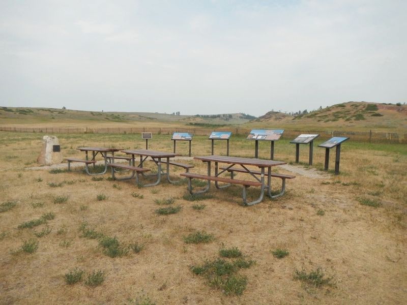
Where the Battle of Little Big Horn Began
June 25, 1876
(map of battlefield)
(showing Custer’s column, Reno’s column, Indian camp, Last Stand Hill)
Custer Battlefield Museum — — Map (db m98277) HM WM
On this site in 1876 the historic Battle of the Little Big Horn began. “When we stand side by side in the circle of no beginning and no ending, the first maker, creator of all things, is in the center. He hears the words of supplication and . . . — — Map (db m86022) HM
Building contractor Ernest Adler constructed these attached, flat roofed storefronts between 1914 and 1920. A German immigrant, Adler was one of Hardin’s most prolific builders. Situated on the edge of the business district, the one-story brick . . . — — Map (db m189252) HM
Hardin women began raising money for a library in 1909. Numerous fundraisers followed, and in 1912 a hundred-book library opened in the home of Walter and Ella Fearis. After the city passed a mill levy in 1914, Walter Fearis wrote library benefactor . . . — — Map (db m189329) HM
Hardin women began raising money for a library in 1909. Numerous fundraisers followed, and in 1912 a hundred-book library opened in the home of Walter and Ella Fearis. After the city passed a mill levy in 1914, Walter Fearis wrote library benefactor . . . — — Map (db m189254) HM
Hardin’s first railroad depot was moved from Fort Custer after being cut into small sections and transported by train over the Big Horn Bridge. That depot was expanded in 1909, but was deemed inadequate after the homestead boom dramatically . . . — — Map (db m189370) HM
Captain Edward Ball, leading two companies of the Second Cavalry from the Montana Column, was ordered to scout along the Bighorn as far south as the 1868 ruins of Fort C.F. Smith. The detachment was then to cross over the divide to the Little . . . — — Map (db m189447) HM
Captain Grant Marsh (1834-1916), one of the most skilled riverboat pilots on the Upper Missouri
during the steamboat era, figured prominently in both the events leading up to the Battle of the Little
Bighorn and its aftermath.
The steamboat . . . — — Map (db m189458) HM
As Hardin’s residential neighborhoods began to take shape during the 1910s and 1920s, the new Craftsman style emerged as a favored design. Its popularity was partly due to the ready availability and low cost of the machine-made, mass-produced . . . — — Map (db m189330) HM
Established as a military post November 1877 by order of President Rutherford B. Haynes and General Phil H. Sheridan. Garrisoned as one of the important Military posts in the Northwest until abandoned by the Government, September 1897. This Fort . . . — — Map (db m148124) HM
In 1900, John Svaren left his home in Bergen, Norway, to join family in South Dakota. There he learned English before homesteading to North Dakota in 1909. With his bride, Betsy, Svaren arrived in Hardin in 1917 to build a home. He applied his . . . — — Map (db m189331) HM
Long before fur trappers entered the Bighorn Valley, Crows, Sioux, and Cheyennes vied for the area’s abundant game. In 1876, Sioux and Cheyenne warriors defeated the U.S. Army at the Battle of the Little Bighorn; the following year, the Army . . . — — Map (db m189333) HM
German immigrant Anton Becker had great faith in Hardin’s future. Becker bought this lot on May 30, 1907, the day town lots went on sale. He soon constructed a two-story brick building, in front of which he installed Hardin’s first cement sidewalk. . . . — — Map (db m189367) HM
The elaborate corbelling on the front façade and the parapet above the transom evoke the glory days of this building, which long provided recreation for Hardin residents. German immigrant Anton Becker, owner of the hotel next door, constructed the . . . — — Map (db m189365) HM
Montana created twenty-six counties during its 1910 county-splitting craze. Among them was Big Horn County, carved from portions of Yellowstone and Rosebud Counties in 1913. Private entrepreneurs constructed the new county’s first courthouses. In . . . — — Map (db m189332) HM
A 30-car cross-country extravaganza, has been called "Montana's greatest publicity stunt". The Centennial Train, which commemorated creation of Montana Territory, also honored 75 years of statehood. The State commissioned Lyman Rice to paint 150 . . . — — Map (db m189445) HM
Charles and Rushann Schneider built this two-story brick business block in 1910. Anticipating the arrival of electricity by four years, the Schneiders had their building wired during its construction. The exterior’s relative simplicity reflects the . . . — — Map (db m189363) HM
St. Joseph’s Catholic Church of Hardin was founded by Jesuit missionaries to the Crow Indians. Fr. Thomas Grant of St. Francis Xavier’s Mission purchased three town lots for $425 in 1908. The Jesuits constructed a plain, gable-front wooden building . . . — — Map (db m189251) HM
On May 4, 1917, Hardin celebrated the “formal opening of the Gay block . . . with a grand ball in the south store room of this magnificent structure.” The storage area’s hardwood floor was perfect for dancing, and construction of the two-story brick . . . — — Map (db m189361) HM
Once upon a time, railroads ruled Montana's transportation landscape. When the first railroad reached Montana in 1881, it began a process where, by 1916, over 5,200 miles of steel track criss-crossed the state. The railroad transformed some . . . — — Map (db m189446) HM
The great plains of eastern Montana was home to thousands of
buffalo before Euro-American hunters nearly wiped them out in the
early 1800’s. The animals were central to the Indian lifeway. In the
dog days, hunters herded buffalo into corrals . . . — — Map (db m99063) HM
For the exhausted Nez Perce, this site, known to them as ćáynim?a•lika?spe (Place of Manure Fire), appeared to be a good place to rest before continuing to Canada. Then a large force of U.S. soldiers surprised them from the east. After . . . — — Map (db m142832) HM
Striking on the run, the U.S. Army planned to surprise and overwhelm the Nez Perce camp. Along this ridge Nez Perce warriors fought back fiercely and stopped the cavalry charge. The surprise attack was blunted, but the Nez Perce were pinned down, . . . — — Map (db m142866) HM
C'Aynnim 'Alikinwaaspa is the Nez Perce name for this site. It means "Place of the Manure Fire" because the Nez Perce used buffalo chips as fuel here.
On September 29, 1877, about 700 Nez Perce men, women and children camped in the basin . . . — — Map (db m142830) HM
Two panels are affixed to a common boulder.
Commemorating the surrender of Chief Joseph and the remnants of his tribe of Nez Perce to General Nelson A. Miles, October 5, 1877.
Here Chiefs Looking Glass, Ollicut, Too-hul-sote and . . . — — Map (db m142802) HM WM
To the
everlasting
memory
of the
Brave Warriors
Chief Joseph's Band
who fought on
these grounds
in the
Nez Perce War
of 1877
Erected by
Nez Perce Indians
and the
Chief Joseph Memorial
Association . . . — — Map (db m142865) WM
With the fighting at a standoff, Hinmatóowyalahtq̓it (Chief Joseph) met with Colonel Miles near this site. Surrender was a survival strategy, to keep the Nez Perce people alive and together. One witness reported that Chief Joseph spoke . . . — — Map (db m142869) HM
These rolling hills and coulees are the site of the last battle of the 1877 Nez Perce War. For the Nez Perce this was the end of a 1,170-mile journey, after many successful skirmishes along the way. Canada was only 40 miles farther, its mountains . . . — — Map (db m142833) HM
About noon the families made camp. The scouts killed several buffalo. This place is ćáynim?a•lika?spe (Place of Manure Fire) .... Some warriors were on the buttes watching for enemies. We expected none. -- himi・n maqsmáqs . . . — — Map (db m142838) HM
This park links a series of widely separated sites of deep significance to the Nez Perce – historic villages, battlefields, and legend sites. The park experience involves a journey across both time and territory. Although firmly connected to . . . — — Map (db m142831) HM
The large depression is the site of a mass grave. Here the U.S. Army buried its casualties from the battle. This ridge is also the site of a hastily erected field hospital -- just a tent were surgeons tended and operated on the wounded. In 1912 the . . . — — Map (db m142868) HM
From where the sun now stands I will fight no more forever.
October 5 1877
Surrender of Chief Joseph to Colonel Nelson A Miles
To the valor and devotion of those both red and white who struggled here
Erected by the Congress of . . . — — Map (db m142801) HM
This battle was fought September 30 to October 5, 1877, on Snake Creek, about 20 miles south of here near the Bears Paw Mountains, where after five days days' siege Chief Joseph, one of five remaining Nez Perce leaders, surrendered to Col. Nelson A. . . . — — Map (db m142800) HM
Fort Belknap Reservation was established in 1888 when Gros Ventres, Blackfeet, and River Crows ceded to the government 17,500,000 acres of their joint reservation that had covered all of northern Montana east of the Rocky Mountains. Home for the . . . — — Map (db m142915) HM
High points such as mountaintops and tabletop buttes are considered powerful and sacred areas by many Indian peoples. Snake Butte is one such location, often used as a place for the spiritual rite of vision questing. The individual vision quest is . . . — — Map (db m205818) HM
On a quiet night, nine miles north of Harlem, Montana the lives of thirteen airmen were lost when two C-141B Starlifter Cargo Planes collided. The thirteen crew members from McChord Air Force Base were on a low level refueling exercise on that . . . — — Map (db m142910) WM
The Lewis and Clark Expedition passed this way on their westward trek across the continent. Expedition members camped on the west side of the Missouri River on July 25, 1805, a short distance upstream from present day Toston Dam.
It was near this . . . — — Map (db m192879) HM
This Plaque Commemorates the Courage and Strength of the Early Pioneers.
Lorentz Homestead
In 1884, William B. Lorentz and his wife Malvina Lorentz moved to this area of the Montana Territory and in 1887 filed a Declaration of . . . — — Map (db m188780) HM
Norwegian immigrant Tom Toston established a ranch and ferry near here in 1871. Strategically located at the junction of the Helena-Gallatin Valley Road and the road to Radersburg, a settlement quickly grew up around Toston’s ranch. Soon the town . . . — — Map (db m188779) HM
Its Beginning
Significant production of gold-rich pyrite ores in the Radersburg District of the Elkhorn Mountains during the 1870s eventually lento the construction of the Toston Smelter in 1885. The Toston Smelter Company - incorporated in . . . — — Map (db m188778) HM
Shortly after the discovery of gold in Confederate Gulch, freighters established a road between Helena and Diamond City. The Missouri River was a barrier to travelers until John Oakes established a ferry in Black Rock Canyon in 1865. A small . . . — — Map (db m141733) HM
"See out at sunrise, the current very strong; passed a remarkable bluff of a crimson coloured east on Starboard intermixed with Stratas of black and brick red slate..."
Imagine canoeing against the Missouri's current, never sure of . . . — — Map (db m192881) HM
J. P. Kearns came to Townsend from Benton, Wisconsin, in 1899. Business-educated and experienced, Kearns astutely recognized the town’s need for a new financial institution and founded the State Bank of Townsend only three months later. The bank was . . . — — Map (db m141732) HM
In 1864, prospectors discovered promising placer gold deposits in Confederate Gulch, named for their political sympathies during the Civil War. This led to a huge gold rush that brought thousands of people to the gulch and the discovery of some of . . . — — Map (db m141735) HM
On December 5, 1875, Masons in Meagher County chartered Valley Lodge No. 21 (A.F. & A.M.) in Centerville, a farming community just north of present-day Townsend. The lodge moved to Townsend in 1884, shortly after the Northern Pacific Railroad . . . — — Map (db m188781) HM
York (ca. 1770-1831) is the only name given for Captain William Clark's slave in the journals of Lewis and Clark (Moulton, 1988).
Lewis and Clark's journals frequently refer to York, a black slave to Captain William Clark. York played an . . . — — Map (db m141726) HM
(Three historical panels are located at this informational kiosk:)(Panel 1:)
Winston - A Town with Dreams of Striking it Rich
Winston History
Welcome to the community of Winston and this area of the . . . — — Map (db m188668) HM
A large red granite monument commemorates the 75 miners who died in the 1943 explosion at the Smith Mine. The United Mine Workers of America installed this memorial in 1947 to memorialize Montana’s worst coal mining disaster. Twenty-two of the Smith . . . — — Map (db m190162) HM
Platted in 1905 by George Lamport and Robert Leavens, Bearcreek was the center of an extensive underground coal mining district. At its height during World War I, Bearcreek boasted a population of nearly 2,000 people. The community was ethnically . . . — — Map (db m190160) HM
A coal-mining town established in 1905, Bearcreek developed quickly, and after just one year the town boasted telephones, city water, and electric streetlights. Bert Vaill, a cashier with the Carbon County Bank of Red Lodge, purchased this lot from . . . — — Map (db m190148) HM
About sixty million years ago, this area was part of a vast subtropical coastal plain with major rivers flowing eastward into an inland seaway. Between these major river systems great thicknesses of plant material accumulated that was converted to . . . — — Map (db m190146) HM
Thirty-nine corrugated metal structures mark the site of the Smith Mine, a ghostly reminder of a once vibrant mining district. The Montana Coal and Iron Company (MCI) began developing the Smith Mine in earnest after the arrival of the Montana, . . . — — Map (db m190143) HM
The Smith Mine is the site of the worst underground coal mine disaster in Montana history. The decaying buildings across the coulee are a memorial to the 74 men who died in the mine on the morning of February 27, 1943. Smoke pouring from the . . . — — Map (db m190113) HM
Shortly after this area was removed from the Crow Reservation in 1892, homesteaders settled along the fertile Clarks Fork River to raise wheat. The discovery of rich coal deposits along Bear Creek, seven miles to the west, generated interest among . . . — — Map (db m167143) HM
In 1863, John Bozeman and John Jacobs blazed a new trail through the buffalo rich Powder River Country to the southwest Montana mining camps. The Bozeman Trail, however, could be deadly for the men and women who traveled it. The Lakota and . . . — — Map (db m239251) HM
Jim Bridger arrived in Montana in 1822 as a member of a Rocky Mountain Fur Co. brigade. For years he had no more permanent home than a poker chip. He roamed the entire Rocky Mountain region and often came through this part of the country. A keen . . . — — Map (db m96630) HM
Jim Bridger arrived in Montana in 1822 as a member of a Rocky Mountain Fur Co. brigade. He roamed the entire Rocky Mountain region and often came through this part of the country. A keen observer, a natural geographer and with years of experience . . . — — Map (db m167010) HM
Organization of the Bridger Methodist Episcopal Church and the Ladies Aid took place in 1899, pre-dating by one year the founding of the town itself. As in other small Montana communities, itinerant ministers like the Reverend John G. Clark served . . . — — Map (db m166987) HM
known as the Pillsbury House
Built 1907
has been placed on the
National Register
Of Historic Places
by the United States
Department of the Interior — — Map (db m167009) HM
The Pryor Mountains to the east cover roughly 300,000 acres. Once entirely Crow Indian territory, now only the north end of the range is on the Crow Reservation. The south end is in the Custer National Forest. The range is bound on the east by . . . — — Map (db m166982) HM
The Pryor Mountains are located on the horizon to the southeast. The prominent cliffs and dip slopes are Madison Limestone, which was deposited in shallow seas over 300 million years ago. Along the margins of the mountains, younger tan-colored . . . — — Map (db m166979) HM
The old Fromberg Bridge was the crowning achievement of Carbon County's concrete bridge program in the early 20th century. Completed in 1915, the graceful arches across the Clark's Fork were the first such use of reinforced concrete in Montana. . . . — — Map (db m166872) HM
Homesteaders who came to farm the Clarks Fork Valley in the early 1900s profoundly affected Fromberg’s growth, adding to its population and elevating its status as a regional trade and shipping center. Dr. Ted Benson, a recent graduate of the . . . — — Map (db m166931) HM
The first Protestant services in the Clarks Fork Valley were held in 1897. The Reverend John G. Clark of Red Lodge officiated in a company boardinghouse tent at the nearby coal mining town of Gebo. By 1905, the growing congregation needed a more . . . — — Map (db m166930) HM
Norwegian-born immigrant John Gibson arrived in the Clarks Fork Valley at the turn of the twentieth century and soon opened brickyards in Fromberg and nearby Belfry. Gibson became one of the area’s most prominent contractors, constructing Fromberg’s . . . — — Map (db m166882) HM
The Gebo Mine, founded in the Clarks Fork Valley in the late 1890s, brought the tracks of the Northern Pacific to this area. The railroad, however, bypassed the coal mine and the town of Gebo that flourished near it because of difficult . . . — — Map (db m166879) HM
Jewish merchant Samuel Greenblatt moved to Fromberg from Gebo in 1900. An immigrant from Russia, Greenblatt built the town’s first commercial building. Two years later he married Jennie Hetch of Chicago at Temple Emanu-El in Helena. Greenblatt built . . . — — Map (db m166929) HM
“Chief shepherd” Walter Jordan and “singing evangelist” Lucile Park preached to a packed house at an October 1908 revival meeting, held above the meat market on Joliet’s Main Street. Forty-five charter members joined together to found the Joliet . . . — — Map (db m190744) HM
The Bank of Joliet opened in 1904 and began planning construction of this stately one-story building soon after. By the time the $8,000 building was completed in 1907, the bank had new owners and a new name. Built on Joliet’s most visible corner, . . . — — Map (db m190745) HM
The Bozeman Trail which crossed Rock Creek near this site, was established by John M. Bozeman and John M Jacobs in 1864 as the shortest route from the east to the Montana gold fields. It was abandoned in 1868. The first trail heard of Texas cattle . . . — — Map (db m190746) HM
Local physician Dr. Samuel Souders owned this commercial lot in 1909 when Dan Davis, an advocate for the construction of a fancy opera house, proposed it for the construction of his vision. The newspapers reported weekly for several months on Davis’ . . . — — Map (db m45384) HM
The manager of the Red Lodge Brewery, Paul Lehrkind, purchased this lot in 1920, likely with the intent of building a home. However, despite efforts to survive Prohibition by manufacturing the “near beer” Bud-O (“Always on Top”), Lehrkind was forced . . . — — Map (db m190277) HM
A combination moving picture theater and boarding house were the original tenants of this two-story masonry building, completed in 1908. Several directors managed the rather short-lived Alcazar, including Steve Roman, whose family long monopolized . . . — — Map (db m45387) HM
Over a quarter of the houses in the elite “Hi Bug” neighborhood were built between 1900 and 1901, including this one-and-one-half-story home, erected as a real estate investment by Red Lodge merchant Walter R. Hall and his wife Louisa. After leasing . . . — — Map (db m190244) HM
Americans organized much of their social life around fraternal groups at the turn of the twentieth century. The Benevolent and Protective Order of Elks provided an important social and charitable outlet for Red Lodge's professionals, who circulated . . . — — Map (db m45395) HM
Butte architect P. J. Donahue drew the plans for the 1899 landmark after fire destroyed its predecessor. Situated at the busy northern end of the commercial district, the building today provides an excellent example of restrained, classically . . . — — Map (db m45402) HM
When prominent local physician and surgeon Dr. Samuel Souders built this magnificent hospital in 1909, it was considered “state-of-the-art.” Amenities included a central heating system, wide doorways and hallways, an elevator, and . . . — — Map (db m45404) HM
Forty-five guests enjoyed a sumptuous dinner and housewarming at the home of John and Alphia Chapman on November 12, 1903. Begun in 1902, completion of the residence was delayed when contractor Walter S. Smith suffered a serious fall from the porch . . . — — Map (db m190278) HM
This two-story building was under construction in 1907, and for a short time housed part-owner Charles Antilla’s dry goods store. In 1912, new owners Ed Ricketts and C. V. Lucas located their Okay Meat Market, later the Red Lodge Meat Market, on the . . . — — Map (db m45388) HM
A natural springs and pond provided ice and water for a brewery established here in the early 1890s. In 1894, arson destroyed the ice house and brewery buildings, but a small, one-room log residence escaped the blaze. Dan Davis purchased the . . . — — Map (db m190562) HM
Architect Seth Hunneywell designed and built this Colonial Revival two-and-one-half-story home for Alfred and Ruth Flager, who lived here from 1902 to 1911. Costing approximately $3,500 to build and boasting “all the modern conveniences,” its “eight . . . — — Map (db m190274) HM
On Sept. 18, 1897, The Sundance Kid (Harry Longbaugh), Kid Curry and others of the "Wild Bunch" rode into Red Lodge after escaping from jail in Belle Fourche, S.D., and announced their intention of making an unauthorized withdrawal from the Carbon . . . — — Map (db m80188) HM
Prominent lumber merchant C. C. Bowlen purchased this lot in 1901. Two years later, when attorney George Pierson decided to build a larger home, Bowlen purchased Pierson’s front-gable residence and moved it a block south to this location. . . . — — Map (db m190559) HM
Photographer Mark E. Hawkes and his son Charley built a photography studio at this location where much of Red Lodge’s history was documented in pictures. Charley later struck out for Great Falls, and son Harry joined Mark. Hawkes & Son sold the . . . — — Map (db m45405) HM
Lieutenant General Philip Sheridan and 124 men forged the first documented passage over the Beartooth Mountains in 1881. Once thought impassible, the route was later modified by E. E. Van Dyke - a miner from coal rich Red Lodge, Montana. His route . . . — — Map (db m45244) HM
In the 1920s Italian shoemaker Ludovico Iarussi (later changed to Jarussi) owned this property containing his shop and several frame commercial buildings. In 1929 Iarussi razed the older shops and constructed the present building. Financially . . . — — Map (db m45409) HM
Finnish immigrant Ephraim Kent settled in Red Lodge in the early 1900s to work in the coal mines while his wife, Fiina, began a small dairy business. It was a family venture from the start, with all the children pitching in to deliver raw milk in . . . — — Map (db m190567) HM
Red Lodge Miner’s Local No. 1771 had grown to more than a thousand members when this labor temple was built in 1909. The United Mine Workers of America organized nationally in 1896 and by 1898, Local No. 1771 had 200 members. The building is a . . . — — Map (db m45412) HM
This log cabin was the home of one of Montana's most notorious citizens - John "Liver-Eating" Johnston, a sobriquet he earned in 1869 while cutting wood for the Missouri River steamboats in north central Montana. After a battle with the Lakota, he . . . — — Map (db m190093) HM
Early Red Lodge businessmen James Blackburn and Dominic Marino jointly built this fine two-story commercial building circa 1905 to house a mercantile business. A series of saloons later occupied the ground floor. An upstairs boarding house, first . . . — — Map (db m190220) HM
A four-square plan, tapered porch pillars, and flared overhanging eaves reflect the Craftsman style influence that affords this distinctive home a more modern appearance than its contemporary neighbors. Decorative cresting and leaded glass add . . . — — Map (db m190440) HM
Rocky Fork Town and Electric Company sold this lot and the one next door to F. P. Musser for $84 in 1896. Immediate resale to real estate agent T. P. McDonald for $177 netted Musser a handsome profit. This four-square cottage was either moved or . . . — — Map (db m190247) HM
2181 entries matched your criteria. Entries 101 through 200 are listed above. ⊲ Previous 100 — Next 100 ⊳