Here the Shippensburg-Baltimore and the Philadelphia-Pittsburgh Roads crossed. Near the crossroads, stood the tavern of Samuel Gettys. In 1775, troops gathered here for Continental service. — — Map (db m17045) HM
Near this site stood Samuel Gettys’ tavern, at which on June 24, 1775 most of Captain Michael Doudel’s company of riflemen was enlisted, from the Marsh Creek settlement, in prompt response to the call of the Continental Congress for volunteers.
The . . . — — Map (db m105372) HM
Near Baltimore Street (Pennsylvania Route 97), on the right when traveling south.
Jennie Wade Aged 20 yrs. 2 mos killed July 3, 1863 while making bread for the Union soldiers. < Right of Monument: > What soever God willeth must be though a Nation mourn. < Left of Monument: > With a courage born of loyalty, she hath done . . . — — Map (db m37949) HM
On Presbyterian Church Road, on the left when traveling west.
In honor of the Revolutionary Soldiers buried in this cemetery Lt. Col. James Chamberlain • Lt. Col. William Gilliland • Major William Bailey • Capt. Hugh Campbell • Capt. John Graft • Capt. Hugh King • Capt. John McIlvain • Lt. Samuel Gilliland • . . . — — Map (db m64714) HM
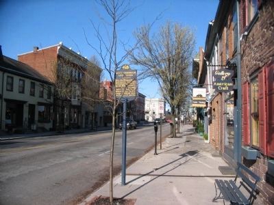
On South Queen Street at East King Street, on the right when traveling north on South Queen Street.
Littlestown is situated at the intersection of the Old Monocacy Road (opened in 1736) and the Baltimore to Pittsburgh Road, (1770) later known as the Gettysburg and Petersburg Turnpike. The Old Monocacy Road was the road between Wrightsville, PA and . . . — — Map (db m231100) HM
On Christ Church Road, 0.2 miles north of Hanover Pike (Pennsylvania Route 194), on the right when traveling north.
In honor of revolutionary soldiers buried in this cemetery.
Johannes Bard Philip Rahn
Jacob Beihl George Jacob Scherman
Jacob Brothers Andreas Schreiver
John Crouse . . . — — Map (db m14861) HM
On Bethel Church Road east of Marshall Road, on the right when traveling east.
Founded 1776, in the Old Stone Manse in South Park, by Reverend John McMillan, pioneer minister and educator. It is the mother of five nearby churches and has given its name to the community. In the cemetery, 14 Revolutionary War soldiers from this . . . — — Map (db m122311) HM
On Washington Pike (Pennsylvania Route 50) 0.1 miles south of Thoms Run Road, on the right when traveling south.
Known as Woodville. Built 1785 by General John Neville; later occupied by his son, Colonel Presley Neville. Refuge of General Neville's family when some Whiskey Rebels burned his home at Bower Hill, July 17, 1794. — — Map (db m40979) HM
On Old Bower Hill Road at Church Street, on the right when traveling south on Old Bower Hill Road.
Oldest Episcopal Church in southwestern Pennsylvania, founded after the French and Indian War by veteran Major William Lea on his land grant. Francis Reno was the first vicar. Church members included General John Neville, the unpopular tax collector . . . — — Map (db m245526) HM
On Beaver Grade Road, 0.1 miles east of Lozer Drive, on the right when traveling east.
A militia captain during the American Revolution and civic leader in the early republic, Meeks was a petitioner to create Allegheny County in 1787. While making his living as a farmer, he took up arms to defend western Pa. during conflict and war. . . . — — Map (db m40221) HM
Near McCrady Road at Beulah Road (Pennsylvania Route 130).
This historic chapel, a landmark in the Pittsburgh area since 1837, is the third building occupied by the congregation of the Beulah Presbyterian Church, which was organized in 1784. Preceeded by two log buildings, the chapel is built of bricks made . . . — — Map (db m122316) HM
Near this site stood Fort Vance, a settlers fort built during the French and Indian War era by Revolutionary War Captain Robert Vance. Robert Vance was a member of the Virginia Regiment of the Colonial Army, under the command of George Washington, . . . — — Map (db m93567) HM
On West Steuben Street (Pennsylvania Route 60) at South Linden Avenue, on the right on West Steuben Street.
On this site was located the isolation hospital erected in 1777 by General Edward Hand to care for troops at Fort Pitt. Blockhouses protected the original two-story log structure. — — Map (db m40394) HM
Commissioned surveyor 1769 by William and Mary College. Personal friend and assistant to George Washington, who commissioned him major in the Revolutionary Army. Quartermaster, Paymaster, and Brigade-Major in the Virginia Line. Staff Officer and . . . — — Map (db m242016) HM
On Jones Avenue (Library Street) south of Bell Avenue, on the right when traveling north.
On May 29, 1825, General Lafayette visited Braddock’s Field and spent the night at the Wallace Mansion. He left for Pittsburgh the next day. — — Map (db m223510) HM
On Sixth Avenue, 0.1 miles south of Wood Street, on the right when traveling south.
Dr. Nathaniel Bedford
Died March 21, 1818 Aged 63
Surgeon at Fort Pitt
Trustee under Penn Grant to Trinity Church, 1787
Incorporator of Pittsburgh Academy now University of Pittsburgh, 1806
Burgess of Pittsburgh, 1806 . . . — — Map (db m236153) HM
On Oliver Avenue just east of Wood Street, on the right when traveling east.
In commemoration of the grant of this land for the Presbyterian Church and for Trinity Church by the heirs of William Penn in 1787, and in honor of the officers of the Colonial and Revolutionary Armies who after assisting in the achievement of . . . — — Map (db m156265) HM WM
On Sixth Avenue, 0.1 miles south of Wood Street, on the right when traveling south.
This whole city block at one time held as many as 4,000 graves. An ancient Indian tumulus (burying ground) originally occupied part of the site and, subsequently, the French of Fort Duquesne (1754) and the British from Fort Pitt (1758), along with . . . — — Map (db m74735) HM
Near Three Rivers Heritage Trail System close to Interstate 279.
(Right side of entrance)
Forks of the Ohio
Fort Pitt Block House
has been designated a
National Historic Landmark
This site possesses national significance
in commemorating the history of the
United States of America
(Left side . . . — — Map (db m40336) HM
This restored wall presents a section through a typical masonry rampart of Fort Pitt. Originally built of brick burned at the site and stone quarried in the area. The fort was a five-sided structure with a bastion at each corner and measured a . . . — — Map (db m99064) HM
On Beechwood Boulevard at Federal Hill Street, on the right when traveling north on Beechwood Boulevard.
Born near Harrisburg, Girty crossed cultural boundaries between native and white societies. He was captured and adopted by Seneca Indians in 1756. Upon his release, he settled here with his family. He worked as an interpreter for the British and . . . — — Map (db m108791) HM
On Kane Boulevard, 0.3 miles west of Bower Hill Road, on the left when traveling west.
Site of General John Neville's mansion, burned to the ground by insurgents during a major escalation of violence in the Whiskey Rebellion, July 16-17, 1794. General Neville was Inspector of Revenue under President Washington. In the two-day battle, . . . — — Map (db m40393) HM
On Corrigan Drive at Stone Manse Drive, on the right when traveling north on Corrigan Drive.
Patriot, Indian Fighter,
Soldier of Revolutionary War.
————————————————
First white man to settle in
what became East Liberty
and later the East End
of Pittsburgh, Pa. — — Map (db m225459) HM
Near Pennsylvania Route 2025, 0.3 miles west of Cochrans Mills, on the right when traveling east.
Revolutionary Soldier
Listed in 1780 as Sergeant in Captain John Santee's Company of the Second Battalion and in 1783 as Lieutenant upon a list of officers of the Sixth Battalion of the Northampton Co. Militia Pennsylvania — — Map (db m79285) HM WM
Prior to settlement, a native american presence evident in this vicinity. What is now Freeport and west of the Allegheny River, did not belong to Pennsylvania until the purchase of 1784. The "Depreciation Lands", surveyed out of this purchase were . . . — — Map (db m114803) HM
In memory of General John Armstrong, a Scottish Covenanter and a soldier of the American Revolution. Lieutenant Colonel, 2d. Battalion Provincial troops 1756. Brigadier General Continental Army 1776. Major General Pennsylvania Militia 1778 to close . . . — — Map (db m47562) HM
On Duss Avenue, on the right when traveling south.
Site of Anthony Wayne's training camp, for the "Legion of the United States" November 1792 to April 1793-his legion trained here to prepare for the Battle of Fallen Timbers on August 20, 1794. Wayne chose this site adjacent to abandoned Logstown, . . . — — Map (db m40230) HM
Near Duss Avenue, 0.1 miles north of Anthony Wayne Drive, on the right when traveling south.
Gen. Anthony Wayne's army camped here Nov. 1792 to April 1793, preparing for the campaign which led to the Battle of Fallen Timbers with the Northwest Indians. — — Map (db m56581) HM
Irish born, educated in medicine, Irvine practiced in Carlisle till the Revolutionary War. Led a Pennsylvania Regiment in important campaigns. In 1781, chosen by Washington to command western department, headquartered at Fort Pitt. Headed . . . — — Map (db m40232) HM
On East End Avenue, on the right when traveling north.
Despite the threat of Indian attack and the hardships of life on the frontier, early white settlers began trickling into the area south of the
Ohio River, attracted by fertile farmland, river transportation, and an abundance of natural resources. . . . — — Map (db m176916) HM
On 3rd Street at Insurance Street, on the right when traveling west on 3rd Street.
The first United States military post north of the Ohio. Located on River Road, in the area between Bank, Insurance, and Market Streets. Built in 1778 and scene of Treaty of Fort McIntosh in 1785; also a survey base. Abandoned in 1791. — — Map (db m40235) HM
On River Road east of Market Street, on the right when traveling east.
1778 — • — 1916
This Marks the Site of
Fort McIntosh
First United States Military Fort
On the north side of the Ohio River
——————————
Erected by
The . . . — — Map (db m44745) HM
On River Road at Insurance Street, on the right when traveling east on River Road.
Fort McIntosh, 1778-1788, built by General Lachlan McIntosh's continentals of the 8th Pennsylvania and 13th Virginia, veterans of Saratoga, Brandywine, Germantown, and Valley Forge, and Virginia Militia, was the first fort built north of the Ohio by . . . — — Map (db m44747) HM
On River Road east of Market Street, on the right when traveling east.
[Left Side of Text]: First Home of the U.S. Army
After the American Revolution was won, Congress authorized formation of a small regular army for general defense. This unit, formed under Col. Josiah Harmar, was named the first . . . — — Map (db m44750) HM
In June 1778, with the French Alliance a reality and Valley Forge behind it, the
Board of War ordered an expedition against Fort Detroit to counter the British disruption
of the western frontier. Washington ordered the 8th Pennsylvania . . . — — Map (db m204297) HM
On River Road at Market Street, on the right when traveling east on River Road.
This marks the western boundary of Fort McIntosh,
erected here in 1778 in defense of the western frontier.
• • • • •
Following the Revolutionary War, a treaty with the
Native Americans was drawn at Fort McIntosh in 1785.
The occasion was . . . — — Map (db m44734) HM
On 3rd Street at Commerce Street, on the left when traveling west on 3rd Street.
In honor of Brigadier General Lachlan McIntosh; born 1727 in Scotland, died 1806. Appointed Western Department Commander of the Continental Army by General Washington May 1778. Erected Fort McIntosh in the fall of 1778, serving as its first . . . — — Map (db m40242) HM
Near Pine Street (Pennsylvania Route 168) 0.4 miles east of Main Street, on the right when traveling west.
Early Methodist Episcopal Church circa 1832. Ground given for church use and free burial plot. Deeded in 1834 by Mathias Hook. Hookstown's founder and a Revolutionary soldier who is buried here.
Summer subscription school held here in 1859. — — Map (db m49699) HM
Near East John Street east of South Juliana Street, on the left when traveling west.
Raised and equipped the 16th regiment
of Virginia Continentals. Fought at White Marsh Plains 1777 Valley Forge Campaign
1775 1783 — — Map (db m177115) HM
On East John Street at South Juliana Street, on the right when traveling east on East John Street.
In Memory of those Soldiers
of the American Revolution
buried in this cemetery
Col. Hugh Barclay · Col. Charles Cessna · Col. Samuel Davidson · Col. Levin Powell · Henry Armstrong · George Funk · Bert Gibson · Frederick Hill · Joseph . . . — — Map (db m176783) WM
On Madley Church Road west of Hyndman Road (Pennsylvania Route 96), on the right when traveling north.
Erected 1929 A.D. by the
Commonwealth of Pennsylvania
to the memory of
Ludwick Lybarger Sr. • George Lybarger • Nicholas Lybarger Sr. • Nicholas Lylarger Jr. • Henry Lybarger
Soldiers of the Revolutionary War
who served in
"Wills Creek . . . — — Map (db m176117) WM
On Raystown Road (Pennsylvania Route 26) at Capt. Phillips Memorial Road on Raystown Road.
Capt. William Phillips and 11 men of his militia company were captured near this point by Indians, July 16, 1780. Ten men were killed here and were buried later by a search party. Capt. Phillips and son Elijah, taken prisoner, were freed by British . . . — — Map (db m91084) WM
Graves of ten of Capt. Phillips' militia killed by Indians, July 16, 1780. Administered by the Pennsylvania Historical and Museum Commission. — — Map (db m91085) WM
Upright Bronze Plaque The following scouts under Capt. Phillips were massacred here by the Indians July 16, 1780. M. Davis, T. Gaitrell, D. Kelley, G. Morris, P. Sanders, T. Sanders, A. Shelly, R. Shirley, H. Skelly, P. Skelly.
Erected 1926 . . . — — Map (db m91086) WM
On East Main Street (Pennsylvania Route 345/724) just east of North Mill Street, on the left when traveling east.
William Bird c 1706-1761
In 1751, William Bird, pioneer ironmaster, built the stone mansion which now houses the Birdsboro Community Memorial Center. The home which faced the Schuylkill River, was conveniently situated across . . . — — Map (db m160550) HM
On East Baumstown Road (U.S. 422) at Center Road (Pennsylvania Route 82/345), on the right when traveling west on East Baumstown Road.
Hopewell Forge, 1744, and Furnace, 1770, were seven miles south. The furnace and the remains of an iron making community of the era are administered by the National Park Service, with recreation areas. — — Map (db m23784) HM
Near Old Philadelphia Pike, 0.1 miles north of Britton Street, on the left when traveling north.
A Humble Dwelling
This modest stone house was built for Michael Fulk (c. 1743 - 1808) around 1783. Unlike the mansion owned by Fulp's wealthier neighbors, such as the Douglass family just up the lane, it offers insight into the lives of the . . . — — Map (db m160527) HM
Wealthy and influential colonial settlers.
George Douglass built his family mansion here
and also the White Horse Tavern in 1765.
This stage coach stop was of historical
importance during the Revolutionary War.
Douglassville was named . . . — — Map (db m25279) HM
Revolutionary soldier, Congressman, Governor 1820-1823, lived in the Hiester Mansion. Now a part of the Berks County Welfare Farm. — — Map (db m84514) HM
On Constitution Boulevard just north of Hill Road, on the left when traveling north.
To the Patriots of Berks County who served the cause of Liberty in the War for American Independence
1775 - 1783
Erected in the 233rd year of American Independence — — Map (db m160600) WM
On this site was the house occupied by Dr. Jonathan Potts; Deputy Director General, 1777-1780, of Northern and Middle Departments of the Continental Army. — — Map (db m25247) HM
Site of the home of Dr. Bodo Otto, Military Surgeon in Continental Army, 1775-82. Served as Surgeon-in-Chief at Valley Forge, 1777-78; Physician and Surgeon of the Continental Hospitals. Died, 1787. — — Map (db m25225) HM
On Washington Street (Business U.S. 422) at Reed Street, on the right when traveling west on Washington Street.
The heirs of Wm. Penn
donated and deeded the lots to
Conrad Weiser and Isaac Levan,
————Trustees.————
The first church was built of logs.
Rev. Wm. Stoy, 1755, was the first . . . — — Map (db m111824) HM
After Burgoyne's surrender, 1777, German mercenaries, mostly Hessian, were held prisoners at various places until end of war. Those brought to Reading, 1781, were encamped until 1783 in huts on the hillside a quarter-mile to the north. — — Map (db m84504) HM
Site of house occupied by Joseph Hiester from about 1792 until his death, 1832; a Lt. Col. in Continental Army; Delegate to Provincial Convention in 1776; Member of Congress for 14 years; Governor of Pennsylvania, 1820-23. — — Map (db m25211) HM
On Schuylkill River Trail, 0.2 miles east of Brentwood Drive, on the left when traveling east.
Birth of Berks County
Settlement began with the Lenni-Lenape of the Delaware Nation. In 1681 William Penn founded Pennsylvania and in 1748 his sons Thomas and Richard established Readingtown. It became the county seat when Berks County was . . . — — Map (db m160558) HM
On Centre Avenue (Pennsylvania Route 61) 0.1 miles south of Spring Street, on the right when traveling south.
With men enlisted from Berks County, Nagel's Company was a part of the first battalion in the colonies authorized by Congress, in June 1775. After gathering at Reading the following month, this company and other companies of the battalion marched . . . — — Map (db m71371) HM
On East Lancaster Avenue (US 222) at Mifflin Blvd. on East Lancaster Avenue (US 222).
Member of the Continental Congress, a Revolutionary soldier, first Pennsylvania governor, 1790-99, lived at his estate Angelica from 1774 to 1794. The Berks County Farm and Home now occupies the site. — — Map (db m84488) HM
This tablet is in commemoration of the services of Revolutionary War soldiers buried in Hain's Church (St. John's Reformed) Cemetery at Wernersville, Pa. This tablet is dedicated in grateful recognition of their patriotism and valor.
[Honor Roll . . . — — Map (db m39299) WM
On Conrad Weiser Pkwy. (US422) at North Water Street on Conrad Weiser Pkwy. (US422).
Erected 1749; once owned by Baron Stiegel. Operated by ironmaster George Ege, 1774-1824. Hessians were employed in Revolutionary days to cut a rock channel for water supply. Site is to the north of Womelsdorf. — — Map (db m84522) HM
On Skelp Road, 0.7 miles Old US 220 (Pennsylvania Route 865), on the right when traveling north.
The Revolutionary fort site can be seen a few miles from here. Built 1778 by Daniel Roberdeau to protect lead mines in Sinking Valley which supplied the Continental army. — — Map (db m52429) HM
This Comfort Inn stands on the site once occupied by Fort Fetter.
Michael Fetter's barn was fortified and named Fort Fetter circa 1777. It served throughout the American Revolutionary War as a fortified structure for the defense of the local . . . — — Map (db m75206) HM
On Washington Avenue (Old U.S. 220) at West 10th Street, on the right when traveling south on Washington Avenue.
Near this spring for many years resided
Thachnectorus "The Spreading Oak"
alias
Captain John Logan (1718-1820)
Eldest son of Shikellemus, Vice-Gerent
of the Iroquois Federation in Pennsylvania
and a staunch and tried friend . . . — — Map (db m134807) HM
Standing before you is a reconstructed Fort Roberdeau,
added to the National Register of Historic Places on May 29, 1974.
Why and How did Fort Roberdeau become a frontier fort during the American Revolutionary War?
Well, the . . . — — Map (db m226806) HM
Follow the time line from 1925 to the present day.
Imagine a walk along the patriotic path from acknowledgement to a concept and finally the fort standing before you today.
July 4, 1925
Marker erected near site of lead mines . . . — — Map (db m226815) HM
Known also as Tioga Point. Connecticut settlers laid out the village in 1786. Site of ancient Indian village of Teaoga. Base for the Sullivan Campaign into central N.Y. Gateway from Southern N.Y. into Pennsylvania for centuries. — — Map (db m90294) HM
Leader of Connecticut land claimants. Served in Sullivan Campaign, 1779. Imprisoned in 1787-89 for leading new state movement. Later served in Pa. legislature. Moved here in 1789; died in 1831. Homesite and grave are east of road. — — Map (db m90297) HM
On South Main Street (State Highway 199), on the right when traveling north.
In Sullivan's Expedition, the march that destroyed savagery and opened the Keystone and Empire States to civilization, four brigades furnished by the states of Pennsylvania, New York, New Jersey and New Hampshire, with Proctor's Artillery and Parr's . . . — — Map (db m33146) HM
On South Main Street at Tioga Street (Pennsylvania Highway 199), on the right when traveling north on South Main Street.
Here within the confines of Fort Sullivan were buried August 14 1779 several soldiers killed the previous day in a skirmish at Chemung as attested by Solomon Talada soldier in the ranks who returned to live in Athens the rest of his life This . . . — — Map (db m33148) HM
On Tioga Street (State Highway 199) at South Main Street, on the right when traveling west on Tioga Street.
Here, between the Chemung and Susquehanna commanding both rivers, Gen. John Sullivan built a fort Aug. 18, 1779. With a camp on the flats, it was base for the central N.Y. campaign and defeat of the Tory-Indian alliance. — — Map (db m33156) HM
On South Main Street (State Highway 199), on the right when traveling north.
Indian village 3 miles distant from Sheshecunnuck Site of Sullivan's Army Encampment August 11-26, 1779 Lay one and one fourth miles south of this point — — Map (db m32912) HM
Near this spot September 26, 1778 Colonel Thomas Hartley and two hundred men of the Pennsylvania Line met and defeated a war party of the six nations. — — Map (db m90024) WM
In memory of Major Jared Phelps a Revolutionary Soldier, who settled in East Smithfield Township in 1811. The ground where this stone rests was given by him to the Congregational Church. — — Map (db m90160) HM WM
On Main Street (U.S. 220), on the right when traveling north.
Gen. John Sullivan's army camped on the Sheshequin Flats below, Aug. 9-10, 1779. The seventh and last over-night stop on the way to Tioga Point. — — Map (db m33161) HM
On Main Street (U.S. 220), on the right when traveling north.
The south door of Iroquois Long House was situated on the point at the meeting of the rivers 200 rods to the northeast Queen Esther's Town of the Delaware Indians was 100 rods to the east along the Chemung River Bank Both towns were destroyed . . . — — Map (db m33160) HM
On Old Mills Road at McEwen Road on Old Mills Road.
Formerly known as Ogehage was an ancient fortified town of the Andastes located fifty rods northeasterly from this marker near the junction of Sugar Creek and the Susquehanna River. Here passed the Sheshequin Trail to the west branch of the . . . — — Map (db m90307) WM
On Main Street at U.S. 6, on the left when traveling south on Main Street.
1775 - 1917
John Paul Jones captures the HMS Drake.
Battles of Lake Champlain & Lake Erie —
Francis Scott Key writes our National
Anthem during the bombing of Fort
McHenry 09/13/1834 [sic - 1814]
War of 1812 — . . . — — Map (db m117293) HM WM
Here Apr. 14, 1782, a party led by Sgt. Thos. Baldwin tried to rescue a woman and her children held as Indian captives. In a four-hour battle, three children were saved but the mother was killed. — — Map (db m90485) WM
Limehill Battlefield In attempting to rescue Mrs. Roswell Franklin and her four children who had been captured by Indians Sergeant Thomas Baldwin and his party met the enemy near this spot after four hours of fighting. Three of the children . . . — — Map (db m90498) HM
On Grand Army of the Republic Hwy (US 6) at Moravian Road on Grand Army of the Republic Hwy (US 6).
Wyalusing
10 1/2 miles from Vanderlip's farm. Fifth encampment of Sullivan's Army on the march from Wyoming to Teaoga, August 6-7, 1779, was on site just west of this road marked by the Moravian Indian Town Monument — — Map (db m90560) WM
On Grand Army of the Republic Hwy (U.S. 6) at Moravian Road, on the right when traveling east on Grand Army of the Republic Hwy.
Gen. John Sullivan's army camped just west Aug. 5-7, 1779, en route to attack the New York Iroquois. A major campaign, destroying 40 villages and ending the Indian-Tory frontier menace. — — Map (db m90562) WM
The Lime Hill Battlefield, April 14th, 1782. Several hundred yards south west and in front of this marker, a rescue party of eight Patriot men ambushed a war party of thirteen Iroquois Indians who were marching five captives, Mrs. Roswell Franklin . . . — — Map (db m90496) WM
Standing Stone-9 ½ miles from Wyalusing. Sixth encampment of Sullivan’s Army on the march from Wyoming to Teaoga August 8-9 1779 was on river lowlands opposite the Standing Stone. — — Map (db m90362) WM
Gen. John Sullivan's army camped on the nearby river lowlands Aug. 8-9, 1779 en route to attack the Six Nations Iroquois. Sixth camp between Wyoming and Fort Sullivan. — — Map (db m90364) WM
On York Road (Pennsylvania Route 263) at Durham Road (Pennsylvania Route 413), on the right when traveling east on York Road.
First licensed in 1763, it was headquarters of the Committee of Observation and Inspection, which organized the revolutionary movement in Bucks County in 1775 & 1776. It was also the site where the county's first military organizations of the . . . — — Map (db m29695) HM
On State Street (Business U.S. 202) at Orchard Street, on the left when traveling east on State Street.
enroute from
Valley Forge, Pennsylvania to
Monmouth, New Jersey,
spent the night of June 19-1778 at the
farm house directly back of this marker.
The Continental Army encamped along
the road and billeted in the village of . . . — — Map (db m116078) HM
[Chronology]
Revolutionary War · 1775-1783
April 19, 1775
"Shot Heard Around the World," the American Revolution begins
October 6, 1775
Continental NAVY established
December 1775
Eric Hopkins appointed Commander of . . . — — Map (db m144330) HM WM
In 1783 the Pa. State Government declared six Doan family members outlaws for robberies, burglaries, and felonies. During the Revolutionary War, the Doans of Plumstead Twp. spied for and sold stolen horses to the British Army. They robbed the county . . . — — Map (db m86298) HM
On Durham Road near Philadelphia Road, on the right when traveling north.
:In the 1700's, Robert Durham built his historical boat in Durham, Pa. These boats were used to ship cannon balls, made at the Durham Furnace, to Philadelphia during the Revolutionary War. On Christmas Eve, in 1776, Washington and his men crossed . . . — — Map (db m21785) HM
Unfortunately, there are few contemporary descriptions of the area at that time. The local “Scotch-Irish” of the 18th century were not as concerned with keeping records of their daily activities as they were with keeping records of their . . . — — Map (db m167757) HM
On August 10, 1777, George Washington chose the Moland House as his headquarters while awaiting military intelligence on British naval and troop movements. With him were 11,000 Continental and militia soldiers encamped on the farms surrounding the . . . — — Map (db m86375) WM
A grave like any hole dug into the earth interrupts the natural layering of soil. For that reason, it can be distinguished as an anomaly—irregular in texture and color in comparison to undisturbed soil at that level.
Although cross-section . . . — — Map (db m85990) HM
On Bellevue Avenue (Pennsylvania Route 2049) at Flowers Avenue, on the left when traveling south on Bellevue Avenue.
Buried here are soldiers who died from wounds suffered in the two Battles of Trenton, Dec. 1776-Jan. 1777, and from disease incurred during the harsh winter. After the battles, Washington's troops occupied four hospital buildings in this village, . . . — — Map (db m23446) HM
On Pennsylvania Avenue at Bridge Street (Lincoln Highway) (Pennsylvania Route 32), on the right when traveling south on Pennsylvania Avenue.
Known as the "Financier of the American Revolution," Robert Morris was regarded by many as second in importance to General George Washington in winning the War for Independence. He gave Washington the decisive support needed to win battles from . . . — — Map (db m82122) HM
999 entries matched your criteria. The first 100 are listed above. Next 100 ⊳