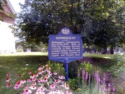
Washington's headquarters Dec. 8-14, 1776. Built in 1773 by Thomas Barkley; restored in 1931. Owners included Robert Morris and George Clymer. Located at Legion and Clymer Aves. — — Map (db m86008) HM
Headquarters of General Washington December 8-14 1776, owned by Robert Morris 1791-1798, owned by George Clymer 1798-1805, he died in residence 1813. Both Robert Morris and George Clymer signed the Declaration of Independence and the Constitution of . . . — — Map (db m86009) HM
In 1718 King George I granted to John Wells a license to operate a ferry on this site, which provided an essential link in the establishment of the principal Stage Coach Route between Philadelphia and New York. The Landing became known as . . . — — Map (db m77999) HM
Coryell's Ferry, a small hamlet on the Delaware River, played an important strategic role during the War for Independence. Throughout the war the ferry crossing was traversed countless times by messengers, supplies, and military detachments. In . . . — — Map (db m147856) HM
In December 1776 General Roche De Fernoy and General William Alexander (Lord Stirling) had their headquarters here at a "hip-roof" house known as The Old Fort. Before the Battle of Trenton, Coryell's Ferry became a military camp. Stockade . . . — — Map (db m47733) HM
In 1778, the Borough of New Hope was the colonial river crossing known as Coryell's Ferry. During the Revolution, the Grand Continental Army under the command of General George Washington crossed the Delaware River into NJ enroute to the battle at . . . — — Map (db m20105) HM
This is the oldest stone house in New Hope. It was built in 1743 by Ichabod Wilkinson, an iron master from Providence, Rhode Island. The structure is an excellent example of colonial "kitchen-parlor" style. Mary Wilkinson, Ichabod's daughter, . . . — — Map (db m147861) HM
Grandchild of Cambridge Elm under which Washington took command 7-3-1775. Raised and given by Alice Paret Dorsey. Marked by Bucks County Chapter D. A. R. — — Map (db m103423) HM
Headquarters of Brigadier-General Lord Stirling previous to the Battle of Trenton. Quartered with him were Captain William Washington, Lieutenant James Monroe (later President of the United States) and Captain James Moore of the New York Artillery, . . . — — Map (db m13770) HM
The Bird in Hand (formerly the "Red Lion Inn" and "Old Frame House") has played a rich and diverse role in the history of Newtown. There is record of a tavern on this site dating back to 1686, and it is considered the oldest frame structure still . . . — — Map (db m32278) HM
Prior to 1750, there existed a dwelling on this site, 1 East Washington Avenue, which had been built by Shadrach Walley, Newtown's first settler. Amos Strickland, a farmer and entrepreneur from Philadelphia, bought the property in 1760. In 1763, he . . . — — Map (db m32510) HM
Sixteen American soldiers, guarding military uniforms being manufactured on these premises were overpowered by a raiding party of forty enemy cavalrymen and infantrymen.
In the heroic but hopeless defense of their post, five guards were killed . . . — — Map (db m32275) HM
This colonial inn, built 1768
by Anthony Siddons,
became headquarters of
the American General
William Alexander,
"Lord Stirling,"
after the battle of Trenton
December 26, 1776 — — Map (db m32386) HM
On Feb. 19, 1778, while the British occupied Philadelphia, some 40 armed Loyalists raided the tavern here. The fighting left 5 American soldiers dead, 4 wounded, 11 captured. Tailors here were making uniforms for use at Valley Forge, and 2,000 . . . — — Map (db m32262) HM
Although some historians believe there may have been a tavern at this location fifty years earlier, Andrew and Nancy McMinn built the first part of the Temperance House, located at 5 South State Street, circa 1772. Part of the building was used as . . . — — Map (db m32432) HM
The White Hall Hotel is located at 127 South State Street. Squire Isaac Hicks, father of Edward Hicks, lived in a frame house on this lot until 1836. During the Revolutionary War, the house was used as a store and was for a time occupied by the . . . — — Map (db m32281) HM
The Old Presbyterian Church was erected on North Sycamore Street in 1769 to replace the original 1734 log structure that stood a half mile to the west on Swamp Road near the high school and the bypass.
In 1776, George Washington used this church . . . — — Map (db m29836) HM
This bell reminds us that the Liberty Bell rested here briefly on September 23, 1777 during its trip to Allentown. A joint project of the Valley Forge Chapter, Pennsylvania Society, Sons of the American Revolution and the Quakertown Historical . . . — — Map (db m95096) HM
Built in 1727. Original site at Durham. In blast until 1789, it made cannon and shot in the colonial wars and Revolution. Onetime owners included James Logan and George Taylor. — — Map (db m21786) HM
The Battle of the Crooked Billet
was fought around this spot
May 1, 1778.
General John Lacey's Command of 400 Officers
and men stationed at The Crooked Billet (now
Hatboro) were attacked by a detachment of
800 men of British Cavalry and . . . — — Map (db m41508) HM
The tavern at Cross Roads, as Hartsville was initially called, was erected in 1742 and was once the scene of much activity, including cattle auctions. Nearby was land that became an encampment site for 13,000 of George Washington's soldiers in 1777. . . . — — Map (db m23310) HM
Gen. Washington's headquarters Aug. 10-23, 1777, during the Neshaminy encampment of 11,000 troops. Here, the Marquis de Lafayette functioned for the first time as Major General at the Council of War on Aug. 21, and Count Casimir Pulaski of Poland . . . — — Map (db m86332) HM
After suffering defeats to the British Army in New york and New Jersey, General George Washington retreated to the Pennsylvania banks of the Delaware River in early December, 1776. On Christmas night, Washington boldly moved approximately 2400 men . . . — — Map (db m76687) HM
The large flat bottom boats housed in this barn are reproductions of a mid-18th century vessel known as the Durham boat. Robert Durham, an engineer at the Durham Iron Works in nearby Reiglesville, Pennsylvania, reputedly designed a prototype for . . . — — Map (db m86026) HM
In 1776, when General George Washington undertook his momentous crossing of the Delaware, the brown stone McConkey Ferry Inn was the only building on this site.Shortly thereafter, the Taylor Family purchased the Inn and surrounding land making way . . . — — Map (db m76662) HM
Has been designated a
Registered National
Historic Landmark
Under the provisions of the
Historic Sites Act of August 21, 1935
this site possesses exceptional value
in commemorating and illustrating
the history of the United . . . — — Map (db m7266) HM
Here Washington and his men braved ice and sleet Christmas night, 1776, to cross the Delaware and to surprise and defeat the Hessians at Trenton. The victory gave new life to the patriot cause. — — Map (db m13395) HM
A Bicentennial gift to the people of the United States from Citizens of the Bedford Indiana area and the Indiana Limestone Industry July 5, 1976. — — Map (db m7277) HM
Crossing Begins | Dec., 25 – 4:00 PM: Washington crossed with commanders John Sullivan, Nathanael Greene, John Glover, and Henry Knox along with 2,400 troops, 18 cannons, baggage, and approximately 50 – 75 horses. Dec., 26 – . . . — — Map (db m61744) HM
To commemorate the crossing of the Delaware River at this point by General George Washington and the Continental Troops, Christmas Night, 1776, and the splendid victory at Trenton.
Committee
John D. James, President
Russell W. Knight, . . . — — Map (db m5401) HM
In memory of
General Richard Butler
Born in Ireland
One of five brothers soldiers distinguished for bravery and devoted service
Captain 2d. Pennsylvania Battalion 1776
Colonel 9th. Pennsylvania Regiment 1777
Major General United . . . — — Map (db m42637) HM
On September 3, 1915, this park was dedicated "To the memory of the soldiers and sailors from Cambria County, Pennsylvania who fought in defense of their country.” A distinguished panel of fourteen Civil War Veterans from across Cambria County . . . — — Map (db m174177) HM WM
Southern face:
To all the Brave Defenders of the Union from the County of Carbon.
Appomattox, 1865.
Northern face:
Wilderness, Hampton Roads, Antietam, Gettysburg
New Orleans, 1815.
Eastern face:
On . . . — — Map (db m32102) WM
In memory of Jacob Weiss, born in Philadelphia Sept. 16, 1750. Pioneer, Patriot and Colonel in the American Revolution. This monument is situated 334 yards east of the spot where he built his log cabin in 1783, on the east bank of the Lehigh River. . . . — — Map (db m86888) HM WM
To Those Who Died To Keep The Nation Whole
This Memorial Is Dedicated In Grateful Appreciation
First Defenders—April 18, 1861, for 3 months.
2nd Reg't. PA. Vols.—April 20, for 3 months.
Eagle Guards, Co. H. 4th PA. Three-Months . . . — — Map (db m134824) WM
The American Light Infantry near this place vigorously resisted the advance of the British at the battle of Brandywine September 11, 1777 — — Map (db m228034) HM
In the early 1700s, blacksmith William Barns foresaw the need for a tavern on "ye Great Road to
Nottingham,” a major highway between Philadelphia and Maryland. In 1714, he built a structure with
distinctive Flenish bond brickwork and a . . . — — Map (db m193930) HM
September 11, 1777 on this site and along this corridor, 800 continental soldiers under General "Scotch Willie" Maxwell engaged some 8000 British Troops. So began the Battle of Brandywine. Taking advantage of terrain and cover of woods, Maxwell's . . . — — Map (db m168933) HM
The 1714 Barns-Brinton House witnessed the
beginning actions of the Battle of Brandywine
with the first shots fired west of this location.
On Sept. 11, 1777, early morning, General
Knyphausen's Crown Force column marched
east on the c.1743 . . . — — Map (db m196466) HM
Earlier known as Yellow Springs. Resort since 1750. Washington's headquarters, Sept. 17, 1777, after Battle of Brandywine. Hospital for his soldiers during the winter encampment at Valley Forge, 1777-1778. — — Map (db m34750) HM
Formerly Yellow Springs
A Revolutionary Hospital
Built by authority of Congress in 1777 stood
about one hundred yards north of this point.
Many Revolutionary soldiers who died in itare buried in this vicinity.Dr. Samuel Kennedyits director and . . . — — Map (db m134162) HM
Colonel Chester Co., Battalion of Minute Men July 21, 1775 Colonel 4th Penna. Infantry Battalion January 3, 1776 Brig. General Continental Army February 21, 1777 to November 3, 1783 Brevetted Major General September 30, 1783 “Resolved . . . — — Map (db m5673) HM
The First and Second Pennsylvania Brigades, temporarily commanded by Brigadier General Anthony Wayne, encamped in this area. About 800 men served in each of the sixteen brigades at Valley Forge. An estimated 34,577 pounds of meat and 168 barrels . . . — — Map (db m5694) HM
< Right Column > John Armstrong Brigadier General J. Peter G. Muhlenberg Brigadier General
William Irvine 3rd Penna Battalion
Joseph Reed Adjutant General < Left Column > Josiah Harman Lieutenant Colonel Thomas . . . — — Map (db m28928) HM
Brigadier General Anthony Wayne First Brigade Colonel Thomas Hartley commanding 1st Regiment Infantry ---------- Colonel James Chambers Raised July 1 1776 Mutered out November 3 1783 2d Regiment Infantry ---------- Colonel Henry Bicker Raised . . . — — Map (db m28846) HM
This marker is placed at the encampment site of regiments of the Commonwealth of Virginia to commemorate the officers and men of Virginia which area, at that time, encompassed what is now the state of West Virginia. These Virginians were wintered . . . — — Map (db m77118) HM
Capt'n. Benjamin Bartholomew was born in Great Valley in the County of Chester State of Pennsylvania February 16th anno dom 1752. At the earliest period of the Revolutionary War he left his plough, and with a heart glowing with patriotism assumed . . . — — Map (db m28104) HM
Patriot and Revolutionary War Hero * Commanded the Chester County “Flying Camp” Militia Regiment in American efforts to repel the British occupation of New York city * Captured upon surrender of Fort Washington and sent to infamous . . . — — Map (db m78172) HM
By midday, Sept. 10, 1777, two Crown Force columns
arrived at Kennett Square village. One column camped
east of the village along the c.1723 road (McFarlan Road),
while the other column camped along the c.1720 road
(Route 82). Generals Howe, . . . — — Map (db m215259) HM
On Sept. 11, 1777, an American force of about 11,000 men, commanded by Washington, attempted to halt a British advance into Pennsylvania. The Americans were defeated near Chadds Ford on Brandywine Creek by approximately 18,000 British and Hessian . . . — — Map (db m189469) HM
Howe planned two separate attacks against the American line. In early morning, the British Army divided here. Knyphausen’s troops went east to engage the center of the line at Chadd’s Ford, while a force under Cornwallis marched approximately 6 . . . — — Map (db m189468) HM
Built by James Walter
Endured the British army occupation
just prior to the Battle of Brandywine
September 11, 1777
The Walter family farmed here for
six generations, until 1945
marked by the
Kennett Township Historical . . . — — Map (db m223888) HM
Nighttime, Sept. 9/10, 1777, before the Battle of
Brandywine, over 8,000 Crown Forces commanded
by Generals Howe and Cornwallis marched toward
Kennett Square from the area of Hockessin, Delaware.
Using portions of Chandler Mill Road and farm . . . — — Map (db m224129) HM
“The Shrieks, Groans, imprecations, deprecations, The Clashing of Swords and bayonets &c&c&c, was more expressive of Horror than the Thunder of the artillery &e on the Day of action.”
Lieutenant Martin . . . — — Map (db m13614) HM
Heeding intelligence reports and Hearing the sound of combat coming from his early-warning Picket Posts, General Anthony Wayne ordered his 4 irreplaceable Cannons and the 1st PA. Division Supply Wagons to quickly evacuate to the west to Sugartown . . . — — Map (db m162689) HM
On the morning after the battle, Colonel Adam Hubley of the 10th Pennsylvania wrote, “I sent my Major [Caleb North] with 4 of our Horsemen on the field who counted our Dead bodys, the enemy’s were taken off…” The two or three . . . — — Map (db m13662) HM
In 1782, five years after Paoli, this picture was painted in London for a British officer who participated in the battle. Although the artist, Xavier della Gatta, never saw the Paoli Battlefield, this rare contemporary image of Revolutionary War . . . — — Map (db m13507) HM
Because of a heroic rear guard action, Wayne was able to escape the Battle of Paoli with 1900 men. The survivors of Paoli never forgot the horror of that night. Indeed, it inspired them to fight with a vengeance at the Battle of Germantown, where . . . — — Map (db m13621) HM
During the early 1800’s the cry “Remember Paoli!” stirred the hearts of listeners with personal memories of the harsh realities of war and lost loved ones. There was still an abiding desire to gather together on the anniversary of that . . . — — Map (db m13661) HM
Following the September 1777 Battle of Brandywine, Continental forces retreated to regroup along Swedesford Road near the White Horse Tavern. With British troops in pursuit, the onset of a sudden downpour and resulting wet gunpowder delayed an . . . — — Map (db m194344) HM
Other local historic sites of interest 1. General Warren Inn (Formerly the Warren Tavern) 2. Waynesborough Restored home of General Wayne 3. Valley Forge National Historical Park 4. St. Peter’s in the Great Valley Episcopal Church 5. Great . . . — — Map (db m13623) HM
While on campaign, the armies tried to keep their baggage to a minimum, and tents required wagons. The British left most of their tents on their ships, so they built shelters called “wigwams” out of brush, leaves, cornstalks, sod, straw, . . . — — Map (db m13617) HM
“At about 12 o’clock Genl. Wayne came riding along in the rear of the 2nd Brigade Calling out ‘Turn out my Boys, the Lads are Comeing, [we’ll give] them a push with the Bayonet through the Smoak.’ The Troops turned out as quick as Could be . . . — — Map (db m13509) HM
Massacre Farm North To E. Whiteland Included A Site. Southwest of This Marker. The 19th Century House and Springhouse, Headwater of Crum Creek. Were torn down in 1989 — — Map (db m48226) HM
Front of Monument: Sacred to the memory of the patriots who on this spot fell a sacrifice to British barbarity during the struggle for American Independence on the night of the 20th September 1777. Left Side of Monument: The atrocious . . . — — Map (db m13399) HM
(front of monument) Sacred to the memory of the patriots who on this spot fell, a sacrifice to British barbarity during the struggle for American Independence on the night of the 20th September 1777. (left side of monument) The . . . — — Map (db m13444) HM
You are standing at the rear of the camp where the wagons were parked. The steeple of the Baptist Church marks the approximate location of Picket Post #3, which guarded the right flank. Lieutenant Samuel Brady was with Picket #3: “Brady . . . — — Map (db m13640) HM
This marker commemorates the men and women who achieved American independence. These Patriots, believing in the noble cause of liberty, fought valiantly to found a new nation. 1775 - 1783 — — Map (db m177896) WM
These Memorial Grounds commemorate the engagement in the Revolutionary War known as the Paoli Massacre, an attack by the British Army on American troops, that took place near this spot toward midnight of September 20, 1777. About 150 American . . . — — Map (db m13505) HM
The land on which the Battle of Paoli was fought has been farmland and woodland since the mid-18th century. Ezekiel Bowen, a farmer of Welsh descent, purchased this land in 1764. County records note that he sold it to Richard Mason of Philadelphia . . . — — Map (db m13619) HM
The Battle of Paoli, also called “The Paoli Massacre”, occurred at midnight on September 20-21, 1777. After their defeat at Brandywine on September 11, Washington’s forces retreated toward Philadelphia, regrouped, and returned to Chester . . . — — Map (db m62398) HM
Since 1896, the 22-acre tract that is the final resting place for the victims of the Paoli Massacre has been under the watchcare and protection of the Paoli Memorial Association. In 1896, a small group of citizens petitioned the Court of Chester . . . — — Map (db m13664) HM
This wall reconstructed in 1964 under the supervision of Raymond S. Cox and J. Gilmore Wilson. The wall contains some stones taken from the old foundations of the Ezekial Bowen log cabin which was standing and occupied by some American officers on . . . — — Map (db m16348) HM
Quarters of
Maj. Gen. William Alexander
Lord Sterling
Continental Army
During the Valley Forge
Encampment
December 19, 1777 – June 19, 1778
Maj. James Monroe
Fifth President of the United States
Also quartered here . . . — — Map (db m62396) HM
On this spot, Joshua Evans built his tavern in 1769 and named it for Corsican patriot General Pasquale Paoli. The Inn, an important early gathering place, was briefly occupied by British soldiers
September 20th 1777 during the Battle of Paoli. . . . — — Map (db m231856) HM
The house in which the Revolutionary leader and Indian fighter was born, Jan. 1, 1745, stands about a mile away. Died at Erie, Dec. 15, 1796; now buried at St. David’s Church, four and a half miles away. — — Map (db m13370) HM
Presented to
Freedoms Foundation at Valley Forge
by members of the Grand Lodge of
Free and Accepted Masons of Pennsylvania
September 9, 1967
————————————————
Rededicated to the
Rights and Responsibilities
of Citizens in a . . . — — Map (db m232152) HM WM
Honor Court to
Brigadier General Lachlan McIntosh
A General charged with the Safety of
George Washington,
the Commander in Chief of the
Continental Army at Valley Forge 1777-78
A Native of Georgia in Command of the
“Life . . . — — Map (db m51742) HM
To Marylanders Who Served Here
Col. Tench Tilghman, Confidential Aide to Washington, who wrote:---
--“formerly of my family - in every action (of) the main army - often refused his pay - left as fair reputation as ever . . . — — Map (db m51458) WM
Village settled by the workers at iron forge begun in 1742. The forge and part of village were burned by the British army in 1777. Washington's quarters during the winter of 1777-78 were in the Isaac Potts' house, a part of the original village. — — Map (db m51761) HM
Brigadier General Henry Knox, Washington’s 27 year old artillery chief, used as his quarters the small stone section of this house. Located upstream on Valley Creek from Washington’s Headquarters, this was the farm home of John Brown and his family. . . . — — Map (db m28876) HM
In contrast to soldiers’ log huts, officers’ quarters appear lavish. But the present houses look significantly different from encampment days. Architectural modifications have more than doubled the size of General Henry Knox’s . . . — — Map (db m28871) HM
Devoted to the patriotism of
Benjamin Franklin
M.A., LL.D., D.C.L.
1706 - 1790
Signer of the Declaration of Independence
Minister at the Court of Versailles
Co-negotiator of the Anglo-American Treaty of Peace
recognizing the . . . — — Map (db m224649) HM
of the Penn. Artillery,
Continental Line.
Served at Valley Forge.
Born in Montgomery County, Pa.
Sept. 24t. 1743:
Died at Harrisburg.
Nov. 16. 1843. — — Map (db m224470) WM
Born Oct. 1st 1746. Departed this
lii3 Oct. 1st 1807. Aged 61 years.
He was Brave in the field;
Faithful in the Cabinet;
Honorable in all his transactions;
A sincere friend and an honest man. . . . — — Map (db m224639) HM
Martha Washington, first First Lady of the nation, merited personal distinction over and above the honors bestowed upon her as the wife of our first president. Her love of mankind and belief in the dignity of the individual found frequent . . . — — Map (db m224710) HM
Chaplain in the Revolution 1776-1783,
In the Indian war 1791-1796,
In the war of 1812-14.
His visitations from hut to hut and his spirted
and patriotic addresses greatly inspired
and cheered the dejected soldiers at Valley
Forge. . . . — — Map (db m224635) HM WM
Pastor of the Brandywine Manor
Presbyterian church, Chester Co. Pa.
April 21, 1761 to Nov. 15, 1785.
Born in Argyleshire, Shotland
Oct. 17, 1728. Died Nov. 15, 1785.
He was an earnest, uncompromising
friend of American liberty: a . . . — — Map (db m224467) HM WM
On this spot General Washington erected his campaign tent (marquee) when he entered Valley Forge December 19, 1777. He occupied this tent until December 24, 1777, when he moved his headquarters to the Potts House at the junction of Valley Creek and . . . — — Map (db m184243) HM