God's plan
Building love at first site since 1880...
For 110 continuous years, God has blessed our city through
the many who have worshipped and worked here in his service.
We do now resolve to keep this faithfulness growing
as we . . . — — Map (db m236622) HM
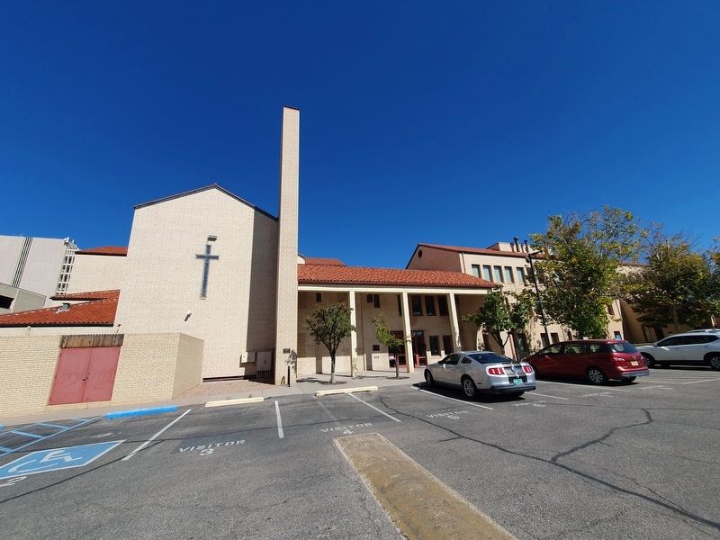
Built 1926. Foundation House, Brothers of the Good Shepherd since 1951.
Site No. 754
A Registered Cultural Property
State of New Mexico — — Map (db m236230) HM
Immanuel Presbyterian Church Built between 1949 and 1956, it bespeaks Albuquerque’s suburban growth, John Meen’s Territorial Revival architecture, and faith. A Registered Cultural Property State of New Mexico — — Map (db m180826) HM
Oldest church in Albuquerque. Has continuously served the community without interruption since 1706. Originally founded and served by the Franciscan Friars, this parish church has been served successively by the Secular Clergy of Durango, Mexico . . . — — Map (db m119451) HM
1706 1793 1796 Today
In recognition of the significant role
it has played in the history of our City,
State and Country, San Felipe de Neri
Church is on the registers of historic
places. San Felipe de Neri Church
has unceasingly served as . . . — — Map (db m180893) HM
You are currently standing at the entrance to Patio
Escondido Mall in Old Town Albuquerque. This mall
area was once home to the Sagrada, a school of the
sacred arts founded by Sister Giotto Moots in 1969.
Sister Giotto, a graduate and dean . . . — — Map (db m181104) HM
Built atop a great mesa for defensive purposes, Ácoma has been continuously occupied since the 13th century. A dramatic battle between the Ácomas and Oñate's forces occurred here in 1599. The mission church of San Esteban was built between 1629 and . . . — — Map (db m36502) HM
(Front of Marker:)
The picturesque mission church of San José de la Laguna was built around 1706 by Fray Antonio Miranda and shows the single – aisle floor plan commonly used in pueblo churches. It has been repaired many times, and . . . — — Map (db m36517) HM
Stagecoaches of the Butterfield Overland Mail Co. began carrying passengers and mail from St. Louis to San Francisco, across southern New Mexico, in 1858. The 2,795-mile journey took 21-22 days. In 1861 the service was re-routed through Salt Lake . . . — — Map (db m6553) HM
In 1884, Shalam Colony was established on the banks of the Rio Grande near the village of Doña Ana by John Ballou Newbrough and a group of Utopian followers called Faithists. Newbrough’s “Book of Shalam" set forth a plan for gathering the . . . — — Map (db m38199) HM
The Catholic chapel was originally built in 1913 on a wing of building 11 across the parade ground. In 1938, buildings 10, 11 and 12 were demolished, but the chapel was left free standing. A new stone façade was added to the old chapel consisting . . . — — Map (db m85868) HM
In 1816, Bernardo Abeyta and the other residents of El Potrero, then a separate community, finished this massive adobe chapel honoring Nuestro Señor de Esquípulas. It is noted for its 6-foot crucifix and its tradition of healing the sick. The . . . — — Map (db m32817) HM
This historical church was begun by the first Spanish settlers of the El Rito Valley in 1827 and completed in 1832. Originally flat roofed and with small window openings in the 5 ft. thick walls, it not only served as an imposing temple, but also as . . . — — Map (db m64977) HM
[ Panel 1: ]
San Juan Parish's Shrine of Our Lady of Lourdes was conceived as place of pilgrimage for those faithful wishing to honor Our Lady and to be given a glimpse
of her place of apparition to St. Bernadette Soubirou in the . . . — — Map (db m32794) HM
Chaco Culture was designated as a UNESCO World Heritage Site in 1987. Chaco Canyon was a major cultural center between 850 and 1250 CE, and is remarkable both for its monumental architecture and its status as a center of trade, politics, and . . . — — Map (db m120186) HM
The Spanish returned to New Mexico 12 years after the 1680 Pueblo Revolt. In front of you are the remains of the smaller church they completed in 1717.
Pecos Pueblo had entered a long decline due to disease, famine, and raids. Over time the . . . — — Map (db m185383) HM
Pecos was one of the largest and most powerful pueblos in northern New Mexico when the Spanish established a mission here. A few years later, in 1625, the first church was completed. You can see remnants of its foundation in front of you. Arrival of . . . — — Map (db m185381) HM
Front:
Humans have inhabited the Pecos Valley for at least 12,000 years. The fifteenth century Towa-speaking trading pueblo, Cicuyé, had over 2,000 inhabitants. During the sixteenth and seventeenth centuries, Franciscan churches were built . . . — — Map (db m119913) HM
The Pecos people farmed for generations before the Spanish arrived. Through the mission Franciscan friars taught the Puebloans about raising animals and ranching. The friars introduced domesticated livestock including sheep, goats, chicken, horses, . . . — — Map (db m185316) HM
After years of oppression, and epidemics and droughts that killed many, the people of Pecos rebelled against Spanish authority in 1680. Here they destroyed the mission church, the symbol of Spanish power.
The revolt united pueblos across the . . . — — Map (db m185382) HM
This is one of the finest surviving examples of Bishop Lamy's French-inspired gothic architecture in New Mexico. Completed in 1906, it is constructed of locally quarried stone instead of traditional adobe. Among its adornments is a painting of . . . — — Map (db m66172) HM
This church was constructed in 1868 following a flood which demolished an earlier building. Dedicated to San Ysidro, patron of farmers, the church incorporates materials salvaged from the original structure. The building is one of the finest . . . — — Map (db m45437) HM
The Mormon Battalion
Council Bluffs, July 16, 1846
Fort Leavenworth, Aug. 2, 1846
Santa Fe, Oct. 9, 1846
San Diego, Jan 29, 1847
Erected June 16, 1940
[ Map of Mormon Battalion Route ]
The Mormon Battalion, composed . . . — — Map (db m150860) HM
This 19th century adobe church is dedicated to San Isidro, ploughman, patron saint of farmers and protector of crops. Christian tradition maintains that in order to allow San Isidro time for his daily prayers an angel plowed his fields. Agua Fria . . . — — Map (db m40452) HM
This structure, St. Joseph's Catholic Church - Iglesia de San José, built
in 1922 to replace the first church (1884), which was situated on land now
occupied by the Pastor's residence. This edifice was constructed under
the direction of . . . — — Map (db m181551) HM
The St. Francis Women's Club was instrumental in raising funds to rebuild San Francisco de Asís Church, which had been condemned and demolished in about 1960.
Their main fundraiser was the annual Fourth of July Ceremonial, featuring dances of . . . — — Map (db m32833) HM
(side one)
Santa Cruz de la Cañada
In 1695, Governor Diego de Vargas founded his first town, Santa Cruz de la Cañada, designed to protect the Spanish frontier north of Santa Fe. The church, which still stands, was constructed in . . . — — Map (db m45673) HM
1630
In 1630 and 1635 Fray Alonso de Benavides wrote his famous Memorials
to the King and the Pope describing a beautiful fourteenth century statue
of the Virgin that he brought to Santa Fe from Mexico City in 1625. "She
is an image in . . . — — Map (db m182322) HM
In the seventeenth century New Mexico was plagued by drought, conflicts between civil and church authorities, and extreme demands placed by the Spanish settlers on the native population. The latter situation caused a deterioration so severe that by . . . — — Map (db m76202) HM
1850
For a quarter century after 1821 New Mexico was part of Mexico and
within the Diocese of Durango, Mexico. During this period secular
(diocesan) priests replaced members of the Franciscan Order. The diocesan
priests, many of whom were . . . — — Map (db m182411) HM
Santa Fe celebrated its 350th anniversary. During that year, special guests Maria Teresa Perez-Balsera and Maria Luisa Perez-Balsera arrived from Spain. The two ladies are direct descendants of Captain-General Don Diego de Vargas, the central figure . . . — — Map (db m76311) HM
While responding to a request to give the Last Rites to a dying man, Franciscan Father Reynaldo Rivera, rector at St. Francis Cathedral, was kidnapped and brutally murdered, sending Santa Fe and the entire state into shock. Ironically, Father Rivera . . . — — Map (db m76317) HM
This neighborhood was first established in the early 1600s by Tlaxcalan Indian servants for whom the original San Miguel Chapel was built. Razed during the Pueblo revolt in 1680; resettled by families of Spanish soldiers after the De Vargas . . . — — Map (db m184948) HM
Priest – Poet – Historian – Archivist
Artist – Author – Biographer – Genealogist
And native-born New Mexican
Major, U.S. Army – W.W. II & Korean Conflict
“THE LOVE I Love is one, . . . — — Map (db m72746) HM
On this site stood the memorable Chapel of The Lady of Light, often called the “Castrense” which marked the northernmost limit of Mexican Baroque style. Here in Santa Fe flourished the Hispano-American civilization which this Chapel typified. . . . — — Map (db m64841) HM
(side one)
Four Sisters of Loretto, Mother Magdalen Hayden and Sisters Roberta Brown, Rosana Dant and Catherine Mahoney, arrived in Santa Fe from Kentucky on September 26, 1852. In January 1853 they established Our Lady of Light Academy, . . . — — Map (db m119764) HM
Oldest church structure in U.S.A. The adobe walls and altar were built by Tlaxcalan Indians from Mexico under the direction of Franciscan Padres. ca. 1610 — — Map (db m116019) HM
(side one)
The first Sisters of Charity arrived in New Mexico Territory in 1865 from Cincinnati at the request of Bishop Lamy with the mission of serving all people regardless of race, religion or ability to pay. Hundreds of sisters . . . — — Map (db m45482) HM
Also used as two-story defensive tower for Palace of the Governors during the 1600’s. Gen. Don Diego de Vargas was probably buried beneath the floor of this chapel in 1704. — — Map (db m64842) HM
Labyrinths have been used around the world since at least 2000 B.C. Their patterns were
built into the floors of medieval Cathedrals and walked by pilgrims of that time. This
labyrinth is built in the style of the one at the great cathedral in . . . — — Map (db m181860) HM
Near to where you are standing is the route of one of the great overland trails of one of the great overland trails of the old west. Established in 1821, as a trade route between Franklin, Missouri, in the United States, and Santa Fe, then part of . . . — — Map (db m185096) HM
Built between 1886 and 1898 in a simplified Gothic Revival style.
Site No. 592
A Registered Cultural Property
State of New Mexico — — Map (db m235423) HM
During the late 17th century, this area had become well known to the Spanish. Called La Vega de Las Nutrias, or meadow of the beavers, it was a welcome paraje, or stopping place, for caravans on the Camino Real. Eighteenth century attempts at . . . — — Map (db m67080) HM
The Santa Cruz Catholic Church was built after 1793 and was licensed on January 13, 1811, and blessed on January 3, 1812.
The restoration of the historic Santa Cruz Catholic Church of Ojo Caliente, New Mexico, began in April, 1991, by the . . . — — Map (db m64962) HM
This Mission Church is one of the oldest churches in America dedicated to San Francisco de Asis. It was constructed between 1813 and 1815 under the direction of the Franciscan Fray José Benito Pereyro. It is an outstanding example of adobe, mission . . . — — Map (db m45725) HM
When Spaniards arrived at Picuris in 1591, they described the pueblo as consisting of nine-story roomblocks. The church is named for its patron saint, San Lorenzo, and according to oral tradition has been rebuilt five times. The original church was . . . — — Map (db m44283) HM
Guadalupe Plaza was the
first site of Our Lady of Guadalupe
Church, built in the early
1800's. The church was torn
down and rebuilt in 1911.
This second church burned
down in 1961 and was relocated
north of this site. — — Map (db m236577) HM
Born in Abiquiu, New Mexico, on January 17, 1793 to Don Severino Martínez and María del Carmen Santistevan (Martinez Hacienda), the life of the Presbyter Don Antonio José Martínez extended through the Spanish (1793-1820), Mexican (1821-1846), and . . . — — Map (db m66666) HM
The village of Las Trampas was established in 1751 by 12 families from Santa Fe, led by Juan de Argüello, who received a land grant from Governor Tomás Vélez Cachupín. The church of San José de Gracia is one of the finest surviving . . . — — Map (db m32123) HM
A Grander Church Abó's first priest, Friar Francisco Fonte, supervised construction of the original “San Gregorio de Abó” from 1622-27. In 1640, Friar Francisco de Acevedo became guardian here and began church renovation. When completed in 1651, . . . — — Map (db m235479) HM
A Kiva Here? Rock walls and unearthed relics can tell us only so much about what people believed 350 years ago. The mysterious, round structure before you resembles a kiva. In Pueblo tradition, kivas are underground meeting chambers for . . . — — Map (db m235521) HM
Crossroads In the 17th century, an ancient trade route that linked the Rio Grande to the Great Plains shared this fragile mountain valley with a bustling pueblo full of people who spoke Tompiro. When a single Spanish priest walked into town in . . . — — Map (db m235524) HM
New Songs The worn stairs before you endured over 50 years of small Tompiro boys hurrying to join the adults in the choir loft above. Franciscans in Mexico in the 1500s had noted how powerfully music aided their mission efforts. Friars here in . . . — — Map (db m235506) HM
People at Work Ahead and to your right you see a complex maze of rooms: the convento of Mission Abó. Here, two dozen Tompiros tackled many tasks crucial to running a mission – from herding livestock and maintaining church properties to grinding . . . — — Map (db m235501) HM
Prayers and Hymns For 17th-century Catholics, this church nave was the spiritual heart of Mission San Gregorio de Abó. When worshippers – both the indigenous people and nearby settlers from Spain – came to hear Mass, they stood and knelt. There . . . — — Map (db m235519) HM
In English:
Crossroads
In the 17th century, an ancient trade route that linked the Rio Grande to the Great Plains shared this fragile mountain valley with a bustling pueblo full of people who spoke Tompiro. When a single Spanish . . . — — Map (db m62066) HM
Located adjacent to the major east-west trade route through Abó Pass, the Tompiro Pueblo of Abó (ca. 1300s-1670s) was one of the Southwest’s largest Pueblo Indian villages. Extensive Indian house complexes are dominated by the unique buttressed . . . — — Map (db m119761) HM
The Tompiro Indian “Pueblo de las Humanas" (ca. 1300-1670s) had 1,500 to 2,000 inhabitants and was a trading center with Plains Indians. The village evolved for centuries on the fringe of the Mogollon and Anasazi cultures. There are two large . . . — — Map (db m119759) HM
On the edge of the Plains stands the abandoned Tiwa Pueblo Indian village of Quarai (ca. 1200–1670s), the southernmost of the Tiwa villages, located along the eastern flanks of the Manzano Mountains. The Spanish Franciscan mission church of La . . . — — Map (db m119760) HM