After filtering for Ohio, 732 entries match your criteria. The first 100 are listed. ⊳
Patriots & Patriotism Topic
By Craig Doda, April 20, 2022
Lincoln Highway Memorial
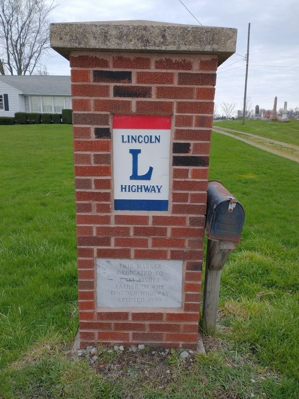
| 1 ► Ohio, Allen County, Beaverdam — Lincoln Highway Memorial — |
| On East Main Street (Ohio Route 696) at Church Street, on the right when traveling east on East Main Street. | |||
| 2 ► Ohio, Allen County, Fort Shawnee — Veterans Freedom Flag Monument — U.S. Marines-Semper Fidelis-Always Faithful — |
| On Buckeye Road east of Ft. Amanda Road, on the right when traveling east. | |||
| 3 ► Ohio, Allen County, Fort Shawnee — Veterans Freedom Flag Monument — The concept of the Freedom flag Monument — |
| On Buckeye Road east of Ft. Amanda Road, on the right when traveling east. | |||
| 4 ► Ohio, Allen County, Fort Shawnee — Veterans Freedom Flag Monument — In Honor — |
| On Buckeye Road east of Ft. Amanda Road, on the right when traveling east. | |||
| 5 ► Ohio, Allen County, Fort Shawnee — Veterans Freedom Flag Monument — 4 United States Code (U.S.C.) §§ 1-10 – The Flag — |
| On Buckeye Road east of Ft. Amanda Road, on the right when traveling east. | |||
| 6 ► Ohio, Allen County, Harrod — Harrod Veterans Memorial Park — The Price of Freedom — |
| On Main Street, on the left when traveling south. | |||
| 7 ► Ohio, Allen County, Lafayette — LaFayette - Jackson Township Civil War Memorial — and Veterans Memorial Garden — |
| On High Street at Main Street, in the median on High Street. | |||
| 8 ► Ohio, Allen County, Lima — Allen County Veterans Memorial — |
| On Main Street, on the left when traveling north. | |||
| 9 ► Ohio, Allen County, Lima — Korean War Memorial — |
| On Main Street, on the right when traveling south. | |||
| 10 ► Ohio, Allen County, Lima — 6-2 — Servicemen's Free Canteen — |
| On Central Avenue, in the median. | |||
| 11 ► Ohio, Allen County, Lima — Veterans Freedom Flag Monument — |
| On Buckeye Road, 0.5 miles west of South Dixie Highway, on the left when traveling west. | |||
| 12 ► Ohio, Ashland County, Ashland — Ashland County Soldiers and Sailors Memorial — |
| On 2nd Street at Cottage Street (Ohio Route 60/511), on the right when traveling west on 2nd Street. | |||
| 13 ► Ohio, Ashland County, Ashland — Ashland County Veterans Memorial — |
| On Main Street (Ohio Route 60/511) at Claremont Avenue, on the right when traveling west on Main Street. | |||
| 14 ► Ohio, Ashland County, Ashland — Ashland County Veterans Memorial Bridge — |
| On Center Street (Ohio Route 60/511) at Lauretta Avenue, on the left when traveling south on Center Street. | |||
| 15 ► Ohio, Ashland County, Ashland — Freer Civil War Memorial — |
| On 2nd Street at Church Street, on the right when traveling west on 2nd Street. | |||
| 16 ► Ohio, Ashland County, Ashland — 2-3 — Frontier Violence During the War of 1812 — |
| On Ohio Route 603, on the right when traveling south. | |||
| 17 ► Ohio, Ashland County, Polk — Polk Veterans Monument — |
| On Ohio Route 89, 0 miles south of County Road 800. | |||
| 18 ► Ohio, Ashtabula County, Jefferson — Bicentennial of the United States of America — |
| On West Jefferson Street at North Chestnut Street (Ohio Route 46/307), on the right when traveling west on West Jefferson Street. | |||
| 19 ► Ohio, Athens County, Athens — Athens County Revolutionary Soldiers Memorial — |
| On Court Street at Washington Street, on the right when traveling south on Court Street. | |||
| 20 ► Ohio, Athens County, Athens — Memorial Auditorium — |
| 21 ► Ohio, Athens County, Athens — Normandy Park — At Ohio University — |
| On Richland Avenue at Plains Road (Ohio Route 682), on the left when traveling south on Richland Avenue. | |||
| 22 ► Ohio, Athens County, Chauncey, Dover Township — Chauncey Civil War Patriots — |
| Near West Bailey Road, 0.1 miles west of Converse Street (Ohio Route 13), on the left when traveling west. | |||
| 23 ► Ohio, Auglaize County, Kossuth — The 77 Unknown Soldiers — |
| On Ohio Route 198, 0.2 miles south of Deep Cut Road (Local Highway 230), on the right when traveling north. | |||
| 24 ► Ohio, Auglaize County, Minster — Flag of Minster — Coat of Arms — |
| On West 4th Street west of North Frankfurt Street, on the right when traveling west. | |||
| 25 ► Ohio, Belmont County, Barnesville — American Legion Post 168 Veterans Memorial — |
| 26 ► Ohio, Belmont County, Barnesville — Barnesville Veterans Memorial — |
| On Arch Street at Main Street (Ohio Route 147), on the right when traveling north on Arch Street. | |||
| 27 ► Ohio, Belmont County, Barnesville — Barnesville War Memorial — |
| On Arch Street at Main Street (Ohio Route 147), on the right when traveling north on Arch Street. | |||
| 28 ► Ohio, Belmont County, Barnesville — The Village Bell — |
| On Arch Street at Main Street (Ohio Route 147), on the right when traveling north on Arch Street. | |||
| 29 ► Ohio, Belmont County, Barnesville — VFW Post 2792 Veterans Memorial — |
| On Chestnut Street, on the left when traveling south. | |||
| 30 ► Ohio, Belmont County, Bellaire — Civil War Memorial — Our Fallen Heroes — |
| On Belmont Street south of 35th Street, on the right when traveling south. | |||
| 31 ► Ohio, Belmont County, Bellaire — War Memorial — And These Our Dead In Honored Glory Rest — |
| On 34th Street at Guernsey Street, on the right when traveling west on 34th Street. | |||
| 32 ► Ohio, Belmont County, Bellaire — West Washington Street World War II Honor Roll — Lest We Forget — |
| On Guernsey Street north of 34th Street, on the right when traveling north. | |||
| 33 ► Ohio, Belmont County, Bellaire — World War II Memorial — In Memoriam — 1941 - 1945 — |
| On Guernsey Street at 34th Street, on the right when traveling north on Guernsey Street. | |||
| 34 ► Ohio, Belmont County, Bridgeport, Pease Township — Lansing (Scott) Cemetery — Established Circa 1808 — |
| On Church Street at Greenbank Avenue, on the left when traveling north on Church Street. | |||
| 35 ► Ohio, Belmont County, Saint Clairsville — Belmont County Revolutionary War Veterans — |
| Near West Main Street. | |||
| 36 ► Ohio, Belmont County, Saint Clairsville — Belmont County Veterans Memorial — |
| On West Main Street (U.S. 40) at North Market Street, on the right when traveling west on West Main Street. | |||
| 37 ► Ohio, Brown County, Georgetown — Ulysses Grant — Average Student to U.S. President — |
| On Water Street south of 3rd Street, on the right when traveling south. | |||
| 38 ► Ohio, Brown County, Georgetown — War Savings Stamps — |
| On South Main Street just south of East Grant Avenue, on the right when traveling north. | |||
| 39 ► Ohio, Brown County, Russellville — Russell Shaw — Pioneer and Patriot — |
| On Main Street (Ohio Route 125) near Columbus Street (U.S. 62), on the right when traveling east. | |||
| 40 ► Ohio, Butler County, Fairfield — Ezekiel Walker - Revolutionary War Soldier — |
| On Seward Road at Dixie Hwy (Ohio Route 4), on the left when traveling south on Seward Road. | |||
| 41 ► Ohio, Butler County, Hamilton — Founding of Fort Hamilton — |
| On High Street (Ohio Route 129/177) at the east bank of the Great Miami River, on the left when traveling west on High Street. | |||
| 42 ► Ohio, Butler County, Hamilton — French Exploration — |
| On High Street (Ohio Route 129/177) west of Monument Street, on the right when traveling east. | |||
| 43 ► Ohio, Butler County, Hamilton — Grand Army of the Republic Memorial — |
| On Monument Avenue south of High Street (Ohio Route 129/177), on the right when traveling south. | |||
| 44 ► Ohio, Butler County, Hamilton — Replica Liberty Bell — |
| On High Street (Route 129) west of North Monument Avenue, on the right when traveling west. | |||
| 45 ► Ohio, Butler County, Hamilton — Site of Fort Hamilton — |
| On High Street (Ohio Route 129/177) west of Monument Street, on the left when traveling east. | |||
| 46 ► Ohio, Butler County, Hamilton — 25-9 — Soldiers, Sailors, and Pioneers Monument — "Victory, the Jewel of the Soul" — |
| On Monument Avenue at High Street (Ohio Route 129/177), on the right when traveling south on Monument Avenue. | |||
| 47 ► Ohio, Butler County, Hamilton — Veterans Memorial — |
| On High Street (Ohio Route 129/177) at Monument Street, on the right when traveling west on High Street. | |||
| 48 ► Ohio, Butler County, Middletown — Middletown Veterans Memorial — |
| 49 ► Ohio, Butler County, Middletown — Middletown War Memorial Flagpole — |
| On Verity Parkway (Ohio Route 4 / 73) at Main Street, on the left when traveling north on Verity Parkway. | |||
| 50 ► Ohio, Butler County, Middletown — Middletown World War II Memorial Chapel & Plaza — |
| 51 ► Ohio, Champaign County, Christianburg — 2-11 — Marion A. Ross — In Memory of — |
| On West Pike Street (Ohio Route 55) at Wilson Street, on the right when traveling east on West Pike Street. | |||
| 52 ► Ohio, Champaign County, St. Paris — St. Paris and Johnson Township World War II Memorial — |
| On Jefferson Street at Plum Street, on the right when traveling north on Jefferson Street. | |||
| 53 ► Ohio, Champaign County, St. Paris — St. Paris Korea and Vietnam Veterans Memorial — |
| On Jefferson Street at Plum Street, on the left when traveling north on Jefferson Street. | |||
| 54 ► Ohio, Champaign County, Urbana — 5-11 — Bailey and Barclay Halls / Johnny Appleseed — |
| On College Way, on the right when traveling south. | |||
| 55 ► Ohio, Champaign County, Urbana — 14- 11 — General Robert Lawrence Eichelberger — Superintendent of West Point — |
| On Scioto Street (U.S. 36) at Ames Avenue, on the right when traveling east on Scioto Street. | |||
| 56 ► Ohio, Champaign County, Woodstock — 24-11 — Lincoln Funeral Train — |
| On Urbana Woodstock Road (County Route 2) 0.4 miles west of Main Street (Ohio Route 559), on the right when traveling west. | |||
| 57 ► Ohio, Clark County, North Hampton — North Hampton Veterans Memorial — |
| On Troy Road (Ohio Route 41) 0.2 miles west of Dialton Road, on the right when traveling west. | |||
| 58 ► Ohio, Clark County, Springfield — Clark County Revolutionary War Memorial — |
| 59 ► Ohio, Clark County, Springfield — George Rogers Clark — Namesake of Clark County — |
| On Main Street at Fountain Avenue, on the left when traveling west on Main Street. | |||
| 60 ► Ohio, Clark County, Springfield — John M. Temple — 43rd Infantry US Army — 12/10/31 - 02/21/99 — |
| On High Street at Limestone Street, on the left when traveling east on High Street. | |||
| 61 ► Ohio, Clark County, Springfield — Purple Heart Memorial — Combat Wounded Veterans — |
| On Limestone Street (Ohio Route 41), on the right when traveling north. | |||
| 62 ► Ohio, Clark County, Springfield — Springfield Burying Ground — |
| On West Columbia Street (U.S. 40) 0.1 miles east of North Wittenberg Avenue, on the right when traveling east. | |||
| 63 ► Ohio, Clark County, Springfield — Union Soldiers Monument — |
| 64 ► Ohio, Clermont County, Point Pleasant — Ulysses Simpson Grant — |
| On Ohio River Scenic Byway (U.S. 52) at Ohio Route 232, on the left when traveling east on Ohio River Scenic Byway. | |||
| 65 ► Ohio, Clinton County, Sabina — Lance Corporal Brett Wightman — Jan. 11, 1983 - Aug. 3, 2005 — Marine Corps — |
| On Howard Street (Ohio Route 729) near Elm Street, on the left. | |||
| 66 ► Ohio, Clinton County, Sabina — Sabina Veterans Memorial — |
| On Howard Street (Ohio Route 729) near Elm Street, on the left when traveling north. | |||
| 67 ► Ohio, Clinton County, Wilmington — 302 TAW C-123 Accident Memorial — |
| 68 ► Ohio, Clinton County, Wilmington — American Legion Post No. 49 Veterans Memorial — |
| On Locust Street (U.S. 22), on the left when traveling west. | |||
| 69 ► Ohio, Clinton County, Wilmington — Clinton County Veterans Memorial — "We Owe So Much to So Few" — |
| On South Street (U.S. 68) at Sugartree Street, on the right when traveling north on South Street. | |||
| 70 ► Ohio, Clinton County, Wilmington — J. W. Denver Williams, Jr. — |
| On Rombach Avenue (U.S. 22) at Park Drive, on the right when traveling east on Rombach Avenue. | |||
| 71 ► Ohio, Clinton County, Wilmington — Kenneth W. Faul — |
| 72 ► Ohio, Clinton County, Wilmington — Wilmington War Memorial — |
| On Rombach Avenue (U.S. 22) at Park Drive, on the right when traveling east on Rombach Avenue. | |||
| 73 ► Ohio, Columbiana County, Lisbon — Civil War Naval Cannon — |
| On Lincoln Highway (U.S. 30) at North Market Street (State Route 45), on the left when traveling east on Lincoln Highway. | |||
| 74 ► Ohio, Coshocton County, Coshocton — Rotary Bicentennial Gazebo — |
| Near Main Street just west of North 4th Street, on the right when traveling west. | |||
| 75 ► Ohio, Coshocton County, Warsaw — 2-16 — Colonel William Simmons — 1757 - 1823 — |
| On Main Street (U.S. 36) at Plum Street, on the right when traveling west on Main Street. | |||
| 76 ► Ohio, Coshocton County, West Lafayette — Pennsylvania National Guard Troop Train Accident, September 1950 — |
| On Railroad Street (Ohio Route 93) at Kirk Street, on the right when traveling east on Railroad Street. | |||
| 77 ► Ohio, Crawford County, Galion — Galion Veterans Memorial / Flag Plaza — 1776 - 1976 — |
| On Harding Way East (Ohio Route 61), on the right when traveling east. | |||
| 78 ► Ohio, Cuyahoga County, Cleveland, Downtown — Abraham Lincoln — |
| Near Saint Clair Avenue Northeast at East Mall Drive, on the right when traveling east. | |||
| 79 ► Ohio, Cuyahoga County, Cleveland, Downtown — Alexis de Tocqueville — |
| On Merwin Avenue at West Street, on the right when traveling south on Merwin Avenue. | |||
| 80 ► Ohio, Cuyahoga County, Cleveland, Downtown — Bob Feller — Pitcher — 1936-1941, 1945-1956 — |
| Near East 9th Street at Larry Doby Way, on the left when traveling north. | |||
| 81 ► Ohio, Cuyahoga County, Cleveland, Downtown — Casimir Pulaski — Brigadier General, U.S. — Marshal General, Poland — 1747-1779 — |
| Near Lakeside Avenue East east of East 6th Avenue, on the left when traveling east. | |||
| 82 ► Ohio, Cuyahoga County, Cleveland, Downtown — Liberty Enlightening the World — |
| On West Saint Clair Avenue just west of West 6th Street, on the left when traveling west. | |||
| 83 ► Ohio, Cuyahoga County, Cleveland, Downtown — October 23, 1956 — "Freedom is Not Free" — |
| On Lakeside Avenue East at East 12th Street, on the left when traveling east on Lakeside Avenue East. | |||
| 84 ► Ohio, Cuyahoga County, Cleveland, Downtown — Robert William Andrew Feller — |
| Near East 9th Street at Larry Doby Way, on the left when traveling north. | |||
| 85 ► Ohio, Cuyahoga County, Cleveland, Downtown — Slovenians, Thomas Jefferson and The Declaration of Independence — |
| On West Mall Drive south of Lakeside Avenue East, on the left when traveling south. | |||
| 86 ► Ohio, Cuyahoga County, Cleveland, Downtown — Spirit of '76 — |
| Near East 9th Street north of Sumner Avenue, on the right when traveling north. | |||
| 87 ► Ohio, Cuyahoga County, Cleveland, Downtown — War Savings Stamps — Cuyahoga County — |
| On West Lakeside Avenue at Ontario Street, on the right when traveling west on West Lakeside Avenue. | |||
| 88 ► Ohio, Cuyahoga County, Independence — "Veterans Plaza" — City of Independence — Dedicated May 27 1996 — |
| On Brecksville Road (Ohio Route 21) south of Sunset Avenue, on the right when traveling south. | |||
| 89 ► Ohio, Cuyahoga County, North Olmsted — North Olmsted Veterans Plaza — Honoring All Who Served — |
| On Lorain Road (Ohio Route 10) at West Park Drive, on the right when traveling west on Lorain Road. | |||
| 90 ► Ohio, Cuyahoga County, North Royalton — Hampson Post No. 499 G.A.R. Civil War Memorial — Veterans Memorial — |
| On Royalton Road (Ohio Route 82), on the left when traveling east. | |||
| 91 ► Ohio, Cuyahoga County, North Royalton — 95-18 — John Shepherd - An American Hero — March 16, 1729 - January 3, 1847 — With Washington All the Way — |
| On Royalton Road (Ohio Route 82), on the left when traveling east. | |||
| 92 ► Ohio, Darke County, Brock — Brock Cemetery Unknown Soldiers Memorial — |
| 93 ► Ohio, Defiance County, Hicksville, Hicksville Township — Freedom's Way USA — Hicksville Bicentennial Memorial — 1776 - 1976 — |
| On North Bryan Street west of West Arthur Street, on the right when traveling west. | |||
| 94 ► Ohio, Delaware County, Delaware — American Legion Post 115 Veterans Memorial — Flame of Freedom — |
| On Sandusky Street at Central Avenue, on the left when traveling north on Sandusky Street. | |||
| 95 ► Ohio, Delaware County, Delaware — Delaware County World War I Memorial — For God and Country — Lest We Forget |
| On William Street (U.S. 36), on the right when traveling west. Reported missing. | |||
| 96 ► Ohio, Delaware County, Delaware — 15-21 — Liberty Presbyterian Church / Nathan Carpenter — American Presbyterian and Reformed Historical Site — |
| On Olentangy River Road (Ohio Route 315) at Home Road, on the left when traveling north on Olentangy River Road. | |||
| 97 ► Ohio, Delaware County, Delaware — Oak Grove Cemetery and Arboretum — |
| On Sandusky Street, on the right when traveling south. | |||
| 98 ► Ohio, Delaware County, Dublin — American Bison — Bison Bison — |
| Near West Powell Road (Ohio Route 750) east of Ohio Route 257, on the right when traveling west. | |||
| 99 ► Ohio, Delaware County, Powell — Polish Patriot Thaddeus Kosciusko — |
| On Riverside Drive (Ohio Route 257) north of Heathrow Drive. | |||
| 100 ► Ohio, Delaware County, Powell, Liberty Township — American Bison — Bison Bison — |
| Near West Powell Road (Ohio Route 750) east of Ohio Route 257, on the right when traveling west. | |||
732 entries matched your criteria. The first 100 are listed above. Next 100 ⊳