After filtering for Colorado, 67 entries match your criteria.
Animals Topic
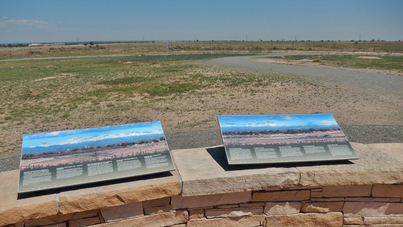
By Cosmos Mariner, June 27, 2018
Habitat for Wildlife Marker (wide view; this marker on left; related marker on right)
| 1 ► Colorado, Adams County, Commerce City — Habitat for Wildlife - A Rich History — |
| Near Gateway Road, 0.7 miles north of Prairie Parkway (East 64th Avenue), on the left when traveling east. | |||
| 2 ► Colorado, Alamosa County, Alamosa — "Old Mose" — The King of the Grizzlies — |
| On 1st Street at Edgemont Boulevard, on the left when traveling east on 1st Street. | |||
| 3 ► Colorado, Alamosa County, Mosca — Evidence of a Changing World — |
| On Lane 6N, 1.2 miles west of State Highway 150, on the left when traveling west. | |||
| 4 ► Colorado, Baca County, Springfield — Baca County Trails — |
| On Main Street (U.S. 287) north of East 8th Avenue, on the right when traveling north. | |||
| 5 ► Colorado, Bent County, Las Animas — Welcome to Boggsville — |
| Near Colorado Route 101, 1 mile south of County Road 10.75, on the left when traveling south. | |||
| 6 ► Colorado, Crowley County, Crowley — Crowley Communities / National Sugar Company / Last Days of the Buffalo / Crowley Country — |
| On Colorado Route 96 at Broadway, on the right when traveling west on State Route 96. | |||
| 7 ► Colorado, Custer County, Greenwood — Cliffhangers and Headbangers — |
| On Colorado 96, 0.4 miles west of County Road 387, on the right when traveling west. | |||
| 8 ► Colorado, Denver County, Denver, Central — Denver City Railway Building — 1883 — Lower Downtown Walking Tour — |
| On 17th Street at Wynkoop Street, on the right when traveling north on 17th Street. | |||
| 9 ► Colorado, Denver County, Denver, Central — 1w — Mint Robbery February 1864 — Wall Street of the Rockies — Seventeenth Street Denver, Colorado — |
| Near 17th Street just west of Larimer Street, on the right when traveling south. | |||
| 10 ► Colorado, Denver County, Denver, Central Business District — 8w — Bonfils — Wall Street of the Rockies — Seventeenth Street Denver, Colorado — |
| Near 17th Street at Champa Street, on the right when traveling south. | |||
| 11 ► Colorado, Denver County, Denver, Central Business District — 9e — Take Your Pick — Wall Street of the Rockies — Seventeenth Street Denver, Colorado — |
| Near 17th Street at Champa Street, on the left when traveling south. | |||
| 12 ► Colorado, Dolores County, Dove Creek — Gunnison Sage Grouse — |
| On U.S. 491 at Guyrene Street, on the right when traveling west on U.S. 491. | |||
| 13 ► Colorado, El Paso County, Colorado Springs, Cascade — Pick a Climate — |
| On Pike's Peak Toll Road. | |||
| 14 ► Colorado, El Paso County, Colorado Springs, Cascade — Take a Closer Look...Alpine/Subalpine Life Zone — |
| On Pike's Peak Toll Road. | |||
| 15 ► Colorado, El Paso County, Colorado Springs, Cascade — Take a Closer Look...Foothills Life Zone — |
| On Pike's Peak Toll Road. | |||
| 16 ► Colorado, El Paso County, Colorado Springs, Cascade — Take a Closer Look...Montane Life Zone — |
| On Pike's Peak Toll Road. | |||
| 17 ► Colorado, El Paso County, Colorado Springs, Cascade — Test Your Bird I.Q. — |
| On Pike's Peak Toll Road. | |||
| 18 ► Colorado, El Paso County, Colorado Springs, West Colorado Springs — A Plentiful Harvest — |
| On Garden Drive, on the left when traveling north. | |||
| 19 ► Colorado, El Paso County, Colorado Springs, West Colorado Springs — Rock Ledge Ranch Historic Site — |
| Near North 30th Street at Gateway Road. | |||
| 20 ► Colorado, El Paso County, Colorado Springs, West Colorado Springs — Welcome to Garden of the Gods Park — |
| Near Juniper Way Loop, on the left when traveling west. | |||
| 21 ► Colorado, El Paso County, United States Air Force Academy — Abert's Squirrel — (Sciurus aberti) — |
| 22 ► Colorado, Garfield County, New Castle — 2 — Exchange Stables — New Castle Museum on the Street — |
| On West Main Street at Vandeventer Avenue, on the right when traveling east on West Main Street. | |||
| 23 ► Colorado, Grand County, Grand Lake — Moose — |
| On Ditch Road, on the right when traveling west. | |||
| 24 ► Colorado, Jefferson County, Golden — Bone Deposition — |
| 25 ► Colorado, Jefferson County, Golden — Brontosaur Bulges — |
| 26 ► Colorado, Jefferson County, Golden — Play in the Wind — |
| On Lariat Loop Road. | |||
| 27 ► Colorado, Jefferson County, Golden — Theropod Track — |
| 28 ► Colorado, Jefferson County, Golden — Triceratops Trail — |
| On 6th Avenue (U.S. 6) 0.5 miles south of 19th Street, on the right when traveling north. | |||
| 29 ► Colorado, Jefferson County, Golden, Lakota Hills — Bird Track — |
| 30 ► Colorado, Jefferson County, Golden, Lakota Hills — Triceratops Tracks — |
| 31 ► Colorado, Jefferson County, Morrison — Dinosaur Ridge — Designated as part of the Dakota Hogback Natural Area — |
| Near West Alameda Parkway, 0.1 miles west of Colorado Highway 470, on the right when traveling west. | |||
| 32 ► Colorado, Kiowa County, Chivington — Humans and the Prairie — |
| Near County Highway W east of Chief White Antelope Way. | |||
| 33 ► Colorado, Kiowa County, Eads — Eads Roadside Park Exhibit — |
| Near E 15th Street (U.S. 287) 0.1 miles east of Maine Street, on the left when traveling east. | |||
| 34 ► Colorado, Kiowa County, Eads — High Plains Country — |
| Near E 15th Street (U.S. 287) 0.1 miles east of Maine Street, on the left when traveling east. | |||
| 35 ► Colorado, La Plata County, Durango — Trails to Rails — Routes to Southwest Colorado 1 — |
| On Main Avenue at East 5th Street, on the left when traveling south on Main Avenue. | |||
| 36 ► Colorado, Larimer County, Estes Park — Animals in Flux — |
| On Fall River Road (U.S. 34), on the left when traveling west. | |||
| 37 ► Colorado, Las Animas County, Kim — Life at Dinosaur Lake — |
| 38 ► Colorado, Las Animas County, Kim — The Site from the Sky — |
| 39 ► Colorado, Las Animas County, Trinidad — 247 — The Ludlow Massacre - Cultural Frontier / Hispano Colorado - El Moro Country — |
| Near El Moro Road (at milepost 18) at Linden Avenue (County Road 71.1). | |||
| 40 ► Colorado, Montrose County, Cimarron — From Mountain to Table — |
| On Morrow Point Dam Road, 0.1 miles north of U.S. 50, on the right when traveling north. | |||
| 41 ► Colorado, Montrose County, Montrose — The Ute Way of Life — Living in Harmony with Nature — |
| On Chipeta Road at U.S. 550, on the right when traveling north on Chipeta Road. | |||
| 42 ► Colorado, Morgan County, Fort Morgan — Watching River Wildlife — |
| On State Highway 52, 0.1 miles north of Interstate 76, on the right when traveling north. | |||
| 43 ► Colorado, Otero County, La Junta — No Fur, No Fort — |
| Near Colorado 194, 0.1 miles County Road 35. | |||
| 44 ► Colorado, Otero County, La Junta — Sheer Abundance to Near Extinction — The abundant and diverse wildlife of the Arkansas River Valley was important to the establishment an — |
| Near State Highway 194 near County Highway 35. | |||
| 45 ► Colorado, Park County, Lake George — Bayou Salado "Salt Marsh" — |
| Near U.S. 24. | |||
| 46 ► Colorado, Pitkin County, Aspen — The Environment — |
| On Colorado 82, on the left when traveling west. | |||
| 47 ► Colorado, Pueblo County, Colorado City — The Story Beneath Your Feet — Colorado — |
| Near State Highway 165 at CanAm Highway (Interstate 25). | |||
| 48 ► Colorado, Pueblo County, Pueblo — 219 — A Highway for the Ages - Trail Days / Palmer's City - Pinon County — |
| Near Interstate 25 at milepost 115,, 1 mile north of Young Hollow Road (Exit 114) when traveling north. | |||
| 49 ► Colorado, Pueblo County, Pueblo — 219 — Pueblo - Trail Days / Industrial Frontier - Pinon County — |
| Near Interstate 25 at milepost 111.6,, 2.5 miles south of Young Hollow Road when traveling south. | |||
| 50 ► Colorado, Rio Blanco County, Phippsburg — Footsteps in Time — |
| On Flat Tops Trail Scenic Byway (County Road 8) 7 miles east of County Road 19, on the right when traveling east. | |||
| 51 ► Colorado, Rio Blanco County, Phippsburg — People of the Shining Mountains — |
| On Flat Tops Trail Scenic Byway (County Road 8) 7 miles east of County Road 19, on the right when traveling east. | |||
| 52 ► Colorado, Rio Grande County, South Fork — Watchable Wildlife — |
| On Silver Thread Lane. | |||
| 53 ► Colorado, Routt County, Steamboat Springs — Sulphur Spring — Temperature: 72° — |
| Near 13th Street (County Road 33) just west of Lincoln Avenue (U.S. 40), on the right when traveling west. | |||
| 54 ► Colorado, Sedgwick County, Julesburg — 223 — Colorado's Wildlife Story — |
| On Interstate 76 at U.S. 385 on Interstate 76. | |||
| 55 ► Colorado, Sedgwick County, Julesburg — 223 — Last Days of the Buffalo — |
| On Interstate 76 at U.S. 385, on the right when traveling north on Interstate 76. | |||
| 56 ► Colorado, Sedgwick County, Julesburg — Prairie Home Companions — |
| On U.S. 385, on the right when traveling south. | |||
| 57 ► Colorado, Teller County, Florissant — Dawn of the Recent Past — |
| 58 ► Colorado, Teller County, Florissant — Delicate Impressions — |
| 59 ► Colorado, Teller County, Florissant — Florissant Valley Today — |
| 60 ► Colorado, Teller County, Florissant — Life in the Forest — |
| 61 ► Colorado, Teller County, Woodland Park — Black (and sometimes brown) Bear — |
| Near Pike's Peak Toll Road. | |||
| 62 ► Colorado, Teller County, Woodland Park — Don’t kill them with kindness — Feeding wild animals on the mountain does more harm than good. — |
| Near Pike's Peak Toll Road. | |||
| 63 ► Colorado, Teller County, Woodland Park — Elk Country — A Majestic Head Dress — |
| Near Pike's Peak Toll Road. | |||
| 64 ► Colorado, Teller County, Woodland Park — Tricky Affairs — The porcupine’s perfect defense — |
| Near Pike's Peak Toll Road. | |||
| 65 ► Colorado, Washington County, Akron — Last Days of the Buffalo / Akron Country — |
| On West 1st Street (U.S. 34) at Custer Avenue, on the left when traveling west on West 1st Street. | |||
| 66 ► Colorado, Weld County, Greeley — Agriculture — |
| On 7th Avenue. | |||
| 67 ► Colorado, Weld County, Rockport — Majestic Plains — |
| On U.S. 85, 0.3 miles south of County Road 126, on the right when traveling south. | |||