After filtering for Nebraska, 67 entries match your criteria.
Education Topic
By Dawn Bowen, July 26, 2008
Lakeland Sod High School Marker
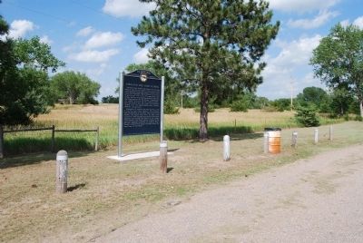
| 1 ► Nebraska, Brown County, Johnstown — 236 — Lakeland Sod High School — |
| On US 20 (U.S. 20), on the left when traveling east. | |||
| 2 ► Nebraska, Buffalo County, Kearney — Hostetler Amphitheatre — |
| 3 ► Nebraska, Buffalo County, Kearney — Kearney State College Memorial Carillon Tower — |
| 4 ► Nebraska, Buffalo County, Kearney — 125 — University of Nebraska at Kearney — |
| On 9th Avenue at U.S. 30, on the right when traveling south on 9th Avenue. | |||
| 5 ► Nebraska, Cass County, Weeping Water — 118 — Weeping Water Academy — |
| On State Highway 50, on the left when traveling north. | |||
| 6 ► Nebraska, Cedar County, Hartington — 321 — Hartington - Home of two Nebraska Governors — |
| On West Franklin Street (State Highway 84) east of South Robinson Avenue, on the left when traveling east. | |||
| 7 ► Nebraska, Cheyenne County, Sidney — Carnegie Library — 1913 — 740 Illinois Street — |
| On Illinois Street (Lincoln Highway) (U.S. 30) at 8th Avenue, on the right when traveling west on Illinois Street (Lincoln Highway). | |||
| 8 ► Nebraska, Cuming County, Bancroft — 31 — Bancroft — |
| On Road South (State Highway 51) 0.4 miles west of State Route 16, on the right when traveling west. | |||
| 9 ► Nebraska, Custer County, Gothenburg — 530 — Etna — |
| On Etna Road just east of State Highway 47, on the left when traveling east. | |||
| 10 ► Nebraska, Dakota County, Homer — 033 — Combs School — Built 1857- Closed 1964 — |
| On U.S. 77, 0.2 miles south of Grant Road, on the right when traveling south. | |||
| 11 ► Nebraska, Dawes County, Chadron — 124 — Chadron State College — |
| On East 10th Street just east of Main Street, on the right when traveling east. | |||
| 12 ► Nebraska, Dawes County, Chadron — 301 — The First Church in Chadron — |
| On West 4th Street just east of Chadron Avenue, on the right when traveling west. | |||
| 13 ► Nebraska, Dawes County, Crawford — 271 — Crawford 1891 School Bell — |
| On 5th Street at Coates Street, on the right when traveling north on 5th Street. | |||
| 14 ► Nebraska, Douglas County, Omaha, Downtown — The Road to Omaha — |
| On Cuming Street at 13th Street, on the right when traveling east on Cuming Street. | |||
| 15 ► Nebraska, Douglas County, Omaha, North Omaha — 4 — Fort Omaha Balloon School — Fort Omaha Walking Tour — |
| On North Road, on the left when traveling west. | |||
| 16 ► Nebraska, Douglas County, Omaha, North Omaha — 5 — Observation Balloon Training at Fort Omaha — Fort Omaha Walking Tour — |
| On North Road, on the right when traveling west. | |||
| 17 ► Nebraska, Douglas County, Omaha, North Omaha — President's House — |
| On West Road, on the left when traveling north. | |||
| 18 ► Nebraska, Douglas County, Omaha, Park East Inc. — 220 — Central High School — |
| On Dodge Street (U.S. 6) 0.1 miles west of North 20th Street. | |||
| 19 ► Nebraska, Douglas County, Omaha, West Omaha — 226 — Father Flanagan's Boys' Home — (The Original "Boys Town") — |
| On Flanagan Boulevard, on the right when traveling west. | |||
| 20 ► Nebraska, Douglas County, Omaha, West Omaha — Msgr. Edward Joseph Flanagan — Leabeg, Ballymoe — 13 July 1886 - 15 May 1948 — |
| 21 ► Nebraska, Douglas County, Omaha, West Omaha — Right Reverend Monsignor Edward J. Flanagan — 1886 - 1948 — |
| On Heroes Boulevard south of Flanagan Boulevard, on the left when traveling north. | |||
| 22 ► Nebraska, Franklin County, Franklin — Dupee Hall of Music — Franklin Academy — 1901 — |
| On P Street near 14th Avenue, on the right when traveling west. | |||
| 23 ► Nebraska, Franklin County, Franklin — 329 — Franklin Academy — |
| On 16th Avenue (U.S. 136) near Q Street, on the right when traveling south. | |||
| 24 ► Nebraska, Franklin County, Franklin — The Old Franklin Congregational Academy — |
| On Q Street, on the left when traveling west. | |||
| 25 ► Nebraska, Garden County, Lewellen — School District 55 — |
| Near U.S. 26, on the left when traveling south. | |||
| 26 ► Nebraska, Hall County, Grand Island — 6th Bomb Group — 24 Bomb Sqd. • 39 Bomb Sqd. • 40 Bomb Sqd. — 1944 • B-29 C.B.I.-Guam-Saipan-Tinian • 1945 — |
| 27 ► Nebraska, Hall County, Grand Island — Grand Island Public School Bell — |
| On 1st Street (U.S. 30) at Cleburn Street, on the left when traveling east on 1st Street. | |||
| 28 ► Nebraska, Hall County, Grand Island — 490 — Old Dodge School — World War II POW Branch Camp — |
| On 1st Street (U.S. 30) at Walnut Street, on the right when traveling east on 1st Street. | |||
| 29 ► Nebraska, Hall County, Grand Island — Oldest Remaining School House — |
| 30 ► Nebraska, Holt County, Page — Page School — |
| On 5th Street (State Highway 45A Spur) at Main Street, on the left when traveling south on 5th Street. | |||
| 31 ► Nebraska, Knox County, Niobrara — Life After the Expedition — Lewis and Clark National History Trail — George Shannon Trail — |
| Near Walnut Street (Outlaw Trail Scenic Byway) (State Highway 12) at Spruce Avenue, on the right when traveling east. | |||
| 32 ► Nebraska, Lancaster County, Lincoln — Institute of Agriculture and Natural Resources — |
| Near East Campus Loop. | |||
| 33 ► Nebraska, Lancaster County, Lincoln — Mueller Tower at University of Nebraska-Lincoln — |
| On Vine Street, on the right when traveling east. | |||
| 34 ► Nebraska, Lancaster County, Lincoln — Osborne Athletic Complex — |
| 35 ► Nebraska, Lancaster County, Lincoln — Paul A. "Doc" Downs — 1891 - 1979 — |
| On East Campus Loop, on the right when traveling west on East Campus Loop. | |||
| 36 ► Nebraska, Lancaster County, Lincoln — 290 — Pershing Rifles — |
| On Vine Street at 14th Street, on the right when traveling west on Vine Street. | |||
| 37 ► Nebraska, Lancaster County, Lincoln — RHO Chapter House — Kappa Alpha Theta — "The first Greek letter fraternity known among women." — |
| On North 16th Street just south of S Street, on the right when traveling south. | |||
| 38 ► Nebraska, Lancaster County, Lincoln — 72 — The University of Nebraska — |
| Near R Street near North 12th Street. | |||
| 39 ► Nebraska, Lancaster County, Raymond — 432 — Crounse — |
| Near West Branched Oak Road, 0.5 miles east of North 126th Street, on the right when traveling east. | |||
| 40 ► Nebraska, Lincoln County, North Platte — District #36 School — |
| Near North Buffalo Bill Avenue, 0.8 miles north of Lincoln Highway (U.S. 30), on the right when traveling north. | |||
| 41 ► Nebraska, Madison County, Norfolk — 529 — St. Paul's Lutheran Church — |
| On Georgia Avenue at North 11th Street, on the left when traveling east on Georgia Avenue. | |||
| 42 ► Nebraska, Nance County, Genoa — U. S. Indian Industrial School Building — Built c. 1907 — |
| Near East Webster Avenue at North Cottonwood Street, on the left when traveling east. | |||
| 43 ► Nebraska, Nemaha County, Brownville — 417 — The Nebraska State Teachers' Association — |
| On South 4th Street just south of Water Street, on the left when traveling south. | |||
| 44 ► Nebraska, Nemaha County, Peru — 80 — Peru State College |
| On 8th Street at 5th Street, on the right when traveling north on 8th Street. Reported permanently removed. | |||
| 45 ► Nebraska, Nemaha County, Peru — 80 — Peru State College — |
| On Park Avenue at 5th Street, on the left when traveling north on Park Avenue. | |||
| 46 ► Nebraska, Nemaha County, Peru — The Little Red Schoolhouse — Nemaha County School District #65 — Constructed 1905 — |
| On 8th Street at 5th Street, on the left when traveling north on 8th Street. | |||
| 47 ► Nebraska, Otoe County, Syracuse — 100 Years of Syracuse History — |
| On Midland Street at 5th Street, on the left when traveling south on Midland Street. | |||
| 48 ► Nebraska, Pawnee County, Steinauer — 12 — Convent House Bed & Breakfast — |
| On Hickory Street just south of 4th Street, on the right when traveling north. | |||
| 49 ► Nebraska, Platte County, Columbus — 139 — Agricultural Park — |
| Near 15th Street east of 10th Avenue, on the left when traveling east. | |||
| 50 ► Nebraska, Platte County, Columbus — Columbus Area Business Hall of Fame — Inducted 2009 — |
| On 13th Street (Business U.S. 30) near 27th Avenue, on the left when traveling east. | |||
| 51 ► Nebraska, Platte County, Duncan — Gardiner School — Platte County School District No. 8 — |
| On U.S. Hwy 30 Frontage Road (original Lincoln Hwy), 0.1 miles east of the intersection of 355th Avenue and 115th Street, on the left when traveling east. | |||
| 52 ► Nebraska, Platte County, Platte Center — 431 — Alfred Maximilian Gruenther — 1899-1983 — |
| On 4th Street just east of D Street, on the right when traveling east. | |||
| 53 ► Nebraska, Red Willow County, Bartley — 135 — Mallalieu University — |
| On Commercial Street north of Walnut Street, on the right when traveling north. | |||
| 54 ► Nebraska, Saline County, Crete — Doane College — |
| Near Boswell Avenue, 0.2 miles east of Boswell Street. | |||
| 55 ► Nebraska, Saline County, Crete — Gates College — |
| Near Boswell Avenue. | |||
| 56 ► Nebraska, Saline County, Crete — Navy Department - United States of America — |
| Near Osterhout Lane. | |||
| 57 ► Nebraska, Scotts Bluff County, Scottsbluff — 365 — Scottsbluff Army Air Field — |
| Near Airport Terminal Street, 0.2 miles east of County Road 25, on the right when traveling north. | |||
| 58 ► Nebraska, Sherman County, Loup City — 513 — Jenner's Park — |
| On North 1st Avenue just north of O Street, on the right when traveling north. | |||
| 59 ► Nebraska, Sherman County, Loup City — Loup City Township Carnegie Library — 1917 — |
| Near N Street just east of North 7th Street, on the right when traveling west. | |||
| 60 ► Nebraska, Sherman County, Rockville — 408 — Austin — |
| On State Highway 58, 0.4 miles south of Road 785, on the right when traveling south. | |||
| 61 ► Nebraska, Thayer County, Bruning — 397 — Bruning Army Air Field — |
| On State Highway 4, 6.8 miles east of U.S. 81, on the left when traveling east. | |||
| 62 ► Nebraska, Thayer County, Hebron — A Tribute To Hebron, Its People and Its Schools — |
| On 4th Street at Jefferson Avenue, on the left when traveling south on 4th Street. | |||
| 63 ► Nebraska, Thayer County, Hebron — 452 — The Hebron CCC And POW Camps — |
| On Holdredge Avenue west of South Avenue, on the left when traveling west. | |||
| 64 ► Nebraska, Washington County, Blair — 177 — Congregational Church of Blair — |
| On S. 16th Street at Colfax Street, on the right when traveling south on S. 16th Street. | |||
| 65 ► Nebraska, Wayne County, Wayne — 26 — Wayne — |
| On South Main Street (State Highway 15) 0.1 miles south of Clark Street, on the right when traveling south. | |||
| 66 ► Nebraska, Wayne County, Wayne — 122 — Wayne State College — |
| On L. Wendt Drive, 0.2 miles east of Main Street (State Highway 15), on the left when traveling east. | |||
| 67 ► Nebraska, York County, York — 269 — Nebraska 4-H Clubs Began in York County — |
| Near North Nebraska Avenue at 4-H Drive, on the right when traveling north. | |||