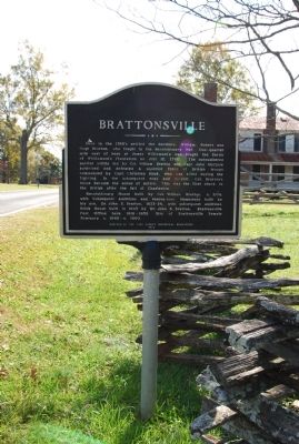
On Brattonsville Road at Percival Road, on the right when traveling south on Brattonsville Road.
Here in the 1760's settled the brothers, William, Robert, and Hugh Bratton, who fought in the Revolutionary War. One-quarter mile east of here at James Williamson's was fought the Battle of Williamson's Plantation on July 12, 1780. The . . . — — Map (db m24500) HM
On Brattonsville Road 0.1 miles north of Percival Road, on the right when traveling south. Reported missing.
The Homestead was built between 1823 and 1826 for Dr. John Simpson Bratton and his wife Harriet Rainey Bratton, the second generation of the Bratton family to live at Brattonsville. Bricks for the chimneys were made on the plantation. The two . . . — — Map (db m272030) HM
On York Street at Bell Avenue, on the left when traveling north on York Street.
Town of Sharon
John L. Rainey, owner of large tracts of land on which Sharon was established, conveyed land to the Presbyterian church in 1889 and 1898, the Methodists in 1897, and the Methodist Episcopal Zion church in 1904. The First . . . — — Map (db m24531) HM
Near Brattonsville Road 0.5 miles north of Percival Road.
This structure, built by William Bratton about 1770, is one of the oldest in York County. The original log house was a two-story home. The timber frame wing at the back of the house was added later. The home was built on the Lincoln Road, . . . — — Map (db m24506) HM
On Brattonsville Road (State Highway 165) 0.1 miles north of Percival Road (State Highway S-46-38), on the right when traveling north.
William Bratton Plantation. In 1766 William Bratton and his wife Martha Robertson purchased 200 acres on the South Fork of Fishing Creek and built a single-pen log house here at the junction of several important colonial roads. The Bratton . . . — — Map (db m95591) HM
On Saluda Street (South Carolina Route 72/901) south of Tigler Court, on the right when traveling south.
Durkee Training Institute. Durkee Training Institute, an African American vocational school, opened in 1932 on Crawford Rd. and moved to this site by 1937-1938. It was founded by Rock Hill native William Mason Chisolm, who named it for . . . — — Map (db m292473) HM
On York Street (State Highway 49) at Woodlawn Street, on the left when traveling north on York Street.
[Front]:
This bank, built in 1909-10 by W.W. Blair, was the first bank in the town of Sharon, incorporated in 1889. Its first officers were J.H. Saye, president; J.L. Rainey, vice president; and A.M. Haddon, cashier. From 1910 to 1929 . . . — — Map (db m24529) HM
On Main Street 0.1 miles west of Nimitz Road, on the right when traveling east.
This town was named for Smyrna Associate Reformed Presbyterian Church, organized ca. 1842. An academy was established here by 1870, and in 1888 the Charleston, Cincinnati, and Chicago Railroad completed its line here. Four years later the post . . . — — Map (db m24525) HM
On Allison Creek Road (County Road 1081) 0.1 miles east of Hands Mill Highway (State Highway 274), on the left when traveling east.
Allison Creek Presbyterian Church. This church was founded in 1854 by residents of the Clay Hill community on Allison Creek, who were members of Bethel (1769) and Ebenezer (ca. 1785) Presbyterian churches. They built this church soon . . . — — Map (db m175696) HM
Town of Yorkville
Formerly known as Fergus's Cross Roads, later Yorkville, this county seat was established in 1785 on land originally granted to John Miller in 1767. According to Robert Mills, the town in 1826 had 8 stores, 5 taverns, a male . . . — — Map (db m11299) HM
On North White Street at Horse Road, on the right when traveling north on North White Street. Reported missing.
Jefferson Davis's Flight South, April 26-27, 1865. Confederate President Jefferson Davis and his Cabinet, making their way south from Richmond, Va. with a cavalry escort, stopped at Fort Mill on April 26, 1865. Davis spent the night at . . . — — Map (db m220414) HM
On Brattonsville Road 0.5 miles south of McConnells Highway ( Highway 322), on the left when traveling south.
On July 12, 1780, at Williamson's Plantation about one-fifth of a mile east from here, Loyalist forces under Capt. Christian Huck were defeated by American forces led by Cols. William Bratton, William Hill, Edward Lacey, Richard Winn, as well as . . . — — Map (db m24538) HM
On Brattonsville Road 0.3 miles north of Percival Road, on the left when traveling south.
[Front Marker]
Where 75 Whigs led by
Colonel William Bratton
defeated a British and Tory
force of 500 men
July 12, 1780.
On this date, Sept.30, 1953, there stands 200 feet to the north of this stone, the Revolutionary home . . . — — Map (db m24508) HM
On Lockhart Road (State Highway 49) 0.3 miles north of Bonner Horton Road, on the left when traveling south.
Under leadership of Dr. Joseph Alexander, pastor 1774-1801, this church, organized in 1769, was a Whig stronghold during the Revolution.
Three hundred yards west is the site of one of the earliest academies in upper South Carolina, . . . — — Map (db m24535) HM
On South White Street at Main Street, on the right when traveling north on South White Street.
(Front)
Fort Mill was established on land received in 1787 by Thomas Spratt, one of the first settlers in this area. According to local tradition, the 4,535-acre tract in Catawba Indian territory was given Spratt by the Catawbas who were . . . — — Map (db m24819) HM
On Wylie Avenue at Wilkerson Street, on the left when traveling south on Wylie Avenue.
(Front:)
The land on which the town of Hickory Grove developed was granted to John McKenney in 1771 by George III of England. The Hickory Grove Post Office was in operation as early as 1831, and a free public school was located here by . . . — — Map (db m24527) HM
On Brattonsville Road 0.1 miles north of Percival Road, on the right when traveling south.
Every brick in this building is a testament to the enslaved African Americans who once lived on this plantation. The 1860 census lists Harriet Bratton owning eighty slaves and twenty slave houses. Of those houses this cabin is the lone survivor. . . . — — Map (db m24895) HM
The upper part of South Carolina was opened to settlement during the mid-1700s. Traveling down the Great Wagon Road from Virginia, Pennsylvania and North Carolina, settlers brought with them vast knowledge needed for life in the wilderness - how . . . — — Map (db m24504) HM
Near Brattonsville Road 0.1 miles north of Percival Road, on the right when traveling south. Reported permanently removed.
Built on the foundations of the original, this building is a replica of the plantation kitchen that stood here until the late 1950s. It was one of the eight brick dependencies once flanking the main house. The kitchen was constructed away from . . . — — Map (db m272031) HM
On Chester Highway (U.S. 321) at McConnells Highway (State Highway 332), on the left when traveling north on Chester Highway.
After the Kings Mountain Railroad was completed in 1852, the McConnellsville Post Office was established here in 1854. The town, named for the McConnell family, was incorporated in 1906. The first intendant was J.T. Crawford; wardens were J.F. . . . — — Map (db m24537) HM
On East Main Street (State Highway 1) near North Oakland Avenue (U.S. 21), on the right when traveling east.
The Andrew Jackson Hotel. The Andrew Jackson Hotel, built in 1926, was funded with more than $250,000 raised by citizens of Rock Hill. Designed by Charles Coker Wilson, it is a fine example of the Beaux Arts style and has been called one of the . . . — — Map (db m285083) HM
On East Black Street (State Highway 5) at Hampton Street on East Black Street.
Black Plantation. This area was once part of the 448.5-acre plantation of Alexander Templeton Black (1798-1875), for whom Church Street was renamed Black Street. In 1851 Black deeded land for a right-of-way and depot to the Charlotte & S.C. . . . — — Map (db m16757) HM
On South Dave Lyle Boulevard south of West Moore Street, on the right when traveling south.
This church was organized in 1869 with Rev. J.A. Rainey as its first pastor and is one of the oldest black institutions in Rock Hill. With support from Northern Presbyterians, it ran a private school as early as the 1880s and was a . . . — — Map (db m292481) HM
On Dave Lyle Boulevard (U.S. 122), on the right when traveling east.
This marker commemorates the genesis of the city of Rock Hill; and stands near the site of the Charlotte and South Carolina railroad company depot erected about 1851. The village which grew up around the depot was granted recognition as Rock . . . — — Map (db m16918) HM
Village of Rock Hill
Main Street was laid out on Alexander Templeton Black's land by Squire John Roddey in 1851. The post office was established in 1852. The village was incorporated by the General Assembly in 1870 with an area of one mile . . . — — Map (db m16624) HM
On W. Liberty Street (State Highway 5) at S. Congress Street (U.S. 321), on the left when traveling west on W. Liberty Street.
Through this intersection originally called Fergus Crossroads have passed
General Thomas Sumter - The Gamecock
General Daniel Morgan - Hero of Cowpens
Lord Cornwallis - British Comdr at Yorktown
Col. Banastre Tarleton - British Comdr at . . . — — Map (db m11290) HM
On East Liberty Street (South Carolina Route 161) at Vector Street, on the right when traveling west on East Liberty Street.
The National Register of Historic Places
South Carolina Department of Archives and History
203 East Liberty Street
York Historic District — — Map (db m267179) HM
On State Street near Benjamin Street, on the right when traveling north.
Purchased in 1965 by The Saint Charles Avenue Presbyterian Church And named in honor of its first pastor and Pastor Emeritus The Rev. Dr. John Samuel Land (1893-1993)Dr. Land was born in York County, South Carolina and graduated in 1914 from . . . — — Map (db m156464) HM
U.S. Post Office and Courthouse
This building was described as "handsome in every respect" when it opened in 1932. It replaced a 1906 post office and housed a new district court and federal offices. It served as a post office until 1986 and . . . — — Map (db m16626) HM
John (Jack) Champion (1817–1908) was a native of York County, South Carolina. He moved to Texas by 1850, the year he and Naomi Jane Standefer (1834–1862) were issued a marriage license in Williamson County. In 1854, Champion bought . . . — — Map (db m2740) HM
On Court Square (State Highway 28) south of Washington Street (State Highway 203), on the right when traveling north.
Abbeville's 6th courthouse - designed in beaux arts classical style by Edwards & Walter of Atlanta - dedicated in 1908 with City Hall/Opera House. (Two buildings indirectly financed by profits from Abbeville Dispensary, only one still operating . . . — — Map (db m14870) HM
Original trestle completed 1852
by Charlotte & South Carolina R.R.
on site of ancient crossing
known as the Nation Ford.
Burning by Federals April 19, 1865,
touched off sharp battle with Southern forces
which resulted in Union . . . — — Map (db m11050) HM
On East Liberty Street (South Carolina Route 161) at Garner Street, on the right when traveling west on East Liberty Street.
The National Register of Historic Places
South Carolina Department of Archives and History
105 East Liberty Street
York Historic District — — Map (db m267173) HM
On East Liberty Street (South Carolina Route 161) east of College Street, on the left when traveling east.
213 East Liberty Street
York Historic District
South Carolina Department of Archives and History
The National Register of Historic Places — — Map (db m267181) HM
On East Liberty Street (South Carolina Route 161) east of College Street, on the right when traveling east.
216 East Liberty Street
York Historic District
South Carolina Department of Archives and History
The National Register of Historic Places — — Map (db m267197) HM
On East Liberty Street (South Carolina Route 161) east of College Street, on the left when traveling east.
217 East Liberty Street
York Historic District
South Carolina Department of Archives and History
The National Register of Historic Places — — Map (db m267183) HM
On East Liberty Street (South Carolina Route 161) east of College Street, on the left when traveling east.
219 East Liberty Street
York Historic District
South Carolina Department of Archives and History
The National Register of Historic Places — — Map (db m267186) HM
On East Liberty Street (South Carolina Route 161) west of Church Street, on the left when traveling west.
230 East Liberty Street
York Historic District
South Carolina Department of Archives and History
230 East Liberty Street
The National Register of Historic Places — — Map (db m267192) HM
On South Congress Street (U.S. 321), on the right when traveling north.
Bratton House Site
Robert Clendinen, Yorkville lawyer and South Carolina Senator from York Disrict (1816-30), purchased this land in 1813. The house which he built here before his death in 1830, was acquired in 1847 by Dr. James Rufus Bratton, . . . — — Map (db m11244) HM
On South Congress Street (Business U.S. 321) just south of West Liberty Street (State Highway 161/5), on the right when traveling south.
There have been four York County courthouses on this site. The first courthouse was constructed of squared logs in 1786. In 1799 it was replaced by a small brick building. Noted S.C. architect Robert Mills designed a third courthouse, completed in . . . — — Map (db m196627) HM
Near East Main Street west of Hampton Street, on the right when traveling west.
The 1887 State charter for Winthrop College specified that its mission was the education of White women. Winthrop would remain segregated until 1964 when three Black pioneers enrolled.
Efforts to integrate Winthrop began in 1948 when the . . . — — Map (db m285073) HM
On West 5th Street just west of North Church Street, on the right when traveling west.
Native Americans have occupied this part of the Catawba River Valley for more than 10,000 years. First came the Paleo Indian hunters following big game and spreading their Ice Age culture south. Later, Archaic Indian peoples adapted to climate . . . — — Map (db m175525) HM
Built circa 1770 by John Dickey of Ireland, via Albemarle County, Virginia. Original site located on Quinn's Road, Tryon, North Carolina. Now called Wilson Chapel Road, Bullock Creek Township, York County, South Carolina.
Home of Richard Sherer . . . — — Map (db m50846) HM
Near East Main Street west of Hampton Street, on the right when traveling west.
In Rock Hill on January 31, 1961, a group of young men walked into McCrory's Five & Dime on Main Street, sat down at the lunch counter and were arrested for trespassing.
Jail, No Ball: How 30 Days Impacted the Civil Rights Movement . . . — — Map (db m285084) HM
On Valley Pike (U.S. 11) south of Shady Lane, on the right.
Near here was born John Sevier, pioneer and soldier, September 23, 1745. He was a leader in the Indian Wars and the Battle of King’s Mountain, 1780. He was the only governor of the short-lived state of Franklin and the first governor of Tennessee. . . . — — Map (db m654) HM
Near Brattonsville Road (South Carolina Route 165) north of Percival Road ( Road 46-380), on the right when traveling north.
Admission is by appointment only.
In 1839, George and Catharine Ladd moved their family to the new Brattonsville Female Seminary located in Colonel William Bratton's renovated log house. Catharine ran the school while George traveled the . . . — — Map (db m274994) HM
On Galilee Church Road, on the left when traveling east.
Ancestral Cemetery of
the Gist Family
Among those buried here are
the secession Governor of
South Carolina
William H. Gist
Aug. 2, 1805 - Sept. 30, 1874
Mary Rice Gist
His second wife
Also
Col. William M. Gist C.S.A. . . . — — Map (db m13468) HM
Near Hotwater Trail 1 mile west of Centerville Road (Virginia Route 614), on the left when traveling west.
William Ludwell Lee of Green Spring Farm died in 1803. A year earlier he had written his will and bequeathed freedom to his slaves. He specified that comfortable homes be built for them on "the Hotwaters," a subsidiary farm about four miles north . . . — — Map (db m226527) HM
On South Piedmont Avenue south of East Mountain Street, on the left when traveling south.
The Barber House is believed to have been built between 1810 and 1845. During the Federal period of architectural style, the hall and parlor floor plan and symmetric chimneys seen here were common. Robert Barber (1805-1859), son of John Barber of . . . — — Map (db m259378) HM
On North McDuffie Street at Whitner Street on North McDuffie Street.
[Front Marker]:
In 1889, the City of Anderson contracted with a 26 year old native son, an engineering graduate of the University of South Carolina, to build a steam power plant and water system for the city. Keeping up with the . . . — — Map (db m10697) HM
On Main Street (State Highway 160) at Academy Street, on the left when traveling east on Main Street.
[South Side]:
1600
Erected to the
Catawba Indians
by
Sam'l Elliott White
and
John McKee Spratt
The latter is a descendant Thos. "Kanahwa" Spratt and the former a descendant of Wm. Elliott (a kinsman of Kanahwas) two . . . — — Map (db m24825) HM
Near East Main Street west of Hampton Street, on the right when traveling west.
On the morning of January 31, 1961, eighteen African American civil rights protesters, most of whom were students at Friendship College, gathered on Main Street in downtown Rock Hill. City police and SLED agents had been notified in advance in . . . — — Map (db m285081) HM
On George Washington Memorial Highway (U.S. 17) south of Chesapeake Road, on the right when traveling south.
Petsworth Parish, one of the four parishes of colonial Gloucester County, was established in the middle of the 17th century. The first parish church was located some four miles southwest near Purtan Bay on the York River. Across Route 17 were built . . . — — Map (db m52645) HM
On Rock Hill Pineville Road (Highway 51) 0.1 miles west of Miller Road.
North Carolina. Colonized, 1585-87, by first English settlers in America; permanently settled c. 1650; first to vote readiness for independence, Apr. 12, 1776.
South Carolina. Formed in 1712 from part of Carolina, which was chartered . . . — — Map (db m11045) HM
On College Drive at South Johnson Street, on the left when traveling south on College Drive.
Towne Center
This side indicates the center point for the second survey by the Town of Gaffney to expand its city limits to include all property within a one-mile radius of this location. The survey was conducted by R.O. Sams, February 27, 1890 . . . — — Map (db m44392) HM
Near Blackstock Road (State Highway 40) 0.2 miles north of New Cut Road, on the right when traveling north.
[Front]:
This church, organized late in the eighteenth century, held its first services in a brush arbor and later constructed a log meeting house. This frame sanctuary, built between 1825 and 1830, was the second building to serve . . . — — Map (db m12627) HM
On Battleground Drive (State Highway 216) at Rock House Road, on the left when traveling south on Battleground Drive.
[Front]:
Col. Frederick Hambright (1727-1817), a prominent militia officer of the American Revolution, lived his last 25 years in a house which stood 200 yds. NE. Hambright, born in Germany, emigrated to America as a boy, and settled in . . . — — Map (db m28236) HM
On Cross Keys Highway (State Highway 49) at Blackstock Road, on the left when traveling east on Cross Keys Highway.
This battle of the Revolution took
place on William Blackstock’s
plantation, 3 miles N. on the south
side of the Tyger River, November 20,
1780. Gen. Thomas Sumter
commanded the American patriots who
repulsed Lt. Col. Banastre
Tarleton’s . . . — — Map (db m11111) HM
On Columbia Avenue at West White Street, on the right when traveling north on Columbia Avenue.
Wheels in Motion is a transformative public art piece that visually represents Rock Hill's evolution from an industrial city dominated by textiles to one that is centered on the creation of new technology and a knowledge economy. The . . . — — Map (db m292504) HM
Near East Main Street west of Hampton Street, on the right when traveling west.
Father Edward Wahl
Quiet Leader, for All God's Children
In August of 1935, 18-year-old Edward Wahl Was one of 22 Catholic seminarians who came to Rock Hill from New York City to start the Oratory Community and to support the Sisters of . . . — — Map (db m285046) HM
Near Courtland Farm Road (Virginia Route 820) 0.2 miles east of Hanover Courthouse Road (U.S. 301), on the right when traveling east.
(side 1)
The Colonial River Road
After centuries of use by native people and the colonists of New Kent County, the road along the Pamunkey River was extended past the tobacco ports of Newcastle and Page’s Warehouse (later . . . — — Map (db m53801) HM
Near Streetman Road west of Ephesus Church Road, on the left when traveling west.
Family History
William Clinton (1754-1847) married Violet Perry (1760-1852) in South Carolina
Their known children are:
1. David - Born 1785. Moved to Campbell County (Douglas), then to Louisiana.
2. John P. - Born . . . — — Map (db m298430) HM
On Dave Lyle Boulevard (State Highway 122) at West Black Street, on the right when traveling south on Dave Lyle Boulevard.
The Rock Hill City Directory listing of businesses that were operating on West Black Street in the late 60s and early 70s.
1. Blue Bird Taxi Company (1972)*
2. Brown's Billiards (1971)
3. People's Undertaking Company (1972)
4. Mutt's . . . — — Map (db m175680) HM
This church, the first Associate Reformed Presbyterian congregation in what is now Anderson County, was organized about 1790 about 1 1/2 mi. SW of this site. Rev. Robert Irwin, its first regular minister, served from 1803 until his death in . . . — — Map (db m11747) HM
In memory of the first person, a young girl whose name is unknown. Buried here about 1760. The story goes that she was visiting the Lesly family and died as a result of injuries sustained while they were making lye soap. John Lesly and his . . . — — Map (db m18756) HM
On Greenville Street (State Highway 20) near Beltline Road (County Road S-1-35).
[Front]:
This cemetery, sometimes called Upper Long Cane Cemetery, dates from 1760. It includes the graves of some of the most prominent families of this area from the Colonial era to the present. The first marked grave is the field . . . — — Map (db m50740) HM
Thin black lines indicate changes in relevance. Between each pair of lines entries are ordered geographically but all have the same relevance.
* Inflectional forms of words are their plurals, singulars, and possessives as well as gramatical tenses and similar variations.