3077 entries match your criteria. Entries 101 through 200 are listed.⊲ Previous 100 — Next 100 ⊳
Historical Markers and War Memorials in the Five Counties of New York City
By Devry Becker Jones (CC0), November 4, 2022
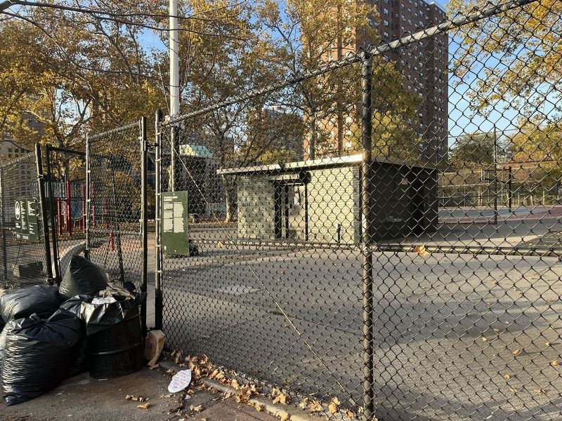
PFC Carlos J. Lozada Playground Marker
| 101 ► New York, Bronx County, Bronx, Mott Haven — 301 — PFC Carlos J. Lozada Playground — |
| On East 135th Street just west of Willis Avenue, on the right when traveling west. | |||
| 102 ► New York, Bronx County, Bronx, Mott Haven — Public School 31 Artifacts — |
| On Grand Concourse north of East 144th Street, on the right when traveling south. | |||
| 103 ► New York, Bronx County, Bronx, Mott Haven — Roundhouse |
| On Willis Avenue Bridge Path south of East 135th Street, on the left when traveling north. Reported unreadable. | |||
| 104 ► New York, Bronx County, Bronx, Mott Haven — 300 — Saw Mill Playground — 0.920 Acres — |
| On East 140th Street just west of Brook Avenue, on the right when traveling east. | |||
| 105 ► New York, Bronx County, Bronx, Mott Haven — St. Ann's Shrine — |
| On St Ann's Avenue, on the right when traveling south. | |||
| 106 ► New York, Bronx County, Bronx, North Riverdale — Vinmont Veteran Park — 3.523 Acres — |
| On Mosholu Avenue at West 254th Street, on the left when traveling north on Mosholu Avenue. | |||
| 107 ► New York, Bronx County, Bronx, Norwood — Site of the Redoubt — |
| On Heliotrope Avenue, on the right when traveling east. | |||
| 108 ► New York, Bronx County, Bronx, Parkchester — 301 — Hugh J. Grant Circle — |
| On Hugh J. Grant Circle at Metropolitan Avenue on Hugh J. Grant Circle. | |||
| 109 ► New York, Bronx County, Bronx, Pelham Bay Park — American Boy — 1932 — Pelham Bay Park — |
| Near Bruckner Boulevard north of Middletown Road, on the right when traveling north. | |||
| 110 ► New York, Bronx County, Bronx, Pelham Bay Park — Bartow – Pell Mansion — Designated Landmark • New York City — |
| Near Shore Road, on the right when traveling north. | |||
| 111 ► New York, Bronx County, Bronx, Pelham Bay Park — Bartow Pell Mansion — |
| Near Shore Road, on the right when traveling north. | |||
| 112 ► New York, Bronx County, Bronx, Pelham Bay Park — Bronx Victory Memorial — |
| Near Charles J. Cimi Place east of Westchester Avenue, on the right when traveling north. | |||
| 113 ► New York, Bronx County, Bronx, Pelham Bay Park — Bronx Victory Memorial — Pelham Bay Park — |
| Near Charles J. Cimi Place east of Westchester Avenue, on the right when traveling north. | |||
| 114 ► New York, Bronx County, Bronx, Pelham Bay Park — Glover’s Rock — |
| On Orchard Beach Road, 0.2 miles west of Park Drive, on the right when traveling east. | |||
| 115 ► New York, Bronx County, Bronx, Pelham Bay Park — Glover’s Rock — |
| On Orchard Beach Road, 0.2 miles west of Park Drive, on the right when traveling east. | |||
| 116 ► New York, Bronx County, Bronx, Pelham Bay Park — Pell’s Treaty Oak — |
| On Shore Road, on the right when traveling north. | |||
| 117 ► New York, Bronx County, Bronx, Van Cortlandt Park — Adoption of the Constitution — |
| Near Broadway (U.S. 9), on the right when traveling north. | |||
| 118 ► New York, Bronx County, Bronx, Van Cortlandt Park — Algernon Sydney Sullivan — |
| On Van Cortlandt Park S, on the left when traveling east. | |||
| 119 ► New York, Bronx County, Bronx, Van Cortlandt Park — Cortlandt House — |
| Near Broadway (U.S. 9), on the right when traveling north. | |||
| 120 ► New York, Bronx County, Bronx, Van Cortlandt Park — David Glasgow Farragut — |
| On Ravine Avenue, on the left when traveling south. | |||
| 121 ► New York, Bronx County, Bronx, Van Cortlandt Park — Major General Porter — |
| Near Broadway (U.S. 9), on the right when traveling north. | |||
| 122 ► New York, Bronx County, Bronx, Van Cortlandt Park — Prison Window — |
| Near Broadway (U.S. 9), on the right when traveling north. | |||
| 123 ► New York, Bronx County, Bronx, Van Cortlandt Park — Van Cortlandt House — |
| Near Broadway (U.S. 9), on the right when traveling north. | |||
| 124 ► New York, Bronx County, Bronx, Van Cortlandt Park — Van Cortlandt House Museum — |
| Near Broadway (U.S. 9), on the right when traveling north. | |||
| 125 ► New York, Bronx County, Bronx, Van Cortlandt Park — Van Cortlandt Mansion — Designated Landmark New York City — |
| Near Broadway (U.S. 9), on the right when traveling north. | |||
| 126 ► New York, Bronx County, Bronx, West Bronx — 9/11 Memorial Mural — 🇺🇸 — |
| On East 149th Street west of Walton Avenue, on the right when traveling west. | |||
| 127 ► New York, Bronx County, Bronx, West Bronx — Before the Bronx Terminal Market — |
| Near Exterior Street north of East 150th Street, on the right when traveling south. | |||
| 128 ► New York, Bronx County, Bronx, West Bronx — Bronx Post Office — Designated Landmark — New York City — |
| On Grand Concourse just north of East 149th Street, on the right when traveling north. | |||
| 129 ► New York, Bronx County, Bronx, West Bronx — Fort Independence Park — |
| On Sedgwick Avenue at Giles Place, on the right when traveling north on Sedgwick Avenue. | |||
| 130 ► New York, Bronx County, Bronx, West Bronx — Fort Number Four — |
| On Reservoir Avenue, on the right when traveling east. | |||
| 131 ► New York, Bronx County, Bronx, West Bronx — Happy Land Social Club Fire Memorial — |
| On Southern Boulevard north of East Tremont Avenue, on the right when traveling north. | |||
| 132 ► New York, Bronx County, Bronx, West Bronx — Jonas Salk — October 28, 1914 - June 23, 1995 — 853 Elsmere Place, The Bronx — |
| On Elsmere Place east of Marmion Avenue, on the left when traveling east. | |||
| 133 ► New York, Bronx County, Bronx, West Bronx — Products and Goods of the Market |
| Near Exterior Street, 0.2 miles north of East 150th Street, on the right when traveling south. Reported unreadable. | |||
| 134 ► New York, Bronx County, Bronx, West Bronx — The Power House — |
| Near Exterior Street, 0.3 miles north of East 150th Street, on the right when traveling south. | |||
| 135 ► New York, Bronx County, Bronx, West Bronx — Transportation Links of the Market — |
| Near Exterior Street north of East 150th Street, on the left when traveling north. | |||
| 136 ► New York, Bronx County, Bronx, Westchester Square — St . Peter's Church Westchester — |
| On Westchester Avenue near Saint Peter's Avenue. | |||
| 137 ► New York, Kings County, Brooklyn, Barren Island — Lituanica — First trans-Atlantic flight by Lithuanians — |
| On Flatbush Avenue at Aviation Road, on the left when traveling north on Flatbush Avenue. | |||
| 138 ► New York, Kings County, Brooklyn, Bay Ridge — Admiral George Dewey U.S.N. — |
| Near Shore Road near between 80th and 82nd Streets, on the right when traveling south. | |||
| 139 ► New York, Kings County, Brooklyn, Bay Ridge — Denyse’s Ferry – Gravesend Bay — Revolutionary War Heritage Trail — |
| On Belt Pkwy, on the right when traveling west. | |||
| 140 ► New York, Kings County, Brooklyn, Bay Ridge — Revolutionary War Cemetery — |
| On Narrows Avenue at Mackay Place, on the right when traveling south on Narrows Avenue. | |||
| 141 ► New York, Kings County, Brooklyn, Bay Ridge — The Battle of Brooklyn — Revolutionary War Heritage Trail — |
| On Belt Pkwy, on the right when traveling west. | |||
| 142 ► New York, Kings County, Brooklyn, Bay Ridge — The Freedom Tree — Maj Donald Cook — |
| On Shore Road near between 80th and 82nd Streets, on the right when traveling south. | |||
| 143 ► New York, Kings County, Brooklyn, Bay Ridge — The Freedom Tree — Richard Cocheo — |
| On Shore Road near between 80th and 82nd Streets. | |||
| 144 ► New York, Kings County, Brooklyn, Bay Ridge — The Freedom Tree — S.Sgt. John Allen Payne — |
| On Shore Road near between 80th and 82nd Streets, on the right when traveling south. | |||
| 145 ► New York, Kings County, Brooklyn, Bedford-Stuyvesant — Charles C. Pinn Triangle |
| On Fulton Street at Lewis Avenue, on the right when traveling west on Fulton Street. Reported permanently removed. | |||
| 146 ► New York, Kings County, Brooklyn, Bedford-Stuyvesant — 301 — Charles C. Pinn Triangle — |
| On Fulton Street at Lewis Avenue, on the right when traveling west on Fulton Street. | |||
| 147 ► New York, Kings County, Brooklyn, Bensonhurst — Milestone Park — Revolutionary War Heritage Trail — |
| On 18th Avenue at 81st Street, on the right when traveling north on 18th Avenue. | |||
| 148 ► New York, Kings County, Brooklyn, Bensonhurst — Milestone Park — |
| On 18th Avenue, on the right when traveling north. | |||
| 149 ► New York, Kings County, Brooklyn, Bensonhurst — Necassius De Sille House — |
| On 84th Street, on the right when traveling east. | |||
| 150 ► New York, Kings County, Brooklyn, Bensonhurst — New Utrecht Cemetery — Revolutionary War Heritage Trail — |
| On 84th Street at 16th Avenue, on the right when traveling east on 84th Street. | |||
| 151 ► New York, Kings County, Brooklyn, Bensonhurst — New Utrecht Liberty Pole — |
| On 18th Avenue at 84th Street, on the right when traveling north on 18th Avenue. | |||
| 152 ► New York, Kings County, Brooklyn, Bensonhurst — New Utrecht Reformed Church — Revolutionary War Heritage Trail — |
| On 18th Avenue at 84th Street, on the right when traveling north on 18th Avenue. | |||
| 153 ► New York, Kings County, Brooklyn, Bensonhurst — New Utrecht Reformed Church — Landmarks of New York — |
| On 18th Avenue at 84th Street, on the right when traveling north on 18th Avenue. | |||
| 154 ► New York, Kings County, Brooklyn, Bensonhurst — The Battle of Brooklyn — Revolutionary War Heritage Trail — |
| On 18th Avenue at 84th Street, on the right when traveling north on 18th Avenue. | |||
| 155 ► New York, Kings County, Brooklyn, Boerum Hill — An 18th Century Well — |
| On Bond Street just north of Pacific Street, on the right when traveling north. | |||
| 156 ► New York, Kings County, Brooklyn, Boerum Hill — Brooklyn — |
| On Atlantic Avenue at Boerum Place, on the right when traveling east on Atlantic Avenue. | |||
| 157 ► New York, Kings County, Brooklyn, Boerum Hill — 5 — Brooklyn Civic Center / Downtown Brooklyn — |
| On Schermerhorn Street at Beorum Place, on the right when traveling west on Schermerhorn Street. | |||
| 158 ► New York, Kings County, Brooklyn, Boerum Hill — Did You Know? — |
| On Fulton Street at Bridge Street, on the right when traveling west on Fulton Street. | |||
| 159 ► New York, Kings County, Brooklyn, Boerum Hill — Fort Masonic — 1814 - 1914 — |
| On State Street at Nevins Street, on the left when traveling east on State Street. | |||
| 160 ► New York, Kings County, Brooklyn, Boerum Hill — St. Cyril's of Turau Cathedral — ☨ — |
| On Atlantic Avenue just east of Bond Street, on the right when traveling west. | |||
| 161 ► New York, Kings County, Brooklyn, Boerum Hill — The History of the Hoyt Street Garden — |
| On Hoyt Street just south of Atlantic Avenue, on the right when traveling south. | |||
| 162 ► New York, Kings County, Brooklyn, Boerum Hill — The Hoyt Street Garden — |
| On Hoyt Street at Atlantic Avenue, on the right when traveling south on Hoyt Street. | |||
| 163 ► New York, Kings County, Brooklyn, Bridge Plaza — Maritcha R. Lyons Park — |
| On Jay Street at Prospect Street, on the right when traveling north on Jay Street. | |||
| 164 ► New York, Kings County, Brooklyn, Bridge Plaza — Trinity Park — .680 acre — |
| On Nassau Street just west of Duffield Street, on the right when traveling west. | |||
| 165 ► New York, Kings County, Brooklyn, Brooklyn Botanic Garden — Magnolia × brooklynensis — 'Yellow Bird' — |
| Near Flatbush Avenue north of Empire Boulevard, on the right when traveling north. | |||
| 166 ► New York, Kings County, Brooklyn, Brooklyn Botanic Garden — Magnolia × brooklynensis — 'Spiced Spumoni' — |
| Near Flatbush Avenue north of Empire Boulevard, on the right when traveling north. | |||
| 167 ► New York, Kings County, Brooklyn, Brooklyn Botanic Garden — Magnolia × brooklynensis — 'Hattie Carthan' — |
| Near Flatbush Avenue north of Empire Boulevard, on the right when traveling north. | |||
| 168 ► New York, Kings County, Brooklyn, Brooklyn Botanic Garden — Magnolia × brooklynensis — #204, Black Beauty Magnolia — |
| Near Flatbush Avenue north of Empire Boulevard, on the right when traveling north. | |||
| 169 ► New York, Kings County, Brooklyn, Brooklyn Botanic Garden — Magnolia 'Judy Zuk' — |
| Near Flatbush Avenue north of Empire Boulevard, on the right when traveling north. | |||
| 170 ► New York, Kings County, Brooklyn, Brooklyn Botanic Garden — Magnolia 'Marillyn' — |
| Near Flatbush Avenue north of Empire Boulevard, on the right when traveling north. | |||
| 171 ► New York, Kings County, Brooklyn, Brooklyn Botanic Garden — A Fruitful Harvest — |
| Near Flatbush Avenue, 0.1 miles north of Empire Boulevard, on the right when traveling north. | |||
| 172 ► New York, Kings County, Brooklyn, Brooklyn Botanic Garden — Americas — World Vegetables — |
| Near Flatbush Avenue, 0.1 miles north of Empire Boulevard, on the right when traveling north. | |||
| 173 ► New York, Kings County, Brooklyn, Brooklyn Botanic Garden — Aquatic Plants for Aquatic Birds — For the Birds — |
| Near Flatbush Avenue, 0.1 miles north of Empire Boulevard, on the right when traveling north. | |||
| 174 ► New York, Kings County, Brooklyn, Brooklyn Botanic Garden — Artful Gardens — |
| Near Flatbush Avenue, 0.1 miles north of Empire Boulevard, on the right when traveling north. | |||
| 175 ► New York, Kings County, Brooklyn, Brooklyn Botanic Garden — 65.130.1-4 — Atlantes Figures, circa 1899 — From the Hugh J. Chisolm residence, formerly at 813 5th Avenue, Manhattan, unknown architect — Limestone — |
| Near Eastern Parkway. | |||
| 176 ► New York, Kings County, Brooklyn, Brooklyn Botanic Garden — Benne — Sesamum indicum — Also known as: sesame, bene seed — |
| Near Flatbush Avenue, 0.1 miles north of Empire Boulevard, on the right when traveling north. | |||
| 177 ► New York, Kings County, Brooklyn, Brooklyn Botanic Garden — Cherry Esplanade — |
| Near Flatbush Avenue north of Empire Boulevard, on the right when traveling north. | |||
| 178 ► New York, Kings County, Brooklyn, Brooklyn Botanic Garden — Children's Garden — |
| Near Flatbush Avenue north of Empire Boulevard, on the right when traveling north. | |||
| 179 ► New York, Kings County, Brooklyn, Brooklyn Botanic Garden — Children's Garden — |
| Near Flatbush Avenue north of Empire Boulevard, on the right when traveling north. | |||
| 180 ► New York, Kings County, Brooklyn, Brooklyn Botanic Garden — Chinese Eggplant — Solanum melongena — Also known as: baigan, balanjay — |
| Near Flatbush Avenue, 0.1 miles north of Empire Boulevard, on the right when traveling north. | |||
| 181 ► New York, Kings County, Brooklyn, Brooklyn Botanic Garden — Cucumber — Cucumis sativus — Origin: India, Southeast Asia 🥒 — |
| Near Flatbush Avenue, 0.1 miles north of Empire Boulevard, on the right when traveling north. | |||
| 182 ► New York, Kings County, Brooklyn, Brooklyn Botanic Garden — Dasheen — Colocasia esculenta — Also known as: taro, cocoyam — |
| Near Flatbush Avenue, 0.1 miles north of Empire Boulevard, on the right when traveling north. | |||
| 183 ► New York, Kings County, Brooklyn, Brooklyn Botanic Garden — Dasheen — Colocasia esculenta — Also known as: taro, cocoyam — |
| Near Flatbush Avenue north of Empire Boulevard, on the right when traveling north. | |||
| 184 ► New York, Kings County, Brooklyn, Brooklyn Botanic Garden — East Asia and South Asia / Pacific and Southeast Asia — World Vegetables — |
| Near Flatbush Avenue, 0.1 miles north of Empire Boulevard, on the right when traveling north. | |||
| 185 ► New York, Kings County, Brooklyn, Brooklyn Botanic Garden — Eddoe — Colocasia antiquorum — Also known as: eddo — |
| Near Flatbush Avenue, 0.1 miles north of Empire Boulevard, on the right when traveling north. | |||
| 186 ► New York, Kings County, Brooklyn, Brooklyn Botanic Garden — Eddoe — Colocasia antiquorum — Also known as: eddo — |
| Near Flatbush Avenue north of Empire Boulevard, on the right when traveling north. | |||
| 187 ► New York, Kings County, Brooklyn, Brooklyn Botanic Garden — L2003.1-4 — Four Pairs of Pegasus Figures, 1934 — Attributed to Harry Lowe — (American, dates unknown) — |
| Near Eastern Parkway. | |||
| 188 ► New York, Kings County, Brooklyn, Brooklyn Botanic Garden — Ginger — Zingiber officinale — Plants of Little Caribbean — |
| Near Flatbush Avenue, 0.1 miles north of Empire Boulevard, on the right when traveling north. | |||
| 189 ► New York, Kings County, Brooklyn, Brooklyn Botanic Garden — Ginger — Zingiber officinale — Plants of Little Caribbean — |
| Near Flatbush Avenue north of Empire Boulevard, on the right when traveling north. | |||
| 190 ► New York, Kings County, Brooklyn, Brooklyn Botanic Garden — 66.250.2 — Ionic Capital and Column Base, circa 1901 — From the Pennsylvania Railroad Station, formerly 31st to 33rd Streets between 7th and 8th Avenues, — Limestone — |
| On Eastern Parkway. | |||
| 191 ► New York, Kings County, Brooklyn, Brooklyn Botanic Garden — Jasmuižas 37 - First (Bird)house — Birch, nails, model trees, acrylic paint — Viktor Timofeev — |
| Near Flatbush Avenue north of Empire Boulevard, on the right when traveling north. | |||
| 192 ► New York, Kings County, Brooklyn, Brooklyn Botanic Garden — Johnny Appleseed Rambo Apple — Malus domestica 'Rambo' — |
| Near Flatbush Avenue just north of Empire Boulevard, on the right when traveling north. | |||
| 193 ► New York, Kings County, Brooklyn, Brooklyn Botanic Garden — Liberty Oaks — May 2002 — |
| Near Flatbush Avenue north of Empire Boulevard, on the right when traveling north. | |||
| 194 ► New York, Kings County, Brooklyn, Brooklyn Botanic Garden — Lily Pool Terrace — |
| Near Flatbush Avenue north of Empire Boulevard, on the right when traveling north. | |||
| 195 ► New York, Kings County, Brooklyn, Brooklyn Botanic Garden — Lily Pool Terrace — |
| Near Flatbush Avenue north of Empire Boulevard, on the right when traveling north. | |||
| 196 ► New York, Kings County, Brooklyn, Brooklyn Botanic Garden — Living Land Acknowledgement — |
| Near Flatbush Avenue, 0.1 miles north of Empire Boulevard, on the right when traveling north. | |||
| 197 ► New York, Kings County, Brooklyn, Brooklyn Botanic Garden — Living Land Acknowledgement — |
| Near Flatbush Avenue north of Empire Boulevard, on the right when traveling north. | |||
| 198 ► New York, Kings County, Brooklyn, Brooklyn Botanic Garden — Living Land Acknowledgement — |
| Near Flatbush Avenue north of Empire Boulevard, on the right when traveling north. | |||
| 199 ► New York, Kings County, Brooklyn, Brooklyn Botanic Garden — Madder (Rubia tinctorum) — Dye Plant Part: Roots — |
| Near Flatbush Avenue, 0.1 miles north of Empire Boulevard, on the right when traveling north. | |||
| 200 ► New York, Kings County, Brooklyn, Brooklyn Botanic Garden — Magnolia Plaza — |
| Near Flatbush Avenue north of Empire Boulevard, on the right when traveling north. | |||
3077 entries matched your criteria. Entries 101 through 200 are listed above. ⊲ Previous 100 — Next 100 ⊳