What was here before?
In 1938, a site adjacent to this playground was surveyed and acquired by the City. At that time, there were five brick residences along Alexander Avenue, ten wood-framed residences, and two garages along East 136th . . . — — Map (db m209721) HM
The architectural artifacts on display inside Hostos Community College were salvaged from Public School 31, which stood on this site from 1899 until 2015. Seen in the photo above, P.S. 31 was constructed as the population of Mott Haven and the . . . — — Map (db m241537) HM
It was [unreadable] that helped to change the surrounding [unreadable] farmland to a city. The first train rumbling through fields and pastures of the Bronx [unreadable]. People [unreadable] and faster to travel here . . . — — Map (db m209718) HM
This playground is named for the Saw Mill Creek, also known as the Mill Brook, which once flowed by this parkland. The creek originated in Gates Place in the North Bronx, ran along what is now Brook and Webster Avenues, and emptied into the Bronx . . . — — Map (db m209723) HM
Here Rests Lewis Morris, "signer" Declaration of Independence; Gouverneur Morris, "penman" Constitution of U.S.A. Judge R.H. Morris, Mayor of New York. — — Map (db m160849) HM
Vinmont Veteran Park serves as a memorial honoring local veterans who served their country in past wars. the park is named after both the surrounding Vinmont neighborhood and adjacent Vinmont Road. These, in turn, are named after Robert C. . . . — — Map (db m193300) HM
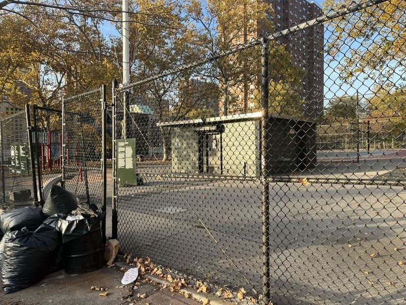
Site of the redoubt thrown up here in October, 1776 by American troops under General Heath to protect the retreat of Washington's Army from New York to White Plains. — — Map (db m12677) HM
What was here before?
This site was once a tract of farmland owned by the Pugsley family in the early 19th century. The land became part of the Cobb and Larkin family farms in the late 1800s, until the City acquired it incrementally in the . . . — — Map (db m238051) HM
This limestone sculpture once stood at the top of the grandstand of Rice Stadium in Pelham Bay Park. The stadium, built in the early 1920s and funded through a gift of Julia Rice in memory of her late husband Isaac Rice, was demolished in 1989. . . . — — Map (db m226276) HM
Built between 1836 and 1842 as a country seat for Robert Bartow, descendant of Thomas Pell who established the Manor of Pelham here in 1654, this house is one of the finest examples of the late Federal style in the country. It was restored by the . . . — — Map (db m32032) HM
A gratefvl city erected this shaft to the gloriovs memory of its Bronx Covnty sons who gave their lives for their covntry in the World War — — Map (db m226277) WM
How did this become a monument?
The efforts to create a Memorial Grove coincided with a plan to erect a unified monument that would honor all servicemen from the Bronx. Bronx Parks Commissioner Thomas J. Dolen submitted plans for the war . . . — — Map (db m226278) HM
Near this site on October 18, 1776, Col. John Glover and 600 Patriots held off British and Hessian forces under Gen. Howe long enough to save Washington’s troops from destruction, enabling them to withdraw to Westchester and ultimate victory. Bronx . . . — — Map (db m32013) HM
Glover’s Rock marks the site of the Battle of Pell’s Point on October 18, 1776. Before the American Revolution, the Siwanoy Native Americans used the rock as a lookout point along their trading route. The glacial granite rock is now named for . . . — — Map (db m98622) HM
On June 27, 1654, beneath a nearby oak, Thomas Pell signed a treaty with Siwanoy Sachems acquiring the Manor of Pelham and pledging “mutual peace and love be maintained.” Fire destroyed the tree in 1906. — — Map (db m192136) HM
In honor of Algernon – Sydney – Sullivan Jurist – Statesman – Orator Born 1826 Died 1887 An immaculate life · Devoted with never failing fidelity to public and private trusts. < Reverse Side : > In honor of Algernon – . . . — — Map (db m53837) HM
Built by Frederick van Cortlandt MDCCXLVIII Placed in the custody of the Colonial Dames of the State of New York – MDCCXLVIII Opened by them as a public Museum MDCCCXCVII This large estate has been held continuously by the descendants of Jacobus . . . — — Map (db m237833) HM
Erected by his wife and son to the memory of David Glasgow Farragut First Admiral in the United States Navy Born July 5, 1801 Died August 14, 1870 --------------- — — Map (db m237832) HM
Major General Porter Adjutant General State of New York 1886 – 1894 < Left Inscription : > He labored to increase the efficiency, perfect the discipline and elevate the standard of the National Guard. < Rear Inscription : > . . . — — Map (db m53835) HM
Prison Window built of Holland brick and stone from the old Sugar House Duane Street 1763 – 1892 Used by the British as a prison for American soldiers 1776 – 1783 Cunningham provost marshal Presented by T.J. Oakley Rhinelander Esq. to the Colonial . . . — — Map (db m53827) HM
Van Cortlandt House has been designated a Registered National Historic Landmark. Under the provisions of the Historic Sites Act of August 21, 1935 this site possesses exceptional value in commemorating and illustrating the history of the . . . — — Map (db m53823) HM
This Revolutionary War landmark is the oldest house in the Bronx and became the first historic house museum in New York City. It is a National Historic Landmark listed on the National Register of Historic Places and is a proud New York City . . . — — Map (db m53830) HM
Here in 1781, to deceive the British, General George Washington kept campfires burning in the area surrounding the house while he gained time for safe withdrawal of his troops across the Hudson River. The property on which this magnificent manor . . . — — Map (db m53824) HM
The lower Hudson Valley and the Bronx Terminal Market share a rich and colorful past.
Macomb's Dam Across the Harlem River
In 1814, Robert Macomb built a dam and toll bridge across the Harlem River in the vicinity of . . . — — Map (db m241545) HM
Completed in 1937 under the supervision of the U.S. Treasury Architect Louis Simon, in accordance with the design of Thomas Harlan Ellett, the building was executed in a style that combines Classical simplicity with the sleekness of Modernism. It is . . . — — Map (db m183128) HM
“King’s Bridge and the heights adjacent, of the utmost importance to the communication between New York and the mainland, & to the security of the Hudson, were reconnoitered by Washington on horseback about June 16, 1776. By direction of the . . . — — Map (db m53814) HM
In memory of the 87 men and women who lost their lives in the Happy Land Social Club fire at 1959 Southern Blvd. west of this site on March 25, 1990.
May they all be happy in eternity.
Although we cannot see them,
Forever they . . . — — Map (db m230087) HM
A graduate of Townsend Harris H.S. and City College (1934), Jonas Salk lived here with his parents and two younger brothers until the age of nineteen. He received an M.D. degree from New York University (1939), followed by a residency at Mount . . . — — Map (db m230086) HM
The Bronx Terminal Market served as the distribution point for thousands of food products satisfying the varied tastes of New Yorkers.
The Market was Open to Everyone
The Bronx Terminal Market served communities in the Bronx . . . — — Map (db m241552) HM
The Power House, an engineering marvel of the 1920s, housed mechanical equipment vital to the operations of the Bronx Terminal Market.
The Power House
The only building remaining on the site of the Bronx Terminal Market, the . . . — — Map (db m241540) HM
The Bronx Terminal Market's road, rail, and water links brought vast amounts of food into New York City.
Delivery Trucks at the Market
Trucks were a constant fixture at the Bronx Terminal Market. The long rows of narrow stores . . . — — Map (db m241555) HM
The original church on this site was built in 1700 to house a parish organized by an act of the Provincial Assembly in 1693. Queen Anne contributed an altar in 1708. In 1763 a charter was received from King George III. The present church, designed . . . — — Map (db m52223) HM
Erected by the citizens and school children of Bay Ridge and Fort Hamilton
September 28th 1899
In honor of the home-coming of Admiral George Dewey U.S.N.
After his victory in Manila Bay May 1st 1898
Executive Committee
F.C Cocheu · R.J. . . . — — Map (db m127008) HM WM
At the time of the American Revolution, travelers from Long Island boarded a ferry that took them across the Narrows to Staten Island near this point. In the summer of 1776, a British fleet commanded by Admiral Lord Richard Howe sailed up through . . . — — Map (db m30752) HM
On July 4, 1776, the Declaration of Independence proclaimed to the world that thirteen British colonies had joined together to create a new nation: the United States of America. Here in Brooklyn, only two months later, the survival of that new . . . — — Map (db m31009) HM
The Freedom Tree
With the vision of universal freedom
for all mankind
This tree is dedicated to
Maj Donald Cook
and all
Prisoners of War
and
Missing in Action
1973 — — Map (db m108744) WM
The Freedom Tree
With the vision of universal freedom
for all mankind
This tree is dedicated to
Richard Cocheo
and all
Prisoners of War
and
Missing in Action
1973 — — Map (db m108745) WM
The Freedom Tree
With the vision of universal freedom
for all mankind
This tree is dedicated to
S.Sgt. John Allen Payne
and all
Prisoners of War
and
Missing in Action
1973 — — Map (db m108746) WM
This Greenstreet located at Lewis Avenue and Fulton Street in the neighborhood of Bedford-Stuyvesant in Brooklyn, is named in honor of community advocate Charles C. Pinn (1966- 1995).
Charles "Chris" Pinn first served as an intern . . . — — Map (db m242960) HM
What was here before?
Originally home to the Lenape, this site eventually became part of the Lefferts family property. The Lefferts patriarch Leffert Pietersen Van Haughwout arrived in Brooklyn in 1660 and the family became one of the . . . — — Map (db m242959) HM
On this site stood the Van Pelt House, portions of which dated to the late 17th Century. During the Revolutionary War, local farmers like the Van Pelts saw their homes used to quarter British and Hessian officers as well as American prisoners. The . . . — — Map (db m30067) HM
This park is at the location of the oldest existing milestone in New York City. The New Ultrecht milestone was placed here in approximately 1741 under the reign of George II. The stone, which served as a directional post to travelers, stood at the . . . — — Map (db m30090) HM
This is the site of the original New Utrecht Reformed Church, built in 1700 on the main street of New Utrecht village. On August 22, 1776, General Howe’s troops occupied the old Church before moving to attack the Americans at Brooklyn Heights. . . . — — Map (db m30062) HM
This Liberty Pole marks the spot over which the American flag first waved in the town of New Utrecht. The original pole was erected by our forefathers at the Evacuation of the British, November 1783, amid the firing of cannons and demonstration of . . . — — Map (db m30342) HM
Completed in 1829, the Church incorporates in its walls the stones from the original structure, which had stood in the eastern corner of the old New Utrecht Reformed Church Cemetery, 16th Avenue and 84th Street since 1700. During the Battle of . . . — — Map (db m30069) HM
The walls of this building, constructed in early Gothic revival style in 1828, contain stones taken from a predecessor church built in 1700 as the first house of worship for the Reformed Protestant Dutch Church of New Utrecht, organized in 1677. The . . . — — Map (db m30177) HM
On July 4, 1776, the Declaration of Independence proclaimed to the world that thirteen British colonies had joined together to create a new nation: the United States of America. Here in Brooklyn, only two months later, the survival of that new . . . — — Map (db m30175) HM
An 18th century well that was about 35-feet deep and still contained water was discovered adjacent to this site in 2017 during construction. The well is believed to be associated with Fort Box, which was one of a line of entrenchments built as . . . — — Map (db m183066) HM
Brooklyn: Court Street - State Street, 1922-1931. Image from the Irma and Paul Milstein Division of the United States History, Local History and Genealogy, The New York Public Library. — — Map (db m183080) HM
In the plaza adjacent to Borough Hall's imposing front steps, summer concerts, a year-round greenmarket and other civic events take place.
Brooklyn's Borough Hall, a downtown landmark since 1966, dates from the mid-19th century. Until . . . — — Map (db m183082) HM
On January 9, 1908, Downtown Brooklyn's Borough Hall Station opened. It was Brooklyn's first subway station and its first-ever underground link to Manhattan. — — Map (db m242759) HM
The cornerstone of the original church building on the present site of the St. Cyril's of Turau Cathedral was laid in 1850 by the congregation of the St. Peter's Episcopalian Church.
In 1857 that building was sold to the Reformed . . . — — Map (db m183067) HM
Our neighbor, the New York City Presbytery, owns this land that was once a rubble-strewn vacant lot. With permission from the Iglesia Presbiteriana del Cristo Vivo, a group of neighbors led by Hoyt Street resident, Margaret Cusack, decided to . . . — — Map (db m183077) HM
Please visit and enjoy the garden whenever the gate is open. the garden was created in 1975 by the Hoyt Street Association with help from neighbors and merchants. The land is owned by the Iglesia de Cristo Vivo. More information about the garden . . . — — Map (db m183078) HM
What was here before?
The Board of Estimate (a now defunct municipal body) first acquired this property in 1944 as part of the construction of the Brooklyn-Queens Expressway (BQE). Built under the direction of Triborough Bridge and Tunnel . . . — — Map (db m183118) HM
Trinity Park, on Gold Street between Sands and Nassau in downtown Brooklyn, is named in honor of the Missionary Servants of the Most Blessed Trinity also known as the Trinitarian Sisters. Under the auspices of the Catholic Settlement Association . . . — — Map (db m241391) HM
'Yellow Bird' was BBG's second yellow-flowering magnolia, introduced in 1981. As a backcross of 'Evamaria', its flowers are smaller but more intensely yellow, much like its seed parent, Magnolia acuminata var. subcordata. — — Map (db m204058) HM
'Spiced Spumoni' began as Magnolia BBG #374 at BBG's Kitchawan Research Center with hybridizers Dr. Evamaria Sperber, Dr. Lola Koerting, and Doris Stone. It found a home at Klehm's Song Sparrow Nursery in Wisconsin when Kitchawan's operations ceased . . . — — Map (db m204059) HM
This hybrid was introduced by BBG in 1989. Its unique flower is mostly yellow with magenta-rose veins appearing from its base. Its name honors the community activist and environmentalist who founded the Magnolia Tree Earth Center in Brooklyn. — — Map (db m204063) HM
This BBG hybrid was never officially registered. Its popularity as one of the darkest purple magnolias led to its market introduction and unofficially official naming by Fairweather Gardens Nursery in New Jersey in 2001. — — Map (db m204069) HM
Known for many years solely by its test plot number, 1164, 'Judy Zuk' was officially named in 2007 in admiration of the former BBG president whose favorite flower was the magnolia. This unique cultivar's yellow flower has a pink blush at its base . . . — — Map (db m204067) HM
Magnolia 'Marillyn' was the last BBG introduction before the breeding program shut down operations in 1991. Introduced in 1989, this hybrid honors Marillyn Wilson, a BBG benefactor and onetime BBG board member. It boasts bright purple flowers . . . — — Map (db m204061) HM
Many of the fruits you know and love—cherries, peaches, apricots, pears, plums, and apples—originated in the Middle East, Asia, or Europe. Over centuries, farmers worldwide have bred an amazing diversity of these fruits. Among apples alone, there . . . — — Map (db m204033) HM
The potato, adapted to the wide variety of climates in the Andes Mountains, was among the first plants cultivated by people in Peru, more than 10,000 years ago. Maize (corn) is believed to have been grown originally in the fertile valleys of . . . — — Map (db m204040) HM
Plants that grow along the water's edge provide food, shelter, and nest material for birds.
Canada goose
North America has seven subspecies of Canada goose but the one that Brooklynites encounter is the giant Canada goose. Native to . . . — — Map (db m204014) HM
Knot gardens intertwine the beauty of plants with the artistic skills of pruning and sculpting. Appearing in English, French, and Italian gardens during the Renaissance, early knot gardens symbolized harmony and order.
A New Take on the . . . — — Map (db m204023) HM
Atlantes Figures, circa 1899
From the Hugh J. Chisolm residence, formerly at 813 5th Avenue, Manhattan, unknown architect
Limestone
65.130.1-4, Anonymous Arts Recovery Society
These four burly male figures once ornamented the town house . . . — — Map (db m109509) HM
Benne, or sesame seed, has been used by people for over 5,000 years. Benne seeds grow inside of a pod that bursts when the seeds are ripe. These seeds are the main ingredient in benne balls, a dessert invented by Afro-Trinidadian people that is made . . . — — Map (db m203992) HM
Each spring, this garden puts on a spectacular show of pink cherry blossoms as rows of Prunus 'Kanzan' bloom. In fall, scarlet oaks (Quercus coccinea) that line the outer paths display colorful leaves.
Cherry Esplanade . . . — — Map (db m204052) HM
This century old garden is devoted especially to children in BBG's gardening classes. Everything you see here is planted, tended, and harvested by kids!
🔎 Look for hand-painted signs
Children don't just plant the . . . — — Map (db m204111) HM
Since 1914, children of all ages have used the Children's Garden as a living classroom to explore the natural world with hands-on activities. Every year, thousands of participants in many different programs cultivate this garden.
The . . . — — Map (db m204112) HM
Written records of this plant's use in China go back more than 2,000 years; how did it arrive in the Caribbean? European colonizers kidnapped and tricked people from China and other countries to move to the Caribbean to work. Plants from these . . . — — Map (db m203995) HM
NYC's iconic Lower East Side pickle can trace its origins to the vining cucumber plant native to the foothills of the Himalayas. Introduced by Columbus, cucumbers were already being cultivated in America when Brooklyn Dutch farmers began growing . . . — — Map (db m204031) HM
Dasheen is a tropical yam-like vegetable related to eddoe. It has many different names and is grown in more than 40 countries around the world. Scientists believe dasheen has been grown for over 5,000 years, even before rice or millet! Dasheen is . . . — — Map (db m203999) HM
Dasheen is a tropical yam-like vegetable related to eddoe. It has many different names and is grown in more than 40 countries around the world. Scientists believe dasheen has been grown for over 5,000 years, even before rice or millet! Dasheen is . . . — — Map (db m204115) HM
East Asia and South Asia
Rice and soybeans, native to Asia, were first domesticated 7,000 to 10,000 years ago in subtropical regions of India, China, and Japan. Today they remain dominant agricultural products and are mainstays of the . . . — — Map (db m204030) HM
Eddoe is a tropical potato-like vegetable that is a family member of dasheen (taro). Eddoe traveled from China and Japan to the West Indies along with people who were forced to live and work in the Caribbean by European colonizers. Despite this . . . — — Map (db m204020) HM
Eddoe is a tropical potato-like vegetable that is a family member of dasheen (taro). Eddoe traveled from China and japan to the West Indies along with people who were forced to live and work in the Caribbean by European colonizers. Despite this . . . — — Map (db m204119) HM
Attributed to Harry Lowe
(American, dates unknown)
Four Pairs of Pegasus Figures, 1934
From the New York City Fire Service Pumping Station, Neptune Avenue at West 23rd Street, Coney Island, Brooklyn, designed by Irwin. S. Chanin . . . — — Map (db m109508) HM
Ginger has been used to settle upset stomachs for over 2,000 years! This flowering plant has a special stem (called a rhizome) that is used for its flavor, smell, and ability to heal. Ginger, like horseradish and wasabi, lets out a chemical with a . . . — — Map (db m204005) HM
Ginger has been used to settle upset stomachs for over 2,000 years! This flowering plant has a special stem (called a rhizome) that is used for its flavor, smell, and ability to heal. Ginger, like horseradish and wasabi, lets out a chemical with a . . . — — Map (db m204118) HM
Ionic Capital and Column Base, circa 1901-
From the Pennsylvania Railroad Station, formerly 31st to 33rd Streets between 7th and 8th Avenues,
Manhattan, designed by Charles Folen McKim
Limestone
66.250.2 Gift of Lipsett Demolition Co. and . . . — — Map (db m109510) HM
"My birdhouse is based on my childhood home in the suburb of Pļavnieki in Riga, Latvia. The architectural style of the typical Soviet-era bloc housing I grew up in was embedded in my early imagination, and became a formative aesthetic in my art . . . — — Map (db m204072) HM
In 1999, this apple tree was planted in the Children's Garden. BBG received two saplings of a Rambo apple tree planted by John Chapman, aka Johnny Appleseed, in Ohio. He promoted the planting of apple trees on the frontier in the early 1800s. — — Map (db m203990) HM
These scarlet oaks are dedicated in remembrance of the events of September 11, 2001 and to those who lost their lives that day.
The Norway maples that grew as the first generation of trees on this site were planted in November 1918 to . . . — — Map (db m204050) HM WM
This formal garden opened in 1921 to complement the Palm House, the Garden's original conservatory. Shimmering pools of water-loving plants are bordered by hardy perennials and seasonal annuals.
The Perennial Border and the Annual . . . — — Map (db m204073) HM
This formal garden opened in 1921 to complement the Palm House, the Garden's original conservatory. Shimmering pools of water-loving plants are bordered by hardy perennials and seasonal annuals.
Providing a stunning backdrop for the . . . — — Map (db m204074) HM
Brooklyn Botanic Garden occupies part of the unceded territory of the Munsee Lenape people, who were the stewards of this land before genocide and forced migration pushed the Lenape west and north to rebuild their nations in what are now . . . — — Map (db m204042) HM
Brooklyn Botanic Garden occupies part of the unceded territory of the Munsee Lenape people, who were the stewards of this land before genocide and forced migration pushed the Lenape west and north to rebuild their nations in what are now . . . — — Map (db m204053) HM
Brooklyn Botanic Garden occupies part of the unceded territory of the Munsee Lenape people, who were the stewards of this land before genocide and forced migration pushed the Lenape west and north to rebuild their nations in what are now . . . — — Map (db m204120) HM
Evidence of madder dye use has been found in ancient Egyptian mummies and archaeological sites in India dating to 2500 BCE. Madder was also mentioned in the writings of Pliny the Elder in the first century CE. — — Map (db m204022) HM
Early spring is fragrant in this formal garden. Magnolia trees are among the earliest flowering plants—their fossils date back to 145 million years ago.
The Administration Building, which opened in 1917 as a laboratory building, is . . . — — Map (db m204056) HM
3075 entries matched your criteria. Entries 101 through 200 are listed above. ⊲ Previous 100 — Next 100 ⊳