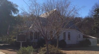
On South Chestnut Street at 1st Street, on the right when traveling south on South Chestnut Street.
A native of Prattville, Wilson Pickett was raised singing gospel in local churches. Upon moving to Detroit as a teenager, he began to blend gospel-style with rhythm and blues, resulting in some of "the deepest, funkiest soul music" to come from the . . . — — Map (db m70804) HM
On Canal Road east of Nancy Lane, on the left when traveling east.
Front:
Orange Beach was named for the oranges that were grown here and exported until the hard-freezes of 1916. The orange groves are gone, but the name remained. Drawn here by the game they hunted, the early Indians discovered the . . . — — Map (db m81851) HM
On Conecuh Avenue East just east of North Prairie Street, on the right when traveling west.
Singer Eddie Kendricks, the first lead tenor for The Temptations, was born on December 17, 1939, in Union Springs to Johnny and Lee Bell Kendrick (the "s" was later added). Throughout their career, The Temptations released 14 Billboard R&B No. 1 . . . — — Map (db m252714) HM
On West Hardaway Ave at North Prairie Street, on the right when traveling west on West Hardaway Ave.
Country singer Hank Williams was from southeast Alabama. In
his beginning years, he sang at many events throughout the
region. In 1948, Mr. E.L. Jackson, owner of the newly built
Western Auto located on North Prairie Street, the town's . . . — — Map (db m252716) HM
On East Railroad Avenue at Jones Street, on the right when traveling north on East Railroad Avenue.
City of Georgiana Founded in 1855
Early settlers moved from Virginia, the Carolinas, Kentucky, Tennessee and Georgia into the deep forests of southern Butler County. In 1855, the Rev. Pitt S. Milner established a home-stead and post . . . — — Map (db m86265) HM
On Rose Street at West Railroad Avenue, on the right when traveling east on Rose Street.
Side 1
Hank Williams' Boyhood Home
Hiram Williams lived in Georgiana from age 7 to 11. In 1931, Mrs. Lillie Williams moved Hiram and his sister Irene from rural Wilcox County to this house owned by Thaddeus B. Rose. When he . . . — — Map (db m81276) HM
On Mc Cullars Lane east of Recreation Dr, on the left when traveling east.
Oxford Lake, since the 1800's, has been the social & recreational center for this area. In the 1900's there was horse racing, boating, & a trolley line that brought visitors to the park. In the 1930s the lake had an amusement park. This site was . . . — — Map (db m261791) HM
On Alabama 189 at County Road 465, on the right when traveling north on Alabama 189.
On July 8, 1905, Charles H. and Cynthia Russell Rhoades
deeded 2 acres of land to the New Providence Primitive
Baptist Church and Rhoades Cemetery. This was the
fourth location for this church organized in the
early 1800s. The other locations . . . — — Map (db m302929) HM
The Muscle Shoals National Recreational Trail complex is a 17-mile paved and primitive trail and bikeway for public use located on TVA’s Muscle Shoals Reservation. This National Recreation Trail System connects numerous historical sites including . . . — — Map (db m106117) HM
On Avalon Avenue at Brown Street, on the left when traveling west on Avalon Avenue.
This sculpture is dedicated to the many individuals whose efforts made Muscle Shoals and the Muscle Shoals area the “Hit Recording Capital of the World,” and to those who continue that legacy.
Legend of the Singing River
The . . . — — Map (db m167279) HM
On East 2nd Street at North Nashville Avenue, on the right when traveling east on East 2nd Street.
(side 1)
Percy Sledge
"When A Man Loves A Woman"
Hospital orderly Percy Sledge recorded 'When a Man Loves a Woman' at Quin Ivy's studio in 1966. Sledge's breakup with a girlfriend inspired the lyrics credited to songwriters . . . — — Map (db m83390) HM
On North Montgomery Avenue at Alabama Avenue, on the left when traveling north on North Montgomery Avenue.
This sculpture is dedicated to the many individuals whose efforts made Sheffield and the Muscle Shoals area the “Hit Recording Capital of the World,” and to those who continue that legacy.
Legend of the Singing River
The . . . — — Map (db m167280) HM
On U.S. 72 west of Howell Heflin Ln, on the right when traveling east.
Musicians have long crossed the Alabama -Mississippi border to perform and record. Mississippians such as Albert King, Little Milton, and Pops Staples recorded at studios in Muscle Shoals and Sheffield, including those owned by Mississippi . . . — — Map (db m280031) HM
On East Main Street (Alabama Route 123) at Creel Richardson Street, on the right when traveling west on East Main Street.
Willie Mae "Big Mama" Thornton was born Dec. 11, 1926, in Ariton, Alabama,
the youngest of the seven children of Rev. George and Mattie Thornton.
She learned to play the harmonica at the age of eight. It is said that she
sat in front of the . . . — — Map (db m274311) HM
On 1st Street North, on the left when traveling west. Reported permanently removed.
In the late 1850s, Cahaba experienced a building boom. Everyone expected the town to prosper because of the new railroad. One of the first large brick structures built in this prosperous period was completed in 1856 by Dr. Saltmarsh.
He . . . — — Map (db m23009) HM
On Vine Street at 1st Street North, on the right when traveling south on Vine Street.
In the late 1850s, Cahawba experienced
a building boom. Everyone expected
the town to prosper because of the new
railroad.
One of the first structures built during
this prosperous period was completed on
this corner in 1856 by Dr. . . . — — Map (db m150847) HM
On Gault Avenue North (US Highway 11) at 4th Street, on the right when traveling north on Gault Avenue North (US Highway 11).
In the late '60s, cousins Randy Owen and Teddy Gentry discovered they shared a common interest in music. Joined by Jeff Cook, they started playing on a regular basis. Working their day jobs and playing any place they could locally in the evenings, . . . — — Map (db m25277) HM
On Gault Avenue North (U.S. 11) at 5th Street Northtwest, on the right when traveling west on Gault Avenue North.
Opened Sept. 1890. Built during local boom period. Converted into theatre during era of silent movies. Closed as a theatre in October, 1935. Purchased by Landmarks of DeKalb County, Inc. 1969. Renovated, restored and reopened to public in 1970. The . . . — — Map (db m83686) HM
Near Gault Ave N, on the right when traveling east.
Panel 1
1819-1838
(partially broken)
?on - During the middle 1700s, the Cherokee
?south into present day Alabama and
?important village of Willstown. Sequoyah
?kee syllabary while living in the area. In
?e Nation officially . . . — — Map (db m224648) HM
On Alabama Route 63 0.2 miles north of Kowaliga Marina Road, on the left when traveling south.
At this site stands the cabin where country music legend Hank Williams composed the song “Kaw-liga” in August, 1952. The song’s title was derived from the name of a Creek Indian town located on the banks of the Kowaliga Creek until 1836.
. . . — — Map (db m68038) HM
On South Pine Street at Ouiwatumpkis Street, on the left when traveling south on South Pine Street.
Born in Wetumpka in 1950 and raised in the Level community, Ronnie
Lovejoy Sr. became a celebrated Soul and Blues singer-songwriter in the late
twentieth century. Lovejoy's musical influences began with his family.
His mother, Golaties White . . . — — Map (db m286050) HM
On South Blvd at Nicholas Ave, on the right when traveling south on South Blvd.
The Ritz Theatre opened its doors on this site September 14, 1936, and for more than fifty (50) years prided itself as the “Hub of the Brewton Community.” Between its first feature, "Yours For the Asking” and its last, . . . — — Map (db m154552) HM
On South 1st Street, on the right when traveling north.
Built of local sandstone in 1935 on land obtained from the American Legion Post No. 5 this municipal amphitheatre seating about 1600 was constructed for staging theatrical and sporting events. Gadsden architect Paul W. Hofferbert designed the . . . — — Map (db m39140) HM
On River Road 0.2 miles south of U.S. 411, on the left when traveling south.
1896-1972. One of the writers of "Popeye" comic, inspired by life & people on Coosa River including father, captain of Gadsden steamboat "Leota." — — Map (db m301103) HM
On Temple Avenue South at 1st St SE, on the left when traveling south on Temple Avenue South.
People living along the Byler Road came to
Fayette to watch movies at the Roxy Theatre,
located on this street. Originally called the
New Richards Theatre, the Roxy opened in 1935.
Lucille Cobb - a member of the family that founded
Cobb . . . — — Map (db m302619) HM
On 2nd Street Southeast at 4th Avenue South ( Route 24), on the left when traveling north on 2nd Street Southeast.
T. A. Wilson built the theater in 1927. Since Red Bay had no electricity at that time, he used a Delco System. Shortly after, electricity became available and he had to switch from Delco to Alabama Power. When he first started in the business, he . . . — — Map (db m83742) HM
On North Jackson Avenue, on the right when traveling north.
The Roxy Theatre was built in 1949. It has served as the center of entertainment and a landmark for Russellville and Franklin County for many years. It is the only one of its kind in Alabama. As movie theatres around the country fell victim to . . . — — Map (db m41131) HM
On County Road 28 west of County Road 30, on the left when traveling west.
In 1908. J.C. Ausley and A.C. Kelly, partners in
Slocomb's Morris Lumber Company, established a
hotel here, naming it "Aus-Kel," bearing the first
three letters of their last names. The facility was located near a collection of mineral springs, . . . — — Map (db m281095) HM
On North Doswell Street at E Williams St, on the left when traveling south on North Doswell Street.
Abbeville's Archie Theatre, located on Doswell Street on the east side of the Courthouse Square, held its grand opening on Thursday, July 1, 1948. Showings of "Sitting Pretty," starring Maureen O'Hara, Robert Young and Clifton Webb, were held at 3 . . . — — Map (db m272797) HM
On South St Andrews Street, on the right when traveling south.
Johnny Mack Brown, an outstanding athlete and western movie star, was born in Dothan on September 1, 1904. Johnny Mack was one of nine children born to John Henry and Hattie McGillivray Brown. The Brown family home was located on South Saint Andrews . . . — — Map (db m83783) HM
On 19th Street North at 2nd Avenue North, on the right when traveling north on 19th Street North.
Celebrities of all races - but particularly Black singers and actors such as
Harry Belafonte, Sammy Davis, Jr., Eartha Kitt, Lena Horne, and Ossie
Davis with wife Ruby Dee - played important roles in the Movement.
Some, including comedian Dick . . . — — Map (db m187822) HM
This building was constructed in 1908 by Louis V. Clark (1862-1934), who also built the historic Lyric Theater located nearby on 18th Street. The Clark Theater on Caldwell Park is named in honor of Mr. Clark’s generosity to the Birmingham Little . . . — — Map (db m27515) HM
On 20th Street (Alabama Route 269) at Ensley/5 Points W Avenue, on the right when traveling west on 20th Street. Reported missing.
"Tuxedo Junction" was the street car crossing on the Ensley-Fairfield line at this corner in the Tuxedo Park residential area. It also refers to the fraternal dance hall operated in the 1920's and 1930s on the second floor of the adjacent building, . . . — — Map (db m25623) HM
On 4th Avenue North at 17th Street North, on the right when traveling west on 4th Avenue North.
The Fourth Avenue "Strip" thrived during a time when downtown privileges for blacks were limited. Although blacks could shop at some white-owned stores, they did not share the same privileges and services as white customers, so they created . . . — — Map (db m26985) HM
On 4th Avenue North at 18th Street North, on the left when traveling west on 4th Avenue North.
Eddie James Kendrick, nicknamed "cornbread", was born the eldest of five children to Johnny and Lee Bell Kendrick in Union Springs, Alabama.
After attending Western-Olin High School in Ensley, Alabama, Eddie was persuaded by his childhood . . . — — Map (db m26724) HM
On 4th Avenue North at 17th Street North, on the right when traveling west on 4th Avenue North.
Prior to 1900 a "black business district" did not exist in Birmingham. In a pattern characteristic of Southern cities found during Reconstruction, black businesses developed alongside those of whites in many sections of the downtown area. . . . — — Map (db m174706) HM
On 3rd Avenue North, on the right when traveling east.
Built by the Publix Theater division of Paramount Studios. This movie palace opened on December 26th, 1927. The theatre, in Spanish / Moorish design by Graven and Mayger of Chicago, seated 2500 in a five story, three-tiered auditorium. Paramount's . . . — — Map (db m27337) HM
On 26th Street South at Hatcher Place on 26th Street South.
Built in 1937 by Gen. Louis Verdier Clark from a design by architect William T. Warren as a community playhouse for cultural activities. It was recognized as one of the best of its kind in the nation. Mrs. Vassar Allen - first president, Bernard . . . — — Map (db m27513) HM
Near 1st Avenue North (U.S. 11) south of 83rd Street North.
East Lake was planned in 1886 by the East Lake Land Company to help sell home sites to the men who came in the 1870's to work in Birmingham's steel industry. First named Lake Como, after the lake in the Italian Alps, it soon came to be called East . . . — — Map (db m83828) HM
On Lakeshore Drive at University Park East, on the right when traveling east on Lakeshore Drive.
The developers of the Town of Edgewood, Stephen Smith and Troupe Brazelton, built the beautiful 117.4 acre lake and clubhouse in 1913-15. Amenities included a swimming pool, dance pavilion, fishing, boating and parking for hundreds of automobiles. . . . — — Map (db m26963) HM
Near South Court Street at Canal Street, on the right when traveling south.
Toward the end of the 19th Century, the U.S. government decided that Native Americans should integrate into American culture and give up tribal sovereignty.
The Dawes Allotment Act forced Native Americans to register on what became known as . . . — — Map (db m212215) HM
Near Hightower Place south of Veterans Drive ( Route 133), on the left when traveling south.
With a fourth grade education, Ezra Culver employed his own innovative concrete process in major 20th century projects. His construction experience included work on Yankee Stadium, Lincoln Tunnel and the Florida Keys bridges. — — Map (db m219299) HM
Near Hightower Place south of Veterans Drive ( Route 133), on the left when traveling south.
Starting his musical career in the 1950's, Kelso
Herston became a leader, playing guitar with
hundreds of performers, producing more than 50
recording artists, publishing 100+ hit songs and
creating more than 5,000 commercial jingles. — — Map (db m219303) HM
On East Tennessee Street (Alabama Route 22) at North Seminary Street, on the right when traveling west on East Tennessee Street.
This marks the site of the pioneering music company of Florence Alabama Music Enterprises (FAME), a name which became renowned worldwide as the home of "the Muscle Shoals Sound". FAME was founded in the early 1960's by three young local . . . — — Map (db m156923) HM
Near Hightower Place south of Veterans Drive ( Route 133), on the left when traveling south.
Known as the "Father of Rock and Roll,"
Sam Phillips established Sun Records in 1952, helping Elvis Presley and other well-known artists launch their careers. He received a Grammy for Lifetime Achievement in music. — — Map (db m219189) HM
Side A
Sam Phillips fell in love with the miracle of sound and the unifying power of music. Moving to Memphis, Tennessee, he embraced the beauty of the blues with his early recordings of Howlin Wolf, B.B. King and other delta artists. In . . . — — Map (db m29270) HM
On South Court Street (U.S. 43/72) at East Limestone Street on South Court Street.
The Rolling Stones in the Shoals in 1969.
The Rolling Stones stayed at the Florence Holiday Inn on this site for several nights while recording at the Muscle Shoals Sound Studio in Sheffield.
When a hired engineer failed to arrive, . . . — — Map (db m165908) HM
On South Court Street (U.S. 72) at West Bluff on South Court Street.
Dedicated to the world-renowned musicians, recording executives, writers, producers, and performers who made Florence and the Muscle Shoals area the “Hit Recording Capital of the World” in the 1960s and 1970s, and to those that continue that . . . — — Map (db m268605) HM
Near Hightower Place south of Veterans Drive ( Route 133), on the left when traveling south.
In 1934, T.S. Stribling won the Pulitzer Prize for The Store, part of a trilogy set in Florence. His story "Birthright" was produced in Hollywood as a silent movie and, later, with sound. — — Map (db m219333) HM
On West College Street at South Marengo Street, on the right when traveling west on West College Street.
William Christopher Handy, widely honored as the “Father of the Blues,” was born in this house on November 16, 1873. In his autobiography, Handy traced the key events in his discovery of the blues back to his time in the Mississippi Delta, . . . — — Map (db m90306) HM
Near West College Street at South Marengo Street, on the right when traveling west.
(side 1)
William Christopher Handy was born on November 16, 1873, in this two-room log cabin, which was located approximately one-half mile north of this site. In 1954, the cabin was dismantled, placed in storage, and restored to its . . . — — Map (db m90292) HM
Near Hightower Place south of Veterans Drive ( Route 133), on the left when traveling south.
Born in Florence in 1873, W.C. Handy wrote some of the country's most recognizable blues music such as the "St. Louis Blues." He became internationally known as the "Father of the Blues." — — Map (db m219308) HM
Near Hightower Place near Veterans Drive ( Route 133), on the left when traveling south.
Buddy Killen earned international renown as a music publisher, songwriter, record producer and recording artist. He help launch the careers of a host of well-known musicians during the last half of the 20th century. — — Map (db m219318) HM
Performing in both silent and talking movies in her long film career, Almeda Fowler was chosen for a coveted role by the legendary Al Reeves to be a star in his traveling vaudeville troupe known as "The Big Beauty Show." — — Map (db m268959) HM
In 1947, Dr. Willie H. ruff, III was selected for the All-Black 766th Air Force Band, playing at every Air Force Base in the U.S. As Professor of Music at Yale University, 1971-2017, his teaching inspired students from across the globe.
Inducted . . . — — Map (db m219301) HM
Beginning in the 1960's Norbert Putnam, an accomplished bassist, played for decades with most of the big names in the world of popular music, along the way, he became a top arranger and producer, as well.
Inducted 2021
City of Florence
Walk of . . . — — Map (db m268507) HM
On Upper Fort Hampton Road (County Route 49) east of Railroad Street, on the left when traveling east.
Limestone County High School (grades 9-12) was established in 1912. Money for the building, nearly $10,000, was obtained from three sources: the sale of property of an old Elkmont Elementary School, state funds, and private donations. Honored and . . . — — Map (db m93851) HM
Near Lauderdale Street west of East Street (County Road 71), on the right when traveling west.
Preservation and Restoration
The residents of Mooresville value the town's past and are committed to historic preservation by working to raise funds to protect its public historic buildings. Some buildings have been lost or changed purpose as . . . — — Map (db m281040) HM
Near University Avenue 0.2 miles east of Booker T. Washington Boulevard.
The young women all seated first, and then the young men march in. But no conversation is allowed until . . . a simple grace is chanted by the
chorus of a thousand voices. —Booker T. Washington, The Working . . . — — Map (db m101926) HM
On Eastside Square at Eustis Avenue Southeast, on the right on Eastside Square.
Tallulah Bankhead 1902 - 1968. Alabama's Best-Known Actress.
Tallulah Bankhead was the toast of the London theatre in the 1920's, and nationally renowned for her dramatic roles in “The Little Foxes” (1939), “The Skin of Our . . . — — Map (db m27850) HM
On North Walnut Avenue at W. Capitol Street on North Walnut Avenue.
The Demopolis Opera House In 1876, the town of Demopolis leased the former
Presbyterian Church, a classic brick structure
built in 1843 and occupied by federal troops during
Reconstruction, to the Demopolis Opera Association.
The . . . — — Map (db m38009) HM
On East Washington Street near Strawberry Avenue, on the right when traveling west.
Side A Establishing a history of theaters in this district, the Braswell Theater introduced its ornate interior to
Demopolis on October 23, 1902, with a performance of
the melodrama Unorna. Built by Frederick Henry Braswell in . . . — — Map (db m85845) HM
On 164 Bankhead Hwy (U.S. 43) at State Highway 243, on the right when traveling west on 164 Bankhead Hwy.
The Pastime
c. 1937
Theatre
has been placed
in the Alabama Register
of
Landmarks & Heritage
by the Alabama
Historical
Commission
February 12, 2015 — — Map (db m302623) HM
On South Wintzell Avenue (Alabama Route 188) at Tapia Avenue, on the right when traveling north on South Wintzell Avenue.
Founded in 1786 by Joseph Bouzage (Bosarge), Bayou La Batre was incorporated in 1955. The local seafood industry in this seafaring town serves as a centerpiece for the Discovery Channel's series, Big Shrimping. In addition, the city was . . . — — Map (db m117254) HM
On South Wintzell Avenue (Alabama Route 188) near Tapia Avenue, on the right when traveling south.
The stream near the site, known as Bayou la Batre, was known during the period of French occupation as "Riviere d'Erbane," then as "Rivere la batterie" because of the French artillery battery located on its banks. The town's name consists of bayou, . . . — — Map (db m117255) HM
On Augusta Street west of South Broad Street, on the right when traveling west.
Joseph Stillwell Cain Jr., recognized today as the patron saint of Mardi Gras in Mobile, purchased this plot of land in 1859 for $500, along with his wife of more than three years, Elizabeth Rabby Cain. The couple built a four-room classic . . . — — Map (db m111285) HM
On North Royal Street at St Francis Street, on the right when traveling north on North Royal Street. Reported permanently removed.
Joseph Stillwell Cain, Jr. was born along Dauphin Street in Mobile, Alabama. Joe served as a clerk for the city, and developed many mystic societies within the city. The Civil War brought all Mardi Gras Festivities to a halt. Cain had participated . . . — — Map (db m86730) HM
On South Royal Street at Government Street, on the right when traveling north on South Royal Street.
On Shrove Tuesday, February 25, 1868, the Order of Myths gathered at this intersection shortly after 8 p.m. and began its first parade. The procession traveled west on Government, north on Warren east on Dauphin, north on Joachim west on State, . . . — — Map (db m100842) HM
On South Joachim Street 0.1 miles south of Dauphin Street, on the right.
Opening night, January 19, 1927, saw crowds gather to hear local dignitaries praise Mobile's "Place of Entertainment". Today the Saenger Theatre remains the entertainment center of downtown. Designed by Emile Weil in the French Renaissance . . . — — Map (db m86503) HM
On North Royal Street at St Michael Street, on the right when traveling south on North Royal Street.
Here played the great of the American and British stage, among them: James Wallack, Fanny Kemble, Ole Bull, Joseph Field, Joseph Jefferson, James H. Hackett, William Macready, Charlotte Cushman, Edwin Forrest, Julia Dean, Junius Booth, Anna Mowatt, . . . — — Map (db m86352) HM
On North Royal Street at North Francis Street, on the right when traveling north on North Royal Street.
Joseph Stillwell Cain has become known as the patron saint of Mardi Gras in Mobile, credited with reviving Mardi Gras after the Civil War.
He was the clerk of the Southern Market, a longtime volunteer with Washington Fire Company No. 8, and a . . . — — Map (db m234672) HM
Near Government Street (Alabama Route 16) at South Franklin Street, on the right when traveling east.
This marker commemorates the one hundredth anniversary of the founding in Mobile of the Comic Cowboys, a Mardi Gras society believed to be unique in all the world. For a century, it has annually fulfilled its mission by using the art of caricature, . . . — — Map (db m101082) HM
All discipline for the moment seems not to be joyful, but sorrowful, yet, for those who are trained by it, afterwards, it yields the peaceful fruit of righteousness.
Hebrews 4:11
Maj. Norman L. Lowry III
Capt. Willie T. Mays
Capt. . . . — — Map (db m64484) WM
On Hall Street at Tuttle Street, on the right when traveling north on Hall Street.
Nat King Cole was a jazz pianist, composer, and singer celebrated as an American popular music artist in the 1940s and 1950s.
He was born March 17, 1919 in Montgomery, Alabama as one of five children to Edward James Coles, a minister at Beulah . . . — — Map (db m71228) HM
On Lincoln Road 0.1 miles north of Harrison Road, on the right when traveling north.
Side 1
Lincoln Cemetery
1907
In 1907 the American Securities Company opened Lincoln Cemetery for African Americans and Greenwood Cemetery for whites, the first commercial cemeteries in the city. Landscape design indicates . . . — — Map (db m71342) HM
On North Perry Street at Monroe Street, on the left when traveling south on North Perry Street.
Built 1936-37 Following a fire in 1932 that destroyed a 19th century City Hall, architect Frank Lockwood designed a replacement for the same site. With the Depression affecting all construction projects during the period, the city received . . . — — Map (db m36571) HM
On North Perry Street at Monroe Street, on the right when traveling south on North Perry Street. Reported missing.
Opened in Oct. 1860 as the South moved closer to secession, the theatre was significant in the social, cultural and political life of the city. In the early months, John Wilkes Booth performed here, Bryant Minstrels introduced "Dixie," which was . . . — — Map (db m247633) HM
On County Road 2120 0.3 miles east of Lower Wetumpka Road, on the left when traveling east.
Pickett Springs
Railroad building and amusement park development flourished in the post-bellum South. In 1880s, Western Railroad of Alabama opened Pickett Springs on site of William Harris’s plantation, “Forest Farm;” Harris’s daughter, Sarah, . . . — — Map (db m38900) HM
On Montgomery Street, on the right when traveling west.
Side A
At the bus stop on this site on December 1, 1955, Mrs. Rosa Parks refused to give up her seat to boarding whites. This brought about her arrest, conviction, and fine. The Boycott began December 5, the day of Parks’ trial, as a . . . — — Map (db m86422) HM
On Maxwell Boulevard north of North Goldthwaite Street, on the left when traveling north.
This mural honors the late Grammy Award winner Nathaniel Adams Coles (1919-1965) later known as Nat King Cole, who was born in Montgomery, Alabama. Cole was an American jazz pianist and vocalist. He acted, performed on Broadway, recorded over 100 . . . — — Map (db m152651) HM
On Old Carter Hill Road (County Route 85) 0.9 miles south of Old Pike Road (County Route 101), on the right when traveling south.
Built by William Matthews Marks, who immigrated from Oglethrope County, GA, on acreage purchased from the U.S. land office in Cahaba, AL for $1.25 per acre.
Foundation is pegged-together heart pine; framing is 3" by 9" timbers; mantles, dados, . . . — — Map (db m86472) HM
On Prospect Drive at 7th Street, on the right when traveling west on Prospect Drive.
"This section lying between Sixth Avenue and Eighth Avenue will provide the central beautification theme as it will evolve into a beautiful elevated rose garden with 2,000 selected roses planted at vantage points… the color ensemble, . . . — — Map (db m279728) HM
On 8th Street at Prospect Drive, on the right when traveling north on 8th Street.
"We are definitely in an era of building; the best kind of buildings - the building of great projects for the benefit of the public and with the definite objectives of building human happiness".
Franklin Delano Roosevelt
Delano park was . . . — — Map (db m86510) HM
On 8th Street at Prospect Drive, on the right when traveling north on 8th Street.
"It is intended that the city shall be not only a first class business and manufacturing place but at the same time it shall be a delightful place for the home and family."
-Promotional brochure from the Decatur Land Improvement and . . . — — Map (db m279729) HM
On County Road 45 north of County Road 4, on the right when traveling south.
Augustus (Gus) Mitchell was born August 8, 1878. He was a merchant, farmer, and supporter of the Vilula School and community. He operated the store from 1924 until his death in 1957. The store served the entire community and was considered the . . . — — Map (db m297112) HM
On Washington Street (U.S. 80) 0.2 miles east of Village Avenue, on the left when traveling east.
Site of the road-house, Green Gables, built in 1928, which became the social center of the Black Belt. It was known for its lively but restrained atmosphere provided by a dance floor, juke box, and excellent T-bone steaks. Mr. Walter Kemp was the . . . — — Map (db m70064) HM
On North Main Street at East Troy Street, on the right when traveling north on North Main Street.
Built in 1940 by the Works Project Administration
(WPA), this building was a cornerstone of the
city and initially served as the home of the
Brundidge City Hall, Police Department, and Jail.
This unique building features decorative
brickwork . . . — — Map (db m274305) HM
On Main Street (State Highway 22) just east of Knight Avenue, on the left when traveling east.
With special thanks to Bob & Mary Schoenberner for their generous donation of this theatre to the citizens of Roanoke. The Martin Theatre was built in 1941 and burned in 1980. The Roanoke Rotary Club, along with the help of many generous . . . — — Map (db m288500) HM
Near County Route 165 2.3 miles south of Nuckols Road (Road 39).
Pokkecheta, or the ball play, was an ancient and vital part of the social life of the Creeks and a popular game among many groups of Southeastern Indians. The game enhanced
interaction between towns and provided highly ritualized sport and . . . — — Map (db m101817) HM
On Selma Road north of Quarles Street, on the right when traveling south.
During the Jim Crow era, Selma Road served as the business, social, and
cultural center for African Americans in Montevallo. Most of the commercial
buildings in the district were owned by Hampton D. and Exie P. Lee an
affluent Black couple from . . . — — Map (db m295137) HM
On Ballantrae Club Drive 0.1 miles east of Weatherly Club Drive, on the right when traveling east.
Side 1
Pelham, Alabama
Pelham, located in Shelby County, Alabama, acquired its name in approximately 1867. It was named for “Gallant Pelham” who fought in the Confederate Army and was killed in action at Kelly’s Ford, . . . — — Map (db m76260) HM
On Jack Warner Parkway (County Road 88) 0.1 miles east of Queen City Avenue, on the left when traveling east.
Born October 22, 1985, Deontay Wilder was raised in Tuscaloosa and graduated from Central High School. At the age of 20 he embarked on a meteoric boxing career, inspired by his oldest daughter Naieya, who was born with Spina Bifida. Wilder won . . . — — Map (db m263200) HM
Near Greensboro Avenue north of Jack Warner Parkway (County Road 88).
Mike Medeiros was affectionately known by the community as Captain Mike. Captain Mike always greeted his passengers on the Bama Belle Riverboat with energy, optimism and a desire to make their experience a wonderful memory. He was a role model for . . . — — Map (db m156404) HM
On County Route 41 at Mellville Road, on the right when traveling north on County Route 41.
Here was located the switchboard known as “Central”, of Winston Telephone, Arley’s Grand Old Party Line. Built about 1909 by Mimm Wright, with an estimated maximum of 25 phones, she was the pulse of the community. When one phone rang, . . . — — Map (db m42857) HM
Jim Binkley was born in 1920 in Wrangell, Alaska. His father was a pioneer riverboat captain who came to Alaska during the gold rush of 1898. Captain Jim ran the entire length of the Yukon River and its major tributaries which supplied the . . . — — Map (db m257556) HM
Our cabins are built of fire killed wood harvested by the Nenana Lumber Company after the Great 10,000 Acre Tok Fire of 1990. Tok is a town of 1,400 near the Athabascan village of Tanacross, between the Tanana River and the Alaska Range, 200 . . . — — Map (db m257555) HM
7444 entries matched your criteria. The first 100 are listed above. Next 100 ⊳