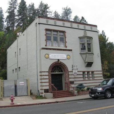
In 1852 Phillip L. Platt preempted a ½ quarter section here. He erected a log building for the lodging of miners. He named his hotel The Kossuth House. Dr. Platt died in 1853. His widow sold the property to Anna W. Clark for $200 in 1856. She . . . — — Map (db m13165) HM
On West Elm Street at North 6th Street, on the left when traveling west on West Elm Street.
In 1906, Coalinga was a boom town and there was a great need for blacksmithing and transporting. So the Cheney family decided to move to Coalinga from Cheney’s Grove, Illinois by way of Petaluma and Maricopa, Calif.
The Cheney Bros. started with . . . — — Map (db m63889) HM
On East Cedar Avenue west of Coalinga Plaza ( North 5th Street), on the right when traveling east.
January 1905, Mrs. Anria Kerr invited ten lay friends to meet at her home to form the “Coalinga Ladies Improvement Club.” Their goal was to “promote harmony and improve social and civic needs.” In 1907 they joined the General . . . — — Map (db m64020) HM
This French Merci Train Boxcar cover is dedicated to all veterans, past, present, and future, as a symbol of tribute to those who have, are now, and will in the future, borne the battle of war and conflict in the preservation of our nation. May the . . . — — Map (db m198102) WM
Near Highway 101 at S Broadway Street, on the right when traveling north.
Hal, a native of San Diego, was graduated from San Diego State College with a degree in Civil Engineering, and subsequently started work with the California Division of Highways in that area.
As a person dedicated to serving the needs of . . . — — Map (db m1556) HM
On 3rd Street west of G Street, on the right when traveling west.
Queen Anne Architecture
Built for Zipporah Russ & Sons Co.
Redwood Land & Investment Co.
Belcher & Crane Abstract Co.
Humboldt Club — Gentleman's Social Club
Eureka Historic Landmark — — Map (db m176808) HM
On G Street at Route 101, on the right when traveling north on G Street.
F.T. Georgeson, Architect; Meeting Site for Humbolt Lodge No. 79 and other lodges upstairs, department and furniture stores downstairs — — Map (db m233367) HM
This historic building was erected in 1887 by L.T. Kinsey and sold to the Society of Humboldt County Pioneers in 1890. On June 15, 1897 it was purchased by Humboldt Parlor No. 14 N.S.G.W. — — Map (db m71970) HM
On 4th Street (U.S. 101) east of G Street, on the right when traveling west.
Built by B.C Mowry and Knights of Pythians
Members for Lodge # 34
Alterations by Barbara Groom,
Owner: Lost Coast Brewery, Apartment, and Theatre
Eureka Historic Landmark
This program possible through a partnership with
property owner . . . — — Map (db m142819) HM
On Main Street (California Route 211) at Brown Street, on the right when traveling south on Main Street.
Erected in the early 1870s, this magnificent structure was a drug store. In 1877 it became known as the Alford Drug Store until 1886. In 1879, Wells Fargo and Co. established an express station in the Alford Drug Store and maintained it through . . . — — Map (db m71959) HM
On Ocean Avenue 0.3 miles east of South Main Street.
The original building was constructed in the late 1800’s as a warehouse for A. Berding, pioneer merchant. Remodeled in 1929, it became the meeting hall for the various Danish lodges. It also serves as the meeting hall of the Native Sons and . . . — — Map (db m71942) HM
On Francis Street at Eugene Street on Francis Street.
Dedicated March 19, 1891
Organized October 2?, 1868 with fifteen members Ferndale Lodge #193 F. & A.M. received its charter the following year. Meetings were held upstairs over the Dodge Store until 1870 when the first lodge hall was built on the . . . — — Map (db m71931) HM
The Memorial Day Parade, previously known as the Decoration Day Parade, in Ferndale began in 1882, when the participants were mainly Civil War Veterans who organized themselves as the Grand Army of the Republic. In the early 1900s, the Native Sons . . . — — Map (db m231396) HM
On Ocean Avenue 0.3 miles east of South Main Street, on the right when traveling east.
Originally constructed as a warehouse in July of 1902; known as the A. Berding Warehouse and housed many businesses. In 1919 Hampton C. Blum acquired the warehouse. In January 1929, The Danish Hall Committee started considerations for pu(r)chase. . . . — — Map (db m71939) HM
On Main Street at 9th Street, on the left when traveling east on Main Street.
Built in 1889, and affectionately known today as the "Low's Building", this three-story structure is the oldest surviving commercial building in the downtown area. Originally built as a meeting hall for the town and later used by various fraternal . . . — — Map (db m316241) HM
A native of Plunkett, Saskatchewan, Canada. Graduated from Stanford University with a degree in Civil Engineering, began work with the Division of Highways in 1936. He worked in many positions and locations throughout his career, becoming State . . . — — Map (db m1509) HM
On Olive Street at South 7th Street, on the right when traveling east on Olive Street.
Established and organized in 1908 as the Men Club to promote the city of El Centro, their first goal was for El Centro to reach a population of 10,000 residents. On October 30, 1908 the women took over the club and renamed it the Women's 10,000 . . . — — Map (db m101569) HM
On East Worthington Road (County Highway S28) at Bypass Federal Highway 116, on the right when traveling east on East Worthington Road.
From their arrival in Fall, 1901, Swiss and their "Americans of Swiss Descent" have contributed greatly to the ethnic diversity of this valley. Their Schwingfests since 1921 and this club since 1924 have celebrated both their ancestral traditions . . . — — Map (db m108846) HM
On South Main Street, on the right when traveling south.
This Plaque Presented to The Beverly and Jim Rogers Lone Pine Film Museum to Honor Masons and Shriners.
Dedicated to all Masons and Shriners who appeared in movies filmed in the Alabama Hills, Lone Pine and surrounding areas. Presented by Kerak . . . — — Map (db m72578) HM
To entertain men seeking their fortunes in mining boom towns, social clubs and fraternal organizations held meetings and offered other diversions in Kern County’s mining communities.
The exhibits on display in this building contain . . . — — Map (db m26006) HM
On Main Street west of Adams Street. Reported missing.
In January of 1867 the Clearlake Lodge #30 I.O.O.F. was organized in Lower Lake. The hall was built in 1868. The Lodge originally has 7 members, D.M. Hanson being the first Noble Grand. — — Map (db m42337) HM
On Main Street at First Street, on the right when traveling north on Main Street.
The International Order of Odd Fellows Lodge #241 established themselves in Upper Lake in 1876. The present structure was completed in 1898 at a cost for land and building of $3,109.02. This mutual aid society hosted numerous activities through the . . . — — Map (db m55398) HM
On North Weatherlow Street near Nevada Street, on the left when traveling north.
Commemorating the centennial of Lassen Lodge No. 149 F.&A.M., March 21, 1961 and in memory of Isaac N. Roop, ardent Free Mason, founder of Susanville, first Governor of the provisional Territory of Nevada, civic leader and friend of Man, and John S. . . . — — Map (db m87783) HM
“We do not know the exact date on which Peter Lassen arrived in America. Let us suppose that he landed in the early spring of 1831. Most reports say that Lassen arrived in Boston, Massachusetts. Also his passport had Boston written as the . . . — — Map (db m31741) HM
On 4th Street near Cedar Street, on the left when traveling west.
This building was built in 1925 by George Peltier and was funded by The Red River Logging Company. The building housed the Free and Accepted Masons and was known as Westwood Lodge #502 F.&A.M. It has been a gathering place of friends and families . . . — — Map (db m66082) HM
Near Angeles Crest Highway (California Route 2) at Vincent Gap.
This monument is dedicated to the memory of Lord Baden-Powell of Gilwell, O.M. Founder of Boy Scouting In the year of his 100th anniversary 50th anniversary of world Scouting 47th anniversary of Scouting in America September 1957
Erected . . . — — Map (db m189748) HM
On Mt Mooney Road near Angeles Crest Highway ( Route 2), on the right when traveling north.
This grove presented by the
California State Society of the
Daughters of the American Revolution
in honor of
Mrs. John Whittier Howe Hodge,
State Regent 1938-1940,
commemorating the
D.A.R. Society's Fiftieth Anniversary. — — Map (db m291772) HM
On First Avenue at Diamond Street, on the left when traveling south on First Avenue.
A Short History
In 1912 the first promotional organization to appear in Arcadia was a woman’s club called the Cooperative Arcadians. This group of 15 women began by sponsoring programs that increased interest in matters of social . . . — — Map (db m200010) HM
On Chevy Chase Drive at Benedict Canyon Drive, on the left when traveling west on Chevy Chase Drive.
This building played an instrumental role in the early
civic and cultural development of Beverly Hills, and was
designed by the architectural firm of Gable & Wyant.
Beverly Hills Historic Landmark No. 3.
Built 1925. Designated 2013. . . . — — Map (db m292808) HM
On Hughes Avenue south of Venice Boulevard, on the left when traveling south.
A portion of the original Spanish landgrant Rancho La Ballona.
The American Legion Post #46 clubhouse was dedicated on August 9, 1930. Contractor Don S. Ely erected the building on this site over the first swimming pool in the area, on . . . — — Map (db m49954) HM
On Brand Boulevard just north of Colorado Street, on the right when traveling north.
The Masonic Temple was dedicated on June 11, 1929 and served as a
meeting place for several Masonic Lodges for nearly three decades.
The building, constructed by J.V. McNeil, was designed by architect and
engineer Arthur Lindley who was also . . . — — Map (db m214526) HM
A twelve foot deodar tree was dedicated in this park on December 26, 1928
by the Montrose - La Crescenta Boy Scouts, Verdugo Hills Council, to honor
the short meritorious life of the valley's model Boy Scout. A small
concrete bench was later . . . — — Map (db m275996) HM
On Rosemont Avenue at Fairway Avenue, on the right when traveling north on Rosemont Avenue.
On this site American Legion Post 288 once stood. The great flood swept through its walls shortly after midnight on New Year’s Day, taking with it 12 local residents. Most had taken refuge inside from the torrential rain and two were dedicated Red . . . — — Map (db m143027) HM
On East 3rd Street, on the right when traveling west.
"All young people, regardless of sexual orientation or identity, deserve a safe and supportive environment in which to achieve their full potential."
Harvey Milk
May 22, 1930 - November 27, 1978
Born on Long Island, New York, Harvey . . . — — Map (db m72477) HM
Near Chalon Road east of Bundy Drive, on the left when traveling east.
The National Honor Society for First-Year Success
Alpha Lambda Delta (ALD) was founded in 1924 by Maria Leonard, the
Dean of Women at the University of Illinois, to recognize academic
excellence among freshman women.
Setting . . . — — Map (db m230861) HM
On Sunset Boulevard 0.6 miles west of Interstate 405, on the right when traveling west.
The Archer School for Girls has been designated a National Historic Landmark. This site possesses national significance in commemorating the history of the United States of America. — — Map (db m230684) HM
On Los Angeles Street north of U.S. 101, on the right when traveling south.
Philippe Garnier, a settler from Gap, France, hired Abraham Edelman to design this brick and sandstone building for Chinese tenants. This was the oldest and most significant building of the original Chinatown of Los Angeles which was located here. . . . — — Map (db m155778) HM
On Flower Street south of 5th Street, on the right when traveling south.
Tall, Dark And Prosperous
City National Plaza’s sleek, gleaming, granite-sheathed, 52-story twin towers are monuments to Los Angeles’ long history and oil
capital, and to the banking money that followed the black gold.
For more . . . — — Map (db m164082) HM
On North Main Street at Cesar E. Chavez Avenue, on the right when traveling north on North Main Street.
The Italian Hall, designed by architect Julius Kraus, was built by the Pozzo Construction Company in 1907 for Marie Ruellan Hammel. The upper floors served as a center for the Italian organizations who used the hall for political meetings, . . . — — Map (db m165332) HM
On Main Street at Cesar Chavez Avenue, on the right when traveling north on Main Street.
Architect Julius Kraus designed this building for Marie Hammel. The
upper floors served as a center for the Italian organizations of the city
who used the hall for political meetings, banquets, weddings and theatrical (operatic) performances. On . . . — — Map (db m174474) HM
On 7th Street just east of Olive Street, on the left when traveling east.
Symbolizing dedication of citizens
to make Southern California
a world sports center.
Declared
Historic Cultural Monument No. 69
by the Cultural Heritage Board,
Municipal Arts Department,
City of
Los Angeles. — — Map (db m177370) HM
On Figueroa Street south of 9th Street, on the left when traveling south.
Perpetuating the spirit of the cultural
involvement of Los Angeles women.
Declared Historic-Cultural Monument No. 196
by the
Cultural Heritage Board,
Municipal Arts Department,
City of Los Angeles. — — Map (db m175227) HM
On Hermosa Avenue at Colorado Boulevard, on the left when traveling north on Hermosa Avenue.
Eagle Rock Women's Twentieth Century Clubhouse,
Craftsman style,
built 1915. Declared 1991,
Historic-Cultural Monument No. 537,
City of Los Angeles,
Cultural Heritage Commission,
Cultural Affairs Department. — — Map (db m232560) HM
Built 1929, Egyptian Revival style, Westin & Westin, architects. Historic-Cultural Monument No. 462, declared November 3, 1989, City of Los Angeles, Cultural Heritage Commission, Cultural Affairs Department.
American Legion Hollywood Post . . . — — Map (db m170037) HM
On Hollywood Boulevard west of Highland Avenue, on the left when traveling west.
Greek Revival style.
Architect - John C. Austin.
Built 1921. Declared 1984,
Historic-Cultural Monument No. 277,
City of Los Angeles,
Cultural Heritage Commission,
Cultural Affairs Department. — — Map (db m231797) HM
On Hollywood Boulevard west of Highland Avenue, on the left when traveling west.
The Masonic Temple, a Neoclassic Revival design
built in 1921, was the work of John C. Austin, who
also designed L.A. City Hall. The memorial service
for silent film director D.W. Griffith, considered the
father of American movies, was held at . . . — — Map (db m231710) HM
On Lodi Place at Lexington Avenue, on the left when traveling north on Lodi Place.
Mediterranean Revival style.
Architect - Julia Morgan.
Built 1926. Declared 1977,
Historic-Cultural Monument No. 175,
City of Los Angeles,
Cultural Heritage Commission,
Cultural Affairs Department. — — Map (db m175069) HM
On Latimer Road at Haldeman Road, on the left when traveling north on Latimer Road.
Spanish Colonial Revival style.
Architect - William J. Dodd.
Built 1923.
Declared 1999,
Historic-Cultural Landmark No. 663,
City of Los Angeles,
Cultural Heritage Commission,
Cultural Affairs Department.
Landmarked by
the Pacific Palisades . . . — — Map (db m179251) HM
On 28th Street west of Central Avenue, on the left when traveling west.
The YMCA "Colored Branch"
The 28th Street Young Men's Christian
Association (YMCA) of Los Angeles,
also known as the "Colored Branch or
"Colored Y," opened its new building
in November 1926 at the corner of
East 28th Street and . . . — — Map (db m229206) HM
On West Jefferson Boulevard at Royal Street, on the left when traveling west on West Jefferson Boulevard.
A Shrine To Entertainment And Service
When the original Shrine Auditorium opened in 1906, the movies that would make it internationally recognizable were in their infancy; the first dramatic film made entirely in Los Angeles was being . . . — — Map (db m138639) HM
The Edmund Blinn House - 1905,
The Women's City Club of Pasadena
since 1945,
has been placed on the
National Register of Historic Places
by the United States Department of the Interior. — — Map (db m302708) HM
On Monte Vista Avenue at 3rd Street, on the right when traveling north on Monte Vista Avenue.
L.T. Paulson, a local builder, designed the
structure in the English Tudor style. It was
completed in 1929 to serve as the home of
San Dimas Masonic Lodge #428 F & AM. The
building has served many functions and
organizations and has played an . . . — — Map (db m167216) HM
On South Mission Drive north of Santa Anita Street, on the left when traveling north.
This building, built in 1951, was purchased by Ramona Parlor No.109
Native Sons of the Golden West in 1998 and renovated as a meeting
hall and a place to display their early California artifacts in their efforts to preserve the “Spirit of . . . — — Map (db m124459) HM
On Grant Avenue at Reichert Avenue, on the right when traveling west on Grant Avenue.
Originally called Loustaunau Hall, erected in 1895, where many organizations held meetings and socials for nearly 100 years. Now hall of Novato Grove Druids No. 113 — — Map (db m102572) HM
On Grant Avenue at Reichert Avenue, on the left when traveling west on Grant Avenue.
In 1890, Dr, H.J. Conradt purchased two lots, where this building now stands, for $10 from the Home and Farm Company. In 1898, when John (Jean) Loustaunau decided to build his own hotel, saloon and restaurant, he and his wife purchased the lots from . . . — — Map (db m102596) HM
Home of San Anselmo American Legion Post 179. Built by the veterans of World War I, Post Ladies Auxiliary, Boy Scout Troops and dedicated community volunteers.
Construction began April 23, 1933 and was completed and dedicated May 27, 1934. . . . — — Map (db m102721) HM
On Greeley Hill Road (County Road J132) north of Pine Street, on the right when traveling north.
On September 9, 1850 California became a state and the Coulterville Independent Order of Odd Fellows Lodge 104 was instituted a year later, on October 31, 1851. Charter members were Samuel A. Scott, George Wilson Coulter, James Wilson, Robert . . . — — Map (db m298256) HM
On Bear Valley Road (County Road J16) at High Street, on the right when traveling south on Bear Valley Road.
This building was constructed C. 1855 of native schist rock. It was purchased in August 1873 by the Freemasons of Hornitos Lodge No. 98, and since early 1875, continue to meet here. The Lodge was originally chartered as Quartzburg Lodge No. 98 on . . . — — Map (db m46900) HM
On Bear Valley Road (County Road J16) at High Street, on the right when traveling south on Bear Valley Road.
This restored Masonic Hall is recognized for the significant community involvement of its members from 1873 to 1930. The Freemasons owned stores and hotels, served as town and county officials, worked as miners and engineers and supported Hornitos . . . — — Map (db m46899) HM
On 17th Street south of Fournier Road, on the right when traveling south.
Also known as "The Grave Yard on the Hill", the date the Mariposa Town Cemetery was founded is unknown, but it is believed to be as early as 1850. The location of many of the earliest graves have been lost to time.
Two fraternal . . . — — Map (db m298784) HM
On Lansing Street near Ukiah Street, on the right when traveling south.
Erik Albertson, first Worshipful Master of Mendocino Lodge No. 179, Free and Accepted Masons, undertook construction of this Masonic Hall in 1866.
Albertson carved "Time and the Maiden," the statue which adorns the roof, out of a single virgin . . . — — Map (db m96627) HM
On North State Street near West Stanley Street, on the right when traveling north.
This wonderful example of Italianate style was built in 1882 and expanded in 1906, adding more offices, a dining room, kitchen and bathrooms.
The Ukiah chapter of IOOF was formed in 1870 and their building was the grandest structure of its . . . — — Map (db m80696) HM
On South School Street near West Perkins Street, on the left when traveling north.
This 1924 Beau Art/classical style building is the second building on this site for the Masons.
Their original 1872 wooden hall burned in 1923. No expense was spared to make this lodge the showcase of Ukiah. The lodge sported a blue Chinese . . . — — Map (db m96480) HM
On Bypass Road at Route 270, on the right when traveling west on Bypass Road.
During the California gold rush, E Clampus Vitus was a fraternal order and benevolence society for miners. It was rumored to be one of the secret societies in the town of Bodie during its heyday.
Today, ECV is dedicated to the preservation of . . . — — Map (db m8493) HM
Alta Lodge No. 333, Free and Accepted Masons was chartered on October 15. 1897.
The original lodge hall was in the brick building at the corner of Hwy. 395 and Hayes Street. The Lodge moved to this location in 1955. An ever changing society . . . — — Map (db m49958) HM
The American Legion was chartered by Congress in 1919 as a patriotic veterans organization. Focusing on service to veterans, servicemembers, and communities, the Legion evolved from a group of war-weary veterans of World War I into one of the most . . . — — Map (db m143558) HM
On Prescott Avenue at Wave Street on Prescott Avenue.
This simple bronze plaque honoring the work of John Steinbeck was sculptured in 1938 by William Gordon Huff. It was dedicated that same year by noted Western historian Dr. Charles L. Camp with all the unwavering oratorical profundity which . . . — — Map (db m54906) HM
On Coombs Street at 1st Street, on the right when traveling south on Coombs Street.
The Napa Native Sons of the Golden West hall was constructed by the order in 1914. The three story steel-framed brick building is a heritage property and an excellent example of civic properties in Napa. It was the tallest structure in Downtown for . . . — — Map (db m106386) HM
On Spring Street south of Oak Avenue, on the left when traveling south.
The Native Sons of the Golden West Hall has served for more than a century as a gathering place and social center of community activity within St. Helena. It is situated just outside the SW edge of the St. Helena Historic Commercial District, which . . . — — Map (db m55661) HM
On Main Street south of Adams Street, on the right when traveling south.
A fine example of Victorian architecture, this building was erected in 1892 by M. G. Richie. For many years it has served the city’s business community. In 1893 the hall and banquet rooms upstairs were leased to Saint Helena Lodge No. 93 Free & . . . — — Map (db m54543) HM
On South Auburn Street at Bank Street, on the right when traveling south on South Auburn Street.
Madison Lodge #23 was established under dispensation from the Grand Lodge of California on May 4th 1852. Its permanent charter was issued on May 5th 1853. Madison Lodge held its first two meetings at the old Columbus School on the present site of . . . — — Map (db m48685) HM
On North Bloomfield Road at Relief Hill Road, on the left when traveling east on North Bloomfield Road.
This picnic area, sponsored by Wm. Bull Meek-Wm. Morris Steward Chapter Number 10, E Clampus Vitus, is for the enjoyment of all. The redwood lumber for the tables came from Nevada City's Christmas Tree, a Sequoiadendron Giganteum and continues to . . . — — Map (db m857) HM
On North Pine Street east of Commercial Street, on the right when traveling west.
The year was 1850 at a location not far from here. The first Masonic Lodge meeting was held under a Charter from state of Wisconsin. Lafayette Lodge #29 was born, the years following in 1851 & 1863 a major part of which was to be known as Nevada . . . — — Map (db m40272) HM
On North Pine Street at Commercial Street, on the right when traveling west on North Pine Street.
After constructing a second-story meeting hall above two existing 19th century commercial buildings, the Nevada City Benevolent and Protective Order of Elks #518 dedicated its first lodge at this location on June 14, 1913. The lodge hall and . . . — — Map (db m40269) HM
On Nevada Street north of Broad Street, on the right when traveling north.
Home of Ida Colley and niece, Winifred Mulloy, founders of Laurel Parlor #6 Native Daughters of the Golden West. Now Deer Creek Inn Bed & Breakfast. — — Map (db m229296) HM
On Beach Boulevard at 11th Street, on the right when traveling south on Beach Boulevard.
Since its establshment in a newly created Orange County (1889), the Buena Park Woman's Club has influenced the civic life of its community. The club helped establish a volunteer fire department in 1915, a library district in 1919, and the town's . . . — — Map (db m50036) HM
On Harbor Boulevard at Chapman Avenue, on the left when traveling north on Harbor Boulevard.
This property has been placed on the
National Register of Historic Places
by the United States Department of the Interior. Built 1919, rehabilitated 1996.
Plaque placed by Fullerton Heritage.
City of Fullerton Local Landmark No. . . . — — Map (db m235019) HM
On Santa Fe Avenue east of Harbor Boulevard, on the left when traveling east.
Odd Fellows Lodge,
Williams Building,
built 1927,
has been placed on the
National Register
of Historic Places
by the United States
Department of the Interior. — — Map (db m217861) HM
This rustic cabin was erected in 1924 by the Lions Club, local carpenters union and Edison Company as a center for scouting in Huntington Beach and has been in continuous use by Troop 1, Boy Scouts of America, ever since.
The cabin was . . . — — Map (db m59874) HM
Near Newport Center Drive 0.5 miles east of Jamboree Road.
This monument commemorates the encampment of the Third National Jamboree of the Boy Scouts of America which was held on this site July 1953.
Here is your "locator guide" to find the camping areas of Boy Scouts from each state, territory and . . . — — Map (db m193942) HM
On Center Street south of Chapman Avenue, on the left when traveling south.
Women’s Club of Orange, established 1915.
Old Towne Preservation Association.
This property is within the Old Towne Orange Historic District, placed on the National Register of Historic Places by the United States Department of the . . . — — Map (db m241287) HM
On Court Street 0.1 miles west of Lincoln Way, on the left when traveling west.
Rebuilt in 1860 after a fire, George Willment resumed his mercantile business on the lower floor of this new fireproof building. The second floor was added at this time which was owned and operated by the Eureka Lodge #16 F&AM. In 1871, Willment . . . — — Map (db m67551) HM
On Commercial Street at Court Street on Commercial Street.
Historical Landmark
Site G. Willment General Store
Second floor was Mason Lodge
Built 1852 – Burned 1855
Rebuilt & Dedicated Dec.,27, 1860
— — Map (db m44075) HM
On Lincoln Way west of Grass Valley Highway ( Highway 49/193), on the right when traveling west.
Instituted in 1852, the first Odd Fellows Lodge organized in Placer County, seventh in California. Meetings were held in several different locations until this building was erected in 1894. Bricks used in construction were made and fired on this . . . — — Map (db m31842) HM
On Commercial Street at Court Street on Commercial Street.
Occupied by Eureka Lodge No. 16 F.A.M.
Much of the material and furnishings came to Auburn via Cape Horn S.A.
This plaque is dedicated to the Pioneers of Auburn by Auburn Parlor No. 232 Native Daughters of the Golden West
June 11, 1933 — — Map (db m44071) HM
On Lincoln Way (California Route 49/193) east of High Street, on the right when traveling east.
The Auburn Masonic Hall was completed in 1917. Since completion it has been home to Eureka Lodge No.16, F. & A. M. The building is clad in beautiful terra cotta manufactured by the Placer County firm of Gladdin McBean. It is the last remaining . . . — — Map (db m31811) HM
On North Main Street, on the right when traveling south.
Free and Accepted Masons
Chartered by Grand Lodge of California
On May 6, 1854 at Illinoistown (about a half mile South of Colfax)
A special Central Pacific train brought the Sacramento Coronet Band and fifty guests for the Dedication of this . . . — — Map (db m45277) HM
3948 entries matched your criteria. Entries 201 through 300 are listed above. ⊲ Previous 100 — Next 100 ⊳