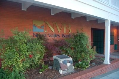
On Main Street (California Route 3 / 229), on the right when traveling north.
Chinatown business district was centered in this area. On September 10, 1874, fire destroyed everything from the corner of Highway 3 & Main Street to the Pacific Brewery, except four adobe buildings. Again, on September 30, 1905, fire destroyed all . . . — — Map (db m56027) HM
Near Main Street (California Route 3 / 229), on the right when traveling south.
Hundreds of Chinese miners came to the Weaverville area in the 1850’s and prospered despite hardships, discrimination and tax on foreign miners. The first house of worship burned in 1873; the Chinese continued their religious traditions in the . . . — — Map (db m56086) HM
On South Bridge Street, on the right when traveling north.
The Chinese Community flourished in this area from the latter 1800s to the 1960s. The first known Chinese resident in Visalia was known to be here as early as December 1859. Visalia Chinatown dates from the early 1890s. Originally encouraged to come . . . — — Map (db m141775) HM
On Highway 120 at Main Street, on the left when traveling west on Highway 120.
Reportedly founded about 1849 by group of Englishmen who employed Chinese as miners. Much surface gold found on hills and flats. Headquarters for stage lines in early 1850’s, and for several California Chinese mining companies. First Chinese Tong . . . — — Map (db m301037) HM
On Red Hill Road just east of La Grange Road, on the left when traveling east.
Built in 1853 by James W. Kerrick. Having come over the emigrant trail, to Keystone District with nine covered wagons. This place originally housed a restaurant, bar rooms and stables. Located on the main road from San Joaquin and Bay Region into . . . — — Map (db m53311) HM
On Columbia Street, on the right when traveling south.
Columbia was a boomtown.
The discovery of gold in 1850 attracted thousands of miners here. As more people arrived, the demand for goods, services and entertainment soared.
In the gold rush, Columbia stores and other businesses thrived. . . . — — Map (db m53301) HM
On Main Street (Italian Bar Road), on the right when traveling north.
Shortly after the fire of August, 1857, this one-story brick structure was built by three Frenchmen; L. Claverie, Charles Meysan, and Victor Pinchard. After their partnership dissolved in 1861, Meysan owned the building until 1869. He sold it to Sun . . . — — Map (db m53300) HM
On South Stewart Street just south of Lyons Street, on the right when traveling north.
This monument is dedicated to the memory of the Chinese pioneers who for years made this section their home. It was a city within a city whose residents were isolated from their surrounding neighbors by a barrier of language, custom and religion. . . . — — Map (db m301043) HM
Near Smith Road 0.5 miles east of Kuehner Drive, on the left when traveling east.
Construction of the railroad through Simi
Valley commenced in 1900 and was
completed in 1904. The Chinese are credited
with helping to build many of America's
western railroad systems. Chinese blue
ware pottery shards (broken . . . — — Map (db m200562) HM
Nestled on this block, between the sea and the San Buenaventura Mission, a Chinese community was established
in the early 1870s. Here merchants, laborers, farmers, cooks, laundrymen, gardeners, and servants conducted
businesses and lived in small . . . — — Map (db m143973) HM
On Dead Cat Alley west of First Street, on the right when traveling east.
Henry Aronson ran a general merchandise store
at 527 Main Street in the 1870s. On this site, at
the rear of his store, a small wooden warehouse
stood. According to local historian Will Weider, an
unknown Chinese immigrant rented the building
as . . . — — Map (db m154483) HM
In 1869 the branch line of the California Pacific Railroad (Cal-P) was laid, connecting Davisville to Woodland to Knights Landing to Yuba City. The tracks crossed the alley about here, angling from Main and College (then called Railroad Street). In . . . — — Map (db m55676) HM
On Broadway Street 0.2 miles east of Feather River Boulevard, on the left when traveling east.
This is the site of Arboga, where 2,465 Japanese Americans forced from
their homes in Placer and Sacramento counties were incarcerated from
May 8 to June 29, 1942, by the United States Government. Four months
prior, on February 19, 1942, . . . — — Map (db m165427) HM WM
The close proximity of the gold mines and the railroad construction contributed to Marysville’s large Chinese population in the mid to late 1880’s. When those activities diminished, the Chinese worked in various occupations, many as laborers . . . — — Map (db m65965) HM
On 20th Street at Blake Street, on the right when traveling south on 20th Street. Reported permanently removed.
During the 1860's, the first Chinese settled in Colorado, drawn here by the completion of the transcontinental railroad as well as by other demands for cheap manual labor. Existing amidst persecution, poverty and wretched living conditions, the . . . — — Map (db m96238) HM
On 19th Street at Larimer Street, on the right when traveling west on 19th Street.
A native of Toyama-ken, Japan, the Rev. Tamai came to Denver in June of 1930. He devoted the rest of his life - 53 years - to the spiritual, cultural and social needs of Buddhists in Colorado, Wyoming, Nebraska, Montana, Kansas, Oklahoma, Texas . . . — — Map (db m231831) HM
On Clear Creek Canyon Road, on the left when traveling west.
Chinese in Colorado
Between two and three hundred Chinese immigrants settled in the vicinity of Central City and Black Hawk in the 1870s, forming the state’s second-largest Chinese community (behind Denver). Most were former railroad . . . — — Map (db m316357) HM
In commemoration of
Ralph L. Carr
Governor of Colorado (1939 - 1943)
Following the Japanese attack on Pearl Harbor, tens of thousands of Japanese Americans were forcibly sent to internment camps by the federal government. These Americans . . . — — Map (db m152979) HM
Near County Road 235/10 south of West Amache Road.
Marker No. 1:
Amache
During the first months of World II, the United States Government ordered over 110,000 men, women, and children of Japanese descent to leave their homes, and incarcerated them in remote, military-style camps. . . . — — Map (db m62111) HM
Near County Road E 0.9 miles south of West Amache Road.
(Front)
Dedicated to the 31 patriotic Japanese Americans who volunteered from Amache and dutifully gave their lives in World War II, to the approximately 7000 persons who were relocated at Amache, and to the 120 who died there during . . . — — Map (db m82732) HM WM
Near County Road 1220 near Interstate 70, on the right when traveling north.
These stone structures appear to be the remains of historic labor camps. Occupied during the late 19th Century, they were used as temporary dwellings by immigrant workers completing railroad construction in Ten Mile Canyon.
The architecture . . . — — Map (db m120009) HM
Discovery of gold in the Rocky Mountains in 1859 lured thousands of prospectors to the area eventually known as the Colorado Territory. This first wave of fortune seekers triggered the development of farms, ranches, businesses, and railroads . . . — — Map (db m222040) HM
On Main Street north of Mather Street, on the left when traveling north.
Between 1863 and 1865, nearly 1,700 men of color enlisted in the 29th Volunteer Infantry Regiment, Connecticut's first non-white military unit. The recruits came from a variety of racial and ethnic origins and professional backgrounds. A . . . — — Map (db m230467) HM
Near Ferry Road (Connecticut Route 148) west of Geer Hill Road ( Route 431), on the right when traveling west.
William Gillette's Secretary and Confidante
A Japanese expatriate who exemplified the Connecticut state motto, "He who transplants sustains," Yukitaka Osaki came to the United States with his elder brother, Yukio, in 1888. The Ozaki family . . . — — Map (db m266480) HM
On Deer Hill Avenue at West Street, on the right when traveling north on Deer Hill Avenue.
The start of the 20th century saw a continual influx of newcomers to Danbury. A religious census taken in 1916 showed that 27 nationalities and 20 creeds were represented among the 22,533 residents of the town.
The 1910 census shows that a . . . — — Map (db m71473) HM
On 6th Street Northeast north of Morse Street Northeast, on the right when traveling south. Reported permanently removed.
Yoko Ono (b. Tokyo, 1933) is an artist, peace activist, and human rights worker who has strongly influenced the Feminist movement. Since the late 1950s, she has been a forerunner of Conceptual art, often using collaboration, audience . . . — — Map (db m111851) HM
Near Meadow Run Northeast west of Ellipse Road Northeast, on the right when traveling west.
John Naka dedicated his life to spreading the joy of bonsai throughout the world. Born in Colorado to Japanese parents, he became one of the 20th century's greatest bonsai masters. He wrote two of the most popular and definitive books on bonsai . . . — — Map (db m207093) HM
Near Meadow Road Northeast just west of Ellipse Road Northeast, on the right when traveling west.
Yuji Yoshimura dared to do what no one had done before: He wrote the most complete practical book on bonsai in English and taught Westerners in his native Japan and in other nations to appreciate and practice this ancient art. Drawn to the potential . . . — — Map (db m144340) HM
Near Meadow Road Northeast just west of Ellipse Road Northeast, on the right when traveling west. Reported permanently removed.
Most bonsai are modeled after natural trees in nature. However, about 400 years ago, it was popular in China to train potted trees into shapes of animals, especially the 12 animals of the Chinese zodiac, which includes the dragon. This tree was . . . — — Map (db m144343) HM
On Vernon Street Northwest at 19th Street Northwest, on the left when traveling east on Vernon Street Northwest.
The large building to your left is Adams School (1930), built for white students when the DC Public Schools were segregated. An Americanization School taught immigrant adults and children the English language and American culture here from . . . — — Map (db m184988) HM
On Louisiana Avenue Northwest just east of New Jersey Avenue Northwest, on the left when traveling north.
[Panel 1 of the historical narrative at memorial entrance]:
On February 19, 1942, 73 days after the United States entered World War II, President Franklin Roosevelt issued Executive Order 9066 which resulted in the removal of 120,000 . . . — — Map (db m40541) HM
On 7th Street Northwest south of H Street Northwest, on the right when traveling south.
dragons to bring rain,
prosperity,
and friendship
More than 280 dragons, crowned by 700 glazed tiles, look down from the Chinatown Friendship Archway before you. Symbols of the spirits that bring rain and . . . — — Map (db m130938) HM
On 7th Street Northwest just south of H Street Northwest, on the right when traveling south. Reported permanently removed.
dragons to bring rain,
prosperity
and friendship
More than 280 dragons, crowned by 700 glazed tiles, look down from the Chinatown Friendship Archway before you. Symbols of the spirits that bring rain and . . . — — Map (db m130937) HM
On 6th Street Northwest south of H Street Northwest, on the right when traveling south. Reported permanently removed.
The Washington Post, Nov. 30, 2016
Lin Han, noodle master
It's a simple window that looks out onto Sixth Street NW, but in a way, it's also a stage. Chinatown Express is the theater. "Fresh Noodle Made on the Spot," the lettering . . . — — Map (db m113107) HM
On Connecticut Avenue Northwest south of Porter Street Northwest, on the right when traveling south.
1920-1930:
Apartments, Shops and Cars
“Connecticut Avenue is the principal approach to what is undoubtedly Washington's greatest suburban buying power” — The Washington Post, December 7, 1930
Early development . . . — — Map (db m155387) HM
On K Street Northwest (U.S. 29) east of 25th Street Northwest, on the right when traveling east.
This building was the gathering place of the Filipino community from the late 1930s to the 1950s and was known as the Manila House. Filipino author Bienvenido "Ben" Santos (1911-1996) wrote about the Manila House in his collection of short stories, . . . — — Map (db m117992) HM
On 4th Street Northwest at Indiana Avenue Northwest, on the left when traveling south on 4th Street Northwest.
Welcome to downtown Washington DC - an area rich in history, culture and places to see. You will enjoy visiting the following sites located in the vicinity of this sign.
Clockwise from top:
"Lone Sailor" at the US Navy . . . — — Map (db m110214) HM
On G Street Northwest at 3rd Street Northwest, on the left when traveling east on G Street Northwest. Reported permanently removed.
“The neighborhood
was our whole life.”
Albert Small, born in the neighborhood in 1902.
This is the oldest surviving synagogue building in Washington. Constructed in 1875 by Adas Israel Congregation, and . . . — — Map (db m29761) HM
On 18th Street Northwest at Newton Street Northwest on 18th Street Northwest.
Just like Mount Pleasant, Bancroft School is known for its ethnic and racial diversity. "at one of the spring fairs in the early 1970s, we asked people to bring native dishes, and I bought 27 little flags to mark the food," parent Gloria . . . — — Map (db m130872) HM
On Sheridan Circle Northwest north of 23rd Street Northwest, on the left when traveling north.
Dr. Philip Jaisohn was a pioneer of independence, democracy and public awakening for the Korean people. After the failed 1884 reformation movement, he was exiled to the United States, where he became the first Korean-born to become an American . . . — — Map (db m39925) HM
On Sheridan Circle Northwest south of Massachusetts Avenue Northwest, on the left when traveling north.
서재필 선생
Philip Jaisohn
1864 - 1951
The First Korean American
Pioneer for the Korean Independence and Democracy
Philip Jaisohn loved his native land, Korea
Shook it from its . . . — — Map (db m223330) HM
On M Street Southeast at 4th Street Southeast, on the right when traveling east on M Street Southeast. Reported permanently removed.
Chinese were hired to do the dangerous work of blasting and laying ties over the treacherous High Sierras. Comprising nearly 80% of Central Pacific's workforce, their contributions made possible the Transcontinental Railroad. — — Map (db m112738) HM
On M Street Southeast at 4th Street Southeast, on the right when traveling east on M Street Southeast.
Chinese and Irish immigrants built about 2,000 miles of track. The 12,000 Chinese were nearly 80% of Central Pacific's workforce. Their hard work and ingenuity to tunnel through the Sierras made possible the Transcontinental Railroad. — — Map (db m170380) HM
On 4th Street Southwest just north of Independence Avenue Southwest, on the right when traveling north.
This stone is one of four Cardinal Direction Markers that honor the four directions—north, east, south, and west. Representatives of Native communities in Canada, Maryland, Chile, and Hawai'i selected a meaningful stone from their . . . — — Map (db m211256) HM
On Maryland Avenue Southwest at 3rd Street Southwest, on the left when traveling west on Maryland Avenue Southwest.
This memorial recognizes American Indian, Alaska Native, and Native Hawaiian men and women who have served in every branch of the United States Armed Forces, from the Revolutionary War to the present day, and the support and sacrifices . . . — — Map (db m161605) WM
Near Jefferson Drive Southwest just west of 7th Street Southwest, on the left when traveling east.
Huma Bhabha's striking sculptural creatures appear to have emerged from either the prehistoric past or a postapocalyptic future. Bhabha, who often cites pulp horror and science-fiction cinema as important points of departure, drew this work's title . . . — — Map (db m184557) HM
Near Jefferson Drive Southwest west of 7th Street Southwest, on the right when traveling east. Reported permanently removed.
The Wish Tree series, begun in 1996, continues Ono's interactive art tradition by inviting visitors to whisper wishes to the tree. — — Map (db m113998) HM
Near Jefferson Drive Southwest just west of 7th Street Southwest, on the left when traveling east.
Yoko Ono
American, b. Tokyo, Japan, 1933
Wish Tree for Washington, DC
2007
Live tree and mixed media
Gift of the artist, 2007 (07.6)
Yoko Ono has been a prolific artist and notable figure in the art world since the 1960s. . . . — — Map (db m205015) HM
Cuban exiles in the 1890's met to plot for independence at a restaurant operated on this site by the patriot Antonio Menendez, a Chinese from Cuba.
Many revolutionaries on their way to join the Mambi Army in Cuba, were given warm welcome and free . . . — — Map (db m15295) HM
The idea was that it would be a park for the people, Not an escape from the City but a place to go to, a place of congregation. May it take its place as a wedge of art into the heart of the new world. Isamu Noguchi
Near Whitehead Street at Olivia Street, on the left when traveling south.
Miriam Williams, pictured left, said "[I was] [o]nly in my late teens when I went to cook for Miss Pauline[....] [She] interviewed me and when she asked about my cooking experience and I said 'just a little home cooking' I could tell she liked me . . . — — Map (db m246974) HM
Near Morikami Park Road north of Puzzle Place, on the left when traveling north.
The Asian-American Federation of Florida
The Japan-America Society of South Florida
respectfully dedicate this lantern to the memory of
Col. Ellison Shoji Onizuka
and his Challenger crewmates
Jan. 25, 1987
in cooperation with . . . — — Map (db m292682) HM
On Walker Street east of 6th Street, on the right when traveling east.
The second half of the nineteenth century saw increased Chinese immigration to
the United States to meet the needs of large-scale labor projects. In 1873, Chinese
laborers were contracted to expand the Augusta Canal. The Chinese Exclusion . . . — — Map (db m235779) HM
On James Brown Boulevard south of D'Antignac Street, on the right when traveling north.
Successive populations of rural, Irish, Chinese, and African-American residents lived adjacent to the second and third levels of the canal, developing a local culture and supporting institutions.
Many workers on the Georgia Railroad, . . . — — Map (db m291966) HM
On Mamalahoa Highway (Hawaii Route 19) near Pauahi Street, on the right when traveling east.
(Legend to Points of Interest to on the Hilo Bay map:)
➊ Kānoe Heiau Kānoe Heiau was one of six major lauakini or sacrificial heiau on the island of Hawai'i dating back to ancient times.
➋ Naha . . . — — Map (db m111236) HM
On Kamehameha Avenue near Lihiwai Street, on the right when traveling west.
Waiakea Town, or Yashijima, was a close-knit, vibrant community which occupied what is known today as Banyan Drive. The golf course and park that you see today was once filled with homes, businesses and Waiakea Kai School, all of which provided . . . — — Map (db m110928) HM
Near Kaleiopapa Street 1 mile north of Alii Highway, on the right when traveling north. Reported permanently removed.
Kauikeaouli was born within this enclosure March 17, 1814 the second son of Kamehameha I and Keopuolani. His reign (1825-1854) was the longest in the history of the Kingdom. While a minor, his kingdom knew the firm regency of Queen Ka'ahumanu, . . . — — Map (db m172848) HM
Near Kupipi Street 0.1 miles north of Keahole Airport Road, on the right when traveling south.
These three dancers convey the grace and power of Hula Kahiko, the ancient dance of Hawai'i. The flow of their skirts and the harmony of their movements capture the rhythm of the dance which highlighted many sacred and ceremonial occasions. Just . . . — — Map (db m190119) HM
Near Kupipi Street 0.4 miles north of Keahole Airport Road, on the right when traveling south.
In Hawai'i, the lei, a garland of flowers, coveys respect, love, friendship, and continuity of life. It may be created from a wide variety of local flora and is offered on many occasions calling for a special token. The giving of leis as a floral . . . — — Map (db m190121) HM
Welcome to Pu’ukohola Heiau, one of the most famous heiau (temples) in the Hawaiian Islands. This heiau is an integral component of the traditional Hawaiian social, political, and religious systems, and a significant place in the history of King . . . — — Map (db m71874) HM
Near Alii Drive 0.5 miles north of Kamehameha III Road, on the left when traveling north.
This archaeological site has been identified as a men's house associated with a person of chiefly rank who resided at the Lonoikamakahiki Residence. Hydration-Rind dating performed by the Bishop Museum indicated that the major portion of this site . . . — — Map (db m39410) HM
Near Alii Drive 0.5 miles north of Kamehameha III Road, on the left when traveling north.
This archaeological site is known as the Inikiwai Heiau. It is sometimes known as the Pahe'ehe'e Ku'ula.
Hawaiian Fishermen built these shrines on promontories along the seashore or near ponds and streams. These shrines are a place for . . . — — Map (db m39305) HM
On Kaleiopapa Street near Ehukai Street, on the right when traveling north.
The Kamehameha Dynasty
As a young man, Kamehameha was a proven warrior and political strategist who rose to power with the support of the chiefs of Kona and unified the island of Hawai'i under his leadership in the late 1700a. He embraced . . . — — Map (db m110302) HM
Near Ninole Loop Road 1 mile Mamalahoa Highway ( Route 11) when traveling east.
The mystical turtle, Kauila, makes her home in the Ka’u District at Punalu’u Bay. According to Hawaiian mythology, Kauila was empowered with the ability to turn herself from turtle into human form and would play with the children along the . . . — — Map (db m129454) HM
Near Waikoloa Beach Drive near Pohakulana Place, on the right when traveling east.
Kalama Hakaleleponi Kapakuhaili was the daughter of ali'i (royalty) Kaihekukui and Iahu'ula. She married Kauikeaouli Kamehameha III, who introduced the division and disbursement of traditional lands known as the "Great Mahele." A very well-educated . . . — — Map (db m110410) HM
Near Akoni Pule Highway (Hawaii Route 270), on the left when traveling north.
The ahupua'a is a traditional land division that runs mauka from the mountains to makai (seaward). The ahupua'a of Lapakahi encompasses more than 2,000 acres along the leeward slopes of the Kohala Mountains. The distance from the upland forests . . . — — Map (db m110324) HM
On Daniel K. Inouye Highway (Saddle Road) (Route 200 at milepost 27) near Mauna Kea Access Road, on the left when traveling east.
Traditional native uses of the Humu'ula area included bird catching and, at much higher elevations, adze quarrying. They were replaced by sandalwood harvesting and hunting wild cattle, and ultimately ranching and astronomy. Over time, travelers . . . — — Map (db m110792) HM
Near Spencer Beach Park Road 0.2 miles west of Kawaihae Road ( Route 270), on the right when traveling west.
Build a heiau on Pu'ukohola, the "hill of the whale," dedicate it to your war god, and you will achieve your dream — you will rule the islands. Responding to this prophecy told by Kapoukahi, a famous seer, Kamehameha built the heiau . . . — — Map (db m172849) HM
On Kalakaua Avenue north of Saratoga Road, on the right when traveling south.
Honoring the World War II Veterans of the 100th Infantry Battalion (Separate), the 442nd Regimental Combat Team, the Military Intelligence Service, and the 1399th Engineer Construction Battalion.
“Veterans who served in these units, . . . — — Map (db m26939) HM
On this site stood the villa of Chun Afong, Hawai‘i’s first Chinese millionaire, who arrived
in Honolulu in 1849. By 1855, he had made his fortune in retailing, real estate, sugar and rice, and for a long time held the government monopoly opium . . . — — Map (db m49676) HM
Near Holomoana Street south of Ala Moana Boulevard.
Fish were easily netted from the ponds near Pi‘inaio Stream.
In ancient times, the
area was home to many Hawaiian families, who enjoyed the offerings in its bountiful waters. It was not unusual to see native men and women fishing, . . . — — Map (db m13127) HM
From olden times Waikīkī was viewed not only as a place of peace and hospitality, but of healing.
There was great mana (spiritual power) in Waikīkī. Powerful kahuna la‘au lapa‘au (or physicians) lived here. Throughout the . . . — — Map (db m13225) HM
Near Holomoana Street south of Ala Moana Boulevard.
The legendary surfer Duke Kahanamoku often strolled the sands of Waikīkī Beach fronting what is now Hilton Hawaiian Village Beach Resort & Spa, 1959.
In ancient times, the coastal plain where you now stand was known as . . . — — Map (db m13082) HM
On Kalaukaua Ave, on the left when traveling west.
Legend says these stones are the living legacy of four powerful Tahitian healers who once resided near this site at a place called Ulukon. From the court of the Tahitian chief, the names of the four were Kapaemahu, Kapuani, Kinohi, and Kahaloa. . . . — — Map (db m73116) HM
On Kalakalua Avenue at Kukio Avenue and Kuamoo Street, on the left when traveling south on Kalakalua Avenue.
(tablet on back of base)
David Kalākaua was born on November 16, 1836. He succeeded to the throne on February 12, 1874, and ruled with his queen, Kapi‘olani. King Kalākaua was the catalyst for the revival and flowering of . . . — — Map (db m13586) HM
On Route 580 1.4 miles west of Route 56, on the left when traveling west.
Many generations ago, every stone was brought by hand up to this bluff from the rivers below to build this heiau (temple). A heiau was often remodeled by a new ruling ali'i (chief) and his kahuna (priest).
Within . . . — — Map (db m65809) HM
On State Highway 56, on the right when traveling north.
The 15-foot cast concrete lantern was constructed in 1915 by Kaua‘i’s first generation Japanese immigrants. As a tribute to their homeland, the lantern commemorates the 1912 coronation of Emperor Taisho. An inscription reads: “Great Japan . . . — — Map (db m9786) HM
May the glimmer of both this historic lighthouse, guiding ships to safe harbor, and the legacy of Senator Daniel K. Inouye, illuminating the voices of Hawaii citizens, always continue to serve as beacons of hope.
'Ike vision, Lawelawe . . . — — Map (db m65776) HM
Near Kokee Road 0.6 miles north of Kauhao Strm, on the right when traveling north.
Niihau lies 17 miles southwest of Kauai and is approximately 18 miles long, 5 miles wide, area 90 sq miles. The island is low at both ends with a high tableland. Highest point is 1,281 feet. The island of Lehua is to the near right. Niihau is . . . — — Map (db m290073) HM
On Kuloa Point Loop Trail east of Pipiwaii Trail, on the right when traveling north.
Residents have always utilized the rich marine resources along the Kipahulu coastline. The steep and rugged coastline cliffs are home to native 'ophii (limpet) and pipipi (nerite snails). Offshore, the lave shelf drops off to deep waters, home to . . . — — Map (db m290154) HM
On Kuloa Point Loop Trail east of Pipiwai Trail, on the right when traveling north.
"…we behold water falling in cascades and running in streams to the sea after having watered the habitation of the natives which are so numerous that a space of three or four leagues [9 or 12 miles] may be taken for a single village." - . . . — — Map (db m290142) HM
Near Pipiwai Trail east of Hana Highway ( Highway 360), on the left when traveling east.
Building a Traditional Hale Today
Hawaiians build houses today using the knowledge passed down
by their elders, with traditional and modern materials.
Cutting the Posts
Posts are cut with modern tools, but the style follows the ancient . . . — — Map (db m291751) HM
On Kuloa Point Loop Trail east of Pipiwai Trail, on the left when traveling east.
"Kipahulu was an 'okana (district) with rich and
diverse but scattered agricultural resources. Its great
valley and lower fringing forests nourished forest taro
and other native food plants, as did the lower kula (open
country) lands above . . . — — Map (db m291750) HM
The Kipahulu District protects multiple intact ahupua'a, traditional land divisions that protect natural resources from mauka to makai (mountain to sea). Boundaries were often along streams and ridges and were marked by ahu (alter) with a pua'a . . . — — Map (db m292633) HM
Near Kuloa Point Loop Trail east of Pipiwai Trail, on the left when traveling east.
Look around. Notice the trees in all stages of growth.
Park staff, volunteers, and partners continually work to restore this native landscape, which was changed by over a century of plantation and ranch use.
Hala (Pandanus tectorius) is a . . . — — Map (db m291741) HM
On Kuloa Point Loop Trail north of Pipiwai Trail, on the right when traveling north.
In 1848 under King Kamehameha III, the Mehele (divide)
privatized land for the first time in Hawai'i. As foreigners
settled in Hawai'i and introduced western ideas, King
Kamehameha III believed the Mahele was a way for Native
Hawaiians to . . . — — Map (db m290132) HM
On Kuloa Point Loop Trail north of Pipiwai Trail, on the right when traveling north.
This rock wall enclosure stands on land that once belonged to the Po'Onika family. Their story illustrates the changes wrought by the 1848 mahele (divide), which privatized land and changed Hawai'i forever.
Frank C. Po'oinka was born here . . . — — Map (db m290130) HM
On Kekaa Drive north of Kualapa Loop, on the left when traveling north.
The Stones of Moemoe and Wahine O Manua These two large pohaku (stones) are steeped in legend. The larger one is over six feet long and resembles a reclining person. It is called Moemoe (to lie in wait or sleep). The taller stone sheltered an abused . . . — — Map (db m290120) HM
Near Haleakala Highway 11.3 miles west of Kekaulike Avenue ( Highway 377), on the left when traveling west.
For millennia, Polynesian navigators explored the Pacific in large double-hulled canoes using stars, tides, currents, the wind, and patterns of bird migration. They introduced the concept of kuleana to mālama 'aina (the . . . — — Map (db m290127) HM
Near Wharf Street at Papelekane Street, on the left when traveling north. Reported damaged.
Look down over the seawall to the boulders below, and
you will notice an unusually shaped stone, which remarkably resembles a chair with a spacious seat and short angular back. Look closely, and you will see that the seat portion is worn down . . . — — Map (db m290069) HM
On Kā'anapali Beachwalk north of Kā'anapali Beach Public Access Trail, on the left when traveling north.
This famous dark lava rock promontory is named Pu'u Keka'a in Hawaiian, which translates as "the rolling hill." To this day, it is revered as a sacred spot known as "ka leina a ka 'uhane" - the place where a soul leaps into eternity.
One of . . . — — Map (db m290125) HM
On Baldwin Avenue north of Makawao Avenue, on the right when traveling north.
Portuguese Hawaiian William and
Annie Cooper lived here and ran
a taxi stand. In 1947, Takeshi and
Suteko Kitada opened Kitada's
Kau Kau Korner. Kitada's lasted
for decades so that locals could
enjoy its hekka and saimin. — — Map (db m293172) HM
On Makawao Avenue at Olinda Road, on the left when traveling north on Makawao Avenue.
Crossroads Service Station was built by Joseph Tam Sing in 1930 and run by Hajime (Jimmie) Karakawa for decades. Notice where two bays for repairing cars used to be along Makawao Avenue. — — Map (db m293025) HM
On Baldwin Avenue north of Makawao Avenue, on the right when traveling north.
The Yoza Ginsho family both worked
and slept next door. However their
living room and kitchen were located
here. Later this building served as
the home of pineapple worker
Koshiro Miyabara, his wife Ichi,
and their children. — — Map (db m293171) HM
On Baldwin Avenue north of Makawao Avenue, on the right when traveling north.
From 1926 to 1938 Chutaro Honda provided shaves, cuts and a porch to socialize. He followed a local tradition by training his daughters Evelyn and Violet in the skills needed to continue the business. — — Map (db m293029) HM
On Baldwin Avenue north of Makawao Avenue, on the right when traveling north.
Kakusuke Matsui built this building as a general store, selling just about anything the community needed, including groceries and dry goods, as well as providing a watch repair service and marriage licenses. — — Map (db m293028) HM
On Baldwin Avenue north of Makawao Avenue, on the right when traveling south.
Rikiichi Kawaguchi founded a fish and
vegetable store here and later added a
restaurant. Tetsujiro and Sono Iwaishi
took over his business in 1937, which
was then known as T. Iwaishi Store.
Their counter service flourished
for decades. — — Map (db m293173) HM
829 entries matched your criteria. Entries 401 through 500 are listed above. ⊲ Previous 100 — Next 100 ⊳