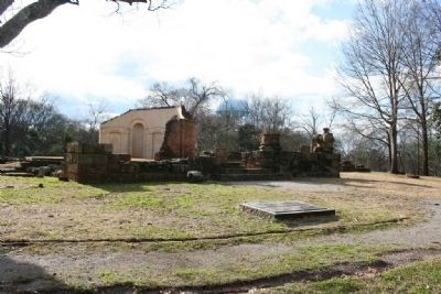
The Capitol in Tuscaloosa was designed by English-born architect, William Nichols, who served as State Architect from 1826 - 1832. Nichols also designed and built the campus of The University of Alabama.
Before coming to Alabama he had . . . — — Map (db m29117) HM
On 23rd Avenue at 17th Street when traveling south on 23rd Avenue.
Built in 1837 by skilled slave craftsmen, the Drish Mansion is notable for its unusual combination of Greek Revival and Italianate architecture. John Drish, a physician and contractor, assisted with building Bryce Hospital, old state capitol, and . . . — — Map (db m217201) HM
On West Broadway Avenue east of 1st Street, on the left when traveling east.
This is the oldest Russian-built church standing in the U.S. The center was built on the vessel or quadrilateral ground plan in 1825. When enlarged in 1894 wings were attached to form a cross, changing the structure to the Pskov or cruciform . . . — — Map (db m305667) HM
On E Street at 4th Avenue, on the left when traveling north on E Street.
Constructed in 1936,
this building remains on its original site.
It survived the March 27, 1964 earthquake.
Major renovation was completed in 1989.
—————————————————
The Anchorage Hotel
Built 1936
has been placed on the
National . . . — — Map (db m254236) HM
On West 10th Avenue west of N Street, on the left when traveling west.
The oldest house in Anchorage was originally built in Knik, Alaska, in 1913. Oscar Gill moved his home to Anchorage in 1916. An Iditarod Trail mail musher and three term mayor of Anchorage, Gill was speaker of the territorial House of . . . — — Map (db m173886) HM
On 4th Avenue at D Street, on the left when traveling west on 4th Avenue.
Store and residence built in 1915.
Only Victorian turreted structure in Anchorage.
In 1948, Mrs. Myrtle Wendler Stalnaker opened
Club 25 restaurant.
Withstood the 8.6 earthquake of March 27, 1964.
Original location was on the southwest . . . — — Map (db m254302) HM
On Tok Cut-Off Highway (Alaska Route 1) east of Gakona School Road, on the right when traveling west.
Providing food and lodging for travellers, roadhouses are and have been essential in Alaska's transportation history. As travel to the Interior, beginning in 1900 over trails to Fairbanks and Eagle from Valdez and later from Cordova increased, . . . — — Map (db m294719) HM
On Cushman Street, on the left when traveling north.
In November of 1907, a two-story wooden schoolhouse with a cupola was completed on this site. Over time, to accommodate growth, the schoolhouse was expanded and additions were made. In 1932, the school was destroyed by fire, but rebuit in 1934 as . . . — — Map (db m238727) HM
On Cowles Street at 5th Avenue, on the right when traveling south on Cowles Street.
In 1916 Arthur Williams began construction of this house, a variation of the
popular bungalow home featured in printed guides that came to Alaska. Windows,
doors, and some finishing items were ordered from Seattle and installed, so the
term . . . — — Map (db m257181) HM
On Jacobsesen Drive 0.2 miles north of Mt Roberts Street, on the left when traveling north.
Welcome to
Juneau
Yak'éi haat yeey.aadí
"It is good that you all have come."
Alaska's capital is steeped in history, Native heritage, art, and natural beauty. Juneau has something for everyone. This place is the homeland of Tlingit . . . — — Map (db m308259) HM
On Calhoun Avenue at Indian, on the left when traveling north on Calhoun Avenue.
A sum of $40,000 was authorized under the Public Building Act of 1910 and construction began in 1912. Governor Walter D. Clark held the first open house January 1, 1913.
State of Alaska
Governor Walter J. Hickel
Alaska Centennial . . . — — Map (db m181739) HM
On South Franklin Street, on the right when traveling north.
built September 16, 1913
has been placed on the
National Register
of Historic Places
by the United States
Department of the Interior — — Map (db m181762) HM
On 3rd Street at North Franklin Street, on the right when traveling west on 3rd Street.
has been placed on the
National Register
of Historic Places
by the United States
Department of the Interior
built • restored
1925 • 2000 — — Map (db m181759) HM
On Creek Street at Stedman Street, on the right when traveling north on Creek Street.
In spite of its more respectable Stedman Street address, this building — along with its Creek Street neighbors — was one of the earliest houses of prostitution, built soon after the Town Council banned prostitution to this side of the Creek. . . . — — Map (db m182042) HM
On Schoenbar Road south of Water Street, on the right when traveling south.
Businesses Flourished in Newtown with the Fleet of Fishing Boats
The old saying goes . . . A boat is a hole in the ocean where a skipper throws money
That's what made Northern Machine Works a long-lived success in Ketchikan's . . . — — Map (db m308970) HM
On Stedman Street south of Creek Street, on the left when traveling south.
Around 1900, adventurous Japanese pioneer George Ohashi came to Ketchikan and opened the New York Café on Front Street. This was the beginning of a three-generation Ohashi family career of entrepreneurial activities.
In 1907, Ohashi built this . . . — — Map (db m182044) HM
On Front Street, on the right when traveling north.
Tailor Pat Gilmore left Ireland in the early 1900s to seek his fortune in Alaska. He wisely invested his "grubstake" in the "Men's Emporium" on Dock Street in 1905. Within a year, he
brought his sweetheart Elizabeth "Lizzie" Guinan over. They . . . — — Map (db m181928) HM
On East Elmwood Avenue east of South Valley Way, on the left when traveling east.
COMMUNITY CENTER
You are in the administrative center of the Matanuska Valley Colony Historic District.
Today, some of the public buildings have been rehabilitated. The teacher[s'] dormitory is a hotel, the school serves as the . . . — — Map (db m254825) HM
On East Elmwood Avenue east of South Valley Way, on the left when traveling east.
DAVID R. WILLIAMS
ARCHITECT
David Reichart Williams, appointed
as chief architect for the Federal
Emergency Relief Administration,
planned 84 of the 100 resettlement
communities.
After researching Alaska's climate and
agricultural . . . — — Map (db m254829) HM
On East Elmwood Avenue east of South Valley Way, on the left when traveling east.
HISTORIC DISTRICT 1935-1936
The Historic District is a tribute to Franklin D. Roosevelt's New Deal, David R. Williams and the Colonists.
MATANUSKA COLONY COMMUNITY CENTER
Listed on The National Register of Historic Places . . . — — Map (db m254843) HM
On Katlian Street, on the left when traveling north.
This site possesses national significance in commemorating the history of the United States of America. The hall is the place of importance in the native community. The original chapter of Alaska Native Brotherhood built this hall in 1914 to serve . . . — — Map (db m133827) HM
On Lincoln Street at Baranof Street, on the right when traveling west on Lincoln Street.
Captain George Foster Emmons (1811-1884), commander of the USS Ossipee, sailed into the Sitka harbor with United States
and Russian Commissioners for the ceremony transferring the Alaskan territory to the United States on 18 October 1867.
Nearly . . . — — Map (db m118712) HM
On Lincoln Street at Monastery Street, on the right when traveling west on Lincoln Street.
Russians and Native Alaskans took the first tentative steps toward mutual understanding in the Russian Bishop's House. The bishop lived here alongside Tlingit students and Native and Kryol (mixed ancestry) men studying to become Orthodox priests. . . . — — Map (db m181607) HM
On Seward Street at American Street, on the right when traveling east on Seward Street.
This two-story, wood clapboard and gambrel roofed cottage-style house was constructed during the summer of 1916 by the United States Department of Commerce, Coast and Geodetic Survey. Prior to the purchase of Alaska by the United States from the . . . — — Map (db m181580) HM
On Lincoln Street at Monastery Street, on the right when traveling west on Lincoln Street.
Built about 1895, the Hanlon-Qsbakken house is on the National Register of Historic Places. It was home to three generations of the Hanion-Osbakken family, who trace their roots in Sitka to early Russian American days. The family held the property . . . — — Map (db m181588) HM
Near Lincoln Street at Monastery Street, on the right when traveling east.
Step across the street to Novo Arkhangelsk, Imperial Russian colonial capital of Alaska and a busy trade center known as the "Paris of the Pacific.” The Bishop's House is the most visible actual remnant of New Archangel. It was built in 1841-42 by . . . — — Map (db m181617) HM
On Lincoln Street at Monastery Street, on the right when traveling west on Lincoln Street.
has been designated a
Registered National
Historic Landmark
under the provisions of the
Historic Sites Act of August 21, 1935
This site possesses exceptional value
in commemorating and illustrating
the history of the United . . . — — Map (db m181596) HM
On Harbor Drive (Local Route F-99) at Maksoutoff Street, on the left when traveling west on Harbor Drive.
The 'Cottage-by-the Sea' was constructed in 1897 by Norwegian prospector Captain Hans Christian Pande. While Alaska was still a Territory, the W.P. Mills Company donated this house to the Sitka Woman's Club for a clubhouse, which led to the . . . — — Map (db m241980) HM
On Lincoln Street west of Finn Alley, on the right when traveling west.
The first Episcopal Church service in Sitka was held at the Presbyterian Chapel on Thanksgiving Day in 1896. The ground was broken for St. Peter's in 1899 and the first service in the new church was held on Thanksgiving Day of that year.
In . . . — — Map (db m290375) HM
On Lincoln Street, on the left when traveling east.
Saint Michael's Cathedral, a National Historic Landmark, is the central point of interest in historic downtown Sitka and is recognizable statewide as the most prominent symbol of the Russian colonial presence in Alaska. It was the main edifice of a . . . — — Map (db m181574) HM
On College Drive at Hillcrest Drive, on the right when traveling west on College Drive.
In 1910, the Sitka Industrial Training School closed for a year as contractors, volunteers and students replaced the original buildings with this state-of-the-art campus.
The New York City architectural firm of Ludlow and Peabody included . . . — — Map (db m308752) HM
On Monastery Street north of Lincoln Street, on the left when traveling north.
It would be more practical to … erect new [rental] houses … places built in the American way, that is frame houses … — Builder Peter Callsen in a letter dated 1887 to Father Vladimir Donskoi, advising the construction of new . . . — — Map (db m181613) HM
On Lincoln Street east of Barracks Street, on the right when traveling east.
This large frame house was constructed as a Russian residence about 1835. Although there has been some modification the building is thought to be the finest remaining example of Russian secular architecture in Alaska. — — Map (db m133829) HM
On Front Street at McKinnon Street, on the right when traveling west on Front Street.
The Patenaude/Grant Building, with its six-sided turret, is architecturally unique in Wrangell and provides a focal point for the east
side of Front Street. The building is historically
significant for its role as the center for city
government . . . — — Map (db m306542) HM
The United States Post Office and Customs House is a rectangular
structure 112' x 48', constructed in 1940-41 under the direction of the New
Deal's Public Works Administration. The building was completed during
the administration of President . . . — — Map (db m301447) HM
Near Mummy Cave Overlook Road 1.5 miles east of North Rim Highway (Indian Route 64).
Discovery of two well-preserved mummies led members of an 1880 archeological expedition to call this site Mummy Cave. The traditional Navajo name for this impressive setting is Tséyaa Kini — House Under Rock. Anasazi lived here for nearly a . . . — — Map (db m170537) HM
Built c.1892, this adobe structure once housed the Eagar School & later a bootlegger's still. Jepson purchased & enlarged the home in 1925 & moved his family from Alpine so his daughters could attend Round Valley High School. — — Map (db m36627) HM
On South Harless Street at West 8th Street, on the left when traveling north on South Harless Street.
On July 24, 1900, the Peter P. Rencher family arrived from Texas in four wagons & set about building their place in Eagar. Completed in 1913, this 5 bedroom, red brick Colonial Revival home was the crown jewel of their labors. — — Map (db m36618) HM
On North Main Street at East 3rd Avenue, on the right when traveling north on North Main Street.
This handsome example of Colonial Revival architecture was home to the manager of Round Valley's ACMIs. His wife, the area's first registered nurse, boarded expectant mothers & teachers from the high school. — — Map (db m36645) HM
Strong lines, flat roofs, smooth, unadorned wall surfaces, and asymmetrical facades are the main characteristics of the International Style of architectural design. In the United States, Richard Neutra was a top architect on this style. In a daring . . . — — Map (db m255934) HM
From its perch on the Painted Desert rim, this building has seen many changes. First built by Herbert Lore in the early 1920s, it was made with the resource most abundant in the area: petrified wood! Look above the double doors and you will see a . . . — — Map (db m255958) HM
On Apache Street at Silva Lane, on the left when traveling east on Apache Street.
Part of the Spanish migration from northern New Mexico to Round Valley, Faustin Baldonado & his son Pedro bought this adobe home w/1 foot thick walls in the 1890's. Originally a cantina, Pedro added rooms when he married in 1900. — — Map (db m36382) HM
On West Main Street (U.S. 180/191), on the right when traveling west.
Built c.1915 & originally called the Apache Theatre, this adobe movie house once showed silent flickers with a hand-cranked projector. Renamed the El Rio in 1937, Round Valley's first theatre is still operating with its original popcorn machine. — — Map (db m36381) HM
On Naco Road east of Ok Street, on the right when traveling west.
Bisbee architect F. C. Hurst designed this building in 1906. Hurst had also designed the Bisbee Central School in 1905.
Designed as a combination city hall and fire station, the design was titled "City Fire Hall Building". The original . . . — — Map (db m195860) HM
On Arizona Street, on the right when traveling north. Reported missing.
The Calumet and Arizona Mining Company developed a new town site in this area in 1905 to ensure the continued success of its mining interests. Using the "City Beautiful" model, the new town site – Warren – provided affordable housing. In 1909 this . . . — — Map (db m48574) HM
On Pan American Avenue (U.S. 191) at 10th Street, on the right when traveling south on Pan American Avenue.
Built in 1905 by El Paso and Southwest Railroad and the Calumet and Arizona Copper Co., and citizens of Douglas.
Expanded in 1916 to include a gym, a swimming pool and other recreational facilities with additional support provided by the . . . — — Map (db m195862) HM
On East 10th Street, on the right when traveling east.
Library Hall was built in 1901 and has served as a Town Hall, a Church, a School and a Library. The building was given to the City of Douglas in March, 1973, by the Phelps Dodge Corporation. — — Map (db m28298) HM
On North High Lonesome Road at West Gleeson Road, on the right when traveling south on North High Lonesome Road.
This jail, built in 1910, replaced a tiny wooden jail which once stood nearby. Constructed entirely of reinforced concrete, it has withstood a hundred years of weather, escape attempts, vandals, neglect, and pillagers (official and otherwise): It . . . — — Map (db m64206) HM
On South 3rd Street at East Toughnut Street, on the right when traveling south on South 3rd Street.
This 1881 double adobe was the site of Garet & Page's Wagon Shop. To your left was the charcoal yard. Charcoal was a primary source of heat for both forges and homes in the early 1880's. This block was part of "Hop Town", the heart of Tombstone's . . . — — Map (db m249782) HM
On East Allen Street at South 4th Street, on the right when traveling west on East Allen Street.
In 1879, Charles Brown opened the Mohave Hotel and one of the first "hash houses" in a tent on this corner. By 1880 he erected a two story adobe building with what was now called the Brown Hotel on the second floor. He had a kitchen large enough to . . . — — Map (db m249813) HM
On East Allen Street at South 4th Street, on the right when traveling east on East Allen Street.
The first business in Tombstone was opened on this corner by J.B. Allen. In 1879 it was purchased by Phillip Smith who opened the Pioneer Store and an agency of the Pima County Bank within the store. When Cochise County was established, Smith . . . — — Map (db m48514) HM
On East Toughnut Street at South 3rd Street, on the left when traveling west on East Toughnut Street.
In 1882, construction began on the Cochise County Courthouse. A kiln was constructed and brick makers were hired to make brick to construct the new courthouse. The cornerstone was laid on August 11, 1882 and the beautiful Victorian Building was . . . — — Map (db m249809) HM
On South 5th Street at East Toughnut Street, on the right when traveling south on South 5th Street.
Sal Anderson and Jacob Smith opened Russ House in December of 1880 as a boarding house and hotel. It was adobe with a broad veranda in view of the mines. It featured spring mattresses and one of the largest dining rooms in Tombstone. Russ House is . . . — — Map (db m249779) HM
On East Safford Street near North 6th Street, on the right when traveling west.
In 1881, Nellie Cashman aided in building an adobe structure which served as a combination church and rectory; the first Pastor was Father Emmanuel P. Schneider. Another church was built in 1882 and Bishop John B. Salpointe dedicated it in 1883. The . . . — — Map (db m27916) HM
On East Fremont Street (Arizona Route 80) at North 4th Street, on the right when traveling west on East Fremont Street.
Upon its completion on June 8, 1881 it became the largest, most elaborate theatre between El Paso, Texas and San Francisco, California.
Albert Schieffelin and William Harwood conceived and constructed a "first class opera house" for the citizens . . . — — Map (db m195859) HM
On North 3rd Street near East Safford Street ( Highway 80), on the left when traveling north.
The First Protestant Church in Arizona Territory under the direction of Endicott Peabody who conducted the first services in this building on June 18, 1882.
The structure is of hand formed adobe brick, stuccoed in 1970 to protect the adobe. The . . . — — Map (db m27920) HM
On East Allen Street, on the right when traveling east.
In September of 1880 a new adobe structure, the Grand Hotel, opened for business. It boasted all the luxury and comfort that 1880 had to offer. It displayed Brussels carpets, a black walnut baluster, walnut furniture and rare oil paintings. John . . . — — Map (db m48515) HM
On East Fremont Street (State Highway 80), on the right when traveling east.
Architect Frank Walker designed this building in Victorian style adapted to Western Territorial. It is constructed of fired red brick. It has been in continuous service since 1882 for Mayors, Marshals and official city offices. In the 1880s it . . . — — Map (db m27918) HM
On South Railroad Avenue near West Maley Street ( Route 186), on the right when traveling south.
Earliest panel brick style commercial building in Willcox. Was a meat market during prohibition. Listed on the National Register of Historic Places. — — Map (db m28175) HM
On East Route 66 at North Leroux Street, on the right when traveling west on East Route 66.
Because of its prime location, this corner, containing two lots, was one of the earliest in Flagstaff to be developed. Pioneer merchant J. R. Kilpatrick built New Town's sixth building here in December 1883. This wooden store building burned in the . . . — — Map (db m119945) HM
On East Aspen Avenue at North San Francisco Street. on East Aspen Avenue.
In 1888, David Babbitt, who had been running a lumber yard on this site, decided to construct a general store. Starting in late summer, he built a 35 X 70 foot structure on this corner, with the long side of the building running west along Aspen . . . — — Map (db m59504) HM
On West Cherry Avenue at North Beaver Street, on the right when traveling west on West Cherry Avenue.
In 1888, at the insistence of a group of Catholic
Laymen, The First Catholic Church in Flagstaff was built of brick on the south side of town. It was moved in 1911 to a temporary site just west of and across the street from the present permanent . . . — — Map (db m33336) HM
On East Route 66 west of South San Francisco Street, on the right when traveling west.
This building for many years was the home of J. J. "Sandy" Donahue's famous Senate Saloon. After earlier frame buildings on the site had been destroyed by fire, Donahue built the present brick structure in 1888.
An important figure in . . . — — Map (db m33266) HM
On South San Francisco Street at West Dupont Avenue, on the right when traveling south on South San Francisco Street.
Flagstaff Presbyterian Church
1892 - 1916
Flagstaff Federated Community Church
1916-1927
Mexican Methodist Mission – El Divino Redentor
United Methodist Church 1927-present
The First Presbyterian congregation of Flagstaff was . . . — — Map (db m33364) HM
On North San Francisco Street north of East Aspen Avenue, on the right when traveling north.
Original proprietors T.A. Riordan David Babbit Architect J. Kennedy Construction by Edivaros & Wiley Los Angeles National Registery of Historic Places Number FHR 107 — — Map (db m157598) HM
On West Aspen Avenue at North Sitgreaves Street, on the right when traveling west on West Aspen Avenue.
Flagstaff's first congregation was formed by the Methodists in 1883 and they raised the first church five blocks east of here in 1887. In 1906 they moved here and constructed this Gothic style building of locally quarried red sandstone. The . . . — — Map (db m178071) HM
The facility was originally constructed in 1925-1926 by the Atchison, Topeka and Santa Fe Railroad as the passenger station for the Flagstaff stop. The City of Flagstaff acquired the building in 1992 using city of Flagstaff Bed, Board & Booze tax . . . — — Map (db m78739) HM
On North San Francisco Street, on the right when traveling north.
The first building on this site was a wooden structure located at 22 N. San Francisco Street dating from the early 1890s. It was the home of a saloon with a cute name, The Office. (“Honey I can’t come home just yet, I’m still at The Office.”) . . . — — Map (db m59510) HM
On North Leroux Street, on the right when traveling north.
This building was constructed in 1909 by John W. Weatherford, the man who earlier built the adjacent Weatherford Hotel. It was the headquarters for the Arizona Overland Telephone Company, housing its offices and physical plant.
Construction . . . — — Map (db m59966) HM
On East Route 66 (U.S. 180) 0.1 miles east of North Park Drive, on the left when traveling east.
Built in 1931 by Dean Eldredge
Restored by Martin and Stacie Zanzucchi
Placed in the National Register of Historic Places
by the U.S. Department of the Interior on May 3, 1994
under the authority of Interior Secretary Bruce Babbitt
. . . — — Map (db m236440) HM
Bright Angel Hotel (below) was built around 1895 to serve stagecoach passengers. In 1905 the hotel became Bright Angel Camp, which eventually included cabins and an adjoining tent village.
In 1935 the Fred Harvey Company replaced the camp . . . — — Map (db m39510) HM
The Bright Angel Lodge, as it is known today, began as a cabin and several tents on this site in 1896. The central unit designed by Mary Jane Colter, was built in 1935. This lodge contains some of the oldest buildings in the Grand Canyon Village, . . . — — Map (db m39565) HM
Welcome to Grand Canyon and Desert View, where sun and sky, canyon and river gorge, tiered plateaus, and historic architecture blend into sweeping panoramas.
Constructed in 1932, the 70-foot tall Desert View Watchtower provides visitors from . . . — — Map (db m250584) HM
Now known as Phantom Ranch, this area along the Bright
Angel delta first gained attention as a tourist camp under the
name Rust's Camp. In 1902, David Rust began the planting
of fruit trees and cottonwoods and the
building of a camp for . . . — — Map (db m310656) HM
Build a structure that provides the widest possible view of Grand Canyon yet harmonizes with its setting: this was architect Mary Colter's goal when the Fred Harvey Company hired her in 1930 to design a gift shop and rest area here at Desert View. . . . — — Map (db m39616) HM
Near Desert View Drive (Arizona Route 64) 21.5 miles east of South Entrance Road.
Mary Colter's Desert View Watchtower creates an illusion of age. Concealed within the tower is an entirely different reality. Workers built a concrete and steel reinforced superstructure and then applied a veneer of native stone. The weathered . . . — — Map (db m169439) HM
Completed in 1935, Bright Angel Lodge was designed and built under the direction of Mary Colter, Fred Harvey company's celebrated Southwest architect. Colter's penchant for rustic designs and her attention to detail led to the creation of this . . . — — Map (db m250419) HM
This cabin is the only remaining building from the early pioneer settlement era of Grand Canyon Village. Built on this site in 1895 by William Owen "Buckey" O'Neill, the two-room office and bunkhouse - complete with v-notched logs, rough mortar . . . — — Map (db m250421) HM
On El Tovar Road at Village Loop Drive, on the right when traveling west on El Tovar Road.
The Grand Canyon National Park Superintendent's Residence is a National Park Service Rustic style building. It was designed in 1921 by Daniel Ray Hull, Chief Landscape Engineer for the National Park Service Branch of Plans and Designs, as the park's . . . — — Map (db m250416) HM
A rich architectural history awaits as you explore Grand Canyon Village. Eclectic in nature, the village is a mix of early pioneer, Santa Fe Railroad, and National Park Service structures. Entrepreneurial-pioneers started building here in the early . . . — — Map (db m95934) HM
On El Tovar Road 0.1 miles north of Village Loop Drive, on the right when traveling west.
Hopi House opened to the public in 1905. In an era when most architects were men, it was Mary Elizabeth Jane Colter's first building. The 36-year-old Colter enlisted the help of local Hopi craftsmen to build Hopi House, using locally quarried . . . — — Map (db m236334) HM
Near Fire Road 307, 1.5 miles east of Coconino Rim Road, on the left when traveling east.
Hull Cabin Historic District, built circa 1890, has been placed on the
National Register
of Historic Places
by the United States
Department of the Interior. — — Map (db m310705) HM
On Desert View Walkways north of Desert View Road, on the right when traveling north.
Mary Colter's attention to detail is reflected in every element of the Desert View Watchtower.
Each rock and painted wall is intended to convey meaning. Colter used ornamental details, seemingly haphazardly, to create an added charm of the . . . — — Map (db m285542) HM
Constructed of locally quarried Kaibab limestone, Lookout Studio appears as if it grew out of the canyon wall. In 1914, Fred Harvey company took a bold step to compete against Kolb Studio (just west of here). They asked Mary Colter to design a . . . — — Map (db m250420) HM
Near Grand Canyon Highway (Arizona Route 67) 43 miles south of U.S. 89A.
When Grand Canyon became a national park in 1919, the North Rim was scarcely developed. While the South Rim had grand hotels and many visitor programs and services, the hard-to-reach North Rim had only rustic tent cabins for 40 guests. The National . . . — — Map (db m163289) HM
Near Grand Canyon Highway (Arizona Route 67) 43 miles south of U.S. 89A, on the left when traveling south.
Under the supervision of the Utah Parks Company and architect Gilbert Stanley Underwood, work crews labored to build a lodge that harmonized with its surroundings. Advertisements for this "Hotel in the Wilderness" boasted that it "seems to have . . . — — Map (db m163552) HM
Near Grand Canyon Highway (Arizona Route 67) 43 miles south of U.S. 89A, on the left when traveling south.
A fire consumed the main lodge building at the height of the Great Depression. The September 1, 1932, fire claimed no lives but left only stones. For four years the ruins of the Grand Canyon Lodge stood undisturbed, silhouetted eerily against a . . . — — Map (db m163553) HM
Flagstone walls and a roof made from earth, this partially dugout building was common on most pioneer farms and ranches. Before modern electric appliances, the cellar acted as a refrigerator to keep vegetables from freezing in the winter, butter and . . . — — Map (db m289948) HM
Rock Bolts
Since Navajo sandstone tends to fracture vertically, rock bolts lock rock slabs together, thereby minimizing rock falls into the canyon. These bolts extend from 45 to 75 feet (14-23 meters) into the canyon wall. They are assembled . . . — — Map (db m40346) HM
It took decades of searching for a perfect location before Marguerite Brunswig Staude's inspiring modern Catholic church could be built. The Chapel of the Holy Cross is an extraordinary architectural achievement, designed by architects Anshen & . . . — — Map (db m94811) HM
21907 entries matched your criteria. Entries 201 through 300 are listed above. ⊲ Previous 100 — Next 100 ⊳