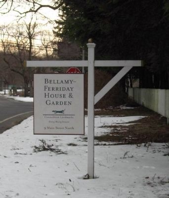
On Main Street South (Connecticut Route 61) 0.1 miles north of Sunny Ridge Road, on the left when traveling north.
Marker Front:
The spring session of the 1703 General Assembly granted to the town of Woodbury the right to enlarge its bounds. Negotiations with the Indian inhabitants were successfully concluded and in 1710 a deed of sale, signed by . . . — — Map (db m26488) HM
On Main Street South (Connecticut Route 61) at The Green, on the left when traveling north on Main Street South.
A Tribute to the Valor
Of The
Men of Bethlehem
Who Fought For
Freedom and Humanity
Civil War
1861 – 1865
Frederick Adkins • Joseph Boyce • Gideon D. Crane • William B. Crane • Francis Dugan • John Ferry • George W. . . . — — Map (db m26491) HM
On Main Street South (Connecticut Route 61) at West Road, on the left when traveling north on Main Street South.
Roll of Honor
Dedicated to the men and women of the town of Bethlehem
who served their country during
the Korean War June 25, 1950 – January 3, 1955
Adams, Glen C., Sr. • Anderson, Richard O. • Bate, Curtiss • Brown, Raymond W. • Bosko, . . . — — Map (db m26559) WM
On Main Street South (Route 61) at West Road, on the left when traveling north on Main Street South.
In memory of
the citizens of Bethlehem
who fought for the defense of our rights
and the independence of our country
1776 – 1781
Andrew Martin, Capt. • Enos Hawlley, Lieut. • Nat’h Chapman, Ens • Alex’ Kasson, Clerk • John Steel, . . . — — Map (db m26561) HM
On Main Street South (Connecticut Route 61) at West Road, on the left when traveling north on Main Street South.
Roll of Honor
Dedicated to the young men and women of this community
who by their patriotism and loyalty served God and country
during the Vietnam War, December 22, 1961 – May 7, 1975
Adams, Glen R. • Albert, J. Rodney • Banks, . . . — — Map (db m27719) HM
On Main Street South (Connecticut Route 61) at West Road, on the left when traveling north on Main Street South.
Dedicated to
the men of Bethlehem
who by their devotion and loyalty
preserved our country
in the War of 1812
Allen, James • Baldwin, Amos • Barnum, Eli • Beebe, Issac • Beecher, Lyman • Burton, Oliver • Coe, Daniel • Church, Samuel • . . . — — Map (db m26562) WM
On Main Street South (Connecticut Route 63) at West Road, on the left when traveling north on Main Street South.
Erected by the people of
the town of Bethlehem
to commemorate the patriotism
and loyalty of those who served
their country during World War II
* Peter S. SprouleClifford Adams • Leon W. Banks • Thomas C. Bate, Jr. • Samuel . . . — — Map (db m26558) HM
On Main Street (U.S. 6) at Park Street, on the right when traveling west on Main Street.
Constitution Oak
In 1902, Connecticut held a constitutional convention. Each town was given a pin oak to honor the event. This tree is one of the few remaining. — — Map (db m28119) HM
On Park Street at Main Street (U.S. 6), on the right when traveling south on Park Street.
First Congregational Church of Plymouth
The First Congregational Church had its beginnings as the Ecclesiastical Society of Northbury, established in 1739. The first meetinghouse was completed during the 1760s. The second meetinghouse was . . . — — Map (db m90830) HM
On Greystone Road Ext. 0.2 miles east of Greystone Road, on the right when traveling east.
Eli Terry was born April 13, 1772. In 1793 Eli Terry moved to
Plymouth where he was involved in the production of wooden
movement clocks. Due to Terry's manufacturing techniques,
clocks became affordable to the American household. In . . . — — Map (db m90894) HM
On Main Street (U.S. 6) at Todd Hollow Road, on the right when traveling west on Main Street.
Plymouth
First settled in the 1720's on land acquired from the Tunxis Indians, the Town of Plymouth, originally named Northbury, was incorporated in 1795. It includes the communities of Plymouth, Terryville, Pequabuck (formerly Susanville), East . . . — — Map (db m28095) HM
On Park Street at Main Street (U.S. 6), on the right when traveling south on Park Street.
Plymouth Burying Ground
1747
National Register of Historic Places
Here lie buried Veterans of the French and Indian War, the Revolutionary War, and the War of 1812.
The gravestones are in rows running north and south. The bodies were placed . . . — — Map (db m90734) HM
On Park Street at Main Street (U.S. 6), on the right when traveling south on Park Street.
Plymouth Center School
Plymouth Center School (right side of top photo) stood on this site from 1900 to 1952. It was built for $6,330, and did not include indoor plumbing. There was an outhouse with separate sections for the boys, girls, and . . . — — Map (db m90736) HM
On North Street near Park Street, on the left when traveling north.
[ south side ]
Lincoln
Erected to Perpetuate the Memory
Of Those Who Lost Their Lives In
The War of 1861
Chaplain James Averill • Lieut. E. J. Candee • Lieut. H. Hubbard • Sgt. W.A. Bishop • Sgt. H.D. Bishop • Sgt. D.B. Wooster • . . . — — Map (db m28097) HM
On North Street at Park Street, on the left when traveling north on North Street.
Site Of
St. Peter’s
Church
1796 - 1915
(panel next to the marker)
St. Peter’s Episcopal Church
St. Peter's Episcopal parish was organized in 1740 by eleven families who longed for their beloved Church of England. They built . . . — — Map (db m90730) HM
On Park Street north of U.S. 6, on the left when traveling north.
This bell came from the Stoughton Building, the structure with the cupola and windvane on your right. It was named after the family of Frederick Stoughton, who donated funds for its renovation in the 1950s.
The inscriptions on the bell . . . — — Map (db m304241) HM
On Main Street at Main Street, on the right when traveling north on Main Street.
Dorence Atwater grew up in the Terryville section of Plymouth. He enlisted in the union Army in 1861 and was captured by Confederate forces in 1863. In February 1864, he was moved to the infamous Andersonville prison camp in Georgia, . . . — — Map (db m28053) HM
On East Plymouth Road at Marsh Road, on the right when traveling north on East Plymouth Road.
The History of the East Plymouth and St. Matthew's Cemetery
East Plymouth (also known as East Church), located at the boundary convergence of Bristol, Plymouth and Harwinton, became a distinct community largely because of events occurring in . . . — — Map (db m90893) HM
On North Main Street, on the right when traveling north.
1917-1918
1941-1945
Dedicated to the loyal sons and daughters of Plymouth, Connecticut, who served their country during World Wars I and II. Erected though the generosity of Judge Andrew W. Granniss, 1953 — — Map (db m29861) HM
On Main Street (U.S. 6) at North Main Street, on the right when traveling west on Main Street.
Dedicated In
Memory Of The
Men And Women
Of The Town Of
Plymouth, Conn.
Who Served
Their Country In
World War I
World War II
Korean War
[ center tablet ]
The Following
Made The
Supreme Sacrifice
World War . . . — — Map (db m28343) WM
On Main Street at North Main Street, on the right when traveling west on Main Street.
Vietnam
1961 – 1975
Six Men Gave Their Lives
Dunn, Richard E. • Esten, John E. • Manarel, Charles R. • Mclellan, Arthur C. • Micloskey, Ken E. • Mitchell, Robert W.
Acker, Robert E. • Albert, Paul A. • Albright, Barry L. • Alexander, . . . — — Map (db m77669) HM
On North Main Street at Hillside Avenue, on the left when traveling north on North Main Street.
[ inscribed on the west side of the granite obelisk ]
Soldiers
[ north plaque ]
Capt. Edward H. Mix Co. B 16th C.V. Drowned in Albemarle Sound March 7, 1864, Aged 25
Capt. Edwin Post Co. B U.S.C.T. Killed at Deep . . . — — Map (db m28055) HM
On Main Street (U.S. 6) at Benedict Street, on the right when traveling west on Main Street.
The Eli Terry Jr. Water Wheel is believed to be one of only two water wheels of its type in the United States. Originally it supplied power to the Terry Clock Shop located on this property. In the early 1830's the manufacture of locks began. By . . . — — Map (db m90349) HM
On South Main Street at Agney Avenue, on the left when traveling south on South Main Street.
The Old Terryville Cemetery features the graves of over 120 of Terryville's earliest residents. The earliest grave is believed to be Francis A. Lewis, who died May 5th, 1832 at the age of one year and five months. The families interred here . . . — — Map (db m90665) HM
On Main Street South (U.S. 6) at Park Road, on the right when traveling north on Main Street South.
West face:
In memory of Woodbury soldiers who died in the Rebellion of 1861.
Above the main inscription are the names of one first lieutenant, two second lieutenants, and
Commissary Sergt.
Walt J. Orton, Oct. 7, '64
Serg'ts . . . — — Map (db m19504) HM
On Main Street South (U.S. 6) at Park Road on Main Street South.
In memory of
The Sons of Old Woodbury
Those who gave their lives in war
Those who lived to build a new nation
Those who are known
Those who must remain ever nameless
Bicentennial
of
the American Revolution
1776 1976 . . . — — Map (db m19226) HM
On Main Street South (U.S. 6) at Park Road, on the left when traveling north on Main Street South.
In 1659 citizens of Stratford purchased from the Pegasset Indians the land, then called Pomperaug Plantation, that is now occupied by Woodbury, Southbury, Roxbury, Bethlehem and parts of Washington, Middlebury and Oxford. It was re-named Woodbury in . . . — — Map (db m17607) HM
On Elm Street north of Park Street, on the left when traveling north.
Built in 1870 to house offices for the Seth Thomas Clock Company, including Seth Thomas' private office. The American Legion purchased it in 1925. The post was designated the "Clifford R. French Post" in honor of the first Thomaston resident to . . . — — Map (db m304240) HM
On East Main Street at North Main Street, on the right when traveling west on East Main Street.
In Loving Memory Of
Fr. Michael J. McGivney
1852 – 1890
Founder of the Knights of Columbus
March 29, 1882
Pastor of St. Thomas Church, Thomaston
1884 – 1890
Founder of the Atlantic Council No. 18
April 8, 1885
This . . . — — Map (db m28121) HM
On South Main Street north of Northfield Road ( Route 254), on the right when traveling north.
Seth Thomas came to Plymouth Hollow in 1813 to manufacture clocks. By 1860 his company was producing 40,000 clocks annually. These clocks were considered the "Tiffany's" of CT clock making. This building was erected in 1915 and became . . . — — Map (db m304232) HM
On Main Street west of Father McGiveney Way, on the right when traveling west.
The American Hall built c. 1867. Clara Barton and Dorence Atwater spoke here on May 29, 1867. First brick bldg in town. The first meeting of the corporators of the Thomaston Savings Bank was held here on Aug 14, 1874. It is also the site of the . . . — — Map (db m304238) HM
On Main Street at East Main Street, on the right when traveling west on Main Street.
The Morse Block, built in 1876 was owned by Miles Morse. It was the first large brick building in Thomaston. Destroyed by fire in 1877, it was rebuilt in 1878. Miles Morse was a Thomaston clock maker who later became a knife maker in town. — — Map (db m304239) HM
On Clay Street at Main Street, on the right when traveling south on Clay Street.
Originally part of the Farmington Proprietors' purchase in 1684 of Mattatuck Plantation, the Thomaston area achieved independence in 1739, being set off as the Northbury Parish. In 1780 Northbury and Westbury united to form Watertown. By 1795 . . . — — Map (db m28139) HM
On Main Street at Park Street, on the left when traveling south on Main Street.
Erected 1902
Erected By
C.L. Russell Post, No. 68,
G.A.R.
And Citizens,
In Commemoration Of The
Soldiers Who Served In
The Civil War
[ battle names inscribed on the column ]
Cold Harbor • Gettysburg • Cedar Creek • . . . — — Map (db m28135) HM
On Main Street at Park Street, on the left when traveling south on Main Street.
Town Of Thomaston
dedicated in honor
of those who served
[ far left tablet ]
Wars And Conflicts
Braucci, Andrew D. Vietnam • Dipesa, John A. Persian Gulf • Duffany, Lawrence F. Vietnam • Grabherr, Edward T. Vietnam • . . . — — Map (db m28575) WM
On South Main Street at Elm Street, on the right when traveling north on South Main Street.
1917 Honor Roll 1918
In Memory of The Heroes of
Thomaston
Who Made The Supreme Sacrifice
in the
World War
Clifford R. Fench • Alexander Crecorek • George V. Lawson • Adam Simoski • William J. Ryan
Erected By
Thomaston Tercentenary . . . — — Map (db m90381) WM
On Main Street at Park Street, on the left when traveling south on Main Street.
Roll of Honor
Dedicated by the Town of Thomaston
To Those Who Served Their Country
In The World War
( column 1 )
Army
Emil A. Albicker • Malcolm E. Aldrich • Alexander Anderson • Harold F. Anderson • Sherwood Vernon Ariel • Ardis E. . . . — — Map (db m28137) HM
On Main Street at East Main Street, on the right when traveling north on Main Street.
Thomaston’s Three Tower Clocks
In 1872 Seth Thomas Clock Company began manufacturing Tower Clocks. Considered to be a sample of high quality workmanship and an ingenious mechanical feat, Tower Clocks are an architecturally important finger-print of . . . — — Map (db m90351) HM
On DeForest Street (U.S. 6) at Veterans Hill, on the right on DeForest Street.
(Front):In commemoration of the patriotism and valor of the men of Watertown who, in the hour of peril, offered their lives that the republic might live, thus winning the gratitude of their fellow-citizens, the admiration of succeeding . . . — — Map (db m18865) WM
Near Main Street (Connecticut Route 63) at French Street, on the right when traveling north.
[ west side ]
To commemorate the suffering and torture inflicted by the Indians upon Jonathan Scott and Hannah Hawkes, his wife, the first permanent settlers of Watertown, this memorial is erected by the Waterbury and Watertown Chapters . . . — — Map (db m31165) HM
Near DeForest Street (U.S. 6) 0.1 miles west of Main Street ( Route 63).
This tablet is erected in grateful recognition of the generosity and public spirit of William J. Munson who gave this park to Watertown in memory of his wife. — — Map (db m18856) HM
Near Main Street (Connecticut Route 63) at French Street, on the right when traveling north.
Revolutionary War Soldier
Michael Dayton
Captain of Connecticut
Born June 4, 1722
Died Sept. 22, 1776
Placed by
Sarah Whitman Trumbull
Chapter NSDAR May 1996 — — Map (db m31164) HM
Near Main Street (Connecticut Route 63) at French Street, on the right when traveling north.
Sacred to the Memory
of the Rev'd John Trumbull
senior Pastor of the Church of Christ
in Westbury
And one of the Fellows of the Corporation
of Yale College;
Who died December 8th AD 1787
In the Seventy third Year of his Age,
And . . . — — Map (db m31162) HM
On Main Street (Connecticut Route 63) at French Street, on the right when traveling north on Main Street.
[ marker on the left column ]
Soldiers of 1776
Ensign Theophilus Baldwin
Col. Aner Bradley
Benaja Bryan
David Buckingham
Thomas Cole
Younglove Cutler
Samuel Dayton
Dr. John Elton
Jonathan Garnsey
Capt. Joseph Garnsey . . . — — Map (db m26473) HM
On DeForest Street (U.S. 6) 0.1 miles south of Veterans Hill, on the right when traveling south.
The local Paugasuck Indians sold this area of land to Thomas Judd and thirty-five other proprietors in 1684. The First Ecclesiastical Society of Westbury was formed in 1738 and in 1780 Westbury separated from Waterbury, was named Watertown, and soon . . . — — Map (db m18931) HM
On DeForest Street (U.S. 6) at Veterans Hill on DeForest Street.
Killed in Action
1950 Korea 1955
All Returned
1964 Vietnam 1973
Argenta, Allen C. • Childs, Christopher J. • Greenwell, Joseph E. • Palmer, Douglas T. — — Map (db m19664) WM
On DeForest Street (U.S. 6) at Veterans Hill, on the left when traveling north on DeForest Street.
In Memory of the Sacrifices
And the Efforts of the
Citizens of This Town
Who Served in World War II
( 1236 names are listed. The following were Killed In Action )
Atwood, Ellsworth B. ★
Baculus, Edward ★
Baldwin, . . . — — Map (db m120292) WM
On DeForest Street (U.S. 6) at Veterans Hill, on the right when traveling east on DeForest Street.
Memorial to our sons and
daughters who served their country in the World War 1914-1918
Dedicated in grateful recognition by the people of Watertown May 30th 1921
Earl D Anderson • J H Haydn Bryan • . . . — — Map (db m231283) WM
On Main Street (Connecticut Route 73) 0.1 miles north of Hillside Avenue, on the right.
Dedicated to the honor and sacrifice of our men and women who served our country in World War II
Honor Roll
(646 names are listed. 23 with stars who did not return.)
Erected to record their names by the citizens . . . — — Map (db m19227) WM
On Main Street South (U.S. 6) at Sherman Hill Road ( Route 64), on the right when traveling north on Main Street South.
In Memory Of
George Washington
1732 – 1799
These Trees Were Planted By The
Daughters Of The Cincinnati
To Commemorate The Bi-Centennial
1932 — — Map (db m29501) HM
On Main Street (U.S. 6) 0.2 miles north of Sherman Hill Road ( Route 64), on the right when traveling north.
In past times the ancient paths in Connecticut were formed by large animals as they moved with the seasons and migrated to salt deposits. The Native Americans followed these same paths as they hunted these animals, traded with other tribes and also . . . — — Map (db m112637) HM
On Main Street S (U.S. 6) at Hollow Road, on the right when traveling north on Main Street S.
This school was also called the South Central School or "the school under the rocks" and was one of 14 District schools in Woodbury. The present building was built in 1867 by George Clark and was used until discontinued in 1899 when students were . . . — — Map (db m210343) HM
On Main Street S (U.S. 6) at Park Road, on the right when traveling north on Main Street S.
This American Liberty Elm was named after "The Liberty Tree:
Our Country's first Symbol of Freedom." On the morning of
August 14, 1765, the people of Boston awakened to discover two
effigies suspended from an elm tree in protest of the hated . . . — — Map (db m210336) HM
Near Main Street South (U.S. 6) at Sycamore Ave ( Route 317).
In memory of long time neighbor and friend
Malcolm “Mac” Baldrige
1922 – 1987
Soldier, Industrialist,
Team Roper, Member Cowboy Hall of Fame,
United States Secretary of Commerce 1981-1987,
Recipient United States . . . — — Map (db m19502) HM
On Main Street S (U.S. 6) near Park Road, on the right when traveling north.
In Honor of the Men and Women of Woodbury
Who Served During the Korean Conflict Era
1950 -1955
Abbott, Frank K. · Clark, John E. · Cole, Norman F. · Cole, Walter H. · Cowles, Robert B. · Creighton, E. Donald · Deschino, John J. · Drakeley, . . . — — Map (db m210338) WM
On Main Street S at Park Road, on the right when traveling north on Main Street S.
In Honor of the Men and Women of Woodbury
Who Served During the Vietnam War Era
1961 -1975
Alba, Louis G. · Anderson, Mark E. · Bacon, William, Jr. · Barry, Kevin G. · Benjamin, John D. · Brown, Edward C. · Brown, Thomas M. · Brownell, Thomas . . . — — Map (db m210342) WM
On Main Street South (U.S. 6) near Park Road, on the right when traveling north.
In honor of
the men of Woodbury
who rendered service in
the World War
1917-1919
Ralph G. Adams • William M. Adams • Gustave Daniel Anderson • George H. Barnes • Harry J. Bauch • Howard D. Beardsley • Edson J. Bennett • William B. Bennett, . . . — — Map (db m19505) HM
On Main Street South (U.S. 6) near Park Road, on the right when traveling north.
[Left Tablet] In honor of the men and women of Woodbury who rendered service World War II 1941-1945
Abbott, H. Ellsworth • Cole, Francis P. • Giggey, Kempton L. • Lundin, Frank G. • Atwood, Gilbert • Cole, Ralph E. • Gillis, Carter E. . . . — — Map (db m19853) HM
On Saville Dam Road (Connecticut Route 318) east of Reservoir Road ( Route 219), on the right when traveling east.
The Saville Dam and Barkhamsted Reservoir supplies water to the greater Hartford area and brought big changes to the towns of Barkhamsted and Hartland.
Before the dam came, the valley was mostly farms and a few small villages along the east . . . — — Map (db m290893) HM
On Pleasant Valley Road (Route 318) at Beach Rock Road, on the right when traveling north on Pleasant Valley Road.
Barkhamsted
Named for Barkhamsted in Hertfordshire, England, this area was part of the Western Lands granted by the proprietors of Windsor to 108 persons of that town in 1732. The first highway through the town was the New Country Road, better . . . — — Map (db m29849) HM
On Legion Road 0.1 miles south of West River Road, on the right when traveling south.
To honor the men of
Camp White
Company 106
established 1934
Civilian Conservation Corps
1933-1942
created by
President Franklin D. Roosevelt
renewing the country’s natural resources
and challenging the human spirit
of . . . — — Map (db m102082) HM
Near Kiwanis/Warner Road just east of Greenwoods Road.
Created to ease the financial strains of the Great Depression, the Civilian Conservation Corps, or CCC, employed over 3,000,000 young men nationwide between 1933-1942. The 21 camps in Connecticut provided barrack-style food and housing along with . . . — — Map (db m140638) HM
Dedicated to
Henry Robinson Buck
1876-1934
whose friendly nature and
work for public recreational
areas endeared him to all
his associates.
This trail was located by him
and built by the Civilian
Conservation Corps. . . . — — Map (db m102032) HM
On Pleasant Valley Road (Connecticut Route 318) at Beach Rock Road, on the right when traveling north on Pleasant Valley Road.
This bell hung in the Hollow Church which was relocated during construction of the Compensating Reservoir. It was cast in Hartford, CT in 1834.
Dedicated 1997
These boulders were provided by the . . . — — Map (db m29848) HM
On River Road (Connecticut Route 181) 0.2 miles south of Pleasant Valley Road ( Route 318), on the right when traveling south.
William Wallace Lee
June 20, 1828 — Sept. 14, 1903
This memorial is erected by the Masonic Veterans Association of Conn. of which body he was venerable master for twenty eight years — — Map (db m289656) HM
On West River Road 1.5 miles north of Route 318, on the right when traveling north.
In this Area in the Past.....
The Austin Hawes Memorial Campground is located in an area once known as the “Greenwoods,” where until the late 1700’s large pine and hemlock trees grew along the Farmington River. From 1800 to 1942 . . . — — Map (db m102111) HM
On Pleasant Valley Road (Connecticut Route 318) at Beach Rock Road, on the right when traveling north on Pleasant Valley Road.
The
Barkhamsted Center Cemetery
The Hollow Cemetery
and the
Tiffany Private Cemetery
Removed from their former locations to
this site. Dedicated to the memory of the
known and the unknown dead.
This new Barkhamsted Cemetery has . . . — — Map (db m29850) HM
On East River Road 1.7 miles south of Route 20, on the left when traveling south.
Who Lived Here ?
James Chaugham (a Native American who was, according to his granddaughter, a member of the Narragansett Tribe) and his wife, Molly (of European descent), lived in a village located here for fifty years,
in what became Peoples . . . — — Map (db m102323) HM
About a dozen cellar holes dot the hillside of
Ragged Mountain.
Some, like the one before you, are clearly marked
with foundations made of stone quarried from
nearby bedrock, similar to the stone located directly
behind this . . . — — Map (db m112227) HM
You are now looking into the Lighthouse Village cemetery. The unmarked, upright field stones
designate the final resting places of many who lived in the community, including the founding couple,
James Chaugham, a Native American, and Molly . . . — — Map (db m102325) HM
Charcoal production was an important industry in northwestern Connecticut in the nineteenth century.
Before Pennsylvania coal became readily available, the iron forges in Litchfield County were reliant upon locally produced charcoal as . . . — — Map (db m112226) HM
The residents of the Lighthouse community were largely self-sufficient
when it came to their subsistence. Bone fragments found in their
fireplaces show that they ate deer and small wild game. Gun flints (used
in flint-lock rifles) and gun . . . — — Map (db m112198) HM
The residents of the Lighthouse community were able to supply many of their needs here on Ragged Mountain. You saw how the foundations of some of their homes were constructed with stone; the people of the Lighthouse quarried some of that stone . . . — — Map (db m112229) HM
On Pleasant Valley Road (Connecticut Route 318) at Beach Rock Road, on the right when traveling north on Pleasant Valley Road.
[ north side ]
1776
The Tribute
Of The
People Of Barkhamsted
To The
Memory Of Her Sons
And Daughters
Who Fought To
Establish Defend And Preserve
The Nation
---
Erected 1897
[ lower plaque ]
World War . . . — — Map (db m29847) WM
On Pleasant Valley Road (Connecticut Route 318) at East River Road, on the right when traveling east on Pleasant Valley Road.
In the 19th century, water power
created the industrial heartland of the Barkhamsted area here.
Doolittle Wagon Shop
The Doolittles built this shop and made wagons and carriages at this site from 1830 to 1869. Many Doolittle . . . — — Map (db m290146) HM
Careful inspection of the ground behind this sign reveals a raised circular mound about 30 feet in diameter, surrounded by a narrow, circular depression. The unnatural shape and bits of charcoal under the leaf layer are the telltale signs of an old . . . — — Map (db m141061) HM
On Riverton Road (Connecticut Route 20) at Robertsville Road, on the right when traveling south on Riverton Road.
In Honor of Lambert Hitchcock, (1795 – 1852), this village was once known as Hitchcocks-ville. Here he originated his chairs & cabinet furniture with Sheraton influence and in 1826 built his water powered mill employing a hundred persons. In 1866 . . . — — Map (db m29887) HM
On East River Road north of Greenwoods Road, on the right when traveling south.
Matthies Grove-Peoples Forest
Farmington River Wild & Scenic
Before European Settlement
A thriving population inhabited this river valley for thousands of
years. Across the field from this kiosk, in an area now known as . . . — — Map (db m289855) HM
On East River Road 1.7 miles south of Route 20, on the left when traveling south.
This portion of the Peoples Forest
was given by the Connecticut
Daughters of the American Revolution
1929
Near this spot was the
site of an Indian Village — — Map (db m93827) HM
On Main Street (Connecticut Route 20) at School Street, on the left when traveling east on Main Street.
-- Riverton --
Northeastern Gateway to the Litchfield Hills
Old Hartford – Albany Stage Route
Home of Hitchcock Chairs
One Mile to Peoples Forest
1 1/2 Miles to Site of Barkhamsted Lighthouse
Home Of L.A. Cooke War Governor
Col. Justin . . . — — Map (db m29856) HM
On Riverton Road (Connecticut Route 20) at School Street, on the right when traveling east on Riverton Road.
In this Area in the Past.....
Since the 1820’s Riverton has been a vibrant part of the town of Barkhamsted.
Riverton is located at the confluence of the Farmington and Still Rivers, which
at one time provided the opportunity for water power . . . — — Map (db m102107) HM
On East River Road 1 mile north of Ripley Hill Road ( Route 318), on the right when traveling north.
[ panel 1 ]
Welcome to Squire's Tavern
Home to the Barkhamsted Historical Society
and the Farmington River Coordinating Committee
The Barkhamsted Historical Society
Squire's Tavern, like the nearby river, has a story to . . . — — Map (db m31204) HM
Near Greenwoods Road north of East River Road when traveling north.
Elliott B. Bronson (1858-1931) of Winchester Center, Connecticut and a two term legislator was involved in the purchase of thousands of acres across the state which became Connecticut State Park and Forest lands. He was the land agent who worked to . . . — — Map (db m289658) HM
Imagine Northwest Connecticut completely bare of trees. In 30-40 year cycles, from the 1700s to the 1920s, entire hillsides of young trees were cut and cleared. This wood was made into charcoal, the preferred fuel of Connecticut’s brick, iron and . . . — — Map (db m140780) HM
On South Canaan Street 0.1 miles south of Sand Road, on the left when traveling south.
In Memoriam
Joseph Deferari
Born July 19, 1894
Died January 20, 1969
Who Donated This Land
For The Principles Of
God, Country And Freedom
To The Veterans
Who Served That Purpose — — Map (db m41852) WM
On East Main Street (U.S. 44) at Granite Avenue, on the right when traveling west on East Main Street.
[ left plaque ]
North Canaan Honor Roll
Korean Conflict June 27, 1950 to July 27, 1954
Amphlett James • Bechetti Frank • Baldesseri Remo J • Baldwin Lester • Ball Bert J 3rd • Bartlett Gerald L • Bathrick Richard G • Beaujon Leroy Y • . . . — — Map (db m42039) WM
On East Main Street (U.S. 44) at Granite Avenue, on the right when traveling west on East Main Street.
[ east side ]
This Tablet Is Reverently
Inscribed to the Memory Of
Those Who Went From That Part
Of The Town of Canaan Which
Later Became North Canaan, And
Who, With Valor and Patriotism,
Defended the Flag of Our Country
In . . . — — Map (db m42098) HM
304 entries matched your criteria. The first 100 are listed above. Next 100 ⊳