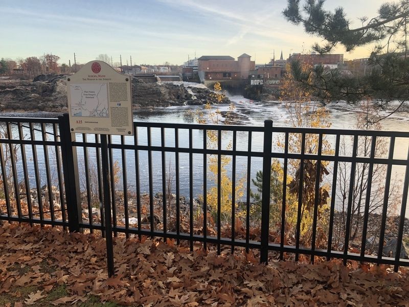
On Auburn Riverwalk 0.1 miles north of Court Street (U.S. 202), on the right when traveling north.
Before it was L-A, this place was Amitgonpontook, which means "the place to dry the fish at the falls." For generations Wabanakis harvested migrating fish each spring. In 1794 Perepol described how travel made this place a part of . . . — — Map (db m186016) HM
On Auburn Riverwalk 0.1 miles north of Great Falls Plaza, on the left when traveling east.
Rivers were the transportation and power for Maine's logging industry from the first sawmill in 1630 in Berwick until 1974. Lewiston's first sawmills were located near the Great Falls. Throughout the year, hardy loggers cut the trees . . . — — Map (db m186026) HM
On Main Street (Maine Route 136) at Court Street (U.S. 202), on the right when traveling north on Main Street.
Leon Leonwood Bean, founder of the Maine company L.L. Bean, began his career in Freeport. In 1902, he moved to W.H. Moody's shoe store at 74 Main Street in Auburn. Soon, with Moody's permission, Bean began to sell pants over the . . . — — Map (db m186027) HM
On Main Street (Maine Route 136) 0.1 miles south of Court Street (U.S. 202), on the right when traveling north.
Welcome to Auburn's Museum in the Streets® Historic Walking Tour.
Auburn's history is a manifold tale of Native Americans and settlers; entrepreneurs and visionaries; industrialization and the American . . . — — Map (db m185956) HM
On Auburn Riverwalk 0.2 miles north of Court Street (U.S. 202), on the right when traveling north.
Welcome to Auburn's Museum in the Streets® Historic Walking Tour.
Auburn's history is a manifold tale of Native Americans and settlers; entrepreneurs and visionaries; industrialization and the American . . . — — Map (db m186022) HM
On Auburn Riverwalk 0.1 miles south of Court Street (U.S. 202), on the right when traveling south.
Auburn's Agriculture, Forestry and Resource Protection Zone was created in the 1960's in an effort to prevent urban sprawl and to preserve our working native lands. This zone limits residential building unless it is connected to a viable farm or . . . — — Map (db m186014) HM
In Memory of Rodney “Rocky” Bonney. Auburn police officer Rodney “Rocky” Bonney died in the line of duty attempting to rescue a youth from these frigid waters. April 06, 1981.
“In Valor There is Hope” — — Map (db m1048) HM
On Auburn Riverwalk just east of Main Street ( Route 136), in the median.
Welcome to Bonney Park
Located in the heart of downtown Auburn, Bonney Park was named in remembrance of fallen Police Officer Rodney "Rocky" Bonney. Bonney Park features playground equipment and great views of the Androscoggin River. Bonney . . . — — Map (db m185973) HM
The Lewiston-Auburn Railroad Bridge was erected in 1909 and served as a vital link to the downtown. It also provided the connection for thousands of Canadian, Irish, Polish and other immigrants to the area. Recognizing the bridge’s historic . . . — — Map (db m1050) HM
On Turner Street at Court Street ( Route 100) on Turner Street.
Erected by the citizens of Auburn in memory of her noble sons who by land and sea gave their lives to preserve the Union and secure freedom to all its people 1882.
[1 Side has 41 names inscribed. Additional side has 41 names . . . — — Map (db m104790) WM
On Auburn Riverwalk 0.1 miles north of Main Street ( Route 136), on the right when traveling north.
The Barker Mill, at 143 Mill Street, was a catalyst for the residential development of what became known as "New Auburn." Auburn had recently annexed Danville in 1867. The Little Androscoggin Water Power Company was formed in 1870 . . . — — Map (db m186001) HM
On Auburn Riverwalk 0.2 miles south of Court Street (U.S. 202), on the left when traveling north.
The banks of the river are home to a variety of plants and animals. If you take the time to walk slowly along its shores, you will catch a glimpse of a once-vast forest ecosystem known as "The Northern Hardwood Forests." These . . . — — Map (db m186012)
On Main Street (Maine Route 136) just south of Vine Street, on the left when traveling north.
Squire Edward Little is called the "father" of Auburn and Lewiston. He inherited vast tracts of land from his father. In 1826, at the age of 53, he moved to Danville (now Auburn) and built what his father called an "extravagant" . . . — — Map (db m185965) HM
On Main Street (Maine Route 136) 0.1 miles south of Court Street (U.S. 202), on the right when traveling north.
Festival Plaza was created as part of the 1997 Auburn Downtown Action Plan for Tomorrow (ADAPT) visioning and revitalization initiative. As designed by Boston's ICON Architecture, Festival plaza establishes a vibrant . . . — — Map (db m185953) HM
On Elm Street just west of Main Street ( Route 136), on the right when traveling west.
The Horatio and Ella Foss Mansion, completed in 1917, is one of the architectural "grande dames" of Auburn, blending Georgian Revival and Spanish influences. Foss owned Dingley, Foss & Company, shoe manufacturers. Ella Foss willed . . . — — Map (db m185969) HM
On Auburn Riverwalk 0.2 miles Court Street (U.S. 202), on the right when traveling north.
These jagged, rocky outcrops that we call the "Great Falls" are actually a combination of three distinct rock formations. The oldest rocks were laid down from 20 to 435 million years ago as continents collided! Over time, they slowly . . . — — Map (db m186020)
On Auburn Riverwalk 0.2 miles north of Main Street ( Route 136) when traveling north.
The Great New Auburn Fire was started by an 11-year-old boy behind a gas station on Mill Street just after lunchtime on Monday, May 15, 1933. The fire, pushed by high gusting winds, spread rapidly through old wooden tenements and . . . — — Map (db m186004) HM
On Auburn Riverwalk just north of Great Falls Plaza, on the right when traveling north.
The Androscoggin River's great power has played a tremendous role in the development of the Lewiston-Auburn communities. The river drops more than 1,500 feet along its journey from the Rangeley Lakes, one of the steepest gradients of . . . — — Map (db m186023) HM
On Auburn Riverwalk 0.1 miles Great Falls Plaza, on the left when traveling north.
Named for the Knight family, the building's longest occupants, the "Knight House" stands as the oldest frame house in downtown Auburn. It is a typical example of houses built in the late 1700s. Nathaniel Knight was a butcher and meat . . . — — Map (db m186025) HM
On Main Street (Maine Route 136) just south of Academy Street, on the right when traveling south.
If a community were to amount to something, Edward Little believed it should have an institution of secondary education. In 1834 he convinced the Maine Legislature to charter the Lewiston Falls Academy. little provided money to . . . — — Map (db m185971) HM
On Auburn Riverwalk 0.1 miles north of Court Street (U.S. 202), on the left when traveling north.
Loss of Maine Farmland
According to the 2017 National Agricultural Statistics Service (NASS) of the USDA Census (a survey done every 5 years), Maine lost a significant amount of farmland between 2012 and 2017.
Near Auburn Riverwalk 0.1 miles north of Main Street ( Route 136), on the right when traveling north.
As with many American rivers that fueled the Industrial Revolution, the Androscoggin has a complex history. It was once considered one of the "Top Ten" most polluted rivers in the country. The paper mills along the river accounted . . . — — Map (db m185995) HM
On Main Street (Maine Route 136) just north of Mechanics Row, on the left when traveling north.
A growing demand for shoes and boots during the Civil War established Auburn as a shoe manufacturing center. Jacob Roak, Ara Cushman, Jeremiah Dingley and others strived to build "a first-rate shoe manufacturing center." Roak Block, . . . — — Map (db m186028) HM
On Auburn Riverwalk 0.1 miles north of Great Falls Plaza, on the left when traveling north.
Oldest frame house of Goffs Corners, Lewiston Falls, and Auburn Village Corp. Now the Civic Center of the City of Auburn Inc. 1869 — — Map (db m186024) HM
On Auburn Riverwalk just east of Main Street ( Route 136), in the median.
Wabanaki History: From Amitgonpontook to Lewiston-Auburn
During the 1680s several hundred Wabanakis fled the English wars of conquest in the south and gathered here at the town of Amitgonpontook. Nearby fish, farm crops, and . . . — — Map (db m185978) HM
On Main Street (U.S. 202) at Lincoln Street, on the right when traveling west on Main Street.
When the U.S.S. Maine was commissioned in 1895, it was the first modern American battleship, and the first modern U.S. Navy warship to be built in an American shipyard of materials and components manufactured in the United States. The Maine . . . — — Map (db m186041) HM WM
Welcome to part of the Wabanaki homeland, Wabanakis—the People of the Dawnland—are the Indigenous peoples of northern New England and southeastern Canada. The four federally recognized peoples in Maine are the Penobscots, . . . — — Map (db m185980) HM
On Main Street (U.S. 202) at Lincoln Street, on the right when traveling west on Main Street.
Lewiston Falls, the upper falls of Pejepscot, "Amitgonpontook." Favorite resort of the Indians for hunting and fishing. Home of Anasagunticooks, chief fort and village of Warumbee on west bank. Coast-to-Canada trail and crossroads for Sebago, . . . — — Map (db m186037) HM
On Beech Street at Oxford Street, on the right when traveling east on Beech Street.
If you've ever seen a working factory, you know they require a lot of power. In Lewiston in the 1800s, the best source was the Androscoggin River. Canals extended that power beyond the riverbanks, making it possible to develop . . . — — Map (db m185983) HM
On Lisbon Street (Maine Route 196) 0.2 miles north of Ash Street, on the right when traveling north.
This Plaza is named for the Honorable Armand A. Dufresne, Jr. (1909-1994), the first person of Franco-American heritage to serve as Maine's Chief Justice. Prior to the appointment as Chief Justice, he served as Androscoggin County . . . — — Map (db m186046) HM
On Auburn Riverwalk just west of Oxford Street, in the median.
The Lewiston-Auburn Railroad Bridge was erected in 1909 and served as a vital link to the downtown. It also provided the connection for thousands of Canadian, Irish, Polish and other immigrants to the area. Recognizing the bridge's historic . . . — — Map (db m185981) HM
On Main Street (Route 202) at Lincoln Street, on the right when traveling west on Main Street.
Lewiston's industry began with the Harris sawmill beside the falls. In 1809, Josiah Little's family built a large wooden building for saw, grist, and fulling mills under one roof. When the mill burned in 1829, the Littles built a . . . — — Map (db m186038) HM
On Main Street (U.S. 202) at Lincoln Street, on the right when traveling west on Main Street.
Dedicated to Gold Star Families
Gold Star Mothers
The term "Gold Star Mothers" applies to mothers whose sons or daughters died while in service to our country. The Gold Star symbolizes the honor and glory accorded a person for . . . — — Map (db m186040) WM
On Lincoln Street just north of Beech Street, on the left when traveling north.
The Grand Trunk Depot, known simply as "The Depot," is a longstanding monument of Lewiston-Auburn's social and industrial history. Around the time of the Civil War, Lewiston's economy was booming as many Canadians immigrated to the . . . — — Map (db m185989) HM
On Main Street (U.S. 202) at Park Street, on the right when traveling east on Main Street.
Where could latter 19th century city residents buy hay for their horses or wood for their stoves? Farmers brought hay, wood, and other produce to Haymarket Square in this wide-open space on Main Street. However, by 1898, the city . . . — — Map (db m186050) HM
On Oxford Street just north of Beech Street, on the right when traveling north.
Welcome to Lewiston's Museum in the Streets® historic walking tour.
Along this trail you will discover the rich heritage of Maine's second largest city. Illustrated panels guide you along the Androscoggin River and through the . . . — — Map (db m185985) HM
On Lisbon Street (Maine Route 196) 0.1 miles south of Journal Alley, on the right when traveling north.
Welcome to Lewiston's Museum in the Streets® historic walking tour.
Along this trail you will discover the rich heritage of Maine's second largest city. Illustrated panels guide you along the Androscoggin River and through the . . . — — Map (db m186042) HM
On Lisbon Street (Maine Route 196) 0.2 miles north of Ash Street, on the right when traveling north.
After a fire destroyed several stores in 1877, leading citizens, among them Congressman William P. Frye, decided to construct "the best opera house east of Boston." The offerings featured travelling stock companies, minstrels, drama, . . . — — Map (db m186045) HM
On Main Street (U.S. 202) at Lincoln Street, on the right when traveling west on Main Street.
To those native sons and daughters of the great state of Maine who made the supreme sacrifice while serving their country on active duty in the United States Navy and Marine Corps during times of armed conflict.
On Armed Forces Day, May 17, . . . — — Map (db m186033) HM WM
On Lisbon Street (Maine Route 196) at Main Street (U.S. 202), on the right when traveling north on Lisbon Street.
Bradford Peck prospered in his Lisbon Street stores. In 1899, he opened the largest department store east of Boston on Main Street. Naysayers predicted bankruptcy, for they believed that customers would not cross Main Street from . . . — — Map (db m186047) HM
On Main Street (U.S. 202) at Lincoln Street, on the right when traveling west on Main Street.
In loving memory of
Richard E. White
Col. US Army
Operation Iraqi Freedom
Aug, 14, 1967 - Jan. 24, 2013
Legion of Merit · Bronze Star
Defense Meritorious Service Medal
— — Map (db m186034) WM
On Main Street (U.S. 202) at Lincoln Street, on the right when traveling west on Main Street.
Erected by the citizens of Lewiston in honor of the men and women who served in the Armed Forces during the World Wars and the Korean Conflict and Vietnam War, all future wars and conflicts. — — Map (db m186035) WM
On Main Street (U.S. 202) at Lincoln Street, on the right when traveling west on Main Street.
Once a fishing spot for indigenous peoples and then the origin of Lewiston industry, Veterans Memorial Park was dedicated in September 2004. This park is the culmination of efforts from the L/A Veterans Council to garner donations . . . — — Map (db m186044) HM
On Main Street (U.S. 202) at Lincoln Street, on the right when traveling west on Main Street.
This memorial tablet is dedicated to the memory of the Lewiston High School men who bore arms in their country's defense in the World War — — Map (db m186036) WM
On Main Street (U.S. 202) at Lincoln Street, on the right when traveling west on Main Street.
The price of freedom is written on the wall
Beneath this memorial are tributes collected at the wall remembering those who sacrificed their lives during the Vietnam conflict — — Map (db m186030) WM
On Main Street (U.S. 202) at Lincoln Street, on the right when traveling west on Main Street.
In 1939, the idea of a universal military vehicle was in the making. The army needed a replacement for the vehicles they had been using. They used motorcycles and side cars from World War I, and vehicles like the modified Ford Model T. The . . . — — Map (db m186032) HM WM