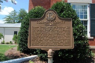
On Appling Harlem Road (US 221,State Road 47) near Shucraft Road, on the left when traveling north.
Columbia County, named for Christopher Columbus, was created by Act of Dec. 10, 1790 from Richmond County. Originally, it contained parts of McDuffie and Warren Counties. Settled by Quakers before the Revolution, it has been the home of many . . . — — Map (db m27049) HM
On Ray Owens Road, on the left when traveling north.
Kiokee Church, the first Baptist Church to be constituted in Georgia, was organized in the Spring of 1772, by the Rev. Daniel Marshall, one of the founders of the Baptist denomination in Georgia. A meeting house was built, and the Rev. Daniel . . . — — Map (db m27064) HM
Born in Columbia County, GA, c. 1794. The son of Abraham and Ann (Waller) Marshall. Followed his father as pastor of this church, which he served until his death. He was educated as the University of Georgia. Notable positions include clerk, . . . — — Map (db m88576) HM
Near Scotts Ferry Road (U.S. 221) just north of Apple Lane, on the right when traveling north.
Dedicated in the honor of a gentleman, who was a true friend to all children of Columbia County; a youth league organizer, coach, sportsman, and community leader. Mr. Morris had vision for the establishment of this park and through his leadership . . . — — Map (db m246026) HM
On Ray Owens Road (State Highway 47), on the right when traveling south.
This building, Kiokee Church's sixth meeting house, was erected in 1937 with the help of many Georgia Baptists as a monument to Daniel Marshall. Not later than 1770, he was arrested for preaching in Colonial Georgia at a site east of this marker. . . . — — Map (db m87419) HM
On Appling Harlem Road (State Highway 47) at Shucraft Road, on the right when traveling south on Appling Harlem Road.
In Sacred Memory of the Men of Columbia County Who Made the Supreme Sacrifice
World War I
Barney Bivins, John Burnett, Doughty Jansen, Selwyn Williamson
World War II
Daniel W. Cason, John B. Crawford, Thomas W. Smith, Robert . . . — — Map (db m87416) WM
On West Robinson Avenue (Georgia Route 223) at Newnantown Road, on the right when traveling west on West Robinson Avenue.
Acclaimed poet, editor, and lecturer of the post-Civil War era, Paul Hamilton Hayne was born in Charleston, South Carolina. A contemporary of Sidney Lanier, Hayne edited Russell’s Magazine and the Charleston Gazette and wrote for the . . . — — Map (db m38987) HM
On Gordon Highway (U.S. 78) at Verdery Street/Planner Mill Road, on the left when traveling east on Gordon Highway.
For the last 20 miles this highway has followed the course of the noted Upper Trading Path that led from present Augusta to Indian tribes as far away as the Mississippi River. By various connections the trail reached the Cherokees of North Georgia; . . . — — Map (db m13815) HM
On South Hicks Street west of North Louisville Street, on the left when traveling west.
This monument is located on the
lot where Oliver Hardy was born
on Jan. 18, 1892. It was placed
here by the Sons of The Desert,
Berth Marks Tent members.
Mayor James B. Lewis, Sr.,
initiated local interest and the
Oliver Hardy Festival . . . — — Map (db m267607) HM
On N Louisville Street (Georgia Route 47), on the right when traveling south.
Harlem became the birthplace of the rotund member of one of Hollywood's greatest comedy teams when Oliver Hardy was born January 18, 1892. After his father died and was buried in the Harlem Cemetery the year of Oliver's birth, Mrs. Hardy took the . . . — — Map (db m15374) HM
On Ridge Road at Washington Road ( Highway 104), on the left when traveling east on Ridge Road.
Damascus Baptist Church, organized July 29, 1820, was constituted by Samuel Cartledge and Widner Hilman. First members were Jeremiah Blanchard, James Ramsey, Jeremiah Roberts, Sara Blanchard, Sara Reid, Dilly Swan and Margaret Wilkins. James . . . — — Map (db m13816) HM
Near Evans to Locks Road 1 mile east of Stevens Creek Road.
Marking the place where two geophysical provinces intersect, the Fall Line attracted Native American settlement, served as a natural crossing point for Hernando DeSoto's journey, and made the Augusta Canal possible.
The roar of water . . . — — Map (db m114331) HM
Near Evans to Locks Road 1 mile east of Stevens Creek Road, on the left when traveling east.
Little has changed here over the past century. The area remains a natural oasis for reflection, social events, and recreation.
The historic Augusta Canal, recognized as one of the most unique and intact canal systems in the United . . . — — Map (db m114327) HM
On Cobbham Road (State Road 150) near Happy Valley Lane, on the left when traveling east.
"Happy Valley", homesite and burial place of Basil Neal, Revolutionary soldier, lies one-half mile off this highway in the direction the arrow points.
Basil Neal or O'Neal, was born in Maryland in 1758. When he was 17 years old his family . . . — — Map (db m27058) HM
On Cobbham Road (State Highway 150) near Mistletoe Road, on the left when traveling west.
Sharon Baptist Church was founded in 1799.
The first pastor, Abraham Marshall, who served
the church until his death in 1819, probably
constituted the church. This building, the
second on the site, was erected in 1869. Many
names . . . — — Map (db m27056) HM
On Cobbham Road (State Road 150), on the right when traveling north.
Shiloh Methodist Church, the outgrowth of the earliest known Methodist place of worship in this community, has had a church building on this site for over 125 years. Originally, services started by a local hermit "who lived by a spring," were . . . — — Map (db m27067) HM
On Cobbham Road (State Road 150), on the right when traveling west.
On this site stood the home of William Few, one of Georgia's signers of the United States Constitution. Built in 1781, the house burned in 1930.
William Few was born near Baltimore, Maryland, June 8, 1748. In 1776 he moved to Augusta, . . . — — Map (db m27053) HM
On Augusta Highway (U.S. 278) at Ellington Airline Road, on the right when traveling east on Augusta Highway.
The Upper Trading Path, one of the historic Indian routes of the Southeast, passed this spot, leading from present Augusta to tribes as far west as the Mississippi River. By various connections the trail reached the Cherokees of North Georgia; the . . . — — Map (db m16002) HM
On Rock House Road 0.1 miles north of West Bypass Road, on the left when traveling west.
The Rock House built by
Thomas Ansley, Sr. ca 1785
Owners (*) who are probably
buried in the cemetery
Thomas Ansley, Sr.
b. 1737 — d. 1809
* 1782 — 1798
Rebecca Cox Ansley
b. 1732 — d. 1814
Abel Ansley, Sr.
b. 1761 — . . . — — Map (db m227205) HM
On Main Street (Georgia Route 17) at Railroad Street, on the right when traveling north on Main Street.
Willie Samuel McTear (1901-1959) was born between Big and Little Briar Creeks in the Happy Valley community. In 1911, he and his mother moved to Statesboro, where he began his life of traveling and performing. Although blind from infancy, Willie . . . — — Map (db m61012) HM
On Hickory Hill Drive 0.1 miles west of North Lee Street, on the right when traveling west.
Populist presidential candidate and Georgia political leader Thomas E. Watson purchased this house from Captain James Wilson in 1900. Watson extensively renovated both the house and grounds, installing telephones and even constructing a power plant . . . — — Map (db m42706) HM
On Tom Watson Way, on the right when traveling west.
After passing the state Bar in 1876, native Thomas E. Watson returned to Thomson and lived in this house with his family from 1881 to 1900. In his first floor office Watson began his law and writing career and entered politics. He served in the . . . — — Map (db m9475) HM
Near Augusta Road (U.S. 78) 0.1 miles east of Thomson Bypass ( Route 17).
This house stood on the site of the large brick house to your right, from 1885 to 1935, when it was moved to this location. John S. Watson (1833-1895) was the great grandfather of John, James, & Bob Wilson. In 1864, after being wounded fighting . . . — — Map (db m108095) HM
On Main Street (State Highway 10), on the right when traveling south.
[East Inscription]:
Woman's Tribute April 26, 1996
[South Inscription]:
They sleep the sleep of
our noble slain
defeated, yet without
a stain, proudly and
peacefully.
[North Inscription]:
In memory of
our . . . — — Map (db m87941) WM
On McDuffie Avenue 0.2 miles west of Main Street (U.S. 78), on the left when traveling east.
McDuffie County was created by Act of Oct. 18, 1870 from Columbia and Warren Counties. It was named for George McDuffie (1788-1851). Born in Columbia (now Warren County, Ga.), he became a political leader in S.C. He was a Maj. Gen. of Militia, . . . — — Map (db m42688) HM
On Main Street (Georgia Route 17) 0 miles north of McDuffie Avenue, on the left when traveling north.
Rear Admiral Richard E. Hawes has long been revered as a distinguished native son of Thomson-McDuffie County, Georgia. Admiral Hawes is remembered for his exceptionally heroic and meritorious service while performing his duty in the United States . . . — — Map (db m61010) HM
On Main Street (U.S. 78) 0 miles north of McDuffie Avenue, on the right when traveling north.
Born near Thomson, Sept. 5, 1856, Thomas Edward Watson, gifted writer, eloquent speaker and longtime political leader of Georgia, spent most of his life in this section. His home, “Hickory Hill,” bought and remodeled extensively by Sen. . . . — — Map (db m42689) HM
On George McDuffie Road 0.5 miles south of Augusta Road (U.S. 278), on the left when traveling south.
From these humble and obscure Georgia pinelands, assisted by the plantation-owning South Carolina Calhouns, George McDuffie rose to become Congressman, Senator, and Governor of South Carolina.
McDuffie's political prominence involved him in a . . . — — Map (db m16065) HM
Near Rock House Road 0.2 miles west of West Bypass Road, on the right when traveling west.
This 18th Century stone dwelling is the only surviving house associated with the Colonial Wrightsboro Settlement (1768). Its builder, Thomas Ansley, used weathered granite, quarried in its natural form from the nearby geographical fall line, as . . . — — Map (db m227207) HM
On Rock House Road 4 miles west of Route 223, on the right when traveling west.
This 18th Century stone dwelling is the only surviving house associated with the Colonial Wrightsboro Settlement (1768). Its builder, Thomas Ansley, used weathered granite, quarried in its natural form from the nearby geographical fall line, as . . . — — Map (db m9809) HM
On Main Street (Georgia Route 17) 0 miles north of McDuffie Avenue, on the right when traveling south.
To Honor
Thomas Edward Watson
1856-1922
Author, Editor, Congressman, U.S. Senator
And
Father of Rural Free Delivery
This Marker was placed in 1949 by Camp No. 1401
Woodmen of the World — — Map (db m58543) HM
On Milledge Street 0.1 miles west of Church Street, on the right when traveling east.
Built by William Usry about 1795 as the seat of his extensive cotton plantations, Usry House early became the center of ante-bellum social life in this region.
In its parlor, the Goodrich-Usry Railroad was conceived, and Lafayette reputedly . . . — — Map (db m55097) HM
Vietnam War
Sgt. John B. Gay
25 OCT 1967
PFC Robert R. White
22 APR 1968
LCLP Willie Mack
10 JUN 1969
Col. Thomas F. Case
31 May 1966
PFC Fred D. Hart
2 JAN 1967
Sgt. Harold J. Crawford
11 JUN 1969
Iraq . . . — — Map (db m87912) WM
On McDuffie Avenue east of Church Street, on the right when traveling west.
In Memory of All
Veterans
of All Wars
Presented by the
Ladies Auxiliary
Unit 6672
to the
Veterans of Foreign Wars
of the United States — — Map (db m87913) WM
On Wrightsboro/Stagecoach Road 4 miles west of U.S. 78, on the left when traveling west.
1773 the Treaty of Augusta
Bartram visited Wrightsborough
He described the view of high hills
and rich vales. He took on supplies. — — Map (db m9810) HM
On McDuffie Avenue at Main Street ( Highway 10) on McDuffie Avenue.
In Sacred Memory of the
Men of McDuffie County
Who Made the Supreme
Sacrifice
World War I
Brown, Daniel, J. ∙ Isdale, Fred, L. ∙ Wilson, Joe, B. ∙ Williams, Henry, E.
World War II
Averett, John, V. ∙ Benson, . . . — — Map (db m87919) WM
On Wrightsboro Road 0.5 miles west of Stagecoach Road, on the left when traveling west.
On this site in 1754, Edmund Grey, a pretending Quaker, founded the town of Brandon, named for one of its leaders. In Dec. 1768, Joseph Mattock and Jonathan Sell, Quakers, obtained a grant of 40,000 acres from the Royal Governor, Sir James Wright, . . . — — Map (db m42657) HM
On Wrightsboro Road 0.6 miles east of Ridge Road, on the right when traveling east.
1799 House of Worship for All Denominations
1810 Wrightsboro Church Constructed
1837 Methodist Episcopal Church South
1939 Methodist Church
1966 Property to McDuffie County Commission
1967 Wrightsboro . . . — — Map (db m110717) HM
On Wrightsboro Road 0.5 miles west of Stagecoach Road, on the left when traveling west.
The Wrightsboro Methodist Church of the Thomson Circuit, on the site of the now dead town of Wrightsboro, has been an active organization for over 125 years. In its historic churchyard are buried several veterans of the Revolutionary War and some . . . — — Map (db m42658) HM
On Greene Street, on the left when traveling west.
Immortalis est veritas.
Truth is immortal
Dulce et decorum est pro patria mori.
It is sweet and glorious to die for the fatherland.
These men died in defense of
the principles of . . . — — Map (db m210642) WM
East face
In 1973, Augusta College named three of the
original arsenal buildings in honor of
commandants of the arsenal. Payne Hall,
storehouse and later headquarters for the
arsenal and administrative building for the
university, . . . — — Map (db m47400) HM
[North Face]:
In Memoriam
"No Nation Rose So White
And Fair:
None Fell So Pure Of Crime"
[West Face]:
Erected
A.D. 1878
by
The Ladies
Memorial Association
of Augusta.
In Honor of the men of
Richmond County . . . — — Map (db m9673) WM
On Reynolds Street at 8th Street, on the right when traveling west on Reynolds Street.
Organized 1872
Constructed 1886
Architect - Enoch William Brown
Contractor - William Henry Goodrich
Closed 1964
Entered in National Register of Historic Places
1978 — — Map (db m114290) HM
On Walton Way at Fleming Avenue, on the right when traveling east on Walton Way.
Augusta State University traces its roots to 1783 when its parent institution, the Academy of Richmond County, was chartered. Offering college-level classes to prepare students for admission into universities as sophomores or juniors, the Academy . . . — — Map (db m15036) HM
On Greene St near 10th St, on the right when traveling west.
[Bell System Logo]
The first telephone
exchange in the State of Georgia
was established at
Augusta, Georgia
August 1, 1879
With seventy eight subscribers,
this was only three years after
Alexander Graham Bell
invented . . . — — Map (db m10038) HM
Home of Freeman Walker, outstanding citizen of early Georgia. Born in Virginia in 1780, he came to Richmond County in his youth and studied law. Freeman Walker, in 1826, deeded 70 acres of land to the United States Government to be used as an . . . — — Map (db m36488) HM
(East face)
Bicentennial
Augusta, Ga
1735 — 1935
(West face)
Gen. James Edward Oglethorpe,
Founder - 1735
Gen. "Light-Horse" Harry Lee
Revolutionary soldier, Commander - 1781
Gen. Robert Edward . . . — — Map (db m32703) HM
On Wheeler Road at Aumond Road, on the right when traveling west on Wheeler Road.
A short distance north of this place, General Joseph Wheeler was born on Sept. 10, 1836. He graduated from West Point in 1859 and held the rank of 2nd
lieutenant when the Civil War broke out. Resigning his commission in the Mounted Rifles, U.S.A., . . . — — Map (db m14829) HM
On this site August 30, 1785, Greenburg Hughes published Augusta's first newspaper, the Augusta Gazette, which continued, after he went to Charleston, until September 30, 1786, when John Erdman Smith, State Printer, began publishing the Georgia . . . — — Map (db m10092) HM
On Magnolia Drive at Comfort Road, on the left when traveling north on Magnolia Drive.
On the golf links of the Forrest Hills-Ricker Hotel, Bobby Jones won the Southeastern Open of 1930. He went on to victory that year in the British Amateur, British Open, U.S. Open, and U.S. Amateur –- golf’s Grand Slam and a feat yet to be . . . — — Map (db m21288) HM
On 7th Street near Telfair Street, on the right when traveling south.
Woodrow Wilson, later to become 27th President of the United States, lived in this Manse of the First Presbyterian Church of which his father, Dr. Joseph R. Wilson, was pastor from 1858 to 1870. Wilson was born in Staunton, Va., in 1856 and he later . . . — — Map (db m9856) HM
On Telfair Street just east of 8th Street, on the right when traveling east.
The current sanctuary was constructed from 1857-63 and is one of the oldest Catholic Church buildings in Georgia. It was designed by J.R. Niernsee, architect of the State House in Columbia, South Carolina. The original 1814 structure served as the . . . — — Map (db m9993) HM
[Marker Front]:
One of Georgia's two signers of the United States Constitution.
Born in Baltimore, Maryland June 18, 1748.
Lieutenant Colonel, Georgia Militia during the American Revolution, 1776-1770.
Representative, Georgia . . . — — Map (db m10108) HM
On Reynolds Street near Burum Alley, on the right when traveling east.
"The settlement of Augusta is of great service
...the Key of all the Indian Countrey"
— James Edward Oglethorpe, 1739
James Edward Oglethorpe captured the lucrative Indian
trade for the colony of Georgia, when he founded Augusta . . . — — Map (db m64103) HM
On Goodrich Street, on the right when traveling north.
(West side)
This
Obelisk-Chimney,
Sole remnant of the extensive
powder-works here erected
under the auspices of the
Confederate Government.
Is, by the Confederate
Survivors Association
of Augusta, with . . . — — Map (db m32871) HM
On Broad Street (Georgia Route 28) at Goodrich Street, on the right when traveling west on Broad Street.
Obelisk chimney one-third mile (from here) marks center of Confederate Powder Works which extended two miles along the river and was the principal powder factory in the South during the War. It supplied Confederate armies with abundant gunpowder of . . . — — Map (db m33454) HM
Near 8th Street north of Reynolds Street, on the left when traveling north.
Although cotton was cultivated in small quantities in the South during the eighteenth century, it was not considered a profitable crop because of the difficulty of separating the seed from the fiber.
In 1793, Eli Whitney, a young man from . . . — — Map (db m114289) HM
On DeLaigle Avenue at 2nd Street, on the left when traveling north on DeLaigle Avenue.
In 1808, Nicholas de L' Aigle, a French
refugee, established brick yards 1/4 mile
south which furnished Augusta with building
brick for 75 years. River clay was "pugged"
to the right constency in a cylindrical vat
by a stone turned with . . . — — Map (db m38190) HM
On Riverwalk (river side) near 8th Street, on the left when traveling west.
In May 1539 Hernando de Soto landed in Florida with over 600 people, 220 horses and mules, and a herd of swine reserved for famine. Fired by his success in Pizarro's conquest of Peru, De Soto had been granted the rights, by the King of Spain, to . . . — — Map (db m27278) HM
On 15th Street, on the right when traveling north.
By deed of self-sacrifice,
such as all humanity claims
and counts amoung its jewels,
hallowed this spot and rendered
his name worthy of such
Lasting Memory
as these rugged stones and
this simple tablet can secure.
For . . . — — Map (db m34003) HM
On Laney Walker Blvd., on the right when traveling east.
Revered as a teacher and a coach,
"Professor Tutt" began his career
under the leadership of Miss Lucy
C. Laney at Haines Institute, where
he remained from 1906 to 1949,
longer than anyone else. From Lincoln
University (Pennsylvania), he . . . — — Map (db m36138) HM
On Laney Walker Boulevard at 11th Street, on the right when traveling west on Laney Walker Boulevard.
A native Augustan, son of former slaves, he worked to support himself and his studies, graduating from Haines Institute and attending Atlanta University prior to earning the M.D. from Howard University Medical School in 1912.
Hired by Pilgrim . . . — — Map (db m200151) HM
On Broad Street, on the right when traveling west.
Born in Ashland, Hanover County, Virginia on March 21, 1794. Grew up in Kentucky under guardianship of Henry Clay. Visited Augusta in 1818, where she met and married Richard Tubman, wealthy merchant. After his death in 1836, she became interested in . . . — — Map (db m9995) HM
Dedicated March 21, 1994
Commemorating the 200th Anniversary of the birth
of
Emily Harvie Thomas Tubman
Sponsored by The State of Georgia
State of Georgia
The Honorable Zell Miller, Governor
City Council of Augusta
The . . . — — Map (db m9996) HM
On Telfair Street near 6th Street, on the left when traveling west.
Paul Fitzsimmons Eve, native Augustan and a founder of the Medical College of Georgia, was a brilliant surgeon recognized internationally and a prolific writer. His war activities included aid to French, Italian and Confederate forces and service as . . . — — Map (db m114274) HM
On Eve Street near Pearl Avenue, on the left when traveling east.
In August, 1864, a violent explosion destroyed the granulating building of the Augusta Powder Works, one of the 28 buildings of the Confederacy’s massive gunpowder mill along Augusta Canal. Eight men and a boy died when 18,000 pounds of gunpowder . . . — — Map (db m53946) HM
On Greene Street at 8th Street, in the median on Greene Street.
On this site May 8, 1845
The Southern Baptist Convention
was organized
by 327 delegates from the states of
Maryland, Virginia, North Carolina, South Carolina, Georgia, Alabama, Louisana, Kentucky and District of Columbia.
———
The . . . — — Map (db m210478) HM
On Greene Street (Georgia Route 28) near 7th (McIntosh) Street, on the left when traveling east.
The Christian Church (Disciples of Christ) began in Kentucky in the early years of the nineteenth century. Dr. Daniel Hook and Captain and Mrs. Edward Campfield established Augusta’s First Christian Church in 1835, despite great suspicion and . . . — — Map (db m14884) HM
To commemorate the great congress of
five Indian Nations held here at Fort
Augusta in 1763. When seven hundred
Indians came to meet the Governors of
Georgia, Virginia, North and South Carolina. — — Map (db m9899) HM
Near 8th Street north of Reynolds Street, on the right when traveling north.
The Savannah River and its tributaries drain more than 10,000 square miles of an area that receives some of the heaviest rainfall on the continent.
Augusta's location on a low bluff at the Fall Line of the river has made the city . . . — — Map (db m114298) HM
This stone marks the site
of the
Colonial Fort Augusta,
built by order of General Oglethorpe
and the trustees
in 1736;
and known,
during the Revolution as
Fort Cornwallis.
St. Paul Church was built
in 1750,
under the curtain of . . . — — Map (db m9803) HM
On Washington St. (6th St,) at Reynolds Street, on the left when traveling north on Washington St. (6th St,).
This site selected by fur traders Kennedy O`Brien and Roger de Lacy as a trading post to be nearer the Indians than Savannah Town, (in present Beech Island). To protect them and others, General Oglethorpe in 1735 built here Fort Augusta (so named . . . — — Map (db m9723) HM
Approximate location of Ft. Grierson, named after British Lt. Col. James Grierson, who commanded a temporary stronghold at this place during occupation of Augusta by the British under Col. Brown from May, 1780, to June, 1781. After a rendezvous . . . — — Map (db m9746) HM
Near River Walk near 8th Street, on the right when traveling west.
Following the establishment of Georgia's first settlement at Savannah in 1733, General James Edward Oglethorpe, founder of the colony, learned of a thriving trading village on the Carolina bank of the Savannah River located near the head of . . . — — Map (db m10321) HM
On Broad Street (U.S. 1) at Seventh Street, on the right when traveling east on Broad Street.
One of two native Georgians who served as generals in the U.S. Army during the Civil War, Montgomery C. Meigs was born here on May 3, 1816, grandson of a University of Georgia president. After graduating from West Point, he oversaw construction of . . . — — Map (db m61640) HM
On Broad Street (Georgia Route 28/104), on the right when traveling west.
(South face)
General
James Edward
Oglethorpe
1696 - 1785
Father of Georgia
Founder of Augusta
(East face)
Founder of Georgia
Member of Parliament
English Prison Reformer
Military General . . . — — Map (db m63749) HM
On Independence Drive near 13th Street (U.S. 1), on the left when traveling west.
[Masonic Emblem]
To
George Walton
(1749 - 1804)
Signer of the Declaration of Independence
Patriot - Soldier - Statesman - Jurist - Freemason
Born a Virginian he became a Georgian in about 1770.
An early leader in the Liberty . . . — — Map (db m33287) HM
On May 21, 1837, Georgia Railroad and Banking Company operated from this place the first railroad train in Georgia. It is the oldest railroad in Georgia continuously operating under its original charter.
Though extensive portions of its lines were . . . — — Map (db m33110) HM
On Broad Street at 7th Street, on the right when traveling west on Broad Street.
2200 feet to the southwest at a place indicated by a marker of the Georgia Historical Commission, Georgia Railroad and Banking Company on May 21, 1837 operated the first railroad in Georgia. It is the oldest railroad in Georgia continuously . . . — — Map (db m61570) HM
On Greene Street 0 miles east of 2nd Street, on the right when traveling east.
The property on which the Widows Home is located was the site of Augusta’s first City Hospital. Constructed in 1818, the hospital provided for the “sick poor” of Augusta and later evolved into the present University Hospital. At City . . . — — Map (db m21519) HM
Augusta served as the capital of Georgia
from 1785 until 1795 when the seat of
government was moved to the new capital,
Louisville. The Georgia General Assembly
met at this site in a two-story building on
the corner of Elbert (Fourth) and . . . — — Map (db m9747) HM
On McDowell Street at Johns Road, on the right when traveling west on McDowell Street.
The colonial Great Indian Trading Path crossed land now a part of Augusta College and followed a part of the present McDowell Street. It was variously called Trading Road, Augusta Road, and the Creek Indian Path. Early platts show it on land owned . . . — — Map (db m10008) HM
The most heavily traveled road in Colonial America passed through here, linking areas from the Great Lakes to Augusta, GA. Laid on ancient animal and Native American Trading/Warrior Paths. Indian treaties among the governors of NY, PA, & VA and the . . . — — Map (db m9906) HM
On Laney Walker Boulevard near Phillips Street, on the right when traveling west.
Established by influential educator Lucy Craft Laney, the Haines Normal and Industrial Institute was chartered in 1886 and grew to include a Kindergarten to Junior College curriculum, the Lamar School of Nursing, and a teacher training program. . . . — — Map (db m34807) HM
On Broad Street, on the right when traveling west.
The Augusta Chronicle is the South's oldest surviving newspaper, in continuous publication. The Chronicle was founded on September 30, 1786. It dates its origins back to August 30, 1785 and the founding of The Augusta Gazette which later became part . . . — — Map (db m10102) HM
On Broad Street at East Boundry Street, on the right when traveling west on Broad Street.
Here stood the home of Edward Telfair. He was one of the group of young patriots led by Joseph Habersham, who broke open the British powder magazine at Savannah on May 11, 1775 and carried away the powder for future use in the Revolutionary War. . . . — — Map (db m32360) HM
On Milledge Road near Cumming Road, on the right when traveling north.
This house was part of the home of John Forsyth located on this property. As U.S. Minister to Spain, in 1819 Forsyth negotiated the treaty by which Florida was acquired by the United States.
He was Congressman from Georgia, 1813- 1818; 1823- 1827; . . . — — Map (db m33624) HM
On Telfair Street at Button Gwinnett Street, on the right when traveling east on Telfair Street.
Nicholas Ware was born in Virginia in 1777.
Ware was the son of Revolutionary War veteran
Captain Robert Ware and moved to Augusta with
his family as a child. He served as Mayor of
Augusta from 1819-1821, later serving several
times in the . . . — — Map (db m200153) HM
Richard Henry Wilde, one of Georgia's most gifted sons - poet, scholar. lawyer, statesman. Lived in this house from 1825 to 1842. Born in Dublin, Ireland, Spet. 24, 1789, he moved to Augusta with his parents in 1802. He was listed as a merchant and . . . — — Map (db m36234) HM
Near 8th Street north of Reynolds Street, on the left when traveling north.
Archaeological evidence has proven the existence of Indian villages in the Augusta area as early as 2,500 B.C., and a type of decorated pottery found at various sites is among the oldest in North America.
Just north of the present-day city . . . — — Map (db m114286) HM
Near James Brown Boulevard north of Reynolds Street, on the right when traveling north.
Augusta made major commitments to industrialization earlier than most other Southern cities, in response to a growing concern that the cotton states were becoming too economically dependent on the industrial North.
Grist mills and sawmills . . . — — Map (db m114284) HM
On Broad Street (Georgia Route 104/28), on the left when traveling west.
Singer, songwriter, musician and one-of-a-kind performer, James Brown has thrilled millions around the world with his hit recordings and electrifying performances. The 1983 Georgia Music Hall of Fame inductee, 1986 Rock and Roll Hall of Fame . . . — — Map (db m63739) HM
On Broad Street (Georgia Route 104/28), on the right when traveling west.
James Edward Oglethorpe was
descended from aristocratic
English family. As a young man
he represented the borough of
Haslemere in Parliament, where he led
inquires into prison conditions and
became interested in social reforms. . . . — — Map (db m63742) HM
496 entries matched your criteria. The first 100 are listed above. Next 100 ⊳