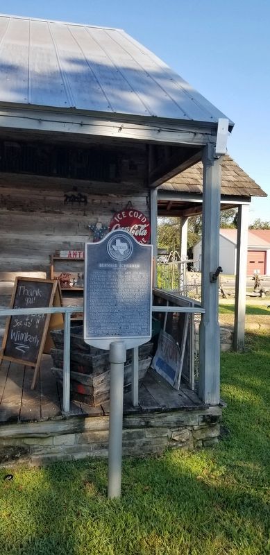
Near Live Oak Street (Farm to Market Road 1457) at Main Street.
Bernard Scherrer left his native Switzerland at the age of 22 for extended travels before reaching Texas in 1833. After serving in Burleson's Regiment during the Texas Revolution, he received a land grant in Colorado County, but settled in Biegel . . . — — Map (db m201940) HM
On North Washington Street south of West Colorado Street, on the right when traveling south.
Erected
by the State of Texas
to the
memory of her defenders
Captain N. H. Dawson
and his command.
Who fell at the battle of Salado Texas
Sept. 18th, 1842. . . . — — Map (db m80829) HM WM
On East Bell Street at North Church Street, on the right when traveling south on East Bell Street.
Czech Catholics, who settled in Fayette County in the mid-1850s, were initially served by area priests. Eventually they petitioned the Bishop of Texas for their own Czech priest, and in 1872 the Rev. Joseph Chromcik (1845-1910) arrived from Europe. . . . — — Map (db m183337) HM
Near Avenue E (Alternate U.S. 90) at East 9th Street.
A native of Hanover, Germany, Charles Welhausen immigrated to Texas with his parents, arriving at the Port of Galveston in 1843. They settled first at Cat Spring in Austin County, and later moved to High Hill in Fayette County, where Charles . . . — — Map (db m179273) HM
On Farm to Market Road 2436 at Kallus Road, on the right when traveling west on Road 2436.
On March 24, 1889, a group of Czech immigrants gathered here to form the Katolicka Jednota Texaska (KJT), or Czech Catholic Union of Texas. A fraternal benefit society, the KJT was chartered on July 4, 1889, with six individual lodges. Through . . . — — Map (db m84615) HM
On Schroeder Road 0.2 miles west of Ernst Parkway (Farm to Market Road 109), on the left when traveling west.
A native of Oldenburg, Germany, John Friedrich Ernst (1820-1863) emigrated to the United States with his family at the age of nine. In 1831, they traveled from New York City to Texas, finally arriving in what is now the town of Industry. The . . . — — Map (db m165424) HM
On North Live Oak Street at West Fayette Street, on the left when traveling north on North Live Oak Street.
The Slovanska Podporujici Jednota Statu Texas, known in English as the Slavonic Benevolent Order of the State of Texas (SPJST), is a fraternal organization founded by Czech-Texans in 1896 at the Fayette County Courthouse in La Grange. For . . . — — Map (db m183369) HM
American heritage collection in mansion built 1927 by William Clifford (1875-1930), Ima (b. 1882), and Mike Hogg (1885-1941), children of first native Texan Governor James Stephen Hogg (1851-1906) and his wife Sarah Stinson. Will Hogg, attorney and . . . — — Map (db m261086) HM
On North Washington Street at West Main Street, on the right when traveling north on North Washington Street.
North Carolina native Phillip Shaver (1814-1875) settled in the Fayette County community of Rutersville c. 1840. Two years later, he joined the Texas Army to defend area settlers from Indians and Mexican soldiers and also received from the Republic . . . — — Map (db m183370) HM
On North Main Street south of West Colorado Street, on the left when traveling south.
About 1890, the structural safety of Fayette County's third courthouse came into question, and plans began for the building of this structure to serve as the seat of justice for the county. The commissioners court hired San Antonio architect James . . . — — Map (db m53236) HM
Near East Mill Street 0.2 miles south of West Main Street.
The Connersville Primitive Baptist Church was built in 1893 in Eastern Fayette County, Texas. The church was originally located on FM 1457 alongside the Richter Cemetery and in front of the Connersville Cemetery. In 2001, it was moved 2 miles to the . . . — — Map (db m183438) HM
On Fink Street at Rothschmitt Lane, on the left when traveling west on Fink Street.
Considered oldest organized group in Lavaca County. Under dispensation granted March 29, 1850, Lodge was chartered January 31, 1851, and named for early Texas colonist and Masonic leader John Murchison, Fayette County. First officers: Isaac J. . . . — — Map (db m167149) HM
Near Landa Park Drive at Monument Drive, on the right when traveling north.
Panel 1
The first German settlements in Texas were Industry in Austin County, founded by Friedrich Ernst in 1831, Biegel in Fayette County, founded by Joseph Biegel in 1832, Cat Spring in Austin County, founded by the von Roeder, Kleberg, . . . — — Map (db m210312) HM
On Old College Road 0.5 miles south of State Highway 159, on the left when traveling south.
First institution of higher education in Texas. Recommended in 1837 by Martin Ruter, D.D. Chartered as a Methodist School in 1840. Granted four leagues of land by the Republic of Texas. After educating more than 8oo students it merged in 1856 . . . — — Map (db m239483) HM
On TX-29 (E University Ave) at Vine St., on the right when traveling west on TX-29 (E University Ave).
Mother of all Texas colleges and universities. Absorbed charters of Rutersville College, Fayette County (1840), and Wesleyan Male and Female College, San Augustine (1844), chartered by the Republic of Texas; McKenzie College, Clarksville (1848), . . . — — Map (db m25322) HM
On Demel Street 0.1 miles south of South 9th Street, on the left when traveling south.
This congregation was organized in 1892 by several Czech families who had relocated from Fayette County, Texas, to an area about 3 miles southeast of Wallis, Texas. The congregation held services in the Krasna School building which was located on . . . — — Map (db m168503) HM
Originally known as the Czech-Moravian Brethren Evangelical Cemetery at Ross Prairie, this site serves Texas' second oldest congregation of the Unity of the Brethren, whose members settled here in the early 1850s. This group hosted the first Czech . . . — — Map (db m183911) HM
On U.S. 77 at Rabb's Prairie Road, on the right when traveling south on U.S. 77.
This portion of Fayette County is named for William Rabb (1770-1831), a prosperous miller from Pennsylvania who came to Texas in 1821 with members of his family. Rabb claimed a site on the east side of the Colorado River he had selected during an . . . — — Map (db m61297) HM
On South White Street at Bauer Rommel, on the right when traveling north on South White Street.
John Henry Moore came to Texas in Austin's Colony in 1823. He built this Blockhouse in his ½ league of land in 1831, and founded the town of La Grange, where the La Bahia trace crosses the Colorado River. It is the oldest structure in Fayette . . . — — Map (db m183544) HM
Near East North Loop Road 0.2 miles west of Wurzbach Parkway.
Jefferson (Jeff) Davis Smith, son of Henry M. and Fanny (Short) Smith, was born in Kendall County, Texas. Jeff, age 9, and his brother Clint, age 11, were kidnapped by Lipan and Comanche Indians while herding sheep near their home in 1871. Jeff . . . — — Map (db m177107) HM
On Walnut Street (U.S. 90), on the right when traveling east.
William L. Menefee, born ca. 1796 in Knox County, Tennessee, served in the Tennessee Militia in the War of 1812. He studied law and was admitted to the bar sometime prior to 1824 when he moved to Alabama. In 1830 he and his wife Agnes (Sutherland) . . . — — Map (db m130391) HM
On West Colorado Street at North Washington Street on West Colorado Street.
As the 19th century drew to a close, a Texas woman could often be found in her garden, which served many purposes. It might have contained herbs for cooking, medicinal, and household uses; a dyeing garden with plants such as agarita and indigo; and . . . — — Map (db m211866) HM
On North Catherine Street at East Alamo Street, on the right when traveling north on North Catherine Street.
On January 2, 1862, Starlin Marion Newberry Marrs was born in Gauley Bridge, Fayette County, Virginia (now West Virginia). At 16, he began teaching in rural schools, working in coal mines to make ends meet. He moved to Texas in 1881, teaching in . . . — — Map (db m97361) HM
Near Westminster Drive just north of Oakleaf Circle, on the right when traveling south.
Educated in the public schools of Houston and La Grange, Anne Webb Blanton began her teaching career in 1887 in the small Fayette County town of Pine Springs. In 1888 she moved to Austin, where she taught public school and attended the . . . — — Map (db m201891) HM
On SH 159 (State Highway 159) at Hofheinz Road, on the left when traveling west on SH 159.
In Jan. 1831 Charles Fordtran, a German of Huguenot descent, joined the colony of Stephen F. Austin. His first work was to survey land for Austin's partner, Samuel May Williams. He was given a league (4,428.4 acres) as his fee. Soon he brought in . . . — — Map (db m146168) HM
On Farm to Market Road 155 at Anton Salas Loop, on the left when traveling north on Road 155.
(obverse)
First ferry in present-day Fayette County. Established about 1824 at the crossing of the La Bahia Road by Jesse Burnam. After the Army of the Republic of Texas crossed on March 19, 1836, the ferry was destroyed by order of General . . . — — Map (db m53220) HM
On North Monroe Street south of E Fannin Street, on the left when traveling north.
Georgia native William Sion Robson migrated to Texas with his parents in 1852. After settling in Round Top (17 miles NE), the family moved to the La Grange area in 1863. After working as a butcher, Robson served in several public offices, including . . . — — Map (db m297386) HM
As a member of Stephen F. Austin's "Old 300," William B. Bridgers received land in Texas in 1824. He and his wife, Cynthia Ross (died c. 1831), had three daughters. Bridgers was a member of Capt. John Alley's company, which rushed to aid Col. John . . . — — Map (db m163246) HM
On South Main Street (U.S. 77) at East Richmond Street, on the right when traveling north on South Main Street.
Milton Garrett York was born in East Texas (San Augustine County) on Sept. 5, 1843. After the death of his parents, Aaron and Ruth (Lucas) York, he went to live with an uncle in Arkansas. Milton returned to Texas about 1860 and briefly taught school . . . — — Map (db m126746) HM
On Farm to Market Road 2571 at Young School House Road (County Road 280), on the right when traveling west on Road 2571.
Maryland native Stephen Scallorn (1787-1887) lived in Kentucky and Tennessee, where he practiced medicine and was active in the Primitive Baptist Church, before moving to Texas. He was attracted to the Republic by the favorable accounts of his . . . — — Map (db m160302) HM
On South Wright Street north of San Diego Street, on the right when traveling north.
Mississippi native J. W. McGill and his wife Lydia (Abell) reared two sons, James Claude (1873-1935) and H. Frank (1883-1952). The McGill brothers attended school in Flatonia, Fayette County, Texas.
In 1904 Claude McGill established small . . . — — Map (db m180626) HM
On Bowers Boulevard 0.1 miles Avenue Sycamore, on the right when traveling east.
Located a few blocks from the first prison in Texas, the 1848 Huntsville Penitentiary, the Captain Joe Byrd Cemetery is the final resting place for more than 3,000 inmates who died while incargerated within the Texas prison system. The first inmate . . . — — Map (db m180265) HM
On Lester Street at North College Street, on the right when traveling west on Lester Street.
Formed from Colorado and Bastrop Counties
Created December 14, 1837
Organized January 1, 1838
Named in Honor of
Marquis de la Fayette
1757-1834
Nobleman and Republican Friend of Washington and of the United States County Seat, La . . . — — Map (db m183276) HM
On South Main Street at West Crockett Street, on the left when traveling south on South Main Street.
When the Congress of the Republic of Texas established Fayette County in 1837, La Grange became its seat of government. A county jail was built in 1838 and used for ten years before it was sold. In 1853, the county purchased two lots in block 33 for . . . — — Map (db m183156) HM
On East Colorado Street at North Madison Street, on the left when traveling east on East Colorado Street.
In 1844, Georgia native William Graham Webb (1824-1902) immigrated to Texas and settled in La Grange. Soon after his arrival in Texas, Webb enlisted as a private during the U.S. - Mexico War, where he joined Jack Coffee Hays' Regiment of the Texas . . . — — Map (db m183175) HM
On Muldoon Cemeteries Lane 0.1 miles north of Farm to Market Road 2237, on the right when traveling north.
Located in southwestern Fayette County, the Muldoon area was first settled in the 1830s when Father Miguel Muldoon acquired a Spanish Land Grant from Stephen F. Austin. The area continued to grow and attract settlers throughout the 19th century. In . . . — — Map (db m220213) HM
On Main Street at North Washington Street (State Highway 237), on the right when traveling south on Main Street.
On the Old San Felipe Trail, in memory of John C. Robison, participant of the Battle of Velasco; Joel W. Robison, McHenry Winburn, Isaac Lafayette Hill, Spencer Burton Townsend, Stephen Townsend, veterans of San Jacinto; J.T. Townsend, John . . . — — Map (db m183314) HM
On Waldeck Cemetery Road 0.1 miles north of Albers Road, on the right when traveling north.
This cemetery has served the Waldeck community of German immigrants for over 100 years. Originally known as Long Prairie, the community met in 1866 to erect a school/church building and to establish a cemetery. Land was acquired from Louis Tittel . . . — — Map (db m220112) HM
On Waldeck Church Lane at Farm to Market Road 2145, on the right when traveling south on Waldeck Church Lane.
Before 1900, the German families of Waldeck, once called Long Prairie, were served by German-speaking Methodist missionaries; by 1885, a congregation had organized. In December 1899, the Rev. August Wenzel led local Lutherans in starting a new . . . — — Map (db m220114) HM
On Plum Grove Cemetery Road 0.4 miles north of West Point Loop, on the left when traveling north.
Old Plum Grove Cemetery began as a family burial ground. Texas pioneer John Y. Criswell buried his wife, Eleanor, on this site. The Criswell family was part of Stephen F. Austin's third colony, which arrived in Texas by 1830. In 1839, the Plum Grove . . . — — Map (db m195931) HM
On Woods Prairie Cemetery Lane 0.4 miles north of State Highway 71, on the left when traveling north.
Zadock Woods (d. 1842), veteran of the War of 1812 and one of Stephen F. Austin's old three hundred colonists, brought his family to settle in this area in 1828. He built a fortified home on land deeded to his son, Montraville, and established a . . . — — Map (db m195933) HM
On Interstate 69E Frontage Road 0.7 miles south of County Road 34, on the right.
Martha Reagan moved with her parents from Tennessee to Fayette County, Texas where she met and married John Rabb (1825-1872). In 1857, John and Martha moved their family to Nueces County and settled near Banquete, where John pursued cattle ranching . . . — — Map (db m270058) HM
On Manchester Street at Saint Charles Street, on the left when traveling north on Manchester Street.
Starks S. Cockrill (1795-1862), son of Christopher and Susanna (Starks) Cockrill, was born in Loudon County, Virginia. After their father died, Starks and several brothers moved to Fayette County, Kentucky. He enlisted in the Kentucky militia and . . . — — Map (db m301218) HM
On North Washington Street at West Main Street (State Highway 159), on the right when traveling north on North Washington Street.
Fayetteville citizens raised $600.00 in private funds, received $200.00 in tax money from the County Commissioners' Court, and built this Victorian precinct Courthouse in 1880. A ball held in the new building netted funds for painting. The 2-cell . . . — — Map (db m183382) HM
On East North Main Street (U.S. 90) at North Middle Stret, on the right when traveling west on East North Main Street.
Founded about 1855 as Lane's Chapel by Alabaman settlers, including Texas Declaration of Independence signer William Menefee. Group met in log cabin (about 6 miles NE), then erected church school building (1859) at Pine Springs. Flatonia was . . . — — Map (db m163248) HM
Near State Highway 92 Spur 0.3 miles west of State Highway 77.
In 1848, a group of La Grange citizens retrieved the bodies of Dawson's men from Salado Creek. The same year the bones of the victims of the black bean episode were returned also, after being exhumed at Hacienda Salado by Major Walter P. Lane . . . — — Map (db m201812) HM
Near State Highway 92 Spur 0.3 miles west of State Highway 77.
Eighteen men survived the Dawson Massacre, which occurred near Salado Creek, within present San Antonio (not Salado, Texas, as stated on the tomb). The following is a corrected list of the survivors:
Three men escaped from the battle:
Thomas . . . — — Map (db m201813) HM
On Farm to Market Road 1295 0.1 miles north of South Knezek Road, on the left when traveling south.
In 1854, Matej (Matthias) Novak (1818-1896), his four children and brother Anton Novak moved to the area and settled along Mulberry Creek in what was then a frontier area known as Hottentot. Other Czech Catholic families began to move to the area . . . — — Map (db m206432) HM
On County Highway 348 0.3 miles west of Avenue B (County Highway 351), on the left when traveling west.
Czech Texans and members of the Lodge Texasky Mir No. 10 Shiner established this cemetery on April 14, 1906 to provide a burial place for SPJST (Slovanska Podporujici Jednota Statu Texas) members and their families. Local and regional SPJST . . . — — Map (db m179325) HM
On Broadway at Ave T, on the right when traveling west on Broadway.
Conrad L. Fuchs, born in Germany in 1834, came to Texas in 1845 with his parents, Pastor and Mrs. Adolf Fuchs, who settled in Austin County. The Fuchs family moved into this area of Burnet County in 1853. In 1861, Conrad Fuchs married Anna E. . . . — — Map (db m140237) HM
On State Highway 159 0.3 miles north of Darden Loop, on the right when traveling north.
Breeding Family Cemetery
(300 yards northwest, across the highway)
David and Sarah Davis Breeding came to Texas from Kentucky and settled here in 1833 with sons John, Richard L., Napoleon B., Fidelio S., and Benjamin W.; John, . . . — — Map (db m84667) HM
On St. Mary's Church Road at Ehlinger-Becker Road, on the right when traveling south on St. Mary's Church Road.
In the 1850s, families of German and Czech origin in the Ross Prairie area were served by visiting priests. After 1855, they worshipped in a log church (2 mi. N) named Saint Joseph, the first permanent Catholic Church in Fayette County. The church . . . — — Map (db m184104) HM
On South Penn Street at W Old Hallettsville Road, on the right when traveling south on South Penn Street.
Born on February 22, 1820, in Bremen, Germany, F.W. Flato immigrated to Texas in 1846 and settled in Austin County. Flato and his wife, Sophia Welhausen, moved to southwestern Fayette County by 1866 where they operated a successful mercantile . . . — — Map (db m293041) HM
On Farm to Market Road 2672 at High Hill Road, on the right when traveling north on Route 2672.
Organized in Fayette County, 1861, by Edmund Creuzbaur, a former Prussian artillery officer, and composed of around 150 men, 4 cannons, 72 horses, 39 mules. It served as both light and heavy field artillery at Fort Brown, Sabine Pass and other . . . — — Map (db m71594) HM
On U.S. 77 0.1 miles north of Farm to Market Road 2436, on the left when traveling north.
Marker Front
Pioneer Czech leader
Scholar, Journalist, Statesman
Born Sept. 19, 1845, Mysi, Czechoslovakia
Entered United States Nov. 1, 1856
Arrived in Fayette County Nov. 29, 1856
Served in Confederate Army 1864-1865
Teacher . . . — — Map (db m144006) HM
Near Park Drive (State Highway 92 Spur) 0.3 miles west of U.S. 77, on the right when traveling west.
German immigrant Heinrich Kreische (1821-1882) purchased nearly 175 acres of property in Fayette County in 1849. A stonemason by trade, he built a house, barn and smokehouse here on the high south bluff above the Colorado River. In the 1860s, . . . — — Map (db m53216) HM
On North Monroe Street at East Colorado Street, on the right when traveling north on North Monroe Street.
Built in 1885 for parish formed in 1855. On lot donated by Shropshire family. In continuous use as only Episcopal Church in Fayette County. Original furnishings, handmade by rector and congregation, still in use.
Recorded Texas Historic . . . — — Map (db m183217) HM
On Beauregard Avenue west of Irving Street, on the right when traveling west. Reported missing.
[Side A]
Led 5th Texas Cavalry Battle Val Verde
in Arizona-New Mexico Campaign 1861
1862 Commanded "Cotton Clad" carrying
cavalrymen dubbed "Horse Marines" in
recapture Galveston January 1863. Made
Brigadier General while leading . . . — — Map (db m126723) HM
On Farm To Market Road (County Road 971) east of County Road 156, on the right when traveling east.
Moravian immigrant Johann Neusser came to Texas in 1872 and settled in Fayette County. In 1881, he and a number of fellow immigrants moved their families to this area. The Georgetown and Granger Railroad Company built a line through Neusser’s land . . . — — Map (db m25399) HM
On North Washington Street at West Main Street, on the right when traveling north on North Washington Street.
Stage station on the Old San Felipe Trail founded by James J. Ross. John Crier, James Cummins - members of Austin's first colony • nearby resided William J. Russell, participant of the Battle of Velasco • Jerome B. Alexander, Fedelie S. . . . — — Map (db m259528) HM
On Farm to Market Road 1291 at C H Allen Road, on the right when traveling south on Highway 1291.
When their infant daughter, Klara, died in 1899, Frank and Josephine Pustejovsky laid her to rest on this land owned by relatives Peter (1857-1927) and Rosina (1859-1919) Krystinek. Later that year, the Krystineks conveyed one acre around her grave . . . — — Map (db m183332) HM
On North Jefferson Street (U.S. 77) 0.1 miles north of West Northline Street, on the right when traveling south.
La Grange's Masonic Lodge organized in 1847, with John Murchison as the first Worshipful Master. Historically, Masons have supported many civic causes including education. The La Fayette Lodge laid the cornerstone for the Fayette County Courthouse . . . — — Map (db m84605) HM
On North Washington Street at West Colorado Street, on the left when traveling north on North Washington Street.
The Dawson Expedition
Under this historic oak on September 15, 1842, Capt. Nicholas Mosby Dawson organized his company of Fayette County mounted volunteers, who rushed to reinforce Col. Matthew Caldwell, after San Antonio was captured by . . . — — Map (db m53231) HM
On Farm to Market Road 154 0.1 miles north of Farm to Market Road 2237, on the left when traveling north.
Located in southwest Fayette County, the Muldoon area was first settled in the 1830s. The community was named in honor of Father Miguel Muldoon and is situated on land acquired in 1831 through a Spanish Land Grant from Stephen F. Austin. Father . . . — — Map (db m220208) HM
On Black Jack Road 0.4 miles north of Farm to Market Road 609, on the left when traveling north.
The Black Jack Springs community, now called O'Quinn, was established by a group of Anglo and German families who settled near the headwaters of the Black Jack branch of Buckner's Creek by 1840.
Pioneer Charles Luck provided land for the burial . . . — — Map (db m183143) HM
Near Farm to Market Road 153 0.1 miles west of North Raymond Road, on the right when traveling west.
Originally known as Winchester Colored Cemetery, Shiloh Cemetery has served the black community of Winchester and its vicinity since they bought it in 1890 during the town's boom period. Its 3.6 acres abuts the east boundary of the Winchester Public . . . — — Map (db m220182) HM
On Farm to Market Road 153 at North Raymond Road, on the right when traveling west on Highway 153.
Shiloh was one of many communities of displaced, newly-freed slaves that sprang up after the Civil War. Named from the bible, it was located outside Winchester, near what became known as the Shiloh Branch of the Colorado River. Shiloh Missionary . . . — — Map (db m220159) HM
Near Farm to Market Road 153 0.1 miles west of North Raymond Road, on the right when traveling west.
In use as burial ground since site gift in 1871 by Col. Nathan Thomas (1809-81), former Republic of Texas congressman, member of the legislature, civic leader.
Many Ingram Prairie pioneer families are interred here. Cemetery association was . . . — — Map (db m220188) HM
On Alternate U.S. 90 0.6 miles west of County Road 132, on the right when traveling west.
Edward M. Rabb (1855-1908) a native of La Grange, Fayette County, Texas, was the son of William and Prudence Smalley Rabb. In the 1880s Dr. Edward M. Rabb settled in this area and purchased 2089 acres of land from S. W. Campbell.
At his . . . — — Map (db m128142) HM
Nine men of Praha a rural community
in Fayette County died in service for
their country during World War II
between February 3, 1944 and February 12, 1945.
PFC Rudolf L. Barta
United States Army
PFC Robert V. Bohuslav
United . . . — — Map (db m212222) HM WM
On Old Stage Coach Road 0.3 miles west of Alabama Highway 13, on the right when traveling south.
On March 31, 1846, the Dublin Post Office was established on the Byler Road in Fayette County to continue mail service when the Eldridge Post Office temporarily closed. Surley Dublin served as its first postmaster and was the office's namesake. . . . — — Map (db m310410) HM
On County Road 2908 0.1 miles south of State Highway 294.
In 1855, brothers Thomas Jefferson “Jeff” (1832-1915) and Jasper (1830-1891) Landrum and others left Fayette County, Georgia, and settled in Cherokee County, Texas, five miles west of Alto. They obtained 640 acres and grew a self-sufficient farm . . . — — Map (db m289576) HM
On East E Street at 4th Street, on the right when traveling east on East E Street.
Before a school existed in Eagle Lake, African Americans were educated at home or in small churches, with some classes held in a local blacksmith shop. The first school for African-American children was located on Main Street in a room on the first . . . — — Map (db m192866) HM
On North College Street north of East Travis Street (Business Texas Highway 71), on the right when traveling north.
Although voted 600 against to 580 for secession, began Confederate recruiting in June 1861. La Grange was headquarters for 22nd Brigade, Texas State Troops, Brig. Gen. Wm. G. Webb commanding, of which 18 companies (1,238 men ) and 72 officers were . . . — — Map (db m84614) HM
On U.S. 64 1 mile west of Ferguson Road, on the left when traveling west.
(obverse)
Hardeman County
Established 1823: named in honor of
Thomas Jones Hardeman
Captain in War of 1812; colonel of Tennessee militia in the fighting before New Orleans; quartermaster, Jackson’s Natchez expedition, 1812. . . . — — Map (db m63088) HM
On Farm to Market Road 1094 at Swearingen Road, on the right when traveling west on Highway 1094.
Austin County pioneer and Texas War for Independence veteran, Elemelech Swearingen, was born in Shepherdsville Kentucky (Bullitt Co.) in 1805. He married Angelina Weeks (1811-1883) in 1827 and in 1831, moved with his family to Texas. The Swearingens . . . — — Map (db m202526) HM
On South White Street near Bauer Rommel, on the left when traveling west.
A center of Lutheran faith in Fayette County. Dedicated Oct. 28, 1866 with Rev. Adam Neuthard as first pastor. Unique pipe organ of cedar built by Traugott Wandke. Stone construction shows German architectural style. Recorded Texas Historic . . . — — Map (db m183301) HM
On Farm to Market Road 1457 0.4 miles west of Hackemack Road, on the left when traveling west.
African American citizens of Fayette County established Connersville Primitive Baptist Church sometime between Dec. 10, 1883, and Nov 10, 1885 by the later date, Thomas Cooper owned 11 1/4 acres of land adjacent to Richter Cemetery on FM 1457. . . . — — Map (db m227848) HM
Near West Houston Street east of Interstate 35 Frontage Road, on the right when traveling east.
One of the most influential and numerous national groups to settle in Hill County, Czechs came to this area from Fayette County and the province of Moravia in Austria-Hungary. Many sought greater freedom due to barriers to attaining national status . . . — — Map (db m151065) HM
On North Washington Street at West Colorado Street, on the left when traveling north on North Washington Street.
No greater sacrifice can be made by the citizens of a democratic nation than to serve in its armed forces in times of war or in times of peace. Fayette County proudly honors and pays tribute to its citizens who accepted the call to arms and served . . . — — Map (db m211869) WM