On River Road at Queen Street, on the right when traveling north on River Road.
About the year 1600 B.C., the Falls of Niagara was located at this point in the Niagara River. During the 12,000 year history of the Falls, it has receded from its initial breach of the escarpment at Queenston Height to is present location 3.66 km. . . . — — Map (db m79652) HM
After this fierce and bloody battle, General Brown ordered the American withdrawal southward. The American forces were not expelled from the position they won, but retired voluntarily. The British regained possession of the battlefield, but were in . . . — — Map (db m139920) HM
Near Lundy's Lane, on the right when traveling west.
Around midnight, with both sides completely exhausted, the Americans withdrew to their camp at Chippawa. They left the British guns behind, allowing Drummond to reclaim them the following morning. “At the Falls of the Niagara we met the enemy . . . — — Map (db m139936) HM
Near Lundy's Lane, on the right when traveling west.
Adam Fralick, a descendent of a United Empire Loyalist family, watched as the tourist industry grew around the War of 1812 battlefield at Lundy’s Lane. In 1836, he purchased this property and built the Battle Ground Hotel. Later, in 1850, Fralick . . . — — Map (db m139940) HM
Near Lundy's Lane at Hanan Avenue, on the right when traveling east.
This was the site of the bloodiest battle of the War of 1812. On the afternoon of 25th July, 1814, Lieutenant-General Gordon Drummond with about 2800 men engaged the invading American army which had recently been victorious at Chippawa. The . . . — — Map (db m49053) HM
Near Lundy's Lane, on the left when traveling west.
The Battle of Lundy’s Lane was a turning Point in the War of 1812-14. While British reinforcements began arriving in North America following the defeat of Napoleon in Europe, the Americans were pushing to gain control of the Niagara Peninsula with . . . — — Map (db m139921) HM
Near Lundy's Lane, on the right when traveling west.
Following the close of the War of 1812, because both sides claimed victory here, the battlefield became a popular tourist destination. For many decades, veterans of the battle were available to conduct personal tours. In 1845, the first of five . . . — — Map (db m139943) HM
On Burning Spring Hill Road just south of Niagara Parkway, on the right when traveling south.
In the late 1790's the river flowed swiftly around these islands. The Bridgewater Mills, a water powered saw and grist mill and an iron foundry, where the first bar iron was made in Canada, were located here. The Mills were burned by the retreating . . . — — Map (db m53402) HM
Near Lundy's Lane, on the right when traveling west.
Following the capture of his artillery by the Americans, Lt. General Drummond and his troops retreated from their defensive position on the height of land in the cemetery to this area on the north side of the hill. Starting before 10 p.m. and . . . — — Map (db m139914) HM
On Niagara Parkway just north of Dufferin Isle Road, on the right when traveling north.
In 1786 John Burch, a United Empire loyalist, constructed a water-powered grist and sawmill on this site. He was the first to use the waters on the west bank of the Niagara River for industrial purposes. The mills were burned by the retreating . . . — — Map (db m79766) HM
On Niagara Parkway just north of Whirlpool Road, on the right when traveling north.
The cut stone markers are the ends of a buried steel trestle that carried the tracks of the Niagara Falls Park and River Railway. It spanned the ravine created by Bowman’s Creek which eroded the soft glacial debris of the buried gorge of a . . . — — Map (db m79563) HM
Near Lundy's Lane, on the right when traveling west.
Born into slavery in Logan County in what is now West Virginia U.S.A., Plato and several friends used the Underground Railroad to reach Canada in 1856, settling in Niagara Falls. He became a popular and respected businessman, as well as an active . . . — — Map (db m139961) HM
Near Lundy's Lane, on the right when traveling west.
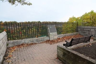
In memory of Lt. Col. Cecil Bishopp who died of wounds received during the raid on Black Rock, New York, July 11, 1813 during the War of 1812. He was buried in this cemetery on July 17, 1813. In 1846 Bishopp’s two sisters erected this memorial in . . . — — Map (db m139969) HM
On Lundy’s Lane, 0.08 kilometers east of Montrose Road, on the right when traveling west.
“If the captain wants me, he may come himself and if he does I will shoot him.”
With these words, Charles Green refused induction into the N. Jersey rebel militia. Imprisoned, he escaped and joined the “King’s Rangers” a . . . — — Map (db m75879) HM
As early as 1795, a small log church, used by a number of denominations, was on top of this hill. Destroyed during the Battle of Lundy’s Lane on July 25, 1814, it was not replaced until 1819 when a combination church and schoolhouse was constructed . . . — — Map (db m139955) HM
Near Lundy's Lane, on the left when traveling west.
Drummond Hill Presbyterian Church Present during the Battle of Lundy’s Lane, a former church once sat at the north east end of the cemetery. Built in 1887 by A.J. Lowell, the current church was then modernized in 1961. Captain Abraham Hull & . . . — — Map (db m139932) HM
On Niagara Boulevard at Sherk Road, on the right when traveling north on Niagara Boulevard.
In 1852 this was the site of the Ebenezer religious community of 800 people. It had log houses, a wharf, store, blacksmith shop, sawmill, woolen mill, flour mill, cannery, cabinet shop and a communal dining hall. Their best known product was high . . . — — Map (db m64653) HM
Near Lundy's Lane at Hanan Avenue, on the right when traveling east.
Here rests, in the hope of a joyful resurrection, the mortal remains of Edgeworth Ussher, Esq., whose devotion to his sovereign and exertions in the cause of his country at a critical period of the history of Canada, marked him out as an object for . . . — — Map (db m75852) HM WM
Near Lundy's Lane, on the left when traveling west.
“ In the centre the repeated and determined attacks of the enemy were met by the 89th Regiment, the detachments of the Royals and King’s and the Light Company of the 41st, with the most perfect steadiness and intrepid gallantry, and the . . . — — Map (db m139922) HM
On Niagara Parkway north of the Botanical Gardens, on the left when traveling north.
The Floral Clock at Queenston was built by Ontario Hydro in 1950. The idea to build the attraction came from Dr. Richard Lankaster Heam, Hydro’s General Manager and Chief Engineer at the time. While preparing for a business trip to England, Mr. . . . — — Map (db m79106) HM
Near Lundy's Lane at Hanan Avenue, on the right when traveling east.
Early on the morning of July 26th, 1814, Lieutenant-General Sir Gordon Drummond awaited another attack on the Lundy's Lane hill near Niagara Falls. Throughout the previous night, this hill had been taken and retaken in the bloodiest, most hard . . . — — Map (db m49693) HM
Near Lundy's Lane, on the right when traveling west.
On the evening of July 25, 1814, Col. James Miller, commander of the 21st US Infantry Regiment, was asked if his regiment could silence the seven British guns that had been holding the attacking American Army at bay for several hours. Miller replied . . . — — Map (db m139956) HM
On St. Paul Avenue at Pinestone Road, on the left when traveling north on St. Paul Avenue.
200 yards north west of the highest point was situated the largest Indian Ossuary yet discovered in the Province. First discovered in 1828. Bones and sand removed in 1908. — — Map (db m75853) HM
Near Niagara Parkway at Rainbow Bridge, on the right when traveling north.
The adjacent stone monument commemorates the visit of their majesties King George VI and Queen Elizabeth to view the site of the Rainbow Bridge on June 7, 1939.
Originally laid at the base of the carillon tower, it was severely damaged by an . . . — — Map (db m115417) HM
Cuban poet and patriot who sang to Niagara and, as José Martí said, awakened “an ever-burning passion for freedom” in the hearts of all Cubans.
Niagara
(fragments)
. . . — — Map (db m78068) HM
On Lundy's Lane at Hanan Avenue, on the right when traveling east on Lundy's Lane.
[Front Side of the Monument]:
To perpetuate
the name and fame of
Laura Secord
who walked alone nearly 20
miles by a circuitous difficult
and perilous route, through woods
and swamps and over miry . . . — — Map (db m49694) HM
On Niagara Parkway, 0.1 kilometers south of Murray.
{The west/city marker side, in English:}
Born and educated in Belgium, Hennepin was ordained a Recollet (Franciscan) friar in France. He was an adventurer at heart and undertook priestly duties in several European countries before being . . . — — Map (db m35487) HM
Lundy’s Lane Battlefield Gateway Commemorated on July 25th, 2014 on the 200th anniversary of the Battle of Lundy’s Lane (1814 – 2014) The City of Niagara Falls acknowledges the generous contribution made by the following partners Government . . . — — Map (db m139945) HM
On Lundy's Lane at Hanan Avenue, on the right when traveling east on Lundy's Lane.
In celebration of the City of Niagara Falls Centennial, and the 190th Anniversary of the Battle of Lundy's Lane, fought on July 25, 1814. These limestone panels were created to pay tribute to those who lost their lives in the battle. Let us remember . . . — — Map (db m49739) HM
On Niagara Parkway just south of Whirpool Road, on the right when traveling north.
The Niagara River Recreation Trail at this point is laid along the former double-track roadbed of the Niagara Falls Park and River Railway. From 1892 to 1932, before there was an auto route along the gorge, this electric railway carried millions of . . . — — Map (db m79520) HM
The Niagara Falls Park and River Railway Powerhouse, built on this site in 1892, was the first hydraulic powerhouse to use water from the Canadian side of the Niagara River. It generated 2100 hp of direct current electricity for the electric . . . — — Map (db m66409) HM
On Niagara Parkway at Whirlpool Road, on the right when traveling south on Niagara Parkway.
The Falls of Niagara were here about 7000 to 8000 years ago, three separate cataracts, about .8 kilometres (.5 miles) apart, fed by drainage from Lake Erie. Then suddenly, other lakes began to pour into Lake Erie, thereby increasing the outflow to . . . — — Map (db m34806) HM
These greenhouses were erected in the year 1946 as a part of the design of the Niagara Parks Commission to develop the natural magnificence of this historic district and to display its charms for the benefit not only of those who are residents of . . . — — Map (db m66411) HM
On Portage Road at Dennis Lane, on the left when traveling north on Portage Road.
Following the cession of the east bank of the Niagara River to the United States in 1783, the British authorities felt compelled to transfer the portage road around Niagara Falls to the west bank of the river. Opened in 1789 by a group of private . . . — — Map (db m75854) HM
On Niagara Parkway close to Victoria Avenue when traveling north.
This trail is provided and maintained through the earnings of The Niagara Parks Commission. The Commission is a self-funding agency of the Ontario Government dedicated to preserving and enhancing the beauty of the lands adjacent to the Niagara River . . . — — Map (db m79579) HM
On Niagara Parkway south of Victoria Avenue, on the right when traveling north.
Leonardo Torres Quevedo (1852–1936) was an ingenious Spanish engineer. Among his creations were algebraic machines, remote control devices, dirigibles and the world’s first computer.
The Niagara Spanish Aero Car was designed by Leonardo . . . — — Map (db m79427) HM
On Niagara Parkway, 0.3 kilometers south of Murray Street, on the right when traveling south.
Nikola Tesla was born to a Serbian family in the village of Smiljan, Croatia.
He was a brilliant child who when only 12 years old, upon seeing a lithograph of Niagara Falls declared that one day he would put a wheel under it and “power the . . . — — Map (db m115358) HM
On Niagara Parkway, 0.3 kilometers south of Murray Street, on the right when traveling south.
Speaking about this monument, Canadian sculptor Les Drysdale says:
“Tesla is as he would have appeared in 1896, age 39, about the time his inventions were being used to create hydroelectric power at Niagara Falls.
As the story goes, . . . — — Map (db m115368) HM
On Niagara Parkway, 0.2 kilometers south of Murray Street, on the right when traveling south.
The St. George Serbian Orthodox Church, Niagara Falls, in partnership with the Niagara Parks Commission, have erected this monument to Nikola Tesla. Physicist, inventor, electrical engineer. Tesla developed the world's first hydroelectric system . . . — — Map (db m115369) HM
This Memorial
– is –
Erected to Commemorate
the celebration of the
One Hundredth
Anniversary of the
Battle of
Lundy's Lane
Held here July 25th 1914
Under the Auspices
– of –
The . . . — — Map (db m54045) HM
On River Road, 0.2 kilometers Hiram Street, on the right when traveling north.
The Rainbow Bridge, owned and operated by the Niagara Falls Bridge Commission, was built in 1940-41 to replace the Upper Steel Arch Bridge. Its abutments are 15.1m (50 ft.) above the level of river ice jams. When it was built its 286m (950 ft.) arch . . . — — Map (db m64661) HM
Ruth Redmond was a teacher at nearby Stamford Collegiate from 1926 to 1967.
In 1954, Miss Redmond began purchasing properties that were adjacent to her home here on the north side of Lundy's Lane. This valuable land was part of the Lundy's Lane . . . — — Map (db m57035) HM
Near Niagara Parkway, 0.1 kilometers north of Murray Street.
First chairman of the Niagara Parks Commission (1885-93) Gzowski was born in Russia of Polish parents. Forced to emigrate, following participation in the Polish Rising of 1830, he came to Canada in 1841. An exceptionally able engineer, he first . . . — — Map (db m226751) HM
On Lundy's Lane, 0.03 kilometers south of Hanan Avenue, on the right when traveling east.
[Front Side of Monument]:
Erected by the
Canadian Parliament
in honour of the victory
gained by the
British & Canadian Forces
on this field on the
25th day of July, 1814
and in grateful remembrance . . . — — Map (db m49790) WM
On St. Paul Avenue at Pinestone Road, on the left when traveling north on St. Paul Avenue.
200 yards north east of this point stood
"Stamford Cottage" later known as
"Stamford Park" the home of
Sir Peregrine Maitland, Lieutenant Governor
of Upper Canada from 1818 to 1828.
The property was purchased in 1822 . . . — — Map (db m75856) HM
On Ferry Street (Road 20) at Sylvia Place, on the right when traveling east on Ferry Street.
John Latshaw architect
Offices for Stamford Township
and
the City of Niagara Falls
1874-1970
and the
Lundy's Lane Historical Museum
since 1970
Commemorated by
the
Lundy's Lane Historical Society
on the
centenary of this . . . — — Map (db m196311) HM
On Niagara Parkway close to Dufferin Isle Road, on the right when traveling north.
On August 6, 1918, this dumping scow broke loose from its towing tug about 1.6 kilometres (1 mile) upriver, with Gustav F. Lofberg and James N. Harris aboard. The men opened the bottom dumping doors and the scow grounded in the shallow rapids. They . . . — — Map (db m79781) HM
Near Niagara Parkway, 0.4 kilometers south of Murray Street, on the right when traveling north.
This is the site of the historic landmark, Table Rock, a shelf of bare rock 61 metres (200 feet) long, 18.3 metres (60 feet) wide. Once part of the crest of the Horseshoe Falls it was left isolated when the Falls receded. Rock falls in 1818, 1828, . . . — — Map (db m64668) HM
The first Table Rock House stood 150 yards north of here. Erected in the year 1853, it occupied a site opposite the historical landmark of Table Rock, an overhanging limestone ledge which fell into the Niagara Gorge in the year 1850. — — Map (db m78088) HM
British and American forces suffered heavy losses at the Battle of Lundy’s Lane on July 25, 1814 and these were severe in proportion to the number of combatants. The casualty rates were nearly equal, as each side recorded around 800 casualties, . . . — — Map (db m139918) HM
Near Lundy's Lane, on the left when traveling west.
Scott’s brigade approached from the south along the Portage Road. Shortly after 7pm on July 25, 1814, they emerged from the woods that covered the area south of this cemetery along present day Barker Street. Ahead, they saw the height of land at . . . — — Map (db m139926) HM
Near Lundy's Lane, on the left when traveling west.
The Americans surged forward, attempting to take the British position. This and repeated attempts failed and they endured heavy losses. Later, under cover of darkness, the American 21st Infantry made its way up the southeast slope of the hill. In a . . . — — Map (db m139931) HM
On Lundy's Lane, on the right when traveling west.
The Battle of Lundy’s Lane was a turning point in the War of 1812-14. While British Reinforcements began arriving in North America following the defeat of Napoleon in Europe, the Americans were pushing to gain control of the Niagara Peninsula. In . . . — — Map (db m139907) HM
On River Road, 0.2 kilometers south of Hiram Street, on the right when traveling north.
"It is further agreed that the waters herein defined as boundary waters and waters flowing across the boundary shall not be polluted on either side to the injury of health or property of the other."
Widely regarded as the first . . . — — Map (db m64648) HM
Near Lundy's Lane, on the right when traveling west.
In the early evening of July 25th, 1814, the British commander, Lt. General Drummond stood on this hilltop. Having just received intelligence that an American force was marching northward in this direction along the Portage Road, he realized that . . . — — Map (db m139912) HM
Near Niagara Parkway, 0.4 kilometers east of York Street (Local Route 81), on the right when traveling west.
On the river banks below here, the Americans were trapped. To the right the Americans scaled the river cliff and seized the Heights above. To the left the British held the Village of Queenston. A British 18-pounder cannon situated here within an . . . — — Map (db m75875) HM
On Niagara Parkway at Elgin Street, on the right when traveling south on Niagara Parkway.
The inukshuk (pronounced IN-OOK-SHOOK) means “in the image of man.” These magnificent lifelike figures of stone erected by the Inuit people are unique to the Canadian Arctic. The traditional purpose of an Inukshuk was . . . — — Map (db m79021) HM
Near Niagara Parkway, 0.5 kilometers north of Fraser Hill, on the right when traveling north.
In 1885, the Province of Ontario established The Niagara Parks Commission as part of an international effort to preserve the natural scenery around Niagara Falls.
Originally, the Commission included Colonel Casimir Gzowski, Chairman, John W. . . . — — Map (db m116093) HM
On Clifton Hill at Niagara Parkway / River Road, on the right on Clifton Hill.
Thomas Baker McQuesten was born in Hespeler, Ontario June 30, 1882. In 1934 he was appointed Minister of Highways and Public Works for the Province of Ontario and Chairman of the Niagara Parks Commission. He served in both positions for ten years.
. . . — — Map (db m78489) HM
On Niagara Parkway just north of Whirlpool Road when traveling north.
This depression was the site in the early 1800’s where John Thompson quarried the exposed limestone ridge at the edge of the gorge, and processed it into agricultural lime. There were two lime kilns and a water-powered sawmill on the site which . . . — — Map (db m79421) HM
On June 15, 2012, the world watched as professional tightrope walker Nik Wallenda crossed the Niagara Gorge on a wire. Table Rock complex marked the Canadian end point for this high wire walk, which began at Terrapin Point, directly across the Gorge . . . — — Map (db m64660) HM
To
the memory of
Burrell Hecock
of
Cleveland Ohio
Aged 17 Years
Who lost his life in an
heroic attempt to rescue
Mr and Mrs
Eldridge Stanton
of Toronto Ontario
when the ice bridge in
the gorge immediately
below . . . — — Map (db m35065) HM
On Niagara Parkway, on the right when traveling north on Niagara Parkway.
Opened in 1906 to supply the Toronto market, this generating station was the first wholly Canadian-owned hydro-electric facility at Niagara Falls. Engineers adapted advanced European and American technologies to a difficult site in a bold and . . . — — Map (db m79737) HM
Near Lundy's Lane at Hanan Avenue, on the right when traveling east.
This Monument erected July 25, 1991
by the American Legion, Niagara
County Committee & Dept. of New York
In memory of the U.S. Officers &
Soldiers who died at the Battle
of Lundy's Lane
Connecticut 25th; New York 23rd;
Massachusetts . . . — — Map (db m49695) HM
Near River Road at Clifton Hill, on the right when traveling north.
An abutment of the Upper Steel Arch Bridge built on this site 1897-98, is visible on the U.S. shore of the river. Also known as the Falls View Bridge and the Honeymoon Bridge, it stood until January 27, 1938, when an ice jam pushed the bridge off . . . — — Map (db m79521) HM
Near River Road, on the right when traveling north.
This plaque marks the entrance to the Upper Suspension Bridge, opened in July 1869, then the longest suspension bridge in the world. The iron cables were hung from timber towers. In 1884-87, this wooden bridge was changed to steel. In 1898, this . . . — — Map (db m64670) HM
On Lundy's Lane, on the right when traveling west.
The Napoleonic Wars raged in Europe from 1803 to 1815 and had a global impact. Wishing to remain neutral and assert its independence, the United States continued to trade with both Britain and France. Nevertheless, diplomatic relations between the . . . — — Map (db m139911) HM
On Niagara Parkway at the exit of the Whirlpool Aero Car parking lot, on the right when traveling north on Niagara Parkway.
An ancient river pre-dating the Wisconsin Glacier flowed through the channel of the Whirlpool Rapids and the Whirlpool draining glacial Lake Erie. After the retreat of the glacier when the present river broke through the rock barriers at Thompson . . . — — Map (db m79581) HM
On Lundy's Lane (Regional Road 20) just west of Queen Elizabeth Way, on the right when traveling east.
A native of Pennsylvania, William Lundy and his wife Nancy (Silverthorn) came to Canada in 1786. They were among the first settlers in the Niagara area. As a United Empire Loyalist, William received from the Crown a large land grant in this section . . . — — Map (db m199068) HM
On Niagara Parkway, 0.2 kilometers north of Fraser Hill, on the right when traveling north.
Built in 1901-05, it was the first Powerhouse on the Canadian side to produce electrical energy for commercial use and sale outside Niagara Falls.
Its location takes advantage of the natural flow of the river which formerly entered here to flow . . . — — Map (db m116098) HM
On Falls Avenue at Niagara Parkway, on the right when traveling south on Falls Avenue.
This beautiful fountain takes its name from Samuel Zimmerman who came to Canada from Pennsylvania in 1842. He amassed a fortune through a series of lucrative contracts involving the building of the second Welland Canal and various Railway Lines, . . . — — Map (db m75881) HM