236 entries match your criteria. The first 100 are listed. ⊳
Signers of the Declaration of Independence Historical Markers
By Michael Herrick, February 22, 2010
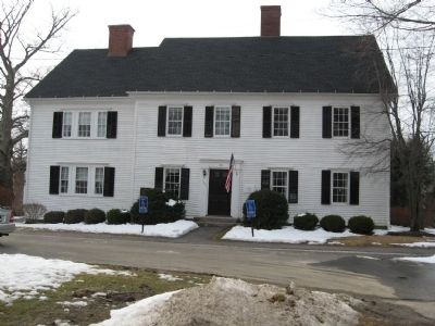
Oliver Wolcott Jr. Home
| 1 ► Connecticut, Litchfield County, Litchfield — Oliver Wolcott Jr. Home — |
| On South Street (Connecticut Route 63) at Wolcott Street, on the right when traveling south on South Street. | |||
| 2 ► Connecticut, Litchfield County, New Milford — Roger Sherman — |
| On Main Street at Church Street, on the left when traveling south on Main Street. | |||
| 3 ► Connecticut, Litchfield County, New Milford — Roger Sherman — |
| On Main Street south of Church Street, on the right when traveling north. | |||
| 4 ► Connecticut, New Haven County, New Haven, Downtown — Roger Sherman — |
| Near Grove Street at High Street, on the right when traveling north. | |||
| 5 ► Connecticut, New Haven County, New Haven, Downtown — Roger Sherman Homesite — |
| On Chapel Street at College Street, on the left when traveling west on Chapel Street. | |||
| 6 ► Connecticut, New Haven County, Wallingford, Wallingford Center — Lyman Hall — |
| Near Center Street (Connecticut Route 150) near South Colony Road, on the right when traveling east. | |||
| 7 ► Connecticut, Windham County, Scotland — Samuel Huntington Birthplace — |
| On Huntington Road (Connecticut Route 14) at Devotion Road, on the left when traveling east on Huntington Road. | |||
| 8 ► Delaware, Kent County, Dover — Caesar Rodney — |
| On South State Street at East Water Street on South State Street. | |||
| 9 ► Delaware, Kent County, Dover, Dover Air Force Base — KC-53 — Byfield — |
| On Delaware Route 9 at Bergold Lane, on the right when traveling north on State Route 9. | |||
| 10 ► Delaware, New Castle County, New Castle — George Read — |
| On Market Street at Harmony Street on Market Street. | |||
| 11 ► Delaware, New Castle County, New Castle — George Read — |
| 12 ► Delaware, New Castle County, New Castle — NC-A8 — Home of George Read — |
| On The Strand. | |||
| 13 ► Delaware, New Castle County, Wilmington, Happy Valley — George Read Memorial — |
| On Delaware Avenue. | |||
| 14 ► District of Columbia, Washington, Northwest Washington, Dupont Circle — John Witherspoon — 1722 Scotland – Princeton 1794 — |
| On Connecticut Avenue Northwest at N Street Northwest, on the right when traveling north on Connecticut Avenue Northwest. | |||
| 15 ► District of Columbia, Washington, Northwest Washington, The National Mall — A Memorial to the 56 Signers of the Declaration of Independence — A Gift From The American Revolution Bicentennial Administration — 1976 — |
| Near Constitution Avenue Northwest (U.S. 50) east of 19th Street Northwest, on the right when traveling east. | |||
| 16 ► District of Columbia, Washington, Southeast Washington, Barney Circle — Elbridge Gerry — Congressional Cemetery — |
| Near E Street Southeast, 0.1 miles east of Potomac Avenue Southeast, on the right when traveling east. | |||
| 17 ► Georgia, Burke County, Waynesboro — 017-8 — Burke County's 8 Governors — |
| On N. Liberty St (U.S. 25) at W. 6th Street (Georgia Route 56/80) on N. Liberty St. | |||
| 18 ► Georgia, Chatham County, Savannah, Historic District - North — Button Gwinnett — |
| Near East Oglethorpe Avenue. | |||
| 19 ► Georgia, Chatham County, Savannah, Yamacraw Village — George Clymer — 1739 - 1813 — |
| On Martin Luther King Boulevard ( West Broad Street ). | |||
| 20 ► Georgia, Gwinnett County, Lawrenceville — 067-1 — Button Gwinnett — |
| On North Clayton Street (Georgia Route 20) 0 miles West Crogan Street (U.S. 29), on the left when traveling north. | |||
| 21 ► Georgia, Hall County, Gainesville — 069-2 — Lyman Hall — |
| Near Spring Street, 0 miles east of Main Street SW. | |||
| 22 ► Georgia, Hancock County, Sparta — 070-3 — Hancock County — |
| On Broad Street (Georgia Route 15/16) at Court Street, on the right when traveling east on Broad Street. | |||
| 23 ► Georgia, Liberty County, Midway — 089-1 — "Hall's Knoll" — Home of Dr. Lyman Hall »—→ — |
| On Ocean Highway (U.S. 17), on the right when traveling south. | |||
| 24 ► Georgia, Liberty County, Midway — 089-2 — Button Gwinnett — |
| On U.S. 17. | |||
| 25 ► Georgia, Liberty County, Midway — Dr. Lyman Hall — |
| On Ocean Highway (U.S. 17) at Martin Rd, on the left when traveling south on Ocean Highway. | |||
| 26 ► Georgia, Liberty County, Sunbury — 089-4B — Sunbury — Home of Many Famous Persons — |
| On Brigantine Dunsmore Road at Fort Morris Road, on the right when traveling north on Brigantine Dunsmore Road. | |||
| 27 ► Georgia, Richmond County, Augusta — George Walton — |
| On Independence Drive near 13th Street (U.S. 1), on the left when traveling west. | |||
| 28 ► Georgia, Richmond County, Augusta — Meadow Garden — |
| On Independence Drive near near 13th Street (U.S. 1), on the left when traveling west. | |||
| 29 ► Georgia, Richmond County, Augusta — 121-34 — Meadow Garden — Home of George Walton ← 400 Ft. —« — |
| On 13th Street (U.S. 1) near Independence Drive, on the left when traveling north. | |||
| 30 ► Georgia, Richmond County, Augusta — 121-28 — The Signer's Monument — |
| On Greene Street near Monument Street. | |||
| 31 ► Georgia, Walton County, Monroe — 147-1 — Walton County — |
| On East Spring Street (Business U.S. 78) 0 miles east of South Broad Street (Georgia Route 11), on the right when traveling east. | |||
| 32 ► Georgia, Wilkes County, Washington — Tarver-Maynard House — Erected 1820 — |
| On East Robert Toombs Avenue (Business U.S. 78) 0 miles west of Poplar Drive (Georgia Route 17), on the left when traveling east. | |||
| 33 ► Indiana, Carroll County, Delphi — Delphi — |
| On U.S. 421. | |||
| 34 ► Indiana, Huntington County, Huntington — Samuel Huntington — 1731 -- 1796 — Signer of the Declaration of Independence — |
| On Jefferson St., 0 miles north of State St. (Road Hunting). | |||
| 35 ► Kansas, Butler County, El Dorado — Signers of the Declaration of Independence — |
| On Central Avenue (State Highway 254) near Gordy Street, on the left when traveling west. | |||
| 36 ► Kentucky, Carroll County, Carrollton — 216 — Carrollton — |
| On U.S. 42 east of Ware Avenue, on the right when traveling west. | |||
| 37 ► Maryland, Anne Arundel County, Annapolis — 6 — Chase-Lloyd House — The Naval War of 1812 in Annapolis — Don't Give Up the Ship — |
| On Maryland Avenue at King George Street, on the left when traveling east on Maryland Avenue. | |||
| 38 ► Maryland, Anne Arundel County, Annapolis — Congress Was Here — West Street — At the End of the Revolution — |
| On West Street (Maryland Route 450) west of Church Circle, on the right when traveling west. | |||
| 39 ► Maryland, Anne Arundel County, Annapolis — The Charles Carroll House — |
| Near Duke of Gloucester Street, on the right when traveling south. | |||
| 40 ► Maryland, Baltimore, Guilford — Clover Hill — (So named circa 1714) — |
| On North Charles Street at University Parkway on North Charles Street. | |||
| 41 ► Maryland, Baltimore, Inner Harbor — Welcome — Heritage Walk — |
| On East Pratt Street east of South Calvert Street (Maryland Route 2), on the left when traveling east. | |||
| 42 ► Maryland, Baltimore, Johns Hopkins Homewood — Homewood — |
| Near University Parkway. | |||
| 43 ► Maryland, Baltimore, Johns Hopkins Homewood — Homewood — |
| On Charles Street (Maryland Route 139) at Greenway, on the right when traveling south on Charles Street. | |||
| 44 ► Maryland, Baltimore, Johns Hopkins Homewood — Homewood — |
| On East Gate west of North Charles Street (Maryland Route 139), on the left when traveling north. | |||
| 45 ► Maryland, Baltimore, Jonestown — Carroll Mansion — |
| On Front Street, 0.1 miles north of Lombard Street, on the left when traveling south. | |||
| 46 ► Maryland, Baltimore, Pigtown — First Stone of the Balt. & Ohio Rail Road — |
| On West Pratt Street west of South Poppleton Street, on the left when traveling west. | |||
| 47 ► Maryland, Baltimore, University of Maryland — National Independence in the Revolution and War of 1812 — |
| On West Redwood Street, on the right when traveling east. | |||
| 48 ► Maryland, Cecil County, Colora — This Tablet is in Commemoration — |
| On Harrisville Road at Firetower Road, on the right when traveling south on Harrisville Road. | |||
| 49 ► Maryland, Cecil County, Earleville — Mount Pleasant — |
| On Grove Neck Road, 1 mile west of Sandy Bottom Road, on the right when traveling west. | |||
| 50 ► Maryland, Cecil County, Earleville — Woodlawn — Formerly "Neighbour’s Grudge" — |
| On Grove Neck Road, 0.1 miles east of Pond Neck Road, on the left when traveling west. | |||
| 51 ► Maryland, Charles County, Port Tobacco — Discover Thomas Stone National Historic Site — More Than History... — |
| Near Rose Hill Road, 1.7 miles north of Port Tobacco Road. | |||
| 52 ► Maryland, Charles County, Port Tobacco — The Stones of Maryland — Thomas Stone National Historic Site — National Park Service, U.S. Department of the Interior — |
| Near Rose Hill Road, 0.6 miles south of Wembly Place, on the right when traveling south. | |||
| 53 ► Maryland, Charles County, Port Tobacco — Thomas Stone — Born 1744-Died 1787 — |
| On Hawthorne Road at Ropse Hill Road, on the right when traveling east on Hawthorne Road. | |||
| 54 ► Maryland, Charles County, Port Tobacco — Thomas Stone — 1743 - 1787 — |
| Near Rose Hill Road. | |||
| 55 ► Maryland, Charles County, Port Tobacco — Welcome to Haberdeventure! — Thomas Stone National Historic Site — National Park Service, U.S. Department of the Interior — |
| Near Rose Hill Road, 0.5 miles south of Wembly Place, on the right when traveling south. | |||
| 56 ► Maryland, Frederick County, Buckeystown — “Carrollton” — |
| On Buckeystown Pike (Maryland Route 85), on the left when traveling north. | |||
| 57 ► Maryland, Harford County, Abingdon — Gov. William Paca — Old Post Road — Established 1666 — |
| On Philadelphia Road (Maryland Route 7) 0.4 miles north of Maryland Route 24, on the right when traveling north. | |||
| 58 ► Maryland, Prince George's County, Hyattsville — The Declaration of Independence / President John F. Kennedy’s Inaugural Address — |
| On Toledo Road just west of America Boulevard, on the left when traveling west. | |||
| 59 ► Maryland, Queen Anne's County, Carmichael — “Wye Plantation” — → — |
| On Carmichael Road, 0.2 miles north of Wye Island Road, on the left when traveling south. | |||
| 60 ► Maryland, Somerset County, Princess Anne — Birthplace of Samuel Chase — 17 April 1741 - 19 June 1811 — ← — |
| On US 13 at MD 362, on the right when traveling north on US 13. | |||
| 61 ► Maryland, St. Mary's County, St. Mary's City — An End of Freedom but Persistence of Faith — |
| Near Point Lookout Road (Maryland Route 5) 0.4 miles west of Rosecroft Road, on the left when traveling west. | |||
| 62 ► Maryland, Talbot County, Trappe — Robert Morris, Sr. — |
| Near Manadier Road, 0.2 miles east of MD 50, on the left when traveling east. | |||
| 63 ► Massachusetts, Bristol County, Taunton — Robert Treat Paine — |
| On Church Green at Summer Street, on the left when traveling west on Church Green. | |||
| 64 ► Massachusetts, Norfolk County, Quincy — John Adams — |
| On Burgin Pkwy at Dimmock Street, on the right when traveling north on Burgin Pkwy. | |||
| 65 ► Massachusetts, Norfolk County, Quincy — John Hancock Birth Site — |
| On Adams Street at Hancock Street, on the right when traveling south on Adams Street. | |||
| 66 ► Massachusetts, Norfolk County, Quincy — John Hancock Birth Site — |
| On Adams Street at Hancock Street, on the right when traveling east on Adams Street. | |||
| 67 ► Massachusetts, Suffolk County, Boston, Downtown — Benjamin Franklin — |
| On School Street, on the left when traveling east. | |||
| 68 ► Massachusetts, Suffolk County, Boston, Downtown — Granary Burying Ground — 1660 — |
| On Tremont Street at Bromfield Street, on the left when traveling north on Tremont Street. | |||
| 69 ► Massachusetts, Suffolk County, Boston, Downtown — Samuel Adams — |
| On Tremont Street at Bromfield Street, on the left when traveling north on Tremont Street. | |||
| 70 ► Massachusetts, Suffolk County, Boston, Downtown — Welcome to Granary Burying Ground |
| On Tremont Street at Bromfield Street, on the left when traveling north on Tremont Street. Reported missing. | |||
| 71 ► Massachusetts, Suffolk County, Boston, Government Center — Samuel Adams — |
| On Congress Street at North Street, on the right when traveling north on Congress Street. | |||
| 72 ► Missouri, St. Louis County, Florissant — Thomas Jefferson — 13 April 1743 - 4 July 1826 (50th annv. of 1776) — |
| On Saint Francois Street just west of North Jefferson Street, on the right when traveling east. | |||
| 73 ► New Hampshire, Hillsborough County, Merrimack — 079 — Matthew Thornton — 1714 - 1803 — |
| On Daniel Webster Highway north of Continental Blvd, on the right when traveling north. | |||
| 74 ► New Hampshire, Rockingham County, Kingston — 046 — Josiah Bartlett — — 1729–1795 — — |
| On West Main Street, on the right when traveling north. | |||
| 75 ► New Hampshire, Rockingham County, Portsmouth — Horse Chestnut — Aesculus hippocastanum — |
| On Market Street, on the right when traveling south. | |||
| 76 ► New Jersey, Burlington County, Bordentown — Francis Hopkinson — 1737 - 1791 — |
| On Farnsworth Avenue (County Route 545) at Park Street (County Route 662), on the right when traveling north on Farnsworth Avenue. | |||
| 77 ► New Jersey, Hunterdon County, Amwell — John Hart's Cave — |
| On Lindbergh Road at Zion Road, on the right when traveling south on Lindbergh Road. | |||
| 78 ► New Jersey, Mercer County, Hopewell — John Hart — Signer of The Declaration Of Independence — |
| On Hart Avenue, on the right when traveling west. | |||
| 79 ► New Jersey, Mercer County, Princeton — John Witherspoon — 1723 - 1794 — |
| Near Nassau Street, on the right when traveling east. | |||
| 80 ► New Jersey, Mercer County, Princeton — Joseph Hewes — |
| On Snowden Lane north of Maybury Hill Road, on the right when traveling south. | |||
| 81 ► New Jersey, Mercer County, Princeton — Rev. John Witherspoon — |
| Near Greenview Avenue, on the left when traveling north. | |||
| 82 ► New Jersey, Mercer County, Princeton — Richard Stockton — |
| Near Quaker Road (County Route 533) at Mercer Road, on the right when traveling north. | |||
| 83 ► New Jersey, Mercer County, Princeton — The Great Lawn / Morven Museum & Garden — |
| On Stockton Street (U.S. 206) just east of Library Place, on the right when traveling west. | |||
| 84 ► New Jersey, Mercer County, Princeton — The West Wing |
| Near Stockton Street (U.S. 206). Reported permanently removed. | |||
| 85 ► New Jersey, Mercer County, Princeton — The West Wing — |
| Near Stockton Street (U.S. 206) just west of Monument Drive, on the right when traveling west. | |||
| 86 ► New Jersey, Mercer County, Trenton, Downtown — Friends Meeting House — 1739 — |
| On North Warren Street (U.S. 206) at West Hanover Street, on the right when traveling south on North Warren Street. | |||
| 87 ► New Jersey, Mercer County, Trenton, Hanover Academy — George Clymer — We mutually pledge to each other our fortunes and our sacred honor — |
| On East Hanover Street west of North Montgomery Street, on the right when traveling west. | |||
| 88 ► New Jersey, Union County, Rahway — Abraham Clark — |
| On St Georges Avenue (County Route 27), on the right when traveling south. | |||
| 89 ► New Jersey, Union County, Roselle — In Remembrance of Abraham Clark — |
| On West Ninth Avenue (County Route 619) at Chestnut Street (County Route 625), on the left when traveling east on West Ninth Avenue. | |||
| 90 ► New York, Albany County, Albany, Downtown — Philip Livingston — |
| On State Street (New York State Route 5) west of North Pearl Street, on the right when traveling west. | |||
| 91 ► New York, Bronx County, Bronx, Mott Haven — St. Ann's Shrine — |
| On St Ann's Avenue, on the right when traveling south. | |||
| 92 ► New York, Kings County, Brooklyn, Carroll Gardens — Louis Valentine Jr. Ballfield / Carroll Park — |
| On Court Street at President Street, on the left when traveling south on Court Street. | |||
| 93 ► New York, Kings County, Brooklyn, Ocean Hill — 300 — Marion & Hopkinson Playground — 0.768 acre — |
| On Marion Street east of Thomas S. Boyland Street, on the right when traveling west. | |||
| 94 ► New York, Kings County, Brooklyn, Ocean Hill — 300 — Marion & Hopkinson Playground — 0.768 acre — |
| On Thomas S. Boyland Street just north of Marion Street, on the right when traveling north. | |||
| 95 ► New York, New York County, Manhattan, Battery Park — National Park Service Sites — |
| Near State Street south of Battery Place, on the right when traveling south. | |||
| 96 ► New York, New York County, Manhattan, Financial District — Francis Lewis, 1713 - 1803 — |
| Near Broadway just south of Pine Street, on the left when traveling north. | |||
| 97 ► New York, New York County, Manhattan, Financial District — Trinity Church — Exploring Downtown |
| On Broadway at Wall Street, on the right when traveling south on Broadway. Reported permanently removed. | |||
| 98 ► New York, Queens County, Queens, Flushing — St. George's Church — Landmarks of New York — |
| On Main Street just south of 38th Avenue, on the right when traveling south. | |||
| 99 ► New York, Suffolk County, Mastic — Gen William Floyd — |
| On Montauk Highway when traveling west. | |||
| 100 ► North Carolina, Chowan County, Edenton — 12 — 1736 St. Paul's Episcopal Church — Parish Organized under Act of Assembly 1701 — Edenton Historical Commission Museum Trail — |
| On West Church Street just west of North Broad Street (State Highway 32), on the right when traveling west. | |||
236 entries matched your criteria. The first 100 are listed above. Next 100 ⊳