213 entries match your criteria. The first 100 are listed. ⊳
Historical Markers and War Memorials
in the Central Utah Valleys Region
By Jeremy Snow, June 23, 2024
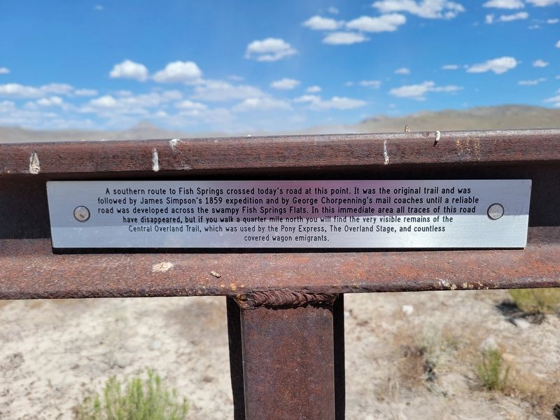
Central Overland Trail - Black Rock Hills Southern Route Marker
1 ► Utah, Juab County, Dugway — COTNU-8A — Central Overland Trail - Black Rock Hills Southern Route —  |
| On Pony Express Road, on the left when traveling west. | |||
| 2 ► Utah, Juab County, Dugway — COTNU-8 — Central Overland Trail - Dugway Pass — |
| On Pony Express Road, on the right when traveling west. | |||
| 3 ► Utah, Juab County, Dugway — OTN-10 — Central Overland Trail - Fish Springs — |
| On Watchable Wildlife Area Access, on the left when traveling south. | |||
| 4 ► Utah, Juab County, Dugway — 91 — Fish Springs Station — |
| On Pony Express Road, on the right when traveling west. | |||
| 5 ► Utah, Juab County, Eureka — N-236-9 — “Old” L.D.S. Church Meetinghouse — Utah Historic Site — |
| On West Main Street at West Dublin Avenue, on the right when traveling east on West Main Street. | |||
| 6 ► Utah, Juab County, Eureka — N-236-4 — B.P.O.E. Block, Elk Lodge #711 — Eureka Historic District — |
| On West Main Street, on the right when traveling east. | |||
| 7 ► Utah, Juab County, Eureka — N-236-2 — Eureka City Hall — Utah Historic Site — |
| On West Main Street, on the right when traveling east. | |||
| 8 ► Utah, Juab County, Eureka — N-236-10 — Eureka Post Office — Eureka Historic District — |
| On West Main Street, on the right when traveling east. | |||
| 9 ► Utah, Juab County, Eureka — N-236 — Eureka United Methodist Church — Utah Historic Site — |
| On West Main Street, on the right when traveling east. | |||
| 10 ► Utah, Juab County, Eureka — N-236-3 — Juab County Courthouse — Utah Historic Site — |
| On North Church Street, on the left when traveling north. | |||
| 11 ► Utah, Juab County, Eureka — N-236-6 — McCornick and Company Bank — Eureka Historic District — |
| On West Main Street, on the right when traveling east. | |||
| 12 ► Utah, Juab County, Eureka — N-236-7 — Old Eureka Post Office — Eureka Historic District — |
| On West Main Street, on the right when traveling east. | |||
| 13 ► Utah, Juab County, Eureka — N-236-1 — St. Patrick's Catholic Church — Utah Historic Site — |
| On North Church Street, on the left when traveling north. | |||
| 14 ► Utah, Juab County, Eureka — N-236-1 — The Bullion Beck & Champion Mining Company Headframe — |
| On West Main Street 0.3 miles west of Church Street, on the right when traveling west. | |||
| 15 ► Utah, Juab County, Eureka — 512 — Tintic Mining District — |
| On Terrace Heights Road when traveling north. | |||
| 16 ► Utah, Juab County, Eureka — Union Pacific Railroad Depot — Eureka Train Depot — |
| On West Main Street, on the right when traveling east. | |||
| 17 ► Utah, Juab County, Greenhaven — COTNU-12 — Central Overland Trail - Boyd Station — |
| On East Pony Express Road, on the right when traveling west. | |||
| 18 ► Utah, Juab County, Greenhaven — COTNU-10A — Central Overland Trail - Fish Springs Mountain — |
| On Wilson Cutoff Road, on the right when traveling west. | |||
| 19 ► Utah, Juab County, Greenhaven — The Crowds Cheered On... — The Route of the Pony Express Trail — |
| On East Pony Express Road, on the right when traveling west. | |||
| 20 ► Utah, Juab County, Greenhaven — Unsung Heros — |
| On East Pony Express Road, on the right when traveling west. | |||
| 21 ► Utah, Juab County, Greenhaven — With Speed Came Limits — |
| On East Pony Express Road, on the right when traveling west. | |||
| 22 ► Utah, Juab County, Ibapah, Callao — Central Overland Trail - Willow Springs (Callao) — |
| On North Pony Express Road, on the right when traveling west. | |||
| 23 ► Utah, Juab County, Ibapah, Callao — 83 — Willow Springs Pony Express Station — |
| On North Pony Express Road. | |||
| 24 ► Utah, Juab County, Levan — 407 — Levan — |
| On North 1st Street East south of East 1st Street North, on the right when traveling south. | |||
| 25 ► Utah, Juab County, Levan — Rolling Out Of The Past — |
| Near Old U.S. 90 4.2 miles south of Interstate 15. | |||
| 26 ► Utah, Juab County, Levan — 387 — The Walker War — |
| On North Main Street, on the right when traveling north. | |||
| 27 ► Utah, Juab County, Mammoth — N-236-8 — Mammoth Fire Station — Utah Historic Site — |
| On Main Street 1.6 miles east of U.S. 6, on the right when traveling east. | |||
| 28 ► Utah, Juab County, Mammoth — Site of the Tintic Hospital — (1902 - 1933) — |
| On Gold Street at Main Street, on the left when traveling south on Gold Street. | |||
| 29 ► Utah, Juab County, Mona — Mona Bicentennial Memorial Park — |
| On Center Street west of Old Highway 91, on the right when traveling west. | |||
| 30 ► Utah, Juab County, Mona — 29 — Old Pioneer Cemetery — |
| On The Mona Road 0.2 miles north of Utah Route 54, on the right when traveling north. | |||
| 31 ► Utah, Juab County, Nephi — 434 — Burraston Ponds — |
| On Burraston Road 0.7 miles west of Old Highway 91, on the left when traveling west. | |||
| 32 ► Utah, Juab County, Nephi — 196 — Early Schools — |
| On North 100 East Street north of East 500 North Street, on the left when traveling north. | |||
| 33 ► Utah, Juab County, Nephi — 459 — Juab Co. Jail — |
| On West Center Street west of Main Street, on the left when traveling west. | |||
| 34 ► Utah, Juab County, Nephi — Oscar M. Booth House — |
| On East 100 South Street, on the right when traveling west. | |||
| 35 ► Utah, Juab County, Nephi — 11 — Salt Creek Canyon Massacre — |
| On Utah Route 132 at milepost 40.5, on the right when traveling east. | |||
| 36 ► Utah, Juab County, Nephi — 2 — Salt Creek Fort — |
| On North 100 East Street north of East 500 North Street, on the left when traveling north. | |||
| 37 ► Utah, Juab County, Nephi — 499 — The Old Mill Wheel — |
| On South Main Street at 100 South Street, on the right when traveling north on South Main Street. | |||
| 38 ► Utah, Millard County, Beaver — UT-7 — Salt Lake to Southern California Road - Cove Fort — |
| On Cove Fort Road, on the right when traveling east. | |||
| 39 ► Utah, Millard County, Delta — “All Gave Some - Some Gave All” — |
| On West 4500 N Street 0.7 miles west of North 10000 W Street, on the left when traveling west. | |||
| 40 ► Utah, Millard County, Delta — 553 — Deseret Relief Society Hall — |
| On Utah Route 257, on the left when traveling south. | |||
| 41 ► Utah, Millard County, Delta — 218 — Escalante Trail — |
| On Main Street. | |||
| 42 ► Utah, Millard County, Delta — 23 — Fort Deseret — |
| On Utah Route 257 4.4 miles south of U.S. 6, on the right when traveling south. | |||
| 43 ► Utah, Millard County, Delta — N-12 — Fort Deseret — Utah Historic Site — |
| Near Utah Route 257 4.4 miles south of U.S. 6, on the right when traveling south. | |||
| 44 ► Utah, Millard County, Delta — 447 — Gunnison Massacre Site — |
| Near West Main Street. | |||
| 45 ► Utah, Millard County, Delta — S-27 — McCullough Log House and Post Office — Utah Historic Site — |
| On West Main Street, on the right when traveling west. | |||
| 46 ► Utah, Millard County, Delta — 119 — Pioneer Cabin — |
| On West Main Street, on the right when traveling west. | |||
| 47 ► Utah, Millard County, Delta — Topaz 1942–1946 — Central Utah WRA Relocation Center — |
| On Main Street. | |||
| 48 ► Utah, Millard County, Delta — Topaz Internment Camp — |
| On West 4500 N Street 0.7 miles west of N 10000 W street, on the left when traveling west. | |||
| 49 ► Utah, Millard County, Fillmore — Built with Pride — |
| On West Capitol Street. | |||
| 50 ► Utah, Millard County, Fillmore — Capitol — |
| On North Main Street, on the right when traveling north. | |||
| 51 ► Utah, Millard County, Fillmore — Dominguez - Escalante Trail — |
| On North Main Street, on the right when traveling north. | |||
| 52 ► Utah, Millard County, Fillmore — S-91 — Edward Partridge, Jr. House — Utah Historical Site — |
| On South 200 West, on the right when traveling south. | |||
| 53 ► Utah, Millard County, Fillmore — Emphasis on Education — |
| On North Main Street, on the right when traveling north. | |||
| 54 ► Utah, Millard County, Fillmore — Fillmore Armory — Utah Historic Site — |
| On West Center Street, on the right when traveling east. | |||
| 55 ► Utah, Millard County, Fillmore — 8 — Fillmore Pioneer Fort — |
| On South Main Street at East Center Street, on the right when traveling north on South Main Street. | |||
| 56 ► Utah, Millard County, Fillmore — 408 — Fillmore's Adobe Church — |
| Near East 500 North 0.2 miles east of Main Street. | |||
| 57 ► Utah, Millard County, Fillmore — From Capital to Museum — |
| On West 100 South Street, on the right when traveling west. | |||
| 58 ► Utah, Millard County, Fillmore — Land of the Yuta — |
| On West 100 South Street west of South Main Street, on the right when traveling west. | |||
| 59 ► Utah, Millard County, Fillmore — 190 — Little Rock Schoolhouse — |
| On 100 West at 100 South, on the left when traveling south on 100 West. | |||
| 60 ► Utah, Millard County, Fillmore — N-9 — Territorial Capitol — Utah Historic Sites — |
| On West Capitol Street, on the right when traveling west. | |||
| 61 ► Utah, Millard County, Fillmore — 7 — Utah’s First Capitol — |
| Near West Capitol Avenue. | |||
| 62 ► Utah, Millard County, Fillmore — Utah's First Capital — |
| On West Capitol Street, on the right when traveling west. | |||
| 63 ► Utah, Millard County, Fillmore — Vision vs. Reality — |
| On West Capitol Street. | |||
| 64 ► Utah, Millard County, Hinckley — Hinckley Schools — |
| On North Main Street 0.1 miles north of Center Street, on the right when traveling north. | |||
| 65 ► Utah, Millard County, Hinckley — S-14 — Millard Academy — Utah Historic Site — |
| On East 200 North at 100 West, in the median on East 200 North. | |||
| 66 ► Utah, Millard County, Holden — 3 — Cedar Springs Fort — (Buttermilk Fort) — |
| On 100 East at 100 North, on the left when traveling east on 100 East. | |||
| 67 ► Utah, Millard County, Holden — Heritage Bell — |
| On 100 North 0.1 miles east of 100 East, on the right when traveling east. | |||
| 68 ► Utah, Millard County, Holden — Holden — |
| On U.S. 50 at Route 64, on the right when traveling east on U.S. 50. | |||
| 69 ► Utah, Millard County, Kanosh — 1867 Chief Kanosh Memorial 1976 — |
| On North Main Street south of 100 North Street, on the right when traveling south. | |||
| 70 ► Utah, Millard County, Kanosh — 549 — Gilmer & Salisbury Overland Stage Company — |
| On West Hatton Road, on the right when traveling east. | |||
| 71 ► Utah, Millard County, Kanosh — Kanosh — |
| On South Highway 91 at South Main Street, on the right when traveling north on South Highway 91. | |||
| 72 ► Utah, Millard County, Kanosh — 200 — Kanosh — |
| On North Main Street south of 100 North Street, on the left when traveling south. | |||
| 73 ► Utah, Millard County, Leamington — Morrison Charcoal Ovens 1882 — |
| On State Highway 132 1.3 miles east of State Highway 125, on the right when traveling west. | |||
| 74 ► Utah, Millard County, Leamington — Morrison Charcoal Ovens 1882 — |
| On Utah State Highway 132 (Utah Route 132) 1.4 miles west of Hwy's 132 and 125 ( Route 125), on the right when traveling west. | |||
| 75 ► Utah, Millard County, Meadow — Chief Walkara — (Chief Walker, Wakarum) — 1810 ca. - - - - January 29, 1855 — |
| On North Main Street at Interstate 15, on the right when traveling south on North Main Street. | |||
| 76 ► Utah, Millard County, Meadow — 191 — Settlement of Meadow — |
| On East Center Street at 100 East Street, on the right when traveling east on East Center Street. | |||
| 77 ► Utah, Millard County, Meadow — Taysom Cabin — |
| On Main Street (Utah Route 133), on the right when traveling south. | |||
| 78 ► Utah, Millard County, Oak City — 472 — Oak City / The Bell — |
| On Main Street at Center Street, on the right when traveling north on Main Street. | |||
| 79 ► Utah, Millard County, Scipio — N-1014 — Scipio Town Hall — Utah Historic Site — |
| On North State Street south of 100 North Street, on the right when traveling south. | |||
| 80 ► Utah, Millard County, Scipio — 234 — Settlement of Scipio — |
| On North State Street south of 100 North Street, on the right when traveling south. | |||
| 81 ► Utah, Piute County, Circleville — 366 — Circleville — |
| On East Main Street at 100 East Street, on the left when traveling east on East Main Street. | |||
| 82 ► Utah, Piute County, Circleville — Circleville Massacre Monument — |
| On U.S. 89, on the left when traveling east. | |||
| 83 ► Utah, Piute County, Circleville — Circleville Veterans Memorial — |
| On East Main Street at N 100 E St, on the right when traveling west on East Main Street. | |||
| 84 ► Utah, Piute County, Circleville — The Circleville Massacre — April 1866 — |
| On U.S. 89, on the left when traveling east. | |||
| 85 ► Utah, Piute County, Junction — N-25 — Piute County Courthouse — |
| On North Main Street, on the left when traveling north. | |||
| 86 ► Utah, Piute County, Kingston — Kingston Ward — |
| On Center Street at W 100 S Street, on the right when traveling south on Center Street. | |||
| 87 ► Utah, Piute County, Kingston — The Fish Lake Cut-off on the Old Spanish Trail — Pathway to Grassy Meadows and Water — |
| On Utah Route 62, on the left when traveling west. | |||
| 88 ► Utah, Piute County, Marysvale — 320 — Marysvale — Daughters of Utah Pioneers — |
| On North Main Street, on the right when traveling north. | |||
| 89 ► Utah, Sanpete County, Axtell — 551 — Settlement of Axtell — |
| On U.S. 89 at Center Street, on the left when traveling north on U.S. 89. | |||
| 90 ► Utah, Sanpete County, Birdseye — Birdseye Marble Quarry — Heartbeat of the Canyon — |
| On U.S. 89 at Birdseye Road (Route 89), on the right when traveling south on U.S. 89. | |||
| 91 ► Utah, Sanpete County, Centerfield — 428 — Centerfield — |
| On South Main Street 0.1 miles north of 300 South Street, on the left when traveling north. | |||
| 92 ► Utah, Sanpete County, Centerfield — 198 — First Public Buildings — |
| On South Main Street 0.1 miles north of 300 South Street, on the left when traveling north. | |||
| 93 ► Utah, Sanpete County, Ephraim — N-191 — Canute Peterson House — |
| On North Main Street, on the right when traveling north. | |||
| 94 ► Utah, Sanpete County, Ephraim — N-770 — Ephraim Carnegie Library — |
| On South Main Street, on the right when traveling south. | |||
| 95 ► Utah, Sanpete County, Ephraim — Ephraim Co-op Building — |
| On North Main Street south of 100 North Street, on the right when traveling north. | |||
| 96 ► Utah, Sanpete County, Ephraim — 483 — Ephraim Pioneer Cemetery — |
| On Pioneer Cemetery Road 0.9 miles north of U.S. 89, on the right when traveling north. | |||
| 97 ► Utah, Sanpete County, Ephraim — 495 — Ephraim Relief Society Granary — |
| On North Main Street south of 100 North Street, on the right when traveling north. | |||
| 98 ► Utah, Sanpete County, Ephraim — 384 — Ephraim Settlement — |
| On East 100 North at North 300 East, on the right when traveling east on East 100 North. | |||
| 99 ► Utah, Sanpete County, Ephraim — Fort Ephraim — 1854 — |
| On East 100 North at North 100 East, on the right when traveling east on East 100 North. | |||
| 100 ► Utah, Sanpete County, Ephraim — 423 — Fort Ephraim Peace Treaty — |
| Near West 100 North Street west of North Main Street, on the left when traveling west. | |||
213 entries matched your criteria. The first 100 are listed above. Next 100 ⊳