16158 entries match your criteria. Entries 101 through 200 are listed.⊲ Previous 100 — Next 100 ⊳
Entries Containing the Word «battle»
By Brian Scott, September 21, 2015
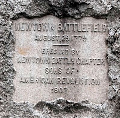
Newtown Battlefield Marker
RANKED BY RELEVANCE, THEN GEOGRAPHICALLY
| 101 ► New York, Chemung County, Lowman — Newtown Battlefield — |
| On Oneida Road (County Road 60) at Lowman Crossover, on the right when traveling east on Oneida Road. | |||
| 102 ► New York, Chemung County, Lowman — Soldiers of the American Revolution — Buried in this Cemetery — |
| On Oneida Road (County Road 60), on the right when traveling west. | |||
| 103 ► New York, Chemung County, Lowman — Soldiers of the American Revolution — Buried in this Cemetery — |
| On Oneida Road (County Road 60), on the right when traveling west. | |||
| 104 ► New York, Clinton County, Town of Peru — Battle of Valcour — |
| On New York State Route 9 north of Lapham Mills Road, on the left when traveling south. | |||
| 105 ► New York, Herkimer County, Mohawk — Fort Herkimer — |
| On Highway 5S, on the left when traveling east. | |||
| 106 ► New York, Kings County, Brooklyn, Flatlands — The Kings Highway — 1636 — |
| On Kings Highway. | |||
| 107 ► New York, Monroe County, Rochester, Charlotte — Battle of the Bulge — |
| On Lake Ave at Beach Ave., on the right when traveling north on Lake Ave. | |||
| 108 ► New York, Nassau County, East Meadow — Battle of the Bulge Veterans Memorial — |
| Near Park Boulevard near County Route 24. | |||
| 109 ► New York, New York County, Manhattan, Battery Park — East Coast Memorial — WWII Battle Monument — |
| Near State Street, on the left when traveling north. | |||
| 110 ► New York, Orange County, Fort Montgomery — Fort Montgomery — |
| On U.S. 9W, on the right when traveling north. | |||
| 111 ► New York, Richmond County, Staten Island, Prince's Bay — Battle of the Bulge Memorial — |
| On Chester Avenue west of Cornelia Avenue, on the left when traveling west. | |||
| 112 ► New York, Saratoga County, Schuylerville — Fort Hardy — |
| On Ferry Street (New York State Route 29), on the left when traveling east. | |||
| 113 ► New York, Saratoga County, Stillwater — 225th Anniversary Battles of Saratoga — 1777 – 2002 — |
| On Park Tour Road, on the left when traveling south. | |||
| 114 ► New York, Westchester County, Harrison, West Harrison — The War for American Independence — |
| On Boulevard, 0.1 miles west of Old Lake Street, on the right when traveling west. | |||
| 115 ► North Carolina, Alamance County, Burlington — Battle of Clapp's Mill — |
| Near Huffman Mill Road. | |||
| 116 ► North Carolina, Bladen County, Clarkton — Old Brown Marsh Presbyterian Church — 2 Miles North East — |
| On North College Street (Business U.S. 701) at Mercer Mill - Brown Marsh Road, in the median on North College Street. | |||
| 117 ► North Carolina, Bladen County, Clarkton — Whistler’s Mother — 1804–1881 — |
| On North College Street (Business U.S. 701) at Burney Ford Road, on the left when traveling south on North College Street. | |||
| 118 ► North Carolina, Bladen County, Council — Oakland — |
| On Elwell Ferry Road (County Route 1730) at North Carolina Highway 87, on the right when traveling east on Elwell Ferry Road. | |||
| 119 ► North Carolina, Guilford County, Greensboro — Nathanael Greene — |
| On Guilford Courthouse NMP Tour Road, on the left when traveling west. | |||
| 120 ► North Carolina, Guilford County, Sedalia — McLean House — |
| On US Highway 70 at Palmer Farm Road, on the right when traveling east on US Highway 70. | |||
| 121 ► North Carolina, Guilford County, Summerfield — Charles Bruce — 1733-1832 — Patriot – Statesman — |
| On Summerfield Road south of Centerfield Road, on the right when traveling south. | |||
| 122 ► North Carolina, Iredell County, Mooresville — John Franklin Moore — 1822-1877 — |
| On South Main Street south of West Center Avenue, on the right when traveling south. | |||
| 123 ► North Carolina, Lenoir County, Kinston — Caring for the Wounded — Harriet's Chapel Battlefield Park — Battle of Kinston Military Park — |
| On Richlands Road (U.S. 258) near Measley Road, on the right when traveling north. | |||
| 124 ► North Carolina, Lenoir County, Kinston — Fighting at Harriet's Chapel — Harriet's Chapel Battlefield Park — Battle of Kinston Military Park — |
| On Richlands Road (U.S. 258) at Measley Road, on the right when traveling north on Richlands Road. | |||
| 125 ► North Carolina, Lenoir County, Kinston — Starr's Battery — Harriet's Chapel Battlefield Park — Battle of Kinston Military Park — |
| Near Richlands Road (U.S. 258) at Measley Road, on the right when traveling north. | |||
| 126 ► North Carolina, Lenoir County, Kinston — The Action in the Swamp — Harriet's Chapel Battlefield Park — Battle of Kinston Military Park — |
| Near Richlands Road (U.S. 258) at Measley Road, on the right when traveling north. | |||
| 127 ► North Carolina, Lenoir County, Kinston — The Center of the Confederate Line — Harriet's Chapel Battlefield Park — Battle of Kinston Military Park — |
| Near Richlands Road (U.S. 258) at Measley Road, on the right when traveling north. | |||
| 128 ► North Carolina, Lenoir County, Kinston — The Confederate Defenses of Kinston — Harriet's Chapel Battlefield Park — Battle of Kinston Military Park — |
| On Richlands Road (U.S. 258) at Measley Road, on the right when traveling north on Richlands Road. | |||
| 129 ► North Carolina, Lenoir County, Kinston — The Night of December 13, 1862 — Harriet's Chapel Battlefield Park — Battle of Kinston Military Park — |
| On Richlands Road (U.S. 258) at Measley Road, on the right when traveling north on Richlands Road. | |||
| 130 ► North Carolina, Lenoir County, Kinston — The Site of Harriet's Chapel — Harriet's Chapel Battlefield Park — Battle of Kinston Military Park — |
| On Richlands Road (U.S. 258) near Measley Road, on the right when traveling north. | |||
| 131 ► North Carolina, Lenoir County, Kinston — The Union Artillery — Harriet's Chapel Battlefield Park — Battle of Kinston Military Park — |
| Near Richlands Road (U.S. 258) at Measley Road, on the right when traveling north. | |||
| 132 ► North Carolina, Lenoir County, Kinston — Wessells' Advance—December 14, 1862 — Harriet's Chapel Battlefield Park — Battle of Kinston Military Park — |
| Near Richlands Road (U.S. 258) near Measley Road, on the right when traveling north. | |||
| 133 ► North Carolina, Mecklenburg County, Charlotte, Second Ward — The Battle of Charlotte — |
| On Elizabeth Avenue at South McDowell Street, on the right when traveling east on Elizabeth Avenue. | |||
| 134 ► North Carolina, Randolph County, Franklinville — Andrew Hunter Bridge — In Memoriam — Randolph County Revolutionary Patriots — |
| On Andrew Hunter Road just west of West Main Street (State Highway 22), on the left when traveling west. | |||
| 135 ► South Carolina, Spartanburg County, Moore — 42-4 — “Kate Barry” — |
| On Stillhouse Road (State Highway 196) at U.S. 221 on Stillhouse Road. | |||
| 136 ► Tennessee, Hardin County, Savannah — Hardin County Confederate Memorial — |
| On Main Street (U.S. 64) east of Adams Street, on the right when traveling east. | |||
| 137 ► Tennessee, Trousdale County, Hartsville — Battle of Hartsville — December 7, 1862 — |
| Near Cemetery Lane south of Tennessee Route 141, on the left when traveling south. | |||
| 138 ► Tennessee, Williamson County, Brentwood — Beechville — |
| On Hillsboro Road (U.S. 431) 0.1 miles north of Hillsboro Valley Road, on the right when traveling north. | |||
| 139 ► Tennessee, Williamson County, Franklin — Carnton — A Final Place of Rest — |
| Near Eastern Flank Circle, 0.4 miles south of Lewisburg Pike (Business U.S. 431), on the left when traveling west. | |||
| 140 ► Tennessee, Williamson County, Franklin — Carnton — Slavery and the Enslaved — |
| Near Eastern Flank Circle, 0.4 miles south of Lewsiburg Pike (Business U.S. 431), on the left when traveling south. | |||
| 141 ► Utah, Utah County, Pleasant Grove — 514 — Site of the First Settlement of Pleasant Grove — |
| On East 200 South, on the right when traveling west. | |||
| 142 ► Virginia, Arlington County, Arlington, Fort Myer — Battle of the Bulge — |
| On Arlington Cemetery south of Farragut Drive, on the right when traveling south. | |||
| 143 ► Virginia, Fairfax — The Battle of the Bulge — |
| Near Armstrong Street east of Chain Bridge Road (Virginia Route 123), on the right when traveling east. | |||
| 144 ► Wisconsin, Marathon County, Wausau — Battle of the Bulge Monument — |
| On North 5th Street south of Washington Street, on the left when traveling south. | |||
| 145 ► Georgia, Dougherty County, Albany — WW II Memorial — |
| Near West Oglethorpe Boulevard at South Washington Street, on the right when traveling east. | |||
| 146 ► Austria, Wien, Stephansdom — Henry Dunant and the Red Cross — 1828 - 1910 — |
| On Am Hof at Bognergasse when traveling north on Am Hof. | |||
| 147 ► United Kingdom, England, East Sussex, Battle — East Range of Cloister — |
| Near High Street at Park Lane, on the right when traveling south. | |||
| 148 ► Alabama, Baldwin County, Spanish Fort — Spanish Fort — |
| On Spanish Main Street north of Spanish Fort Boulevard (U.S. 31), on the right when traveling north. | |||
| 149 ► South Carolina, Marion County, Rains — 34-1 — Battle of Blue Savannah |
| On U.S. 501 at South Carolina Highway 41, on the right when traveling east on U.S. 501. Reported missing. | |||
| 150 ► Virginia, Frederick County, Middletown — Battle of Cedar Creek — |
| On Valley Pike (U.S. 11), on the right when traveling north. | |||
| 151 ► Kentucky, Hickman County, Columbus — The Battle at Belmont, Missouri — 7 November 1861 — |
| 152 ► Texas, DeWitt County, Cuero — 3072 — Leonard Roy Harmon — (1917-1942) — |
| On Leonard Roy Harmon Drive, 0.1 miles south of East Broadway Street (U.S. 87), in the median. | |||
| 153 ► Florida, Polk County, Fort Meade — Fort Meade Veterans Memorial — |
| On West Broadway Street at Charleston Avenue on West Broadway Street. | |||
| 154 ► Louisiana, Rapides Parish, Pineville — Korean War Memorial — Korean War / The Korean War - June 25, 1950 - July, 1953 — Freedom is not free — |
| On Louisiana Route 28 east of Hembling Drive, on the right when traveling east. | |||
| 155 ► Missouri, Jasper County, Carthage — Rendezous At Carthage — |
| On Chestnut Street, 0.2 miles east of River Street, on the left when traveling east. | |||
| 156 ► Virginia, Hanover County, Mechanicsville — The Battle of Gaines’ Mill — |
| On Watt House Road (Virginia Route 718), on the right when traveling south. | |||
| 157 ► Georgia, Catoosa County, Ringgold — Catoosa County Veterans — |
| Near Christian Road south of Lafayette Street, on the right when traveling south. | |||
| 158 ► Maryland, Washington County, Sharpsburg — The Newcomer House — |
| On Boonesboro Pike (Maryland Route 34), on the left when traveling east. | |||
| 159 ► Belgium, Région Wallonne, Liège, Malmedy — American Massacre Memorial — Battle of the Bulge — |
| On Rue de Luxembourg at Rue de Walmes on Rue de Luxembourg. | |||
| 160 ► Belgium, Région Wallonne, Luxembourg, Bastogne — Memorial du Mardasson — The Battle of the Bulge — An account written on the walls of the monument. — |
| On Rue de Clervaux (N859). | |||
| 161 ► Alberta, Wainwright District, Fabyan — The Battle River Trestle — The Trestle — |
| On Viewpoint Road, 0.6 kilometers north of Township Road 452 when traveling west. | |||
| 162 ► Alberta, Wainwright District, Fabyan — The Battle River Trestle — Wainwright — |
| On Viewpoint Road, 0.6 kilometers north of Township Road 452 when traveling west. | |||
| 163 ► New Brunswick, Saint John County, Saint John — Françoise Marie Jacquelin — and the Battle for Fort La Tour / et la lutte pour le fort La Tour — |
| Near Lancaster Avenue, 0.2 kilometers east of Bridge Road (New Brunswick Route 100), on the left when traveling east. | |||
| 164 ► New Brunswick, Westmorland County, Sackville — Battle of Normandy — D Day June 6th, 1944 — Juno Beach — |
| On Bridge Street (New Brunswick Route 106) at Weldon Street, on the left when traveling east on Bridge Street. | |||
| 165 ► Newfoundland and Labrador, Avalon Peninsula, Newfoundland, St. John's — Battle of Signal Hill — La bataille de Signal Hill — |
| Near Signal Hill Road. | |||
| 166 ► Nova Scotia, Kings County, Grand Pré — The Landscape of Grand Pré/Le Paysage de Grand-Pré — How the Battle Unfolded/Le déroulement de la bataille — |
| On Grand Pré Road at Old Post Road, on the right when traveling north on Grand Pré Road. | |||
| 167 ► Ontario, Brant County, Oakland — The Battle of Malcolm’s Mills — 1814 — |
| On Oakland Road (County Route 4) at King Street South (County Route 24), on the right when traveling west on Oakland Road. | |||
| 168 ► Ontario, Chatham-Kent, Thamesville — Battle of Moraviantown, 1813 — Bataille de Moraviantown, 1813 — (Battle of the Thames) / (Bataille de la Thames) — |
| On Longwoods Road (County Route 2), on the right when traveling east. | |||
| 169 ► Ontario, Chatham-Kent, Thamesville — Participants in the Battle of the Thames — Tuesday, October 5, 1813 — Tecumseh Parkway — |
| Near Longwoods Road (Provincial Highway 2) 4.2 kilometers east of Victoria Road (Provincial Highway 21), on the right when traveling east. | |||
| 170 ► Ontario, Chatham-Kent, Thamesville — Participants in the Battle of the Thames — Tuesday, October 5, 1813 — Tecumseh Parkway — |
| Near Longwoods Road (Provincial Highway 2) 4.2 kilometers east of Victoria Road (Provincial Highway 21), on the right when traveling east. | |||
| 171 ► Ontario, Chatham-Kent, Thamesville — Participants in the Battle of the Thames — Tuesday, October 5, 1813 — Tecumseh Parkway — |
| Near Longwoods Road (Provincial Highway 2) 4.2 kilometers east of Victoria Road (Provincial Highway 21), on the right when traveling east. | |||
| 172 ► Ontario, Chatham-Kent, Thamesville — Participants in the Battle of the Thames — Tuesday, October 5, 1813 — Tecumseh Parkway — |
| Near Longwoods Road (Provincial Highway 2) 4.2 kilometers east of Victoria Road (Provincial Highway 21), on the right when traveling east. | |||
| 173 ► Ontario, Chatham-Kent, Thamesville — Participants in the Battle of the Thames — Tuesday, October 5, 1813 — Tecumseh Parkway — |
| Near Longwoods Road (Provincial Highway 2) 4.2 kilometers east of Victoria Road (Provincial Highway 21), on the right when traveling east. | |||
| 174 ► Ontario, Chatham-Kent, Thamesville — Participants in the Battle of the Thames — Tuesday, October 5, 1813 — Tecumseh Parkway — |
| Near Longwoods Road (Provincial Highway 2) 4.2 kilometers east of Victoria Road (Provincial Highway 21), on the right when traveling east. | |||
| 175 ► Ontario, Chatham-Kent, Thamesville — Prelude to Battle — Tuesday, October 5, 1813 — Tecumseh Parkway — |
| Near Longwoods Road (Provincial Highway 2) 4.2 kilometers east of Victoria Road (Provincial Highway 21), on the right when traveling east. | |||
| 176 ► Ontario, Essex County, Amherstburg — The Battle of Lake Erie — |
| Near Dalhousie Street west of Rankin Avenue. | |||
| 177 ► Ontario, Essex County, Windsor — The Battle of Windsor - 1838 — |
| On 254 Pitt Street West, 0.2 kilometers east of Dougall Avenue, on the right when traveling west. | |||
| 178 ► Ontario, Hamilton, Stoney Creek — Battle of Stoney Creek — |
| Near King Street West east of Centennial Parkway South. | |||
| 179 ► Ontario, Hamilton, Stoney Creek — Battle of Stoney Creek — 1813 — |
| Near King Street West east of Centennial Parkway South. | |||
| 180 ► Ontario, Leeds and Grenville United Counties, Prescott — The Battle of the Windmill — La Bataille du Moulin à Vent — |
| On Windmill Road close to Leeds and Grenville Road (County Route 2), on the right when traveling east. | |||
| 181 ► Ontario, Leeds and Grenville United Counties, Prescott — The Battle of the Windmill — La Bataille du Moulin à Vent — |
| On Windmill Road close to Leeds and Grenville Road (County Route 2), on the right when traveling east. | |||
| 182 ► Ontario, Leeds and Grenville United Counties, Prescott — Welcome to the Site of The Battle of the Windmill — |
| Near Windmill Road, 0.3 kilometers south of King Street East (County Route 2). | |||
| 183 ► Ontario, Middlesex County, Glencoe — Battle Hill — |
| On Longwoods Road (Provincial Highway 2) close to Pratt Siding Road, on the right when traveling east. | |||
| 184 ► Ontario, Middlesex County, Glencoe — Battle of Longwoods — March 4, 1814 — |
| On Longwoods Road (Provincial Highway 2) close to Pratt Siding Road, on the right when traveling east. | |||
| 185 ► Ontario, Niagara Region, Chippawa — Battle of Chippawa — |
| On Niagara River Parkway just west of Edgworth Road, on the right when traveling south. | |||
| 186 ► Ontario, Niagara Region, Chippawa — Chippawa Battlefield Panel 1 — Background to a Battle — |
| Near Niagara River Parkway just west of Edgworth Road, on the right when traveling south. | |||
| 187 ► Ontario, Niagara Region, Chippawa — Chippawa Battlefield Panel 4 — Battle on the Plain — July 5, 1814 4:30 p.m. — |
| Near Niagara River Parkway just west of Edgworth Road, on the right when traveling south. | |||
| 188 ► Ontario, Niagara Region, Chippawa — The Battle of Chippawa — |
| On Edgworth Road just west of Niagara River Parkway, on the right when traveling west. | |||
| 189 ► Ontario, Niagara Region, Chippawa — The Battle of Chippawa — La Bataille de Chippawa — |
| On Niagara River Parkway north of Edgworth Road, on the right when traveling south. | |||
| 190 ► Ontario, Niagara Region, Niagara Falls — Battle Ground Hotel — |
| Near Lundy's Lane, on the right when traveling west. | |||
| 191 ► Ontario, Niagara Region, Niagara Falls — Battle of Lundy's Lane — Bataille de Lundy's Lane — |
| Near Lundy's Lane at Hanan Avenue, on the right when traveling east. | |||
| 192 ► Ontario, Niagara Region, Niagara Falls — Battle Stages — |
| Near Lundy's Lane, on the left when traveling west. | |||
| 193 ► Ontario, Niagara Region, Niagara Falls — Bicentennial of the Battle of Lundy’s Lane — |
| Near Lundy's Lane, on the right when traveling west. | |||
| 194 ► Ontario, Niagara Region, Niagara Falls — One Hundredth Anniversary of the Battle of Lundy's Lane — |
| Near Lundy's Lane close to Hanan Avenue. | |||
| 195 ► Ontario, Niagara Region, Niagara Falls — The Aftermath of Battle — |
| On Lundy's Lane, on the left when traveling west. | |||
| 196 ► Ontario, Niagara Region, Niagara Falls — The Battle of Lundy’s Lane — War of 1812 — |
| On Lundy's Lane, on the right when traveling west. | |||
| 197 ► Ontario, Niagara Region, Niagara Falls — The British Defense — The Battle of Lundy’s Lane — |
| Near Lundy's Lane, on the right when traveling west. | |||
| 198 ► Ontario, Niagara Region, Niagara-on-the-Lake — The Battle of Fort George — |
| Near Queens Parade, on the right when traveling north. | |||
| 199 ► Ontario, Niagara Region, Niagara-on-the-Lake — The Battle of Fort George — La Bataille de Fort George — |
| On Queen Street north of Newark Street, on the right when traveling north. | |||
| 200 ► Ontario, Niagara Region, Queenston — 1 — Attack — The Battle of Queenston Heights Walking Tour — Stop 1 of the 5-stop walking tour — |
| Near Niagara Parkway just north of Portage Road. | |||
16158 entries matched your criteria. Entries 101 through 200 are listed above. ⊲ Previous 100 — Next 100 ⊳
* Inflectional forms of words are their plurals, singulars, and possessives as well as gramatical tenses and similar variations.