1134 entries match your criteria. The first 100 are listed. ⊳
Historical Markers and War Memorials on the Central Coast Region
By Joseph Alvarado, April 26, 2022
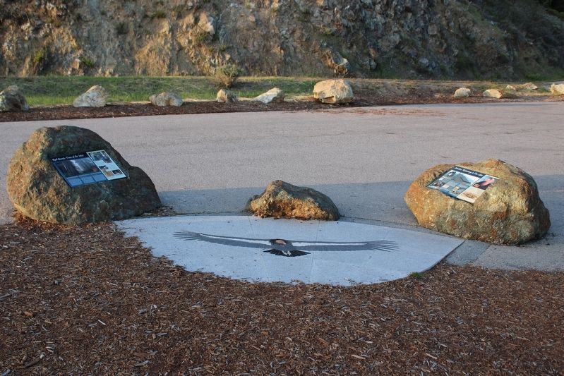
Condors marker on the right, Redwood marker on the left.
1 ► California, Monterey County, Big Sur — Condors: Returning to Our Skies —  |
| Near Cabrillo Highway (U.S. 1 at milepost 37). | |||
| 2 ► California, Monterey County, Big Sur — Cooper Cabin — Andrew Molera State Park — |
| Near Cabrillo Highway (California Route 1), on the left when traveling south. | |||
| 3 ► California, Monterey County, Big Sur — Daring: Dog-hole Ports — Ship to Shore, Shore to Ship — |
| On Cabrilla Highway (State Highway 1 at milepost 37), on the right when traveling south. | |||
| 4 ► California, Monterey County, Big Sur — Deetjen's Big Sur Inn — |
| On California Route 1 at Rancho Grande Road, on the right when traveling north on California Route 1. | |||
| 5 ► California, Monterey County, Big Sur — End of an Era — U.S.S. Macon ZRS-5 — |
| Near Cabrillo Highway (California Route 1), on the left when traveling north. | |||
| 6 ► California, Monterey County, Big Sur — Esselen: We Are Still Here — Man-tah-i-te "That is the Truth" — |
| On Carbillo Highway (State Highway 1 at milepost 37), 1.6 miles south of Partington Ridge Road, on the right when traveling south. | |||
| 7 ► California, Monterey County, Big Sur — High Seas: The Ocean Highway — West Coast Connections — |
| On Cabrilla Highway (State Highway 1 at milepost 37), on the right when traveling south. | |||
| 8 ► California, Monterey County, Big Sur — House with a View — |
| On Cabrillo Highway (Route 1), on the right when traveling south. | |||
| 9 ► California, Monterey County, Big Sur — Inspiration: A Wild Coast and Lonely — |
| On Cabrillo Highway (State Highway 1 at milepost 37), on the right when traveling south. | |||
| 10 ► California, Monterey County, Big Sur — Manchester — |
| Near Las Padres National Forest Road 23S01. | |||
| 11 ► California, Monterey County, Big Sur — On Top of the Rock — |
| Near Cabrillo Highway (State Highway 1 at milepost 54). | |||
| 12 ► California, Monterey County, Big Sur — Pioneers: Homesteading the Sur — Roughing It — |
| On Cabrilla Highway (State Highway 1 at milepost 37), on the right when traveling south. | |||
| 13 ► California, Monterey County, Big Sur — 951 — Point Sur Light Station — |
| Near Cabrillo Highway (California Route 1), on the right when traveling south. | |||
| 14 ► California, Monterey County, Big Sur — Red Giants: Trees of the Mist — |
| Near Cabrillo Highway (State Highway 1 at milepost 37). | |||
| 15 ► California, Monterey County, Big Sur — Two Women From Two Worlds — |
| Near Cabrillo Highway (California Route 1), on the right when traveling south. | |||
| 16 ► California, Monterey County, Bradley — Camp Roberts Veterans Memorial — |
| On New Mexico Avenue west of Arizona Boulevard. | |||
| 17 ► California, Monterey County, Bradley — De Anza Trek Reinactment — |
| Near Nacimiento Road at California Boulevard, on the left when traveling west. | |||
| 18 ► California, Monterey County, Bradley — 232 — Misión San Antonio de Padua — (Turn Off 5 Miles North) — |
| On U.S. 101 Spur, on the right when traveling north. | |||
| 19 ► California, Monterey County, Bradley — Pleyto — |
| Near New Pleyto Road, on the left when traveling south. | |||
| 20 ► California, Monterey County, Carmel Highlands — Whalers Cabin — |
| On road to visitor parking, on the left when traveling north. | |||
| 21 ► California, Monterey County, Carmel-by-the-Sea — Early American Baptisms in California — |
| Near Rio Road at Lausen Drive, on the right when traveling east. | |||
| 22 ► California, Monterey County, Carmel-by-the-Sea — 135 — Junípero Serra / Establishing the California Missions / A Lasting Tribute — The Ave Maria Bell — |
| On Rio Road near Lausen Drive. | |||
| 23 ► California, Monterey County, Carmel-by-the-Sea — Korean War Memorial — |
| Near 6th Avenue. | |||
| 24 ► California, Monterey County, Carmel-by-the-Sea — Lt. Colonel Juan Bautista De Anza — |
| On Rio Road, on the right when traveling north. | |||
| 25 ► California, Monterey County, Carmel-by-the-Sea — Mission Cross — |
| Near Rio Road at Lausen Drive, on the right when traveling east. | |||
| 26 ► California, Monterey County, Carmel-by-the-Sea — Portola Crespi Cross — |
| Near Calle La Cruz at Ribera Road. | |||
| 27 ► California, Monterey County, Carmel-by-the-Sea — September 11, 2001 Memorial — |
| Near Mission Street at 6th Avenue. | |||
| 28 ► California, Monterey County, Carmel-by-the-Sea — Vietnam War Memorial — |
| Near Mission Street. | |||
| 29 ► California, Monterey County, Carmel-by-the-Sea — World War I Memorial — |
| On Ocean Avenue at San Carlos Street, in the median on Ocean Avenue. | |||
| 30 ► California, Monterey County, Carmel-by-the-Sea — World War II Memorial — |
| Near 6th Avenue. | |||
| 31 ► California, Monterey County, Carmel-by-the-Sea, Golden Rectangle — Carmel North Dunes Habitat Restoration — |
| On Ocean Avenue at San Antonio Avenue, on the right when traveling west on Ocean Avenue. | |||
| 32 ► California, Monterey County, Carmel-by-the-Sea, Northwest Carmel — Ford Meadow — |
| On 17 Mile Drive south of Del Ciervo Road, on the left when traveling west. | |||
| 33 ► California, Monterey County, Castroville — For the Sake of the Children — (The Japanese Schoolhouse) — |
| On Geil Street near Pajaro Street, on the right when traveling west. | |||
| 34 ► California, Monterey County, Castroville — Juan B. Castro — |
| On Merritt Steet (California Route 183) north of Preston Street, on the right when traveling north. | |||
| 35 ► California, Monterey County, Castroville — The Castroville Japanese Schoolhouse — For the Sake of the Children — Kodomo No Tame Ni - Para El Bien De Los Ninos - Per Il Bene De Ragazzi — |
| On Geil Street near Pajaro Street. | |||
| 36 ► California, Monterey County, Del Monte Forest — Lone Cypress — Perched over the Pacific for Hundreds of Years |
| On 17 Mile Drive west of Highway 1, on the right when traveling south. Reported missing. | |||
| 37 ► California, Monterey County, Del Monte Forest — Point Joe — |
| On 17 Mile Drive west of Old 17 Mile Drive, on the right when traveling south. | |||
| 38 ► California, Monterey County, Del Monte Forest, Pebble Beach — Allisen Corpuz — 2023 U.S. Women's Open — Major Champions at Pebble Beach — |
| Near 17 Mile Drive north of Cypress Drive. | |||
| 39 ► California, Monterey County, Del Monte Forest, Pebble Beach — Betty Jameson — 1940 U.S. Women's Amateur — Major Champions at Pebble Beach — |
| Near 17 Mile Drive north of Cypress Drive. | |||
| 40 ► California, Monterey County, Del Monte Forest, Pebble Beach — Bird Rock — |
| On Bird Rock Road west of 17 Mile Drive, on the right when traveling south. | |||
| 41 ► California, Monterey County, Del Monte Forest, Pebble Beach — China Rock — |
| On 17 Mile Drive, on the left when traveling north. | |||
| 42 ► California, Monterey County, Del Monte Forest, Pebble Beach — Crocker Grove — |
| On 17 Mile Drive west of Madre Lane, on the right when traveling west. | |||
| 43 ► California, Monterey County, Del Monte Forest, Pebble Beach — David Gossett — 1999 U.S. Amateur — Major Champions at Pebble Beach — |
| Near 17 Mile Drive north of Cypress Drive. | |||
| 44 ► California, Monterey County, Del Monte Forest, Pebble Beach — Gary Woodland — 2019 U.S. Open — Major Champions at Pebble Beach — |
| Near 17 Mile Drive north of Cypress Drive. | |||
| 45 ► California, Monterey County, Del Monte Forest, Pebble Beach — Grace Lenczyk — 1948 U.S. Women's Amateur — Major Champions at Pebble Beach — |
| Near 17 Mile Drive north of Cypress Drive. | |||
| 46 ► California, Monterey County, Del Monte Forest, Pebble Beach — Graeme McDowell — 2000 U.S. Open — Major Champions at Pebble Beach — |
| Near 17 Mile Drive north of Cypress Drive. | |||
| 47 ► California, Monterey County, Del Monte Forest, Pebble Beach — Harrison Johnston — 1929 U.S. Amateur — Major Champions at Pebble Beach — |
| Near 17 Mile Drive north of Cypress Drive. | |||
| 48 ► California, Monterey County, Del Monte Forest, Pebble Beach — Jack Nicklaus — 1972 U.S. Open — Major Champions at Pebble Beach — |
| Near 17 Mile Drive north of Cypress Drive. | |||
| 49 ► California, Monterey County, Del Monte Forest, Pebble Beach — Jack Nicklaus — 1961 U.S. Amateur — Major Champions at Pebble Beach — |
| Near 17 Mile Drive north of Cypress Drive. | |||
| 50 ► California, Monterey County, Del Monte Forest, Pebble Beach — Lanny Wadkins — 1977 PGA Championship — Major Champions at Pebble Beach — |
| Near 17 Mile Drive north of Cypress Drive. | |||
| 51 ► California, Monterey County, Del Monte Forest, Pebble Beach — Monterey cypress, naturally — |
| On 17 Mile Drive west of Madre Lane, on the right when traveling west. | |||
| 52 ► California, Monterey County, Del Monte Forest, Pebble Beach — Pebble Beach Golf Links — |
| On 17 Mile Drive east of Cypress Drive, on the right when traveling east. | |||
| 53 ► California, Monterey County, Del Monte Forest, Pebble Beach — Robert "Skee" Riegel — 1947 U.S. Amateur — Major Champions at Pebble Beach — |
| Near 17 Mile Drive north of Cypress Drive. | |||
| 54 ► California, Monterey County, Del Monte Forest, Pebble Beach — Sam Morse — |
| Near 17 Mile Drive, on the right when traveling north. | |||
| 55 ► California, Monterey County, Del Monte Forest, Pebble Beach — The AT&T Pebble Beach Pro-Am — |
| Near 17 Mile Drive north of Cypress Drive. | |||
| 56 ► California, Monterey County, Del Monte Forest, Pebble Beach — Tiger Woods — 2000 U.S. Open — Major Champions at Pebble Beach — |
| Near 17 Mile Drive north of Cypress Drive. | |||
| 57 ► California, Monterey County, Del Monte Forest, Pebble Beach — Tom Kite — 1992 U.S. Open — Major Champions at Pebble Beach — |
| Near 17 Mile Drive north of Cypress Drive. | |||
| 58 ► California, Monterey County, Del Monte Forest, Pebble Beach — Tom Watson — 1982 U.S. Open — Major Champions at Pebble Beach — |
| Near 17 Mile Drive north of Cypress Drive. | |||
| 59 ► California, Monterey County, Del Monte Forest, Pebble Beach — Viktor Hovland — 2018 U.S. Amateur — Major Champions at Pebble Beach — |
| Near 17 Mile Drive north of Cypress Drive. | |||
| 60 ► California, Monterey County, Gonzales — Gonzales — |
| On 4th Street near Center Street, on the left when traveling east. | |||
| 61 ► California, Monterey County, Gonzales — Gonzales Veterans Memorial — |
| On 5th Street near Center Street, on the right when traveling west. | |||
| 62 ► California, Monterey County, Gonzales — The Mustard Seed Trail — One Voice Murals Project — |
| On 4th Street, on the left when traveling east. | |||
| 63 ► California, Monterey County, Gonzales — The Stag Saloon — |
| On Alta Street just north of 3rd Street, on the right when traveling north. | |||
| 64 ► California, Monterey County, Greenfield — Metz Field/Chapin Int'l Airport — |
| Near Metz Road 0.7 miles south of Elm Avenue, on the right when traveling south. | |||
| 65 ► California, Monterey County, Jolon — De Anza Expedition 1775 - 1776 — (Mission San Antonio de Padua) — |
| Near Mission Road 6.2 miles Jolon Road (County Route G14). | |||
| 66 ► California, Monterey County, Jolon — First Marriage in California — |
| On Mission Creek Road. | |||
| 67 ► California, Monterey County, Jolon — Jose Mario Gil Adobe — |
| Near Primative Campground Road, on the right when traveling west. | |||
| 68 ► California, Monterey County, Jolon — The Hacienda — Milpitas Ranch House — |
| Near Infantry Road, on the left when traveling west. | |||
| 69 ► California, Monterey County, King City — De Anza Expedition 1775-1776 — |
| On San Lorenzo Park Road, on the right when traveling north. | |||
| 70 ► California, Monterey County, King City — Dutton Hotel — |
| On Jolon Road (County Route G14) 0.4 miles north of Mission Road, on the right when traveling south. | |||
| 71 ► California, Monterey County, King City — Jolon — |
| On Jolon Road (County Route G14) 0.2 miles north of Mission Road, on the left when traveling south. | |||
| 72 ► California, Monterey County, King City — La Gloria Schoolhouse — |
| Near San Lorenzo Park Road, on the left when traveling north. | |||
| 73 ► California, Monterey County, King City — 232 — Mission San Antonio de Padua — ← 23 Miles — |
| On Jolon Road (County Road G14) 0.2 miles south of El Camino Real (U.S. 101), on the right when traveling south. | |||
| 74 ► California, Monterey County, King City — Salinas Valley Cookwagon, c. 1888 / Cook Wagon — |
| Near San Lorenzo Park Road, on the left when traveling north. | |||
| 75 ► California, Monterey County, King City — Wind Power — |
| Near San Lorenzo Park Road, on the left when traveling west. | |||
| 76 ► California, Monterey County, Lockwood — Lockwood — CA. 93932 — |
| On Jolon Road at Lockwood-Jolon Road, on the right when traveling west on Jolon Road. | |||
| 77 ► California, Monterey County, Marina — A Coastal Attack the Army Couldn’t Stop — Fort Ord Dunes State Park — |
| Near 8th Street. | |||
| 78 ► California, Monterey County, Marina — A Coastal Attack the Army Couldn’t Stop — Fort Ord Dunes State Park — |
| Near 8th Street. | |||
| 79 ► California, Monterey County, Marina — Former Firing Range Becomes a State Park — Fort Ord Dunes State Park — |
| Near 8th Street. | |||
| 80 ► California, Monterey County, Marina — 1919 — Post 694 — |
| On Legion Way, on the right when traveling west. | |||
| 81 ► California, Monterey County, Marina — Stilwell Hall: A Fond Memory — Fort Ord Dunes State Park — |
| Near 8th Street. | |||
| 82 ► California, Monterey County, Marina — Training to Defend America — Fort Ord Dunes State Park — |
| Near 8th Street. | |||
| 83 ► California, Monterey County, Marina — Welcome to Fort Ord Dunes State Park! — |
| On 8th Street. | |||
| 84 ► California, Monterey County, Monterey — 19th Century Sailing Ship's Anchor — |
| On Calle Principal at Jefferson Street, on the right when traveling north on Calle Principal. | |||
| 85 ► California, Monterey County, Monterey — 400th Anniversary of the Naming of Monterey Bay by Gen. Sebastián Vizcaíno — 16 December 1602 – 16 December 2002 — |
| Near Monterey Peninsula Recreation Trail, on the right when traveling north. | |||
| 86 ► California, Monterey County, Monterey — 9/11 Memorial — |
| On Lake Del Monte Drive. | |||
| 87 ► California, Monterey County, Monterey — A Day in the Canneries — Historic Cannery Row — |
| Near Bruce Ariss Way. | |||
| 88 ► California, Monterey County, Monterey — Admiral Raymond A. Spruance Plaza — |
| On Menneken Loop. | |||
| 89 ► California, Monterey County, Monterey — Alvarado Adobe — |
| On Dutra Street at Jefferson Street, on the left when traveling north on Dutra Street. | |||
| 90 ► California, Monterey County, Monterey — American Revolutionary War Historical Site — 1779-1783 — |
| Near Church Streeet, on the left when traveling east. | |||
| 91 ► California, Monterey County, Monterey — Associated Oil Fire – 1924 — Historic Cannery Row — |
| Near Cannery Row. | |||
| 92 ► California, Monterey County, Monterey — 6 — Bouchard Monument |
| Near Corporal Ewing Road. Reported permanently removed. | |||
| 93 ► California, Monterey County, Monterey — Building Cannery Row — Historic Cannery Row — |
| On Wave Street, on the left when traveling south. | |||
| 94 ► California, Monterey County, Monterey — Cannery Divers Memorial — |
| On Cannery Row east of Reeside Avenue when traveling west. | |||
| 95 ► California, Monterey County, Monterey — Captain Don Gaspar de Portola — |
| Near Alvarado Street at Del Monte Avenue, on the left when traveling north. | |||
| 96 ► California, Monterey County, Monterey — Casa Abrego — |
| On Abrego Street at Pearl Street, on the left when traveling north on Abrego Street. | |||
| 97 ► California, Monterey County, Monterey — Casa Amesti — |
| On Polk Street, on the left when traveling east. | |||
| 98 ► California, Monterey County, Monterey — Casa Bonifacio — |
| On Mesa Road 0.3 miles south of Fremont Street, on the left when traveling south. | |||
| 99 ► California, Monterey County, Monterey — Casa Buelna — |
| On Mesa Road south of Fremont Street, on the right when traveling south. | |||
| 100 ► California, Monterey County, Monterey — Casa de la Torre — |
| On Pierce Street at Jefferson Street, on the left when traveling north on Pierce Street. | |||
1134 entries matched your criteria. The first 100 are listed above. Next 100 ⊳