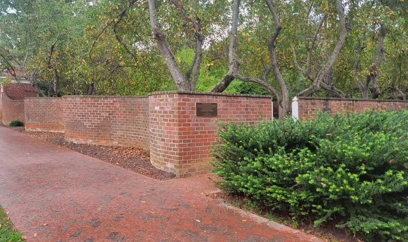
These garden walls,
included by Thomas Jefferson in his original designs for the academical village, were built by enslaved laborers.
The walls were reconstructed and enclosed gardens planted by
The Garden Club of Virginia
1952 . . . — — Map (db m230924) HM
Thomas Jefferson founded the University of Virginia. The cornerstone of its first building was laid on October 6, 1817, in the presence of three presidents of the United States—Jefferson, James Madison, and James Monroe. In 1825, the . . . — — Map (db m61101) HM
Built before 1744 by
Col. Joshua Fry
1699-1754
Surveyor, Mathematician, Pioneer
Commander-in-Chief of Virginia Forces
French and Indian War
George Washington Inscribed over his Grave
“Here lies the good, the just
and the noble . . . — — Map (db m23244) HM
Bounded by the James River to the south and the Rivanna River to the north, this nationally significant district encompasses 83,627 acres. Listed on the National Register of Historic Places in 2007, it includes buildings influenced by Jefferson’s . . . — — Map (db m23240) HM
Civil War relic collectors found Stuart’s winter camp and skirmish site (shaded area of map) long before the Rio Hill Shopping Center opened in 1989.
Metal detectors were used to search the area and artifacts—bullets, buttons, belt and . . . — — Map (db m7692) HM
In December 1863, Confederate troops established winter quarters here. The approximately 200 soldiers, under the command of Capt. Marcellus N. Moorman, were from Stuart’s Horse Artillery Battalion and were equipped with 16 cannons. The men built . . . — — Map (db m7690) HM
On February 29, 1864, General George A. Custer and 1500 cavalrymen made a diversionary raid into Albemarle County. Here, north of Charlottesville, he attacked the Confederate winter camp of four batteries of the Stuart Horse Artillery commanded by . . . — — Map (db m255211) HM
The Woolen Mills area of Charlottesville traces its roots back to the late 1700s. It was Thomas Jefferson who realized the Rivanna River's vitality was the key to economic growth in the area.
Originally a grist mill was started on . . . — — Map (db m172975) HM
The St. John School, built here in 1922–1923, served African-American students during the segregation era. Julius Rosenwald, president of Sears Roebuck and Co., collaborated with Booker T. Washington in a school-building campaign begining in . . . — — Map (db m102560) HM
In 1866 Dr. William D. Boaz established the first commercial apple orchard in Covesville. These orchards specialized in the Albemarle Pippin, which became one of the most prized and profitable apple varieties grown in Virginia. By 1890 the success . . . — — Map (db m25473) HM
The church was established in 1884.
The oldest person buried in the
cemetery was born in 1835.
The first burial occurred in 1907
and the last burial in 2018. The
members are now worshipping
in their 3rd church, located on
State Route . . . — — Map (db m259388) HM
The town grew around a rail stop established on Wayland’s farm in 1878. It was named for Col. B. Claudius Crozet, (1789–1864)—Napoleonic Army officer, and Virginia’s Engineer and Cartographer—he built this pioneer railway through the Blue Ridge. . . . — — Map (db m1798) HM
Earlysville Union Church is a rare surviving
early-19th-century interdenominational church
constructed in Albemarle County. Built in
1833, this frame structure served as a
meetinghouse for all Christian denominations
on land deeded by John . . . — — Map (db m21650) HM
This tablet placed here by the Colonial Dames of America in the State of Virginia in the year 1930, commemorates the founding of the First Buck Mountain Church established under the authority of The Church of England and builded one mile west of . . . — — Map (db m21690) HM
Near here, on both sides of the Rivanna River, was located the Monacan Indian village of Monasukapanough. This village was one of five Monacan towns that Captain John Smith recorded by name on his 1612 Map of Virginia, though many more . . . — — Map (db m106829) HM
The 19th-century mill village of Rio Mills stood 600 yards west of here, where the former Harrisonburg-Charlottesville Turnpike crossed the South Fork of the Rivanna River. Following the Battle of Rio Hill on 29 February 1864, Union General George . . . — — Map (db m106830) HM
Shortly after the formation of St. Anne's Parish in 1745, this established church stood on a knoll 100 yards north on nearby Ballenger Creek. Not used regularly after the old parish was dissolved in 1785, the building was in ruins by 1820 and was . . . — — Map (db m29953) HM
In 1762 the vestry of St. Anne's Parish purchased from William Burton 400 acres here for the residence and lands of the rector of the parish, established in 1745. This glebe was so used almost until the dissolution of the old parish. It was sold in . . . — — Map (db m29951) HM
Albemarle County. Albemarle County was formed in 1744 from Goochland County and named for William Anne Keppel, the second Earl of Albemarle, titular governor of Virginia from 1737 to 1754. A portion of Louisa County was later added to . . . — — Map (db m22780) HM
After reinforcements from Brig. Gen. "Mad" Anthony Wayne arrived on 10 June 1781, the Marquis de Lafayette moved south from his camp on the Rapidan River to prevent further raids by Gen. Charles Cornwallis's British troops encamped at Elk Hill. . . . — — Map (db m303345) HM
On 3 Sept. 1963, nine years after the U.S. Supreme Court
declared racial segregation of public schools unconstitutional,
26 African-American students formerly enrolled at all-black
schools desegregated Albemarle High School, . . . — — Map (db m234288) HM
This was the girlhood home of Viscountess Nancy Astor, first woman member of the British Parliament. She was a daughter of Chiswell Dabney Langhorne, who bought “Mirador” in 1892. The house was built sometime after 1832 for James M. Bowen. — — Map (db m1536) HM
Nearby stands Mirador the childhood home of Nancy, Viscountess Astor, the first woman member of Parliament. Born Nancy Witcher Langhorne in 1879, she lived here from 1892 to 1897. In 1906 she married Waldorf Astor and moved to England permanently. . . . — — Map (db m1535) HM
The monument before you honors Virginia state highway workers who lost their lives while serving the Commonwealth’s travelers. No public funds were used to build this memorial. It was built entirely with donations from Virginia Department of . . . — — Map (db m26332) HM
Half a mile north was born, 1774, Meriwether Lewis, of the Lewis and Clark Expedition, sent by Jefferson to explore the far west, 1804–1806. The expedition reached the mouth of the Columbia River, November 15, 1805. — — Map (db m1795) HM
Late in April 1862, Maj. Gen. Thomas J. “Stonewall” Jackson marched his army out of the Shenandoah Valley through the Blue Ridge Mountains to deceive Union Maj. Gen. John C. Fremont into thinking he was headed for Richmond. On 3 May, Jackson . . . — — Map (db m253813) HM
During the Shenandoah Valley Campaign (March - June 1862) Confederate Maj. Gen. Thomas J. "Stonewall" Jackson used deceptive maneuvers and sharp attacks to divert Union forces from the Peninsula Campaign against Richmond. Late in April, Jackson's . . . — — Map (db m209781) HM
The vestry of Fredericksville Parish commissioned a church for this site in 1745. First known as Middle Church, the wood-frame building was later called Walker's Church. Thomas Jefferson attended the nearby classical school of the Rev. James Maury, . . . — — Map (db m170120) HM
Beautification in memory of
Marjorie S. Twohey
Founding member of the
Keswick Garden Club
First president of Charlottesville Council of Garden Clubs
[Lower plaque:]
This plaque commemorates the 50th anniversary of the . . . — — Map (db m170121) HM
Extending from the Orange County line on the north to the outskirts of Charlottesville with the Southwest Mountains forming its spine, this historic district encompasses more than 31,000 acres and contains some of the Piedmont’s most pristine and . . . — — Map (db m17447) HM
Here was the doorway of the colonial church, given by the Walkers and served by the Maurys, for their kinsfolk and friends
The Builders of Old Albemarle
Erected by The Blue Ridge Committee of the Colonial Dames of America in the State . . . — — Map (db m307543) HM
Soon after the Civil War, the Rev. Robert Hughes
(1821-1895) and other freedmen organized Union
Branch Baptist Church, later known as Union Run
Baptist Church. Spiritual life was vital to formerly
enslaved African Americans, and . . . — — Map (db m259391) HM
Just north was a classical school conducted by the Rev. James Maury, rector of Fredericksville Parish from 1754 to 1769. Thomas Jefferson was one of Maury’s students. Matthew Fontaine Maury, the “Pathfinder of the Seas,” was Maury’s . . . — — Map (db m17459) HM
A bequest of Samuel Miller (1792–1869) provided funds to found the Miller School in 1878. Miller, a Lynchburg businessman born in poverty in Albemarle County, envisioned a regional school for children who could not afford an education. The school . . . — — Map (db m21699) HM
Named for the community it served. This established church of old St. Anne’s Parish was built on a hill about one half mile east as early as 1769. In 1776 there were plans to build nearby a new, brick church. This new church had not been completed . . . — — Map (db m158048) HM
Ben Brown and other newly freed slaves, who
founded the community after the Civil
War, first named the settlement Egypt and then Bethel.
About 1881, the community became known as Proffit when the Virginia Midland Railway placed
a stop here, . . . — — Map (db m16946) HM
Here stands the Barclay House, built about 1830, later the home of Dr. James Turner Barclay, inventor for the U. S. Mint and missionary to Jerusalem. He founded the adjacent Diciples Church in 1846 and served as its first preacher. It is now the . . . — — Map (db m17995) HM
Five miles southwest of here is the Hatton Ferry on the James River which began operating in the 1870s. James A. Brown established the ferry and a store on land first rented and then purchased from S.P. Gantt in 1881. In 1883 when a post office was . . . — — Map (db m88501) HM
In 1745 old Albemarle County was organized at Scott’s landing, its first county seat, here on the great horseshoe bend of the James River. In 1818 the town was incorporated as Scottsville, beginning in 1840 it flourished as the chief port above . . . — — Map (db m17894) HM
On August 20, 1969, flood waters of the James River rose to this point as an aftermath of Hurricane Camille causing great loss to the people of Scottsville.
This plaque was erected to remind all who read it of the vulnerability of mortal man to . . . — — Map (db m17948) HM
At 3 p.m. on Monday, March 6, 1865, the first of Union Gen. Philip H. Sheridan’s 10,000 cavalrymen under Gens. Wesley Merritt, Thomas Devin, and George A. Custer entered Scottsville unopposed. To accomplish their mission—destroy the
James . . . — — Map (db m17844) HM
In memory of the soldiers who died in the Confederate General Hospital in Scottsville
1862-1863
Beattie, F.M. Co. H 23 NC
Boyle, Andrew Co. D 41 VA
Brashear, Denis P. Co. E 4 AL
Clark, Henry Co. E 15 AL
Clark, Hosey L. Co. F 2 MS . . . — — Map (db m22784) HM
Just to the south was Mount Warren, the home of Wilson Cary Nicholas. He served in the Continental army, represented Albemarle County in the General Assembly (1784–1789, 1794–1799), and was a delegate to the Virginia Convention of 1788 . . . — — Map (db m19406) HM
Ferries In Virginia
The James, York, Rappahannock and smaller rivers were the primary means of commercial transportation in Virginia until the advent of railroads in the mid-1800’s. In most locations ferries provided the only way to cross . . . — — Map (db m14527) HM
History of Hatton Ferry.
The Hatton Ferry began operation in 1870, when Buckingham County authorities issued a court order to construct a public ferry across the James River to the Albemarle County lands of Thomas P. Gantt (ca. 1846-1896), a . . . — — Map (db m99392) HM
James A. Brown began operating a store and ferry at this site on rented property in the late 1870’s. In 1881 he bought the land from S. P. Gantt at which time the store became a stop on the Richmond and Alleghany Railroad. Two years later, Brown was . . . — — Map (db m12882) HM
The land was patented in 1735. The old house was built in 1790; the new in 1828. Here lived Thomas Mann Randolph, governor of Virginia 1819–1922, who married Martha, daughter of Thomas Jefferson. — — Map (db m17335) HM
Thomas Jefferson—author of the Declaration of Independence, third president of the United States, and founder of the University of Virginia—was born near this site on 13 April 1743. His father, Peter Jefferson (1708–1757), a surveyor, planter, and . . . — — Map (db m17306) HM
This estate was the home of James Monroe, fifth president of the United States. In 1793, James and Elizabeth Kortright Monroe purchased 1,000 acres adjoining Jefferson’s Monticello. Called Highland, the plantation, eventually totaling 3,500 acres, . . . — — Map (db m23437) HM
The house was built about 1770 by workmen engaged in building Monticello. Mazzei, an Italian, lived here for some years adapting grape culture to Virginia. Baron de Riedesel, captured at Saratoga in 1777, lived here with his family, 1779–1780. . . . — — Map (db m21952) HM
Philip Mazzei, a Tuscan merchant and horticulturalist, arrived in Virginia in 1775 and was persuaded by Thomas Jefferson to settle here. Jefferson gave him 193 acres of land, and Mazzei named his property Colle (meaning "hill"). He built a house ca. . . . — — Map (db m170655) HM
General Lee ordered all columns of his army from the Richmond and Petersburg trenches to rendezvous at this village on the Richmond & Danville Railroad. Here he hoped to obtain rations before continuing the march to North Carolina to join General . . . — — Map (db m18871) HM
Confederate Gen. Robert E. Lee ordered all of the Army of Northern Virginia's columns retreating west from Richmond and Petersburg to rendezvous at this courthouse village on April 4-5, 1865. Lee hoped that Richmond & Danville Railroad trains . . . — — Map (db m180224) HM
Born in Middlesex County on November 24, 1754, Joseph Eggleston was brought to Amelia County at the age of four to be raised at the nearby family homestead of "Egglestetton". Private schooling at home led to his entrance into William and Mary . . . — — Map (db m262995) HM WM
We dedicate this monument to all courageous men and women who served and died to keep our beautiful flag flying over us. God bless America and all her veterans. — — Map (db m180252) WM
Patriot
Father John Bannister Tabb was born in Amelia County in 1845 at “The Forest”, the Tabb family plantation. A member of one of wealthiest families in Virginia, he was carefully schooled by private tutors until the age of 14, when . . . — — Map (db m35959) HM
Tabb was born in 1845 at "The Forest" here in Amelia County into one of Virginia's oldest and wealthiest families, and was destined for the life of a gentleman farmer. The American Civil War changed everything for young John. Despite failing . . . — — Map (db m180255) HM
This mortar belonged to the battery cammanded by Captain J.N. Lamkin. On July 30, 1864, at the “Crater”, the battery helped check the Union advance until Mahone came up. Four mortars were captured near Flat Creek in Lee’s Retreat, April . . . — — Map (db m18873) HM
Lee's army, retreating toward Danville, reached this place, April 4-5, 1865, only to find that the supplies ordered here had gone on to Richmond. The famished soldiers were forced to halt to forage. The result was that Lee, when he resumed the march . . . — — Map (db m18874) HM
Born Mary Virginia Hawes at Dennisville about eight miles south, Harland was a prolific author, producing a syndicated newspaper column for women, many short stories, 25 novels, 25 volumes on domestic life, and 12 books on travel, biography, and . . . — — Map (db m19029) HM
Amelia County is largely indebted to one woman for bringing formal education and religion to African Americans after the Civil War. In 1865 Mrs. Samantha Jane Neil left her home in Pennsylvania to search for her husband’s body. He had been a . . . — — Map (db m20239) HM
Amelia County is largely indebted to one woman for bringing formal education and religion to African Americans after the Civil War. In 1865 Mrs. Samantha Jane Neil left her home in Pennsylvania to search for her husband's body. He had been a . . . — — Map (db m180249) HM
Grub Hill Church Cemetery
Revolutionary War veteran
Major Joseph Eggleston interred here 1811.
Served in VA Continental Dragoons. — — Map (db m262789) HM
Pvt James Milton Parrish Feb 4 1926 - Feb 19 1945
94th Inf Div 302nd Inf Reg
MIA at Tettingten Germany during the Saar
Basin Battle buried May 12 1949 Portsmouth VA
— — Map (db m180253) WM
Rosa Bowser, educator and social reformer, was enslaved at birth at Clay Hill plantation in Amelia County. Educated in Richmond's public schools, she taught school, supervised teachers, and helped form the first African American teachers association . . . — — Map (db m255027) HM
Russell Grove Presbyterian Church and the Russell Grove School were established as a result of the efforts of Mrs. Samantha Jane Neil, a Presbyterian missionary and teacher of African-American children after the Civil War. At first the school . . . — — Map (db m28927) HM
Russell Grove Presbyterian Church and the Russell Grove School were established as a result of the efforts of Mrs. Samantha Jane Neil, a Presbyterian missionary and teacher of African American children after the Civil War. At first the school . . . — — Map (db m180251) HM
In memory of those who served our country in all wars
Lest We Forget
World War I
Rease Booker •
Bennett L. Harris •
George E. Hoover •
Lloyd Majors •
James H. Purcell •
Grover C. Starr •
Samuel Woodson • . . . — — Map (db m180245) WM
Noted lawyer and statesman William Branch Giles was born 12 Aug. 1762 in Amelia County and educated at Hampden-Sydney College, Princeton, and the College of William and Mary. Giles served Virginia in the United States House of Representatives . . . — — Map (db m19039) HM
Through early morning showers on April 6, 1865. Gen. Robert E. Lee's weary men and creaking wagons slogged west toward Farmville and expected rations. They passed through Deatonville, “a cluster of half-a-dozen brick farmhouses,” and . . . — — Map (db m117558) HM
During this day, the entire Confederate line would march west on the Rice-Deatonville Road toward Farmville. Constantly pressing Lee's rearguard, Union troops would fight a brief action at every turn. These delays would eventually lead to the . . . — — Map (db m293809) HM
Union cavalry under Gen. Henry E. Davies, Jr. left Gen. Philip H. Sheridan’s column near Jetersville on April 5, 1865, on a reconnaissance mission against the Army of Northern Virginia. Davies swept by here, rode through Paineville, and four Miles . . . — — Map (db m28834) HM
A portion of the Union army encountered Lee’s rearguard as the Southerners completed their night march around Grant's troops. This was also the scene of an April 5 engagement as Union cavalry returned from destroying a Confederate wagon train at . . . — — Map (db m293011) HM
This is the Hillsman House, used by the Unionists as a hospital in the engagement of April 6, 1865. From the west side of the creek the Confederates charged and broke through the Union infantry, but were stopped by the batteries along the . . . — — Map (db m8284) HM
Union forces assembled along this ridge while Confederate troops prepared on the opposite slope. Federal forces crossed Little Sailor’s Creek for a fierce battle which compelled many Southerners to surrender. The house served as a hospital for both . . . — — Map (db m293004) HM
While passing through this intersection, the Confederate column was attacked by Union cavalry. Consequently, part of Lee’s army, and the main wagon train, turned north onto the Jamestown Road while the main portion continued straight ahead to Rice’s . . . — — Map (db m293010) HM
Shortly before noon on April 6, 1865, elements of Union Gen. George Crook's cavalry division attacked Confederate Gen. Richard H. Anderson's infantry corps as it marched through this intersection. While most of the Army of Northern Virginia . . . — — Map (db m256599) HM
Lee found Union cavalry and infantry across his line of retreat at this station on the Richmond and Danville Railroad. Rather than attacking the entrenched Federals, he chose to change direction and begin a night march toward Farmville where . . . — — Map (db m18886) HM
Near here Lee, moving south toward Danville, in the afternoon of April 5, 1865 found the road blocked by Sheridan. He then turned westward by way of Amelia Springs, hoping to reach the Southside (Norfolk and Western) Railroad. — — Map (db m86137) HM
After evacuating Petersburg and Richmond on 2-3 Apr. 1865, Gen. Robert E. Lee's Army of Northern Virginia retreated west to Amelia Court House to obtain supplies and then turn south to North Carolina. On 6 Apr., however, when Maj. Gen. Philip H. . . . — — Map (db m155598) HM
Sheridan reached here on April 4, 1865 with cavalry and the Fifth Corps, and entrenched. He was thus squarely across Lee's line of retreat to Danville. On April 5, Grant and Meade arrived from the east with the Second Corps and the Sixth Corps. — — Map (db m10217) HM
From here Union cavalry moved north on April 5, 1865 to ascertain Lee's whereabouts. On the morning of April 6, the Second, Fifth and Sixth corps of Grant's army advanced from Jetersville toward Amelia Courthouse to attack Lee. — — Map (db m86139) HM
Three miles north is Amelia Springs, once a noted summer resort. There Lee, checked by Sheridan at Jetersville and forced to detour, spent the night of April 5-6, 1865. — — Map (db m10219) HM
Nottoway County. Area 310 Square Miles. Formed in 1788 from Amelia, and named for an Indian tribe. Tarleton passed through this county in 1781. Here lived William Hodges Mann, Governor of Virginia 1910-14. (Reverse) Formed in . . . — — Map (db m10220) HM
Nottoway County. Area 310 Square Miles. Formed in 1788 from Amelia, and named for an Indian tribe. Tarleton passed through this county in 1781. Here lived William Hodges Mann, Governor of Virginia 1910-14.
Amelia County. . . . — — Map (db m18925) HM
The building in front of you was a witness to war, a battlefield hospital, and the birthplace of one of the nation's foremost Black educators.
Built in the 1780s by Moses Overton, the farmhouse was occupied by James Hillsman and his wife, Lucy, . . . — — Map (db m271588) HM
As night began to fall here on, April 6, 1865, the hard fought battles of Little Sailor's Creek and the crossroads near the Marshall Farm draw to a close. Federal surgeons work by the little natural light that's still available. They are inside . . . — — Map (db m271590) HM
Erected in memory of W. R. Turner, historian of Blackstone, Virginia, for his work to preserve the historic battlefields and routes of General Robert E. Lee’s retreat Centennial Year 1961 Piedmont Area Explorer Scouts B.S.A. Erected by . . . — — Map (db m239932) HM
Here Custer, commanding advance guard of an Army of the Potomac, struck and drove back Fitz Lee, left flank guard of Army of Northern Virginia, April 3, 1865. — — Map (db m6156) HM
When Gen. Robert E. Lee evacuated the Army of Northern Virginia from Petersburg and Richmond on April 2-3, 1865, he ordered the army’s wings to unite at Amelia Court House, where trains would meet them with food and other supplies. The army would . . . — — Map (db m6049) HM
April 3, 1865 As Lee's men continued their morning march toward Ameila Court House, cavalries skirmished around this church. Forced to withdraw, the armies continued a running battle that ended near Deep Creek. Namozine Church also served as a . . . — — Map (db m6071) HM
"The men pressed forward, holding their fire with wonderful self control till they were in plain site of the enemy almost face to face."
As the Federal troops realigned themselves after the creek crossing, and because of the shorter . . . — — Map (db m293006) HM
(Front)
Battles of Sailors Creek
April 6, 1865
"My God! Has the army been dissolved?"
General R. E. Lee
Hillsman's Farm
US 442 CS 3.400
Marshall's Crossroads
US 172 CS 2,600
Lockett's Farm (Double Bridges)
US 536 . . . — — Map (db m271592) HM WM
"We found a stream of muddy water a dozen feet wide..."
“The colonel’s clear voice sounded ‘ATTENTION’....Descending the hill; ‘Prepare to cross a marsh!’ was passed along the line....Three or four minutes later we found ourselves . . . — — Map (db m293005) HM
During the early evening hours of April 6, 1865, General Frank Wheaton's First Division of the Union VI Corps (Army of the Potomac) quickly formed into lines of battle. Making up the left flank of the Federal's assault on General Richard Ewell's . . . — — Map (db m293885) HM
The events that unfolded here on April 6, 1865 were influenced by a landscape that was millions of years in the marking. The park is in the Piedmont geologic province. Geologists working in state and federal agencies started mapping this region in . . . — — Map (db m293887) HM
3987 entries matched your criteria. Entries 101 through 200 are listed above. ⊲ Previous 100 — Next 100 ⊳