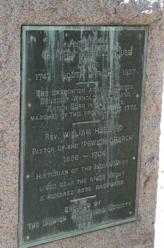
Side 1 A few rods east of this spot were the dwelling and school house of Ezekiel Cheever first master of the Grammar School 1650-1661. In the east side of the common was the home of Rev. Nathaniel Ward 1634 Minister of Ipswich 1637 . . . — — Map (db m97170) HM WM
To all those who served their country
1775 Revolutionary War 1781
1812 War of 1812 1812
1861 Civil War 1865
1898 Spanish American War 1898
1899 Campaign Era 1917
1917 World War I 1918
1941 World War II 1945
1950 Korean Conflict . . . — — Map (db m97169) WM
On August 31, 1824, General Lafayette was welcomed at the Meetinghouse, dined at Treadwell's Public House, and set out for Newburyport. — — Map (db m284807) HM
Ahead of you lie Market Square and Market Street, which was once a swamp until Samuel Appleton build a “cart bridge” over it in 1639.
First known as "The Way to the Mill", Market Street was entirely residential until it was transformed into . . . — — Map (db m253817) HM
The Original Center of the Ipswich Community
Welcome to the Meetinghouse Green (now generally referred to as the North Green), the center of colonial Ipswich, and one of the most significant sites of 17th century Massachusetts. The area was . . . — — Map (db m253779) HM
From the date of its settlement by John Winthrop and twelve associates, 1630, Agawam (Ipswich) was the seat of pillow lace making, by 1790 the annual production was 41,979 yards. This craft continued until the introduction of lace machinery. — — Map (db m47920) HM
Here on August 23, 1687, the citizens of Ipswich, led by the Reverend John Wise, denounced the levy of taxes by the arbitrary government of Sir Edmund Andros, and from their protest sprang the American revolution of 1689 — — Map (db m253778) HM
For three centuries, Sawmill Point was the site of gristmills, fueling mills, and sawmills powered by the Lower Falls of the Ipswich River. Through the foresight of Alice Shurcliff, this park now stands as a window to the river and to the history . . . — — Map (db m254013) HM
In 1689 the Town of Ipswich acquired the six acres of the South Green with the proviso “that the said land…shall lie common.” Before then the land had been subject to many ownership disputes.
For 200 years, the South Green served the Town well, . . . — — Map (db m253910) HM
From church to Town Hall and District Court to condominiums - the adaptive reuse of an historic building.
With its historic exterior largely intact, the former church that later became Town Hall and the District Court is now a residential . . . — — Map (db m253820) HM
Erected by Gen James Appleton, Woman's Relief Corps of Ipswich, May 27, 1897.
A tribute of gratitude to those Union soldiers and sailors of the Civil War of 1861-1865, whose last resting place is unknown. — — Map (db m253819) HM
The Indian region called Saugus, settled 1629 by people from the Puritan colony at Salem, named for Lynn Regis in England, 1637. First place in North America to make boots and shoes for export. — — Map (db m48071) HM
In honor of the men and women of Ward Six who served in World War II and dedicated to those who made the supreme sacrifice to God and country
Their memory perpetuated by the McDonaugh Square Associates 1941-1945
Reverse side of memorial, 2 rows . . . — — Map (db m97369) WM
Belonging to the Fountain Inn, where Sir Harry Frankland, collector of the Port of Boston, while supervising the erection of Fort Sewall, met Agnes Surriage in 1742. Agnes, a poor fisherman's daughter, later became Lady Frankland and returned with . . . — — Map (db m47951) HM
This hill was formerly known as Bailey's Head. During the Revolution and the War of 1812, it was used as a fortification, Fort Washington, manned by local citizens with help if needed from the Lafayette Guards and the Marblehead Light Infantry. . . . — — Map (db m36617) HM
Fort Sewall
Marblehead Massachusetts
Marblehead, founded in 1629, has always been a famous seaport – for fishing, foreign trade, boat building, sail making and yachting. Local sailors have been champions in world competitions, the America's . . . — — Map (db m36608) HM
Built in 1742 for defence (sic) against French cruisers. U.S.S. "Constitution" sought shelter under the fort's guns when chased by H.M.S. "Tenedos" and "Endymion" April 3, 1814. Named after Samuel Sewall of Marblehead, Chief Justice of . . . — — Map (db m47952) HM
Fort Sewall Site Plan
Legend
A Kitchen
B Guard Room
C Store Room
D Dungeon
E Magazine
F Temporary Magazine
The bomb-proof headquarters, covered with several feet of earth, consists of four rooms (left to right): . . . — — Map (db m36603) HM
Gen. Casimir Pulaski
Arrived in Salem Harbor at
Fort Sewall Marblehead
July 23, 1777
Revolutionary War Hero
Polish and American Patriot
Died in Battle at Savannah, GA
October 11, 1779
Erected 1989
Polish American Congress . . . — — Map (db m36605) HM WM
Huzzah! For "Old Ironsides"
Marblehead citizens have embraced
USS Constitution
on three historic visits:
3 April 1814 when beneath the guns of Fort Sewall she found refuge from an overwhelming British force
29-31 July 1931 when under . . . — — Map (db m36606) HM
[Top Marker]
In July of 1789, Representative Elbridge Gerry, native of Marblehead, signer of the Declaration of Independence, and Vice President of the United States under President James Madison, filed H.R. Bill 12 in Congress, . . . — — Map (db m21453) HM
[ north side ]
In Memory of Our Country's Defenders
1776 – 1812 – 1861
Erected by the Citizens of Marblehead
Dedicated July 4, 1876
Our Patriots Who
Fell In Defense Of
The Union
1861 • M. Hennessy • S.J. Goodwin . . . — — Map (db m36542) HM
[ right panel ]
Vietnam
Veterans
Memorial
This memorial
Erected by Vietnam
Veterans, Families,
Friends, and Town
of Marblehead
[ left panel ]
John C. Archbold
Warren W. Boles
Edgar S. Doliber
Tristan W. . . . — — Map (db m36548) HM
This Memorial Dedicated By The
Citizens of Marblehead
To The Memory Of
Charles H. Evans Killed in Action – July 20, 1918
Irving E. Brown Died in France – October 13, 1918
William F. Farry Died in France – February . . . — — Map (db m36599) HM
[ left panel ]
World War II
1941 – 1946
Richard W. Ahlman Jr. • James S. Baily Jr. • Clifford G. Barry • Sidney A. Benson • James E. Brophy • Charles L. Carlson • John W. Clark Jr. • Frederick T. Clive • John F. Connors • . . . — — Map (db m36598) WM
Established in 1638, one of the oldest graveyards in New England. Site of first meetinghouse. Six hundred Revolutionary heroes and several early pastors were interred at the top of the hill. — — Map (db m48005) HM
Honored by being designated to the National Register of Historic Landmarks Built by the citizens of Marblehead as the center for their town government, it is a rare example of a public building in continual use since colonial days. Its history . . . — — Map (db m218893) HM
Fort Sewall is a unique earthwork fortification positioned to defend Marblehead for over three centuries. In 1644 the provincial government granted permission to build an earthwork fort at Gale's Head and provided two guns. . . . — — Map (db m36601) HM
First ferry across the Merrimack river from Newbury to Salisbury, established about 1639, and the only route from Boston to the eastern frontier. In 1641 George Carr was appointed ferryman with rights which continued in his family for generations. — — Map (db m47972) HM
Brought from the siege of
Louisburg
by Nathaniel Knapp Jr. 1759
preserved by his son
Isaac Knapp
as a memorial to his father
and also to his brother
Jacob Knapp
who served at Bunker Hill
and was a member of the . . . — — Map (db m115543) HM
has been designated a
National
Historic Landmark
This site possesses national significance
in commemorating the history of the
United States of America
1974
[Second marker]
Cushing House
Home of
Margaret Cushing . . . — — Map (db m260632) HM
The first bridge over the navigable waters of the Merrimac River
Open to travel November 26, 1792
Built in seven months under the direction of Timothy Palmer
Rebuilt as a suspension bridge 1810
Rebuilt 1828 and maintained as a . . . — — Map (db m260675) HM
1790-1990
Bicentennial of the United States Coast Guard
We the people of Newburyport, Massachusetts dedicate this plaque to the men and women of the United States Coast Guard who have courageously and faithfully served the nation for 200 . . . — — Map (db m85229) HM
Built in 1746 by Michael Dalton, later the residence of his son, Tristram Dalton, one of the first two United States Senators from Massachusetts. Here were entertained George Washington and
other distinguished men. — — Map (db m49452) HM
On this site dwelt Edward Rawson, secretary of the bay colony for thirty-six years, deputy to the General Court for twelve years, elected clerk of the House of Deputies in 1645, he died in Boston 1693. — — Map (db m47984) HM
Black soldiers and sailors from Newburyport have fought in each of America's military
conflicts, often serving a nation that did not recognize their rights as full citizens.
During the Civil War (1861-1865), President Abraham . . . — — Map (db m260673) HM
On This Site
The first bridge over the navigable
waters of the Merrimack River was
erected by Timothy Palmer in 1792.
It was superseded in 1810 by a
chain suspension bridge built by
John Templeman from plans furnished
by James . . . — — Map (db m263633) HM
In the 18th and 19th centuries, Black activists from Newburyport filed lawsuits, wrote editorials, and petitioned in the effort to end slavery. Their tireless activism helped to build one of the greatest social movements in United States history: . . . — — Map (db m260651) HM
A domed Victorian train station was built in 1893 behind where the Winter Street condominiums stand today. At the time, there were 32 trains traveling to Boston every day.
The station operated for 75 years and was destroyed by fire on May 2, . . . — — Map (db m115590) HM
This area has a concentration of graves and stone markers for Black men,
women, and children buried in the 18th and 19th centuries. There are also many
unidentified graves here, found by ground penetrating radar, which are now
marked “Once Known” . . . — — Map (db m260631) HM
When the British Parliament in 1773 imposed a tax on tea imported into the American Colonies the act was widely resented.
In indignation tea was brought by the people to Market Square and burned.
To commemorate the incident this tablet was . . . — — Map (db m115416) HM
Brown Square was established in 1802 by Moses Brown, a wealthy merchant who established a rum distillery on Newburyport's waterfront and built the Garrison Inn.
Moses Brown (1742-1827) was a prosperous Newburyport merchant, . . . — — Map (db m260662) HM
Brown Square's founder, Moses Brown, became wealthy and helped develop Newburyport based on his profits from New England's “Triangle Trade”, the economic engine that drove much of the slave trade in the 18th and 19th centuries.
Moses . . . — — Map (db m260663) HM
1679-1681 arrested, tried, imprisoned and reprieved. Confined to her husband William Morse 4 acre house lot on the SE side of Market Square until her death. — — Map (db m260648) HM
The Rise, Fall and Rebirth of the Newburyport Custom House The Custom House collected federal taxes on international imports during the peak of Newburyport’s maritime trade era, and went into a drastic decline for nearly a century after the . . . — — Map (db m181628) HM
This historic building, built as a Markethouse and Lyceum by the citizens of Newburyport in 1822, served as the Central Fire Station from the mid-1800s until 1980.
A cooperative effort by the public and private sectors has restored the structure as . . . — — Map (db m115567) HM
In honor of
the proud, brave fishermen
who lost their lives at sea.
May they rest in peace.
In memory of
The Crew of F/V Lady Luck
Who were lost at sea
The night of January 31, 2007
Captain Sean P. Cone - Age 24
Crewman . . . — — Map (db m85230) HM
There are 12 panels in this marker, with hundreds of names of those who served, as well as a recitation of the Gettysburg Address — — Map (db m115625) WM
A misplaced switch forced a freight train onto a dead-end side track on May 23, 1873, and the 34-ton steam locomotive smashed through barriers and fell down the embankment to Merrimac Street below. The engineer and fireman jumped clear before the . . . — — Map (db m115587) HM
It was first shaped thousands of years ago by a huge chunk of ice which broke off a retreating glacier.
When the ice finally melted, it left a steep-sided pit that geologists call a kettle hole.
In 1645 the first settlers from England named . . . — — Map (db m115536) HM
“She’s the Liverpool Packet- O Lord, let her go!”
The Dreadnought, in her ten years running in the Atlantic Packet Service, made for herself such a name that she is still remembered: “The wild boat of the Atlantic ,” As . . . — — Map (db m85299) HM
To commemorate
the memory of the officers and men
who left this Memorial Hall
April 16, 1861
in answer to the first call of
Abraham Lincoln
for troops to defend the Capital
issued April 15, 1861
Capt. Albert W. Bartlett . . . — — Map (db m115617) WM
Near this spot was "Watts Cellar," a landmark before the settlement of Newbury in 1635. An excavation used for the storage of fish by fishermen who visited the New England coast. — — Map (db m47985) HM
1805-1879
Garrison the Liberator
Presented by William H. Swasey July 4 1893
Side 2 I solicit no man’s praise. I fear no man’s censure. The Liberty of a People. Is the gift of God and Nature
Side 3 Neither God nor the . . . — — Map (db m84824) HM
(left tablet)
Reverend …
John Lowell
Thomas Cary
John Murray
Charles Milton
Christopher Bridge Marsh
Ministers of this City
Judge Theophilus Bradbury
Nicholas Pike
Timothy Palmer
”Lord” Timothy . . . — — Map (db m115614) HM WM
Newburyport native, William Lloyd Garrison, nationally known for his radical views and fiery rhetoric, became one of America's foremost spokesmen for the abolition of slavery.
William Lloyd Garrison (1805-1879) was a prominent spokesman . . . — — Map (db m260666) HM
Born and raised in poverty in the early 1800s in Newburyport, Garrison received almost no formal schooling. He apprenticed at The Newburyport Herald at age 12 and later established his own abolitionist paper The Liberator at age . . . — — Map (db m260667) HM
Battle of Lexington
April 19, 1775
Samuel Cook Aet 33 · Benjamin Deland, Jr Aet 25 · George Southwick, Jr Aet 25 · Jotham Webb Aet 22 · Henry Jacobs, Jr Aet 21 · Ebenezer Goldthwaite Aet 21 · Perley Putnam Aet 21
Citizens of Danvers
Fell . . . — — Map (db m309706) WM
Captain Samuel Flint
Was Born April 9, 1733
In a House Which Stood Beside This Lake
He Commanded a Militia Company
From This Community
At The Battle of Lexington, April 19, 1775
On October 7, 1777, at the 2nd Battle of Saratoga . . . — — Map (db m257259) HM
Named from a bear caught by the tide and killed in 1700. Commercial and shipbuilding center of Rockport for 160 years. First dock built here 1743. Sandy Bay Pier Company organized 1809. Site of Stone Fort and Sea Fencibles Barrack during War of 1812. — — Map (db m48007) HM
Answering a sudden alarm to meet at the house of Lieutenant Benjamin Tarr, grandson of Richard Tarr the first settler, sixty-six men from this village under Captain John Rowe, marched to Charlestown and fought in the Battle of Bunker Hill. — — Map (db m73109) HM
This Cannon from The
U.S.S. Constitution
"Old Ironsides" Was
Presented to the Sandy
Bay Historical Society
By Descendants of The
First Settler, Richard
Tarr, and Dedicated
August 20, 1931 — — Map (db m36255) HM
The Project
This is the bell from the steeple of the First Congregational Church of Rockport. It is the bell that is rung hourly by the Town Clock, still owned by the Town of Rockport. It is also rung by means of a rope and bell wheel on . . . — — Map (db m115529) HM
Here stood the cabin of Richard Tarr founder of the Tarr Family on Cape Ann. He came to Marblehead in 1680, then settled in Sacco, Maine. Driven thence by Indians, he became the first settler of Sandy Bay (Rockport) in 1690. — — Map (db m48008) HM
Here stood the first framed house in Sandy Bay (Rockport) built in 1700 by the second settler John Pool. He built the first sawmill, bridge and vessel in this settlement, and furnished the lumber used in building Long Wharf, Boston, in 1710. — — Map (db m48842) HM
Original plot given by the first settler, Richard Tarr, who was buried here in 1732. Here lie most of the early settlers and many of the officers and soldiers of the French and Indian, Revolutionary and 1812 Wars. — — Map (db m48841) HM
Site of fort erected by public subscription as a protection againat British warships during the War of 1812, captured in a sneak attack and dismantled by frigate Nymphe. Ammunition gone, all nine seafencibles taken prisoner, the townsmen hurled . . . — — Map (db m36300) HM
These Our Dead In Honored Glory Rest
World War I
1917 1918
James E. Bryan R.C.A.
John A. Carlson U.S.A.
Dwight P. Dutton U.S.M.C.
Edward R. Everett U.S.A.
Harold T. Grover U.S.A.
Edward Peterson U.S.A.
World War II
1941 . . . — — Map (db m36282) HM
Due east from here on July 16 1605 the Sieur De Monts sent Samuel De Champlain ashore to parley with some Indians. They danced for him and traced an outline map of Massachusetts Bay. These French explorers named this promontory, The Cape of Islands. — — Map (db m74709) HM
Straitsmouth Island was first sighted in 1614 by Captain John Smith. He also spotted nearby Thacher and Milk Islands and named all three the Turks' Heads.
Lighting the Way
Built in 1834, the island's first lighthouse was 19 feet . . . — — Map (db m115515) HM
To the glory of God and in honor of the first settlers of Sandy Bay
The First Parish in Rockport was constituted in 1755. The corner stone of this meeting house laid in 1803. The tower was shattered by a British bombardment in 1814. . . . — — Map (db m73110) HM
Town Wharves
First timber wharf built in 1743 to shelter fishing boats. In 1793 62 vessels of 5 to 10 tons were sighted in Rockport Harbor. From incorporation of Sandy Bay Pier Co. in 1811 wharves were rebuilt and extended of durable granite blocks . . . — — Map (db m36262) HM
Near this spot, their graves unmarked, lie buried
Maximilian and Joseph Jewett
sons of
Edward and Mary (Taylor) Jewett
of Bradford England
They came over in 1638 in the Company led by
Rev. Ezekiel Rogers
which settled the . . . — — Map (db m115313) HM
The burial ground set apart at the settlement of the
town of Rowley in 1639. Here
are buried Ezekiel Rogers,
Samuel Phillips, Samuel
Shepard, Edward Payson and Jedediah Jewett, the earliest
ministers of the town, and
nearly all the original . . . — — Map (db m115314) HM
Rowley's tribute to her men who served in the military or naval service of the United States in the War to preserve the Union. There names appear here. Erected 1901 1861-1865
[There are three sides of engraved names] — — Map (db m97164) WM
1917-1919 Erected by the town or Rowley in honor of the men who served their country in the World War
Followed by 3 columns of names inscribed alphabetically
Dedicated 1935 — — Map (db m97168) HM
Born and raised in Salem, Massachusetts, Catherine M. Larkin was a 1938 graduate of Salem Hospital School of Nursing. In 1941 as WWII erupted, she voluntarily enlisted in the U.S. Army Nurse Corps. In the rank of Chief Nurse, 1st Lieutenant Larkin . . . — — Map (db m233304) HM WM
Historic Collins Cove in Salem was once ringed with salt marsh. Restoration began in spring 2019.
Historic Collins Cove in Salem was once ringed with salt marsh. Starting in 1845, Boston and Maine railroad filled the tidelands to transport . . . — — Map (db m233294) HM
Alexander Graham Bell
Inventor of the apparatus which first transmitted speech through long lines of electrified wire lived from 1873 to 1876 in a house on this spot owned by Mrs. Mary Ann (Brown) Sanders
In these years but not chiefly in . . . — — Map (db m230062) HM
In memory of those who lived and labored at the almshouses and hospitals on this land, and in honor of those known and unknown who are quietly resting here in unmarked graves. — — Map (db m233301) HM
378 entries matched your criteria. Entries 101 through 200 are listed above. ⊲ Previous 100 — Next 100 ⊳