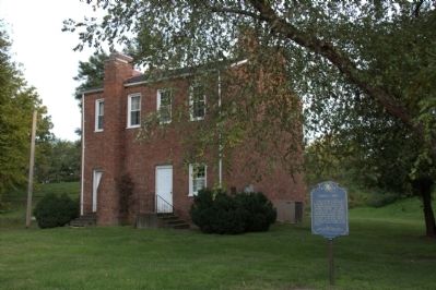
On Main Street south of Adams Street, on the left when traveling south.
This was the original site of the home of John Marshall, one of the founders and president of the Bank of Illinois, the first bank chartered by the Illinois Territorial Legislature. The charter was issued in 1816. The bank opened at Shawneetown . . . — — Map (db m60312) HM
On Main Street north of Old Shawneetown Road, on the right when traveling north.
One of Shawneetown's earliest brick buildings, Rawlings' Hotel, stood on this lot. It was built in 1821-1822 for Moses Rawlings, who owned until 1841. On May 7, 1825, it was the site of a reception held for the Marquis de Lafayette during his . . . — — Map (db m154634) HM
On Main Street north of Garfield Street (State Route 13), on the right when traveling north.
In commemoration of the families that lived in Tent City after the devastating flood of 1937. One and a half mile east of Junction, a 15-acre strip of the Finney Austin farm was used to erect a " tent colony" to house Gallatin county flood . . . — — Map (db m208171) HM
On Main Street at Old Shawneetown Road, on the left when traveling north on Main Street.
Here we honor the spirit of the place called "Shawneetown." This proud spirit was born in the heart of the first stalwart Shawnee brave who saw in this beautiful river site, a homing place. It ignited in the first white settler 17 years before the . . . — — Map (db m154636) HM
On South Murphy Street at Edwards Street, on the left when traveling south on South Murphy Street.
Since World War I, more than 82,000 American soldiers are unaccounted for. This unoccupied seat is dedicated to the memory of those brave men and women and to the sacrifices each made in serving this country. God Bless You, God Bless . . . — — Map (db m306291) WM
On West Shawnee Avenue, on the right when traveling east.
Born in Ireland in 1814, Michael K. Lawler came here to Gallatin County in 1819. After serving as a captain in the Mexican War, he lived on his farm near here until the outbreak of the Civil War. In May 1861 he recruited the 18th Illinois Volunteer . . . — — Map (db m154627) HM
On West Shawnee Avenue, on the right when traveling west.
James H. Wilson, American Army officer, engineer, and author, was born in 1837 on his family's farm about a mile south of here. He attended Shawneetown schools, McKendree College, and the United States Military Academy. In the spring of 1864, during . . . — — Map (db m154626) HM
On Ohio River Scenic Byway at East McClernand Avenue on Ohio River Scenic Byway.
The Illinois Territory was formed in 1809. Its Governor, Ninian Edwards, laid out a district on Sept. 14, 1812 and called it the County of Gallatin. After Albert Gallatin, Secretary of the U.S. Treasury. The county changed size and shape often . . . — — Map (db m210685) HM
On Lincoln Boulevard East just south of East McClernand Avenue, on the right when traveling north.
This plaque is a token of gratitude from the people of Gallatin County for services render our country by the men and women of our Armed Forces. — — Map (db m208424) WM
On Lincoln ST. E at E McClernand Avenue, on the right when traveling north on Lincoln ST. E.
Since World War I, more than 82,000 American soldiers are unaccounted for. This unoccupied seat is dedicated to the memory of those brave men and women and to the sacrifices each made in serving this country. God Bless You, God Bless . . . — — Map (db m208299) WM
On Park Avenue 0.1 miles east of East Park Avenue, on the right when traveling east.
The impressive limestone cave located along the Ohio River is one
of the most compelling features of Cave-in-Rock State Park. With a
reputation as a robber's den and outlaw hideout, the cave looms large
in popular folk tales of the Illinois . . . — — Map (db m161218) HM
On Canal Street (Illinois Route 1) at Market Street, on the right when traveling south on Canal Street.
Meriwether Lewis, William Clark, and about twenty men passed this place in the fall of 1803 on their famous journey westward. Cave-In-Rock, a natural landmark near here, was well known and noted on some early maps of this area. The party . . . — — Map (db m154573) HM
On Canal Street (Illinois Route 1) at Market Street, on the right when traveling south on Canal Street.
This natural cave located nearby was known to European explorers as early as 1729. Its location was noted in diaries and journals of travelers. It was noted on maps used by Lewis and Clark.
Late in the 18th century, The Cave was the habitat for . . . — — Map (db m155030) HM
On Canal Street (Illinois Route 1) south of Market Street, on the right when traveling south.
Since World War I, more than 82,000 American soldiers are unaccounted for. This unoccupied seat is dedicated to the memory of those brave men and women and to the sacrifices each made in serving this country. God Bless You, God Bless . . . — — Map (db m303217) WM
On Main Street at Locust Street, on the left when traveling south on Main Street.
Anna Bixby Trail
This point marks the beginning of an early trail traveled by Anne Hobbs Bixby, mid-wife and herb doctor, while caring for the sick in the Rock Creek community, 8 miles northeast of here. A century before recognition was . . . — — Map (db m303306) HM
On County Road 750E 0.1 miles north of County Road 12, on the right when traveling north.
For 6 to 9 months a year, the Iron Furnace was "in blast."
These quiet hills came alive with the sounds of axes and
picks, horses and wagons, and the shouts of hardworking
men-24 hours a day,7 days a week!
A blast furnace requires large . . . — — Map (db m161399) HM
On County Road 750E N north of County Route 12, on the right when traveling north.
Before you stands the only remaining iron furnace structure in the entire state of Illinois. This priceless historic edifice became part of the Shawnee National Forest in 1950.
Outstanding in Its Field
Built in 1837, the Illinois Iron . . . — — Map (db m161400) HM
On Market Street west of Locust Street, on the right when traveling west.
As the Big Creek Baptist Church is the oldest Baptist church in Illinois with continuous services, the site of the Big Creek Church is two miles west of this location. Elders Stephen Stilley and William Jones led in constituting the Big Creek Church — — Map (db m155007) HM
On Main Street at Market Street, on the right when traveling north on Main Street.
Erected by the…citizens of Hardin County in memory of our heroes, who gave their lives for the…freedom of our country, on land, on sea, and in the air.
World War I
James T. Brown • James English • Clifford Ferrell • Louis H. Hossler • . . . — — Map (db m303304) WM
On Main Street north of Locust Street, on the left when traveling south.
James (1776-1837) and Elizabeth (1789-1863) McFarlan was married on January 22, 1806 and arrived in this area about 1810 by way of North Carolina and Tennessee. According to local history, they built the southwest portion of the hotel in 1812. In . . . — — Map (db m303307) HM
On Main Street at Market Street, on the right when traveling north on Main Street.
Since World War I, more than 82,000 American soldiers are unaccounted for. This unoccupied seat is dedicated to the memory of those brave men and women and to the sacrifices each made in serving this country. God Bless You, God Bless . . . — — Map (db m303219) WM
On County Road 750E 0.1 miles north of County Road 12, on the right when traveling north.
Imagine this peaceful site abuzz with
activity! It took about 40 men to keep the
furnace "in blast” and many more to
support the workers and their families,
creating the furnace community.
At the Break of Day
The village sprang . . . — — Map (db m161401) HM
On Main Street (Illinois Route 34) west of Walnut Street, on the left when traveling north.
Fluorite, the official Illinois state mineral, was discovered in 1839 by James Anderson while digging a well near Fairview Landing one half mile SW of this site. Fluorite was a waste product until the steel industry began using the mineral in their . . . — — Map (db m154632) HM
On Main Street (Illinois Route 34) at 2nd Street, on the right when traveling south on Main Street.
People have been digging, processing and transporting fluorite (fluorspar) here since 1842. In the 1940s, Rosiclare and Hardin County led the U.S. in fluorite production and were known as "The Fluorite Capital of the World".
What is . . . — — Map (db m206198) HM
On Main Street (Illinois Route 34) at 2nd Street, on the right when traveling south on Main Street.
William Pell, Jr. settled here in 1832, founded Pell's Landing. In 1874, Pell's Landing was incorporated as Rose Clare and became the City of Rosiclare in 1932. Always an important river town, the discovery of fluorite and other minerals in the . . . — — Map (db m206199) HM
On Main Street (Illinois Route 34) at 2nd Street, on the right when traveling east on Main Street.
Travel the Byway and discover the importance of the Ohio River to the nation and the world. Experience the magnificent natural landscapes of southern Illinois while coming to know how the historic events and people that shaped the region and the . . . — — Map (db m196762) HM
On South 3rd Street (County Route 7) south of East Seldon Street, on the left when traveling south.
In the third year of the American War for Independence, Lt. Col. George Rogers Clark and his army of 170 Virginia volunteers camped 5 miles southeast of here. On July 2, 1778, Clark made the fourth of five camps on his march from Fort Massac to . . . — — Map (db m161442) HM
On South Washington Street at East College Street, on the right when traveling north on South Washington Street.
The evolution of Southern Illinois University began here in 1856 when Presbyterians founded Carbondale College. Suffering hardships during the Civil War, the college was sold to the First Christian Church in the mid 1860s and renamed Southern . . . — — Map (db m161077) HM
On North Illinois Avenue (U.S. 51) at East Main Street ( Route 13), on the right when traveling north on North Illinois Avenue.
On April 23, 1861, eleven days after Confederates fired on Fort Sumter, the cofounder of Carbondale, Daniel Harmon Brush, called a public meeting on this town square. Brush delivered a patriotic speech in support of the Union. Two days later, Brush . . . — — Map (db m161965) HM
Near East Main Street (Illinois Route 13) east of South Logan Avenue.
In this cemetery was held the first Memorial Service to the Civil War Veterans Apr. 1866 which inspired Gen. John A. Logan a citizen of Carbondale to issue General Order No. 11 as Grand Commander of G.A.R. establishing National Memorial Day May 30 . . . — — Map (db m174000) HM
Near South Washington Street at East Main Street ( Route 13).
When Saddam Hussein, the dictator of Iraq, invaded and seized Kuwait in August 1990, the UN and the US took it as an act of aggression. With UN sanction, a coalition of 24 nations led by President George Bush deployed half a million troops in the . . . — — Map (db m163488) HM
Near South Washington Street at East Main Street ( Route 13).
On June 25, 1950 North Korean Armed Forces invaded South Korea. To contain Communist aggression, President Harry Truman ordered American forces to defend South Korea. The UN called on all member nations to help repel the invaders. Fifteen responded, . . . — — Map (db m163490) HM
Near West Main Street (Illinois Route 13) east of Glenview Drive.
"If I have helped someone along life's way then my living has not been in vain"
Born in Brookport, Illinois Rev. Turley was a man interested in all facets of life. He always liked to build, loved the positive approach to problems, glorified in . . . — — Map (db m167726) HM
On South Logan Avenue south of East Main Street ( Route 13), on the right when traveling north.
The first memorial service in Illinois, and one of the first in the nation, to honor those who had died in the Civil War, took place at Woodlawn Cemetery on April 29, 1866. On that day, a group of more than 200 veterans gathered at the old "Blue . . . — — Map (db m163493) HM
On East Main Street (Illinois Route 13) east of South Illinois Avenue (U.S. 51), on the left when traveling west.
(all are photo captions:)
Daniel Harmon Brush founded Carbondale in 1852 along the right-of-way of the Illinois Central Railroad. The railroad became the center of the town's activity, bisecting what would become the Town Square. The . . . — — Map (db m161966) HM
Near South Washington Street south of East Main Street ( Route 13).
Following construction of the Illinois Central Railroad, frame and brick commercial buildings were built on the east side of the Town Square. The photo to the right depicts the 100 block of North Washington (ca. 1870). The Richart and Campbell . . . — — Map (db m161968) HM
Near South Washington Street south of East Main Street ( Route 13).
In 1869, Carbondale was chosen as the location for Southern Illinois College. By the early 1870s, several new commercial brick buildings were planned for the Town Square, reflecting growth and optimism.
The Newell House Hotel at 101 South . . . — — Map (db m161969) HM
On East Main Street (Illinois Route 13) at North Washington Street, on the right when traveling west on East Main Street.
A major change in the configuration of the Town Square occurred about 1900 when the Illinois Central Railroad announced an expansion of its Carbondale facilities. New tracks were added, and the St. Louis Division Office, depicted in this ca. 1920 . . . — — Map (db m161970) HM
On East Jackson Street at North Washington Street, on the right when traveling east on East Jackson Street.
By 1900, fifty trains a day stopped at the Town Square. Passengers disembarked to find commercial buildings with corner turrets and ornate windows. Examples are the Dunaway Building, erected in 1900 at 102-106 East Jackson, and the F.A. Prickett . . . — — Map (db m161972) HM
On East Jackson Street west of North Washington Street, on the right when traveling east.
In 1898, the railroad industry was approaching its height in Carbondale. The expansion of the Illinois Central Railroad resulted in numerous families relocating to the area and major expansion of railroad facilities north of the Town Square. This . . . — — Map (db m161974) HM
On East Jackson Street at North Illinois Avenue (U.S. 51), on the right when traveling east on East Jackson Street.
Because of the active railroad freight and passenger line, overnight lodging facilities were in demand, and several hotels were constructed. The most imposing of the early hotels was the Union House, later the Planters House Hotel; it stood on the . . . — — Map (db m161973) HM
On North Illinois Avenue (U.S. 51) north of East Main Street ( Route 13), on the right when traveling north.
The Solomon and Winters Dry Goods Store, built in 1897, at the northeast corner of Illinois Avenue and Jackson Street is in the background of this photo (ca. 1905). This was the first commercial building in Carbondale with a corner turret. The . . . — — Map (db m161977) HM
On West Main Street (Illinois Route 13) east of South Illinois Avenue (U.S. 51), on the left when traveling west.
In 1868, the city passed an ordinance forbidding frame construction on the Square. The photo to the left (ca. 1900) depicts the New Brush Building at 100 South Illinois Avenue. The store was built in 1895 to replace the city's first commercial . . . — — Map (db m161975) HM
On West Main Street (Illinois Route 13) east of South Illinois Avenue (U.S. 51), on the left when traveling west.
This statue was placed here by Station Carbondale, Inc. through donations from people dedicated to the preservation of Carbondale's railroad history.
The first train came to Carbondale, July 4, 1854. As many as 53 passenger trains passed . . . — — Map (db m161978) HM
Near South Washington Street at East Main Street ( Route 13).
In 1954 the army of the revolutionary government of North Viet Nam was on the verge of ending French colonial role in Viet Nam. Fearing the spread of Communism in SE Asia, the US eased the French out, set up a government in Saigon, and sent massive . . . — — Map (db m163489) HM
On South Washington Street north of Logan Drive, on the right when traveling north.
On this site
WIDB
Student Radio Station
began operations on April 12, 1970, from student built studeios in the basement of the Wright I dorm. — — Map (db m258240) HM
On South Logan Avenue south of East Main Street ( Route 13), on the right when traveling north.
On April 29, 1866, over 200 veterans and several thousand citizens gathered at Woodlawn Cemetery to honor those who had died in the Civil War. General John A. Logan delivered the keynote address, saying "Every man's life belongs to his country, and . . . — — Map (db m161076) HM
Near South Washington Street at East Main Street ( Route 13).
In 1914 war broke out in Europe between the Allies (Britain, France, and Russia) and the Central Powers (Germany and Austria-Hungary). After three years of fighting, German armies defeated Russia and drove deep into France. The sinking of the . . . — — Map (db m163492) HM
Near South Washington Street at East Main Street ( Route 13).
War began in 1939 between the Axis (Nazi Germany and Fascist Italy) and the Allies (France, Britain, and others). In 1940-41, German forces conquered most of Europe and North Africa and invaded Russia. Japan joined the Axis and attacked the US at . . . — — Map (db m163491) HM
On Washington Street at Walnut Street, on the right when traveling west on Washington Street.
Erected A.D. 1920
B.B. Easterly Pres'd't. • F.A. Richards, Clerk • Thos. G. Dunn • Samuel Smith • Munroe Lunceford • S. L. Porter — — Map (db m191123) HM
On Madison Street at Washington Street, on the right when traveling north on Madison Street.
A memorial to our United States Vietnam War Veterans
Elmer Matthew Shield Feb 15,1949 - Nov 4, 1969 •
Phillip Arbeiter •
Gary Beisner •
Homer Bradshaw •
Gerald "Peck" Derossett •
Gilbert "Shorty" Easterly •
Natham Geiger • . . . — — Map (db m191196) WM
On Park Road west of Brunkhurst Avenue, on the right when traveling north.
Captain William Boone, the nephew of the famous Daniel Boone, is thought to have been the first white settler in Jackson county, having arrived shortly after Lewis and Clark discovered Tower Rock. William Boone's son, Benningen, was the first white . . . — — Map (db m180340) HM
On 3rd Avenue 0.1 miles north of Schickle Street, on the right when traveling north. Reported missing.
In continuous use since 1872. Moved from north Grand Tower to this site in 1896. It's Gothic architecture is primarily of solid walnut. A Civil War veteran was the first minister. — — Map (db m196141) HM
The American War Mothers,
Tower Rock Charter,
Grand Tower, Illinois,
Honor these men who made
The supreme sacrifice in
The service of their country
Robert Fisher • Roy E. Nimmo • Aubrey East • Robert S. East, Jr. • Lorain Rushing . . . — — Map (db m161855) WM
On Front Street north of Market Street, on the right when traveling south.
In November 1803, Meriwether Lewis, William Clark, and their party passed by here on their way west. They camped across the river. Clark sketched the area, the local landmarks of Tower Rock and the Sugar Loaf, and their keelboat anchored near the . . . — — Map (db m161439) HM
On Market Street at Railroad Street, on the left when traveling west on Market Street.
Who, for more than 30 years from 1940 served more than a million and a half all-you-could-eat home-cooked meals to all comers on this site. Those of us who enjoyed her cooking affectionately dedicate this plaque to her. — — Map (db m191114) HM
On Park Road at Brunkhorst Avenue, on the right when traveling north on Park Road.
This steam locomotive built by H. K. Porte Co. in 1929, donated to Devils Backbone Park, Grand Tower, Illinois in 1961, by Central Illinois Public Service Co. — — Map (db m190983) HM
On Front Street south of Maple Street, on the right when traveling north.
In Memoriam
The American Legion
Tower Rock Post 921
Grand Towers, lll.
Honor these men who made
The supreme sacrifice
In the service of
Their country
World War I
Pvt. Lorain Rushing
Died September 26, 1918, . . . — — Map (db m161858) WM
On Illinois Route 3 0.3 miles south of Rodee Road, on the right when traveling south.
In December of 2009, the lush wetland at the heart of Lover's Pond Nature Preserve was renamed in honor of James "Gene" Korando, a lifelong resident of this area and avid outdoorsman.
Humble Beginnings
"Gene" Korando was born May 26, . . . — — Map (db m161856) HM
Murphysboro celebrated its first Logan Day on August 3, 1914. This event drew 25,000 visitors, including national dignitaries and a large number of Civil War veterans.
The main focus of Logan Days was to dedicate this monument as the . . . — — Map (db m203172) HM
On Oak Street west of South 16th Street, on the right when traveling east.
The Pathe News Company recorded the activities surrounding Murphysboro's first "Logan Day" on August 3, 1914. The film appeared in movie houses a little over a week later. Among them was Murphysboro's Tilford, now Liberty Theater, which opened in . . . — — Map (db m203169) HM
On South 11th Street at Chestnut Street, on the right when traveling north on South 11th Street. Reported permanently removed.
Lindorf Ozburn, born in Jackson County, Illinois in 1823, married Diza Glenn, John A. Logan's cousin. Ozburn, who served with Logan in the Mexican War, joined the Illinois 31st Infantry at the beginning of the Civil War. On Logan's promotion to . . . — — Map (db m208665) HM
On South 10th Street at Walnut Street, on the right when traveling south on South 10th Street.
In July 1861, J.D. Wheatley of Duquoin wrote Illinois Governor Richard Yates that a Confederate company was drilling in Murphysboro. A Union officer sent to investigate discovered a group of men in uniforms made of red and white bed ticking drilling . . . — — Map (db m160953) HM
On Walnut Street east of 11th Street, on the right when traveling east.
Dr. Conrad Will, the "Father of Jackson County," was born in Pennsylvania in 1779 and came to Illinois in 1813. He was a physician but also operated a grist mill, tannery, and salt works. He was one of the founders of Jackson County and in 1816 . . . — — Map (db m160951) HM
On Oak Street west of South 16th Street, on the right when traveling west.
Samuel H. Dalton, a widower, purchased this board and baton house from the John A. Logan estate in 1887 for $150.
Dalton, born enslaved in 1839 in Richmond, Virginia, lived in Mississippi at the beginning of the Civil War. After emancipation . . . — — Map (db m203170) HM
On South 11th Street at Walnut Street ( Route 149), on the right when traveling south on South 11th Street.
Dr. John Logan, born in Ireland in 1788, came to America with his family in 1793. He moved to Jackson County in 1822 where he married Elizabeth Jenkins. Dr. Logan served four terms in the Illinois Legislature and became a friend of Abraham Lincoln. . . . — — Map (db m161005) HM
On Walnut Street (Illinois Route 149) west of 14th Street, on the right when traveling east.
Elizabeth Jenkins, born in 1803 in North Carolina, married Dr. John Logan in 1825. When her son, John A. Logan, joined the Union Army in 1861, Elizabeth refused to speak to him. In this, she reflected the strong Southern feelings held across Egypt, . . . — — Map (db m161007) HM
On South 10th Street at Chestnut Street, on the left when traveling north on South 10th Street.
The first coal mine in Illinois was located one-half mile south of here along the south bank of the Big Muddy River. William Boone and his indentured servant, a man named Peter, loaded a small raft with coal from an outcropping and, after floating . . . — — Map (db m160955) HM
On Airport Road at Glenn Road, on the right when traveling west on Airport Road.
Lt. Col. Clark and his troop of 170 Virginians camped near here on July 2, 1778. It was their third campsite during a march from Fort Massac to Kaskaskia to capture that post from the British. Earlier that day, the troop was lost for a time on . . . — — Map (db m161008) HM
On Walnut Street (Illinois Route 149) at South 11th Street, on the right when traveling east on Walnut Street.
In August 1862, federal authorities detained Israel Blanchard, John A. Logan's brother-in-law, as he walked near the court house. Blanchard was subsequently taken to the Logan Hotel, and arrested on vague charges related to alleged anti-war . . . — — Map (db m161006) HM
On Walnut Street (Illinois Route 149) west of 10th Street, on the right when traveling east.
On January 10, 1816, Jackson County, created from Randolph and Johnson counties, became Illinois' ninth county. It was named for General (later President) Andrew Jackson, hero of the Battle of New Orleans. The county's first seat, Brownsville, . . . — — Map (db m160952) HM
On Walnut Street (Illinois Route 149) at South 11th Street, on the right when traveling east on Walnut Street.
Murphysboro celebrated its first Logan Day on August 3, 1914. This was Illinois’ second Logan Day, the first occurred in Chicago in 1897. Logan Day brought 25,000 people to Murphysboro. Among the attendees were Illinois Governor Edward F. Dunne, . . . — — Map (db m119541) HM
On Edith Street east of South 17th Street, on the right when traveling east.
John A. Logan was born here in 1826. He fought in the Battle of Bullrun as a Democratic U.S. Congressman. Logan joined the Union Army and before the Civil War's end he earned the rank of Major General. Experiences in the war changed Logan from a . . . — — Map (db m161003) HM
On Edith Street east of South 17th Street, on the right when traveling east.
In 1806, surveyors mapped Southern Illinois noting the small prairies extending across the region. These "pocket prairies" preserved remnants of the vast grassland which covered the area in prehistoric times. Climate changes brought the growth of . . . — — Map (db m203173) HM
On Oak Street just west of South 16th Street, on the right when traveling west.
Their term of service being up in February 1865, 205 members of the 56th Illinois Infantry chose to muster out. Before doing so they fought at Bentonville, North Carolina, the regiment's final engagement. Their journey home began March 29th, . . . — — Map (db m203167) HM
On Walnut Street (U.S. 149) at South 17th Street, on the right when traveling west on Walnut Street.
"True craftsmen of their historic trade…civic minded contributors to Murphysboro and Southern Illinois"
The Southern Illinoisan: April 17, 1966
Born in Macon, Georgia, Jim and Benjamin Deal moved to Murphysboro in 1922. The . . . — — Map (db m302367) HM
On South 17th Street south of Edith Street, on the right when traveling north.
The sandstone outline marks the location of Dr. John and Elizabeth (Jenkins) Logan's 1823 to 1844 home.
Their home faced west with an apple and peach orchard between it and that road. The 20' x 50' two story log building consisted of two rooms . . . — — Map (db m203174) HM
On 14th Street north of Main Street, on the left when traveling north.
This building was constructed for the Southern Division of the Illinois Supreme Court, one of three divisions created by the Constitution of 1848. Court met in lodge halls in Mount Vernon prior to completion of the center section of this building . . . — — Map (db m61702) HM
On North Clear Lane 1.5 miles east of North Campground Lane, on the right when traveling east.
The Atkinson Cemetery was established March 11, 1875, by James Atkinson, who granted the land as a community burial ground. The first recorded burial (1843) was of Sarah A. Short, daughter of Thomas Jefferson and Martha "Patsy" (Maddux) Short. The . . . — — Map (db m236731) HM
On 14th Street north of Main Street, on the left when traveling north.
This monument commemorates Abraham Lincoln's visit to this courthouse on November 18-19, 1859. At that time this building was the Illinois Supreme Court, First Grand Division, and Lincoln was here on behalf of his client, the Illinois Central . . . — — Map (db m61741) HM
On North 27th Street just north of Caroline Street, on the right when traveling south.
Mt. Vernon resident Bill Steffy constructed this replica of the Thomas Atkins Blacksmith Shop in 1993. The former Atkins Blacksmith Shop was located in Waltonville, Illinois. any of the contents of the Blacksmith Shop are original to the Thomas . . . — — Map (db m239808) HM
On North 27th Street 0.1 miles north of Caroline Street, on the left when traveling north.
The former Mt. Vernon jail was donated to the Jefferson County Historical Society in the 1980's and was moved to the Village in 1992. The 1820 structure was originally located at 11th and Main Streets at the present Fire Department's location and . . . — — Map (db m262023) HM
On North 27th Street 1 mile Caroline St., on the left when traveling north.
Replica of the James Thomas Johnson General Store originally located in the 600 block of Opdyke Street (present day location of the old Mt. Vernon Township High School football field). The store was constructed in the latter half of the 19th . . . — — Map (db m262024) HM
On North 27th Street 0.1 miles south of Highland View, on the right when traveling south.
The Goshen Road was one of the main arteries of travel in the early 1800's, when Illinois was frontier country. The road ran in a Northwesterly direction from Shawneetown to Edwardsville - A distance of more than 150 miles. Shawneetown and . . . — — Map (db m88993) HM
On Aviation Drive north of New Fairfield Road ( Route 15).
These loved ones gave their tomorrows so that we could have our todays
World War I
Arnold, Robert E. • Blankenship, Fred • Bond, Roy • Borden, Clyde • Foster, Floyd A. • Fred, Gale • Glasebrook, Harlay • Glenn, Harry • Gowler, Samuel . . . — — Map (db m212636) WM
Near Broadway Street (Illinois Route 15) east of South 24th Street.
Founded by Samuel H. Watson and Van Wilbanks, consisting of 58.89 acres. The first burial was Frank M. Watson on October 7, 1875. Cemetery deeded to Oakwood July 6, 1883. First officers were G.F.M. Ward and John H. Rackaway. Burial site for James M. . . . — — Map (db m209606) HM
Near North 27th Street north of Caroline Street, on the left. Reported damaged.
This Road Grader, originally owned by John F Walker, Scheller, Bald Hill Township, and later by his son Alden was used in terracing farmland as well as on rural roads.
In the 1930's it was used to help maintain the gravel road between . . . — — Map (db m262021) HM
On 14th Street north of Main Street when traveling north.
From 1853 until his nomination for the Presidency in 1860, Lincoln was retained as an attorney by the Illinois Central Railroad, the leading corporation in the state. During this period Lincoln handled many cases for the railroad in state and . . . — — Map (db m61742) HM
On 14th Street north of Main Street, on the left when traveling north.
In 1870 a Third State Constitution was adopted. The Constitution of 1870 provided for the establishment of the Illinois Appellate Court by the legislature after 1874. Four Districts of the Appellate Court were established in 1877. Mt. Vernon was . . . — — Map (db m61746) HM
On 14th Street north of Main Street, on the left when traveling north.
Illinois's Second State Constitution, which was adopted in 1848, provided for one Supreme Court divided into three Grand Divisions. Mt. Vernon was designated as the site of the First Grand Division, Springfield was the site of the Second Grand . . . — — Map (db m61743) HM
Dedicated to Veterans
of All Wars
In Memory of all
U. S. Soldiers and Sailors
This cannon was rededicated
November 8, 2003
to the memory of all
Jefferson County Veterans
The renovation work
was performed by the
1st Illinois . . . — — Map (db m61701) WM
On 27th Street 0.1 miles south of Logan Street, on the left when traveling south.
In memory of
Jefferson County Veterans
"The nation which forgets its defenders will be itself forgotten."
Calvin Coolidge
To give a life is a miracle of God
To lose a veteran is an unforgettable memory
Dedicated December 7, . . . — — Map (db m61932) WM
On 14th Street north of Main Street, on the left when traveling north.
This monument depicts Abraham Lincoln as he appeared in the late 1850s. In the fall of 1860, a few weeks before he was elected to the Presidency, Lincoln received a letter from Grace Bedell, an 11-year-old girl from Westfield, New York. In her . . . — — Map (db m61747) HM
On Broadway (Illinois Route 15) at 7th Street, on the left when traveling east on Broadway.
We honor all women,
past, present, and
future for their
patriotism to the
United States of America
To honor all women veterans for
their service to God, home & country — — Map (db m61760) WM
567 entries matched your criteria. Entries 101 through 200 are listed above. ⊲ Previous 100 — Next 100 ⊳