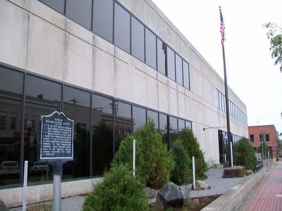
In the First American National Bank building which once stood here, Employers Insurance of Wausau opened, on June 1, 1928, a facility for rehabilitating injured workers. It was the first center of its kind established by the insurance industry. To . . . — — Map (db m89816) HM
These granite blocks were part of the third Marathon County Courthouse completed in May 1892, it stood on the block bounded by Third, Scott, Fourth and Jefferson Streets. This courthouse was razed in April, 1955. — — Map (db m48178) HM
Clean drinking water has always been important, but in 1885, Wausau Water Works was built for a different reason — to supply water for fighting fires. 1885 was an especially bad fire year in Wausau. There were 23 alarm fires, including a . . . — — Map (db m48064) HM
If you were a French voyageur in the 1600s or arrived with George Stevens in 1838, you would have heard and seen large rapids churning and bubbling here in front of you. Without dams, the river was much shallower than it is now. It swirled and . . . — — Map (db m44343) HM
"Erected by the people of Marathon County and Burns Post No. 388 Veterans of Foreign Wars of the U.S. in grateful appreciation of the noble sacrifices of those from this county who gave their lives in the World War 1917–1918"
Ahart Joe . . . — — Map (db m48149) HM
In the 1800's, Callon was a busy stop for trains transporting lumber, potatoes and pickles from local farmers. The power of the Eau Claire River inspired the construction of many sawmills, including the portable mill operated by William Callon. . . . — — Map (db m138865) HM
Snowmobiling is a very popular winter activity for many outdoor enthusiasts. The Mountain-Bay State Trail is a major link in the more than 22,000 miles of Wisconsin snowmobile trails. Snowmobiles can travel over 70 miles from Weston to . . . — — Map (db m138862) HM
This trail was originally a railway built between Eland and Wausau by the Milwaukee, Lake Shore and Western Railway.
In 1996, the Friends of Mountain-Bay State Trail, the Wisconsin State Parks System and Marathon County Parks worked together . . . — — Map (db m138807) HM
To the memory of
those who served
in World War II
1941 - 1945
Joseph Barker • Joseph Pinkhart
Harold Butterfield • Robert Plummer
Harold Ethington • Norbert Roloff
Henry French • Edward Sonneaberg
★ Hugh French • . . . — — Map (db m162293) WM
Before air conditioning, interstate highways, and automobiles, a privileged few escaped the hot summers of the lower Midwest by taking trains to resorts built by the railroads in the north woods. Besides bringing settlers north and moving lumber . . . — — Map (db m162291) HM
Constructed in 1911, Lena Road School is one of the few remaining intact one-room schoolhouses in Marinette County. The school grounds feature the original privies and an early hand water pump. For over fifty years, local farming families . . . — — Map (db m39248) HM
The lumber companies which created many of the communities in northern Wisconsin have passed from the scene, but the villages remain, monuments to the hardihood and persistence of the residents who worked and lived in these communities. Goodman was . . . — — Map (db m86898) HM
This is a typical load of 10,000 board feet of logs, as harvested during the lumber boom, about 1885. The logs were marked and piled at the river's edge. In the spring, they were floated down the Menominee River to the various booms of the thirty . . . — — Map (db m16130) HM
This was a typical homesteaders' residence in the late 19th century. The Evancheck family donated the cabin in 1994 and it was reassembled on Stephenson Island. It had been in their family for almost a century. — — Map (db m38985) HM
I hope the problems of life will be met and solved as they arise to the happiness and contentment of human kind
Isaac Stephenson
Born at Maugerville New Brunswick June 18 1829- Came to Wisconisn November 15 1845 – Located . . . — — Map (db m88826) HM
Marinette native John Hubley was born on May 21, 1914, and was inspired to become an artist by his mother and grandfather, both of whom were painters. Joining Disney to paint layouts in 1936, he found he disliked the studio’s ultra-realistic style . . . — — Map (db m224102) HM
This river is named after the Menominees who lived here until they moved to the Wolf River in the 1850's. The Menominee River served as the main artery of commerce until the 1850's. Indians and fur traders moved their furs downriver in canoes to a . . . — — Map (db m15956) HM
The Marinette Train Depot was constructed by the Chicago Milwaukee and St. Paul Railroad in 1903 to replace an earlier depot which dated to the 1880's. The depot is a one story Queen Anne style structure with a rectangular plan. Known as a . . . — — Map (db m135290) HM
Indian chief's daughter after whom Marinette City and county were named. Southerly about 60 feet stood her home and trading post from 1846 to 1895. — — Map (db m39244) HM
To the memory of over 600 men, women and children who perished when every building in the Village of Peshtigo was burned and many surrounding farms were devasted in the great tornado of fire October 8, 1871. — — Map (db m120658) HM
Theoretical Half Way Point
North Pole [right arrow]
3117.55 miles
Equator [left arrow]
3097.39 miles
The spheroidal shape of the earth makes degrees of latitude in the north longer than in the south. The true half-way . . . — — Map (db m4413) HM
This bridge crosses the river that has been the heart of the
community since the founding of Peshtigo.
This river provides power for our commerce and daily lives.
This river also protected some of our citizens who sought
refuge in . . . — — Map (db m120500) HM
On the night of 0ctober 8, 1871, Peshtigo, a booming town of 1700 people, was wiped out of existence in the greatest forest fire disaster in American history.
Loss of life and even property in the great fire occurring the same night in Chicago . . . — — Map (db m277533) HM
The term “graded school” was used to refer to any school that had more than one room and therefore contained more than one grade level of pupils. The McAllister State Graded School was built in 1914 and added to in 1919, 1924 and 1936. . . . — — Map (db m58569) HM
Originally covered by magnificent stands of forests, the northern two-thirds of the county consisted of cutover lands which attracted farmers from the corn belt during World War I. Wartime prosperity and settlement were followed by agricultural . . . — — Map (db m76254) HM
John Muir, the father of America's National Parks, lived on the northeast side of this lake from 1849 to 1855. Although he travelled all over the world, Muir never forgot this land, and tried several times to buy and preserve parts of it, . . . — — Map (db m20150) HM
He came to America as a lad of eleven, spent his 'teen years in hard work clearing the farm across this lake, carving out a home in the wilderness. In the "Sunny woods overlooking a flowery glacial meadow and a lake rimmed with water lilies," he . . . — — Map (db m20149) HM
The congregation of the United Presbyterian Church of North America was organized in 1851 in the town of Buffalo by a group of early Scotch settlers. At first meetings were held in homes and later, in the section schoolhouse.
In the year of . . . — — Map (db m121833) HM
—Principal—
Christian Endeavor Academy
1902 — 1925
Born August 24, 1859, Nevinville, Iowa
Died November 10, 1945, Milwaukee, Wisconsin
Graduate B. A. Tabor College, 1882
Yale Divinity School B. D. 1887, . . . — — Map (db m28165) HM
This quarry was once Montello's leading industry, with approximately 200 employees. It was recognized for its paving blocks covering streets in several cities, its crushed granite for various usages, and most of all, for its beautiful hard . . . — — Map (db m3556) HM
Once home to the Mound Builders, the Winnebago and the Menominee, destination of the voyageurs, a pioneer settlement harnessing diverse natural resources, today a modern community with a rich heritage.
The earliest eastern visitors observed the . . . — — Map (db m53074) HM
In memory of
our dear relatives
and friends, who made the
supreme sacrifice, in defense
of our beloved country.
In Memory Of
Dean Dennis Crane
12/7/45 - 6/21/67
Joseph Kresic, Jr.
6/30/48 - 11/30/68
They Gave . . . — — Map (db m39599) HM
It was over this road that John Muir traveled to such early settlements as Kingston and Pardeeville. Muir was eleven when he came here from Scotland with his father, brother and sister in 1849. His mother arrived with her other children after a . . . — — Map (db m4029) HM
The remarkable crisscrossing pattern on this sandstone was formed by an extinct animal. It crawled across moist, ripple-marked sand at the edge of a shallow tropical ocean, which covered Wisconsin about 520 million years ago during the Cambrian . . . — — Map (db m2791) HM
On June 25, 1950, Communist North Korea invaded the Republic of Korea. Backed by Soviet Russia, the North Koreans quickly overran most of the peninsula. South Korea appealed to the United States for assistance, and President Harry Truman immediately . . . — — Map (db m2788) HM
Built in 1867, this one room rural school has served as the center of community life in Russell Flats for over 130 years. Constructed by Scotch-Irish settlers who arrived here in the early 1850s, the school has also functioned as the local . . . — — Map (db m20121) HM
Generally called "Depot Camp," it is the oldest standing lumber camp in Wisconsin. It remains where originally built in 1880, in what was one of the greatest white pine regions of the middle west. Expert woodsmen built the camp as is evidenced by . . . — — Map (db m36898) HM
The Couillardville area covers approximately one and one half miles along the Lower Oconto River Valley. The area is filled with archeological sites extending from Paleo-Indian through the Historic Indian occupations. South of this site on the north . . . — — Map (db m139711) HM
This library, by architect Henry Foeller, was completed in 1903. Oconto lumberman George Farnsworth gifted $15,000 for the building and gave the dedicatory address. The library is a beautiful example of the Neoclassical Revival style and is a vital . . . — — Map (db m139713) HM
This church was organized June 10, 1886. The first service was held here October 31 of the same year. Seven years earlier Mary Baker Eddy, the Discoverer and Founder of Christian Science, had founded the Church of Christ, Scientist, in Boston, . . . — — Map (db m13164) HM
On December 2, 1669, the Eve of St. Francis, Father Claude Allouez arrived at Oconto, then a village of about 600 Indians. Here Allouez founded the Mission of St. Francois Xavier, the first mission in north eastern Wisconsin. Six French fur traders . . . — — Map (db m13440) HM
Dedicated to the Men and Women of Oconto County who served their country in war and peace… and in reverent memory of those who gave their lives — — Map (db m130589) WM
Oconto Site has been designated a Registered National Historic Landmark under the provisions of the Historic Sites Act of August 21, 1935. This site possesses exceptional value in commemorating and illustrating the history of the United States . . . — — Map (db m139709) HM
At this site approximately 4,500 years ago, Wisconsin Indians gathered to bury their dead. Because of their use of copper tools, weapons and ornaments, this group became known as the Old Copper people. They fashioned spearpoints, knives and . . . — — Map (db m58143) HM
This building is all that remains of the once-larger Stanley Toy Company building. Established by Chester Schwedler in 1946, the Stanley Toy Company made cast-metal horse-drawn carriages and bunny toy carts. On December 29, 1949, fire destroyed the . . . — — Map (db m58140) HM
Cyrus and Kitty Hart constructed this home in 1868 as an Italianate style residence. It was one of the first brick houses in the county. George and Fannie Beyer purchased the house in 1878 and in the 1890s remodeled it to its current Queen Anne . . . — — Map (db m249313) HM
In 1854, Samuel Thomas and his sons Samuel H. and Cyrus purchased the land and established a commercial fishing settlement between Smith's Creek and Wittkopf's Slough. On October 8, 1871, the Peshtigo Fire destroyed the settlement buildings and the . . . — — Map (db m261908) HM
The Mecikalski Stovewood General Store is named for John Mecikalski, who emigrated from Prussia with his parents in the 1870s. John married and purchased land in Oneida County. Together, four Mecikalski brothers supplied valuable services during the . . . — — Map (db m68704) HM
The Oneida County Zoning Ordinance, adopted May 16, 1933, was the first comprehensive rural zoning ordinance in the United States. In the early 1930's, most northern Wisconsin counties were in financial difficulties. The Oneida County Board of . . . — — Map (db m33651) HM
This mythical creature is the official symbol of Rhinelander. It was created in 1896 by "Gene" Shepard, Rhinelander pioneer timber cruiser and famous prankster. Shepard claimed to have discovered the animal in the woods near Rice Creek. He . . . — — Map (db m255515) HM
He was the first player to hit 200 home runs in the National League. "Cy" Williams played for six years with the Chicago Cubs and for thirteen years with the Philadelphia Phillies. Tied by Babe Ruth with forty-one home runs in 1923. His lifetime . . . — — Map (db m36120) HM
You are in the original Oneida Purchase Unit that marked the beginning of Nicolet National Forest. The first tract of land, acquired from the Thunder Lake Lumber Company in 1928, contained 12,940 acres. Today there are 640,000 acres rich in scenic, . . . — — Map (db m36011) HM
The Eagle River-Three Lakes Chain of 28 Lakes is the largest inland Chain of Lakes in the World. The 28-Lake Chain has over 174 miles of shoreline. It spans from 5 miles southeast of the Town of Three Lakes to 1.5 miles west of the City of Eagle . . . — — Map (db m36093)
On this site, Dr. Kate Pelham Newcomb, a well-respected and loved physician, provided medical care from her office and treatment room during the 1940s and 1950s. One of only two doctors for the vast northern Wisconsin area, she treated local . . . — — Map (db m185568) HM
Dr. Kate NewComb had a dream -- a hospital for the Lakeland area. Through contributions and volunteer help, the hospital was started. Because of the lack of funds the building was discontinued. Pennies would now help to complete the hospital.
. . . — — Map (db m36000) HM
World War I • World War II
This monument erected in memory of those
who made the supreme sacrifice for their country.
Trapp-Gehrke Post 292 · 1946
In honor of all veterans who came to the aid of their country.
By the Trapp Gehrke . . . — — Map (db m36083) HM
The World’s Largest Penny was dedicated on May 29, 1954 as a tribute to the staff and students of Arbor Vitae-Woodruff School. This monument reflects Dr. Kate Pelham Newcomb‘s dream for a local hospital, as well as the community spirit of Woodruff . . . — — Map (db m177737) HM
Can a village live to tell the tale of two railroad lines and a depot?
The railroads originated as a means to transport lumber to mills in the Stevens Point area. As times changed, farm products such as potatoes became the main . . . — — Map (db m26147) HM
Early Norwegian immigrants settled Central Wisconsin in the mid-1800s and brought with them the traditional church architecture still found in the hills and fjords of their native land. South New Hope Church was chartered in 1888 when synod debates . . . — — Map (db m156507) HM
These open grasslands in the Buena Vista Marsh, Portage County, were one of the last remaining strongholds of the Greater Prairie Chicken in Wisconsin. Once abundant in the state, this impressive bird nearly disappeared when its grassland habitat . . . — — Map (db m253644) HM
A native of Wisconsin and graduate of the University of Wisconsin–Stevens Point, John E. Toepfer made a lifelong commitment to researching the greater prairie chicken, focusing many of his efforts on these grasslands of central Wisconsin. John’s . . . — — Map (db m253641) HM
The Felician Sisters were founded in Poland in 1855 by Blessed Mary Angela Truszkowska. They began their North American ministry on this site at the request of Fr. Joseph Dabrowski on November 21, 1874, and continued here until September 27, 2018. . . . — — Map (db m275682) HM
In 1834 John Baptiste Du Bay established a trading post on the Wisconsin River one mile east of here for the American Fur Company. His wife was Princess Madeline, daughter of Oshkosh, Chief of the Menominee Indians. According to tradition, Du Bay’s . . . — — Map (db m1770) HM
This property is listed in the National Register of Historic Places by the United States Department of the Interior
The Nelsonville Mill is one of the oldest mills in this part of the state and the last of its kind in Portage County. On . . . — — Map (db m255701) HM
"Greater love hath no man than to
lay down his life for his fellow man"
This is a remnant of an iron girder from the World Trade Center in New York City. It is enshrined here in remembrance of those who gave the complete and final measure . . . — — Map (db m47769) HM
This site marks the beginning of the village of Rosholt. In 1867, Jens Rasmussen, who came from Lolland, Denmark, purchased land and improved a beaver dam here to furnish power for a grist mill. In 1885 the dam was acquired by John Gilbert Rosholt . . . — — Map (db m33000) HM
In Memoriam
World War II
Luther J. Bestul
Leonard L. Dahlen
Onufry Dzwonkoski
Emory J. Nelson
Nick C. Ostrowski
Korea
Joseph S. Berna
David E. Halverson
Ernest M. Kaminski
The whole earth is the tomb of heroic men . . . — — Map (db m33083) WM
Parachutes • Air Assault
Gliders • Glider Pilots
Airborne
Forces
Memorial
To Their Perpetual Honor
Presented By The Citizens Of
Wisconsin
and
The Badger State Chapter
of the
82nd Airborne Division Association . . . — — Map (db m51431) HM
This sign marks the future location of a monument to acknowledge the Mass Native Burial site here on the UW-Stevens Point campus.
In the 1860s, Scarlet Fever devastated a diverse group of Native Americans including Ho-Chunk, Menominee, . . . — — Map (db m280355) HM
The residents of Stevens Point depended on the Wisconsin River not only to transport logs, but also to provide clam shells for the button industry. The clammers found an abundance of quality shells in the river to support a commercial venture. In . . . — — Map (db m5466) HM
Born in Poland 1747
organizer of
the American cavalry
during the
Revolutionary War.
Erected in commemoration
of the 150th anniversary of his death
1779, at Savannah, GA. — — Map (db m29661) HM
At This Site, Dr. Lee Sherman Dreyfus Ninth President of WSU from 1967 - 1972 and First Chancellor of USWP from 1972 - 1978, Was Sworn in as Wisconsin's 40th Governor on January 1, 1979. — — Map (db m280357) HM
Stoker Jets: Fireman used these controls to use steam to blow coal from the auger to different parts of the firebox. Originally the coal was hand shoveled into the firebox but an auger was . . . — — Map (db m196617) HM
Here, for 110 years, stood District School No. 2, the oldest public building in Stevens Point. Completed in 1850, its appearance reflecting its New England heritage, it served the pioneer community as school, recreation, and civic center, and . . . — — Map (db m20969) HM
About 1840, near this site, Bloomer & Harper built one of the important early sawmills in northern Wisconsin. It was long known as McGreer's Mill, named for an early owner. By 1890, over 700 million feet of lumber, much of it sawed here, was floated . . . — — Map (db m20745) HM
When World War I started in 1914, Poland was divided between the empires of Prussia, Austria, and Russia. In 1917, a Polish National Committee organized regiments of Polish-American men to fight under a Polish flag in Europe. Forty-eight . . . — — Map (db m138225) HM
The first land entry affecting Stevens Point after the Indian treaty of 1836 was made by Andrew Mullarkey in 1844. This land was purchased by Mathias Mitchell who in 1847 platted four streets and the Public Square. A Liberty Pole with homemade flag . . . — — Map (db m20928) HM
In Loving Memory Of
Those Who Gave Their Lives
World War I
Benjamin J. Brill · Peter P. Kulas · Frank Novak · Frank E. Printz · Walter F. Winecke · Frank M. Zylka
World War II
John Bartkowiak · Felix Blavat · Eugene . . . — — Map (db m41815) HM
"These Made The
Supreme Sacrifice"
Bekowski, Andrew
Cisewski, Leonard
Domack, Eugene
Drifka, Raphae
Glodowski, Chester
Koltz, Benedict
Mayek, John
Maziarka, Edward
Peskie, Frank
Shafranski, William
Vaughan, Rolyn . . . — — Map (db m41836) HM
This plaque commemorates the pioneers who established Stevens Point during the 1840’s, 50’s and 60’s. Community life centered here at the foot of Main Street where supplies were transshipped from wagon to boat for the trip north to lumber camps. . . . — — Map (db m1038) HM
The Stevens Point Women's Club has supported schools, women, labor forces, suffrage, and much more. Still today they show their love and support of this community as well as they did during the Great War, later named World War 1 (WW1).
In . . . — — Map (db m196694) HM
One of an estimated twenty-four such statues in the world, this Boy with the Leaking Boot is thought to have been purchased in 1895 as part of an improvement project for Stevens Point's Public Square. The Boy design may have originated in Italy (or . . . — — Map (db m26412) HM
Once the rail hub of central Wisconsin, Stevens Point’s Historic Southside Railroad Complex still contains buildings, engines and tracks that evoke the time when the railroad was the dominant means of transportation in the country. The first train . . . — — Map (db m1033) HM
In memory of those
from this community who
answered their country's call.
Martin Adam · Frank Adams, Jr. · Romulus Berens · Anastazia Blaskoske · Raymond Borgen · Benjamin Brill · Darrell D. Burtis · Reynold Chapman · George H. Chase · Max . . . — — Map (db m36957) WM
Flag Etiquette
The American Flag should be lighted at all times.
The Flag should be only flown in fair weather.
When lowering the Flag, no part of it should touch the ground or object.
Sore the Flag folded . . . — — Map (db m196850) HM
A sawmill was built here in 1852 by Luther Hanchett and Amos Courtwright. It was purchased in 1864 by Alexander and Thomas McDill who later added a grist mill. The site was occupied after 1902 by Wisconsin Graphite Company and from 1916 to 1951 by . . . — — Map (db m20924) HM
At this site on the South Fork of the Flambeau River was a sorting pond where logs were separated by logging company brand marks. By unleashing a wall of water 20 miles upstream at the Round Lake Logging Dam, loggers flushed millions of logs to . . . — — Map (db m47223) HM
(side 1)In memory of the first settlers of Ogema, Spirit and Hill and all who continued moving forward through one hundred years with devotion to their heritage, weaving a fabric of hope, love and toil. (side 2) A Tribute to the . . . — — Map (db m150294) HM
373 entries matched your criteria. Entries 101 through 200 are listed above. ⊲ Previous 100 — Next 100 ⊳