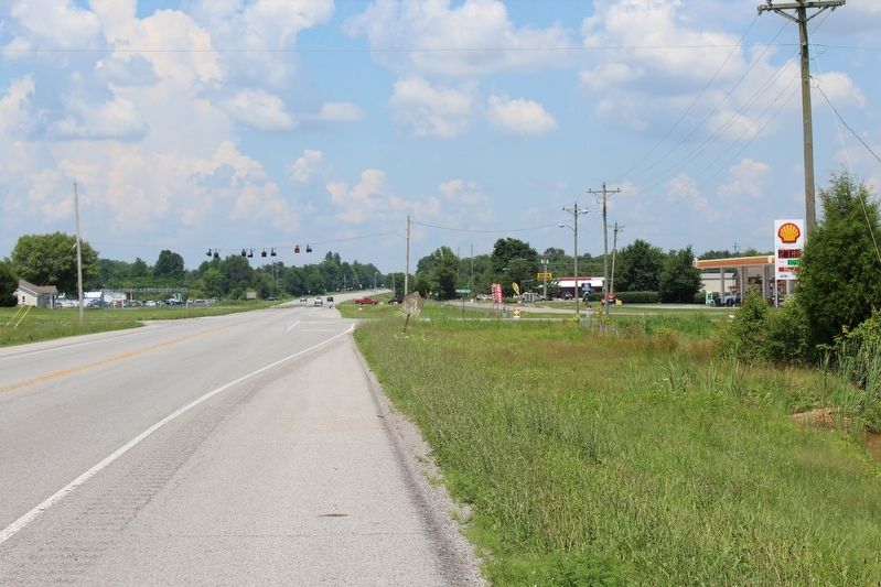
Near Park Road 0.3 miles west of Battlefield Road (Kentucky Route 1920).
The 436 members of the 38th Indiana Infantry Regiment deployed here, in a cut cornfield, next to the 10th Wisconsin Infantry. These men supported Captain Peter Simonson’s six cannon, which were located to your right. It was a crucial position; . . . — — Map (db m46482) HM
On South Buell Street (U.S. 68) at West Third Street, on the left when traveling south on South Buell Street. Reported missing.
About 4 PM on October 8, Colonel Samuel Powell was ordered to move his brigade westward and discover how many Federal troops were stationed west of Perryville. His 1,000-man force dutifully advanced along the Springfield Pike (today US 150 and 4th . . . — — Map (db m283866) HM
On Whites Road west of Battlefield Road (Kentucky Route 1920), on the right when traveling north. Reported permanently removed.
The inexperienced 80th Indiana Infantry Regiment was part of Union Colonel George Webster’s brigade. This unit included the 50th, 98th, and 121st Ohio infantry regiments and the 19th Battery, Indiana Light Artillery, commanded by Captain Samuel . . . — — Map (db m142157) HM
Near Battlefield Road (Kentucky Route 1920) 2 miles north of Hays Mays Road, on the left when traveling north.
The inexperienced 80th Indiana Infantry Regiment was part of Union Colonel George Webster’s brigade. This unit included the 50th, 98th, and 121st Ohio infantry regiments and the 19th Battery, Indiana Light Artillery, commanded by Captain Samuel . . . — — Map (db m288476) HM
Near Park Road 0.3 miles west of Battlefield Road ( Route 1920).
The Battle of Perryville was a fierce fight for the 420 members of the 79th Pennsylvania Infantry. Fighting in these fields, this unit suffered 40 killed, 146 wounded, and 30 missing. This represents a loss of more than fifty percent of the . . . — — Map (db m288944) HM
Near Whites Road near Battlefield Road ( Route 1920). Reported permanently removed.
The Battle of Perryville was a fierce fight for the members of the 79th Pennsylvania Infantry. Fighting in these fields, this unit suffered 40 killed, 146 wounded, and 30 missing. This represents a loss of more than fifty percent of the . . . — — Map (db m168004) HM
Near Hays Mays Road 0.6 miles east of Whites Road, on the right when traveling east.
As the Confederates were turning the flank of the Union forces northern end of the battle, the brigades commanded by Samuel Powel and Daniel Weisiger Adams were tasked with tying down Union Third Corps on Peters Hill. Adams, not seeing any enemy . . . — — Map (db m288624) HM
On South Buell Street (U.S. 68) at East 2nd Street (U.S. 68/150), on the right when traveling north on South Buell Street.
He was a member of one of Perryville's most prominent families who earned a degree in mechanical engineering and rose to become the President of The Amour Company, in Chicago. He came to dislike the corporate and urban way of life. Quitting his job, . . . — — Map (db m283603) HM
On South Buell Street (Route 68) at East 2nd Street (U.S. 68/150) on South Buell Street.
She was an American Idol winner who is presently pursuing a successful career in both the music and film industries in California. We are all rooting for you Alyssa, and hope you are able to visit us as soon you can work it into your schedule. — — Map (db m283841) HM
Near Park Road south of Battlefield Road ( Route 1920), on the right when traveling south.
Army of the Mississippi
General Braxton Bragg
Right Wing
Major General Leonidas Polk
Cheatam's Division
Major General Benjamin F. Cheatam
First Brigade
Brigadier General Daniel S. Donelson
8th, 15th, 16th, 38th, 51st Tennessee . . . — — Map (db m167751) HM WM
First Army Corps Major General Alexander McD McCook Tenth Division Brigadier General James S. Jackson Thirty-Third Brigade Brigadier General William R. Terrill 80th, 123rd Illinois and 105th Ohio Infantry Regiments and detachments . . . — — Map (db m270858) HM
Near Hays Mays Road 0.6 miles east of Whites Road, on the left when traveling east.
Before the Confederate infantry attacked, the Southern army tried to weaken the Federal position by bombarding the Union lines with artillery fire. At noon, Captain William Carnes’ Confederate artillery battery took up position on one of the far . . . — — Map (db m46487) HM
On Hays Mays Road 0.6 miles east of Whites Road, on the left when traveling east.
They were outnumbered, but they were ready. Watching from the top of the hill across the road, members of the 3rd Ohio Infantry Regiment saw waves of attacking Confederate infantry moving toward them. These Federal soldiers, anchoring the . . . — — Map (db m185090) HM
Near Hays Mays Road east of Whites Road, on the right when traveling west. Reported permanently removed.
They were outnumbered, but they were ready. Watching from the top of the hill across the road, members of the 3rd Ohio Infantry Regiment saw waves of attacking Confederate infantry moving toward them. These Federal soldiers, anchoring the southern . . . — — Map (db m167639) HM
Near Park Road 0.3 miles west of Battlefield Road ( Route 1920).
Maney’s attacking Confederates immediately discovered the lethal danger of attacking the eight Union cannon on top of the ridge in front of you. Some sought cover behind a split-rail fence, but the Union artillery shattered the rails, killing and . . . — — Map (db m288807) HM
Near Park Road west of Battlefield Road ( Route 1920). Reported permanently removed.
Maney’s Confederates immediately discovered the lethal danger of attacking the eight Union cannon on top of the ridge in front of you. The Confederates sought cover behind a split-rail fence, but the Union artillery shattered the rails, killing and . . . — — Map (db m46469) HM
On Hays Mays Road 0.7 miles east of Whites Road, on the left when traveling east. Reported permanently removed.
The 500 soldiers of the 42nd Indiana were suffering from an intense thirst. Their canteens dry from a recent drought, the commanders allowed these troops to find pools of water in Doctor's Creek, located just in front of you.
The men stacked . . . — — Map (db m88475) HM
On Hays Mays Road 0.7 miles east of Whites Road, on the left when traveling east.
The 490 soldiers of the 42nd Indiana were suffering from an intense thirst. Their canteens dry from a recent drought, their commanders allowed these troops to find pools of water in Doctor's Creek located in front of you. The men stacked their . . . — — Map (db m288511) HM
On South Jackson Street at West 2nd Street (U.S. 150), on the right when traveling south on South Jackson Street.
(left panel)
The battle was brought on by Confederate Lieut. Gen. Braxton Bragg as a delaying action to insure safe withdrawal of a huge wagon train of supplies and to enable him to effect a junction with the army of Maj. Gen. E. Kirby . . . — — Map (db m46239) HM
On West 2nd Street (U.S. 150) near Buell Street (U.S. 68), on the right when traveling west. Reported permanently removed.
October 8, 1862 here 16,000 Confederates under General Braxton Bragg fought 22,000 Federals under General Don Carlos Buell. Bragg, facing superior forces, withdrew. Union casualties 4211; Confederate, 3396. — — Map (db m5193) HM
On Park Road 0.1 miles west of Battlefield Road (State Route 1920), on the left when traveling west. Reported missing.
Here 16,000 Confederates under General Braxton Bragg fought 22,000 Federals under General Don Carlos Buell. Bragg, facing superior forces, withdrew. Union casualties, 4211; Confederate, 3396. — — Map (db m55026) HM
On Battlefield Road (Kentucky Route 1920) 0.7 miles south of Park Road, on the right when traveling south.
October 8, 1862. Here 16,000 Confederates under General Braxton Bragg fought 22,000 Federals under General Don Carlos Buell. Bragg, facing superior forces, withdrew, Union casualties, 4211; Confederate, 3396. — — Map (db m68552) HM
On Hayes-May Road, on the right when traveling west.
Owned by Squire H. P. Bottom, it was a key position in Battle of Perryville, Oct. 8, 1862. At the beginning of battle, held by USA troops. After a massed attack, Confederates took the house and held it. The battle over, Bottom identified and buried . . . — — Map (db m167646) HM
Near Hays Mays Road 0.6 miles east of Whites Road, on the right when traveling east.
Since about 10:00 in the morning, William H. Lytle's brigade had taken up position on the right flank of Union 1st Corps commanded by General Alexander M. McCook. The 3rd Ohio Volunteer Infantry, supported by the 15th Kentucky infantry, were . . . — — Map (db m288622) HM
On East 2nd Street (U.S. 68/150) at North Bragg Street (U.S. 68), on the right when traveling west on East 2nd Street.
This is an 1868 photograph of the Boyle House, a stage coach inn that operated on this site during the latter half of the nineteenth century. The old building has been remodeled at least three times since its stage coach days. — — Map (db m283908) HM
On South Buell Street (U.S. 68) at West Second Street (U.S. 68/150), on the right when traveling south on South Buell Street.
The Confederate Army’s advance into Kentucky in 1862 was initiated to relieve Tennessee of Union control, to align the help of dissatisfied Kentuckians and to gain access to the rich supplies Kentucky offered.
General Kirby Smith entered . . . — — Map (db m283860) HM
Near Battlefield Road (Kentucky Route 1920) 0.5 miles south of Park Road, on the left when traveling south.
Captain William Watts Carnes had just turned 22 years old when the Battle of Perryville was fought. A student at the United States Naval Academy when the Civil War began he resigned and joined Jackson's Tennessee Battery as a lieutenant. He was . . . — — Map (db m288259) HM
On South Buell Street (U.S. 68) at East 2nd Street (U.S. 68/150), on the right when traveling north on South Buell Street.
A prohibitionist who became staunchly anti-alcohol, after her husband remained intoxicated for a long period of time after their marriage. Eventually they
divorced and she pursued her vehement alcohol prohibition desires until it became a national . . . — — Map (db m283605) HM
On South Buell Street (U.S. 68) at East 2nd Street (U.S. 68/150), on the right when traveling north on South Buell Street.
He left home to pursue more education at the age of ten. His father wanted him to quit school to help on the farm. He went to live with an aunt and uncle and finished high school and graduated from the University of Kentucky in 1926. He earned . . . — — Map (db m283844) HM
Near Hays Mays Road 0.3 miles south of Whites Road, on the left when traveling south.
Forced back from the hills above Doctor's Creek, the Union soldiers retreated to this position. Their lines were in chaos - regiments intermingled, the wounded were left behind and some panicked troops raced for the rear. Most soldiers, however, . . . — — Map (db m88483) HM
Near Hays Mays Road 0.6 miles east of Whites Road, on the left when traveling east.
Forced back from the hills above Doctor's Creek, the 10th Ohio Infantry retreated to a position a few yards behind you. The Union lines were in chaos--regiments intermingled, the wounded were left behind, and some panicked troops raced for the . . . — — Map (db m289242) HM
Near Park Road 0.3 miles west of Battlefield Road ( Route 1920), on the right when traveling west.
When the Battle of Perryville ended, hundreds of dead soldiers were left on the battlefield. The Confederates, who attacked the Union battle lines, lost 532 killed, 2,641 wounded, and 228 missing (3,401 total). Federal losses were just as . . . — — Map (db m46421) HM
On Harrodsburg Road (U.S. 68) south of South Braxton Drive, on the right when traveling south.
Used by Confederate Gen. Braxton Bragg as headquarters during the Battle of Perryville, Oct. 8, 1862. Crawford Spring, back of the house, furnished vital water supply to CSA troops on the drought stricken battlefield. — — Map (db m46248) HM
On Harrodsburg Road / North Bragg Street (U.S. 68) near Hardee Street, on the left when traveling south.
As Confederate and Union armies converged over to the west the day and night before great Battle of Perryville, Oct. 8, 1862, there was constant fighting for water. Almost unprecedented drought had made water so scarce that troops contended for . . . — — Map (db m68319) HM
Near Battlefield Road (Kentucky Route 1920) 0.7 miles north of Hays Mays Road, on the left when traveling north.
At 2:45 P.M., Confederate General Bushrod Johnson's brigade, the lead element of General Simon B. Buckner's division, came over this ridge and opened the battle in this part of the field. At Perryville, Johnson commanded 1,500 men in 5 Tennessee . . . — — Map (db m288634) HM
Near Park Road west of Battlefield Road ( Route 1920). Reported permanently removed.
In 1862, the ravine in front of you was planted in corn, the fields recently cut and harvested. Here, on this ridge, the Union soldiers established a strong defensive position. Two brigades and six cannon awaited the Confederate attack.
With a . . . — — Map (db m168005) HM
Near Park Road 0.3 miles west of Battlefield Road ( Route 1920).
Union Brigadier General William Terrill was nearly panic-stricken. To his surprise, thousands of Confederates swarmed over the fields in front of you, moving toward the Federal lines. The shouts of attacking Southern troops and the crescendo of . . . — — Map (db m288828) HM
Near Park Road 0.3 miles west of Battlefield Road ( Route 1920).
As Maney’s Confederates reached the top of this hill they watched the fleeing Union soldiers retreat into the valley in front of you. The Southerners lost hundreds of men killed and wounded during the fight to take this ridge, and their hearts . . . — — Map (db m288839) HM
Near Park Road west of Battlefield Road ( Route 1920). Reported permanently removed.
As Maney’s Confederates reached the top of this hill they watched the fleeing Union soldiers retreat into the valley in front of you. The Southerners had lost hundreds of men killed and wounded during the fight to take this ridge, and their hearts . . . — — Map (db m141638) HM
Near Park Road west of Battlefield Road ( Route 1920). Reported permanently removed.
Union Brigadier General William Terrill was nearly panic-stricken. To his surprise, thousands of Confederates swarmed over the fields in front of you, moving toward the Federal lines. The shouts of attacking Southern troops and the crescendo of . . . — — Map (db m141649) HM
Near Park Road 0.3 miles west of Battlefield Road ( Route 1920).
Here, on this ridge, the Union soldiers established a strong defensive position at the eastern edge of a 25 acre cornfield. Leonard Harris' brigade along with William Lytle's brigade to your left and six cannon of Peter Simonson's Battery awaited . . . — — Map (db m289620) HM
On Whites Road just west of Hays Mays Road, on the right when traveling west.
During the Battle of Perryville, the Dixville Crossroads, the intersection in front of you, was a crucial tactical point on the battlefield.
Here, the Dixville Road (now called Whites Road), which runs to Dixville in Mercer County, . . . — — Map (db m288362) HM
On Whites Road at Hays Mays Road, on the left when traveling north on Whites Road. Reported permanently removed.
During the Battle of Perryville, the Dixville Crossroads, the intersection in front of you, was a crucial tactical point on the battlefield.
Here, the Benton Road (now called Whites Road), which runs to Dixville in Mercer County, intersects . . . — — Map (db m167664) HM
Near Park Road near Battlefield Road ( Route 1920). Reported permanently removed.
When Donelson’s shattered regiments reached this position, nearly half of his men had been killed and wounded. Despite the appalling casualties, the Confederate attack continued to the west.
With Donelson’s 16th Tennessee Infantry Regiment . . . — — Map (db m46480) HM
Near Park Road west of Battlefield Road ( Route 1920). Reported permanently removed.
When Donelson’s brigade moved into this valley, they were met with a deadly surprise. The rolling terrain had prevented the Confederates from seeing all of the Union troop positions. When the Confederates reached this valley, they became trapped in . . . — — Map (db m46481) HM
On Park Road east of Battlefield Road. Reported missing.
Confederate Brigadier General Daniel Donelson had been given great responsibility. His brigade was to open the Confederate attack by assaulting the northern end of the Union defensive line. Once Donelson’s brigade moved forward, other Southern . . . — — Map (db m46430) HM
On South Buell Street (U.S. 68) at East 2nd Street (U.S. 68/150), on the right when traveling north on South Buell Street.
Elementary school teacher in Kentucky who enrolled in the University of Chicago at the age of 37. Studying literature, philosophy and graduating with honors as Phi Beta Kappa; became a prolific writer of thirteen books and many poems. Two of . . . — — Map (db m283845) HM
On Hays Mays Road 0.4 miles east of Whites Road, on the right when traveling east.
After Peter Simonson's 5th Indiana Battery pulled back to this location, we take up the story in Ormund Hupp's own words:
We had but just got in battery and ordered to lay on the ground, holding our fire for close action, as our ammunition . . . — — Map (db m288419) HM
Near Whites Road 0.1 miles west of Hays Mays Road, on the right when traveling west.
When night fell and the fighting ended, Union troops in this area feared the Confederates would resume the attack. The Union army controlled the crucial Dixville Crossroads, the intersection located to your right. The Union soldiers spent several . . . — — Map (db m288340) HM
On West Fourth Street at South Buell Street (U.S. 68), on the left when traveling west on West Fourth Street. Reported unreadable.
The area around this cave was the site of Perryville’s original settlement, Harbison’s Station. Named for its founder, James Harbison, the station was settled in the 1770s. Harbison and the group of Virginians traveling with him chose this location . . . — — Map (db m283888) HM
Near Hays Mays Road 0.4 miles east of Whites Road, on the right when traveling east.
Ebenezer Gay (1856-1871) graduated 6th in his class from the U.S. Military Academy at West Point in 1855. After serving in the US army on the frontier with the Dragoons, he was promoted to Captain in the 16th United States Infantry when the Civil . . . — — Map (db m288474) HM
On Hays Mays Road 0.1 miles east of Whites Road, on the left when traveling east.
Major General Leonidas Polk
(1806 - 1864)
While in operational command of the Confederate Army of Mississippi, he accidentally rode behind the Union 22nd Indiana Regiment, commanded by Lieutenant Colonel Squire Isham Keith. . . . — — Map (db m289008) HM
Near Whites Road east of Hays Mays Road, on the right when traveling east. Reported permanently removed.
After capturing Union Captain Samuel Harris' artillery battery, located behind you, Confederate troops led by Brigadier General St. John R. Liddell moved to this area to support other advancing Southern units.
Night was falling, and, as . . . — — Map (db m167641) HM
Near Park Road 0.3 miles west of Battlefield Road ( Route 1920).
Colonel George Penny Webster, commander of the Union 34th Brigade at Perryville, was born near Middletown, Ohio, on December 24, 1824. An attorney, Webster volunteered for the Mexican War where he was wounded in the shoulder during the Battle . . . — — Map (db m289569) HM
On Whites Road east of Hays Mays Road, on the right when traveling east. Reported permanently removed.
Colonel George Penny Webster, commander of the Union 34th Brigade at Perryville, was born near Middletown, Ohio, on December 24, 1824. An attorney, Webster volunteered for the Mexican War where he was wounded in the shoulder during the Battle of . . . — — Map (db m167844) HM
On South Buell Street (U.S. 68) at East 2nd Street (U.S. 68/150), on the right when traveling north on South Buell Street.
A very rare trilobite species found in a quarry here in Perryville. This is the only known record of occurrence of this species we have in the world today.
The quarry has also revealed many other types of fossils as well, but the Hagani is the . . . — — Map (db m283608) HM
Near Park Road 0.3 miles west of Battlefield Road ( Route 1920).
Before the entire Union I Corps (numbering nearly 20,000 men) arrived on the field, this location marked the extreme left, or northern end, of the Union battle line. Six cannon commanded by Union Captain Samuel J. Harris were placed at this . . . — — Map (db m289049) HM
Near Whites Road east of Hays Mays Road, on the right when traveling east. Reported permanently removed.
Before the entire Union First Corps (numbering nearly 15,000 men) arrived on the field, this location marked the extreme left, or northern end, of the Union battle line. Six cannon commanded by Union Captain Samuel J. Harris were placed at this . . . — — Map (db m88690) HM
Near Park Road 0.3 miles west of Battlefield Road ( Route 1920).
During the retreat of the 105th Ohio, John Hartzell encountered "a double rail fence... running parallel to our line - called a "Devil's Lane." — — Map (db m288843) HM
Near Park Road 0.3 miles west of Battlefield Road ( Route 1920).
Major Abner T. Hawkins' Mississippi Sharpshooters (later named 15th Battalion Sharpshooters) was organized during the late summer of 1862 at Chattanooga, Tennessee. The battalion consisted of two companies of men, one commanded by Lieutenant T.M. . . . — — Map (db m289269) HM
On Whites Road at Hays Mays Road, on the left when traveling north on Whites Road.
The Fifty-ninth Illinois Volunteers, commanded by Maj. Joshua Winters, here suffered 113 casualties of 325 engaged. The Seventy-fifth Illinois, Lieut. Col. John E. Bennett, lost 225 of 700. Serving with Col. Michael Gooding's Thirteenth Brigade, the . . . — — Map (db m167827) HM
On South Buell Street (U.S. 68) south of West Second Street (U.S. 150), on the right when traveling south.
West of Perryville, a battle erupted about 4:15 p.m. when Mississippians under C.S. Colonel Samuel Powel were moving west along the Springfield Pike ran headlong into Union Maj. General Charles C. Gilbert's 22,000-man corps, positioned on and . . . — — Map (db m283862) HM
On Park Road 0.3 miles west of Battlefield Road ( Route 1920). Reported missing.
The Battle of Perryville
In the summer of 1862, Confederate General Braxton Bragg’s Army of the Mississippi invaded Kentucky. Bragg hoped to enlist recruits, pull Union troops out of Tennessee, and hold Kentucky for the Confederacy. With . . . — — Map (db m46422) HM
On South Buell Street (U.S. 68) at East 2nd Street (U.S. 68/150), on the right when traveling north on South Buell Street.
He founded a fort after the Revolutionary War in a cave by the Chaplin River, which later became Perryville. He went to the rescue of his fellow men under attack by Native Americans and was beheaded. His body was never found, only his head, which . . . — — Map (db m283606) HM
On South Buell Street (U.S. 68) at East 2nd Street (U.S. 68), on the right when traveling north on South Buell Street.
Talented musicians and performers who have thrilled millions of music fans the world over. The awards are too numerous to list here but the world is a far better place to live because of their musical pursuits. Wherever their travels lead them, . . . — — Map (db m283607) HM
Near Park Road 0.3 miles west of Battlefield Road ( Route 1920).
When the contending armies converged on Perryville, it hadn't rained in central Kentucky for several months. Many streams and creeks were completely dry, and Doctors Creek, located behind you, was nearly drained from the severe drought. Only a . . . — — Map (db m289248) HM
Near Park Road 0.3 miles west of Battlefield Road ( Route 1920).
Reaching the top of this ridge, Colonel Tomas M. Jones' Confederate brigade was met with a deadly surprise. On the hill across the valley, six Union cannon and 5,000 veteran Union soldiers faced Jones' three regiments, numbering less than 900 . . . — — Map (db m289443) HM
On South Buell Street (U.S. 68) at West Fourth Street, on the right when traveling south on South Buell Street.
Karrick-Parks House. Bivouac for Confederate troops on Oct. 7, 1862, night before Battle of Perryville. Karricks ordered to vacate home the next day. Day after the battle they returned to survey damage, found little done. Officers, doctors . . . — — Map (db m46396) HM
On South Buell Street (U.S. 68) at East 2nd Street (U.S. 68/150), on the right when traveling north on South Buell Street.
He both wrote and composed the song "Walk On By" which was performed by American country music artist Leory Van Dyke. It was released in 1961 as the first title track from the album Walk On By.
The song spent 37 weeks on the country chart . . . — — Map (db m283775) HM
On Battlefield Road (County Route 1920) south of Whites Road, on the left when traveling south.
Near here was the home of Charles King and Caroline Purdom Kirkland. To escape the Battle of Perryville, they traveled with their 3 young children 10 miles south to the home of Caroline’s father in Forkland. When they returned a few days later, they . . . — — Map (db m68320) HM
On South Buell Street (U.S. 68) just north of West Fourth Street, on the right when traveling north.
In the 1860's, storekeepers of Merchants Row volunteered postal services for the Perryville Community. Usually, they managed the post office for one year at a time, taking turns with their neighbors. This is the original "Letter Box"
for Lattimer's . . . — — Map (db m283904) HM
On South Buell Street (U.S. 68) at East 2nd Street (U.S. 68/150), on the right when traveling north on South Buell Street.
He is a United States Air Force officer who was captain of Air Force One for twelve years and retired to Texas. His father, C.A. Bond founded Boy Scout Troop 90 in the early 1900's and was a detective for the Railroad. Lt. Col. Bond is welcome back . . . — — Map (db m283768) HM
Near Park Road at Battlefield Road ( Route 1920), on the left when traveling west. Reported permanently removed.
The scene must have been spectacular to the members of Captain Charles Lumsden's artillery battery. Rolling their four cannon up to this hill to support the attacking Confederate infantry, the Southern cannoneers beheld the Union line that stretched . . . — — Map (db m63361) HM
Near Park Road 0.3 miles west of Battlefield Road ( Route 1920).
The scene must have been spectacular to the members of Captain Charles Lumsden's artillery battery. Rolling their four cannon up to this hill to support the attacking Confederate infantry, the Southern cannoneers beheld the Union line that . . . — — Map (db m289256) HM
Near Whites Road just west of Hays Mays Road, on the right when traveling west.
During the 19th century, the road from Mackville to Perryville crossed Wilson's Creek here (Wilson's Creek is located behind you). The entire Union First Corps, mumbering nearly 15,000 men, approached the battle from this road.
After the . . . — — Map (db m288314) HM
Near Park Road west of Battlefield Road (Route 1920). Reported permanently removed.
Confederate Brigadier General George Maney was growing concerned. On the hill to your front, eight Union cannon blasted away, killing and wounding dozens of Southern soldiers. Maney knew that his brigade had to take the hill and quickly silence . . . — — Map (db m46467) HM
Near Park Road 0.3 miles west of Battlefield Road ( Route 1920).
Confederate Brigadier General George Maney commanded the reserve brigade in Benjamin F. Cheatham's Division. Since the other two brigades of the division were climbing the steep bluffs in his front, Maney was ordered to "march by the right flank" . . . — — Map (db m288797) HM
On South Buell Street (U.S. 68) at West Second Street (U.S. 150), on the right when traveling south on South Buell Street.
(obverse)
Merchants' Row
Originally known as Main St., the town's historic commercial center renamed Buell St. to honor Union general D.C. Buell. Now called Merchants' Row, most buildings built 1830-40. Temperance leader Carrie . . . — — Map (db m46399) HM
On Hays Mays Road 0.6 miles east of Whites Road, on the right when traveling west.
Among the 61,000 Union soldiers who at the Battle of Perryville ended Confederate attempts to gain control of Kentucky were six Michigan units. The most heavily engaged of these were Coldwater’s Loomis Battery (Battery A of the . . . — — Map (db m46357) HM
On South Buell Street (U.S. 68) at East 2nd Street (U.S. 68/150), on the right when traveling north on South Buell Street.
University of Louisville law degree; three time Congressman from Eighth District; first Comptroller of the Treasury; founding member of the Bank of Lexington; deputy clerk for Kentucky for the Internal Revenue Service. His grandfather, John Durham, . . . — — Map (db m283770) HM
On Hays Mays Road 0.1 miles east of Whites Road, on the right when traveling east.
Upon being detached from Gay's Cavalry on the hilltop above the Bottom House, the Second Minnesota Battery's Howitzers and Caissons were retired to the field, across the road on the left and in front of the Russell House awaiting further orders. . . . — — Map (db m288418) HM
On South Buell Street (U.S. 68) at East 2nd Street (U.S. 68/150), on the right when traveling north on South Buell Street.
Wife to Nick Clooney, who was a very skilled writer, inventor, and television host. Mother to actor George Clooney. She "reached for the stars and caught them." We are extremely proud of the many
accomplishments of both Nina and her family over the . . . — — Map (db m283767) HM
Near Park Road 0.3 miles west of Battlefield Road ( Route 1920).
Gen. Jackson was born in Fayette Co., Ky. 1823, died Perryville, Oct. 8, 1862. Graduated Jefferson College, Canonsburg, Penn. and Transylvania University. Lawyer, Hopkinsville. Lieutenant 1st, Ky. Cavalry, Mexican War. Member of Congress, 1861, . . . — — Map (db m167828) HM
Near Park Road 0.3 miles west of Battlefield Road ( Route 1920).
The ridge in front of you was packed with 2,300 Union troops. Colonel William H. Lytle's veteran brigade was straight ahead. On the ridge to your right, Colonel Leonard Harris' veteran brigade also overlooked this position. The Confederates in . . . — — Map (db m289142) HM
On South Buell Street (U.S. 68) at West 2nd Street (U.S. 68/150), on the right when traveling north on South Buell Street.
Established as Harberson's Fort before 1783 by James Harberson, Thomas Walker, Daniel Ewing and others at the crossroads of Danville-Louisville and Harrodsburg-Nashville routes. Town laid out by Edward Bullock and William Hall, 1815, named for . . . — — Map (db m283602) HM
On Park Road 0.3 miles west of Battlefield Road ( Route 1920), on the right when traveling west.
In mid-1862, President Abraham Lincoln wrestled with the idea of issuing the Emancipation Proclamation. With Confederate armies pressing into Maryland and Kentucky, Lincoln realized that he could not issue the Proclamation until the Union secured a . . . — — Map (db m46363) HM
Perryville Battlefield has been designated a Registered National Historic Landmark Under the provisions of the Historic Sites Act of August 21, 1935 this site possesses exceptional value in commemorating and illustrating the history of the United . . . — — Map (db m21450) HM
Near Park Road 0.3 miles west of Battlefield Road ( Route 1920).
(front, south)
Confederate Memorial
Nor braver bled for a brighter land, nor brighter land had a cause so grand.
(side, east)
On fame's eternal camping ground their silent tents are spread, and glory guards with . . . — — Map (db m282283) WM
On South Buell Street (U.S. 68) at West Third Street, on the left when traveling south on South Buell Street. Reported permanently removed.
As the Union and Confederate armies deployed around Perryville on October 7 and 8, the city’s inhabitants found themselves caught in the middle. Many residents fled the town in haste, taking whatever belongings they could collect. Other civilians . . . — — Map (db m283861) HM
On Whites Road 0.1 miles west of Hays Mays Road, on the left when traveling west.
On October 10, 1861, the 5th Wisconsin Light Artillery was organized at Camp Utley, Racine, Wisconsin, under Captain Oscar Pinney. At the Battle of Perryville, the battery was attached to Union General Robert Mitchell's division, under Colonel . . . — — Map (db m288387) HM
On South Buell Street (U.S. 68) at East 2nd Street (U.S. 68/150), on the right when traveling north on South Buell Street.
Wrote biographies of both Presidents
Grover Cleveland and Jefferson Davis;
a historian who studied at the University
of Leipziq, University of Berlin, Oxford,
and St. Johns University (Shanghai, China). He also taught at Princeton, Oxford, . . . — — Map (db m283774) HM
On Hays Mays Road 0.1 miles east of Whites Road, on the right when traveling east.
On the knoll, it was a key position on the Union left flank under Maj. Gen. McCook in Battle of Perryville, Oct. 8, 1862. The scene of desperate fighting, it changed hands twice and was hit many times. After the battle it was used as a hospital. — — Map (db m46355) HM
On West 4th Street west of South Buell Street (U.S. 68), on the left when traveling west.
On October 7, 1862, Confederate officers arrived at the Karrick family's home. They warned of an imminent battle and told the house's inhabitants to leave. The family fled town after packing up what little belongings they could. When Harriett . . . — — Map (db m284172) HM
Near Park Road west of Battlefield Road ( Route 1920).
As fighting raged, Union soldiers in Brigadier General William Terrill’s brigade were driven from the ridge and the split rail fence in front of you. Most of these troops had never been in combat. This inexperience sometimes led men and officers to . . . — — Map (db m46484) HM
Near Battlefield Road (Kentucky Route 1920) 0.7 miles north of Hays Mays Road, on the left when traveling north.
Semple's Alabama Battery was formed in Montgomery, Alabama in March of 1862. Initially stationed at Mobile Alabama, it joined the Army of the Mississippi after the Battle of Shiloh, and marched into Kentucky attached to General S.A.M. Wood's . . . — — Map (db m288667) HM
Near Park Road near Battlefield Road ( Route 1920).
(base)
Dedicated to the memory of
Sgt. Harris B. Cope
Company G
16th Tennessee Infantry
who fell in the fields ahead
October 8, 1862
(top)
Donelson’s Brigade
The brigade of Brig. Gen. Daniel S. Donelson . . . — — Map (db m46420) HM
Near Park Road 0.3 miles west of Battlefield Road ( Route 1920).
The six guns of Union Captain Peter Simonson’s 5th Battery, Indiana Light Artillery were posted on this ridge. These Hoosiers had a commanding view of the Confederate advance, and their battery anchored the center of the Union battle line. . . . — — Map (db m168006) HM
1029 entries matched your criteria. Entries 101 through 200 are listed above. ⊲ Previous 100 — Next 100 ⊳