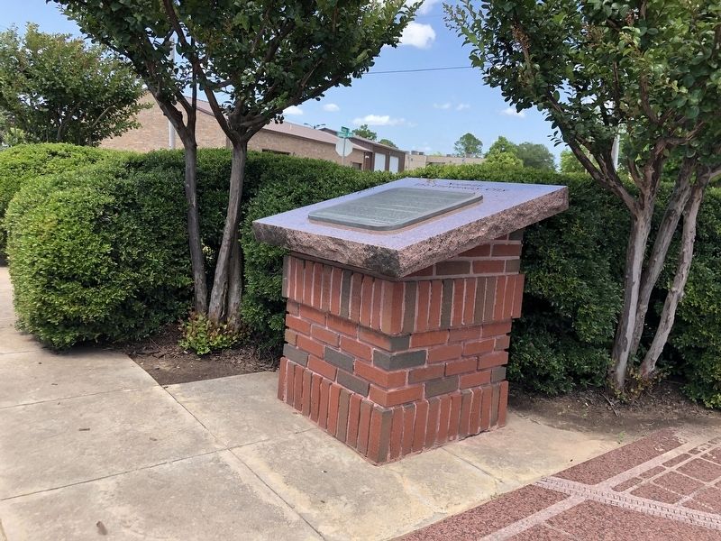
The U.S. census of 1910 indicated that the young City of Norman had a population of 3724. As the home of the University of Oklahoma, it was understandable that providing education would be the destiny of this community. In 1893 the first public . . . — — Map (db m279194) HM
In memory of Norman's long-forgotten pioneer settlers whose prairie graves were disinterred in 1890 by governmental order. Historical records indicate not all remains were marked. To these pioneering souls, we dedicate this plaque.
August 2nd, . . . — — Map (db m279861) HM
This Union building, along with Memorial Stadium, honors the University of Oklahoma students who died in World War I. In later years, it has honored those who have served their country in all wars and national emergencies. The idea for a student . . . — — Map (db m278452) HM
This part of the campus is named in honor of Vernon Louis Parrington (1871-1929). Born in Illinois, raised in Kansas, and educated at Harvard College, he came to the University of Oklahoma on September 8, 1897 to teach English. When he arrived the . . . — — Map (db m278759) HM
This house designed by
architect Harold Gimeno
has been placed on the
National Register
of Historic Places
by the United States
Department of the Interior
Built 1927 — — Map (db m278108) HM
McCarter Hall is named in honor of Pete Kyle McCarter (1910-1988), who served as the university's first provost from 1970 to 1973. Born and raised in Mississippi, McCarter attended the University of Mississippi for his bachelor's degree and . . . — — Map (db m276871) HM
The Physical Sciences Center was designed by architects Dow Gumerson and Donald McCormick, and was constructed in 1969 at the cost of $5.5 million. Originally, the Physical Sciences Center was to include three buildings constructed in phases down . . . — — Map (db m278563) HM
This park is named in honor of R. Boyd Gunning (1913-1990). Gunning, who served OU in many capacities, is best remembered as the first and highly successful executive director of the University of Oklahoma Foundation, a post he held for thirty . . . — — Map (db m276812) HM
This building is named for Dr. Aute Richards, head of the
department of Zoology from his arrival at the University of Oklahoma
in 1920 until 1942. Dr. Richards also served the university as
director of the School of Applied Biology (1934-1942), . . . — — Map (db m277197) HM
In 1899 the Oklahoma Territorial Legislature created a natural history museum to preserve Oklahoma’s rich heritage. More than 100 years later, the Sam Noble Oklahoma Museum of Natural History was built to protect the museum’s priceless . . . — — Map (db m143652) HM
In 1866, the United States signed treaties with the Creek and Seminole Nations and acquired land in central Indian Territory that would later be called the Unassigned Lands. In 1870, the U.S. Land Office contracted for the area to be surveyed. The . . . — — Map (db m278187) HM
The School of Library Science was founded in 1929 within the College of
Arts and Sciences. The founding Director was Jesse Lee Rader, a member
of the University of Oklahoma class of 1908, who had been appointed
University Librarian in 1909. In . . . — — Map (db m277504) HM
This park is named in honor of Charles and Lynn Schusterman of Tulsa. Charles Schusterman,
distinguished OU alumnus and inaugural member of OU's Seed Sower Society, served as founder, chairman and CEO of Samson Investment Co. He graduated from OU . . . — — Map (db m277472) HM
Perhaps the best indication of the hardship suffered by the University [of Oklahoma] during the decade of the Great Depression is this: the Norman campus's income in the 1932-1933 academic year was $1.58 million; ten years later, during the . . . — — Map (db m279287) HM
Home to the University of Oklahoma's Army and Navy Reserve Officers Training Corps, the Armory accommodates the training of student cadets and midshipmen. Military training programs at OU were born during the last days of World War I in April 1917 . . . — — Map (db m277198) HM
Although the Norman townsite was settled during the Land Run on April 22, 1889, Cleveland County did not exist for another year, and almost wasn't named Cleveland County. In fact, if not for the efforts of Norman's early citizens and civic . . . — — Map (db m121630) HM
On October 21, 1912, the University [of Oklahoma] inaugurated its third president in a solemn ceremony in front of the new administration building. Stratton Brooks had made it a condition of his taking the job that the authorities abandon their long . . . — — Map (db m279123) HM
The town site of Norman came into existence with a very dramatic event that occurred April 22, 1889 at high noon when the Great Land Rush originally began. Before that moment, the original town site of 320 acres had been planned by Charles . . . — — Map (db m278967) HM
The Oklahoma Mesonet is a world-class network of environmental
monitoring stations that delivers real-time measurements of atmospheric
and soil conditions continuously in every county of Oklahoma. This
weather station represents an Oklahoma . . . — — Map (db m276638) HM
The ExxonMobil Lawrence G. Rawl Engineering Practice Facility was completed in February 2010 as a one-of-a-kind building in the College of Engineering where students can benefit from real-world interdisciplinary experience. In addition to OU . . . — — Map (db m278378) HM
Professor Elkouri graduated from the OU College of Law in 1947 and earned LL.M. and S.J.D. degrees from the University of Michigan. He joined the OU law faculty in 1952. Though he retired from full-time teaching in 1985, Professor Elkouri . . . — — Map (db m276742) HM
The Gaylord Family Oklahoma Memorial Stadium was first built to honor students who died in World War I. The stadium's west side was built in 1925 and the east side in 1928. Further expansion occurred in 1949, 1975 and 1980.
In 1999, Athletics . . . — — Map (db m277241) HM
On April 22, 1889 at twelve o'clock noon, possibly the most dramatic land settlement in the history of the United States occurred in this area. This unfolding drama was the Great Land Run of 1889 that opened for settlement the part of Indian . . . — — Map (db m278854) HM
“Let's get up a football team!” It was at this location in September, 1895, that Jack Harts voiced a vision that would be credited as the spark that created the University of Oklahoma football program. At this present-day site of 121 E. Main St. . . . — — Map (db m279720) HM
The home of Swedish born artist,
Oscar B. Jacobson & Jeanne d'Ucel
became a center for international
celebrities, artists & writers,
1918-1966. Jacobson, Director, of
the O.U. School of Art, 1915-45,
revolutionized art education in
Oklahoma. . . . — — Map (db m277888) HM
John Frank was the founder of the OU Ceramics Program. The program has sent its undergraduate and graduate students around the world to pursue engaging careers as artists and entrepreneurs.
He was born into a family of very limited means in . . . — — Map (db m276687) HM
[Text on front side missing]
In 1947 Goff was commissioned by H.E. and Lois Ledbetter to build this home in Norman. It was completed in 1948. This house was added to the National Register in 2001. In his work, Goff sought to bring . . . — — Map (db m277906) HM
Oklahoma became the 46th state on Saturday, November 16, 1907 when President Theodore Roosevelt signed a proclamation officially joining the “Twin Territories” – Indian Territory and Oklahoma Territory – into a brand new state. As of that time, the . . . — — Map (db m279772) HM
[Text from Side One unavailable]
committee. During his tenure, he advocated such sweeping changes as the addition of endowed professorships to reward merit and retain outstanding faculty members and the construction of a thriving student . . . — — Map (db m276741) HM
In the spring of 1871, Kentuckian Abner Ernest Norman
was hired as a chainman for a government survey
crew working its way from the Red River to north of
the Canadian River. He later was placed in charge of
the crew, having studied math and . . . — — Map (db m278767) HM
The National Weather Center building, a partnership between the National Oceanic and Atmospheric Administration and the University of Oklahoma, was completed in 2006. The center is one of the largest facilities of its kind in the world. It provides . . . — — Map (db m276581) HM
The National Weather Center building, a partnership between the National Oceanic and Atmospheric Administration and the University of Oklahoma, was completed in 2006. The center is one of the largest facilities of its kind in the world. It provides . . . — — Map (db m276633) HM
This weather station represents an Oklahoma Mesonet site. The Oklahoma Mesonet is a world-class network of environmental monitoring stations that measure atmospheric and soil conditions 24 hours a day, 365 days a year, in every county of Oklahoma. . . . — — Map (db m276680) HM
Construction of the OU Field House was completed in 1928. It was originally designed as a Physical Education building. At that time, all OU students were required to take a physical education course before graduating. From the time of its . . . — — Map (db m277475) HM
The completion of the Peggy and Charles Stephenson Research and Technology Center marked an important milestone in the history of science, research and technology at the University of Oklahoma. It capped a decade in which the University led the Big . . . — — Map (db m276686) HM
Before being battered by the Great Depression at the end of this decade, the University [of Oklahoma] experienced a period of sustained growth. Some of this expansion was manifested in the creation of new programs and departments, and at mid-decade, . . . — — Map (db m279268) HM
The Robert S. Kerr Courtyard honors the late Robert S. Kerr, Oklahoma's governor, U.S. senator and leader in the energy industry. Generous support for the courtyard was provided by William G. and Joffa Kerr. and the Robert S. and Grayce B. Kerr . . . — — Map (db m278411) HM
This walk, which extends in front of the Gaylord Family-Oklahoma Memorial Stadium from Jenkins Street to Michael F. Price Hall, and the gardens to the north side of it are named in honor of Roy T. Oliver, Jr. He graduated from the University of . . . — — Map (db m277474) HM
This walk, which extends in front of the Gaylord Family-Oklahoma Memorial Stadium from Jenkins Street to Michael F. Price Hall, and the gardens to the north side of it are named in honor of Roy T. Oliver, Jr. He graduated from the University of . . . — — Map (db m277477) HM
The S.J. Sarkeys Complex is named in honor of S.J. Sarkeys, energy industry leader, philanthropist and founder of the Sarkeys Foundation. The complex includes multiple facilities, which enrich the OU student experience by providing a myriad of . . . — — Map (db m276896) HM
[Text from Side One unavailable]
projects as diverse as the development of alternative energy sources to new therapies for diabetes, Alzheimer's, cancer, and other diseases. It also will foster more collaboration with the OU Health . . . — — Map (db m276692) HM
In the spring of 1909, the University of Oklahoma Board of Regents approved the establishment of a law school and the University began a search for the first dean of the school. Julian Charles Monnet, who received a graduate degree from the Harvard . . . — — Map (db m276798) HM
The Weitzenhoffer Family College of Fine Arts is the oldest and the most comprehensive college of fine arts in the Great Plains states. The first courses in music were given in 1893. The addition of painting, drawing, and drama led to the . . . — — Map (db m278057) HM
This courtyard and its gardens honor William Jarboe Ross, a 1952 graduate of the University of Oklahoma and a 1954 graduate of the College of Law. It is the gift of the late Edith Kinney Gaylord. Through the courtyard, Edith Gaylord desired not . . . — — Map (db m276757) HM
James Garner – Native Son
James Garner was born James Scott Bumgarner on April 7, 1928 in Norman and is known to his friends as Jim. Jim's family had no show business background, although his brother Charles was a talented guitar player and . . . — — Map (db m279435) HM
U.S. Naval Air Station
Norman, Oklahoma
Commissioned on July 28, 1942
De-commissioned on March 4, 1946
On March 20, 1942, the U.S. Navy announced that an aviation base to train Navy pilots would be constructed in Norman located on . . . — — Map (db m279420) HM
The first students – fifty-seven of them – arrived at the University of Oklahoma on the morning of September 15th, 1892. The university's building on the forty-acre campus south of town was under construction, so they gathered in “the Rock Building” . . . — — Map (db m279066) HM
This part of the campus is named in honor of Albert Heald Van Vleet
(1861-1925). Born in Iowa and raised and educated in Nebraska and Wisconsin, he
earned his PhD at the University of Leipzig in 1897 and then undertook
an additional year of study . . . — — Map (db m277196) HM
Walker Tower was constructed in 1966 during the final phase of President George Lynn Cross' plans to expand university housing to accommodate the enormous growth OU's student body had experienced during his tenure. Initially a part of Couch Center, . . . — — Map (db m276898) HM
World War II and the Korean Conflict
1941-1954
On Sunday, December 7, 1941, the City of Norman wakened to a pleasant wintry morning. After lunch, the day was shattered by radio news bulletins that Japan had attacked the United States at . . . — — Map (db m279295) HM
Whitehand Hall opened in 1921 as Albert Pike Hall, a men's dormitory owned and operated by the Masonic Lodge of McAlester. The University of Oklahoma later purchased it in the summer of 1946. On August 14 that same year, the building was renamed in . . . — — Map (db m278637) HM
Devon Energy Hall was dedicated in January 2010 as a multi-disciplinary facility for the College of Engineering. This building was designed to create a collaborative learning environment, and at the time of construction represented the largest . . . — — Map (db m278374) HM
1859: First oil well in Oklahoma Territory is drilled by Lewis Ross, who struck oil while drilling for salt water near Salina on the Grand River.
1890: The University of Oklahoma is chartered.
1897: The first commercial oil . . . — — Map (db m278318) HM
The Norman Public Library was constructed in 1929 by the local construction company of Barbour and Short. Designed by the Oklahoma City architectural firm of Hawk and Parr, this building is an example of the Italian Renaissance style of . . . — — Map (db m278275) HM
Annexing hundreds of acres of east side farm and ranch and to build a reservoir and protect itself from Oklahoma City's encroachment, Norman grew to 184 square miles by the mid-1960s. By area, it was the nation's 10th-largest incorporated city.
. . . — — Map (db m279776) HM
As they were throughout the state, the 1980s were a challenge to Norman and Cleveland County. The decade began on an upbeat note as the major industries – York, Shaklee and Totco – all reported strong production. But later troubles in the national . . . — — Map (db m279810) HM
Former Governor and U.S. Senator David L. Boren's 1994 surprise appointment as President of the University of Oklahoma touched off both a campus and a community renaissance that continued throughout the decade and into the next. President Boren and . . . — — Map (db m279824) HM
Banker and real estate investor, William S. Moore
and his wife Agnes, built this house in December
1899. In November 1908, Moore sold the house to
Harry Ginter Lindsay and his wife Daisy, the
niece of Agnes Moore. The Lindsay's owned a . . . — — Map (db m278261) HM
Citizen participation characterized much of the municipal government dialogue during the 1970s. It was a time of government questioning nationwide and Norman residents were no exception. More than 9,000 citizens signed a petition to lower Norman's . . . — — Map (db m279808) HM
Norman's first “talkie” movie theater, the Sooner, was designed, constructed and owned by notable Norman architect Harold Gimeno in 1928/1929. (Population of Norman in 1930 - 9,603). Designed in the Spanish revival style, the structure remains . . . — — Map (db m278179) HM
A football championship can quickly alter the skyline of a university community. In 2000 under the direction of Coach Bob Stoops, the University of Oklahoma Sooners won their 7th
national football title which then encouraged the expansion of the . . . — — Map (db m279828) HM
With the completion of this building in February 1933, local civic leaders realized a twenty-year dream that Norman would have its own federal building. Previously, the U.S. Postal Service had operated out of rented facilities in town. The . . . — — Map (db m278272) HM
President David Ross Boyd (1853-1936) arrived in Norman on August 6, 1892. Born in Ohio and educated at Wooster College, he had been hired as the first president of the fledgling University. He later recalled, “Not a tree or shrub broke the . . . — — Map (db m278633) HM
This structure was originally built to house the Faculty Club of the University of Oklahoma in 1925. The original Faculty Club was organized in 1920 by a group that included such long
time university leaders as Dr. Stratton D. Brooks, President of . . . — — Map (db m278634) HM
This building honors the memory of Fred Jones. Jr., a University of Oklahoma student who died tragically in 1950. Jones was a Business Administration Senior in the Class of 1951. It was his love for flying that led to his untimely death when the . . . — — Map (db m278632) HM
In many ways a university must be built and rebuilt by each succeeding generation. The university will not continue to live on as a vital institution in our society unless each succeeding generation gives to it new energy, creativity, intellectual . . . — — Map (db m278586) HM
The ACM was a low observable, subsonic, turbofan powered, and air-launched cruise missile designed and manufactured by General Dynamics. It began initial design in 1983 and made its first test flight in 1985. The first production ACM's were . . . — — Map (db m281312) HM
This memorial is dedicated to the first operational tornado forecast issued on March 25, 1948 by Major Ernest J. Fawbush and Captain Robert C. Miller at Tinker Air Force Base, Oklahoma.
Issued several hours before a tornado struck Tinker Air . . . — — Map (db m281337) HM
From this noted watering place came the name of "Bison," 1 mi. so., "Buffalo Springs" was the camp site of Pat Hennessey and his men just before they were massacred, 7 mi. so., July 4, 1874. Next day, a war band of Indians was stood off by ranchmen . . . — — Map (db m39801) HM
Opened by Run, Sept. 16, 1893. On line here, 15,000 waited for carbine signal fired by cavalryman at High Noon. Lt. C.A. Hedekin, commanding Troop A, U.S. Cav. Race for land started from post on knoll half mile west, by wagon, buggy. bicycle, horse . . . — — Map (db m284582) HM
At the opening of "Old Oklahoma", April 22, 1889, this was the north line for the Run starting at 12 o'clock noon. Prairies and hills in the 2,000,000 acre tract, south, were peopled by tens of thousands, homes were planted and tent cities sprang up . . . — — Map (db m39796) HM
A section of the famed Chisholm Trail (1867-1885), which was used to drive cattle from Texas to the rail heads in Kansas after the Civil War, crosses a portion of Vance AFB near the entrance to the Armed Forces Reserve Center. The trail was named . . . — — Map (db m89793) HM
This sculpture is a tribute to the pioneers of Oklahoma. The farmer, "Boomer" Sooner represents the spirit of the pioneers who settled the frontier during the 1893 Land Run. The WWII aviator is Lt. Col. Leon Vance, Medal of Honor recipient, Enid . . . — — Map (db m216181) HM
Here passed the Old Cattle Trail, blazed by Jesse Chisholm, which finally stretched for eight hundred miles from San Antonio, Texas to Abilene, Kansas over which cowboys from the pasture-lands of the great southwest drove their herds to the . . . — — Map (db m55715) HM
This marker sits on the Missouri Compromise line which by an Act of Congress on March 6, 1820, enabled Missouri to be admitted to the Union as a Slave State. But, the Act forbade slavery in the rest of the Louisiana Purchase North of the 36° 30' . . . — — Map (db m55714) HM
This is the only remaining United States Land Office from the six Oklahoma land runs (1889-1896) and other Oklahoma land openings. This office was built in Enid for the registration of claims in County O, later named Garfield County, for the land . . . — — Map (db m215978) HM
The Red Fork Trail Ranch House stood about a half-mile to the south of this location, now marked by a granite monument on Red Fork Street. The image above was drawn by Adolph Hunnius in 1876, a surveyor. (courtesy of the Kansas State Historical . . . — — Map (db m284625) HM
Stockade buildings of Red Fork Ranch on the Chisholm Trail, at the Cimarron or Red Fork river crossing here, included a stage station to change horses and a supply depot for travelers, late 1860's to 1890's. Troops from Ft. Sill were on duty here . . . — — Map (db m284626) HM
Site one-half mile west. This ranch station, noted watering place on the Old Chisholm Trail, was attacked in the last Indian Wars and found deserted a few days later, July 5, 1874, by Indian Agent J.D. Miles who asked for U.S. Cavalry to guard the . . . — — Map (db m284623) HM
On the Old Chisholm Trail. This station was noted for its water well; the name, from a huge indentation in the ground here, resembling imprint of a bull's foot. Buildings were still standing on site, 50 yards east of the old trail, and 4.5 miles . . . — — Map (db m284621) HM
Oklahoma's 1st rural mail route was established at Hennessey on Aug. 15, 1900, with Albert W. Darrow as carrier, his salary at $500 a year. J.A. Felt was the Hennessey postmaster. Route ran east over 24 mi., serving population of 700, in 31 sq. mi. — — Map (db m284610) HM
Serving as a post office from 1890 to 1909. The town was named for John F. Lacey from Iowa who served as a member of the congressional committee on Indian Affairs and Chairman of the Committee on Public Lands which opened Oklahoma Territory to . . . — — Map (db m284605) HM
Honoring the veterans of World War One and World War Two who so valiantly and triumphantly defended our national honor
Vietnam Capt. Edward L. Goucher 1938-1967
Left Panel
World War One
1917-1918
Everett H. Best, 1890–1918 . . . — — Map (db m284616) WM
Freighter Hennessey's charred body tied to his wagon wheel was found in a smouldering fire near 3 of his drivers, all killed on July 4, 1874, in last Indian wars when his train was on way along Chisholm Trail to Kiowa Agency. Grave is 2 blocks west. — — Map (db m284608) HM
Attacked & killed by Indians, July 2, 1874.
Reverse Side
Hennessey, Pat Hennessey, Who Gave Our Town, Thy Name, While Time Lasts, We'll Sing Thy Praise, Thou'Lt Live for Aye and Aye in Fame
by Mrs. Annette B. Ehler
Memorial by . . . — — Map (db m284613) HM
After his regiment helped in the victory at Las Quasimas, Cuba, he was killed as he charged over San Juan Hill, July 1, 1898, in the Spanish-Americans War. This Oklahoma boy - Hennessey High School graduate - rode horseback to Guthrie, and enlisted . . . — — Map (db m284609) HM
Erected in Memory of
Roy V. Cashion
Born March 16 1881
Troop D 1st U.S. Vol.
Rouch Riders
Killed July 1 1898
on San Juan Hill
Battle of Santiago
Cuba — — Map (db m284615) WM
"Apostle Paul Sykes"
The first sculpture to be placed on the sidewalk is "Apostle" Paul Sykes, a black man born into slavery who walked from Mississippi to Kingfisher for the land opening of 1891. Sykes founded the Straightgate Church and . . . — — Map (db m284648) HM
Located 3 miles north. Was formed Mar. 17, 1920, by a special election vote to consolidate the districts of White Cap, Twilight, Wandell, and Bird Creek. The school graduated its first senior class in 1924 its last in 1968. It continued as a grade . . . — — Map (db m184804) HM
Four years after his arrival in Kingfisher in 1893, 27-year old Arthur Ellsworth (A.E.) Bracken opened a second-hand furniture store on Main Street, adding an undertaking department in 1899. By 1909, he had completed construction of this two-story . . . — — Map (db m284686) HM
Charles "C.P." Wickmiller first came to Oklahoma as the photographer for Captain David L. Payne on his 1883 "Boomer" expedition, then returned to stake his claim in the April 22, 1889 Land Run. That afternoon he set up his pharmacy supplies in a . . . — — Map (db m284652) HM
Born in Virginia in 1832, Abraham Jefferson Seay, served as Oklahoma's third territorial governor. When he was four, the Seay family moved to Missouri where Abraham taught school and later practiced law.
In 1861 Seay enlisted in the United . . . — — Map (db m284770) HM
Constructed in 1892, this house originally belonged to Abraham Jefferson Seay, the third territorial governor of Oklahoma. Seay sold his home to G.H. Logan in October 1901. Mr. Logan was the founder of Logan-Ames Co. and a business owner in . . . — — Map (db m284766) HM
This was the U.S. Land Office site for filing claims at opening of "Old Oklahoma," April 22, 1889; also at opening of Cheyenne and Arapaho lands on April 19, 1892. J. C. Robberts was first Register, and J. V. Admire, first Receiver. First . . . — — Map (db m29318) HM
Founded by Congregationalists, this college – site one mile north, 1890- 1922, achieved renown in education and character-building.
It lives on at the University of Oklahoma as the Kingfisher College Chair of the Philosophy of Religion . . . — — Map (db m72993) HM
682 entries matched your criteria. Entries 101 through 200 are listed above. ⊲ Previous 100 — Next 100 ⊳