178 entries match your criteria. Entries 101 through 178 are listed.⊲ Previous 100
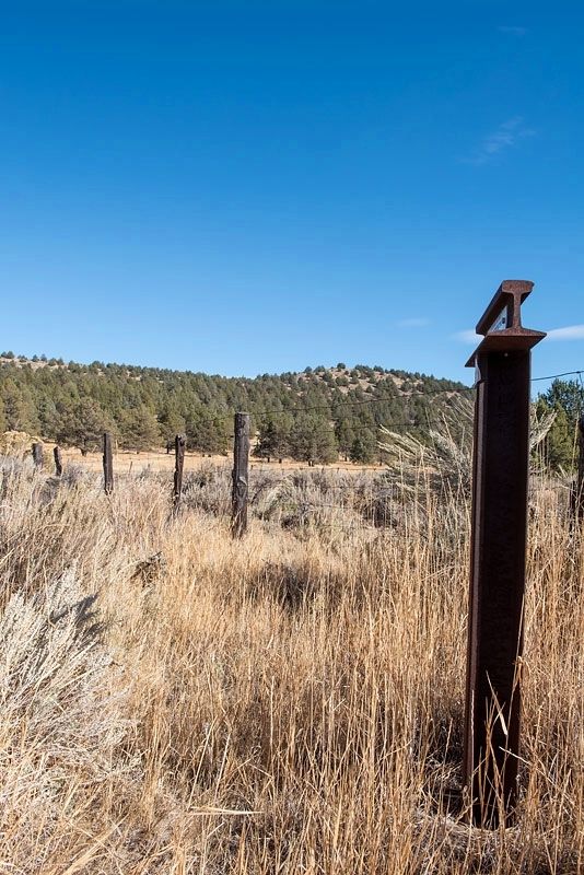
Trails West Inc. Historical Markers
Trails West marks the California, Applegate, Overland Trails as well as other related Western Trails with their notable "T" Rail markers. They have over 600 markers in place.
"Road good ... Still crooking round the inlets of lake, make 8 miles and camp at a fine bold spring but not cold."
Virgil Pringle, Oct 2, 1846 — — Map (db m151579) HM
"Drove 16 miles down Shasta Valley, most of the way good roads, no hills to cross now, but in places the road is stony. Today passed one or two houses. The first I have seen for several months" - James S. Cowden, Oct 11, 1853 — — Map (db m151631) HM
"After noon we drove on until night and no water to be seen
anywhare; so we pitched camp and stayed all night without
water; in the morning we hitched up and pushed on for water"
-James Baron, Aug 9, 1855 — — Map (db m151586) HM
"At noon we came to a pine forest. Traveled in it the
rest of the day. One very steep stony hill to go up.
Road considerably stony at intervals all day."
- George McCowen, Aug 28, 1854 — — Map (db m151589) HM
"Started at 6 went on to pine woods took dinner no
water or grass then passed on to Butte Creek & followed
it three miles & campt round a little lake quite stony to
day poor country"
- Hinsdale Truman Shepard Sep 4, 1852 — — Map (db m151590) HM
"Started & went 15 miles to Shasta River & campt
verry cold nights frost last night not [feeling]
any better" - Hinsdale Truman Shepard, Sep 7, 1852 — — Map (db m151633) HM
"The first day of October we journeyed west fourteen miles to the Snelling Ranch, now called the Hurd Ranch, near Sheep Rock, Shasta Valley." - Andrew Soule, Oct 1, 1854 — — Map (db m151629) HM
"Went 15 miles came to a big meadow [grass lake] & campt we took water with us this morning found no good water here" - Phoebe S. Terwilliger, Oct 11, 1854 — — Map (db m151608) HM
"Only drove 6 miles to a good camping place. Are yet on Butte Creek. There is a large amount of timber ... The hills and mountains are nearly all covered with a heavy growth of pine timber" - James S. Cowden, Oct 9, 1853 — — Map (db m151604) HM
"We are now out of the diggers and and in the Shasta
Valley tribe (country) they are not so hostile" - Sophronia Helen Stone, Sep 20, 1852 — — Map (db m151592) HM
"The next day we followed up Butte Creek for six
miles and pitched our tents. We lost a fine horse here."
- Andrew Soule, Sep 29, 1854 — — Map (db m151595) HM
Original Marker (2008):
Yreka Trail - Splendid Pine Timber
"Passed through splendid pine timber & fur [sic] & spruce ... Passed the dividing ridge of the Shasta Mountains Verry [sic] rough & bad roads this afternoon 18 miles to day . . . — — Map (db m151902) HM
“Crossed on the natural bridge ... Composed of
solid rock ... Went 15 miles had some stony
road and came to Clamouth Lake & campt”
-Phoebe Hogeboom Terwilliger, Oct 8, 1854 — — Map (db m113111)
“Morn. Fine. Cook still sick no breakfast or dinner
for today. Get away in good time road runs
over the bluff quite rocky to lake”
-John Pratt Welsh, Aug 26, 1853 — — Map (db m113116)
“Here road leaves [Klamath] Lake and follows up the
side of a steep hill 1/2 mile but is not hard to climb”
-William Cochran Stoddard, Sep 16, 1852 — — Map (db m113109)
“Crossed the Sacremento [Lost River], over the hill
or divide to a large swamp down this to a lake
(Clammett) about 3 ms, down the lake and camped”
-Lester Hulin, Oct 8, 1847 — — Map (db m113117)
“Here we came in cite of the bute It is a splendid cite Went down the hill on to the flats Spencer & Brill shot a deer.”
– Hinsdale Truman Shepard, Sep 6, 1852 — — Map (db m151609) HM
'Left camp early. About 10 o'clock commenced down hill. Nooned at the Sheep Rock'
- George McCowen, August 30, 1854
For guidebook availability
Trails West Inc., www.EmigrantTrailsWest.org — — Map (db m195081) HM
"Stop at Sheep Rock Here is ceder [sic] and pine Large strait [sic] and tall Now this is a large rocky region where the mountain sheep abounds Deer and antelope to[sic]" - Sophronia Helen Stone, Sep 22, 1852 — — Map (db m151610) HM
"Made a drive of 20 miles and campt by what are called Sheep Rock Springs, at the head of Shasta River Valley and about 30 miles from our destination, Yreka City." - James S, Cowden, Oct 10, 1853 — — Map (db m151627) HM
“Drove into town (Yreka) and a mighty town it is... several very good brick buildings. ...nothing can be bought here for less than two bits, a loaf of bread that use to cost five cents is 25, salt 25 per lb.” George McCowen, Sep 1, 1854 — — Map (db m151576) HM
"Today we have landed to our journeys end neare Yreka, whare
we stopped to graze our teems ... we exspect to stay here some
days to rest for the man that crosses the planes will feel
like resting when he gits through" - James Bardin, Aug 11, . . . — — Map (db m151637) HM
"The top of this hill is a narrow flat surface -... the hill is covered with tent wagons, oxen, mules, horses, men women, and children; some camps are on either side of the road, for several miles back." - J. Goldbrough Bruff, Oct 21, 1849 . . . — — Map (db m87731) HM
"The view below and before us truly grand - - the lofty mountains the stupendous rocks with the deep but magnificent vale below ... renders this one of the finest and most picturesque views I ever beheld" - Henry Austin, Oct 21 1849 . . . — — Map (db m87743) HM
"We gained the summit of greatest elevation. ... here we found 8 dead oxen, 2 discarded wagons, pieces of others, clothing, & c, scattered around" - J. Goldborough Bruff, Oct 21, 1849
Guidebook available
Trails West Inc., P.O. Box . . . — — Map (db m87741) HM
"There is an immense abyss on either side, we could look down thousands of feet. The side of the ridge seeming almost perpendicular" - Charles Glass Gray, Sep 29, 1849
Guidebook available
Trails West Inc., P.O. Box 12045, Reno, NV 89510 . . . — — Map (db m87734) HM
"Could you see me I would not be recognized, dirty, filthy & ragged are fully equal in appearance (to) the natives excepting being in an entire state of nudity" - Wm. Steuben, Sep 20, 1849
Guidebook available
Trails West Inc., P.O. . . . — — Map (db m87729) HM
"At Lassens ... saw many of the emigrants arriving here. They are broken down with the fatigue. Young men made old & stiff. Many dying with dysentary, fever, scurvey" - Pardon Tiffany, Oct 10, 1849
Guidebook available Tails West Inc. P.O. . . . — — Map (db m89185) HM
“Started for Marysville with good road at noon... hitched up and plodded on our dusty road to Marysville, where we arrived at 4 o’clock. This is a busy little place, but they had just had quite an extensive fire” – William . . . — — Map (db m113874) HM
”with practically no food for man or beast, and by bringing all the energy and courage which both men and beast possessed,…we succeeded in…reaching the first, or Johnston’s settlement.”
-Benjamin Hoffman, Sep 1, 1849 — — Map (db m40842) HM
"At the entrance of the pass was a pleasant little spring & fine branch." - Wakeman Bryarly, Jul 20, 1849
Guidebook available
Trails West Inc, P.O. Box 12045 Reno NV 89510 — — Map (db m138456) HM
"We enter a gorge of the hills which in a short time brings us to a large ampitheatre surrounded with rock of every kind of fanciful character." -- Joseph Middleton Aug 26, 1849 Guidebook Available
Trails West Inc. P.O. Box 12045, Reno . . . — — Map (db m123955) HM
"A ride ... brought us to the outlet of this romantic vale, a very narrow pass - just wide enough for a wagon, and on either side very high, jagged and thin walls of granite ... called the 'Pinnacle Pass'" - J.G. Bruff, Aug 29, 1849
. . . — — Map (db m123990) HM
"The gray granit rocks stand in pyramid monument & dome forms., here & there towering aloft. The road winds along between them. Emigrants names are written ... on these curious structures" -- Augustus Ripley Burbank, Aug 4, 1849 Guidebook . . . — — Map (db m123987) HM
"The Oregon road take up the bluff and follows the course of the (Snake) river while we keep to the left and follow the creek (Raft River) nearly to its source. ... crossing the creek we followed up the bottom" -- Byron McKinstry, Aug 1, 1850 . . . — — Map (db m123844) HM
"Arrived at Raft River, crossed and nooned. ... traveled five miles up Raft River and camped after recrossing it. Grass in abundance and plenty of wood" -- Cyrus Loveland, Aug 3 1850
Guidebook Available
Trails West Inc. P.O. Box 12045, . . . — — Map (db m123846) HM
"We traveled up Raft River 16 miles. The road, water and grass, good. Entirely destitute of timber, except a little willow on the streams and the wild sage." -- Chester Ingersoll, Aug 13, 1847
Guidebook Available
Trails West Inc. P.O. . . . — — Map (db m123848) HM
"After crossing (Cassia Creek) we crossed a swamp, which required considerable persevering to get through safely. Three miles farther we encamped on the side of a hill, between two ranges of mountains" -- Wakeman Bryarly, Jul 18, 1849
. . . — — Map (db m123883) HM
"By an easy ascent reached a summit and as gradually descended to a valley (Upper Raft River Valley) of sage and sand sloping to the south east. The streams running towards the (Great) Salt Lake." Byron N. McKinstry, Aug 3, 1850
Guidebook . . . — — Map (db m123886) HM
"We came onto the Subetts Cut Off road (Hudspeth Cutoff), or rather that cut off come onto our road which is the old and longest road." -- Henry Anable, Aug 7, 1852
Guidebook Available
Trails West Inc. P.O. Box 12045, Reno NV . . . — — Map (db m123882) HM
"The moon just rising above the mountains, throwing mild light over the valley & opposite mountain, formed a beautiful scene of prairie mountain life." -- Hugh Brown Heiskell, Sep 3, 1849
Guidebook Available
Trails West Inc. P.O. Box . . . — — Map (db m124026) HM
"Continue descending but passing over sandy hills on the south of the road [south of Hwy 50]... Good grass and water 2 miles [to Clear Creek]" - James H. Compton, Sep 20, 1853 — — Map (db m228421) HM
"We continued on following the river. The main road leaving the river for 12 miles. Over a strip of desert without grass or water the road along the river being a pack route and impracticable for wagons" - Calvin Taylor, Sep 17, 1850 — — Map (db m159073) HM
"Ragtown...is a collection of tents and canvass shanties, where a tolerable meal can be had at one dollar a head. Whiskey is sold, cards are played, gambling pretty extensively carried on and hay sold" - Henry Sheldon Anable, Sep 1, 1852 — — Map (db m159072) HM
"Passing out of the canyon we went up [Edwards Creek] Valley between two ranges of mountains ... to Cold Springs where we ... prepared for crossing the sixty mile desert by cutting grass and fillings our kegs with water" - Lumin A. Scott, Aug 29, . . . — — Map (db m159358) HM
"Long before sunrise our teams were on the trail marching forward on the desert. Very little to note save the dust & brightness of the glittering sand. Now & then a grave, little donage & dead stock." - John Clark of Virginia, Aug 21, 1852 — — Map (db m149414) HM
“A gradual ascent [rough road], the latter portion in a ravine [of Clear Creek], to the top of a ridge [at Spooner Summit].”
- William Bartlett [Bartlett’s Guide], Aug 13, 1853
Guidebook Available
Trails West Inc. P.O. Box 12045 Reno . . . — — Map (db m224084) HM
"We have to cross the river four times... on each side of you there is a perpendicular wall of vast rock... overhanging the road so one has a feeling very near bordering on fear as he passes under those precipices" -- Lewis Beers, Aug 3, 1852 — — Map (db m149731) HM
“The trail or road… ascends a considerable hill 1/3 mile ahead of us… the water here is cool, but too alkaline to be agreeable. Hot Springs in the river-bank, sulphur, &c.” —
J. Goldborough Bruff, Sep 7, 1849 . . . — — Map (db m81179) HM
About two miles southwest of this marker, the Greenhorn Cutoff ascended and wound through the hills for about twelve miles to avoid river crossings in Carlin Canyon. — — Map (db m70353) HM
"We had to descend a bad hill to get down to the creek, where we nooned near some well springs." -- Byron McKinstry, Aug 10, 1850
Guidebook available
Trails West Inc, P.O. Box 12045 Reno NV 89510 — — Map (db m138454) HM
"The water is warm and tastes but little better than soap suds. We use acid in all the water we drink, by that means we manage to get along, although we are all anxious to get off this river" - Ephriam Brandiff, Aug. 16, 1852 — — Map (db m70354) HM
"The road still continues on the south side of the river, there is also one on the north side and I believe it is the old one. The one on the south side is said to be the best." - Joseph Middleton, Sep 18, 1849
Guidebook available
Trails . . . — — Map (db m138455) HM
"Saw in this distance a flag flying denoting a trading post, rode over to it but found the most they had to sell was very poor whiskey. ... These traders get a great price for everything they sell." - Henry S. Anable, Aug. 25, 1852 — — Map (db m70355) HM
"We crossed the river 3 times ... which has become almost a perfect torrent ... our men have had all kinds of sport at the crossings, the water sometimes taking them off their feet and rolling them over like a barrel." - James Godfrey, Aug 7, 1849 — — Map (db m149927) HM
"Came to another crossing of the river (here from the...left flows down into the river one of the finest spring rivulets...). The 23rd crossing...is quite difficult. Made so by the large round bolder [sic] rocks...in its bed." - Augustus . . . — — Map (db m149982) HM
"Leaving the [Truckee] river bore off to the right over a sage plain near a mile with rather sandy road to the base of a low ridge." - D. B. Andrews, Aug 9, 1852 — — Map (db m149888) HM
[Just before fording to the north side of Truckee River]" the road forks the left hand one is the old Truckee Route to Sacramento...The right hand one and the one we traveled is Beckwiths Cutoff [Beckwourth Trail]" - East S. Owen, Aug 22, 1852 — — Map (db m149925) HM
"Drove over a hill and came through a most beautiful pine forest to the [Truckee] river and crossed it for the last - 27th time. Camped on the opposite side by a spring." - Joseph Curtis Buffum, Aug 7, 1849 — — Map (db m149990) HM
"Following up the Truckee, on a sandy road, in four miles an abrupt mountain shut out the valley, compelling us to cross the stream, which we found quite dangerous, because of the swift current and deep water." John Steele, Sep 10, 1850 — — Map (db m149892) HM
"The valley opens and we pass some very pretty
locations. Timber in a great many varieties, some
entirely new to me." Virgil K. Pringle, Oct 11, 1846 — — Map (db m152440) HM
"Make 10 miles and camp at a considerable sized creek
[Ashland Creek], the best camp we have had for several
[days.] Road very good. High mountains around."
- Virgil K. Pringle, Oct 11, 1846 — — Map (db m152442) HM
"Father and I rode down to Jacksonville about 10 miles
from Wagner's Fort. The country is very fine. The town is
wedged up into the mountain but the mines are all stopped
Business is very dull" - Welborn Beeson, Sep 4, 1853 — — Map (db m149048) HM
"The roads today were excellent and the face of nature
appeared full as interesting as yesterday Followed
down Rogue River [Bear Creek] about 12 mi[le]s & camp"
-Lester Hulin, Oct 15, 1847 — — Map (db m152444) HM
We continued our journey towards Jacksonville this morning,
designing to find a suitable place to graze our cattle until we
can find a shelter for our families...we then proceeded across
a prairie...where we encamped" - William Hoffman, Oct . . . — — Map (db m152446) HM
"The valley is about 3 miles wide here. It is not the main Rogue
River Valley, but a branch of it called Bear Creek...The first
tomatoes and melon patch I found I helped myself to as many as
I could eat being very hungary" - Wellborn Beeson, . . . — — Map (db m152443) HM
"Move one mile to camp (on Grave Creek), having none last night, and spent the day burying Mr. Cowley's daughter (Martha), who died yesterday evening, age about 14 years." - Virgil K. Pringle, Oct. 19, 1846 — — Map (db m112854) HM
"Left camp late this day on acct. of having to find a good road or pass through the Swamps of the utah outlet finally succeeded and encamped on the East Bank of Utah outlet making 5 [miles]"
James F. Reed, August 23, 1846 — — Map (db m154074) HM
178 entries matched your criteria. Entries 101 through 178 are listed above. ⊲ Previous 100