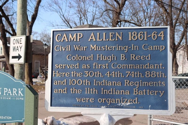
Colonel Hugh B. Reed served as first Commandant. Here the 30th, 44th, 74th, 88th, and 100th Indiana Regiments and the 11th Indiana Battery were organized. — — Map (db m215667) HM
On February 22, 1832, ground was broken two blocks north for the canal, which would link Lake Erie at Toledo with the Ohio River at Evansville. Jordan Vigus, Canal Commissioner, Charles W. Ewing, Samuel Hanna, Elias Murray participated in the . . . — — Map (db m21045) HM
Home 1948-1967 of Farnsworth, inventor of television. Farnsworth (1906-1971) was instrumental in perfecting the image formation mechanism which enabled the first effective image transmission in 1927. Farnsworth Radio and Television Corporation in . . . — — Map (db m65186) HM
This area of the Three Rivers was a site of settlement of Native Americans for as much as 10,000 years. The collection of villages known as Kekionga, located in the present-day Lakeside neighborhood, was a center of the Miami nation in historic . . . — — Map (db m21501) HM
Erected, 1750, by Captain Raimond
Surrendered to the British under Lieutenant Butler in 1760.
Ensign Richard Holmes and British garrison massacred by Miami Indians in 1763.
The most severe engagement of battle between Gen. Josiah . . . — — Map (db m21036) HM
This stone sentinal continues to watch over the land as it has since 1889. Its presence is a monument to those souls who lived, learned and played here.
The "State Sschool" was home to thousands of children and adults with intellectual and . . . — — Map (db m225929) HM
To the Memory of
Major John Wyllys
And His Brave Soldiers Who
Were Killed Near this Spot
In The Battle of
Harmar's Ford
Oct. 22, 1790
With the Indians Under
Chief Little Turtle — — Map (db m21358) HM
The Battle of Kekionga in October 1790 was the first battle fought by the United States Army after the War for Independence. The campaign had been ordered by President Washington against the Miami settlement of Kekionga, the center of Indian . . . — — Map (db m21497) HM
ME-SHE-KIN-QUAH, Chief
of the Miami Indians
Teacher of his people
Friend of the United States
His endeavors toward peace
should serve as an inspiration
for future generations
This plot of ground, the last
resting place of Chief . . . — — Map (db m21066) HM
Chief Little Turtle was one of the most feared and respected leaders during the frontier wars of the 1780s and 1790s when Fort Wayne was born. Known to his people as Meshekinnoquah, Little Turtle is thought to have been born in 1752 in a village . . . — — Map (db m21503) HM
The Saint Mary's River and the St. Joesph River converge in Fort Wayne to form the Maumee River. The most important geographical feature of the area is the short distance overland between the Three Rivers system, which eventually flows to the . . . — — Map (db m239133) HM
Anchoring the southern edge of the Headwaters Park “Thumb” until circa 1874, the Wabash & Erie Canal’s importance to transportation to the western part of the United States and to the growth of Fort Wayne was substantial. Headwaters Park . . . — — Map (db m16985) HM
The Three Rivers Water Filtration Plant was constructed between 1931 and 1933 as a solution to persistent difficulties suffered by the growing city of Fort Wayne in obtaining a sufficient quantity of safe drinking water.
Before the 1870s, . . . — — Map (db m239135) HM
A tract of 320 acres of land extending west of the St. Joseph River (the modern Bloomingdale and Spy Run neighborhoods) was set aside by an act of Congress in 1808 for the Indian agent William Wells in recognition of his many services to the U.S. . . . — — Map (db m168274) HM
A capsule was buried on this site on May 11, 2002 when citizens of Takaoka and Fort Wayne met to re-affirm an alliance established in 1977. The capsule, containing articles related to the 25th anniversary, will be opened on the occasion of the . . . — — Map (db m239279) HM
Born in Massachusetts, 1776
Died near Fort Wayne, 1843.
Buried in the David Archer Cemetery
Pioneer apple grower of Indiana and Ohio.
The Indiana Horticultural Society
and all those who are endeavoring to carry
on the work he nobly commenced . . . — — Map (db m59649) HM
Abraham Lincoln Came to Indiana in 1816 when but seven years old. Upon becoming of age in 1830 he migrated to Illinois. This statue by Paul Manship portrays Abraham Lincoln as a Hoosier youth. — — Map (db m162800) HM
9 January 1865. Patrick H. Keegan sold this half-lot to carpenter James C. Dillon who built a frame, one, and one-half story house.
28 June 1889. His three daughters sold this house to Patrick H. Keegan.
21 April 1914. Mr. . . . — — Map (db m197188) HM
In this house on October 6, 1908, was born Jane Alice Peters. Daughter of Frederick C. and Elizabeth Knight Peters, she took the professional name of Carole Lombard and became one of the most important figures in the motion picture industry. . . . — — Map (db m109155) HM
Oldest church structure in continuous use in Fort Wayne area and seat of Catholicism in northern Indiana.
Christianity carried to this part of the New World in 1600's by Catholic missionaries. Land formerly part of burial ground for Miami . . . — — Map (db m45024) HM
For nearly a century, the principal
business street of Fort Wayne, named for
Dana Columbia, hotel and canal boat operator.
Here was the terminal for passengers
and freight arriving and departing via
stagecoach and canal. Ground broken
for . . . — — Map (db m197141) HM
Fire Station #3
226 W. Washington Blvd
has been placed on the
National Register
of Historic Places
by the United States
Department of the Interior
c. 1893 — — Map (db m197147) HM
The first Presbyterian minister to conduct services at Fort Wayne was the Rev. Matthew Wallace, an Ohio pastor who served as chaplain to the army under General William Henry Harrison during the War of 1812 and accompanied the troops in the relief . . . — — Map (db m197192) HM
French built a palisaded fort on this strategic site in 1722; named Fort Saint Philippe des Miamis. One of three French forts built in what is now Indiana to protect French fur trade from encroaching English. First of five forts built over time . . . — — Map (db m241261) HM
Fort Wayne
Printing Building
c. 1911
has been placed on the
National Register
of Historic Places
by the United States
Department of the Interior — — Map (db m197146) HM
“Well done, good and faithful servant.”
(Ft. Wayne Chamber of Commerce – Jan. 7, 2927)
J.B. Franke dedicated his lift to service of others. He donated 80 acres to the City of Fort Wayne, which is now known as Franke park. Mr. . . . — — Map (db m119974) HM
Kresge-Groth
Building
c. 1926
has been placed on the
National Register
of Historic Places
by the United States
Department of the Interior — — Map (db m197144) HM
Louis Mohr Block
has been placed on the
National Register
of Historic Places
by the United States
Department of the Interior
Built 1891 — — Map (db m197195) HM
The Aqueduct
Carrying the Wabash and Erie Canal across the St. Marys River was located just north of the bridge about where the Nickle Plate Railroad crosses the river and was the playground and swimminghole for the West End Boys. Completed . . . — — Map (db m99093) HM
Commandants 1680-1697; Jean Baptiste Vissat, Sieur DeVincnnes, Francois-Margane, Sieur DeVincennes. 1725; Ensign Douville,. 1734; Ensign DuBuison.
In 1747, savages burned the fort but it was rebuilt. M. DeRaimond was commandant in 1748.
. . . — — Map (db m232369) HM
Schmitz Block
c. 1888
has been placed on the
National Register
of Historic Places
by the United States
Department of the Interior — — Map (db m197145) HM
Established in 1846 as the Fort Wayne Female College on grounds donated by Wm. Rockhill.
In 1855 the college consolidated with the Fort Wayne Collegiate Institute for Young Men and it was then call the M.E. College.
In 1890 the college grounds . . . — — Map (db m100138) HM
St. Mother Theodore Guerin founded the first
catholic school in Fort Wayne on this site
in 1846. Her community, The Sisters of
Providence, taught young people of
Fort Wayne for over 125 years. She was canonized
a Saint October 15, 2006
. . . — — Map (db m197229) HM
The present Allen County Courthouse is the fourth to serve the county's judicial needs. Its cornerstone was laid on November 17, 1897, in the largest public ceremony held in Fort Wayne to that time. Louis Peltier, who had been born in the fort in . . . — — Map (db m162792) HM
In 1852 John Brown, a stonemason, built this last remaining vestige of the early canal era in FortWayne.
A native of Glasgow, Scotland, Brown came by canal boat to Allen County in 1847 with his wife Mary. He and his Scottish business partner, . . . — — Map (db m100141) HM
The Edsall House, the oldest structure in downtown Fort Wayne and the city's second hospital, was built by William S. Edsall in 1839. Edsall was a fur trader, builder, ferry operator, surveyor, sawyer and merchant, and was prominent in Fort Wayne . . . — — Map (db m215660) HM
The Embassy Theater is the last of
the great movie and stage houses in Fort
Wayne, and its restoration marks one of
the city's outstanding volunteer efforts.
Construction of the theater and the
adjoining Indiana Hotel was begun in
1926. . . . — — Map (db m197230) HM
The First French Fort
The French lived among the Miami at the Three Rivers as early as 1697 when Jean Baptiste Bissot, Sieur de Vincennes (d. 1719), and Francois Marie Bissot de Vincennes, the son of Jean Baptiste . . . — — Map (db m241262) HM
John Grimes constructed a house on this lot in 1842, and on March 13, 1854, he sold the place to Sion S. Bass and his wife, Eliza. Sion Bass had come to Fort Wayne in 1848 from Salem, Kentucky, and worked for the Ewing fur-trading enterprise. He was . . . — — Map (db m197189) HM
The Roman Catholic Parish of St. Paul was established at this site in 1864 for German-speaking Catholics of the then northwestern part of Fort Wayne.
Over the course of 138 years, this property also served the needs of St. Paul . . . — — Map (db m197185) HM
The Rotary Club of Fort Wayne was established January 9, 1915, when 35 local business professionals and community leaders held the Clubs first meeting at the former Commercial Club on Harrison Street in downtown Fort Wayne. In the 100 years since . . . — — Map (db m197194) HM
The intersection of Main and
Calhoun streets was the busiest corner in
Fort Wayne between the 1890s and the
1960s, for it was here, at the "Transfer
Corner,” that all the trolleys (and later
buses) converged from their various
routes.
. . . — — Map (db m197143) HM
Henry Rudisill, whose efforts had resulted in the establishment of Fort Wayne's first German Lutheran congregation in 1837, also initiated the founding of the community's first English-speaking Lutheran parish, the English Lutheran Church of the . . . — — Map (db m197187) HM
The Protestant Episcopal Assembly met May 26, 1839 with 17 charter members in Fort Wayne's courthouse. They built First Trinity Episcopal Church in 1847 on the northwest corner, Berry and Harrison Streets. Present Trinity Church built 1865, . . . — — Map (db m197191) HM
Edsall (1811-1876) was an early community leader, serving on the first City Council, and later was a land office register and County Clerk. He was also a fur trader, merchant, plank road and railroad builder in the Fort Wayne area and helped Fort . . . — — Map (db m215666) HM
donated to the City of Fort Wayne
by Consul-General of Japan in Chicago Naoki Ito
Sunday, May 20, 2018
as a gesture of goodwill and friendship
to celebrate the Fort Wayne Cherry Blossom Festival
Sign donated by:
Japanese American . . . — — Map (db m197149) HM
Illsley. "Illsley" was the name of the large estate of Frank Illsley Brown and Anna Bond Brown. Their stately Italianate home faced west toward the St. Mary's River and was surrounded by extensive gardens. The front of the property on . . . — — Map (db m225926) HM
Originally in twenty three lots at a site selected by the Wabash Railway for a depot to serve a rich agricultural area. The first steam train arrived over the newly completed Fort Wayne-Toledo right of way on January 1, 1902. A post office was . . . — — Map (db m183600) HM
On north bank of prehistoric Lake Maumee. The ridge formed by the bank was part of the pioneer overland trace from Detroit to Fort Wayne. This route was surveyed as early as 1837 for the ridge road, served in the late nineteenth century as a toll . . . — — Map (db m183602) HM
This cemetery exists because every life is worth loving and remembering - always.
[Names listed on the back of the marker sharing the names of the interred.] — — Map (db m183603) HM
Once an Indian trail directly through these school grounds, the route followed by General Anthony Wayne's army in its departure from the fort in 1794 and the way by which General William Harrison's troops came to the relief of the garrison at Fort . . . — — Map (db m211614) HM
First called "The Opening", a natural clearing in the forest, settled about 1837. On the old Lima Plank Road connecting Howe (Lima) and Fort Wayne. Home of the Perry Centre Seminary, founded 1856 and closed 1861 when the entire faculty and all adult . . . — — Map (db m76402) HM
It served in multi functional roles to include field and anti-tank gun. These types of artillery
pieces were used by the U.S. Army during World War I, the interwar period, and World War II.
Originally of French design, the Canon de 75 modèle . . . — — Map (db m241291) HM
Colonel John Hardin, of the Kentucky Militia, with 180 men and Captain John Armstrong, U.S. Army, with 30 men, were routed here on October 19, 1790, by Indians under Miami Chief Little Turtle during General Harmar's Campaign. — — Map (db m232339) HM
One of the greatest developments in Monroeville in the early 1900s was the electric railroad which put the community in the line of traffic for passengers and freight. The line was known as the Fort Wayne, Van Wert and Lima Traction Company and was . . . — — Map (db m211613) HM
Monroeville, Indiana was in a vast wooded area, with many lumber mills, stave and barrel factories in operation.
At one time it was the home of Lloyd C. Douglas, noted writer. Here he obtained the incentive to write some of his books, . . . — — Map (db m211610) HM
Wabash and Erie Canal lock was discovered here June 1991 during excavation for highway construction. It was built 1838–1840 by Henry Lotz and named for lock keeper Joseph Gronauer. The rare, well-preserved timber-frame design lock measured . . . — — Map (db m2498) HM
Artist - Kim Linker
The New Haven Community Foundation
was officially founded in March 2015
with the purpose to enhance the lives
of our residents and to invest in our
community's future.
This New Haven Community Foundation
bulldog and the . . . — — Map (db m197135) HM
The Lincoln Highway was the first auto road across the United States. Promoted by Carl G. Fisher, of Indianapolis, the Lincoln Highway route was announced in 1913. From Times Square in New York City to Lincoln Park in San Francisco, the Lincoln . . . — — Map (db m197131) HM
Past this point flowed
the Wabash and Erie Canal
begun in 1832 and
dedicated July 4. 1843 at Fort Wayne.
In its final phase the canal
extended 459 miles
from Maumee Bay to Toledo,
through New Havens southwestward
to Layette and then to . . . — — Map (db m197133) HM
"We ask a lot of those who wear our uniform.
We ask them to leave their loved ones, to travel
great distances, to risk injury, even to be
prepared to make the ultimate sacrifice of their
lives. They are dedicated. They are honorable.
They . . . — — Map (db m197129) WM
This clock tower, along with Woodburn Plaza, is dedicated in honor of Harry and Jeanette Henney for a lifetime of involvement and commitment to the people and city of Woodburn.
Upon graduating from Manchester College in 1935, Harry moved to . . . — — Map (db m193531) HM
First town incorporated in Maumee Township. Once called "Phelps Station" on the Wabash Railroad. A strategic point in a vast woodland of timber unsurpassed in the United States for variety and condition.
Incorporated as a 5th class city in . . . — — Map (db m193534) HM
(Front Side)
Construction begun summer 1942 under Captain Stratton O. Hammon, who used broad authority over laborers, suppliers, and railroad; base in use February 1943. More than 1,000 workers employed during construction. Base was over . . . — — Map (db m63819) HM
County formed by Indiana General Assembly 1821. Thirty acres of land were purchased, and John Tipton donated thirty acres, for county seat. State commissioners named county seat Tiptona — after Tipton; local elected commissioners renamed it . . . — — Map (db m48105) HM
Revolutionary War Soldiers
buried in Bartholomew County
1776 ——— 1976
(Row One) - - William Campbell • John Carney • Joseph Carter • Arthur Chenoweth, Jr. • Thomas Cook • Richard H. Crittenden • Benjamin Ensley • . . . — — Map (db m48339) HM
(( Walk - Way Stones ))
Bartholomew County
Veterans Memorial
Dedicated May 30, 1997
The Bartholomew County Memorial for
Veterans is a tribute to those living and
dead who answered the Nations Call in
the conflicts of . . . — — Map (db m48474) WM
( Left Side )
- -( Seals )- - Branches of the United States Military
( Right Side )
They shall grow not old
as we that are left grow old
Age will not worry them
nor time condemn
But at the going down of the sun . . . — — Map (db m48337) WM
In Honor
of those who served
their Country in the World War
1917 — (Seal) — 1918
(American War Mothers)
Erected 1929
Bartholomew County War Mothers — — Map (db m48341) HM
In late 1800’s railroads and new technology opened national markets to Midwest producers, including Indiana, a leader in corn products. Joseph Gent patented operations and devices to mass-produce flaked corn. Gaff, Gent, & Thomas Co. Began making . . . — — Map (db m238476) HM
From 1830 to 1880 the community of Lowell Mills thrived here along Driftwood River. There were two grist mills, a cooperage, a shoemaker's shop, a distillery, a saw mill, a woolen mill, an inn and general store. When the mills closed, the town was . . . — — Map (db m63794) HM
(Front Side)
Incorporated and its factory built here 1890. Reorganized 1891; William H. Lincoln then led the company to great success, stressing quality and artistic merit in fine, high-grade furniture. By 1895, production included . . . — — Map (db m63818) HM
Our Pioneer Heritage
Here, from the days of the frontier, the covered wagon, the Indian Wars, come reflections which make us feel humbly grateful for the vision, courage and sacrifice of our pioneer forebears which made possible the community . . . — — Map (db m242295) HM
Congregation was formed in 1879; reorganization in 1882 by the Reverend John R. Miller and a core of determined members. The present building, formerly a theater, was acquired in 1913. This African-American church, like many others, has served its . . . — — Map (db m63815) HM
To the memory of
Gen. John Tipton
1786-1839
Founder of Columbus, Indiana
Gen. Joseph Bartholomew
1766-1840
Our county bears his name
Both heroes at Tippecanoe — — Map (db m242302) HM WM
((The ‘greatest care’ has been given to get each person’s name correct. If any mistakes are found, please contact me so correction can be made. - - Al Wolf.))
Honor Roll
———
Bartholomew County . . . — — Map (db m48551) WM
Mandated by Indiana's 1836 Internal Improvement Act, construction began in Madison 1836. Completed along this site 1843; Elizabethtown platted 1845 as a result of the railroad. Completed to Indianapolis in 1847. Linked Ohio River and interior of . . . — — Map (db m63798) HM
Founded 1847 A.D.
by
Citizens of Hartsville. It was taken over by the Church of the United Brethren in Christ in 1849 - Opened as a college in 1850 - Burned January 30, 1898 - It was one of the first co-educational colleges in America.
. . . — — Map (db m63807) HM
Original site of coeducational United Brethren school founded 1850 as Hartsville Academy by public act of Indiana General Assembly. Campus moved four blocks south, circa 1865; destroyed by fire, January 1898. Many graduates became distinguished . . . — — Map (db m63805) HM
Mitchell, Co. F, 27th Indiana Volunteers, is buried in
Hartsville Baptist Cemetery. He found Confederate General
Lee's "Lost" Special Orders No. 191 near Frederick, MD, September 13, 1862. Union General McClellan then engaged Lee at the Battle . . . — — Map (db m63806) HM
Served throughout the entire Revolutionary War, including five years as a member of the most prestigious corps of the American Revolution –
General George Washington’s Life Guard. He now sleeps in peace in Sharon Cemetery. — — Map (db m167019) HM
In perpetual memory of those whose selfless service fought for honor, freedom, country.
With malice toward none, with charity for all, with firmness in the right as God gives us to see the right, let us strive on to finish the . . . — — Map (db m240679) WM
Benton County formed by General Assembly in 1840. Oxford first county seat; Fowler became second, 1874. Designed in Second Empire Style by Gorden P. Randall and built 1874 by Levi L. Leach. Located at geographical center of county on land donated by . . . — — Map (db m21487) HM
BP Wind Farms Fowler Ridge
Facilities at a glance
Fowler Ridge 1
Project owner: Subsidiaries of BP Wind and Dominion Resources
Power purchaser: Dominion Energy Marketing Inc, Indiana Michigan Power | Appalachian Power . . . — — Map (db m240929) HM