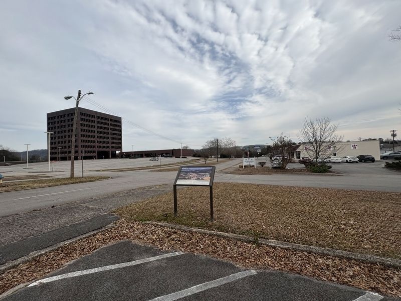
The first headquarters for the Manhattan Project were in the offices of the US Army Corps of
Engineers North Atlantic Division on the 18th floor of a skyscraper in lower Manhattan, NY.
Across multiple New York City sites, the Manhattan Engineer . . . — — Map (db m293569) HM
Built in 1943 near the main business district (Jackson Square), this standard Army chapel was soon known with the Manhattan Project as "The Chapel-on-the-Hill". On 30 September 1943 it was dedicated for Jewish, Catholic, and Protestant worship. The . . . — — Map (db m112102) HM
The Manhattan Project was a monumental undertaking that required a massive population of
employees/residents. Since its establishment in 1942, the high-security town of Oak Ridge
jumped to a population of 75,000 by 1945. Due to security concerns, . . . — — Map (db m293570) HM
On a route that was first authorized to be "cut and cleared" in 1787, the Rock Pillar Bridge 60 yards to the north-northeast was built in the early 1900's. This road became known as the Emery Road and was one of the earliest routes used in the . . . — — Map (db m89677) HM
Realizing early on the need for a place for Secret City visitors to stay, construction of the Guest
House began in the spring and finished in July of 1943, one of the first buildings finished during
the Manhattan Project. Unlike other structures . . . — — Map (db m293577) HM
The Guest House provided accommodations for visitors to the Clinton Engineering Works (Oak Ridge) during the time of the Manhattan Project, which led to the development of the atomic bomb. The Guest House hosted such dignitaries as physicists J. . . . — — Map (db m114613) HM
The Robertsville Community was settled in 1804 by Collins Roberts, who had received a 4,000-acre land grant in this region. Robertsville was one of four communities in the area that predated Oak Ridge. The community was dispersed in 1942 when the . . . — — Map (db m176887) HM
The Scarboro Community was founded by three brothers in the early 1790s. Jonathan, David and James Scarborough traveled from Virginia and settled here. Scarboro was one of four area communities that predated Oak Ridge. The community remained largely . . . — — Map (db m32575) HM
It was also the home of the only elementary, Junior high, and Black High School in Oak Ridge. Under the leadership of Principal Arizona Officer, the Scarboro School with grades one through six continued to operate as a community school until 1967. . . . — — Map (db m263874) HM
Before the Manhattan Project, a spring-fed lake known as the "Duck Pond once provided water for horses and cattle along Emory Road, an early route used in the settlement of Middle Tennessee. During World War II, a town sprung up seemingly . . . — — Map (db m215321) HM
Outdoor recreation was essential for Oak Ridge residents' morale
during the Manhattan Project. Tennis courts, baseball diamond
and a pool were built. Tennis courts, however, were used for
more than just tennis. Being one of the few places in town . . . — — Map (db m293572) HM
With the threat of war looming, Anderson County residents voted overwhelmingly against secession in 1861. When Confederate forces occupied East Tennessee and established a conscription center at nearby Clinton, Unionists slipped into Kentucky to . . . — — Map (db m112103) HM
In December 1942 University of Chicago physicists demonstrated that the newly discovered element plutonium could be made using a “pile” of uranium and graphite blocks. Aware that Germany was seeking to develop a weapon of unprecedented . . . — — Map (db m112351) HM
The top priority of the secret wartime Oak Ridge project was the Y-12 plant. That was the code name given to the process considered the best bet for separating weapon-grade uranium-235 (U-235) from U-238. This isotope separation process was the . . . — — Map (db m112349) HM
The Electromagnetic Separation Plant was a Manhattan Project facility built in 1943 to separate U-235 from U-238. Material for the first atomic bomb was produced here. In place of unavailable copper, nearly 14,000 tons of silver were borrowed from . . . — — Map (db m263872) HM
Convicts cut trees from Militia Hill and surrounding hillsides in 1892 so soldiers could spot attacking miners. Many of those trees were American chestnuts. Convicts and soldiers could not know that a fungus carried by Chinese chestnuts, brought to . . . — — Map (db m102280) HM
Soldiers of the Tennessee National Guard became easy targets for miners positioned on higher ground after trees were cut from Fort Anderson. Convicts then dug these breastworks to provide cover from attacking miners.
War correspondents from . . . — — Map (db m102279) HM
Welsh miners from the Knoxville Iron and Coal Company began mining coal at the foot of this hill in 1867, but were replaced by convict laborers during a strike in 1877. After convicts were brought to a mine in Briceville in July 1891, miners and . . . — — Map (db m101896) HM
After the Civil War, southern states leased convicts to private industry to cope with a growing number of convicts and dwindling state budgets. The system degenerated to where primarily young African-Americans were being arrested and forced to work . . . — — Map (db m101897) HM
Country Music songwriter and performer Dean Dillon was born Larry Dean Fynn on March 26, 1955, in Lake City, Tennessee (later renamed Rocky Top). Although Dillon began his career as a performer, he became renowned as a songwriter. His work includes . . . — — Map (db m248181) HM
Soldiers responded to attack by firing cannons from here into the Miners Nest encampment on Walden Ridge, located south of the Wye Gap. Soldiers also shot cans filled with mud through the Wye Gap into the town of Coal Creek to signal that the town . . . — — Map (db m102281) HM
The Tennessee National Guard built Fort Anderson on Militia Hill in 1892 to restore order during the Coal Creek War. The fort is located off Vowell Mountain Road, and listed on the National Register of Historic Places.
According to the Tennessee . . . — — Map (db m101893) HM
In 1877, convicts replaced striking Welsh miners in the Knoxville Iron and Coal Company Mine, located in the hollow to the south. Prison records show that 131 convict miners died there from 1877 to 1893, while others were caught igniting methane gas . . . — — Map (db m101892) HM
Fort Anderson was built here on Militia Hill in January 1892 as a base for the Tennessee National Guard to protect convict laborers and restore order. Hostilities escalated with as many as 2500 miners from Tennessee and Kentucky participating in the . . . — — Map (db m102277) HM
The Tennessee Coal Mining Company in Briceville dismissed convict labor in February 1892 and sold stock in the company to miners. Subsequent attempts to convince Gov. Buchanan to remove troops from the watershed failed, so miners attacked at this . . . — — Map (db m102284) HM
The arrival of General Carnes with the bulk of the state militia overwhelmed the miners by the late summer of 1892. Although they lost the final battle, Coal Creek miners won the war when newly-elected Gov. Peter Turney fulfilled a campaign promise . . . — — Map (db m102282) HM
Agricultural land in the region was owned and being farmed by 1880. Younger sons of farmers sought opportunities in mining, learning new job skills from experienced Welsh miners. Mining also offered opportunities for African-Americans who comprised . . . — — Map (db m101895) HM
In late June of 1863, Union Major General William S. Rosecrans launched a massive offensive from his base in Murfreesboro in an attempt to drive Confederate General Braxton Bragg's 43,000-man Army of Tennessee from its entrenchments at Shelbyville . . . — — Map (db m277761) HM
Webb gratefully acknowledges the gift from Mr. and Mrs. William Ransom Jones, Sr., William Ransom Jones, Jr. '88, and Jennings H. Jones '90, making possible the purchase of the bell in 2013.
First rung in Bell Buckle by the Class of 2014 on . . . — — Map (db m278251) HM
Z.T. Crouch, Webb School employee, built this house in 1913 on a plat deeded from W. R. (Sawney) Webb. The home of H. Pearl and Virginia Wright Sain from 1959 till 1995, it was also the site of Sain Stables from 1960 to 1973. Shaker's Shocker was . . . — — Map (db m277759) HM
This building is dedicated in honor of Eugene F. Strobel (1927-2016) for his tireless service to the town of Bell Buckle as its mayor from 1978-1986. Mr. Strobel was a professor at Middle Tennessee State University and an ardent naturalist.
Mayor . . . — — Map (db m277760) HM
The Webb School was founded in 1870 in Culleoka by William Robert Webb, known affectionately to thousands as "Sawney." It was relocated to Bell Buckle in 1886. Sawney was active in educational, political, religious, social, and community affairs, . . . — — Map (db m278249) HM
Founded 1870, at Culleoka, by William R. ("Sawney") Webb, whose brother John M. ("Old Jack") Webb joined him in 1874. It moved here in 1886. Its curriculum, embracing chiefly Latin, Greek and Mathematics, was designed to give a sound preparatory . . . — — Map (db m24169) HM
On this knoll, members of the Federal party which attempted to destroy the Western & Atlantic R.R. in 1862, assembled before starting their foray. It started with seizure of the engine "General" and ended with recapture of the engine at the Georgia . . . — — Map (db m80317) HM
The Reserve Corps (Granger) moved south along this road, screened by the Army's Cavalry (D.S. Stanley). Taking Guy's Gap, against minor resistance, they pushed rapidly into Shelbyville, evacuated the same morning by the Corps of Maj. Gen. Leonidas . . . — — Map (db m26075) HM
Born on March 3, 1916 and raised in his father’s ancestral home of Bedford County, Tennessee, Austin C. Shofner forever changed World War II.
When World War II commenced for the United States in 1941, Capt. Shofner fought as a company . . . — — Map (db m214902) HM
The Veterans Memorial Plaza is conceived and designed to honor, commemorate and forever remember the veterans of Bedford County Tennessee who have served in the armed forces throughout the world. It is to recognize the sacrifices these brave men . . . — — Map (db m85709) WM
This was Lot 44 of the original town plan. A log church was built here in 1815. The Presbyterians used it, and built the present church in 1817. In 1856, a Catholic congregation bought the building, selling to the Northern Methodists in 1894. These . . . — — Map (db m25049) HM
Born in NC, 1783; veteran of the War of 1812; early Bedford County manufacturer; Whig political leader. In 1810 Cannon provided 100 acres of land for the site of the "Town of Shelbyville" and in 1817 donated 5 acres to Dickson Academy and a lot to a . . . — — Map (db m26807) HM
In the cemetery north of the road are buried Confederate soldiers of the Army of Tennessee, who fell while opposing the advance of Rosecrans' Army of the Cumberland through Liberty Gap and Guy's Gap, in late June, 1863. Also buried here are soldiers . . . — — Map (db m25864) HM
Preface
After the Battle of Stones River ended on January 2, 1863, Union Gen. William S. Rosecrans occupied Murfreesboro. Confederate Gen. Braxton Bragg withdrew south to the Highland Rim to protect the rail junction at Tullahoma, Bragg's . . . — — Map (db m85714) HM
Born in a house which stood here. Enlisted in the 1st Tenn. Volunteers for the Mexican War; on graduation from US Military Academy in 1853, commissioned in Dragoons. Resigning for the Confederacy and rapidly promoted to colonel, he was captured at . . . — — Map (db m207913) HM
In memory of the
"Shelbyville Rebels" Co. F.
41st Tenn. Reg't. C.S.A. and
all soldiers from Bedford
County who fought for the
Confederacy in the War
Between the States 1861-1865
Erected and affectionately dedicated
by the Agnes L. . . . — — Map (db m85555) WM
Born on November 15, 1858, James S. Gilliland, an African American native of Shelbyville and self-taught stone mason, work extensively with limestone. He envisioned turning his log house into a stone home with fifteen-inch thick walls quarried over . . . — — Map (db m282004) HM
The first Bedford County public school for African-Americans was known as 'Slip up'. Between 1889 and 1894, 27 schools for African American (mostly one-teacher) were established in various Bedford County communities. Organized in 1895, McAdams was . . . — — Map (db m263119) HM
Son of Michael, an immigrant from Frankfurt on Main, Germany in 1760. Migrated by covered wagon, horseback and afoot from North Carolina in 1808 with his family and settled this tract of land on Thompson's creek. The land was granted to him by the . . . — — Map (db m80313) HM
Mary Shirley, who was born on 17 February 1762, married William McGuire on 23 February 1778 in Virginia. During the Revolutionary War William and Mary McGuire with son Michael were taken prisoner on 26 June 1780 and moved from Virginia to Montreal, . . . — — Map (db m262420) HM
Dedicated to the Memory of the Thirteen Free and Accepted Masons Who Were Among the First Signers of the Constitution of the United States.
A.D. 1787 - A.D. 1987
Donated by Normandy Lodge No. 617 Shelbyville Lodge No. 122 of Free and . . . — — Map (db m207988) HM
Captain Charles Davis of the 7th Pennsylvania Volunteer Cavalry received the Medal of Honor for leading a cavalry charge on June 27, 1863 to the south, directly up Main Street, in the face of Confederate artillery and troops defending the . . . — — Map (db m263407) HM
Governor of Tennessee for three successive terms 1939-1945. A native of Bedford County and graduate of Webb School, Princeton and Harvard Law School, he was Attorney General of the 8th Judicial Circuit, a member of the 63rd and 70th General . . . — — Map (db m25868) HM
Shelbyville Central High was a public, 4~year high school that served students across Bedford County. This building was completed in 1939, opened for classes in 1940, and was occupied by the school until 1977. The facilities expanded in 1955 with . . . — — Map (db m297577) HM
Shelbyville was established in 1810 on 100 acres of land donated by Clement Cannon (1783-1860), local manufacturer and veteran of the War of 1812. The city was named in honor of General Isaac Shelby (1750-1826), statesman and noted Revolutionary War . . . — — Map (db m85443) HM
This 90-acre tract is home of the Tennessee Walking Horse National Celebration - "The World's Largest Walking Horse Show". On July 17, 1939, a non-profit association was chartered to conduct a national celebration to honor and exhibit the Tennessee . . . — — Map (db m25869) HM
The Tribute of the South to S.A. Cunningham, founder and editor of the "Confederate Veteran",
January, 1893 - December, 1913.
He gathered the history of his people written in tears but radiant with glory.
(On left side of . . . — — Map (db m263522) HM WM
[Side A]
Shelbyville — “Little Boston”
Shelbyville, Tennessee, better known as “Little Boston,” was a hotbed of Unionist sentiment throughout the war. When William Rosecrans' Union army captured the town, they were welcomed as . . . — — Map (db m191662) HM
Moore County Established 1871; named in honor of
Major Gen. William Moore
He settled in Tennessee in 1808, coming from Kentucky. Commanded a company in the Creek War; finished the War of 1812 as a Major General. Member of the State House . . . — — Map (db m61915) HM
U.S. Army 79th Infantry
Feb 19, 1925
Lost his life in the
Normandy Invasion
July 12, 1944
Erected by his buddies, friends, and relatives
Sponsored by Rover Community Club — — Map (db m263520) WM
By
Sergeant Major Larry E. & Mrs. Sheila M. Williams, US Army / Retired
Commander Camp #72 (Manchester), Starnes DBE., TN Div., SCV
10 December 2011 — — Map (db m152097) WM
Wartrace is located on a 5000-acre North Carolina grant acquired by General Andrew
Jackson at an 1802 marshal's sale in Nashville. In 1805, Jackson came to the area to establish his boundaries for the opening of the lands for settlement by the . . . — — Map (db m152096) HM
Hardee's Corps retired to the Wartrace-Fairfield defensive line, January, 1863. Here they remained until late June, when Rosecrans, moving the bulk of the Federal Army of the Cumberland around the right flank to Manchester, made Bragg withdraw from . . . — — Map (db m152093) HM
In 1909, the merchants of Wartrace constructed a wooden platform on this site. The platform was used as a stage for performances by the merchants' band and as the judges' reviewing stand for horse shows that were then held on Front Street. The . . . — — Map (db m267842) HM
The Beechwood Plantation house, which formerly stood at this site, was an important Confederate headquarters during the Tullahoma Campaign. It was built for Col. Andrew Erwin, Jr. and family in 1826. The Erwins, who were southern sympathizers, . . . — — Map (db m25862) HM
Jazz trombonist Jimmy Cleveland was a versatile musician whose work was largely confined to other artists' sessions, pit orchestras and broadcasting. Among the artists he backed were Quincy Jones, Miles Davis, James Brown, Billie Holiday, Cannonball . . . — — Map (db m267849) HM
In April 1862, Major James M. Shanklin with 197 men of the 42nd Indiana Infantry campedon the west bank of Wartrace Creek, near the end of Bridgeview Street, to secure the supply line of the Nashville & Chattanooga Railroad by guarding two bridges . . . — — Map (db m152103) HM
Strolling Jim, the first World's Champion Tennessee Walking Horse, is buried in a pasture directly behind the Walking Horse Hotel. Foaled in 1936, this former work horse was ridden to the championship by Floyd Carothers at the first Walking Horse . . . — — Map (db m24165) HM
(side 1)
Anatomy of a Campaign
In late June of 1863, Union Major General William S. Rosecrans launched a massive offensive from his base in Murfreesboro in an attempt to drive Confederate General Braxton Bragg’s 43,000-man Army of . . . — — Map (db m152889) HM
In 1850, Rice Coffey gave eight acres to the Nashville and Chattanooga Railroad on which the main line would run with a depot and freight house at the junction of the branch line to Shelbyville. In 1851, town lots were laid off. The following year, . . . — — Map (db m88407) HM
An early post office of this name was opened Sept. 28, 1835, in the home of William H.H. Burton, which stood at this site. It remained here until Aug. 27, 1837, when it was moved to the public square of Camden and the name changed to "Camden." . . . — — Map (db m109047) HM
Born 1779, South Carolina, died 1860, Benton County Tenn. Citizen soldier, War of 1812, member of Benton County's first quarterly court February 1836. Patriot for whom Benton County was named. Presented to the Citizens of Benton.
(Base monument) . . . — — Map (db m74482) HM
During the Civil War, several engagements occurred along the strategically important Tennessee River within about five miles of here. In each one, cavalrymen engaged naval forces.
On April 26, 1863 near the mouth of the Duck River east of here, . . . — — Map (db m74512) HM
8½ miles east, at Johnsonville Landing, Forrest's Cavalry Corps, after blocking river approaches from both directions with captured Federal vessels and gunfire, destroyed the Federal base at Johnsonville. Losses were 4 gunboats, 14 steamboats, 17 . . . — — Map (db m237476) HM
U.D.C. Marker to eight Irish CSA soldiers
probably worked on railroad
1860-1861
Erected by
Captain Nathaniel A. Wesson
United Daughters of the Confederacy
1992 — — Map (db m109049) WM
Mary Cordelia Beasley-Hudson, a life-long resident of Benton County, was an advocate for women's suffrage. The Tennessee General Assembly approved an amendment to the state constitution to allow women's suffrage on April 15, 1919. Seven days later . . . — — Map (db m81359) HM
On March 5, 1963, at 30 years of age, country singer Virginia Patterson Hensley, better known as Patsy Cline, along with her manager, Randy Hughes, and fellow Grand Ole Opry stars, Hawkshaw Hawkins and Cowboy Copas, were killed in a plane crash in . . . — — Map (db m184907) HM
Mildred Jolly Lashlee was the first woman elected to the Tennessee Senate for a full “regular” term. Elected in November 1944, she represented the 26th Senatorial District. Before her election she was appointed to complete the term of . . . — — Map (db m109048) HM
Born June 2, 1863, in a log cabin, about ½ mile N., he studied law at Charlotte, later began practice at Camden. Attorney General of the 13th Judicial District, 1908-12, he was the last Tennessee governor to be elected by a convention. . . . — — Map (db m74481) HM
Some of the lesser known battles and incidents of wars have afforded drama and have portrayed characteristics of the participants far beyond those of usual recorded history. Such was the Battle of Johnsonville, fought between Maj. Gen. N. B. . . . — — Map (db m146444) HM
In 1862 and 1863, Confederate cavalry raids along the Louisville & Nashville Railroad often shut down operations and slowed the flow of supplies into Nashville. The Union army built a supply depot at Johnsonville to help alleviate the disruptions. . . . — — Map (db m171324) HM
The logs for this cabin were taken from a barn owned by Mr. James Sykes of Eva. The barn was used by scouts for General Nathan Bedford Forrest during a reconnaissance of the Pilot Knob area on November 4, 1864. The lower story of the Syke's home . . . — — Map (db m171323) HM
"The river, a small rivercraft landing, its proximity to the N. B. Forrest State Park, and the Methodist assembly ground…make it attractive to visitors."
- Tennessee County History Series
The town of Eva began its . . . — — Map (db m183537) HM
Below the hill to your front and concealed by thick brush, Confederate troops under the command of Maj. Gen. Nathan Bedford Forrest constructed five artillery positions to deploy guns against the Union supply depot at Johnsonville. On November 3, . . . — — Map (db m146438) HM
By the fall of 1864, the Civil War was not going well for the Confederacy. The Union invasion of the Deep South continued to ravage both the military and civilian population of the war-torn region. In an attempt to halt the advance, Confederate Lt. . . . — — Map (db m146440) HM
(side 1)
Commemorating the capture
of Federal gunboats
by Forrest's cavalry in the
Johnsonville Expedition
November 4, 1864.
(side 2)
"Faith is the duty of the hour."
N.B. Forrest, Major-General
to . . . — — Map (db m146443) WM
"In those days, that was how you got over there; there was no highway”
-Ken Ingram
The track leading to the Tennessee River
Railroad Bridge once started here. The
nearby depot served as the debarkation
point for . . . — — Map (db m183534) HM
Take Exit 133, State Route 191, and drive north to visit two state parks associated with the struggle to control the Tennessee River during the Civil War.
In 1861, the Confederates built Fort Donelson on the Cumberland River and Fort Henry . . . — — Map (db m96639) HM
Late in 1862, the Union army Gen. Ulysses S. Grant threatened Vicksburg, Mississippi. Confederate Gen. Braxton Bragg ordered Gen. Nathan Bedford Forrest to sever Grant's West Tennessee supply line, which extended from Columbus, Kentucky, via the . . . — — Map (db m118580) HM
Established 1807. Named for Anthony Bledsoe. Born 1733. Died July 20, 1788. Captain in the Colonial Army from Virginia. Major in the Revolutionary Army, Colonel in the Tennessee Militia. This marker is erected by the Volunteer Chapter, U.S.D.of . . . — — Map (db m109176) HM