1488 entries match your criteria. Entries 201 through 300 are listed.⊲ Previous 100 — Next 100 ⊳
Historical Markers and War Memorials
in the Scioto Valley Region
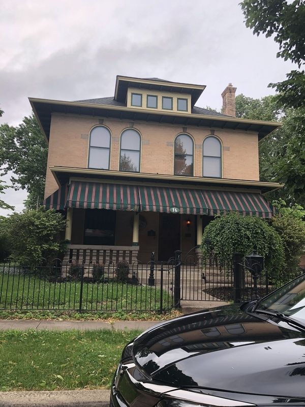
By Duane and Tracy Marsteller, May 26, 2024
Berry-Shade House Marker
201 ► Ohio, Franklin County, Canal Winchester — Berry-Shade House —  |
| On West Mound Street west of North High Street, on the right when traveling west. | |||
| 202 ► Ohio, Franklin County, Canal Winchester — C.P. Rees House — |
| On West Mound Street at Elm Street, on the right when traveling west on West Mound Street. | |||
| 203 ► Ohio, Franklin County, Canal Winchester — Carty-Tussing House — |
| On Elm Street at West Oak Street, on the right when traveling south on Elm Street. | |||
| 204 ► Ohio, Franklin County, Canal Winchester — Columbus, Hocking Valley and Toledo Railway Depot — |
| On North High Street at West Oak Street, on the right when traveling south on North High Street. | |||
| 205 ► Ohio, Franklin County, Canal Winchester — David's Evangelical Lutheran Church — |
| On Elm Street at West Mound Street, on the right when traveling south on Elm Street. | |||
| 206 ► Ohio, Franklin County, Canal Winchester — Fenstermaker House — |
| On East Mound Street east of North High Street, on the left when traveling east. | |||
| 207 ► Ohio, Franklin County, Canal Winchester — Franklin Hills Cemetery Veterans Section — |
| On Winchester Southern Road near Elder Road, on the right when traveling south. | |||
| 208 ► Ohio, Franklin County, Canal Winchester — Game-Himrod House — |
| On West Mound Street west of North High Street, on the left when traveling west. | |||
| 209 ► Ohio, Franklin County, Canal Winchester — Helpman-Chaney House — |
| On West Columbus Street west of Clinton Street when traveling west. | |||
| 210 ► Ohio, Franklin County, Canal Winchester — Interurban Railway — 1904 - 1930 — |
| On South High Street at West Waterloo Street, on the right when traveling south on South High Street. | |||
| 211 ► Ohio, Franklin County, Canal Winchester — Interurban Railway — 1904 - 1930 — |
| On South High Street at East Waterloo Street, on the right when traveling north on South High Street. | |||
| 212 ► Ohio, Franklin County, Canal Winchester — James Griffith House — |
| On Washington Street 0.1 miles south of West Columbus Street, on the right when traveling south. | |||
| 213 ► Ohio, Franklin County, Canal Winchester — Leckner-Miller House — |
| On North High Street north of West Waterloo Street, on the left when traveling north. | |||
| 214 ► Ohio, Franklin County, Canal Winchester — Madison Grange No. 194 and Shop — |
| On North High Street at West Alley, on the right when traveling north on North High Street. | |||
| 215 ► Ohio, Franklin County, Canal Winchester — Methodist Church Parsonage — |
| On West Columbus Street west of Liberty Street, on the left when traveling west. | |||
| 216 ► Ohio, Franklin County, Canal Winchester — Peoples Bank Company Building — |
| On North High Street at West Waterloo Street, on the right when traveling south on North High Street. | |||
| 217 ► Ohio, Franklin County, Canal Winchester — Peter Ehrenhart House and Shop — |
| On North High Street at East Mound Street, on the right when traveling north on North High Street. | |||
| 218 ► Ohio, Franklin County, Canal Winchester — Phillip Game House — |
| On North High Street at West Mound Street, on the left when traveling north on North High Street. | |||
| 219 ► Ohio, Franklin County, Canal Winchester — Tallman-G. Hathaway-Heffley House — |
| On North High Street north of West Waterloo Street, on the left when traveling north. | |||
| 220 ► Ohio, Franklin County, Canal Winchester — 108-25 — The Interurban Depot — |
| Near Towing Path. | |||
| 221 ► Ohio, Franklin County, Canal Winchester — Veterans Memorial — |
| On Winchester Southern Road NW (Ohio Route 674) 0.5 miles south of Lithopolis Road NW, on the right when traveling south. | |||
| 222 ► Ohio, Franklin County, Canal Winchester — William King House — |
| On East Waterloo Street at North Trine Street, on the right when traveling west on East Waterloo Street. | |||
| 223 ► Ohio, Franklin County, Canal Winchester — Wood Family Office — 35 N. High St. — |
| On North High Street north of Cherry Alley, on the right when traveling north. | |||
| 224 ► Ohio, Franklin County, Canal Winchester — Zarbaugh-Arnold House — |
| On North High Street at West Mound Street, on the left when traveling north on North High Street. | |||
| 225 ► Ohio, Franklin County, Canal Winchester, Ashbrook Village — 17-25 — Bergstresser/Dietz Covered Bridge — 1887-1991 — |
| On Washington Street at Ashbrook Road, on the right when traveling south on Washington Street. | |||
| 226 ► Ohio, Franklin County, Canal Winchester — Canal Winchester High School Veterans Memorial — |
| On Washington Street at Dietz Drive, on the right when traveling south on Washington Street. | |||
| 227 ► Ohio, Franklin County, Canal Winchester, South Columbus — Canal Winchester — |
| On West Oak Street near North High Street, on the right when traveling west. | |||
| 228 ► Ohio, Franklin County, Canal Winchester, South Columbus — 26-25 — Canal Winchester and the Ohio and Erie Canal — |
| On South High Street, on the right when traveling north. | |||
| 229 ► Ohio, Franklin County, Canal Winchester, South Columbus — Canal Winchester Veterans Memorial — |
| Near Cemetery Road. | |||
| 230 ► Ohio, Franklin County, Canal Winchester, South Columbus — Canal Winchester Vietnam Veterans Memorial — |
| Near Cemetery Road, on the left when traveling east. | |||
| 231 ► Ohio, Franklin County, Canal Winchester, South Columbus — Faith United Methodist Church — |
| On West Columbus Street at High Street, on the left when traveling west on West Columbus Street. | |||
| 232 ► Ohio, Franklin County, Canal Winchester, South Columbus — Ohio's Oldest Active School — |
| On Washington Street at Franklin Street, on the right when traveling south on Washington Street. | |||
| 233 ► Ohio, Franklin County, Canal Winchester, South Columbus — 126-25 — Old Canal Winchester School (1862 - 2007) — |
| On Washington Street just north of Franklin Street, on the left when traveling north. | |||
| 234 ► Ohio, Franklin County, Canal Winchester, South Columbus — Prentiss School No. 8 — |
| On West Oak Street near North High Street, on the right when traveling west. | |||
| 235 ► Ohio, Franklin County, Canal Winchester, South Columbus — Pvt. Alfred Cannon — |
| On North High Street at Oak Street, on the left when traveling north on North High Street. | |||
| 236 ► Ohio, Franklin County, Canal Winchester, South Columbus — Stradley Place — |
| On High Street 0.1 miles south of Waterloo Street, on the right when traveling south. | |||
| 237 ► Ohio, Franklin County, Columbus, Airport — 94-25 — Original Port Columbus Airport Terminal — 1929-1958 — |
| On Fifth Avenue, on the right when traveling east. | |||
| 238 ► Ohio, Franklin County, Columbus, Arena District — Columbus' First Professional Game — April 25, 1876 — |
| On Neil Avenue at Nationwide Boulevard, on the left when traveling north on Neil Avenue. | |||
| 239 ► Ohio, Franklin County, Columbus, Arena District — Columbus Union Station Arch — |
| On John H McConnell Boulevard at West Nationwide Boulevard, on the left when traveling south on John H McConnell Boulevard. | |||
| 240 ► Ohio, Franklin County, Columbus, Arena District — Confederate General John Hunt — |
| On West Spring Street at West Street, on the right when traveling east on West Spring Street. | |||
| 241 ► Ohio, Franklin County, Columbus, Arena District — 33-25 — General John Hunt Morgan, CSA / Morgan's Escape — |
| On West Street at Spring Street (U.S. 33), on the right when traveling south on West Street. | |||
| 242 ► Ohio, Franklin County, Columbus, Arena District — Harold M. Cooper — |
| On Neil Avenue at Nationwide Boulevard, on the left when traveling north on Neil Avenue. | |||
| 243 ► Ohio, Franklin County, Columbus, Arena District — Native Americans — |
| On Long Street (U.S. 33), on the left when traveling east. | |||
| 244 ► Ohio, Franklin County, Columbus, Arena District — The Clippers — 1977- — |
| On Neil Avenue at Nationwide Boulevard, on the left when traveling north on Neil Avenue. | |||
| 245 ► Ohio, Franklin County, Columbus, Arena District — The Columbus Buckeyes — 1883-84, 1889-91 — |
| On Neil Avenue at Nationwide Boulevard, on the left when traveling north on Neil Avenue. | |||
| 246 ► Ohio, Franklin County, Columbus, Arena District — The Columbus Senators — 1900-1930 — |
| On Neil Avenue at Nationwide Boulevard, on the left when traveling north on Neil Avenue. | |||
| 247 ► Ohio, Franklin County, Columbus, Arena District — 42-25 — The Irish in Columbus — |
| On John McConnell Boulevard at Spring Street (U.S. 33), on the right when traveling north on John McConnell Boulevard. | |||
| 248 ► Ohio, Franklin County, Columbus, Arena District — The Jets — 1955-1970 — |
| On Neil Avenue at Nationwide Boulevard, on the left when traveling north on Neil Avenue. | |||
| 249 ► Ohio, Franklin County, Columbus, Arena District — The Negro Leagues in Columbus — 1900, 1908, 1921, 1930, 1932-33, 1935 — |
| On Neil Avenue at Nationwide Boulevard, on the left when traveling north on Neil Avenue. | |||
| 250 ► Ohio, Franklin County, Columbus, Arena District — The Ohio Penitentiary — |
| On West Spring Street at West Street, on the right when traveling west on West Spring Street. | |||
| 251 ► Ohio, Franklin County, Columbus, Arena District — The Railroads — |
| On Long Street (U.S. 33), on the left when traveling east. | |||
| 252 ► Ohio, Franklin County, Columbus, Arena District — The Red Birds — 1931-1954 — |
| On Neil Avenue at Nationwide Boulevard, on the left when traveling north on Neil Avenue. | |||
| 253 ► Ohio, Franklin County, Columbus, Arena District — The Western League — 1892, 1896-99 — |
| On Neil Avenue at Nationwide Boulevard, on the left when traveling north on Neil Avenue. | |||
| 254 ► Ohio, Franklin County, Columbus, Arena District — Tragedy and the Demise of the Ohio Penitentiary — |
| On West Spring Street at West Street, on the right when traveling east on West Spring Street. | |||
| 255 ► Ohio, Franklin County, Columbus, Arena District — Transportation, Growth, and Development — |
| On Long Street (U.S. 33) at Neil Avenue, on the left when traveling east on Long Street. | |||
| 256 ► Ohio, Franklin County, Columbus, Brewery District — A Hive's Lifecycle — exploring the nature of change — |
| Near Lower Scioto Greenway west of West Whittier Street, on the right when traveling west. | |||
| 257 ► Ohio, Franklin County, Columbus, Brewery District — An Ecological Restoration Story — Teaming Up to Support Biodiversity — |
| Near West Whittier Street west of Maier Place, on the right when traveling west. | |||
| 258 ► Ohio, Franklin County, Columbus, Brewery District — Heather’s Tree — The Roots of the Grange Insurance Audubon Center — |
| Near West Whittier Street west of South Front Street. | |||
| 259 ► Ohio, Franklin County, Columbus, Brewery District — 57-25 — Trinity Lutheran Seminary — |
| On High Street (U.S. 23) at Stimmel Street, on the right when traveling south on High Street. | |||
| 260 ► Ohio, Franklin County, Columbus, Brookside Woods — The Old Church Bell — |
| On Bent Tree Boulevard at Federated Boulevard, on the right when traveling east on Bent Tree Boulevard. | |||
| 261 ► Ohio, Franklin County, Columbus, Central Clintonville — Clintonville / Clinton Township — |
| On North High (U.S. 23) at East North Broasway, on the right when traveling north on North High. | |||
| 262 ► Ohio, Franklin County, Columbus, Clintonville — Clinton Township High School / East North Broadway Historic District — A New Marker, Also a Replacement — |
| On East North Broadway, on the right when traveling east. | |||
| 263 ► Ohio, Franklin County, Columbus, Clintonville — East North Broadway Historic District — An Historic Neighborhood in Columbus, Ohio |
| On East North Broadway, on the right when traveling east. Reported permanently removed. | |||
| 264 ► Ohio, Franklin County, Columbus, Clintonville — Truman & Sylvia Bull Coe House — |
| On East Lakeview Avenue 0.1 miles east of North High Street, on the right when traveling east. | |||
| 265 ► Ohio, Franklin County, Columbus, Dennison Place — 51-25 — First Modern Streamflow Measurement in Ohio — |
| On King Avenue at the Olentangy River, on the right when traveling east on King Avenue. | |||
| 266 ► Ohio, Franklin County, Columbus, Dennison Place — The King Avenue Bridge — A Brief History — |
| On King Avenue. | |||
| 267 ► Ohio, Franklin County, Columbus, Discovery District — Always CMA — 2020 — Melissa Vogley Woods, American, born 1968 — |
| On North Washington Avenue south of East Gay Street, on the right when traveling south. | |||
| 268 ► Ohio, Franklin County, Columbus, Discovery District — Always CMA — 2020 — Melissa Vogley Woods, American, born 1968 — |
| On North Washington Avenue south of East Gay Street, on the right when traveling south. | |||
| 269 ► Ohio, Franklin County, Columbus, Discovery District — Broad Street United Methodist Church — |
| On East Broad Street (U.S. 62) at South Washington Avenue, on the right when traveling east on East Broad Street. | |||
| 270 ► Ohio, Franklin County, Columbus, Discovery District — 97-25 — Columbus Main Library / Judge Noah Swayne Home — |
| On Library Park North, on the right when traveling east. | |||
| 271 ► Ohio, Franklin County, Columbus, Discovery District — 13-25 — Deaf School Park — |
| On Town Street, on the left when traveling east. | |||
| 272 ► Ohio, Franklin County, Columbus, Discovery District — Deaf School Park Topiary Garden: 'A Sunday Afternoon on the Ile de la Grande Jatte' — |
| On East Town Street west of South Washington Street, on the right when traveling west. | |||
| 273 ► Ohio, Franklin County, Columbus, Discovery District — Donn Vickers Gazebo in Thurber Park |
| On Jefferson Avenue north of Willow Street, in the median. Reported permanently removed. | |||
| 274 ► Ohio, Franklin County, Columbus, Discovery District — Donn Vickers Gazebo in Thurber Park — |
| On Jefferson Avenue at East Broad Street (U.S. 40), on the right when traveling north on Jefferson Avenue. | |||
| 275 ► Ohio, Franklin County, Columbus, Discovery District — Elaine Hastings Mason — |
| On East Town Street west of South Washington Street, on the right when traveling west. | |||
| 276 ► Ohio, Franklin County, Columbus, Discovery District — Elijah Pierce — |
| On Long Street at Washington Avenue, on the left when traveling east on Long Street. | |||
| 277 ► Ohio, Franklin County, Columbus, Discovery District — First Congregational Church — |
| On North 9th Street at East Broad Street (U.S. 62), on the left when traveling north on North 9th Street. | |||
| 278 ► Ohio, Franklin County, Columbus, Discovery District — 75-25 — George Bellows / Roy Lichtenstein — |
| On East Broad Street (U.S. 40) at Washington Avenue, on the right when traveling west on East Broad Street. | |||
| 279 ► Ohio, Franklin County, Columbus, Discovery District — Home Site of Henry Howe — Historian — 1816 — 1893 — |
| On North 9th Street at Old National Road (U.S. 40), on the left when traveling north on North 9th Street. | |||
| 280 ► Ohio, Franklin County, Columbus, Discovery District — 78-25 — James Thurber — |
| On Jefferson Avenue, on the right when traveling south. | |||
| 281 ► Ohio, Franklin County, Columbus, Discovery District — Kelton House — Historic Underground Railroad Site — |
| On East Town Street east of South Washington Avenue, on the left when traveling east. | |||
| 282 ► Ohio, Franklin County, Columbus, Discovery District — 119- 25 — Snowden- Gray House — |
| On East Town Street, on the right when traveling west. | |||
| 283 ► Ohio, Franklin County, Columbus, Discovery District — 73-25 — St. Patrick Church / St. Patrick College and Aquinas College High School — |
| On Grant Street at Naghten Street, on the right when traveling north on Grant Street. | |||
| 284 ► Ohio, Franklin County, Columbus, Discovery District — Topiary Garden — |
| On East Town Street at South Washington Avenue, on the right when traveling west on East Town Street. | |||
| 285 ► Ohio, Franklin County, Columbus, Discovery District — Topiary Garden — |
| On Town Street west of South Washington, on the left when traveling east. | |||
| 286 ► Ohio, Franklin County, Columbus, Discovery District — Topiary Garden — |
| On East Town Street at South Washington Avenue, on the right when traveling west on East Town Street. | |||
| 287 ► Ohio, Franklin County, Columbus, Discovery District — Topiary Garden — |
| On East Town Street at South Washington Avenue, on the right when traveling west on East Town Street. | |||
| 288 ► Ohio, Franklin County, Columbus, Discovery District — Topiary Garden — |
| On South Washington Avenue at East Town Street, on the right when traveling south on South Washington Avenue. | |||
| 289 ► Ohio, Franklin County, Columbus, Discovery District — Washington Gladden — |
| On East Broad Street (U.S. 40/62) at Cleveland Avenue ( Route 3), on the right when traveling west on East Broad Street. | |||
| 290 ► Ohio, Franklin County, Columbus, Discovery District — Wesley Chapel Methodist Church — |
| On East Broad Street (U.S. 40) at South Washington Street, on the right when traveling east on East Broad Street. | |||
| 291 ► Ohio, Franklin County, Columbus, Downtown — America’s Pioneer Kindergarten — |
| On East Rich Street, on the left when traveling west. | |||
| 292 ► Ohio, Franklin County, Columbus, Downtown — American Federation of Labor — Since 1881 — |
| On S. 4th St. (U.S. 23) 0.4 miles south of E. Town St., on the right when traveling north. | |||
| 293 ► Ohio, Franklin County, Columbus, Downtown — 105-25 — American Federation of Labor / United Mine Workers of America — |
| On Long Street (U.S. 33) at Front Street on Long Street. | |||
| 294 ► Ohio, Franklin County, Columbus, Downtown — Big Branch Coal Mines Memorial — |
| On West Long Street (U.S. 33) west of Marconi Boulevard, on the left when traveling north. | |||
| 295 ► Ohio, Franklin County, Columbus, Downtown — 32-25 — Birthplace of the Veterans of Foreign Wars — |
| On East Main Street east of South 5th Street, on the left when traveling east. | |||
| 296 ► Ohio, Franklin County, Columbus, Downtown — Broad Street Bridge — The Historic National Road in Ohio — |
| On West Broad Street Old National Road (U.S. 40) at Washington Blvd, on the right when traveling east on West Broad Street Old National Road. | |||
| 297 ► Ohio, Franklin County, Columbus, Downtown — Celebration of Life — The Arthur Boke and Sarah Sullivant Statue Project — |
| On Broad Street (U.S. 40) at Washington Boulevard, on the right when traveling west on Broad Street. | |||
| 298 ► Ohio, Franklin County, Columbus, Downtown — Central High School — The Historic National Road in Ohio — |
| On West Broad Street Old National Road (U.S. 40) at Washington Blvd, on the right when traveling east on West Broad Street Old National Road. | |||
| 299 ► Ohio, Franklin County, Columbus, Downtown — 120-25 — Columbus Civic Center Historic District — |
| On West Main Street (Ohio Route 3) at West Rich Street (U.S. 62), on the right when traveling east on West Main Street. | |||
| 300 ► Ohio, Franklin County, Columbus, Downtown — Crossroads of Commerce — |
| On East Town Street at South 5th Street, on the left when traveling east on East Town Street. | |||
1488 entries matched your criteria. Entries 201 through 300 are listed above. ⊲ Previous 100 — Next 100 ⊳