This final resting place of early Closter settlers was established by Barent and Resolvert Nagel on their 1,030-acre tract jointly purchased in 1710. The first burial is believed to be Jan Adriansen, c. 1721. The Nagel brothers divided their land . . . — — Map (db m63546) HM
Built about 1745 on land purchased in 1710 by Barent and Resolvert Nagel. The frame wing was added later. Owned by Barent’s son John by 1754 and later by grandson David Naugle, a militiaman during the Revolutionary War. In about 1784 David built a . . . — — Map (db m7910) HM
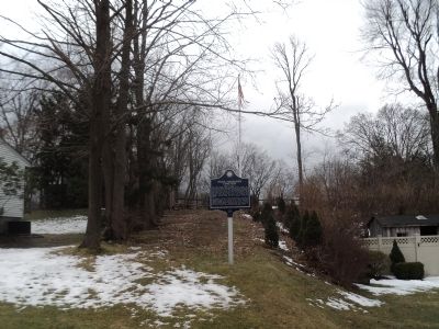
Established as the “Protestant Reformed Dutch Church of Closter City”, it was the first church erected in the Borough of Closter. Dedicated October 7, 1862, tradition says the church was the headquarters of the “Harrington Rifles”, a group of . . . — — Map (db m7917) HM
He saw the redcoats on the eastern hills. This Closterman who galloped through the mist to warn the troops encamped down the road at Fort Lee. His plow horse carrying him to glory on the most important ride in history, the hinge on which the door . . . — — Map (db m63549) HM
This active graveyard dates to the earliest settlement period of Closter’s history. Documented burials date to circa 1722 and include Dutch pioneer families with names like Vervalen, Naugle (Nagle), DeClark, Ferdon, Parsells, Auryansen, Demarest, . . . — — Map (db m63551) HM
In 1795 Walter Parcells, a mason, erected this house of local stone on 34 acres of land on what was then known as Closter New Road. Built in the Federal style, it is 1½ stories high with a gambrel style roof. The frame wing was added later and . . . — — Map (db m7915) HM
The main wing of this house was built in 1808 by Benjamin P. Westervelt who served in the local militia during the Revolution. The site of this house has been continuously owned by the Westervelt family since early colonial times. General Erskine’s . . . — — Map (db m7207) HM
Established A.D. 1917 for use in connection with the port of embarkation at Hoboken New Jersey.
Named in honor of Major-General Wesley Merritt
Continously in service of his country July 1, 1855 to June 16, 1900 — — Map (db m7495) HM
In memory of those soldiers who gave their lives for their country while on duty in Camp Merritt.
This monument marks the center of the camp and faces the highway over which more than a million American soldiers passed on their way to and from . . . — — Map (db m7496) HM
In 1776, a 180 acre farm here was owned by Loyalist John Ackerson. It extended from the Tenakill to the Hudson, bordered on the north by the road used by British invaders that year. Seized as enemy property, it was bought in 1784 by Militia Captain . . . — — Map (db m7212) HM
In colonial times a crude road led from here to a landing at the Hudson River. According to the reports and maps of Generals Erskine and Wayne this road was used by Cornwallis in attacking Fort Lee on November 20, 1776. On May 10, 1779 it was used . . . — — Map (db m7206) HM
Built 1872 at “Demarests Station” on the Northern Railroad of New Jersey. Designed by noted architect J. Cleveland Cady, it was considered the “handsomest on the line.” The depot was built of Palisades stone quarried on the . . . — — Map (db m7508) HM
“Here lies the remains of Douwe Talema, who died on the 11th day of May 1779 in his Ninetieth Year. This aged Man at his Residence near this Place was wilfully and barbarously murdered by a Party of Tories. Traitors to their country who . . . — — Map (db m63547) HM
Sautes Tave’s Begraven Ground Pre-Revolutionary Cemetery Placed by David Demarest Chapter Daughters of the American Revolution May 30th, 1957 — — Map (db m63548) HM
This example of Dutch Colonial architecture was built between 1780-1790 by Derick Banta, soldier in the American Revolution, after his birthplace here was burned by Tories. Owned by the Quackenbush family from 1792, it was sold to Isaac Dixon in . . . — — Map (db m7507) HM
In grateful remembrance
of the
Citizens of Dumont
who so nobly answered their country’s call to arms to fight in the Great War for Liberty and Democracy
1917 - 1919
[A list of names follow]
Along this road Washington and his . . . — — Map (db m7512) WM
Organized in 1723 as the Schraalenburgh Reformed Dutch Church. First church was built in 1728. In 1801 the present Old North Reformed Church was built, one mile north of first site, and continues as a Reformed congregation. This sanctuary is . . . — — Map (db m7486) HM
In the time of the revolution, the road turned here and followed the brook to Peter Burdett’s ferry, the important Hudson River approach to General Nathaniel Greene’s encampment at Fort Lee, on the hill, and the connecting link with the American . . . — — Map (db m22101) HM
Lest We Forget
This Memorial
Is Dedicated To
The Residents
Of The Borough
Of Edgewater
Who Served
In Defense Of
Our Country
During The
Period Of The
Southeast
Asian Conflict
May 28, 1973
In Memory Of
Edward . . . — — Map (db m38962) HM
* Farrell J.P. • * Murphy M. • * Regan W. • * Weir G.H. • Zaikowski A. • Allen Jack • Adams H. • Aarons S.M. • Burns Leroy • Bernhardt W. • Buckley Leo • Bobat S. • Baker Wm. • Berton G. • Burns B. • Blaustein M. • Blaustein H. • Bilanti A. • . . . — — Map (db m38964) WM
In Memory of the Men Of
Edgewater, N.J.
Who Gave Their Lives
For Their Country
In World War II
Paul O. Allen • William E. Barber • William J. Conway • John J. Delaney • John F. Eager • Robert M. English • Benjamin L. Godleski • Alonza H. . . . — — Map (db m38960) HM
Built for the Hoboken Ferry Company and launched in 1905, it plied the Hudson River between Hoboken and Manhattan (Barclay St.) for 62 years. This double-ender steamboat was designed to carry 986 passengers and a number of vehicles. It was in . . . — — Map (db m9528) HM
Dedicated to
Tsunesaburo Makiguchi
Visionary teacher and child advocate.
He founded the Soka Gakkai in 1930 to
promote humanistic education education based
on Buddhist principles. He was arrested
for opposing the Japanese military . . . — — Map (db m38963) HM
"Vriessendael"
1640
Colony of David DeVries
The first known colony in present Bergen County was founded in 1640 by David Pietersz DeVries, a Dutch explorer, sea captain and patroon. Then part of New Netherland, the plantation included the . . . — — Map (db m38959) HM
Built c. 1782 by Cornelius J. Van Houten as an addition to the earlier house of his father, John C. Van Houten. Located in “Slotterdam”, the farm stretched between the Passaic and Saddle Rivers and was raided during the Revolutionary . . . — — Map (db m43782) HM
Let Us Hold in Honored Memory Those Who Served Their Country In the Great War 1914 -1918
[Column A:]
Reginald S. Aberle • Frank Aurricchio • Anthony Bamond • Frederick Block • Dominick Brescia • Anthony Decker • Frank Decker • Charles . . . — — Map (db m22165) WM
An area which in colonial times included part of Emerson, Kinderkamack extended southward into part of River Edge. The name is found recorded as early as 1686. This portion became Etna in the late 19th century and Emerson in 1909. The road which . . . — — Map (db m8634) HM
Built in 1860 on Palisade Avenue as “The Englewood Presbyterian Church”, it was the first church established in the city. A new, larger church was built on the original site and the old building was taken down, stone by stone, and re-erected at . . . — — Map (db m7011) HM
Built about 1808 by Henry DeMott, this sandstone Dutch Colonial house was once attached to the pre-Revolutionary homestead of Albert Lydecker. Material from the older house used in the present frame wing built c. 1810 by Peter Westervelt. The . . . — — Map (db m7133) HM
This former school was originally built in 1818 near the Liberty Pole Tavern. In 1850 it was moved here and rebuilt with the original materials. This part of Englewood was then known as Highwood. The name Englewood School was adopted in 1897. It . . . — — Map (db m7129) HM
Organized in 1860 as “The Englewood Presbyterian Church”, the first edifice was erected on this site in the same year. It was the first church building in Englewood and the first Presbyterian congregation in Bergen County. Today’s structure was . . . — — Map (db m6970) HM
Built c. 1800 by John G. Benson, a farmer, and from 1794 to 1797, a captain in the militia. This house, an example of post-Revolutionary War Dutch Colonial architecture, was built on property confiscated by New Jersey from the Reverend Garret . . . — — Map (db m7009) HM
This area named for a Liberty Pole erected here before the Revolution. The strategic junction was the scene of many American and British troop movements, including the 1776 retreat of the Continental Army from Fort Lee, and British activity in 1776 . . . — — Map (db m7012) HM
Organized in 1865, the congregation first met in homes and in the armory on Van Brunt St. The original church was built in 1866. The present chapel was erected in 1895 as a parish hall. Today’s Gothic church structure, built in 1899, has the rose . . . — — Map (db m7010) HM
This photograph was taken here at “Bloomer’s Beach” in the summer of 1932. From the Park’s Annual Report for that year: “The bathing beaches and bath houses were open to the public from the latter part of May until Labor Day. . . . — — Map (db m64906) HM
Dedicated to
Laurance Spelman Rockefeller
in recognition of his devoted service to the Palisades Interstate Park Commission from 1939 to 1979. His leadership in the conservation of America’s natural resources and his generosity are timeless . . . — — Map (db m163223) HM
Named for
John D. Rockefeller, Jr.
in recognition of his public spirited desire to preserve the palisades in their natural beauty
His far-sighted conception of a great parkway opening the area to the public and his generosity which helped . . . — — Map (db m163101) HM
Section 1:
Now a public garden and cultural center, Wave Hill, with its sweeping views of the Palisades, was a summer home to the family of future United States president Theodore Roosevelt and later to author Mark Twain.
In 1900, when he was . . . — — Map (db m163379) HM
For centuries, the PALISADES – ancient columns of igneous rock that rises hundreds of feet above the Hudson River – have inspired poets and painters with their loft grandeur. Here, quaint fishermen’s villages once dotted the shores below, while . . . — — Map (db m162914) HM
Built about 1806 by Jacob Haring and purchased by Thomas Cadmus in 1816. He was a farmer who owned adjacent land and today the house is known by his name. There were many later owners and in the 1920s it became a commercial property. The two-room . . . — — Map (db m62967) HM
This Park is dedicated
As a living memorial
to those of Fair Lawn
who made the supreme sacrifice
in
defense of their country
the United States of America
Dedicated May 29, 1949
— — Map (db m143691) WM
This plaque is dedicated to the millions who perished because of hate and intolerance, and the millions who gave their lives defending humanity in the war from 1939-1945. Those who forget history are bound to repeat it.
Presented to: The Borough . . . — — Map (db m63374) WM
WORLD WAR I
Harry Cappendycke - Army - Oct. 8, 1918
Daniel S. Yeomans - Army - Oct. 8, 1918
Charles Marshner - Army - Oct. 14, 1918
WORLD WAR II
Ellsworth Smith - Army - Sep. 9, 1942
William M. Cozine Jr. - Air Force - Feb. 6, 1943 . . . — — Map (db m63380) WM
"Set your goals high. Work hard and believe in yourself and you can be whatever you want." Mary Ann Collura.
Dedicated by the grateful Residents of Bergen County — — Map (db m63048) HM
Dedicated to the memory of the
men and women of Jewish faith
who gave their lives in the
service of their country.
Placed in their memory by the
Lt. James I. Platt Post No. 651
Jewish War Veterans
of the United States
August 19, . . . — — Map (db m63528) WM
Reflecting the need for additional river crossings as the area grew in the late 19th century, the contract for the original bridge was awarded in July 1890 to Riverside Bridge and Iron Works of Paterson, N.J. for $8,895. This original bridge was . . . — — Map (db m62435) HM
This colonial home was built in the 18th century by a Naugle. He was said to have been a paymaster in Layayette’s Light Division. The house served as a landmark on many Revolutionary War maps. It is believed that Lafayette visited here in 1824. . . . — — Map (db m63050) HM
Radburn Station, located in the Borough of Fair Lawn, was built in 1930 and designed by the architect Clarence S. Stein. Stylistically, the building is significant since the station is a fine example of the Dutch Colonial Revival trend in . . . — — Map (db m62968) HM
One of the last farmsteads in Fair Lawn stood on this site. The house built by Henry A. Hopper in 1855 was razed for road improvement in 1989. He was a Sheriff and Freeholder of Bergen County and served in the State Legislature. In 1919 William M. . . . — — Map (db m63049) HM
On this site stood what was known as
"The Slave House"
Part of the Acker estate "Fair Lawn" from which the borough received its name. The "Slave House" was built much earlier than the 1865 Acker home and may have been used as a shelter for . . . — — Map (db m63295) HM
This piece of steel from the World Trade Center is in memory of those residents who perished that day and to the brave men and women who gave their lives to save so many others.
Their courage and love of our country will be a source of strength . . . — — Map (db m63391) WM
Included in the New Jersey Register of Historic Places and National Register of Historic Places, Radburn achieved its special place in the realm of community planning and architecture as a forerunner in new town planning and cluster development. . . . — — Map (db m63527) HM
Erected in Lasting
Memory of Those
Who Lost Their Lives
On September 11, 2001
Roko Camaj – Age 60 – Tower 2
Danny A. Correa-Gutierrez – Age 25 – Tower 1
Christian L. Desimone – Age 23 – Tower 1
Jeremy Glick – Age 31 – UA Flight 93 . . . — — Map (db m196018) HM
1894
This Monument
Dedicated May 30, 1954
To Honor the Memory of
The Deceased Members of the
Volunteer Fire Department
Borough of Fairview, N.J.
Erected by the Volunteer Fire Department — — Map (db m196024) HM
In Memory of
Our Departed Comrades
Who Died Defending America’s Freedom
World War I
Albert Arbogast · Joseph Bonin · Salvatore Giammarco · James Masso · Angelo Nunziato · Charles Pouzenc · Peter Radvanzsky · Charles Ress · Julius Zannette . . . — — Map (db m196022) WM
Fortifications were protected by obstacles, such as an abatis, or other major hindrances to assaulting troops. They were easily placed before a parapet, or breastwork, wherever trees were plentiful and were used to supplement defensive rampart . . . — — Map (db m7735) HM
In 1911, the Société Francaise des Films et Cinematographs Éclair purchased land on the west side of Linwood Avenue for the construction of a motion picture studio in downtown Fort Lee. Éclair was a manufacturer of film and film . . . — — Map (db m54901) HM
The word “cannon” is derived from the Latin canna, meaning tube, pipe or gun and dates back to the 13th Century. In the 1400’s, the term described a cylinder made from iron bars “soldered” together and fortified with . . . — — Map (db m7737) HM
Christopher Columbus Memorial Plaza Dedicated Oct. 11, 1971 Leonardo da Vinci Society Bergen County New Jersey ( Lower Plaques : ) Granite Monument donated by Anthony K. Macagna Bronze sculpture donated by Adeline Bracco in memory of . . . — — Map (db m62906) HM
Killed in the Line of Duty at the Evans Film Fire – February 7th, 1925 Linwood Ave. & Main St. • Fort Lee, N.J. On Saturday, February 7, 1925 the department responded to a fire at the National Evans Film Laboratory located at . . . — — Map (db m54910) HM
Beneath these cliffs, Henry Hudson’s Half-Moon was welcomed by the Lenni Lenape Indians on September 3, 1609.
Nearly 167 years later, this giant Bluff Rock became a strategic stronghold in the American War for Independence as the conflict . . . — — Map (db m7707) HM
Fort Lee Road (Main Street) was the main roadway to General Washington’s Headquarters in Hackensack. Supplies and men were in constant movement on the road to re-supply Fort Washington in New York. The Continental Army began it’s “Retreat to . . . — — Map (db m7657) HM
General Washington was in Fort Lee many times during the Battle of New York. His main headquarters was in Hackensack, but had a temporary headquarters in Fort Lee near Anderson Avenue and Elizabeth Street. His main objective in Fort Lee was to . . . — — Map (db m7647) HM
General Knox was the Commander of the Continental Army Artillery. He was in charge of the placement of the artillery cannons on the palisades in Fort Lee. His main objective was to stop the British fleet from sailing up the Hudson River. He was one . . . — — Map (db m7650) HM
General Gates was commissioned a Brigadier General and was appointed Adjutant General of the Continental Army in 1775 by orders of General Washington. He was in Fort Lee with General Washington in October 1776. — — Map (db m7652) HM
Fort Lee was constructed by General Mercer on October 18, 1776 on orders from General George Washington. Originally called Fort Constitution, it was re-christened Fort Lee in honor of General Charles Lee, second in command of the Continental Army, . . . — — Map (db m7653) HM
Spanish American War
Mexican Expedition
General of the Armies
World War I
Attended the dedication of Monument Park as keynote speaker in 1908 — — Map (db m7656) HM
General Greene took command of Fort Lee on September 17, 1776 from General James Iwing. At that time there were around 2,667 troops stationed in Fort Lee. The encampment was the main quartermaster post for supplying men and equipment to Fort . . . — — Map (db m7648) HM
(1) July 12 - Fort Lee’s fortifications laid out. Together with Fort Washington on the opposite bank and aided by a river barrier, the twin fortresses are intended to thwart British control of the Hudson.
(2) July 12 - General Howe’s forces . . . — — Map (db m189474) HM
This American Liberty Elm was named after “The Liberty Tree: Our Country’s first Symbol of Freedom.” On the morning of August 14, 1765, the people of Boston awakened to discover two effigies suspended from an elm tree in protest of the . . . — — Map (db m70392) HM
The military magazine derives its name from the Arabic word, “Makhazin”, meaning granary, or storehouse. Revolutionary War magazines were constructed with emphasis on fire and waterproofing, easy accessibility to the guns serviced and . . . — — Map (db m7742) HM
Mortar shells from this battery plummeted down in high soaring arcs upon the warships, tearing through the canvas sails and bursting upon the wooden deck.
This mortar battery, joined with heavy guns on both sides of the River, made running the . . . — — Map (db m7705) HM
This defensive breastwork was built on the western edge of the bluff and guarded the road from Burdette’s Ferry to the west (to the Bastion). The parapets of timber filled with soil were built upon a stone base and were sufficient height to afford . . . — — Map (db m7710) HM
Old Army Road, now called Palisade Road, was used by General Washington and his staff to reach the palisades for observing movement on the Hudson River crossings and New York. The road was also used to re-supply General Knox’s artillery positioned . . . — — Map (db m7658) HM
Palisades Interstate Park has been designated a Registered National Historic Landmark under the provisions of the Historic Sites Act of August 21, 1935 this site possesses exceptional value in commemorating and illustrating the History of the United . . . — — Map (db m7344) HM
Through the 1890s, quarries blasted the Palisades for stone to make gravel and concrete. The largest of these, Carpenter Brothers’ quarry, was just south of here (background photograph and B). Many thousands of tons of broken rock were taken . . . — — Map (db m47511) HM
On July 12th, 1776, the British warships Phoenix and Rose sailed beneath the unarmed Bluff Rock, later named Fort Lee. This provocative action led Congress to order General Washington “By every art and whatever expense to obstruct effectively . . . — — Map (db m7712) HM
The Solax Studio was built in 1912 by Alice Guy Blaché, who had begun directing films for the Gaumont Company in Paris in 1896. In 1907, Leon Gaumont sent Alice and her new husband, Herbert Blaché, to take charge of Gaumont’s . . . — — Map (db m72627) HM
At Fort Lee, “hutting” – the building of permanent huts – was started at General Greene’s command to:
“Fix proper places for barracks, none to be nearer the fort than 50 rods…build timber huts…boards are to be had only for the roof. The huts . . . — — Map (db m7738) HM
(Front of Monument) :
In commemoration of the Soldiers of the American Revolution - 1776 – Erected by the State of New Jersey under the auspices of the Fort Lee Revolutionary Monument Association - 1908 –
(Left of . . . — — Map (db m7348) HM
These are the times that try men’s souls. The summer soldier and the sunshine patriot will, in this crisis, shrink from the service of their country; but he that stands it now, deserves the love and thanks of man and woman. In celebration of Fort . . . — — Map (db m47538) HM
This battery was believed to be the “Barbette Battery” as its location commanded a large field of fire of the river, stretching North to South from the Chevaux-De-Frise to the Bluff Rock’s southern edge.
A Barbette Battery’s guns fired over a . . . — — Map (db m7740) HM
Author-Soldier
“Common Sense” “American Crisis”
January 10, 1776 December 19, 1776
Thomas Paine volunteered for the Continental Army. He marched to Amboy, New Jersey, located off . . . — — Map (db m7655) HM
Dedicated to the men and women of the United States Army who participated in the Battle of the Bulge during World War II in Belgium and Luxembourg the greatest land battle fought by the United States Army under extreme winter conditions suffering . . . — — Map (db m54913) HM
New Jersey is known as the Crossroads of the American Revolution and this Fort Lee crossroad on Main Street represents one of the most important sites in the United States. Here, on present day Main Street, Major General Nathanael Greene led the . . . — — Map (db m70375) HM
This retreat route on Main Street in Fort Lee, N.J. enabled General George Washington’s army to escape capture from the British and prevent the end of the War for Independence. Patriot and soldier Thomas Paine wrote about his experience in Fort Lee . . . — — Map (db m70376) HM
British Lieutenant General Charles Lord Cornwallis and five thousand of his troops crossed the Hudson River and made their way to Fort Lee from Huyler’s Landing Road on November 20th, 1776. General Nathanael Greene, warned of the invasion by a . . . — — Map (db m70384) HM
The Continental Army’s retreat route ran from the bluffs of Fort Lee’s Palisades, site of the American fortifications and nearby encampment, west on Fort Lee Road (present day Main Street) and continued west through the current towns of Leonia, . . . — — Map (db m70433) HM
The Willat Film Manufacturing Corp. began assembling property at the northwest corner of Main Street and Linwood Avenue in 1913, and by 1915 owned three lots occupying nearly half this block. Carl A. Willatowski, a film pioneer known . . . — — Map (db m54905) HM
Jules Brulatour, who had earned a fortune as the agent for George Eastman’s motion picture film, built the Peerless studio on Lewis Street in 1914. It was the original home of the World Film Corporation, which Brulatour formed with . . . — — Map (db m54909) HM
Built about 1793 by James A. Ackerman on land owned by the family since 1727. The farm was then in the locality known as Ponds Neighborhood and within the old Township of Franklin. In 1841 the house was purchased by Adam Boyd who farmed the land . . . — — Map (db m43853) HM
Originated as an Indian trail across land the Redmen called “Campgaw”. It was surveyed during the Revolutionary War by Robert Erskine, George Washington’s mapmaker, and connected settlements in the Ramapo and Saddle River Valleys. Franklin Lakes . . . — — Map (db m12395) HM
Known to the Indians as “Michanagrape,” these waters were formed by the melting glacier some 10,000 years ago. In 1700 the lake was named Christian Pool when it was included in a land grant to Michael Hawden. Later called Great Pond, . . . — — Map (db m52941) HM
Organized in 1855 as the Methodist Episcopal Church of Campgaw, the first church was built on Circle Ave, in 1856, but was destroyed by fire in 1919. William V. Pulis donated a lot ‘in a most commanding part of the village.’ and the stone church . . . — — Map (db m27048) HM