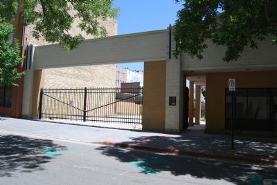
On Regent Street, on the right when traveling north.
This site originally housed two buildings used as brothels on Salt Lake City’s busy Commercial Street during the late 1800’s and early 1900’s. Commercial Street was created in 1871, one of the first streets to be cut through Salt Lake City’s large . . . — — Map (db m35306) HM
On West Broadway just west of West Temple, on the right when traveling west.
Jews have been part of Utah’s religious, economic, social, and political life since the mid-19th century. Congregation B’Nai Israel was organized in 1874. The first service was held in March, 1883. B’Nai Israel merged with Congregation Montefiore in . . . — — Map (db m35792) HM
On South Main Street at South Temple Street, on the right when traveling south on South Main Street.
Utah‘s first public building
The Council House, a sandstone and adobe building designed by Truman O. Angell, was completed on this site in 1851. As the state's first public building, it fulfilled multiple roles, housing
government and . . . — — Map (db m245959) HM
On West 200 South just west of John Stockton Drive (South 300 West) (U.S. 89), on the left when traveling west.
The Crane Company constructed this building in 1910 to house the Salt Lake City branch of its internationally-known valve, engine, plumbing fixture, and heating system business. The company opened its Salt Lake branch in 1902, just a few years . . . — — Map (db m146857) HM
On South Main Street north of South 3rd Street, on the right when traveling south.
This building was constructed in 1902 for David Keith. Keith was another of Utah's mining magnates and a close friend of Thomas Kearns. The two men developed one of the world's most lucrative silver mines, the Silver King in Park City. This building . . . — — Map (db m223414) HM
On Rio Grand Street at Broadway (300 South), on the right when traveling south on Rio Grand Street.
This railroad station was constructed between 1908 and 1910 to serve the Denver and Rio Grande Railroad and the Western Pacific Railroad. The Denver and Rio Grande Railroad was completed between Denver and Salt Lake City in March 1883, and the . . . — — Map (db m34997) HM
On West South Temple Street, on the right when traveling east.
Site of Utah’s first commercial radio broadcast
The stately, six-story office building which once stood on this corner was known at various times as the Deseret News, Oregon-Shortline, and Union Pacific Building, depending on which . . . — — Map (db m245871) HM
On Main Street at 100 South, on the right when traveling south on Main Street.
Built in 1864, the Eagle Emporium Building is the oldest existing commercial building in downtown Salt Lake City. William Jennings, Utah's first millionaire, constructed the building to house his mercantile business. The Eagle Emporium Building was . . . — — Map (db m35804) HM
On South West Temple Street at South University Street, on the right when traveling south on South West Temple Street.
This building was constructed in 1915-16 for the Fraternal Order of Eagles. The architect was Niels Edward Liljenberg, a Swedish immigrant who designed many institutional buildings in Utah. The Eagles Club was one of a number of . . . — — Map (db m257585) HM
On Main Street north of 200 S, on the right when traveling north.
The First National Bank Building features the oldest known cast iron facade in the Intermountain West. It was designed by Richard M. Upjohn, one of America’s most distinguished 19th-century architects. The building originally had a fourth story . . . — — Map (db m35541) HM
On Main Street, on the right when traveling north. Reported permanently removed.
This site, the northeast corner of First South and Main (formerly East Temple Street), was first occupied in the 1850s by an adobe building housing the Hooper & Eldridge bank. This bank was succeeded under territorial law in 1871 by the Bank of . . . — — Map (db m263086) HM
On West Market Street just west of South Main Street, on the left when traveling west.
After Utah became a state in 1896, the Federal Government began planning a building to house federal offices in Salt Lake City. The Treasury Department considered two sites for the building. After vocal opposition from many of Salt Lake City's . . . — — Map (db m146591) HM
On Main Street north of 200 S, on the right when traveling north.
This monument marks the site of the Great Salt Lake City station of the Pony Express, St. Joseph Mo. - Sacramento Cal., inaugurated April 3, 1860. — — Map (db m200663) HM
On West 200 South just east of 400 West, on the right when traveling east.
The Henderson Block was the first produce warehouse constructed along Salt Lake City’s rail lines. This strategic location helped Wilber S. Henderson transform his produce business into one of the largest wholesale grocery companies in the . . . — — Map (db m146860) HM
On West 200 South just east of 400 West, on the right when traveling east.
The Henderson Block was constructed 1897-1898 for Wilber S. Henderson to house his wholesale grocery business. The Three story stone and brick office and warehouse was designed by architect Walter E. Ware. Additions were made to the building in 1931 . . . — — Map (db m146899) HM
On Main Street, on the right when traveling north.
Designed by architect John C. Craig, the Herald Building was constructed in 1905 to house the Salt Lake Herald, a daily newspaper which began publication in June 1870. The Salt Lake Herald ceased publication in 1920. During its existence, the paper . . . — — Map (db m35544) HM
On 300 South at 300 West, on the right when traveling west on 300 South.
The Holy Trinity Greek Orthodox Church is evidence of the size and religious devotion of Salt Lake City's Greek immigrant community. In the early 20th century, Greeks were the largest immigrant group in Utah. Salt Lake City's Greek community was . . . — — Map (db m35696) HM
On 300 West at 300 South, on the right when traveling north on 300 West.
Constructed in the traditional Byzantine style, Holy Trinity held its first service on August 15, 1924. Located in the center of the Salt Lake City immigrant district, the church served Greek miners, railroad and smelter workers and their families. . . . — — Map (db m35285) HM
On 300 West at 300 South, on the right when traveling north on 300 West.
Replaced the First Greek Church in Utah, consecrated in 1905. Designed in the Byzantine tradition, its construction began in July 1923 and was completed in August 1924. Surrounding the church were once many immigrant neighborhoods dependent on the . . . — — Map (db m35283) HM
On South Main Street south of South 2nd Street, on the right when traveling south.
While 13 stories tall, the Continental Bank Building's main street façade is only three bays wide. The building's narrowness gives it a vertical emphasis. Its design combines Second Renaissance Revival elements on the first two floors and a plain . . . — — Map (db m223395) HM
Hotel Victor
1910, David C. Dart
Constructed by Katherine Belcher, the Hotel Victor is one of a dozen hotels built in downtown Salt Lake City shortly after the completion of the city's two major railroad depots. The second and third . . . — — Map (db m263281) HM
On Main Street at North 2nd Street, on the right when traveling south on Main Street.
The Karrick Block is the oldest existing work of Richard Kletting, one of Utah's most prominent architects. Kletting is best known for designing the State Capitol Building. The Karrick Block was one of his first commercial works in Utah. Its façade . . . — — Map (db m223413) HM
On Main Street south of South 2nd Street, on the right when traveling south.
The Lollin Block, built in 1894, is the work of prominent Utah architect Richard Kletting. The building reflects Kletting's preference for classical motifs. The building's classical elements include Roman arches, dentil moldings, and egg-and-dart . . . — — Map (db m223411) HM
On South Main Street, on the left when traveling north.
The McIntyre Building was constructed in 1908–1909 for William H. McIntyre, Sr. who became wealthy after the development of his mammoth mine in Utah’s Tintic Mining District. This building, designed by Richard K. A. Kletting and constructed of . . . — — Map (db m35560) HM
On South Main Street, on the right when traveling north.
On this site John Morgan, noted Civil War Veteran, Educator, L.D.S. Missionary and Church Leader, established the first successful educational institution in the Territory of Utah.
Here was established the Morgan College in 1870, Utah’s first . . . — — Map (db m152852) HM
On East 100 South at South State Street, on the right when traveling west on East 100 South.
The Mountain States Telephone & Telegraph Company finished the first two stories of this building in 1939. The additional four stories were added in 1947 as the demand for telephones boomed after World War II. This building is one of the . . . — — Map (db m146597) HM
On South Main Street just north of University Boulevard (U.S. 89), on the right when traveling north.
Colorful, inlaid tiles and a wide, bracketed cornice adorn the New Grand Hotel. John Daly built the hotel in 1910. Daly owned several lucrative silver mines in Park City, including the Daly-West, and was influential in Salt Lake City’s . . . — — Map (db m146598) HM
On West Market Street west of South Main Street, on the right when traveling west.
When first constructed in 1906, the New York Hotel provided luxurious accommodations for travelers. The building offered steam heat and electric lights in every room while advertisements assured all guests of excellent service. The hotel . . . — — Map (db m146586) HM
On West Market Street west of South Main Street, on the right when traveling west.
The International Order of Odd Fellows wsa one of the many secret fraternal organizations popular in 19th-century America. These organizations engaged in a variety of social and charitable activities. They also offered "fraternal insurance" . . . — — Map (db m146593) HM
Near Broadway (300 South), on the right when traveling west.
The Park Hotel is significant for its association with the early 20th-century development of Salt Lake City’s transportation and industrial district. Built immediately after the completion of the nearby Rio Grande and Union Pacific railroad . . . — — Map (db m34996) HM
On West 200 South east of South 200 West, on the right when traveling east.
This building has housed the same business since its construction in 1914. The Decker-Patrick Company, which advertised itself as "Wholesale dealers in dry goods, notions, and men's and women's furnishing," later changed its name to the Patrick . . . — — Map (db m146858) HM
On West Broadway (West 300 South) west of West Temple Street, on the right when traveling west.
Built just three blocks east of the Denver & Rio Grande Depot, the Peery Hotel was well-placed to take advantage of Salt Lake City's rail traffic. The building has functioned continuously as a hotel since its construction in 1910. The E-shaped . . . — — Map (db m146859) HM
This monument marks the site of the "Old Fort" in which the Mormon Pioneers wintered in 1847-48 and in which some of the settlers resided for several years. Brigham Young laid the foundation stones on August 10, 1847, for 4 of the 17 houses . . . — — Map (db m161604) HM
On Main Street north of 100 South, on the right when traveling north.
At this location on October 18 1861 stood the telegraph pole, shown on above plaque, on which telegraph wires were joined which spanned a continent and united two oceans.
On that date the first two telegrams transmitted were as follows: . . . — — Map (db m35085) HM
On Pierpont Avenue, on the right when traveling west.
The Oregon Shortline Railroad Company built the lower, eastern section of this building to house its offices in 1897. Shortly therafter, the Salt Lake City School Board contracted with the railroad to build the small annex and larger, more elaborate . . . — — Map (db m35714) HM
On Main Street, on the right when traveling north.
The Salt Lake Herald Building's U-shaped plan is unusual. Many 19th and early 20th- century buildings have a U-shaped plan to allow light and air to reach interior offices. Most often, however, the "U" opens to the rear or the side of the . . . — — Map (db m35543) HM
Built 1909 of sandstone & brick.
Exchange organized 1888.
Played essential part in
development of nation’s
resources as financial center
for mining activities
of the west. — — Map (db m132147) HM
This street is named Exchange Place after the Salt Lake Stock and Mining
Exchange Building. As part of his efforts to make south downtown the financial center of Salt Lake City, Samuel Newhouse donated this site to the Salt Lake Mining and . . . — — Map (db m35610) HM
On State Street, on the right when traveling north.
This monument marks the site of the Social Hall, the first recreation center in the intermountain west. Built by the Church of Jesus Christ of Latter-day Saints under the direction of Brigham Young. Made of plastered adobe walls with native wood . . . — — Map (db m35756) HM
On State Street (Highway 89) at Social Hall Avenue, on the right when traveling north on State Street.
This glass enclosure marks the site of Social Hall, Utah’s first theater. Mormon
settlers built the Social Hall in 1852, just five years after their arrival in the Salt Lake Valley. The simple adobe building was evidence of the strong . . . — — Map (db m35753) HM
On West 300 South, on the right when traveling east.
Joseph Baungarter built the Garden Hotel in 1909. Ware & Treganza, one of Salt Lake City's most successful architectural firms, designed this simple commercial building. While best known for its Craftsman and Prairie style works, the firm also . . . — — Map (db m275763) HM
In the summer of 1847, this site, known then as the "Old Fort," was the first permanent Anglo-Saxon settlement in the west. It was here that the American Flag was first raised. This Sesquicentennial Flag Pole is raised as a tribute to the pioneers . . . — — Map (db m35269) HM
Friends and business partners, Roy Simmons and I. J. "Izzy" Wagner spent more than half a century building businesses - including Zions Bank - and improving their communities. The time they devoted to enhancing beauty, culture, and history in . . . — — Map (db m35325) HM
Near South Main Street north of Local Road 200S, on the right when traveling north.
Pony Express Division Headquarters
Here, Ben Ficklin, General Superintendent, and Major Howard Egan and James C. Bromley, Division Superintendents, had their headquarters.
The Following Were Honored Utah Riders
Howard Egan • . . . — — Map (db m249860) HM
On South State Street at 100 South, on the right when traveling south on South State Street.
Long, long be my heart with such memories filled; like the vase in which roses have once been distilled.
You may break, you may shatter the vase if you will,
but the scent of the roses will hang ’round it still.Thomas Moore
. . . — — Map (db m35755) HM
On 300 West at 400 South, on the right when traveling south on 300 West.
On this ten acre square during the years 1847-1849 stood the first fort, historic Mormon bastion, sometimes called the "Plymouth Rock of the West." Homes were erected of logs or adobe, side by side, with the rear walls forming a protective . . . — — Map (db m35280) HM
On 200 West at 300 South, on the right when traveling south on 200 West.
Utah's first pioneer burial site was located just thirty feet west and two hundred feet south of
this point. Here, thirty-three Utah pioneers were buried beginning with three year-old Milton Thirlkill. This youngster from Mississippi drowned on 11 . . . — — Map (db m35194) HM
On West 200 South west of John Stockton Drive (U.S. 89), on the right when traveling west.
Aaron Keyser constructed this building in 1901 and leased it to Emmanuel Kahn for his grocery business. Kahn was among the first Jewish settlers in Utah. In 1913, the Kahn Grocery Company moved to a new location and the N. O. Nelson . . . — — Map (db m146592) HM
On South Main Street, on the right when traveling north.
One of Utah‘s oldest financial institutions
Brigham Young founded Zion Savings Bank and Trust Company in 1873 to promote thrift and generate savings for investments in the wake of a financial panic. For the first few years the bank . . . — — Map (db m245953) HM
On Little Cottonwood Canyon Road, on the right when traveling west.
Behind this building lies the Bay City Tunnel of the Emma Mine. In 1873 the Emma received international attention when its silver-bearing vein faulted and British investors accused mine managers of fraud. British Parliament discussed war, and . . . — — Map (db m272812) HM
On South 2000 East, on the right when traveling south.
Built on a 200 acre farm land north of Parley's Creek and east of 20th East between the years of 1849-1852, it was the largest gristmill in the Utah territory. It operated between 1852-1857 and was shut down in 1857 due to the entrance of Johnson's . . . — — Map (db m273450) HM
On South 700 East (Utah Route 71) at East Nibley View Court, on the right when traveling south on South 700 East.
In the early 1860's George and Mary B. Calder built one of the first amusement parks on this spot. They cleared the land with oxen, planted grass and trees and converted a natural spring of water into a lake for boating. It was spanned by a . . . — — Map (db m40229) HM
Although the origins of Westminster College date back to the establishment of the Salt Lake Collegiate Institute on April 12, 1875, Converse Hall, constructed in 1906, was the first
building erected on the campus of Westminster College. The . . . — — Map (db m273640) HM
Dedicated June 1990
In grateful memory of Col. William M. & Jeannette Ferry who donated the acreage for the campus of Westminster College and one of the original buildings.
Ferry Hall 1908-1987 stood on the present site of the Bill and Vieve . . . — — Map (db m273641) HM
On South 2000 East at East Stratford Avenue, on the right when traveling south on South 2000 East.
Parley P. Pratt’s Toll Road. The Deseret News, dated June 29, 1850, described Parley Pratt's new route through Parleys Canyon as The Golden Pass, the new route through the mountains.
This alternate valley entrance was explored and built . . . — — Map (db m273451) HM
History of the Brickyard
In 1878, John P. Cahoon began manufacturing bricks on the old homestead on 4th West and 53rd South in Murray, Utah. As demand increased, he found it necessary to move his plant to a better location. As a result, on . . . — — Map (db m275760) HM
On East Sugarhouse Park North Road, on the left when traveling west.
Hill was born October 7, 1879 in Gävle, Sweden and executed at the Utah State Penitentiary on November 19, 1915.
In hobo jungles, on picket lines and at workers' rallies, Hill was well-known as the author of popular labor songs and as a . . . — — Map (db m273519) HM
On E 2100 South, on the right when traveling east.
The foundation work on the Salt Lake Temple was nearing completion and soon would be ready for the granite upper walls. The four day trip from the quarry with oxen-drawn wagons could not possibly provide stone as quickly as it was needed. To . . . — — Map (db m1420) HM
On East Sugarhouse Park North Road, on the left when traveling west.
All prisoners committed to the Pen in the 1880s were immediately
dressed in stripes and had the beards shaved. They were placed in cells five feet wide, seven feet high, and seven feet long. The cells were constructed three tiers high with only . . . — — Map (db m273516) HM
On East Sugarhouse Park North Road, on the left when traveling west.
From January of 1855 until 1951, Sugar House Park was home to the Utah State Penitentiary. Brigham Young chose the prison site, which was exactly six miles from the city center and the land was free. The original prison was just 16 "cozy cells dug . . . — — Map (db m273517) HM
Home of one of the earliest efforts toward the creation of local industry in Utah. At these crossroads, in 1853-55, a structure was erected which stood for many years as a symbol of pioneer enterprises and courage. Its site was approximately two . . . — — Map (db m1436) HM
On East 2100 South, on the left when traveling west.
This monument marks the site of the Utah Penitentiary, selected by Brigham Young in October 1853, then a safe 6 miles form the center of the city. The first buildings of adobe brick, surrounded by a 12 foot wall, were occupied in January 1855. Early . . . — — Map (db m273638) HM
On East 2100 South, on the left when traveling west.
After World War II the growth of the city to the south and east made it imperative to
construct a large prison facility in a more isolated area. In 1951 all the old penitentiary buildings were demolished and the inmates transferred to the "Point of . . . — — Map (db m273639) HM
On East 1st Avenue, on the right when traveling east.
This statuary and surrounding gardens have been created in tribute to the Mormon pioneers, who sang joyously "All is Well" amid their trials and rigors of the long trek from Nauvoo, Illionis to Salt Lake Valley.
Their beginnings came on April . . . — — Map (db m245954) HM
On East South Temple Street, on the right when traveling west.
This home was built in 1920 for Newell C. Beeman and his wife Anna Jane Harvey. Beeman, a native of Phelps, New York, spent most of his working life engaged in various enterprises connected with iron and coal mining. He was superintendent of the . . . — — Map (db m274883) HM
On East South Temple Street, on the right when traveling west.
This two-story clapboard-sided house was built for Frederick J. and Ellen Clegg Tullidge around 1892-'94. A native of Salt Lake City, Frederick Tullidge's work included stone cutting for the construction of the Salt Lake LDS temple. In 1900, the . . . — — Map (db m274887) HM
On East South Temple Street, on the right when traveling west.
This two-story Victorian Eclectic style house was likely built in 1898 for Gracia Flanders, daughter of a railroad tycoon. Miss Flanders was a piano teacher and taught lessons in this house. After she moved to Berkley, California, in 1919, the house . . . — — Map (db m274890) HM
On East South Temple Street, on the right when traveling west.
Constructed in 1907, this two-story four-square type house with a hipped roof was designed by the firm of Walter E. Ware and Alberto O. Treganza, two of Utah's best-known architects. Strongly influenced by the Prairie School style, for which the . . . — — Map (db m274925) HM
Formed in 1856 to accommodate rapid growth in the area, the 20th Ward originally met in a meetinghouse on 2nd Avenue between D and E streets. By 1884 when the need for a larger facility and the desire of the school board to use the location for a . . . — — Map (db m1560) HM
On State Street at South Temple, on the right when traveling north on State Street.
Built by Brigham Young for his own children stood on this corner lot 1860-1903 This early school was directed by Eli B. Kelsey, who in soliciting additional students announced in the Deseret News, December 12, 1860, as follows:
. . . — — Map (db m35005) HM
Anderson Tower was built in 1884 by Robert R. Anderson (1848-1935) a pioneer of 1867, and one of the original settlers on the north bench of Salt Lake City. The tower was patterned after similar towers Mr. Anderson had seen in Scotland as a young . . . — — Map (db m124173) HM
On North Temple at North State Street, on the right when traveling east on North Temple.
Honored here for his roles as pioneer, colonizer, governor, and religious leader, Brigham Young was best known as simply "Brother Brigham". A beloved leader and wise counselor, he served as President of the Church of Jesus Christ of Latter-day . . . — — Map (db m132637) HM
On A Street East north of Second Avenue, on the right when traveling south.
Brigham Young's Garden Wall was built in the 1850s as a protection
and a "make work" project.
The wall was eight feet high and thirty inches thick at the base. The
wall receded to about twelve inches at the top. Using the surrounding . . . — — Map (db m245950) HM
Canyon quarries provided stone for many pioneer structures. Much of the sandstone used in homes, civic buildings, and the temple's first foundation came from Red Butte Canyon, just east of here. Little Cottonwood Canyon, to the south, supplied . . . — — Map (db m234528) HM
On 4th Avenue west of I Street, on the right when traveling west.
When Dr. Ellis Reynolds Shipp graduated from Women's Medical College in Philadelphia with a specialty in obstetrics and diseases of women and children, she returned to Salt Lake City to practice medicine and open her School of Obstetrics and Nursing . . . — — Map (db m123640) HM
On State Street at South Temple Street, on the right when traveling north on State Street.
The Eagle Gate marked the entrance to the homes of Brigham Young. During the early settlement of the valley, Brigham Young was aloted the land lying athwart the mouth of City Creek Canyon. His New England heritage prompted him to desire the privacy . . . — — Map (db m35161) HM
On East 1st Avenue east of North State Street, on the right when traveling east.
The well-known Mormon hymn, O My Father, has lifted millions of hearts through generations with its sublime message on man's eternal journey. Words to the hymn were written by Eliza R. Snow. Born in Becket, Massachusetts in 1804, she was . . . — — Map (db m234341) HM
This marker stands 90 ft. north of the gate to Lindsey's Gardens. First playground in Utah. In 1865 Mark Lindsey and wife Bithiah Savill Lindsey, handcart pioneers of 1859, homesteaded a quarter-section; built a home, dance hall, museum, lunch . . . — — Map (db m263160) HM
On South Temple Street (State Highway 186) at C Street, on the right when traveling west on South Temple Street.
Construction of this English Gothic Revival Style Church began in June 1903 and was completed May 1906. Architect was W. E. Ware. Built of local red sandstone. — — Map (db m121760) HM
Pioneer gardeners made "the desert blossom as the rose." Brigham Young, in his vision of their new communities, urged immigrants and missionaries to bring plants from around the world. All kinds of flowers; fruit and vegetable crops; medicinal . . . — — Map (db m234527) HM
Near East First Avenue east of North State Street.
Born June 1, 1801, at Whitingham, Vermont
Died August 29, 1877, at Salt Lake City, Utah
Brigham Young, second President of the Church of Jesus Christ of Latter-day Saints succeeded Joseph Smith, founder of the Church, who was martyred at . . . — — Map (db m62788) HM
In memory of John M. Bernhisel
June 23, 1799 - September 28, 1881
Pioneer - Statesman - Physician
A graduate of the University of Pennsylvania in 1827, Dr. Bernhisel joined the L.D.S. Church, while practicing medicine in New York City. In . . . — — Map (db m263197) HM
In memory of our dead
Lieut G.E. Allen Post No.409. V.F.W.
Erected May 30 1924
Presented by the Veterans of Foreign Wars Department of Utah with appreciation to COMMISSIONER JENNINGS PHILLIPS, JR.
an outstanding American and patriot. . . . — — Map (db m263190) WM
On East South Temple Street at F Street, on the right when traveling west on East South Temple Street.
This building was designed by Frederick Albert Hale, a prominent Utah architect, and constructed of Sanpete limestone between 1898 and 1900. Characteristic of the Neoclassical style, it incorporates colossal colonnades, a pedimented portico, and . . . — — Map (db m273868) HM
On East South Temple Street at B Street Southeast, on the right when traveling west on East South Temple Street.
This tablet placed
in memory of Lawrence Scanlan
first Bishop of Salt Lake
Missionary-builder of this cathedral by his successor — — Map (db m276352) HM
The American Institute of Certified Planners
has designated
the Plat of the City of Zion
as a
National Historic Planning Landmark
The "Plat of the City of Zion" incorporated in a remarkable treatise on urban design addressed to . . . — — Map (db m276658) HM
On B Street East, on the right when traveling north.
Richard Kletting, an immigrant born July 1, 1858 in Wurttemburg, Germany. Kletting was trained in engineering and architectural technology in Germany and France, where he worked on notable buildings, such as the Bon Marche and Sacred Coeur at . . . — — Map (db m245949) HM
In grateful remembrance of our loyal sons who gave their lives serving our country in World War Two
Roy Ikeda · Shigeru Mori ·
Takeo Fujino · Edward Ogawa ·
Noboru Miyoko · John Akimoto ·
Mitsuru Miyoko · Victor Akimoto ·
Ben Masaoka · . . . — — Map (db m263189) WM
On D Street at 2nd Avenue, on the right when traveling north on D Street.
On this site in 1857, the Twentieth Ward or Twentieth District School was erected, John Toone builder. The one large room served for school, church and recreation. In 1860 a two-story addition was constructed. Pupils came from all parts of Salt Lake . . . — — Map (db m43559) HM
On East South Temple Street at Q Street, on the right when traveling west on East South Temple Street.
Built in 1909, this Colonial Revival house was originally the home of Mrs. Frances Horlick Walker, widow of Samuel S. Walker. The Walker brothers are known for their mining and banking concerns in Utah. Born in England in 1837, Mrs. Walker came to . . . — — Map (db m274927) HM
Waterwheels commonly powered pioneer mills. The first mill on City Creek was a gristmill, built by hand in October of 1847 to grind wheat that the pioneers had brought across the plains. The energy harnessed from canyon streams in the area powered . . . — — Map (db m234529) HM
942 entries matched your criteria. Entries 401 through 500 are listed above. ⊲ Previous 100 — Next 100 ⊳