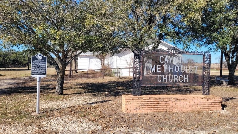
Located near Childress Creek, the Cayote community grew around a grocery store, later known as Cayote Store, established about 1866. The store supplied settlers and drovers herding cattle to markets. In 1879, the store applied for a post office . . . — — Map (db m264605) HM
Called the "Father of Norwegian Immigration to America", Cleng Peerson migrated to the United States from his native Norway in 1821. He traveled extensively and encouraged his countrymen to settle on land he selected in the east and midwest. Coming . . . — — Map (db m283689) HM
Constructed in 1923 as the administration building for the Lutheran College of Clifton, this structure served students and faculty until 1954, when the school merged with Texas Lutheran College in Seguin. The building was sold in 1954 and housed the . . . — — Map (db m233814) HM
Built in 1884 by the Wrought Iron Bridge Company of Canton, Ohio, at a cost of $6,465, this bridge spans 150 feet across the north Bosque River. This type of bridge, called a Whipple Truss, was named for its designer. One of the few remaining . . . — — Map (db m233815) HM
One of three polling places in first election held after Bosque County was organized in 1854. Of 21 votes cast on that occasion (Aug. 7, 1854) in county, 17 were polled under this tree. J.K. Helton was election judge.
Officials elected were: . . . — — Map (db m233720) HM
South Carolina natives William and Rutha Gary migrated west with their family, and by 1852 settled in this area, then part of McLennan County. In 1854, when Bosque County was formed, William Gary was chosen as one of five county commissioners. Five . . . — — Map (db m233716) HM
Joseph Olson left Norway with his family-wife Anna Karina, daughter, Anna Marie 8 years, sons Ole Mikkel 6 years, Jacob 4 years, and Torborg 1 year, in May of 1858. They traveled to America, landing first in Quebec, Canada after 7 weeks at sea. . . . — — Map (db m233724) HM
After the Joseph Olson family immigrated to the United States from Norway in 1858, they lived first in the homes of Norwegian immigrants in the Norse community. In 1866, Olson (1811-1894) built a log cabin for his family on part of his original . . . — — Map (db m233723) HM
The first Norwegian immigrants to Bosque County arrived in 1854. As the number of Norwegian settlers increased after the end of the Civil War, most families continued the rural farming traditions practiced in their homeland. The commercial and . . . — — Map (db m283683) HM
Though never as numerous as some national groups emigrating from Europe, Norwegians left an imprint on rural life in Texas.
Hundreds sailed to the United States beginning in the 1830's. For those who settled in Texas, Bosque County had great . . . — — Map (db m283688) HM
Mother church former Evangelical Lutheran Church in Texas. Organized June 14, 1869 by Norwegian settlers of Bosque County. Building erected 1875-1885.
Cleng Peerson, pioneer of Norwegian emigration to U.S. (Landed 1821) is buried here. . . . — — Map (db m283678) HM
Organized May 6, 1896. Located on land donated by N.J. Nelson and T.T. Hogevold. The first building, erected with voluntary donations and labor, opened as high school Oct. 28, 1897; after 1923 housed artifacts collection of Jacob Olson, early . . . — — Map (db m233721) HM
In 1857, R.G. Grant of Coryell County built a wooden mill at this site, using the waters of the Bosque River to power his operation. Two years later, the property transferred to J.H. Stinnett, and the mill building was used as a commissary and . . . — — Map (db m233818) HM
Following the settlement of Norwegian immigrants in Bosque County in 1854, Lutheranism became the predominant denomination in the region. In 1886, St. Olaf Kirke, named after the Patron Saint of Norway, was built to address the worshiping practices . . . — — Map (db m283675) HM
Built in 1886 of native stone by architect Andrew Mickelson and his brothers, Christian and Ole Mickelson. It originally had a dirt floor and planks laid on wooden kegs for pews. The bell was acquired in 1897. The church served the Norwegian . . . — — Map (db m283478) HM
In 1869, Methodists in the Iredell area began worshiping at Hester Schoolhouse, a building used by both Baptists and Methodists for services. The Rev. Peter W. Gravis served as pastor. Two years later, the Methodist congregation moved to Wills . . . — — Map (db m161851) HM
According to local oral tradition, land for this cemetery and the adjacent church was donated by the family of Ward Keeler, a New York native who came to Bosoue County about 1870 and founded the town of Iredell. The oldest documented grave here is . . . — — Map (db m161857) HM
Started before 1879, the Union Hill School was one of several rural schools that served the early settlers of Bosque County. A two-room 1888 schoolhouse, located across the road, was used until 1914, when a two-story building was constructed at this . . . — — Map (db m194308) HM
Named for the Bosque (Spanish for "Woods") River. The territory now part of this county was traversed in 1841 by the Texan-Santa Fe Expedition. Maj. George B. Erath, noted surveyor and soldier, explored the region prior to its settlement. The . . . — — Map (db m240399) HM
Dr. Russell Daniel Holt (1910-1959) began working as a camp surgeon for the CCC at Camp Beauregard, Louisiana. After hearing that there was a need for a doctor in Meridian, Dr. Holt began practicing in the area in 1938 and set up the city's first . . . — — Map (db m178412) HM
John Clabaugh and W.A. Mason, missionaries for the Texas Baptist Convention, established first Baptist Church of Meridian on March 13, 1859 with ten area residents. Circuit-riding Preachers conducted the first worship services, and the . . . — — Map (db m161803) HM
Soldier, Statesman and Indian fighter. In his native Georgia, a Legislator and Mayor of City of Atlanta. General in Cuban Liberation Forces, 1850.
On reaching Texas 1856, joined State Troops fighting Indians. Elected 1859 to State . . . — — Map (db m161844) HM
Only a log kitchen now marks the homesite of John Lomax, one of the foremost collectors of American folksongs. Here, on part of the Chisholm Trail, young Lomax heard cowboys crooning and yodeling to restless herds; negro servants taught him jig . . . — — Map (db m238741) HM
South Carolina native James J. Lumpkin (b. 1852) settled in Meridian in 1878. He established a medical practice and pharmacy, and was a prominent landowner. He married Ida Etoile (Fuller) (d. 1954), daughter of Moses W. Fuller (1830-1868), a . . . — — Map (db m238637) HM
Local Episcopalians founded the St. James congregation in 1913. Charter members Dr. James Julius Lumpkin and his wife, Ida Etoile (Fuller), donated this site, and church officials consecrated the new facilities that year. The church prospered in . . . — — Map (db m161841) HM
Organized in 1889, the Morgan Methodist Church first held worship services in the Baptist church building. At an 1891 revival, the fellowship initiated plans to construct this sanctuary. Originally a one-room structure, the building was enlarged in . . . — — Map (db m69595) HM
Steiner Baptist Church began in 1891 in the town of Fowler as Fowler Baptist Church. The church’s first structure was built in 1906 on property donated by Joe Yates, but a fire destroyed the building in 1907 and it was rebuilt the following year. . . . — — Map (db m263615) HM
The Coon Creek community evolved from the Old Cyrus community, the oldest settlement in southeastern Bosque County. The first settler was Temple Spivey who purchased land on the Brazos River in 1853. In January 1856, John Jackson Smith purchased . . . — — Map (db m161798) HM
John Jackson Smith (1799-1867) and his wife Margaret (1802-1881) migrated here from Mississippi in the 1850s and founded Smith Bend community. They gave land for this cemetery after the death of their son Burton (1832 1856). The Smiths' daughter . . . — — Map (db m161788) HM
Methodists in this area trace their history to the 1840s. When circuit-riding preachers began holding camp meetings on a near-by farm. In 1889, after the railroad caused Valley Mills to relocate south of the Bosque River, the Methodists built their . . . — — Map (db m233633) HM
Pioneer area settler Joshua McCuistion donated land at this site for a Methodist chapel to serve the community of Hollis Prairie. Completed about 1880 adjacent to a schoolhouse, it was built by John R. Lane and his sons, for whom the settlement was . . . — — Map (db m84910) HM
Tennessee native Roden Taylor Crain, a member of Capt. William Kimbro's company of San Augustine County volunteers, was a soldier in the struggle for Texas Independence from Mexico. He fought at the Battle of San Jacinto on April 21, 1836, and later . . . — — Map (db m233706) HM
By the mid-1850s, F.F. Bloodworth had built a log cabin in the early Valley Mills settlement which served as a school, community meeting place, and the Liberty Hill Baptist Church. In 1855, that congregation had ten charter members but grew to 38 . . . — — Map (db m233702) HM
A standard No. 9 combination freight passenger depot, built in 1910 on Temple-Cleburne line of Gulf, Colorado & Santa Fe Railway.
Local social center, especially at train time, when in pre-radio and tv era the conductor brought late news, or . . . — — Map (db m233635) HM
Indian fighter, lawman and rancher. Settled on the Palo Pinto County frontier, 1854. Led neighbors in defending homes during Indian raids.
In 1860 helped rescue Cynthia Ann Parker, who had been taken 24 years before by Comanches.
Captain . . . — — Map (db m194301) HM
This cemetery was originally known as the Morgan Cemetery due to its location on land owned by Daniel Morgan (1818-1892), a native of Kentucky. Morgan came to Texas from Illinois with his family in 1834. Morgan served in the Civil War in Company F, . . . — — Map (db m194300) HM
World War I
Russell Moseley, Inf.
Joe Lail, Inf.
Lafayette Webb, Inf.
World War II
Harold Adams, A.A.F.
Moffett C. Cook, Prcht. Trp.
John Clifford Cook, C.G.
Norval R. Mccarty, Inf.
Charley Freeman, M.M.
Alfred . . . — — Map (db m194303) WM
Came to Texas from North Carolina in 1845. Fought in Mexican War and Indian Campaigns.
In the Civil War, commanded Confederate cavalry regiment in Texas outposts from Red River to Fort McKavett. Camps were a day's horseback ride apart. Patrols . . . — — Map (db m194304) HM
Kings Highway Camino Real Old San Antonio Road
Marked by The Daughters of The American Revolution and The State of Texas A.D. 1918 — — Map (db m221441) HM
There was a schoolhouse near this site in 1854 when, according to tradition, the first interment was made here. That early grave, for a child by the name of Whitley, had no marker and has been lost.
This land was part of a one-league headright . . . — — Map (db m292078) HM
This school originated as Madison Academy, founded in 1886 in Madisonville by John Hodges Allen (1854-1920), an educator from Mississippi. When his brother Rivers O. Allen (1865-1925) joined him in 1896, the institution became Allen Academy, a . . . — — Map (db m290364) HM
This school originated as Madison Academy, founded in 1886 in Madisonville by John Hodges Allen (1854-1920), an educator from Mississippi. When his brother Rivers O. Allen (1865-1925) joined him in 1896, the institution became Allen Academy, a . . . — — Map (db m307898) HM
On March 30, 1885, the City of Bryan purchased seven lots in this area as a site for a public school to provide separate but equal and impartial instruction for black children of the community, as prescribed by the Texas State Constitution of 1876. . . . — — Map (db m187778) HM
Brazos County, part of Stephen F. Austin’s colony, was created from Washington County in 1841. It was first named Navasota County, with Boonville as the county seat. In 1842 the name was changed to Brazos County. Through the Civil War, Millican, . . . — — Map (db m119591) HM
Furnished horses, equipment and clothing for county men in the Civil War.
Levied war taxes on property, exempting lands or estates of Confederate soldiers.
After surveying to determine needs of the families of Brazos soldiers, appropriated . . . — — Map (db m119642) HM
Boonville was selected as the county seat of Navasota County in 1841. In January 1842, the name was changed to Brazos County. The area selected was named Boonville and was to encompass one hundred and fifty acres purchased for $150. A three-acre . . . — — Map (db m170514) HM
Brazos Union Lodge was organized in Boonville in 1852. Four years earlier, another lodge, named Boonville Lodge No. 55, was created at Boonville and worked under a dispensation for several months before receiving a charter in January 1849 from the . . . — — Map (db m170459) HM
During World War II, construction of Bryan Army Air Field (Bryan AAF) began in August 1942. The U.S. Army Air Forces site grew out of a war department initiative to train pilots and instructors. The site was the only instrument instructor school for . . . — — Map (db m233745) HM
Established June 13, 1868 - three years after dedication of Bryan Townsite. Graveyard land - 20 acres, then on north edge of Bryan - was sold to the city for $100 by J.C. Hubert. More land was added June 15, 1915; area is now 48 acres. Many . . . — — Map (db m170316) HM
Center of cultural and civic activities in Bryan since 1903. Established through inspiration of the mutual improvement club (renamed the Woman's Club, 1909), under the leadership of Mmes. Lucy Miley Brandon and Rose Fountain Howell who with modest . . . — — Map (db m119639) HM
English native Charlie E. Jenkins came to America in 1873 and to Bryan in 1878. One of Bryan's most prolific and talented builders of the late 19th and early 20th Centuries, Jenkins' legacy of distinctive structures has been recognized by national . . . — — Map (db m170311) HM
The Civil War and its aftermath greatly affected Brazos County. War halted progress of the Houston & Texas Central Railway and made Millican a boomtown. After the war, the railroad created a new town, Bryan City, and brought a need for men and . . . — — Map (db m170303) HM
After the founding of the American Legion Organization in 1919, efforts to form a local post in Bryan soon followed. Thirty-three Brazos County World War I veterans called for registration booths to be placed throughout the county where honorably . . . — — Map (db m268118) HM
Organized Nov. 21, 1867, in the Presbytery of Brazos by the Rev. J.H. Hutchinson, this apparently was the second denominational group in Bryan. In 1871, members themselves built their first sanctuary at Washington and 29th Streets. This effort was . . . — — Map (db m170268) HM
"Welcome to My Town"
Father of Brazos County
Harvey Mitchell was born in 1821 in Tennessee. Because his parents could not afford to send him to college, the ambitious 18 year old came to Texas in 1838. From 1839 to 1842, . . . — — Map (db m170405) HM
Came to Texas from Tennessee in 1839, and joined "minute men" protecting north frontier from Trinity to Brazos River. Moved to Brazos County; served 1842-1853 in County offices: Deputy Clerk, County Clerk, Surveyor, Chief Justice. Taught school, . . . — — Map (db m119644) HM
Isom Palmer, whose name has various spellings, was born to Martin and Sarah (Hardwick) Parmer. In 1825, the Palmer (Parmer) family moved to Texas, settling near Nacogdoches the next year, and participated in the 1826 Fredonian Rebellion. Palmer . . . — — Map (db m170312) HM
Kings Highway Camino Real Old San Antonio Road
Marked by the Daughters of the American Revolution and the State of Texas A.D. 1918 — — Map (db m222167) HM
Occupying a prominent corner in the southern end of Bryan's central business district, the La Salle hotel is an architectural landmark representative of the city's early 20th-century commercial development. At that time, Bryan was a major . . . — — Map (db m119640) HM
In the late 1890s, Sam Luther donated the land at this site for a school. At the time, most residents of the Leonard community were Polish, German and Czech immigrants who were drawn to the area by the Brazos River’s rich soil. The Leonard School . . . — — Map (db m233731) HM
In December 1924, Martin Kapchinskie purchased land at this site, along a one-lane country road connecting Bryan to Texas A&M University, near the communities of Union Hill and Midway. Here, he opened a store for travelers and named it Martin's . . . — — Map (db m168371) HM
Eli Seale 1793-1857
Elias (Eli) Seale was born in North Carolina in 1793. He served as a fifer in the War of 1812 in Mississippi, and in 1835 moved with his three brothers and his family from Alabama to Texas. He received his Mexican . . . — — Map (db m170484) HM
Bryan's St. Joseph Roman Catholic Church began in 1873 with a congregation that drew from the city as well as rural communities in the area. For the next 25 years, the church used existing cemeteries for the burials of parishioners. These included . . . — — Map (db m170348) HM
A movie theater has been at this location since 1913 and named “The Queen” since 1914. It was originally located in the three-story Stoddard Hotel built here in 1889. The Schulman family purchased the theater business in 1926 and the . . . — — Map (db m119641) HM
Great thoroughfare of pioneer Texas, stretching 1,000 miles from Saltillo, Mexico, to present Louisiana. The general route followed ancient Indian and buffalo trails, but the oldest marked portion, known as "Trail of the Padres", was blazed in 1691 . . . — — Map (db m68683) HM
This parish traces its origin to Episcopal services held in nearby Millican in 1864. A yellow fever epidemic in the Millican area prompted the relocation of the Saint Andrew's Mission to Bryan in 1867. A parish was formed that year and led by The . . . — — Map (db m129293) HM
In 1929, Father Frank D. Urbanovsky, known as Padre Panchito, came to Bryan to assist the pastor at St. Joseph Catholic Church. He soon began to travel the countryside and minister to the Mexican and Mexican American population living in Bryan, . . . — — Map (db m267504) HM
Established in 1841 as the county seat of Navasota County by John Millican, John H. Jones, J. Ferguson, E. Seale, and Mordecai Boon whose name it bears • The name of the county was changed to Brazos in 1842 • Boonville flourished until 1866 when . . . — — Map (db m170254) HM
The Ursuline Sisters, founded by St. Angela in Italy in 1535, opened their first girls' school in North America in Quebec in 1639. In 1727, they opened the Ursuline Academy in New Orleans, followed in 1847 with the Ursuline Academy in Galveston. . . . — — Map (db m179149) HM
Although Catholic worship services were celebrated in Bryan by 1869, this church traces its history to the early 1870s. The first church building was erected about 1871 for a small active parish. The Reverend John Moore is considered to be the . . . — — Map (db m170269) HM
The Rev. Joseph Pelnar of Bryan's St. Joseph Catholic Church erected a parish school building here in the early 1890s. The children of East European immigrant families dominated student enrollment at St. Joseph's until about the 1930s. Teachers . . . — — Map (db m170271) HM
Early-day Texas travelers had only four choices when they needed to get from one town to another — walk, ride a horse, bounce along in a buggy, or take a stagecoach. Multi-passenger horse-drawn stagecoaches - Texas' first regularly scheduled . . . — — Map (db m170518) HM
Anglo settlement in this area can be traced to 1851. Henry B. Steele (1837-1912) built a general merchandise store in 1855 to serve residents of the rural community, originally called Mudville because of frequent Brazos River floods. The store . . . — — Map (db m268115) HM
This burial ground was part of the Steep Hollow community, named for the valley of the Steep Hollow Branch, a tributary of Wickson Creek. Residents were ranchers and farmers, and the community had a general store, cotton gin, gristmill and . . . — — Map (db m187735) HM
Immediately after the end of World War II, The Agricultural and Mechanical College of Texas faced a severe housing and classroom space shortage because of the groundswell of returning veterans. Starting in 1946, facilities were leased at Bryan . . . — — Map (db m254239) HM
Bryan was platted on land granted to the Houston & Texas Central Railroad in 1859. In 1900, a second railroad, the Calvert, Waco & Brazos Valley (CW & BV) was built through Bryan by George Gould. The CW & BV built a depot here in 1900; besides train . . . — — Map (db m119629) HM
The First National Bank of Bryan traces its history to 1862 when its earliest predecessor, a private lending agency, was established by W.H. Flippen and Milton Parker in Millican. In 1867, after the Houston and Texas Central Railroad extended its . . . — — Map (db m170259) HM
The Boonville School Play Yard likely was associated with the school conducted in the courthouse building but may have also been used by the school in the nearby Masonic Lodge building. Nineteenth century playgrounds were located in open spaces . . . — — Map (db m174273) HM
Before refrigeration and the canning process were developed, salt curing and smoking meats were the only ways to preserve fish, poultry, beef, and pork. Almost every farm family had a smoke house, and many cities had commercial smoke houses that . . . — — Map (db m174256) HM
The State of Texas consists of 254 counties. Washington County, with its settlements of Independence and Washington on the Brazos, was one of the 23 counties created in 1836 following Texas independence. Most of the area of present day Brazos . . . — — Map (db m170365) HM
On November 17, 1835, after Francis Smith convinced the people of Cincinnati, Ohio, to aid the cause of the Texas Revolution, the Ohioans began raising funds to procure two cannons and their attendant equipment for Texas. Since the United States . . . — — Map (db m170471) HM
Founded in October 1895 as the Mutual Improvement Circle, this organization began with twenty members. Initially gathering in individual homes, the club met as a study group to improve members' minds, serve the community, and promote the cause of . . . — — Map (db m170267) HM
Native of Missouri. Member of prominent family who were Texas statesmen, planters, developers. Grandson of Moses Austin, who obtained from Mexico charter for American Colony in Texas, but died before making settlement. Nephew of Stephen F. . . . — — Map (db m119643) HM
Though it's called a cabin, the Turner-Peters Dogtrot was house and home during the 1800s to early settlers. For over 160 years, the homestead was situated atop a sandy hill overlooking a small branch of Peach Creek in Grimes County. Thanks to . . . — — Map (db m170387) HM
Granddaughter of Harvey Mitchell, a pioneer settler of Brazos County, Wesa Weddington began teaching Latin and Spanish in 1903 in Bryan public schools. She received a Masters Degree in 1918 from Columbia University and then taught while serving as . . . — — Map (db m201994) HM
The rural farming community of Wixon was settled in the late 1860s by former residents of several war-torn southern states. The Wixon School and Wixon Cumberland Presbyterian Church were established in the 1870s on land adjacent to this cemetery. . . . — — Map (db m292075) HM
When Boonville was selected as the first seat of Brazos County in 1841, the town was designed and built around a public square with a cemetery established soon afterwards on lot 1, covering ten acres. The earliest documented burial in the . . . — — Map (db m292080) HM
As the first public cemetery for the City of Bryan, the Old Bryan City Cemetery (also known as Bryan's Old Graveyard and Bryan's Public Cemetery) was in use by 1861. It predates the incorporation of the City of Bryan and is sited on land originally . . . — — Map (db m268121) HM
Land for this cemetery was sold in 1889 by Josef Stasta (1833-1894) to Joseph Mekeska, president of Moravian Brothers Burial Ground. The deed specified the land would be used exclusively for a Moravian cemetery. The cemetery contains eleven grave . . . — — Map (db m255965) HM
Methodism among African American Texans predates the civil war with the first church being established in 1848. the earliest known African American minister in Brazos county was reverend Emmanuel Hammitt who served under Reverend W.S. South after . . . — — Map (db m239014) HM
[Golden Wheel]
This Tree has stood at three
Brazos County Courthouses
1841 Ferguson Springs
1843 Boonville
1892 Bryan
William Scott Chapter D.A.R.
Bryan - 1932
— — Map (db m243660) HM
"Bryan Station, Brazos County, Nov. 21, 1866...I hope a better day is dawning, for last Sabbath a Baptist church was organized here and 16 members united with it," wrote Mrs. Sara Dodson. One block west of this site stood first house of worship, a . . . — — Map (db m255967) HM
Among the circuit riders who preached to early Methodists in this area were The Rev. Robert Alexander, presiding elder of the district, and The Rev. H.V. Philpott, who conducted services in a hall above a saloon. The Rev. H.G. Horton organized this . . . — — Map (db m255966) HM
In 1935, the Bryan school board elected to construct a two-room, wooden school building for Spanish-speaking children for grades one through four. The site chosen was on the Joe Batts property along the new route for Highway 21, west of the city. . . . — — Map (db m267502) HM
3999 entries matched your criteria. The first 100 are listed above. Next 100 ⊳