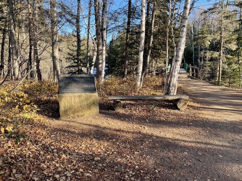
So named in honor of Clarence R. Magney (1883-1962), lawyer, mayor of Duluth, district judge, justice of Minnesota’s Supreme Court, student of Minnesota history, defender of its wilderness areas, champion of their preservation.
As a young man . . . — — Map (db m232202) HM
Originally made from cedar and birch bark, the Canot du Nord functioned as the workhorse of the 18th and 19th century fur trade. These birch bark canoes could carry several tons of trade goods and between 4 and 6 voyageurs, the occupational . . . — — Map (db m235254) HM
You are looking across Gunflint Lake at the Canadian shore. This was one of the international routes taken by the voyageurs in the late 1600's into the 1800's. — — Map (db m231493) HM
Gunflint Trail Area
The Gunflint Trail is one of Minnesota's most famous roads. Along its 56 miles are trails on old railroads, clear lakes, moose viewing areas, giant magnetic boulders, ancient meteor strikes, recovering fire areas, and . . . — — Map (db m235139) HM
Wildfire!
At 11.44 am, May 5, 2007, a wildlife was reported in the vicinity of Ham Lake, near the Boundary Waters Canoe Area Wilderness and the Gunflint Trail. By the time the Ham Lake Fire was 100% contained fourteen days later, it had . . . — — Map (db m231835) HM
Listen! Can you hear echoes from the 1930s, when 200 men of the Civilian Conservation Corps (CCC) used picks and shovels to construct the Cascade River Overlook?
The Overlook, where you stand today, is part of the 118-acre Cascade . . . — — Map (db m203021) HM
An Indian community of about 200 people was located in this area about 1915. An ancient Indian cemetery is located about two blocks northeast of this historic church — — Map (db m203254) HM
In 1906 this community was named in honor of Colonel William Colvill, commander of the First Minnesota Regiment.
At the Battle of Gettysburg, July 2, 1863, this regiment was ordered to charge and advance of Confederates twenty times their . . . — — Map (db m232203) HM
When Newton H. Winchell, Minnesota's state geologist, and, Ulysses S. Grant II (the president’s son) surveyed this area in the 1890s, they concluded that a peak in the Misquah Hills was the state's highest point. Using an aneroid barometer, . . . — — Map (db m151362) HM
Native peoples harvested Lake Superior fish for thousands of years prior to 1835, when John Jacob Astor's American Fur Company established a commercial fishing post in Grand Marais. The company employed these same Native peoples, as well as former . . . — — Map (db m267409) HM
The rocks of the North Shore of Lake Superior record the last period of volcanic activity in Minnesota. This volcanism occurred 1.1 billion years ago when the North American continent began to rupture along a great rift valley, which extended from . . . — — Map (db m203069) HM
The harbor of Grand Marais is the result of unequal weathering or erosion of two types of rock. One of these, called diabase, resulted from the cooling of molten material which was forced between two earlier lava flows. The dark, massive diabase, . . . — — Map (db m203155) HM
“I seek the power of the rock, the magic of the water, the religion of the tree, the color of the wind, and the enigma of the horizon.” ~George Morrison George Morrison was a visionary, modern artist from the North Shore. He was given two . . . — — Map (db m267438) HM
Henry Mayhew, explorer, prospector, entrepreneur and county commissioner, was credited with developing Gunflint Trail and Grand Marais. Capitalizing on the North Shore's well-established commercial fishing and tourism industries, he constructed the . . . — — Map (db m203209) HM
Ancient Volcanoes
1.1 billion years ago, 500 million years before invertebrates appeared, a giant volcanic rift began to open where Lake Superior now lies. Huge lava flows erupted from the rift, spreading over hundreds of square miles . . . — — Map (db m203225) HM
In 1972 Consolidated Papers, Inc., of Wisconsin Rapids, Wis., ended long distance rafting of pulpwood across Lake Superior. From 1923–1972, Consolidated rafted over two million cords of pulpwood from Minnesota and Canada to Ashland, Wis. Minnesota . . . — — Map (db m203083) HM
Built in the 1940s in Colvill, Minnesota by John and Randolph Samskar and donated to the Cook County Historical Society by the Randolph Samskar Estate. A number of fishermen along the North Shore had similar, but often smaller, smokehouses. Most . . . — — Map (db m267435) HM
From the 1700s until the early 1900s, itinerant missionaries braved extreme hardships to minister sporadically to North Shore settlers. In 1855, Jesuit missionaries from Fort Williams, Ontario, served Chippewa City, an Ojibwe community of about 100 . . . — — Map (db m200626) HM
In the winter of 1936-37, James Scott and his son, Roger, built the NeeGee — a commercial fishing tug used in the deep waters of Lake Superior. Grand Marais had a commercial harbor for many years, and the Scotts were among the earliest . . . — — Map (db m267412) HM
Lake Superior Indians recognized the unique nature of this bay long ago, naming it "Kitchi-Bitobig", meaning "double body of water." When white man first settled around this bay, in 1854, a few Indian families lived in tepees and cabins around the . . . — — Map (db m203151) HM
Or “Friend” in Ojibwe, was built at Grand Marais in 1936 by the Scott Family. While other fishing tugs fished from this harbor, only the Neegee was built here. A typical Lake Superior fishing tug, the Neegee was intended to fish off shore. In the . . . — — Map (db m267430) HM
Welcome!
The Point is a broad tombolo which defines the two natural harbors that have made Grand Marais an important spot on Lake Superior's shore for centuries. The 8.4 acre Point was conveyed to the federal government in 1942, and is part . . . — — Map (db m203216) HM
Hedstrom Lumber Mill
This 6 acre site, bounded by the Gunflint Trail, County Road 60, and the Devil Track River, was home to the Hedstrom Lumber mill and office from 1914 to 1994. The 4 acre eastern portion, once boulder filled and rough, . . . — — Map (db m231483) HM
Ojibwe elders at Grand Portage still remember the little village along the lakefront of the early 20th century. Like the kids in the photograph, they might have ridden on the first road from Duluth to Thunder Bay — old US Highway 61 — after it . . . — — Map (db m267284) HM
In the 1960s, archeologists discovered here remains of a structure used between 1785 and 1802, unusual because it was built on posts. They found artifacts that match the bills of lading from bales, kegs, and cassettes (small trunks) that were canoed . . . — — Map (db m152972) HM
First People Pieces of pottery found in this area show that humans have lived here for thousands of years. Archaeological evidence of ancient pits tell us that people mined copper from Isle Royale — visible on the horizon — some . . . — — Map (db m267378) HM
Voyageurs who did not want to buy things at the North West Company store inside the Depot had another option — or so it appeared. They could visit Boucher's Tavern, which once stood on the land before you. Operated by their fellow Frenchman, Jean . . . — — Map (db m267366) HM
The Gates are shut always after sunset and...
there are two Sentries keeping a look out all
night chiefly for fear of accident by fire.
John Macdonell, Grand Portage, 1793
This gatehouse was not intended to . . . — — Map (db m152975) HM
High Falls and nearly 20 miles of other falls and rapids made river travel impossible for Indians and fur traders. The Indians developed “The Grand Portage” (meaning “the great carrying place”), a nine-mile trail bypassing the falls and rapids to . . . — — Map (db m267352) HM
The oldest existing log church in Minnesota. The log structure was built in 1865, during the pastorate of Father Dominic Du Ranquet from Canada. The Jesuit fathers served the mission until 1905. The tamarack logs were covered with siding in 1940. . . . — — Map (db m254467) HM
Early loggers sent all their logs down the Pigeon River. How did they get the logs over High Falls? The wooden structure that you can see on the Canadian side of the Pigeon River is the remains of a log flume. Constructed in 1899 to avoid log . . . — — Map (db m267337) HM
Minnesota's Northern Border
Determining, surveying, and marking Minnesota’s border with Canada took 142 years and left the state with a tag end called the Northwest Angle standing isolated and alone on the Canadian side of Lake of the . . . — — Map (db m206879) HM
The Grand Portage, or "the great carrying place, Gichi Onigamiing, has been a meeting point for centuries: it was part of an extensive Native American trading network well before the first French trader arrived in 1731. Though the French formally . . . — — Map (db m152968) HM
"All the buildings within the Fort are sixteen in number...Six of these buildings are Store Houses for the company's Merchandise and Furs, etc., the rest are dwelling houses shops compting and Mess House..."
John Macdonell 1793
"June . . . — — Map (db m153048) HM
The lever fur press, much like the reconstructed model before you, was frequently used at fur trading posts operated by the North West Company. It was simple to operate and could be constructed from wood found near the post. Fur pelts, with . . . — — Map (db m153042) HM
American Indians developed the birchbark canoe hundreds or thousands of years ago. It would provide the technology that allowed the North West Company to span the continent.
"Canots du Nord"
The 24-foot north canoes could be portaged . . . — — Map (db m153049) HM
The Grand Portage, or Great Carrying Place, was a key 18th century link between the Pigeon River and Lake Superior, making it also a vital connection between Montreal and the rich fur-bearing lands far to the northwest. Traveled for centuries before . . . — — Map (db m62049) HM
Inside the Historic Depot in front of you are three of the sixteen buildings that once comprised the summertime headquarters of the North West Company. The depot was not a fort but instead a secure transshipment point for valuable furs and trade . . . — — Map (db m152973) HM
Montreal canoemen were hired to paddle to Grand Portage. Once there, each man had to carry several 90-pounds (41-kg) bundles of trade goods and supplies up the Grand Portage to Fort Charlotte, where the bundles were repacked for canoe brigades . . . — — Map (db m153054) HM
The Treaty of Paris 1783 generally concluded the disputing of the boundaries between the U.S. and Canada. However, there was much controversy over the section of the treaty which provided that the dividing line for this area be the “usual water . . . — — Map (db m267334) HM
This was the view of the bay in front of you in the 1950s. It was the heyday of resorts in a fisherman's paradise at the end of the Gunflint Trail. — — Map (db m232018) HM
Saganaga Lake is located along the Border Route, an ancient travel route between Lake Superior and the interior waters of Lac La Pluie (Rainy Lake) that is often referred to as The Voyageur's Highway.
Saganaga Lake was an . . . — — Map (db m231492) HM
Saganaga Lake is located along the Border Route, an ancient travel route between Lake Superior and the interior waters of Lac La Pluie (Rainy Lake) that is often referred to as The Voyageur's Highway.
Saganaga Lake was an . . . — — Map (db m232520) HM
The word "portage" is French for "to carry."
Canoe rests were built between 1933 - 1942 in the Superior Roadless Wilderness Area, now known as the Boundary Waters Canoe Area Wilderness (BWCAW), by the Civilian Conservation Corp (CCC). . . . — — Map (db m232921) HM
You are standing near the former site of the Judge's Cabin built approximately 1934.
"American Plan" was a popular cabin rental option from the 1920s-1970s. American Plan cabins were furnished with beds, chairs, dressers, and a wash . . . — — Map (db m235864) HM
Trapper's lives were spartan and generally routine.
Before freeze-up, they brought in supplies, cut wood, and weather-proofed their cabins and shelters. Returning in November, they set trap lines along trails looping fifty miles or so through . . . — — Map (db m231548) HM
This log was taken from a dead red pine (Pinus resinosa) tree growing on Voyageurs Island in Lake Saganaga.
Through a process called crossdating, the growth rings of this tree have been matched to those of living trees growing elsewhere in . . . — — Map (db m231689) HM
You follow Old Sven into the smallest building. He opens a ledger on a desk.
"You'll be paid the standard rate, a dollar a day. That'll be $26.00 for the month. You work from dawn until dark. If there's an early moon you may work . . . — — Map (db m152959) HM
Welcome to the actual location of Camp #8 of the St. Croix Logging Company
- used in 1906 as a winter logging camp and for several more seasons as a spring camp for log drivers.
Early this morning, at the sawmill in Winton (3 miles east of . . . — — Map (db m153106) HM
The Pioneer Vermilion Iron Mining Company opened the Pioneer Mine in 1888 and began shipping ore the following year. When Oliver Iron Mining Company leased the Pioneer in 1898, it was producing over 500,000 tons annually. Eventually, it was . . . — — Map (db m127860) HM
The Pioneer Mine began operation in 1888. Shafts No. 1 and No. 2 were abandoned and replaced by vertical A Shaft, which was sunk in 1909 and in 1943 an incline from 8th level to surface was completed. Men, timber for support and equipment were . . . — — Map (db m127868) HM