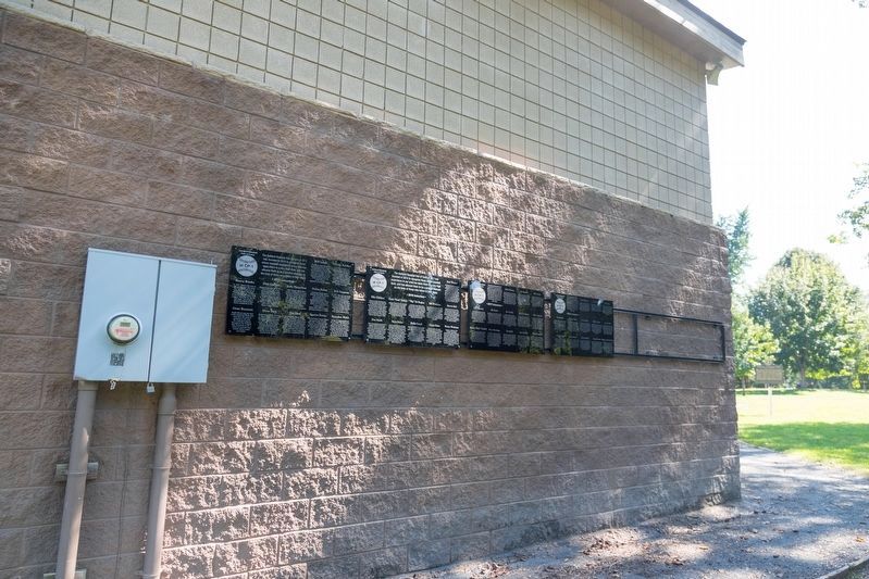
The Ashland Baseball Hall of Fame at CP-1 was founded in 2015 to recognize those whose baseball experience in our area has taken them to a very high level, and has allowed them to be a positive example on the lives of those who follow in their . . . — — Map (db m126475) HM
The Ashland Baseball Hall of Fame at CP-1 was founded in 2015 to recognize those whose baseball experience in our area has taken them to a very high level, and has allowed them to be a positive example on the lives of those who follow in their . . . — — Map (db m127160) HM
The Ashland Baseball Hall of Fame at CP-1 was founded in 2015 to recognize those whose baseball experience in our area has taken them to a very high level, and has allowed them to be a positive example on the lives of those who follow in their . . . — — Map (db m127164) HM
The Ashland Baseball Hall of Fame at CP-1 was founded in 2015 to recognize those whose baseball experience in our area has taken them to a very high level, and has allowed them to be a positive example on the lives of those who follow in their . . . — — Map (db m127183) HM
The Ashland Baseball Hall of Fame at CP-1 was founded in 2015 to recognize those whose baseball experience in our area has taken them to a very high level, and has allowed them to be a positive example on the lives of those who follow in their . . . — — Map (db m228076) HM
The Ashland Baseball Hall of Fame at CP-1 was founded in 2015 to recognize those whose baseball experience in our area has taken them to a very high level, and has allowed them to be a positive example on the lives of those who follow in their . . . — — Map (db m228077) HM
The Ashland Baseball Hall of Fame at CP-1 was founded in 2015 to recognize those whose baseball experience in our area has taken them to a very high level, and has allowed them to be a positive example on the lives of those who follow in their . . . — — Map (db m228078) HM
Settled by 1799 by members of the Poage family of Virginia. Known as Poage's Landing until named in 1854 for Henry Clay's Lexington estate, by the owners, Ky. Iron, Coal and Manufacturing Company. It engaged M. T. Hilton to lay out a town, then . . . — — Map (db m59244) HM
During World War II American women contribute to the effort by working side by side with men in the defense industry. Ashland Clayton & Lambert plant was no exception. There, local women helped produce millions of 40 mm shell casings for the U.S. . . . — — Map (db m228071) HM
The Booker T. Washington School was built in 1903 for grades 1-8. By 1931 it included a four year high school at its Central Ave & 7th ST location. All Boyd Co. schools were not integrated until 1962. In that year, Booker T. Washington closed. We . . . — — Map (db m228066) HM
Organized baseball in Ashland began when the Ashland Colonels, a minor league team, played at Armco Field from 1939-42. Games then moved to Central Park and, in 1955, Ashland joined the Little League program. The two original fields were known as . . . — — Map (db m126474) HM
In 1894 Ashland Board of Education assumed management of “Negro School,” where African American William Reynolds was principal. In 1901 a bond issue passed with support of blacks and Superintendent J.G. Crabbe. School board then funded . . . — — Map (db m127190) HM
Ashland, the largest city in eastern Kentucky, is located on the banks of the Ohio River in Boyd County. This second class city, when first incorporated by act of legislature in 1856, was located in Greenup County. Boyd County was created four years . . . — — Map (db m228063) HM
Elizabeth started this quilt top in 1836 as a memorial to her family. Two sons, John V. and Mathias (Bub) Mitchell, are named on this piece; other sons were veterans of the Civil War. A finished quilt was made from this practice pattern piece. In . . . — — Map (db m228068) HM
One and one half miles NE in
Central Park is an irregular row
of mounds, part of a chain built
by prehistoric men who were the
forerunners of American Indians.
Many of remains of that ancient
people which once dotted this area
were leveled as . . . — — Map (db m126471) HM
Kentucky native, Laura White, designed the Old First Christian Church on 17th Street in Ashland. It was built in 1890 in the Gothic Style at a cost of $6000. Avoiding post-Civil War unrest, Laura's father, Dougherty White, sent his wife and daughter . . . — — Map (db m228064) HM
NORTON FURNACE. In 1967, the world’s oldest known operating blast furnace. Built by Norton Iron Works Co. in 1873, an iron shell stack 67 ft. high with maximum inner diameter of 18 feet, burning “stone coal.” It produced 10,502 tons . . . — — Map (db m128281) HM
Organized June 11, 1819, at home of Maj. Jas. Poage, north of this spot, as Bethesda Presbyterian Church by Rev. Robert Wilson with 20 members. First a mile SW on Pollard Rd.; moved 1828 to Beech Grove, ½ mile W. and in 1858 to this corner . . . — — Map (db m59242) HM
Austin, William, Bruce and Frank Henderson, four sons of John W. and Mary Sue Henderson, were all in military service during the Second World War. In 1942 a service flag was proudly displayed above the mantle as the parents read a letter from one of . . . — — Map (db m228070) WM
This stadium served the Ashland Public Schools. Built in 1937 for $6,500 as a WPA project, it was dedicated on Thanksgiving Day that same year. The Ashland High School Tomcats record of success includes 11 state championships. In 1944, the Tomcats . . . — — Map (db m73802) HM
Built Dubuque, Iowa in 1928 (Originally named John W. Weeks) This vessel was retired from service and presented to the city of Ashland, Kentucky by Armco Steel Corporation September 1, 1960 — — Map (db m228074) HM
Welcome to Boyd County, Kentucky, home of the Judds (the famous mother/daughter Nashville award winning duo). US 23 was named "The Country Music Highway" in 1994 in recognition of the numerous country music stars from the region. In 2002, through . . . — — Map (db m228072) HM
A former Canadian working for the United States during the Civil War invented several
pieces of light ordnance which, although apparently excellent weapons, did not seem to have
been particularly popular. Norman Wiard (1826-1896) was born in . . . — — Map (db m127198) HM
Bellefonte Furnace. The most successful of pioneer
Kentucky charcoal furnaces in the
Hanging Rock Iron Region. Built
by Archibald Paull, George Poague
and others in 1826. Its stone
stack was 34 feet high with a
maximum inner diameter of . . . — — Map (db m126468) HM
USA post located here to protect Ohio River traffic. Became supply base and communications center for Union forces in the Big Sandy region. In winter 1861-62 troops under Col. J.A. Garfield, later 20th President U.S., drove CSA from area by victory . . . — — Map (db m73765) HM
Boyd County was created in 1860 from parts of Greenup, Carter, and Lawrence and lies at a point where Ohio, West Virginia and Kentucky meet. Linked to Ohio by two bridges over the Ohio River and with two more to West Virginia (across the Big Sandy . . . — — Map (db m73756) HM
For Linn Boyd. Born Tenn., 1800. Came to West Ky. in youth. Ky. Legislature, 1827-31. Congress, 1835-37, 1839-55, and Speaker 1851-55. Author of Resolution to annex Texas. The Ky. delegation proposed Boyd for Vice President at Democratic Convention, . . . — — Map (db m73754) HM
James H. McCoy. Oldest son of Randall and Sarah. Last living McCoy feudist before passing away in 1929. He was a peacemaker in the feud and tried to talk Frank Phillips out of killing Jim Vance & Bill Dempsey. In 1928, James & Tennis Hatfield, . . . — — Map (db m126114) HM
To the memory of Judge John M. Elliott, distinguished statesman and jurist. Assassinated while in the discharge of his official duties as Judge of the Court of Appeals of Kentucky. This monument respectively dedicated by his widow. — — Map (db m73757) HM
The first woman elected to Kentucky
legislature, 1921. Mary E. Flanery
elected to House of Representatives
from Boyd County. She had worked
for woman suffrage; was concerned
with marriage and divorce laws
and educational reform. At her
death, . . . — — Map (db m126102) HM
For her dedication and service to the City of Catlettsburg as City Clerk from 1974 tο 1979, City Treasurer from 1979 tο her retirement, July 2008. Thank you for your hard work of 34 years.. — — Map (db m286522) HM
Buena Vista Furnace Built by William Foster and Co. in 1847, 2¼ miles west, named for Mexican War battle that year. It was an important factor in the Hanging Rock iron industry until dismantled in 1876. Its 1874 production was 4113 tons. Stone . . . — — Map (db m126266) HM
Princess Furnace. Built here in 1876-77 by Thomas W. Means (1803-90), for 50 years the leading figure in the iron industry of this area, owner of furnaces in Kentucky, Ohio, Virginia, Alabama. This iron-jacketed stack burned “stone . . . — — Map (db m126230) HM
Clinton Furnace. Stood one mile east. Its stone stack was 10 ft across inside, about 35 ft. high, built in 1832 by George, William Thomas H. and Hugh A. Poage. In 270 days of 1838 it used 2992 tons of ore, 247,000 bushels of charcoal to make . . . — — Map (db m126229) HM
Sandy Furnace. Built 1853 by Young, Foster & Co
(Dan and John Young, William Foster,
Irwin Gilruth), 4 miles west on a
9,000 acre tract. Stone stack
originally 32 ft. high, 10½ ft.
across inside. In 1854, its last
year of operation, . . . — — Map (db m126132) HM
Matthew Sellers is among first to experiment with gliding and power flight. Did this research at his home and laboratory, 6 miles south, 1897-1911. Built most advanced wind tunnel of his day, 1903, to study lift and drag of various wing designs; and . . . — — Map (db m145292) HM
Retreating from Cumberland Gap General George W. Morgan’s Union force of 8,000 men camped here Sept. 1862. CSA Morgan’s Raiders harassed USA, 30 miles along here; skirmishing, felling trees across roads and preempting food and supplies. Covering 200 . . . — — Map (db m145350) HM
As Gen. George W. Morgan's Union force, 8,000 when here, retreated from Cumberland Gap, they were harassed from West Liberty by CSA Gen. John H. Morgan's Raiders. Failure of reinforcements to reach here caused Confederates to leave Oct. 1, 1862 and . . . — — Map (db m272680) HM
In their blue and gray uniforms for over forty years, Civil War veterans gathered here annually, around campfires, with song and story, friends and former foes, revived war memories, and always a pilgrimage to graves of their comrades in cemetery of . . . — — Map (db m73788) WM
For Col. William Grayson Carter, state senator, 1834-36. The 88th Ky. county formed, 32nd in size. Carter was created from Greenup and Lawrence. Noted in early years for 5 iron furnaces, its clay products, industry developed in late 1800's. Carter . . . — — Map (db m73789) HM WM
E. K. Railway purchased 25,000
acres of land in Little Sandy
Valley at close of the Civil War.
Tracks laid to this site June 10,
1871. Grayson was location of depot
and repair shops. Stinson Branch
was laid, 1893, with more straight
track . . . — — Map (db m144463) HM
Six miles south, site of famous iron
furnace, erected, 1848, by R. M.
Biggs and others. Operated 37 years,
averaging 15 tons pig iron daily
which was hauled by ox teams to
Ohio River for shipment. Iron
produced here was used for rails,
plows, . . . — — Map (db m144955) HM
Pactolus Furnace Built in 1824 by Joseph McMurtry and David L. Ward, on the site of an earlier bloomer forge. Its stone stack used charcoal fuel, and its air blast machinery was powered from a dam, 5 1/2 ft. high, in Little Sandy River. Capacity . . . — — Map (db m73787) HM
In memory of William Jason Fields, United States Representative 1911-1923, Governor of Commonwealth of Kentucky 1923-1927. Born Dec. 29, 1874, Willard Ky. -Carter Co. — — Map (db m196300) HM
Dedicated to the memory of our comrades who entered the service of their country. Those who were wounded and those who gave up their lives in the World War of 1917-1918.
Sponsored by Moore-Armstrong Post No. 138, American Legion; Willie C. . . . — — Map (db m164262) WM
Here the EK had a junction with
the Elizabethtown, Lexington &
Big Sandy Railway that connected with
the Ashland Coal and Iron Railway in
Denton. January 1882 both would
become part of Chesapeake & Ohio
Railway. The EK and C&O shared a
depot . . . — — Map (db m145351) HM
Created from parts of Carter,
Lewis and Elliott Counties with
county seat here by legislative
act signed Feb. 9, 1904, by Gov.
J.C. W Beckham for whom it was
named. C. C. Brooks appointed
County Judge. On April 29, 1904,
the Court of Appeals . . . — — Map (db m145288) HM
In memory of those who gave their lives for freedom.
Vietnam
Chaffins, Ernest Jr. -
Colecrove, Robert H -
Dickerson, George E -
Eden Chester W -
Fitch, William A -
Jackson Larry, R -
Littleton, David E -
Tackett, George E . . . — — Map (db m164373) WM
WIA programs are done by eastern Ky. Concentrated employment program, inc. Funded by Workforce Investment Act funded by U.S. Dept of Labor by Ky. Ed. Cabinet, Div. of Work Force Services. — — Map (db m164385) HM
“Honest Bill from Olive Hill.”
Home of Gov. William Jason Fields,
34th Governor of Kentucky, 1923-27.
Promoted Kentucky’s first grant of
Federal aid for road construction,
consolidation of schools, teacher-training colleges at . . . — — Map (db m145260) HM
Olive Hill is the birthplace of Tom T. Hall.
Born to Reverend Virgil L. and Della Lena Hall,
he used his God-given talents to become famed
as one of America's balladeers, telling in music
form the story of the common folk and the . . . — — Map (db m164383) HM
Built in 1848 by A. McCullough and Lampton Brothers. Its stone stack was 36 feet high. 11½ feet across inside at widest point, and burned “stone coal” rather than charcoal. It was served by its own railroad spur. In 1866 it produced . . . — — Map (db m144425) HM
In 1873, line was extended from
Grayson to Willard. Located here
were a turntable, water tower,
railroad scales, & engine house.
Near-by, the Lick Branch & Lost
Creek spurs, as well as EK coal
mines and coal camp existed. In
1892, an angry . . . — — Map (db m145353) HM
Saltpeter mined here from which gunpowder was made that was used by Kentucky riflemen during the war of 1812. There are remains of those works in cave, reputed rendezvous for counterfeiters in early years, artifacts and Indian graves found in cavern. — — Map (db m164261) HM WM
Saltpetre Cave is considered by many historians to be the site of the earliest industry in the area. The cave was used during the War of 1812 as a source of the major ingredient in making gunpowder. The site is currently listed on the National . . . — — Map (db m164394) HM
Since the early 19th century,
adventurers have been
attracted to the caves in this
area. For some there was a
need to enter the caves
because they provided raw
materials which improved daily
life. Others entered just for the
fascination of . . . — — Map (db m164392) HM
This burial ground is the final resting place of seven unnamed soldiers who were killed in a Civil War skirmish here in late Sept. 1862, between forces of USA Gen. George W. Morgan and CSA Gen. John H. Morgan. Union forces retreating from . . . — — Map (db m164300) HM
Side 1
Gen. George W. Morgan's 9,000 USA force occupied Cumberland Gap June 18 to Sept. 17, 1862. Cut off from supplies, Morgan began 200-mile retreat. On way through here USA harassed by CSA Morgan's Raiders. Failure of reinforcements . . . — — Map (db m164301) HM
For John M. Elliott, born in Va., 1820. Came to this area, 1830. Admitted to bar, 1843. Ky. Legis., 1847-53. U. S. Congress, 1853-59. Ky. Legis., 186I, but expelled for his southern sympathy. Congress of Confederate States, 1862-65. Circuit Judge . . . — — Map (db m164303) HM
Development of this area’s rich coal, iron, and timber resources began in 1867 when Eastern Kentucky Railway laid track from the Ohio River to Argillite. But after years of operating losses, the railroad went into receivership in 1919, and the work . . . — — Map (db m126331) HM
In the log meeting house of Palmyra Baptist Church, once located near here, Greenup Association was formed in 1841. John Young (1764–1855), early settler on Little Sandy River and Palmyra’s pastor, enlisted two other churches from across Ohio . . . — — Map (db m126332) HM
Pennsylvania Furnace Stood 3¼ miles west. Built 1845 by George and Samuel Wurts, later owned by Eastern Kentucky R.R. which shipped its production to Ohio River. Operated until 1881, producing 2213 tons of iron in 1873. Its stone stack was 38 . . . — — Map (db m211784) HM
Bellefonte Furnace. The 96th blast furnace built in Hanging Rock Region since 1818. Considered most highly perfected in existence when erected, 1942, by Armco Steel Corp., with hearth 25 feet across, producing 1000 tons of iron daily, later . . . — — Map (db m126411) HM
USA Brigadier General George W. Morgan with 8000 men reached here October 3, 1862 on way to Camp Dennison, Ohio, after retreating over 200 miles from Cumberland Gap in 16 days, harassed by CSA Morgan’s Raiders. USA forces had held Gap but . . . — — Map (db m126367) HM
Buffalo Furnace
A major producer of iron in the Hanging Rock Region 1851-75, an important Union Army supplier in Civil War. Built by H. Hollister and Ross. Stone stack originally was 36 ½ feet high, with a steam powered air blast. . . . — — Map (db m73782) HM WM
Side 1
Union Civil War training camp was organized Dec 12, 1861. Made up of 20-25 acres. It became center of volunteer enlistees under command of Col. D.W. Lindsey. Recruits from surrounding counties, Frankfort & Louisville were assigned . . . — — Map (db m73769) HM
County named, 1803, for Christopher Greenup, governor of Kentucky, 1804-08. Born in Virginia, 1750, officer in American Revolution. Began law practice in Kentucky, 1783. Clear of Virginia court for the district or Kentucky, 1785-92. Member, . . . — — Map (db m126369) HM
A major factor in development of this area, the Eastern Kentucky Railway opened from the Ohio River here to Argillite in 1867; finally reached Webbville, Lawrence Co., 1889. It hauled local timber, iron ore, and coal, but never fulfilled its owners' . . . — — Map (db m73781) HM
Tribute to the Founders of Greenbo Lake State Resort Park-The progressive citizens of Greenup and Boyd Counties, aware of the need for outdoor recreation, organized the Greenbo Recreation Association February 25, 1952. This organization appointed . . . — — Map (db m73784) HM
Vital leaders of Greenup County and town were Thomas Waring, Seriah Stratton, Jesse Boone (Daniel’s son), Andrew and Thomas Hood. In Andrew Hood’s home they organized court of quarter sessions (1804) an circuit court(1806). Waring and Boone were . . . — — Map (db m126365) HM
Iron made in Kentucky. A major producer since 1791, Ky. ranked 3rd in US in 1830s, 11th in 1965. Charcoal timber, native ore, limestone supplied material for numerous furnaces making pig iron, utensils, munitions in the Hanging Rock, Red River, . . . — — Map (db m73778) HM
By your own soul’s law learn to live. And if men thwart you, take no heed. If men hate you, have no care; sing your own song, dream your dream, hope your hope, and pray your prayer. — — Map (db m126372) HM
This Kentucky Poet Laureate was born and lived most of his life in W-Hollow, near Greenup. An educator and prolific writer, Stuart authored books, short stories, and poems which portray Appalachian Ky. He received Guggenheim fellowship, 1937; . . . — — Map (db m73779) HM
Racoon Furnace. Built in 1833 by D. Trimble and J.T. Withrow, six miles south. Originally 35 ft. high with a maximum inner diameter of 10½ ft. In 1873 this furnace produced 1467 tons of iron. It owned about 10,000 acres of land, mining its . . . — — Map (db m126376) HM
Hopewell Furnace. In 1824 William Ward built here a bloomery forge, converting it, 1832-33, to a blast furnace, also known as Camp Branch Furnace. Air blast was water-powered. In 1838 this stone stack made 600 tons of ore, and burning 165,000 . . . — — Map (db m126324) HM
Development of Greenup’s iron
resources in the mid-1800s relied
heavily on the E. K. Railway and
its extension near the Greenup
furnace. The furnace and the new
town that developed near it were
renamed Hunnewell in honor of
businessman Walter . . . — — Map (db m126269) HM
This Kentucky Poet Laureate was
born and lived most of his life in
W-Hollow, near Greenup. An educator
and prolific writer, Stuart authored
books, short stories, and poems
which portray Appalachian Ky. He
received Guggenheim . . . — — Map (db m211770) HM
Built 6 miles west in 1846 on a tract of 30,000 acres by Samuel Seaton and others. Stone stack is 35 feet high, 10 feet across inside. Charcoal fueled, steam-powered air blast. In 22 weeks of 1854, produced 970 tons of iron, hauled in pigs by . . . — — Map (db m144394) HM
The first white child born of American parents west of the Allegheny Mountains—Mrs. Lucy Virgin Downs—was a resident of Oldtown, Greenup County, from 1807 until her death in 1847. She was the daughter of Jeremiah and Lucy Virgin, born . . . — — Map (db m126330) HM
The centerpiece of Greenbo Lake State Resort Park is beautiful 225-acre Greenbo Lake.
Explore the lake with a relaxing canoe, motor boat or pontoon ride or by bicycle. Bike and
boat rentals make it easy and enjoyable. Try your
luck at fishing . . . — — Map (db m162506) HM
Laurel Furnace. Built 4 miles west by George and Samuel Wurts in 1849. The bottom half of the stack, originally 39 feet high, is carved from one block of stone cliff. Maximum inner diameter 10½ feet. It made 2150 tons of iron in 31 weeks . . . — — Map (db m126328) HM
Oldtown Covered Bridge is an
Official Covered Bridge of Kentucky
Bridge built circa 1880 (builder unknown)
Reconstructed in 1999
[Remainder of marker non-historical and omitted] — — Map (db m212008) HM
Caroline Furnace. Stood 1½ mi. south. Built 1833 by
Henry, Blake & Co. Stone stack was
35 ft. high, with a maximum inner
diameter of 10 ft.; burned charcoal.
Air blast powered by steam. In
1838, produced 750 tons of iron,
consuming . . . — — Map (db m126406) HM
The race track named “Raceland” was known as the “Million Dollar Oval.” A record crowd of 27,000 packed the grandstand for the inaugural Raceland Derby in 1924. That race featured Kentucky Derby winner “Black . . . — — Map (db m126402) HM
World's first continuous steel
sheet rolling mill put into
operation here, 1923. Conceived
by John B. Titus and built by
ARMCO, process rated as one of
the great inventions in human
history. In 1953 hot strip mill
replaced first continuous . . . — — Map (db m211671) HM
Amanda Furnace. A stone stack 35 feet high, 10 feet across inside, built in 1829 by James E. McDowell, John Culver, John H., Edwin P., Robert C., and William L. Poage; later owned by the Paull family, buried on the hillside above. In 196 days . . . — — Map (db m126467) HM
First village in Kentucky built
by Shawnee Indians and French
traders. Visited in January 1751 by
Christopher Gist, George Croghan,
Andrew Montour, Robert Kallendar
and a servant. Located on site of
an earlier Fort Ancient settlement,
it . . . — — Map (db m146890) HM
One of Kentucky’s longest wooden one-span covered bridges, length 195 feet. B.F. Bennett and his brother Pramley built the bridge in 1855 or 1856 to accommodate customers at their mill. It has withstood severe floods through the years. Original . . . — — Map (db m144392) HM
Enterprise Furnace stood 6 miles south. Built, 1826, by Richard Deering, James McCoy and Jacob Clingman, on the site of a bloomery forge erected in 1824. Its air blast was operated by water power, and it burned charcoal fuel, producing as much . . . — — Map (db m144390) HM
Built in 1855 by brothers Benjamin Franklin (BF) and Parmaly Bennett, both Master Carpenters. Original beams sawn at the nearby sawmill from native Hemlock trees. The piers (stones) for the bridge are from the nearby Globe Furnace, which they . . . — — Map (db m247650) HM
325 entries matched your criteria. The first 100 are listed above. Next 100 ⊳