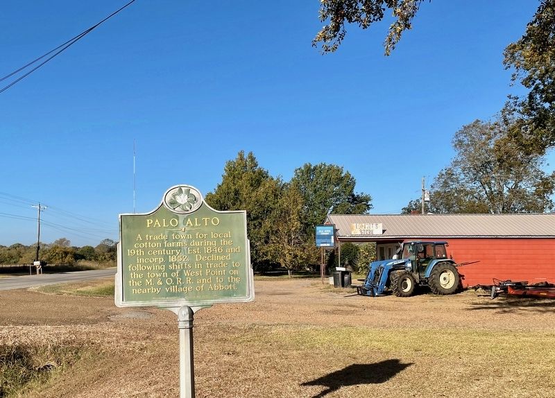
A trade town for local
cotton farms during the
19th century. Est. 1846 and
incorp. 1852. Declined
following shifts in trade to
the town of West Point on
the M. & O. R. R. and to the
nearby village of Abbott. — — Map (db m235115) HM
Excavated June 1934 by
Mississippi Department of Archives and History
Dunbar Rowland, LL.D., Director
Jordan B. Chambers, Archeologist
— Marked 1934 by —
Horseshoe Robertson Chapter
Daughters of the American . . . — — Map (db m107820) HM
Front
Erected 1927 by Horse-Shoe Robertson Chapter Daughters of the American Revolution in tender memory of Clay County World War Veterans.
West Point Army Officers:
Navy - Marine
{List of names}
Clay County Army . . . — — Map (db m107332) WM
One of the giants of post-World War II Chicago blues, Chester Arthur Burnett, aka “Howlin’ Wolf,” was born in White Station, just north of West Point, on June 10, 1910. In his early teens Burnett began performing in the Delta and was . . . — — Map (db m50299) HM
Marked 1934 by
Israel Miller Society
Children of the American Revolution
— Members —
{Listing of members and titles}
Built by A.J. Pearson & Sons — — Map (db m107821) HM
Named for Mary Holmes of Rockford, Illinois, who dedicated her life to education, this school was founded in Jackson in 1892 by the Presbyterian Church (U.S.A.) Board of Missions for Freedmen as a seminary for African American women. Mary Holmes . . . — — Map (db m107537) HM
Constructed ca. 100 B.C.-A.D. 400 for the burial of high-status members of an unknown local tribal group. An associated village site lies across the highway to the Southwest. — — Map (db m107534) HM
Front
In memory of
those who fought to
liberate West Point
Feb. 21, 1864
Their actions resulted
in victory against
a vastly superior
Federal army. Their
bravery will always
be remembered.
Rear . . . — — Map (db m107823) WM
E. 10 mi. Plantation home built c. 1852 by Geo. H. Young. Octagonal cupola. Gen. N.B. Forrest visited here during the Civil War. National Fox Hunters Assn. organized here. — — Map (db m50160) HM
County seat of Clay (formerly Colfax ) County. Chartered November 20, 1858, one year after the arrival of the Mobile and Ohio Railroad. — — Map (db m50298) HM
Unity Presbyterian Church organized in 1828 with the Rev. Thos. Archibald, pastor. Buried here are early settlers, one Revolutionary War soldier, two War of 1812 soldiers, and three Civil War soldiers. — — Map (db m8966) HM
Built in 1946 as the first “Road Switcher” of its type in U.S. Columbus and Greenville Railway’s first diesel powered locomotive. Retired in 1984 after thirty-eight years on freight and passenger trains. — — Map (db m8457) HM
The Beersheba Cumberland Presbyterian Church became part of the Tombecbee Presbytery in 1825 and joined the New Hope Cumberland Presbytery in 1866. The cemetery was established in 1827 and contains the graves of many veterans. The date Beersheba . . . — — Map (db m8477) HM
Congregation established in 1834 by William Ervin, Elizabeth and Drennon Love, James Ervin, Rosamond Odeneal and Thomas and Margaret E. Witherspoon. These Scots-Irish pioneers from Alabama and the Carolinas settled here after the Choctaw Cession of . . . — — Map (db m8484) HM
Here in 1862 Confederacy built huge arsenal employing over 1000 persons. Later one of buildings became original site of Union Academy, first free public school for Negroes in Columbus. — — Map (db m8553) HM
Dedicated in 1863. This is the oldest Catholic Church in NE Miss. It once served a parish that included Corinth & Meridian. The design for the Gothic structure was conceived by Fr. J. B. Mouton, the first pastor. — — Map (db m8486) HM
Originally, 1817-21, known as Possum Town. Became one of richest cities in old Black Prairie cotton belt. Home of state's first free school and M.S.C.W. — — Map (db m8487) HM
The Black Prairies of eastern Mississippi have produced a number of notable blues musicians, including Howlin’ Wolf, Bukka White, and Big Joe Williams. Activity in Columbus, the largest city in the region, centered around areas such as this block of . . . — — Map (db m27607) HM
Began here, April 25, 1866, with first annual placing of flowers on graves of Blue and Gray. Idea originated at meeting in Twelve Gables home of Miss Matt Morton. — — Map (db m8552) HM
The first "laboratory" school for teacher training in the state was established in 1907 by the faculty of Industrial Institute and College (1884), now Mississippi University for Women, the first public college for women in America. The present . . . — — Map (db m8554) HM
Dennis Wicks, Jr. designated land in the early 1900’s to build a pond for family members to water their livestock. The pond was called Wicks Pond. He also donated a water pump for clean drinking water.
Dennis Wicks, Jr.
November 17, 1883 ~ . . . — — Map (db m178992) HM
Organized in 1832 by Thomas Blewett, with Rev. A.S. Bayley serving as the first pastor (1832-1834), this church has erected two sanctuaries. The first was built here in 1838, and the second, this Gothic Revival-style structure designed by Reuben . . . — — Map (db m69565) HM
Founded, 1839, through efforts of Talbert Fanning and David Lipscomb. Present structure, erected 1849-50, housed refugee State Senate in Civil War. Here Tennessee-Tombigbee Waterways Agreement was signed in 1958. — — Map (db m8555) HM
One of America's leading playwrights, Tennessee Williams was born here March 26, 1911. He received the Pulitzer Prize for "Streetcar Named Desire" and "Cat on a Hot Tin Roof." Both stories set in the South. — — Map (db m8556) HM
Oldest church organization in Columbus, dating from 1831. Second structure, built in 1844, became synagogue after building of present church, 1860-1867. — — Map (db m8557) HM
State's oldest free school. Has functioned since 1821. Worthy trustees, using 16th section income & employing able teachers, early made Columbus a cultural center in northeast Mississippi. — — Map (db m8582) HM
SW, 12 blocks. Two state governors, over 1,000 C.S.A. soldiers, including 4 generals, lie here. The decorating of their graves & those of Union soldiers, inspired F.M. Finch's "The Blue and the Gray." 1867. — — Map (db m8583) HM
Henry Armstrong, born Henry Jackson in this area in 1912, began his professional boxing career in 1931. Armstrong became the only boxer to hold world titles simultaneously in three weight divisions. He was named boxer of the year in 1937 and 1938 . . . — — Map (db m13902) HM
James “Jim” Wicks designated land in the early 1900’s to build a school to educate family members. The school was named Wicks Normal School.
James “Jim” Wicks
February 20, 1867 ~ January 2, 1939 — — Map (db m178993) HM
Built by Thomas Blewett circa 1840 for daughter Regina and James Harrison, leading lawyer and politician. Site of 1865 marriage and home of Stephen D. and Regina Harrison Lee. — — Map (db m8584) HM
Joshua Lawrence Meador was born in 1911 in Greenwood, Mississippi, and moved here at age seven. Meador worked for Walt Disney Productions from 1936 to 1965 as head of the effects department. His film credits include Snow White, Fantasia, Bambi, . . . — — Map (db m64694) HM
Built in 1953, the S.D. Lee High School
was designed by Jackson architect R. W. Naef
in the International Style. Named for former
Confederate general Stephen D. Lee, Lee High
School was constructed in the early phases of
the Equalization . . . — — Map (db m244671) HM
[Center] Dedicated to the honor and memory of our men and women of Lowndes County who served our country
World War II ★ Korea ★ Vietnam ★ World War I
[Left wing] In honor of those who gave their lives . . . — — Map (db m244667) WM
Remember WWI Veterans
This gate, a symbol of remembrance, is dedicated to the men and women of Lowndes County who served their country in the World War 1917-1918.
Erected November 11, 1933 by Tombigbee Unit No. 69 American Legion Auxiliary . . . — — Map (db m244666) WM
Built by War Department 1817-20, to connect New Orleans with Nashville. Suggested by & named for Gen. Andrew Jackson. Soon became an important commercial & telegraph route. — — Map (db m8585) HM
Organized by enslaved people in
1833, Missionary Union Baptist
Church is among the oldest black
congregations in northeast
Mississippi. After emancipation,
the church was chartered in 1867
during the pastorate of Rev. Jesse
Freeman Boulden. . . . — — Map (db m244670) HM
The oldest state supported woman's college (1884) in the United States. It pioneered in adding vocational subjects to standard arts-science program. — — Map (db m8586) HM
Established in 1833 when James and Susannah Vaughn donated 5.7 acres of land to the Mt. Pleasant congregation. After Judge John Perkins donated an adjacent 5-acre plot to the congregation in 1851, the church was moved and the original site was . . . — — Map (db m20116) HM
In September 1966, six local African American
women integrated the Mississippi State College for
Women. Undergraduate students Diane Hardy,
Barbara Turner, and Laverne Greene, and graduate
students Jacqueline Edwards, Mary Flowers, and
Eula . . . — — Map (db m244664) HM
Ned Wicks designated land to build a church in the early 1900’s for family members to worship the Lord. The church is called New Zion Missionary Baptist Church.
Ned Wicks
August 1849 ~ circa 1929 — — Map (db m178995) HM
6 mi. N. at mouth of Tibbee and ford in Tombigbee is site of old Indian village, fort, and cotton trading center. Incorporated 1836, but declined with river trade. Now a wilderness.
(supplement)
This sign was originally posted (1952) . . . — — Map (db m178939) HM
The Queen City Hotel, located at this site, was once the cultural hub of the African American community in Columbus. Constructed in the 1880s, the building was opened as a hotel in 1914 by blues guitarist Robert Walker and later owned by Edward . . . — — Map (db m140700) HM
For several decades beginning in the early 1900s, the Queen City Hotel, which stood across the street from this site, was at the center of a vibrant African American community along 7th Avenue North. Clubs and cafes in the area featured blues, . . . — — Map (db m302520) HM
With the faith and courage of their forefathers who made possible the freedom of these United States The Boy Scouts of America dedicate this copy of the Statue of Liberty as a pledge of everlasting fidelity and loyalty 40th Anniversary . . . — — Map (db m259017) HM
Opened 1820s. Ran from Jackson Military Road to Natchez Trace by way of Louisville, Doak's Stand & Choctaw Agency. For years it was only direct route from Columbus to Jackson. — — Map (db m28075) HM
The first rural consolidated school in Mississippi. The school was moved to this site in 1904 and flourished under the guidance of Professor B. G. Hull, who was principal until 1918. Due to the success of the school, Hull was recognized as a . . . — — Map (db m8622) HM
Home of Lt. Gen., C.S.A.; legislator; first president Miss A. & M. College; member Constitutional Convention of 1890; one of organizers of Vicksburg Military Park; Commander United Confederate Veterans; military historian. — — Map (db m8623) HM
Established before the Civil War, Sandfield Cemetery served historically as a burial ground for the African American community in Columbus. Among the approximately 250 people buried here are Rev. Jesse Freeman Boulden, a leader in the . . . — — Map (db m140696) HM
Parish organized Jan. 1, 1837. First church consecrated 1838. Present church begun 1854, consecrated Nov. 15, 1860, by the Rt. Rev. William Mercer Green, first Episcopal Bishop of Miss. — — Map (db m8624) HM
Friends of Libraries U.S.A.
Literary Landmarks Register
The Tennessee Williams
Visitors Center
Author, playwright, and poet
Thomas Lanier "Tennessee" Williams
(1911-1983),
was born in Columbus, Mississippi.
In tribute to his . . . — — Map (db m8719) HM
A native of Columbus, Walter Lanier "Red" Barber (1908-1992) as a boy lived on North 4th Avenue. He began a storied career in radio broadcasting in 1934 after receiving a job offer from the Cincinnati Reds. Barber was the voice of the Cincinnati . . . — — Map (db m8626) HM
W. 5 mi. Built 1852 by Col. Geo. H. Young, who used own plant for gas lighting. In Civil War housed refugee girls from Memphis & New Orleans. Site of organization of National Fox Hunters Association. — — Map (db m8627) HM
Wicks Community is an African American community established in 1887. This land was purchased by Dennis Wicks from Simon Leob, a Jewish man. Dennis Wicks was a former slave, the son of Ned Wicks. Ned Wicks was purchased as a slave by a farmer named . . . — — Map (db m178987) HM
Eminent lawyer and editor. U.S. Congressman, 1852-1861. Miss. Quartermaster-General, 1861. Commanding General of famous Mississippi Brigade. Killed at Gettysburg. Here is site of plantation home. — — Map (db m8628) HM
The large tree that you see here is known by several common names, including Osage orange and hedge apple. We will use a colloquial name, Bodock (bodark), based upon the original French name, bois d’arc (wood of the bow). The Osage Indians made . . . — — Map (db m178982) HM
Organized 1869. Original building ¼ mile West. Rev. Thomas Benton Wood, first pastor. Land Given by Martha Kidd Vaughn, lumber by A.P. Presley. — — Map (db m8629) HM
Zacharias Wicks, Sr. designated land in 1920 as a burial ground for family members. The cemetery is called Wicks memorial Garden.
Zacharias Wicks, Sr.
April 12, 1872 ~ June 15, 1950 — — Map (db m178997) HM
Side A
Big Joe Williams (c. 1903-1982) epitomized the life and times of the rambunctious, roving bluesman, traveling from coast to coast and around the world playing rugged, rhythmic blues on his nine-string guitar at juke joints, house . . . — — Map (db m27750) HM
Estab. in 1825 on the corner of a 1400 acre plantation owned by James Brownlee, Sr. & his wife Mary. Three brothers who lost their lives in the service of the Confederate States of America lie buried here. — — Map (db m8485) HM
Born Camden, S.C. 1794.
Died Lowndes County, Miss. 1869.
He won fame and the gratitude of our forefathers by his daring ride from Ft. Stephens to Nashville, Tenn, to procure General Jackson’s aid against the Creek Indians.
This tablet . . . — — Map (db m178937) HM
Sam Hairston was born on January 20, 1920, in this area. In 1944, shortly after returning from service in World War II, Hairston began his baseball career with the Birmingham Black Barons and the Indianapolis Clowns of the Negro League as an . . . — — Map (db m140689) HM
"Ye Shall Know Them By Their Fruits." Matthew 7:16
Fountainhead of Methodism laid by South
Carolinians 156 years ago. Recognition goes mainly
to Capt. E. C. Leech, whose influence was largely
responsible for the construction of this . . . — — Map (db m244672) HM
Formed 1834; chartered 1837; in 1849 it was made county seat of Monroe, the first county in the state north of Vicksburg. Cotton trade center and former port for Mobile trade. — — Map (db m102590) HM
This property has been placed on the National Register of Historic Places by the United States Department of the Interior Aberdeen A Mississippi Treasure — — Map (db m259053) HM
Front
In 1940 singer-guitarist Booker “Bukka” White, who lived in Aberdeen during the 1920s and ‘30s, recorded the blues classic “Aberdeen Mississippi Blues.” Twenty-three years later the song’s title enabled . . . — — Map (db m102609) HM
A native of Alabama, John Gregg (1828-1864) moved to Texas where he served as a member of that state's secession convention and later in the Provisional Confederate Congress. Elected colonel of the 7th Texas Infantry, Gregg was promoted to Brigadier . . . — — Map (db m102606) HM
Hernando DeSoto & his expedition entered present Monroe Co. following an Indian trail from Buttahatchie River. They crossed the Tombigbee R. ¼ mi. E. Dec. 16, 1540 & marched up what is now this street. — — Map (db m102601) HM
Physician, historian, author. Originated syndicated health column. Chicago health commissioner. Pioneered in pure water and milk laws. Founded Evans Memorial library. — — Map (db m102599) HM
This property has been placed on the National Register of Historic Places by the United States Department of the Interior Aberdeen A Mississippi Treasure — — Map (db m259101) HM
Judge Sykes, 1876-1945, was Justice of the Miss. Supreme Court 1961-1925, and Chairman of Federal Radio Comm. until becoming first Chairman of the Federal Communications Commission, serving until 1935. — — Map (db m102589) HM
Home of noted politician, criminal lawyer, judge, legislator, congressman of U.S. & Confederacy, author of book, "Recollections of Mississippi & Mississippians." — — Map (db m102587) HM
Parish organized May 10, 1848.
Cornerstone laid Oct. 16, 1851.
Dr. Joseph H. Ingraham, rector
and architect.
Building fund started by
Jane Martin Dalton. — — Map (db m102595) HM
Just as Amory’s history is tied to the railroad, so is much of its musical legacy. Several generations of blues, soul and gospel performers came from the families of African-American workers employed here by the Frisco line. Others worked as . . . — — Map (db m174015) HM
Front
Amory's Tribute
to the Heroes of
1861—1865
Right Side
List of Members Stonewall Camp #427, Amory, Monroe County, MS
Rear
To the women of the Confederacy whose pious ministrations to our . . . — — Map (db m102891) WM
Becker's first Post Office
building operating from
1920 until early 1960s.
Given to the
Amory Regional Museum
by
Mr. Hershel Sandlin
in memory of his wife
Mrs. Kay Sandlin — — Map (db m102616) HM
On May 22, 1736, a military force commanded by Jean Baptiste Le Moyne de Bienville, Governor of French Louisiana, landed nearby to attack the Chickasaw. A palisade of 600 log posts was built near here as a base of operations. Defeated in the Battle . . . — — Map (db m102615) HM
Area E. of Tombigbee R., S. of Gaines' Trace ceded in Chickasaw Council House Treaty, 1816. Became part of Monroe Co., 1821. South portion severed, 1830, at formation of Lowndes Co. — — Map (db m102611) HM
South one mile. Initially an Indian trading post at southern terminus of Gaines Trace. Named for the cotton gin built by U.S. Government for the Chickasaw ca. 1801, it grew into an important river town and cotton market with formation of Monroe . . . — — Map (db m102613) HM
The Gilmore Sanitarium was built in 1916 by Ellie Davidson Gilmore and his wife, Virginia. This twenty-two bed facility included a laboratory and operating room. The sanitarium served as Amory's primary hospital until 1961, after which the building . . . — — Map (db m102610) HM
Mound built circa 100 A.D. for the burial of high-status members of an unknown Indian tribal group. Cemetery established during the mid-1800s by the Nabers family and other early settlers of Monroe County. — — Map (db m102612) HM
New Hope Primitive Baptist,
the oldest church in N. Miss. was
organized in 1819 4 mi. S.W. &
moved here in 1833. Thomas
Willingham was the first
pastor. The 1819 Record Book
lists white & black members. — — Map (db m244678) HM
N. E. 4 mi. From date of incorporation in 1830 to 1836 it was Monroe Co. seat. S. J. Gholson, J. M. Tucker, & Reuben Davis lived here. River and railway traffic brought about its decline. — — Map (db m173889) HM
Founded in 1826 by Abraham Howell (1792-1867) & Sarah Andrews Howell (1794-1879)
Married in South Carolina October 6, 1811
Settled in Monroe County, Mississippi in 1817
Their children: (*buried here)
Andrew* • John • Gilbert • Elisha* • . . . — — Map (db m244675) HM
To protect the first white settlers on tributaries of the Buttahatachie River, Gov. David Holmes created Monroe County June 20, 1815 from land between the Tombigbee and Black Warrior Rivers. — — Map (db m173888) HM
The Church of Jesus Christ of Latter-Day Saints was organized on April 6, 1830. Missionaries first arrived in northeastern Mississippi in 1839. Here at Mormon Springs many converts to the church were baptized. Using stones to dam the stream, they . . . — — Map (db m270954) HM
2 mi. NW was the flourishing port of Camargo, named by veterans for their Mexican war camp. The town had a steamboat landing, schools, cemetery, and church. Confederates won a skirmish here, July 14, 1864 — — Map (db m50325) HM
The Gulf Ordnance Plant was a military munitions plant where shells were packed for use during World War II. This plant was in operation from 1942 until the war ended in 1945. Managed by Procter and Gamble, the plant covered 6,720 acres of land, . . . — — Map (db m102585) HM
Built ca. 1847 as the homestead of William Thomas Lenoir, the plantation was continuously owned and farmed by the Lenoir family until its sale in August of 2000. The Lenoir home is the only Classical Revival style house in Mississippi. On February . . . — — Map (db m102583) HM
Free Will Baptists & Methodists
joined in 1845 to build the
only church in Sipsey Fork, the
community between Splunge,
Sipsey & Buttahatchie Rivers.
The present church; built in
1963, is on the fourth site. — — Map (db m173885) HM
S. 2 mi. from Smithville.
Road surveyed in 1807
by E. P. Gaines. Ran
from Cotton Gin Port to
Tennessee R., providing
short route to north from
isolated settlements of
lower Tombigbee Valley. — — Map (db m173893) HM
Born in Smithville, Rod Brasfield was the Grand Ole Opry's top male comedian from 1947-1958, a beloved sad sack foil for Red Foley and Hank Williams and a comic sparring partner for Minnie Pearl and June Carter. He played dramatic and comic roles in . . . — — Map (db m173897) HM
Smithville had its beginning on December 3, 1836, when Co Chubby,
a Chickasaw Indian Co-signatory of the Treaty of Pontotoc, sold
Section 6, Township 12S, Range 9E to James D. Couch.
About 1840, William Smith purchased land at this site and . . . — — Map (db m173895) HM
Built in 1844 as New Pleasant
Ridge and called "Grubtoe."
this is the oldest Free Will
Baptist Church in Mississippi
and the oldest church building
in Monroe County. — — Map (db m173887) HM
137 entries matched your criteria. The first 100 are listed above. The final 37 ⊳