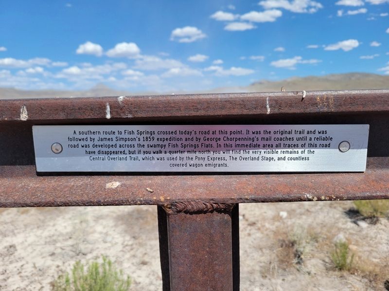
On Pony Express Road, on the left when traveling west.
"Having reached the plain the road ran for eight miles over a broken surface...it then forked. The left, which is about six miles the longer of the two, must be taken after rains, and leads to Devil's Hole.... We chose the
shorter cut and after . . . — — Map (db m249726) HM
On Pony Express Road, on the right when traveling west.
"Course nearly southwest across desert to 'Short Cut Pass'. Through this pass Chorpenning & Company, the mail contractors, have made a road, but it is so crooked and steep as to scarcely permit our wagons to get up it."
Capt. James H. Simpson, . . . — — Map (db m249722) HM
On Watchable Wildlife Area Access, on the left when traveling south.
"A rude stage station was established at Fish Springs, and the lonesome keeper greeted us warmly. The spring was a large pool of water lying
at the base of a low mountain. For three or four miles it sent out a large and copious stream, but the . . . — — Map (db m249730) HM
On West Main Street at West Dublin Avenue, on the right when traveling east on West Main Street.
This building, designed by architect Richard C. Watkins, served as the Eureka L.D.S. Ward Meetinghouse from its construction in 1902 until 1976. It was dedicated in 1903 by Apostle Reed Smoot. The Gothic Revival Style building has been an important . . . — — Map (db m75369) HM
On West Main Street, on the right when traveling east.
Constructed in 1909-1910 by the Benevolent and Protective Order of Elks, Tintic Lodge #711 was designed by architects, Richard C. Watkins and John F. Birch and built by contractor, Martin E. Anderson, a Logan contractor. Cost of the building was . . . — — Map (db m75428) HM
On West Main Street, on the right when traveling east.
The Eureka City Hall was built in 1899 by the Eureka City government and functioned as the offices for city court, mayor, sheriff, recorder, treasurer, council chamber and city volunteer fire department. John J. Pilgrim, a city official, drew the . . . — — Map (db m75426) HM
On West Main Street, on the right when traveling east.
The Eureka Post Office was constructed in 1922 by the United States Government for the commercial center of the Tintic Mining District. James A. Wetmore served as “Acting Supervisory Architect.” The structure represents the only example . . . — — Map (db m75371) HM
On West Main Street, on the right when traveling east.
Constructed in 1891 with funds secured from the local Methodists and the Mission Conference of 1890, this building is important in documenting the religious life of Eureka and Tintic. Methodism began in Tintic when Dr. Thomas C. Iliff visited and . . . — — Map (db m75370) HM
On North Church Street, on the left when traveling north.
The Juab County Courthouse, built in 1891 for $5,000, served as the City Hall until 1899 when Eureka City Hall was built. This courthouse served as a jail for the county and much of the time for the city. It still functions as a County Courthouse . . . — — Map (db m75431) HM
On West Main Street, on the right when traveling east.
This building was constructed in 1909 to serve as the new home of McCornick and Company bankers and has continued to the present to serve as a bank. McCornick and Company first came to Eureka in 1898, when they moved their bank, fixtures and all, . . . — — Map (db m75430) HM
On West Main Street, on the right when traveling east.
Built circa 1894, this building served as the town post office until 1922, when a new post office building was constructed. In 1926 a merchandising company, known as "Everybody's" occupied the building. It is a good example of the commercial . . . — — Map (db m75429) HM
On North Church Street, on the left when traveling north.
St. Patrick's Catholic Church, built in 1885, remains as one of the oldest Catholic Churches in Utah. Constructed under the direction of Reverend Denis Keily, the building represents both importance of Irish settlement in Tintic, as well as the . . . — — Map (db m75432) HM
On West Main Street 0.3 miles west of Church Street, on the right when traveling west.
This monument has two markersPlaque A: (Side of monument)
Bullion Beck and Champion Mining Company Headframe
This massive sixty-five foot Montana-type headframe is the only remnant of the Bullion Beck and Champion Mining . . . — — Map (db m75433) HM
The discovery of the outcrop of the Sunbeam Lode and the subsequent organization of the Tintic Mining District on December 13, 1869, was the beginning of a mining district which ultimately became world-famous. The name is in honor of the Ute . . . — — Map (db m75338) HM
On East Pony Express Road, on the right when traveling west.
"At Boyd Station is a well 12 feet deep."
Cornelius Prather July 31, 1862
"Left camp [at Fish Springs] at seven o'clock. Drove on to the first station [Boyd Station] and nooned."
Albert Jefferson Young August 12, 1862
2017 Utah . . . — — Map (db m249756) HM
On Wilson Cutoff Road, on the right when traveling west.
"Soon after starting it commenced to rain, which softened the road so much as to cause the wagons to stall... At this point the road doubles the point of the range along which we have been traveling."
Captain James H. Simpson, May 7, 1859 . . . — — Map (db m249752) HM
On East Pony Express Road, on the right when traveling west.
In 1845, it took six months to get a message from the East Coast of the United States to California. By the late 1850s, a half million people had migrated west and were demanding up-to-date news from home. Something had to be done to deliver mail . . . — — Map (db m249762) HM
On East Pony Express Road, on the right when traveling west.
Strategically placed relay stations across the western frontier proved to be a major contributing factor to the early success of the Pony Express mail service. "Station keepers" assigned to these outposts readied swift horses, fresh and rested, . . . — — Map (db m249757) HM
On East Pony Express Road, on the right when traveling west.
The first teams of Pony Express riders amazed the nation by accomplishing their east and westbound deliveries within the projected 10-day schedule. The speed of the riders even had a role in swaying a divided California to stay with the Union . . . — — Map (db m249761) HM
On North Pony Express Road, on the right when traveling west.
"At sunup came to Willow Springs and camped. This is quite an extensive valley. These springs are deep holes like wells and some so deep there can be no bottom found. Some run over, others stand level full. Every year some stock is lost here by . . . — — Map (db m249496) HM
This station was established April 3, 1860 on the route of the Pony Express between St. Joseph, Missouri and Sacramento, California. It was discontinued October 27, 1861 when the transcontinental telegraph line was opened.
An overland stage . . . — — Map (db m249495) HM
On North 1st Street East south of East 1st Street North, on the right when traveling south.
Spring 1867, Church leader Erastus Snow helped select a new site for Chicken Creek Settlement, relocated due to unfavorable living conditions. Brigham Young named it Levan. Snow appointed Wm. Morgan and James Wilson as supervisors. Early in 1868, . . . — — Map (db m75457) HM
Near Old U.S. 90 4.2 miles south of Interstate 15.
In 1902, construction began on a dam to
supply much needed irrigation water to
a very dry western Millard County. Fifteen
exhausting years later, Yuba Dam was
completed.
The water share holders were assessed $5 per
share to pay for . . . — — Map (db m75458) HM
On North Main Street, on the right when traveling north.
In July 1853, a trade of fish for flour between an Indian and Mrs. James Ivie, ended in a skirmish; one Indian died, Chief Walker refused peace offer of ponies, beef, flour and blankets unless Mr. Ivie stood trial by Indians; raids began. Colonel . . . — — Map (db m75456) HM
On Main Street 1.6 miles east of U.S. 6, on the right when traveling east.
This structure, constructed c. 1930, is significant for it's association with the history of firefighting in Mammoth. In August 1912, the Mammoth City Council organized a volunteer firefighting unit, and on August 27, 1912, the first meeting of the . . . — — Map (db m75443) HM
On Gold Street at Main Street, on the left when traveling south on Gold Street.
Built as a boarding house in 1893 and converted to a hospital in 1902. The Tintic Hospital served the people of the Tintic mining district until 1933.
Originally operated by Drs. Mott, Townsend and Stephens, it was purchased by Dr. Steele . . . — — Map (db m75442) HM
On Center Street west of Old Highway 91, on the right when traveling west.
In memory of our Mona School and the dedicated teachers, board members, custodians, students and citizens who made it great; we have built this monument from sandstone and brick recovered therefrom. The bell hereon, signaled the beginning of school . . . — — Map (db m75280) HM
On The Mona Road 0.2 miles north of Utah Route 54, on the right when traveling north.
This monument is erected in memory of the pioneers buried here. There are about 20, whose resting place surrounds this monument.
The first grave was that of Nancy Maria Biglow Love, who died November 27, and was buried November 28, 1852.
. . . — — Map (db m75292) HM
On Burraston Road 0.7 miles west of Old Highway 91, on the left when traveling west.
Burraston Ponds was the campsite of the Escalante Expedition, 27 September 1776, from Santa Fe to the Utah Basin. Father Escalante mapped this area and named this spring "Ojo de San Pablo" or Eye of Saint Paul.
The great Indian chiefs before . . . — — Map (db m75277) HM
On North 100 East Street north of East 500 North Street, on the left when traveling north.
The first settlers arrived here in 1851. A one room building was erected and used for Church and School in 1852. Candice Smith and George Spencer and wife were teachers. In 1855 a schoolhouse was erected inside the fort and early teachers were: . . . — — Map (db m75271) HM
On West Center Street west of Main Street, on the left when traveling west.
This building has two markersDaughters of Utah Pioneers Marker
Prisoners from Juab county were first held in the basement of the Social Hall that stood on the corner of Center Street and Second East in Nephi. The next jail . . . — — Map (db m75270) HM
On East 100 South Street, on the right when traveling west.
Constructed in 1893 by Oscar M. Booth, this house is an excellent example of the Queen Anne architectural style in Utah. Some identifying features of the home include its side-hall plan, asymmetrical massing, long wrap-around porch, and the . . . — — Map (db m75268) HM
On Utah Route 132 at milepost 40.5, on the right when traveling east.
This monument replaces one previously erected (that crumbled through weather conditions) by Langley A. Bailey, Sr., Jacob Bowers and Henry Knowles in memory of the following pioneers: Jens Jergensen and wife, Jens Terkelsen and Christian E. Kjerulf . . . — — Map (db m75247) HM
On North 100 East Street north of East 500 North Street, on the left when traveling north.
Completed in November 1854 by the Pioneers of Salt Creek (Nephi) for protection against Indians. The inclosure was 3 blocks square, from 1st West to 2nd East and from 1st North to 2nd South Streets. Markers have been placed at the corners. The . . . — — Map (db m75272) HM
On South Main Street at 100 South Street, on the right when traveling north on South Main Street.
In 1859, John Hoile established a flour gristmill at First South between First and Second East. The mill consisted of a small one-story frame building. On June 20, 1870, the mill was bought by John Hague who operated it until he died in 1900. The . . . — — Map (db m75269) HM
On Cove Fort Road, on the right when traveling east.
"16th Passed over some beautiful rich bottoms covered with green grass which is uncommon at this season of the year on this route. Passed over a high divide into a beautiful round valley [Cove Fort]. I shot the largest hare in this valley I have . . . — — Map (db m257255) HM
On West 4500 N Street 0.7 miles west of North 10000 W Street, on the left when traveling west.
442nd Regimental Combat Team, 100th Infantry Battalion, Military Intelligence Service (MIS)
Formed during World War II, these three US Military units were comprised of Japanese-American young men from the US mainland, Hawaii and from ten . . . — — Map (db m1332) HM
On Utah Route 257, on the left when traveling south.
The Relief Society in Deseret was first organized in September of 1877. This group of women met in each other's homes until 1878, when they had a large, one-room adobe hall built. In 1894 the members of the Relief Society decided they should . . . — — Map (db m69541) HM
Father Escalante camped here October 2, 1776. His exploring party of ten men headed by Father Francisco Dominguez and map-maker Pacheco preached to the Indians and charted a northern route between Santa Fe, New Mexico and Monterey, California. They . . . — — Map (db m1439) HM
On Utah Route 257 4.4 miles south of U.S. 6, on the right when traveling south.
Erected as a defense against Pahvant Indians in the Black Hawk War, completed in 18 days by 98 men. Wm. S. Hawley and Isaac W. Pierce, foremen; John W. Radford, Supt. Opening celebration July 25, 1865. The fort was 550 feet square, bastions at . . . — — Map (db m69542) HM
In 1853, Captain John W. Gunnison was selected to lead an expedition to find a trans-continental railroad route. He followed the Old Spanish Trail through Salina Canyon, over the mountains to Pahvant Valley, and upon reaching Fillmore, visited . . . — — Map (db m69536) HM
On West Main Street, on the right when traveling west.
Constructed November 1907 – January 1908 by Henry McCullough, his two sons and son-in-law, of logs hauled 30 miles from Fillmore. Delta's first Post Office -- January 1908 - March 1912. — — Map (db m69545) HM
On West Main Street, on the right when traveling west.
This pioneer cabin was built in December 1907 by Henry J. McCullough and was the second house in the town of Melville. One month later January 18, 1908, the first Post Office was established and the name changed to Burtner. Adjoining this cabin, on . . . — — Map (db m69546) HM
Fifteen miles west at Abraham is the location of the bleak desert site of a concentration camp, one of ten in Western America, in which 110,000 persons of Japanese ancestry were interned against their will during World War II. They were the victims . . . — — Map (db m1438) HM
On West 4500 N Street 0.7 miles west of N 10000 W street, on the left when traveling west.
Site of Topaz Internment Camp.
Over 120,000 Japanese-American, two thirds of whom are U.S. citizens, are uprooted from their west coast homes and incarcerated by their own government. It is 1942, wartime hysteria is at a peak. They are . . . — — Map (db m144120) HM
The stoneworkers who constructed the Statehouse initialed the building with pride. Though they expected their initials to be covered by stucco they took the time and effort to leave their marks on the building. A quick search will show many . . . — — Map (db m254560) HM
On North Main Street, on the right when traveling north.
In 1849, after a peace treaty was signed between Mexico and the United States, Congress was petitioned to admit the State of Desert to the Union. However, this petition was denied and the Organic Act of September 9, 1850, created the Utah Territory. . . . — — Map (db m69578) HM
On North Main Street, on the right when traveling north.
The written history of the Intermountain Region begins in 1776 with the remarkably accurate diary of Father Escalante, a Spanish Franciscan priest. He and Father Dominguez, together with eight companions, were the first white men known to have been . . . — — Map (db m69579) HM
On South 200 West, on the right when traveling south.
This sandstone house was built by a local contractor for Edward Partridge, Jr., in 1871. Partridge moved to Utah with his mother and other family members in 1848. His father, who died in 1840, was the first bishop of the LDS Church. Edward was . . . — — Map (db m69584) HM
On North Main Street, on the right when traveling north.
Three different education facilities existed on the this block at the same time.
The Statehouse functions as a Presbyterian Mission School for several years after the Civil War. Their primary goal was to eliminate polygamy by educating the . . . — — Map (db m254554) HM
On West Center Street, on the right when traveling east.
The Fillmore Armory was constructed in 1937-1938 and is associated with the second generation of Utah National Guard (UTNG) armory construction. Even in times of peace, training was essential for soldier to be effective and prepared for active . . . — — Map (db m254553) HM
On South Main Street at East Center Street, on the right when traveling north on South Main Street.
This marks the Southwest corner of the Fort, built in October and November 1851 as protection from Indians, by first 17 families under direction of Anson Call, Jesse W. Fox, surveyor. About 2 city blocks in size, the front wall 8 to 10 feet high was . . . — — Map (db m69583) HM
Near East 500 North 0.2 miles east of Main Street.
These stones, quarried in Chalk Creek and hauled by oxen in 1854, were used in the foundation of the two-storied 30 x 40 adobe church building located in the Pioneer Fort one half block east of Main Street. Remodeled into one 30 x 60 hall with oval . . . — — Map (db m69580) HM
On West 100 South Street, on the right when traveling west.
As the focal point of the community, the Statehouse has served many functions over the years. First as Utah's capital building,then as: dance hall, theater, jail, school and even a hiding place for the Deseret News. It currently serves as a State . . . — — Map (db m254567) HM
On West 100 South Street west of South Main Street, on the right when traveling west.
There are three markers on this kioskCenter Marker
The Ute Domain
First described by Spanish explorers as the YUTA Indians (pronounced Ute-ah), the ancestors of the Ute people are thought to have migrated from the . . . — — Map (db m75470) HM
On 100 West at 100 South, on the left when traveling south on 100 West.
Fillmore was settled in 1851. Before the close of the first year the Pioneers had erected a log school room inside the fort. It had split logs for seats, a dirt roof and floor. In 1854 an adobe church was built which also served as school. In 1867 . . . — — Map (db m69581) HM
Creating Fillmore City and Millard County the Territorial Legislature of Utah selected Pahvant Valley, as Capitol site October 29, 1851. This spot was selected by Governor Brigham Young. Construction work began in 1852. Truman O. Angell, architect . . . — — Map (db m1277) HM
On West Capitol Street, on the right when traveling west.
Why Fillmore?
On September 8, 1851 Govenor Brigham Young placed his cane on the North East corner of this block and designated this geographically centered location as Utah's capital. The large open space, water and building materials were . . . — — Map (db m254562) HM
Large for early Utah, the existing building is only a small portion of the original plan, just as the State of Utah, is only a small portion of the proposed State of Deseret. Both the capitol building and the state were reduced in size as . . . — — Map (db m254564) HM
On North Main Street 0.1 miles north of Center Street, on the right when traveling north.
In 1889 the first school was held in the Benjamin W. Scott home located a mile south of the Hinckley Park. It was often referred to as "The Old Mud Temple." In 1934 this monument was placed on the site of the building by the Boy Scouts and the . . . — — Map (db m69540) HM
On East 200 North at 100 West, in the median on East 200 North.
Built 1909 - 1910 of brick
Architect: S.T. Whicker
Construction Supervisor:
T. George Theobold
Millard LDS Academy
1910-1923
Hinckley High School
1923-1953 — — Map (db m69538) HM
On 100 East at 100 North, on the left when traveling east on 100 East.
Erected 1855-56, was 150 feet long north and south by 75 feet wide. Facing each other and standing 30 feet apart were two rows of adobe houses. The gateways were in the north and south walls.
Richard Johnson and William Stevens, Sr. and families . . . — — Map (db m69575) HM
On 100 North 0.1 miles east of 100 East, on the right when traveling east.
Bell was originally mounted in the steeple of Holden Ward Chapel dedicated in 1883. The bell was rung 30 minutes before Church services were to begin, also rung on special occasions.
Present bell tower erected as a reminder to present and future . . . — — Map (db m69577) HM
On U.S. 50 at Route 64, on the right when traveling east on U.S. 50.
Established by Mormon Pioneers in 1855, as Fort Cedar Springs. Church President Brigham Young gave permit for the families of William Stevens Sr. and Richard Johnson to start a settlement near these grassy, spring-fed cedar hills.
Joined that . . . — — Map (db m233843) HM
On North Main Street south of 100 North Street, on the right when traveling south.
This town was named after the Indian Chief C'nos. Born in 1821 in California, he was a stately, intelligent and loving ruler of the Indians of Pahvant Valley. He died in 1884. — — Map (db m75516) HM
On West Hatton Road, on the right when traveling east.
The town of Hatton was settled in 1854 on the old immigrant trail leading to southern California. This site identifies one of the stops the Gilmer and Salisbury Overland Stage made on the way from Salt Lake City, Utah, to Pioche, Nevada, and on to . . . — — Map (db m275659) HM
On South Highway 91 at South Main Street, on the right when traveling north on South Highway 91.
Kanosh dates back to 28 April 1867 when Brigham Young, with the approval of Chief Kanosh, advised the pioneers to move from Petersburg (Hatton), Utah to the area then known as the campground of the Pahvant Tribe of Indians. When this move took place . . . — — Map (db m275658) HM
On North Main Street south of 100 North Street, on the left when traveling south.
The townsite of Kanosh selected by Brigham Young was surveyed in 1867. The first settlers were Noah Avery, William Penney and Baldwin Watts. Upon advice from Brigham Young, families from Petersburg, Corn Creek, added strength to the new settlement. . . . — — Map (db m75517) HM
On State Highway 132 1.3 miles east of State Highway 125, on the right when traveling west.
These charcoal ovens are evidence of a historic man using natural resources. Reminders, which once upon a time, formed the basis of a man’s industrial enterprise. In 1882 that man, George Morrison, hired Nicholas Paul to build four charcoal ovens. . . . — — Map (db m34859) HM
On Utah State Highway 132 (Utah Route 132) 1.4 miles west of Hwy's 132 and 125 ( Route 125), on the right when traveling west.
These charcoal ovens are evidence of a historic man using the natural resources. Reminders, which once upon a time formed the basis of a man's industrial enterprise. In 1882, that man, George Morrison hired Nicolas Paul to build four charcoal ovens. . . . — — Map (db m80117) HM
On North Main Street at Interstate 15, on the right when traveling south on North Main Street.
Walkara, Ute Indian chieftan, was one of the principal Indian chiefs when the Mormons first entered this area in 1848. Feared from California to New Mexico, he was a remarkably sly chief, daring horse thief, savage slave trader, furious enemy, . . . — — Map (db m75514) HM
On East Center Street at 100 East Street, on the right when traveling east on East Center Street.
The first settlers, James and Janet Duncan with four other families came in 1857, lived in dugouts on the ridge one mile west. In 1859 a culinary water problem caused them to move east where ten families began the settlement of Meadow, so named for . . . — — Map (db m75515) HM
On Main Street (Utah Route 133), on the right when traveling south.
Charles Taysom built this cabin at this location in 1866. •
Restored by the descendants of Charles & Mariah Taysom. •
Dedicated in memory of their pioneer sacrifices and endurance, 2002. — — Map (db m69585) HM
On Main Street at Center Street, on the right when traveling north on Main Street.
Marker A:
Oak City
Oak City was named after Oak Creek, a sparkling mountain stream meandering through scrub oak and gray sagebrush. It provided water, the lifeblood of this community.
Founded in 1868 by pioneers who had formerly . . . — — Map (db m69573) HM
On North State Street south of 100 North Street, on the right when traveling south.
Built in 1935, the Scipio Town Hall is one of over 230 public works buildings constructed in Utah under various New Deal programs during the Depression years of the 1930's and 40's. The types of buildings constructed included schools, county . . . — — Map (db m75461) HM
On North State Street south of 100 North Street, on the right when traveling south.
In 1860, thirteen Latter-day Saint families settled Round Valley. Brigham Young visited them in May, 1863, and advised, because of Indians, they move their settlement away from the mountain area. He accompanied the men to the center of the valley, . . . — — Map (db m75459) HM
On East Main Street at 100 East Street, on the left when traveling east on East Main Street.
Circleville was settled in 1864 by a group of pioneers from Sanpete County. The
Church of Jesus Christ of Latter-day Saints organized a branch, William J. Allred,
Presiding Elder. Land was cultivated and homes erected. In 1865 the Black Hawk . . . — — Map (db m74778) HM
(front of monument)
To the Memory of the
Koosharem Band
Paiute Indian Tribe of Utah
Massacred by local Mormon Settlers April 22–24, 1866
during Utah's Black Hawk War (1865–1872)
In remembrance of the innocent who were lost in . . . — — Map (db m154070) HM WM
On East Main Street at N 100 E St, on the right when traveling west on East Main Street.
Center Panel
Freedom Is Not Free
Dedicated to Those Who Served
★ Honor Roll ★
World War I - Otto Beebe
World War II - Raymond "Ruby" Brinkerhoff
Korean War - Arnold E. Peterson . . . — — Map (db m272442) WM
During the Black Hawk War, on November 26, 1865, Ute Chief Tamaritz's band of around twelve warriors raided the thinly populated settlement of Circleville—ill-prepared to defend itself—killing four citizens.
Believing that Paiutes had . . . — — Map (db m154071) HM WM
On Center Street at W 100 S Street, on the right when traveling south on Center Street.
Kingston Ward of the Church of Jesus Christ of Latter-Day Saints
This site marks the place where the 26 X 48 foot, brick church was erected in 1896 at a cost of $1500. In 1953 it was remodeled and rededicated. The church was used until . . . — — Map (db m240506) HM
On Utah Route 62, on the left when traveling west.
An Historic Trade Route Passed This Way
In the early 1800s, untold number of men, mules, and horses plodded along a well-travelled trail that skirted the western shores of Fish Lake. Can you imagine the dust, noise and smells of a trading . . . — — Map (db m260605) HM
On North Main Street, on the right when traveling north.
In 1864 several families of Latter-day Saints settled in this valley but were forced to evacuate because of Indian troubles. Here in 1868 miners discovered precious metal, and took possession of the area. April 15, 1883, a branch of the L.D.S. . . . — — Map (db m74781) HM
On U.S. 89 at Center Street, on the left when traveling north on U.S. 89.
Axtell, originally called Willow Creek, is a wide-spread, productive farming community located on the boundary of Sanpete and Sevier Counties. It is a living monument to the rugged characteristics of the pioneers who came to this valley. Axtell was . . . — — Map (db m74902) HM
On U.S. 89 at Birdseye Road (Route 89), on the right when traveling south on U.S. 89.
Looking east to the red ledges you can see the quarry, originally operated by the Mormon Church and others in the 1880's to the 1940's as the Nebo Rock Works, Thistle Rock Works and Birdseye Marble Quarry.
The stone polishes to a high degree and is . . . — — Map (db m101133) HM
On South Main Street 0.1 miles north of 300 South Street, on the left when traveling north.
Gunnison settlers began farming the land to the south in the early 1860's, each claiming his acreage under "Squatter's Rights" and later paying a filing fee of $1.25. Water was obtained from the Sanpitch River and fresh mountain springs. By 1877 . . . — — Map (db m74903) HM
On South Main Street 0.1 miles north of 300 South Street, on the left when traveling north.
In the Early 80's Centerfield was known as "The Field" or "South Gunnison". The thirty families living there erected a public building in 1882 made of red pine logs with a slab roof covered with clay. A stone fireplace furnished the heat while the . . . — — Map (db m74905) HM
On North Main Street, on the right when traveling north.
Constructed of local brick and stone in 1869 by Canute Peterson and his eldest son, Peter, this house (as well as the two homes just north built for his other two wives) is significant as one of Ephraim's oldest pioneer homes and as the home of one . . . — — Map (db m74994) HM
On South Main Street, on the right when traveling south.
Built in 1914-1915, the Ephraim Carnegie Library is one of 23 Carnegie Libraries in Utah and one of over 1650 library buildings in the United States that were founded by millionaire/philanthropist Andrew Carnegie. Carnegie donated the entire cost of . . . — — Map (db m74993) HM
On North Main Street south of 100 North Street, on the right when traveling north.
Constructed in 1871-72 of local oolitic limestone, this Greek Revival style building is one of the remaining examples of the more than 120 cooperative mercantiles that were established by the LDS church between 1868 and 1878. The first floor was a . . . — — Map (db m74997) HM
On Pioneer Cemetery Road 0.9 miles north of U.S. 89, on the right when traveling north.
In 1854, Ephraim's first settlers erected a one and one half acre stone fort for housing and protection against Indian attacks. A cemetery was not included in their plans. The first pioneer to die was Mr. Manwaring. Permission had been granted to . . . — — Map (db m75027) HM
On North Main Street south of 100 North Street, on the right when traveling north.
President Brigham Young, in 1876, gave the Relief Society sisters an assignment to store wheat for a time of need. This historic, oolite limestone building was constructed as a granary in response to this concept. Pioneer women and children followed . . . — — Map (db m74995) HM
On East 100 North at North 300 East, on the right when traveling east on East 100 North.
In 1852 Isaac Behunin and family came to Pine Creek. By 1854 seventy-seven families had arrived. Branch L.D.S. Church organized, Rueben W. Allred was presiding elder. Reddick N. Allred captain of militia. Ft. Ephraim incorporated as a city 1868, . . . — — Map (db m75022) HM
On East 100 North at North 100 East, on the right when traveling east on East 100 North.
There were two forts on this site in 1854-55. The settlers referred to the first structure as Little Fort. Mormon pioneers sent men from other Central Utah settlements on February 7, 1854 to start work on the small fort that would cover about . . . — — Map (db m75025) HM
Near West 100 North Street west of North Main Street, on the left when traveling west.
The Indian War years of 1865-72 brought bitter hardships to Sanpete and other central Utah areas. Different bands of Indians stealthily attacked settlers from their mountain hideouts, then fled to safety. Twenty-seven settlements were evacuated; two . . . — — Map (db m276825) HM
213 entries matched your criteria. The first 100 are listed above. Next 100 ⊳